One year with my new camera. At this point I had learned some photography skills and was exploiting the "manual" mode of the camera. I took these pics on December 2012 in a trip I made to "La Chapa" in Falcon state.
La Chapa is a town that is located at an altitude of 2808 in the Sierra de Falcón which is a series of mountains of relatively low altitude, east-west oriented, formed by the Sierra de San Luís and the Sierra de Churuguara and its foothills and intramuontaneous valleys in which from their summits the rivers have origin and flow towards the coast. The climate is varied in this region, you can have semi-arid vegetation in the low intramontane valleys and humid forest vegetation with average temperatures of 17 ° C in the highest valleys and its summits.
I made this trip from my hometown, which is a very hot city (with a lot of semi-arid vegetation) to this part of Falcón State in approximately 2 hours, when you go up the Sierra you can feel the temperature change very fast which is pretty cool for me, also you can have aview of the dam "El Isiro", which is the main source of water supply of Falcon state. I went to La Chapa with my family and stayed at my uncle's house.
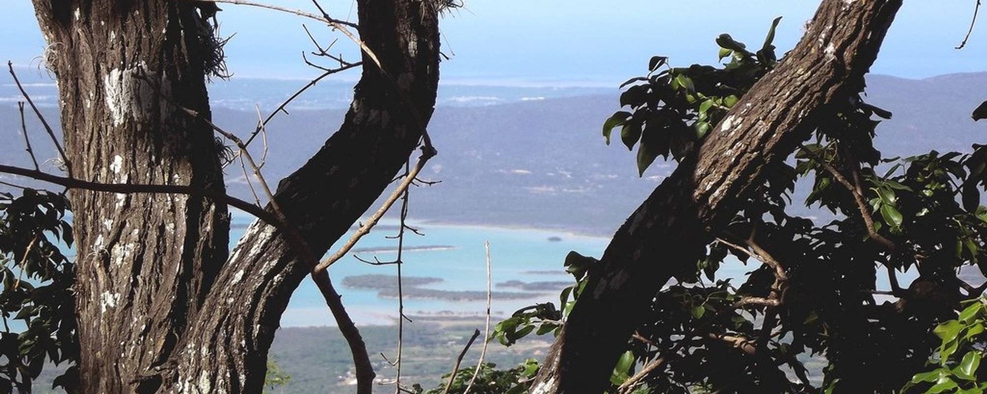
Look at this view from behind of the house!
These are the branches of a tree that is right behind the house, they got white paint when the house was being painted :P and that blue "lake" at the bottom is the dam "El Isiro".
But of course I have some better views of this.
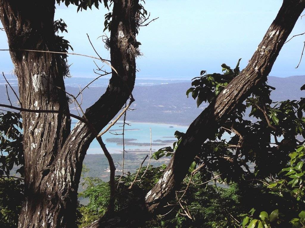
Before we got to my uncle's house we made a stop to see the landscape
I loved those clouds shadows in here. You are watching in here part of the Sierra de Falcón :D
And almost on the horizon by the left part of this pic you can see Coro city!
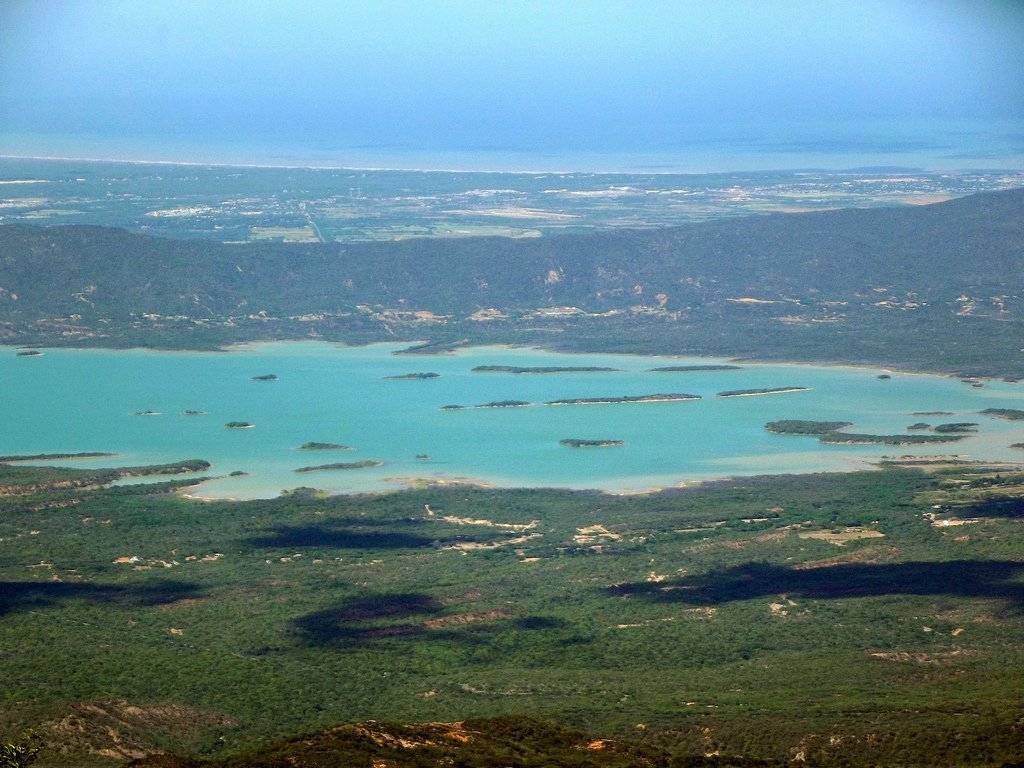
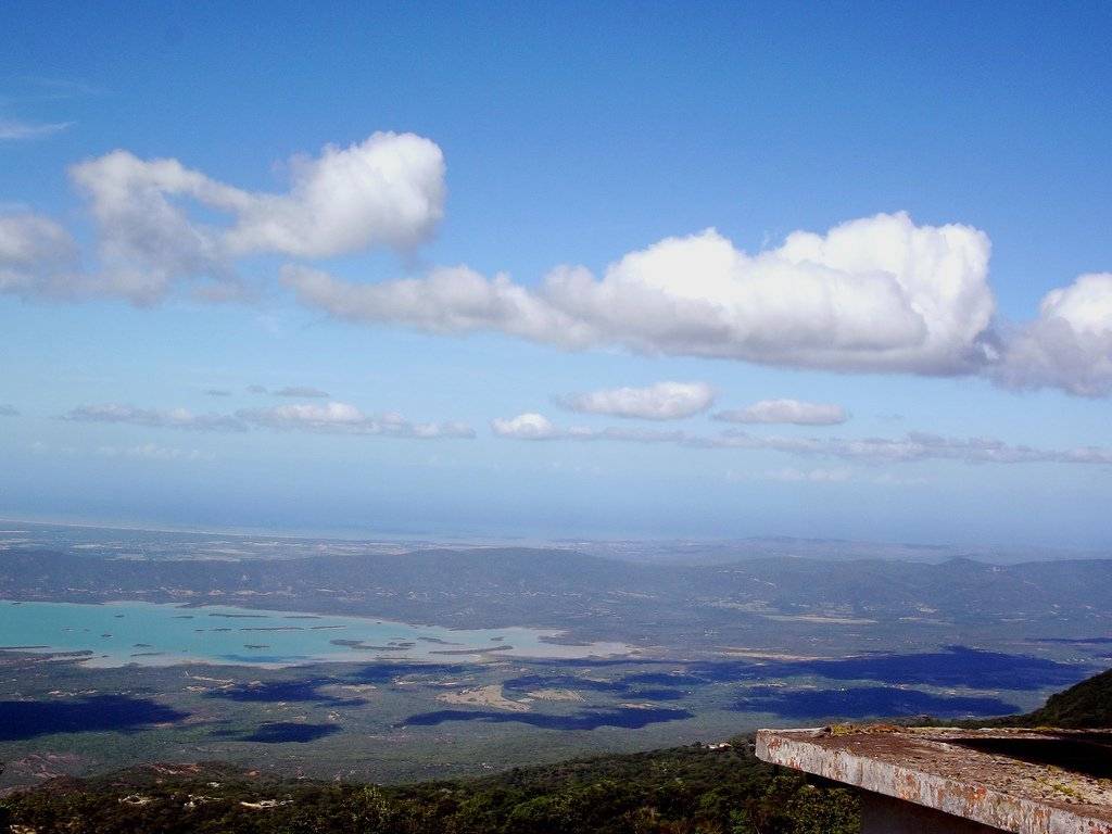
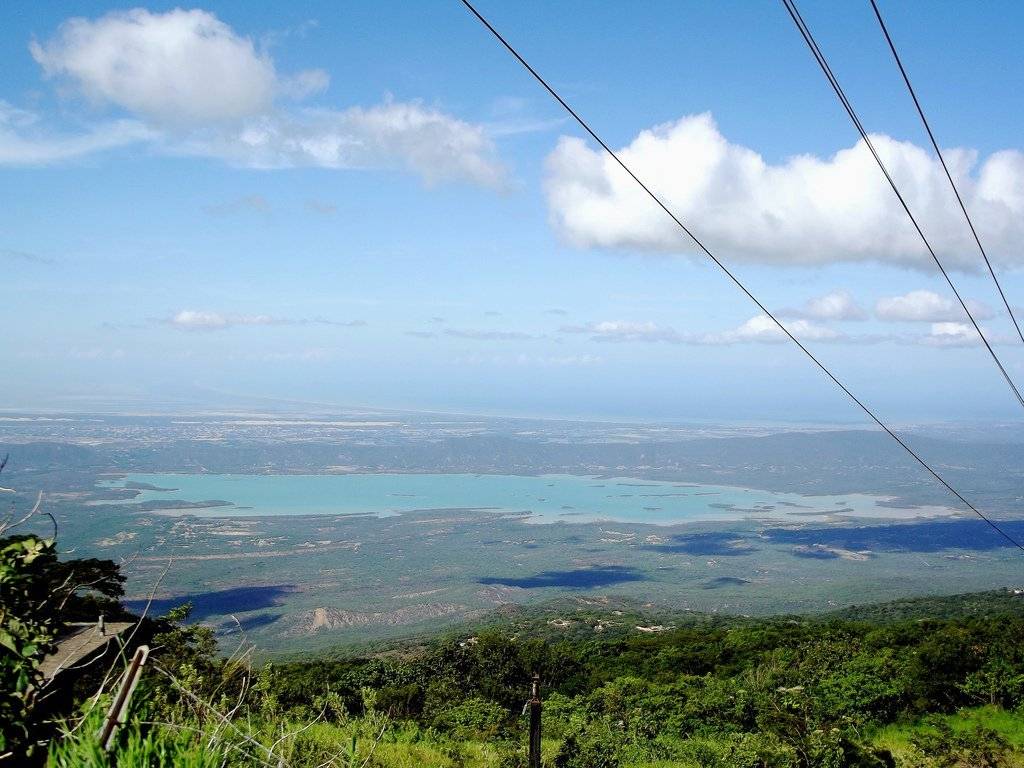
Now, this is a properly view of the dam :D We were so high over the mountain (hah) that we could see the clouds shadows as those big black stains and even the water of the dam looks so much lighter than it was when we were passing nearby.
We were even so high (hah) that we could see some distortion in the horizon! Look at this
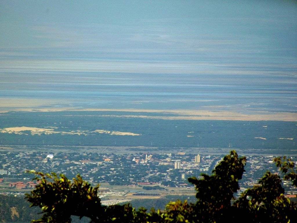
This is Coro city and as you go above you can see some "sands" right where the distortion starts, those sands are the Médanos de Coro National Park, just some dunes :D above this you have the Médanos Isthmus that connects the Paraguaná Peninsula (the place I came from, my hometown is the capital city of the peninsula) with the rest of Falcón state, obviously that cannot be seen in here and that's why we just see some distortion.
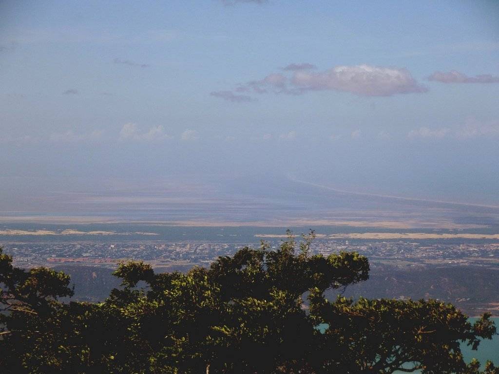
Here we have a wider view of Coro and if you try to figure out the distortion a little bit you can see it is cone shaped. At the center of the Peninsula there's the only "mountain" in the whole Peninsula which is the Cerro Santa Ana that many people climb almost every day; We could see it from here but I coulnd't make it to appear in the pics. I was struggling very hard to take this shots, and I even got fustrated because I couldn't get what I wanted. One year with the cam but I didn't have the enough skills yet!
After taking all these shots we finally got to my uncle's house, which was sorrounded by many trees and nature!
I didn't take pics of his house because he didn't allow me to and I didn't want to stay in the woods that night.
Ready to Blog & Earn?
With TravelFeed, easily start your own travel blog and earn as you go. It's the smart platform for travelers who want to profit from their passion. Create a free account
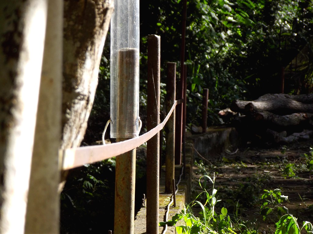
He had a big front yard and I just started to play with perspective. This was the fence that marked the limits of his property, and in the back some wood for the night ;D
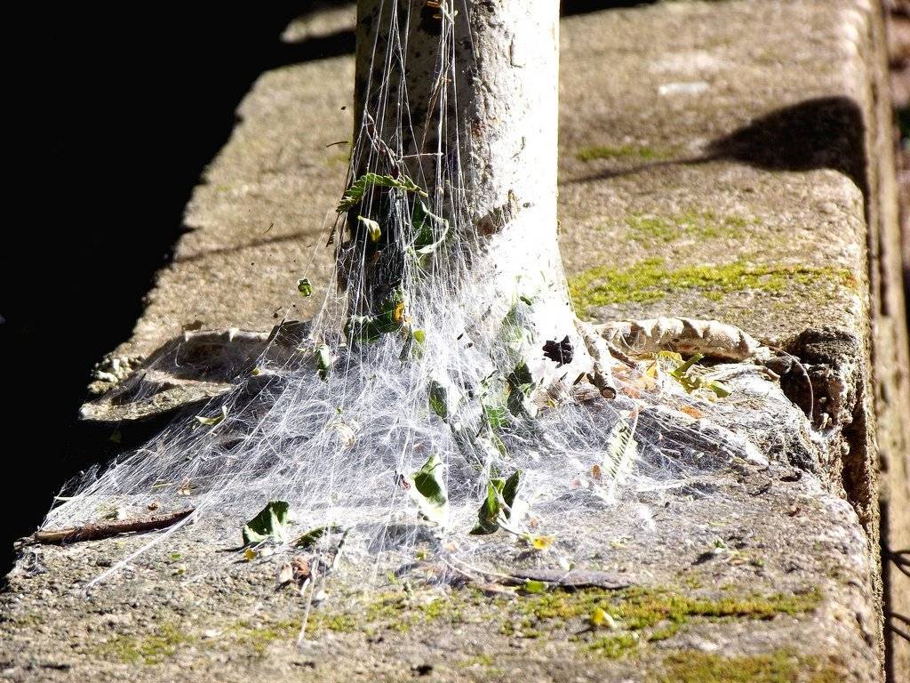
A spiderweb I was very mesmerized with!
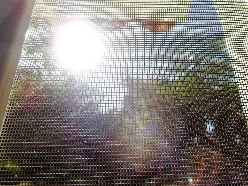
Trying to look at the trees outside and failing on it, all for the sake of not getting bitten by mosquitoes!
Don't Forget: Get Travel Health Insurance!
To make your trip a worry-free experience, TravelFeed recommends SafetyWing Nomad Insurance. It provides comprehensive health coverage while you travel, so you can focus on exploring, not the unexpected. Get a quote here
We spent these final days of the year in this house, having nice conversations during very cold (af) nights and eating some grilled food, and of course drinking some beer and cocuy!
Thank you very much for watching and reading! Let me know what you think about my first "manual mode" shots please :D
Greetings!
Travel Resources for your trip to Venezuela
Recommended by TravelFeed
Flights: We recommend checking Kiwi.com to find the best and cheapest flights to Venezuela.
Accomodation: Explore the best places to stay in Venezuela on Booking.com, Agoda and Hostelworld.
Travel Insurance: Medical emergencies abroad can be pricey, but travel health insurance is not. We always use SafetyWing for affordable and reliable coverage.
Car Rental: For hassle-free car hiring, DiscoverCars is our trusted choice with a wide selection of vehicles.
Internet: Got an eSIM compatible phone? Airalo is perfect for reliable internet access during your trip. Just install it before you go, and you're set!
Day Trips & Tours: We recommend GetYourGuide for a variety of well-organized and enjoyable activities.
Travel Planner: Need a hand planning? Our free travel planner chatbot is your personal guide to Venezuela. Chat now.
Disclosure: Posts on TravelFeed may contain affiliate links. See affiliate disclosure.
