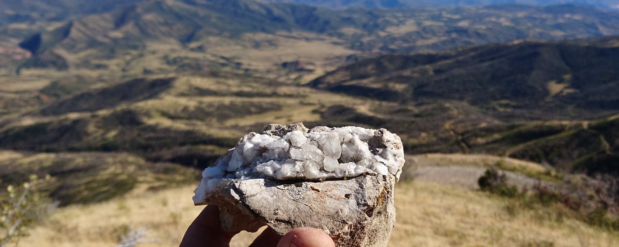
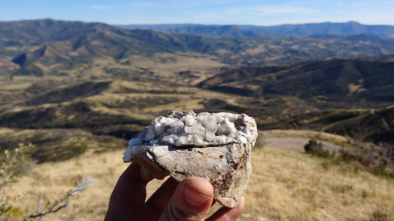
Quartz crystal points looking out over Diamond Fork Canyon area
Last weekend we had a fun family hike up Little Diamond Trail (Forest Service Trail 016) in Diamond Fork Canyon, Utah. I posted about our recent camping trips along Little Diamond Creek, and when I noticed on a map that there was a trail up the mountain that looms over where we camped, I knew it was going to have amazing views out over the whole Diamond Fork area. It did not disappoint!
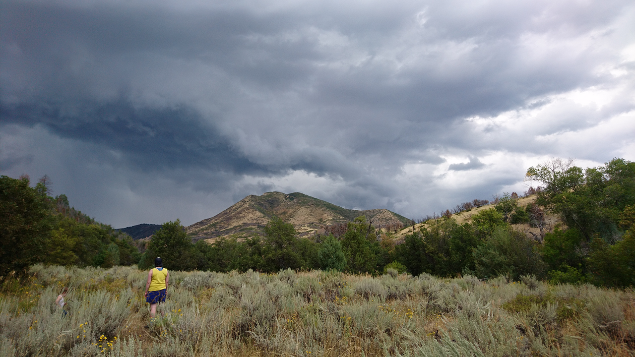
Looking up at the (as far as I can tell) unnamed mountain from our camp site area
Getting There
From I-15 take the Price-Manti exit (highway 6) and follow hwy 6 for 11 miles until a left turn onto Diamond Fork Road (paved). In ~ 5 miles take a left onto the dirt Forest Service road 338 and stay right at the fork when it becomes road 038 which dead ends into the trail.
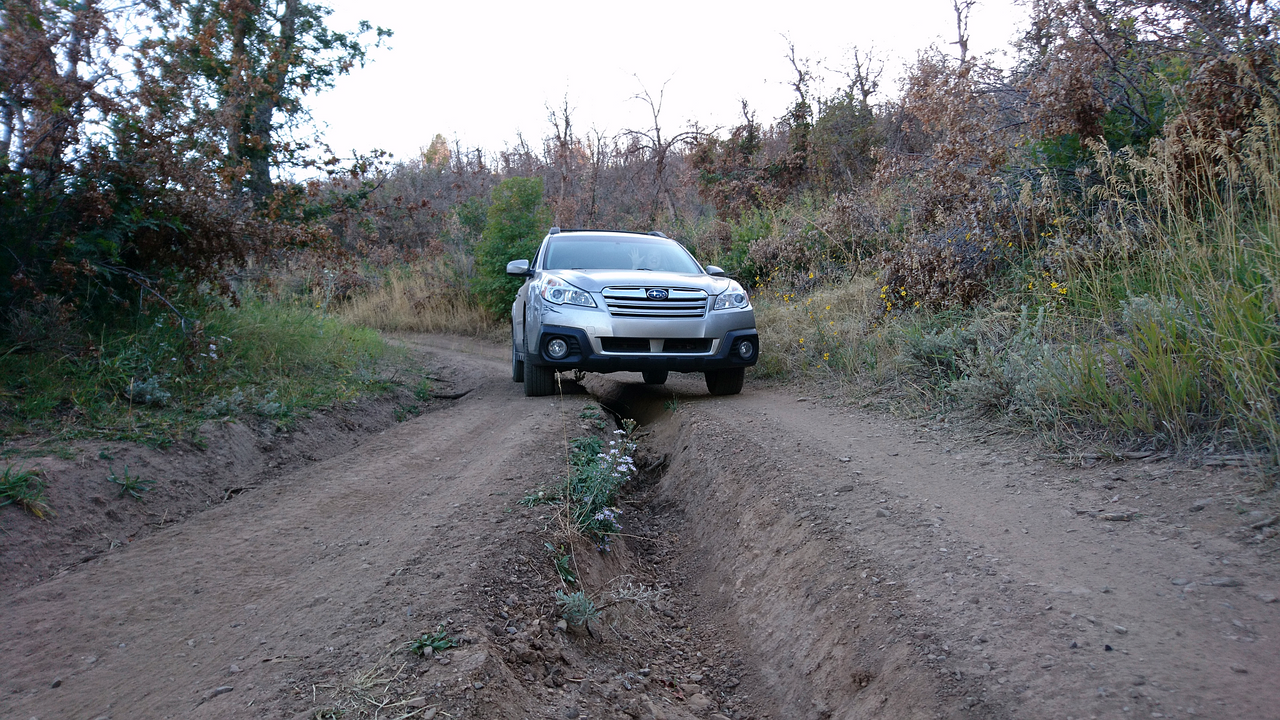
Road 038 becomes very rutted as it begins to climb up out of the Little Diamond Creek valley. Four wheel drive would be highly recommended, and even with four wheel drive after a while it got rough enough that we weren't comfortable taking our Subaru Outback farther. I later realized that we had actually driven up past where the road "ends" on the map, and had driven the beginning section of the "trail". The whole trail is in fact an old mine road and there was no signage noting a trailhead that we saw. A jeep or ATV could probably drive the entire trail.
The view looking down from the first switchback
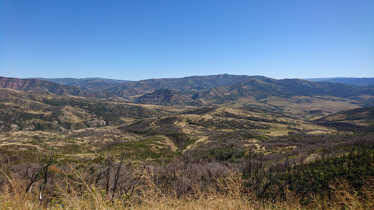
The trail ascends the mountain in a series of switchbacks at a relatively gentle grade. The trail is mostly exposed with very little shade. On the plus side this means every time you turn around and look behind you there are gorgeous views over Diamond Fork Canyon to the south. It would be a brutal hike on a hot day though (we went on a cooler day as it is beginning to transition to fall here).
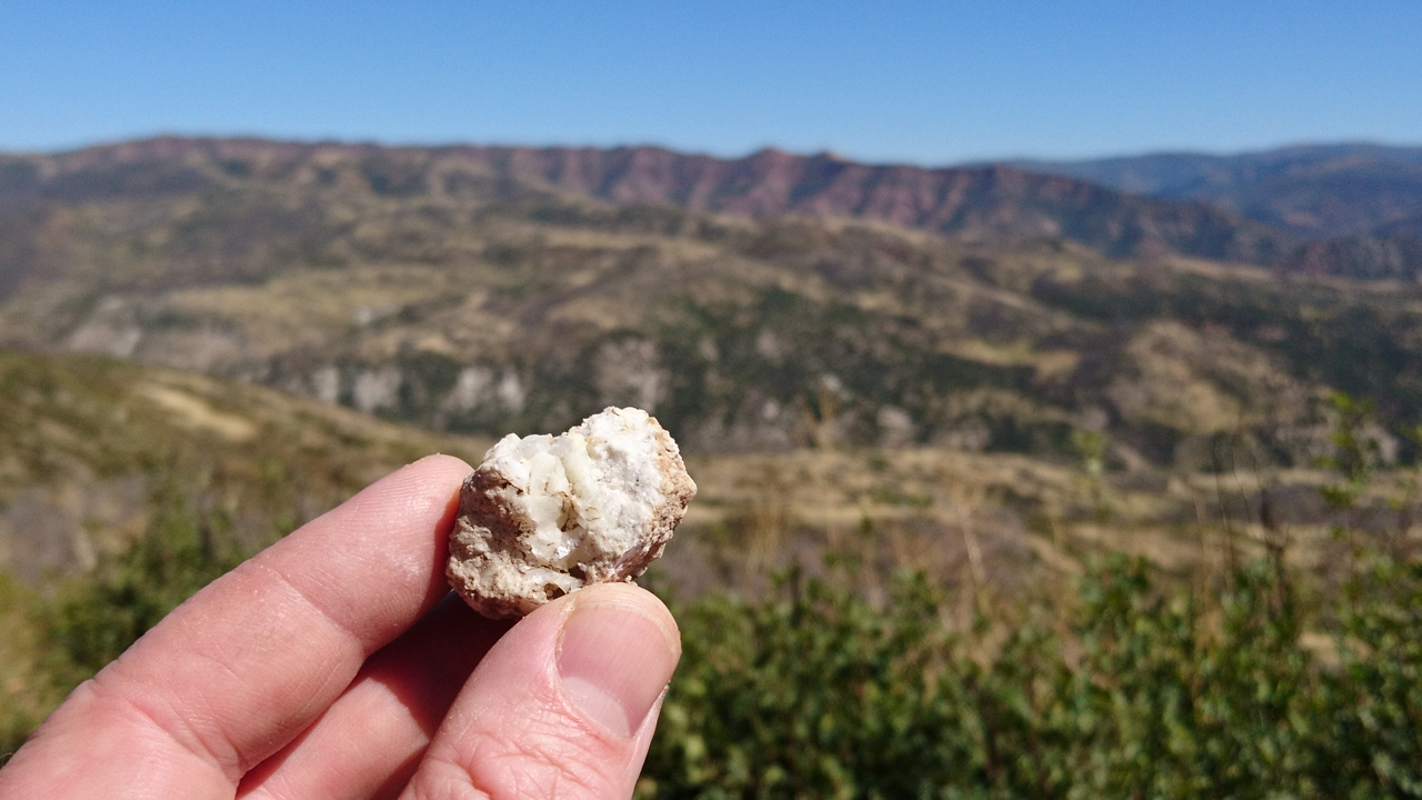
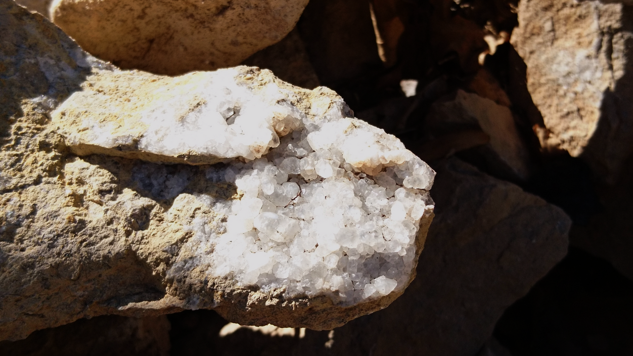
We noticed immediately that there was a lot of crystallization in the rocks, almost every chunk of limestone I picked up from the trail had pockets of quartz crystals.
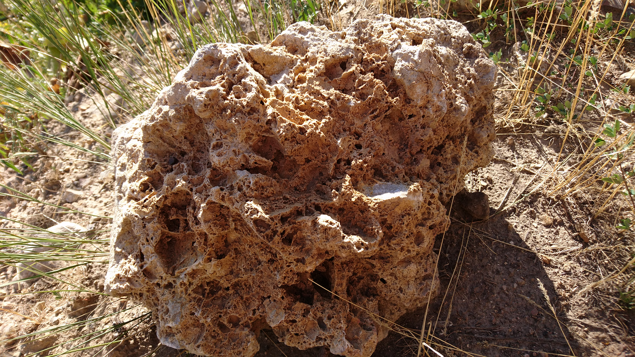
I loved the look of this highly eroded chunk of limestone
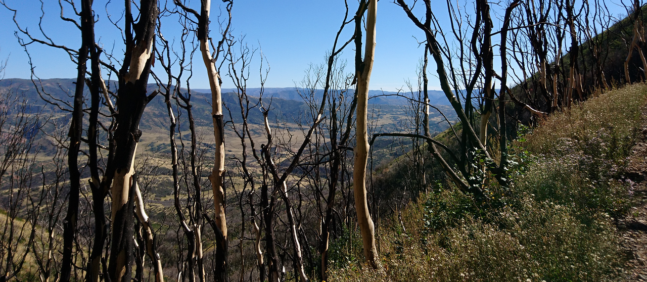
At some point in the recent past a wildfire left the skeletons of what was once a grove of aspen to stand watch. I found the twisted blackened trunks to be very beautiful in a harsh way.
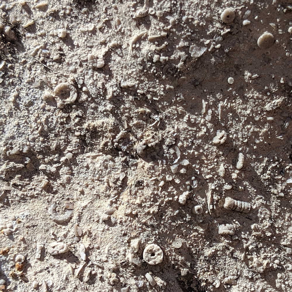
We came across a shale layer that was tilted nearly vertically in the uplift event that raised the mountains, and the trail crossed it several times on the way up.
Agatized fossil clam shells in thin shale slabs
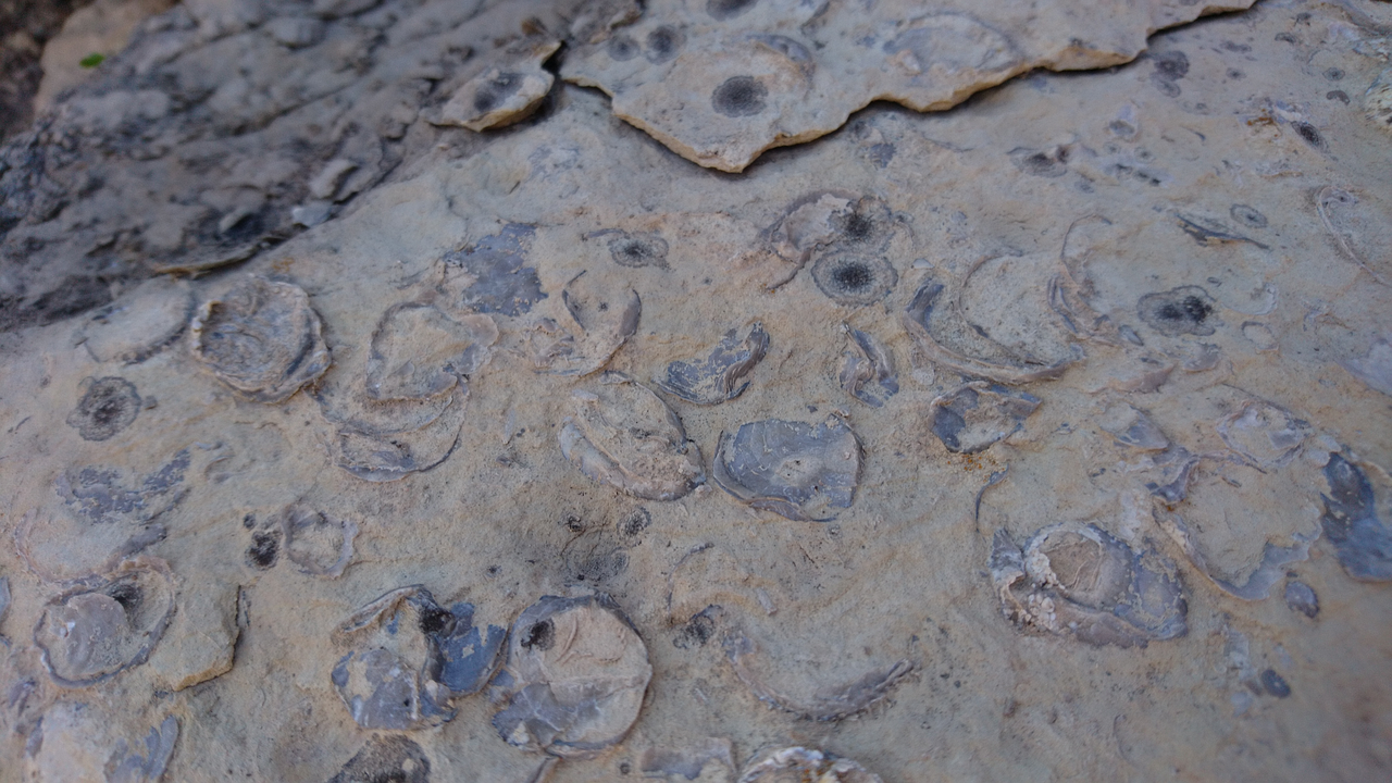
This band of shale was deposited by the Cambrian sea ~ 500 million years ago and it was absolutely loaded with fossils of shells and other marine invertebrates.
Ready to Blog & Earn?
With TravelFeed, easily start your own travel blog and earn as you go. It's the smart platform for travelers who want to profit from their passion. Create a free account
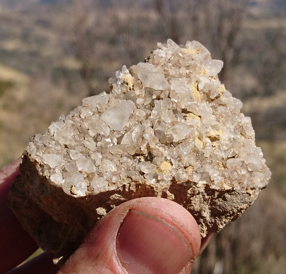
Sheets of quartz crystal points formed in the cracks between layers of shale. The nicest crystals in terms of clarity and size that we found were in this shale.
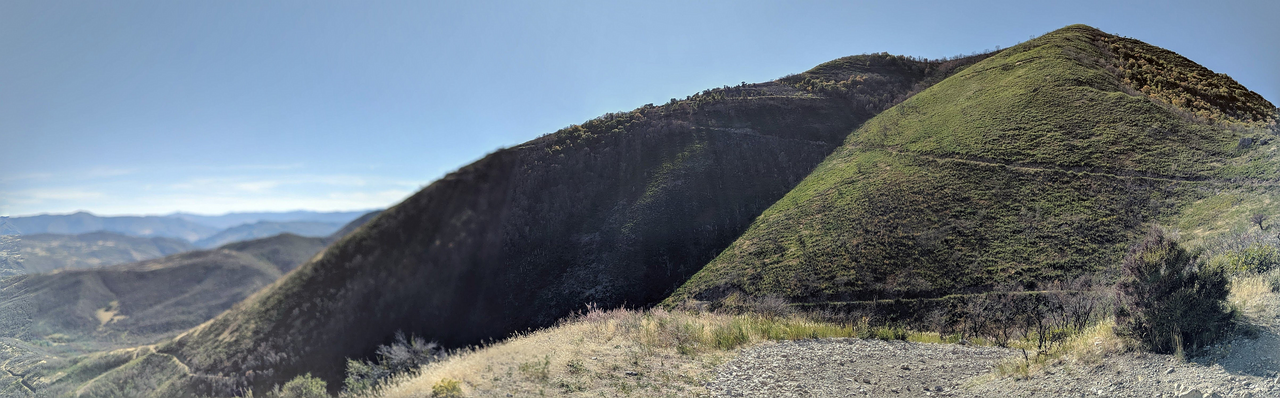
The things were getting tired so we didn't make it to the top of the mountain, but we did make it to the top of a secondary peak which gave stunning views to the north as well as the views south over Diamond Fork. If we had continued, once the trail reaches the peak it continues on the other side along a flat ridge for a couple miles that looks like it would have amazing views down on both sides.
Don't Forget: Get Travel Health Insurance!
To make your trip a worry-free experience, TravelFeed recommends SafetyWing Nomad Insurance. It provides comprehensive health coverage while you travel, so you can focus on exploring, not the unexpected. Get a quote here
Looking down from the highest elevation we reached (~7300'), you can see several sections of the trail below
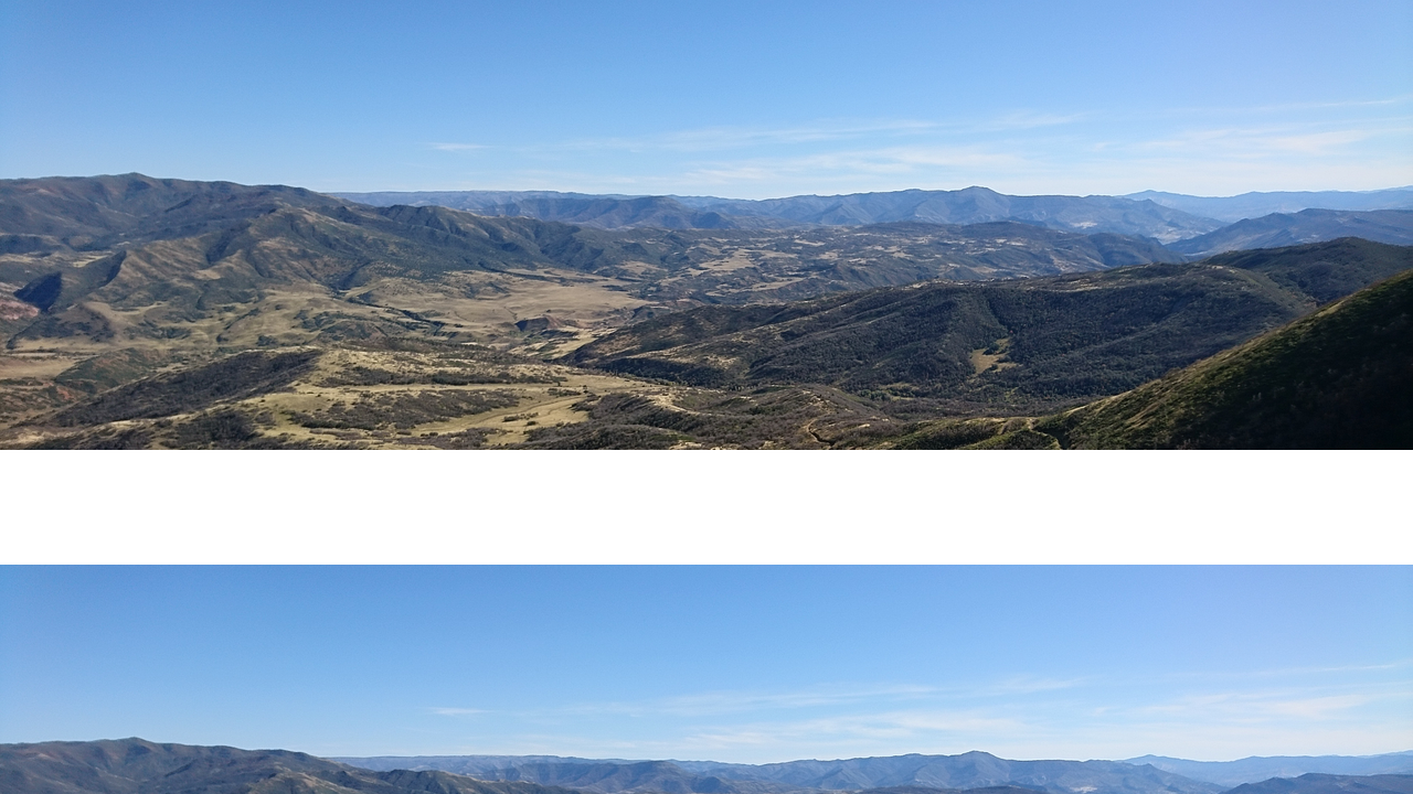
The trail continuing past where we stopped to the peak
I also uploaded a 360° pan video shot from the highest elevation we reached, click the link to view on 3speak.
Geology Sources
https://ugspub.nr.utah.gov/publications/public_information/pi-87.pdf
http://geology.byu.edu/virtualfieldtrip/Cambrian%20Ocean/ophir_shale.htm
http://geology.byu.edu/Home/sites/default/files/volume-15-part-3-1968.pdf
Travel Resources for your trip to United States
Recommended by TravelFeed
Flights: We recommend checking Kiwi.com to find the best and cheapest flights to United States.
Accomodation: Explore the best places to stay in United States on Booking.com, Agoda and Hostelworld.
Travel Insurance: Medical emergencies abroad can be pricey, but travel health insurance is not. We always use SafetyWing for affordable and reliable coverage.
Car Rental: For hassle-free car hiring, DiscoverCars is our trusted choice with a wide selection of vehicles.
Internet: Got an eSIM compatible phone? Airalo is perfect for reliable internet access during your trip. Just install it before you go, and you're set!
Day Trips & Tours: We recommend GetYourGuide for a variety of well-organized and enjoyable activities.
Travel Planner: Need a hand planning? Our free travel planner chatbot is your personal guide to United States. Chat now.
Disclosure: Posts on TravelFeed may contain affiliate links. See affiliate disclosure.
