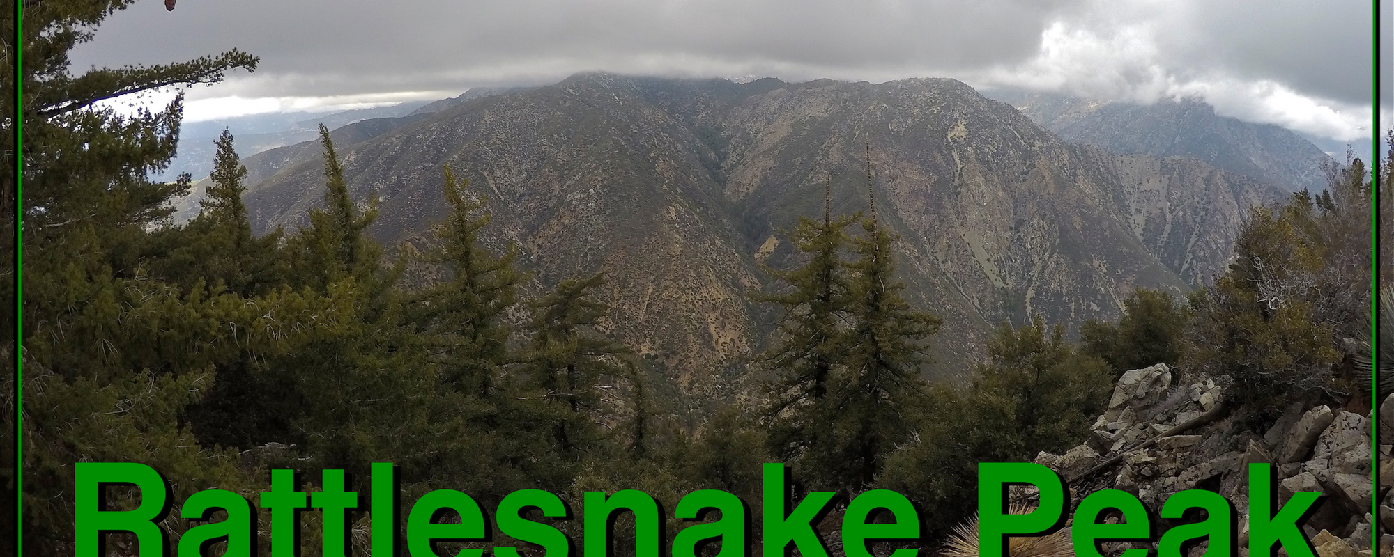
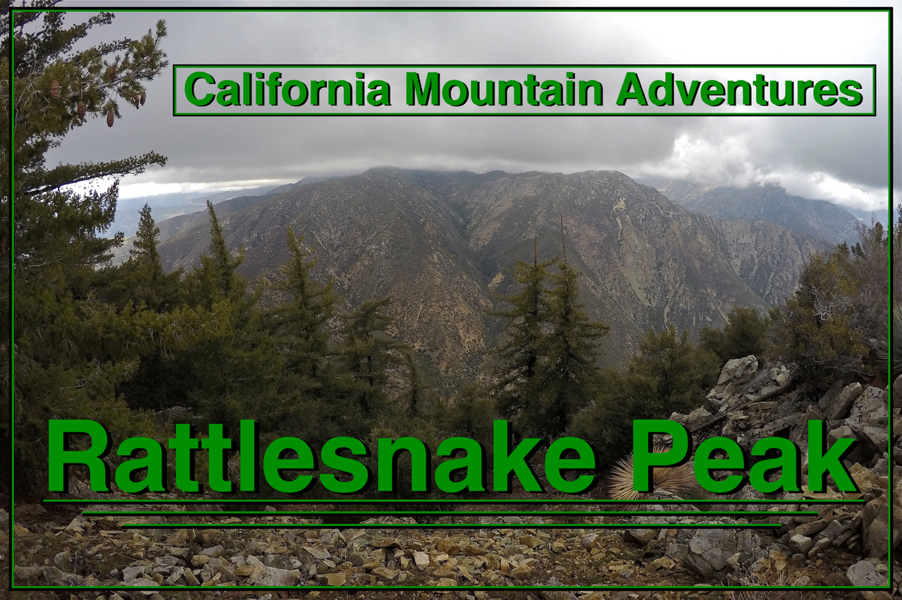
Welcome to this edition of
California Mountain Adventures!!
In this adventure some friends and I climb up and camp on top of
Rattlesnake Peak!
Rattlesnake Peak is a 5826 ft (1776 m) peak in the San Gabriel Mountains in Southern California. This hike was a loop beginning and ending at the Shoemaker road trailhead going up the southeast ridge and down the northeast ridge with an overnight stay on top of the peak!
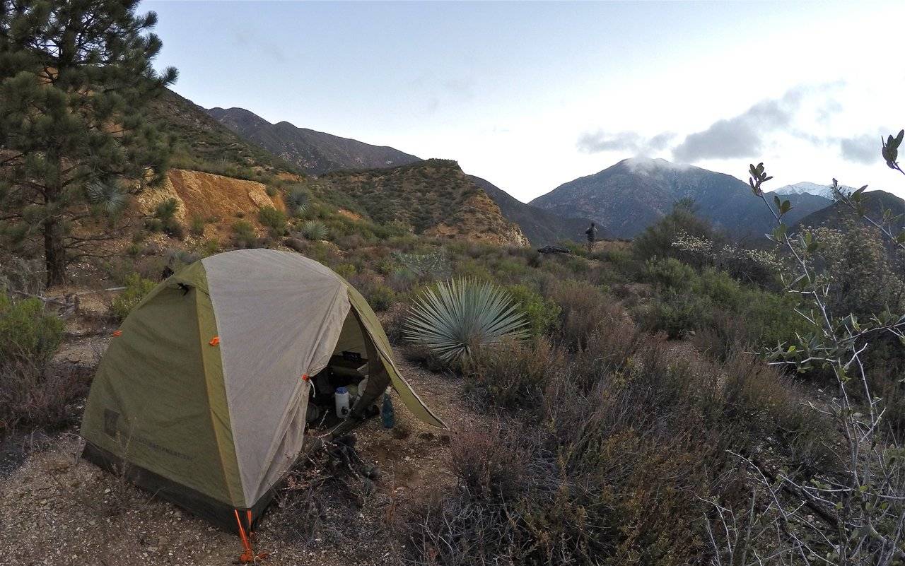
After he got off work my buddy Alan (aka Pharraoh on Youtube) picked me up and we drove up to the trailhead and met his other buddies Matt and Ryan. We started hiking up Shoemaker road in the dark with the East fork of the San Gabriel river raging down below us. We followed the road to the cutoff for the trail to the peak. We went a short distance up the trail and then made a small detour out to a large flat area on the hill that was flattened many years ago to place some water tanks. The old tanks are still there but have long since been out of use. We setup our camp there and got some rest for the big climb to the summit the next day.
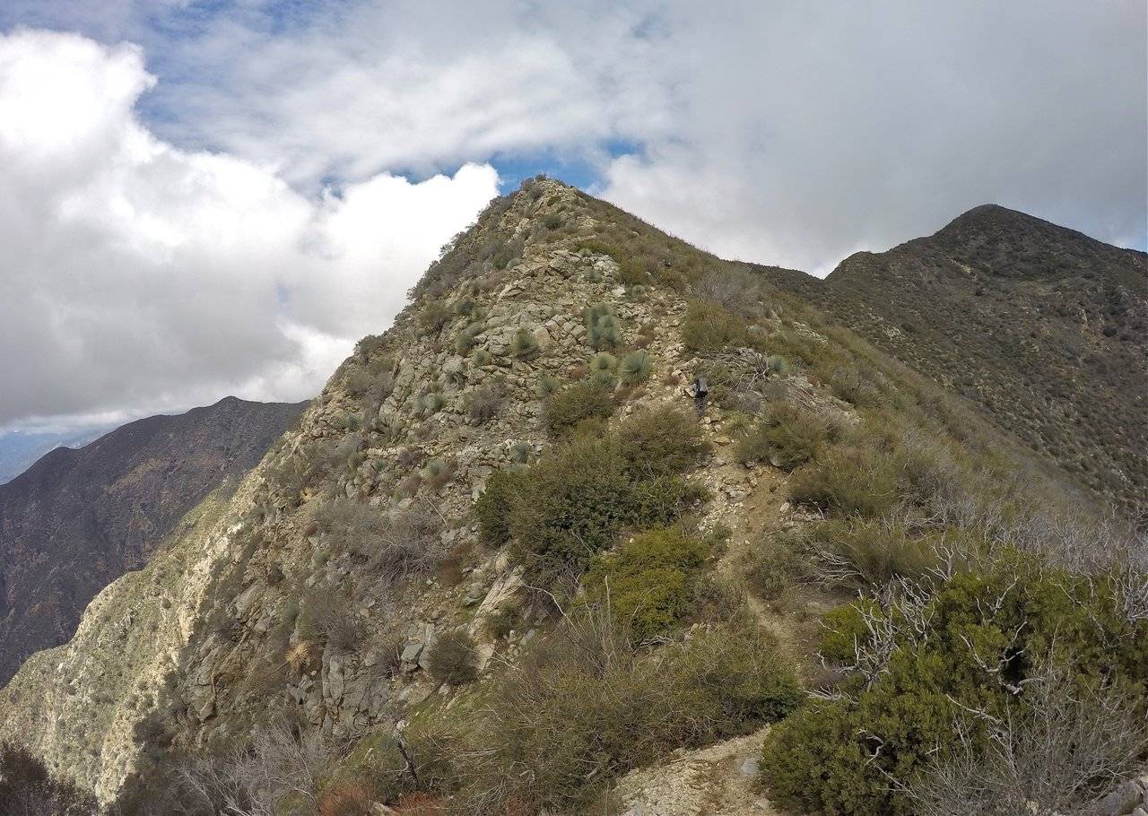
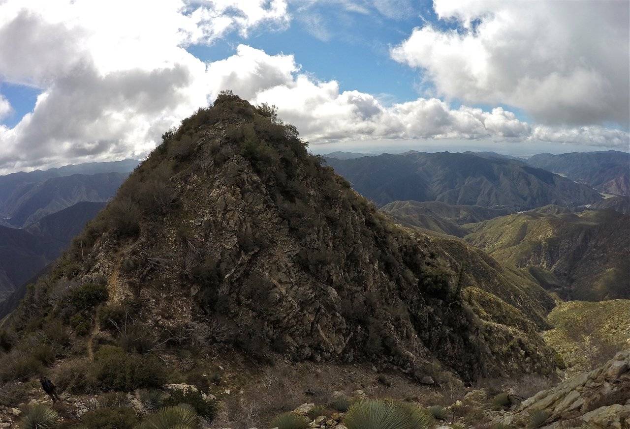
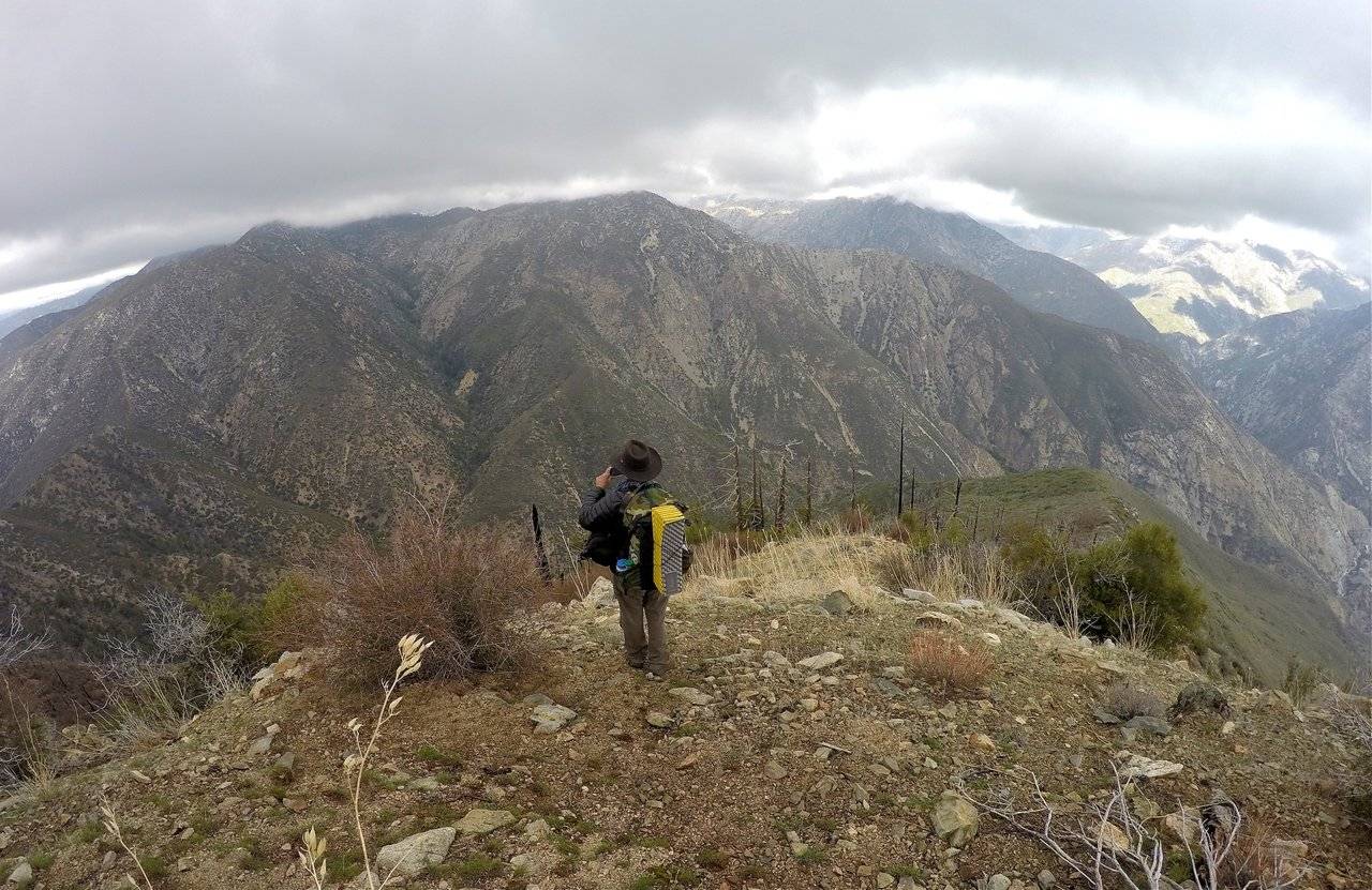
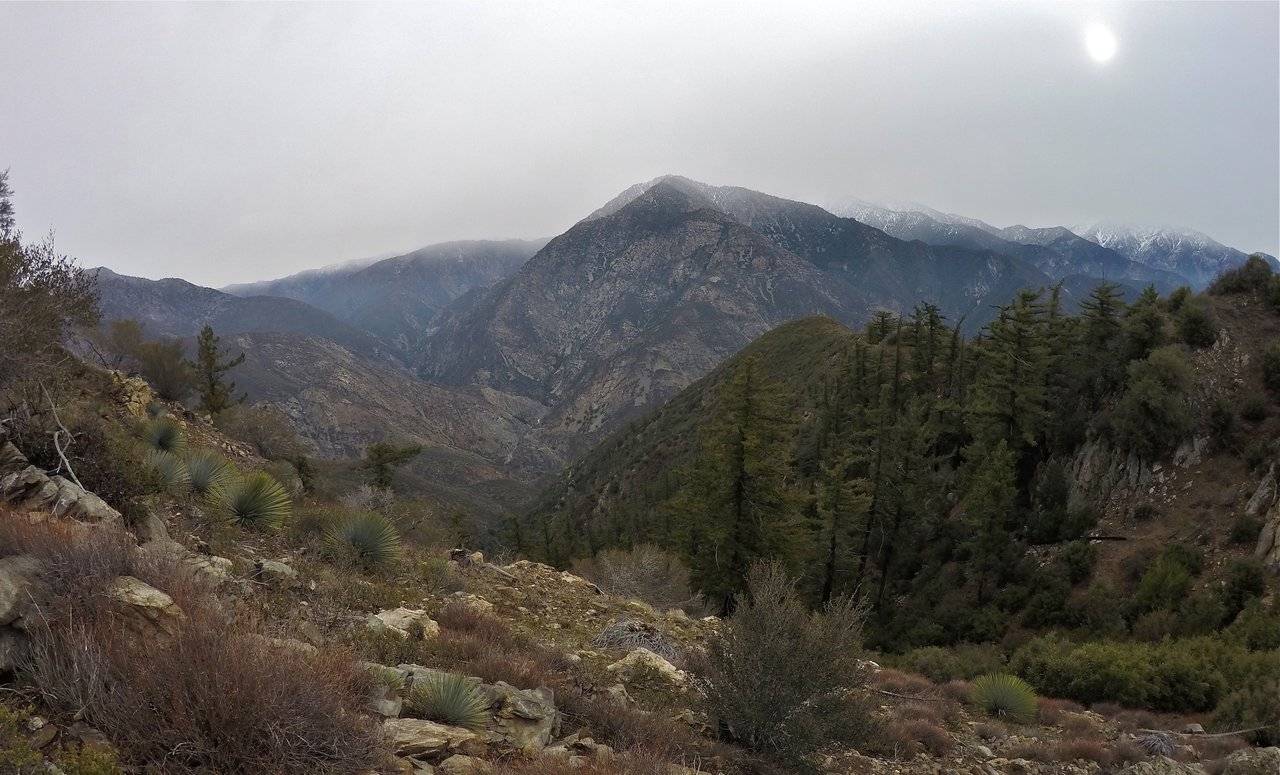
We woke up to a cold frosty morning. We made some breakfast, packed up camp, and started the big climb. The climb wasn't really technical at all, just brutally steep. Going straight up the mountain with overnight packs was a real test of endurance. We stopped to rest multiple times. The southeast ridge had great views over Graveyard canyon and Camp Williams and even out to the San Gabriel reservoir which is quite full right now! But as we climbed the clouds were building and started blocking some of our views. We watched as the clouds blew all around us. Engulfing us at times. We knew there was a chance of these clouds dropping some rain/snow, but we were hoping it wouldn't be much. We continued climbing, pushing our way up the ridge one stretch at a time.
Morning time at camp
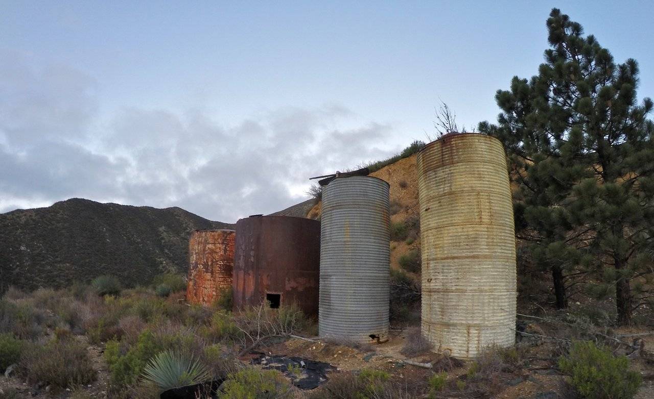
The old water tanks
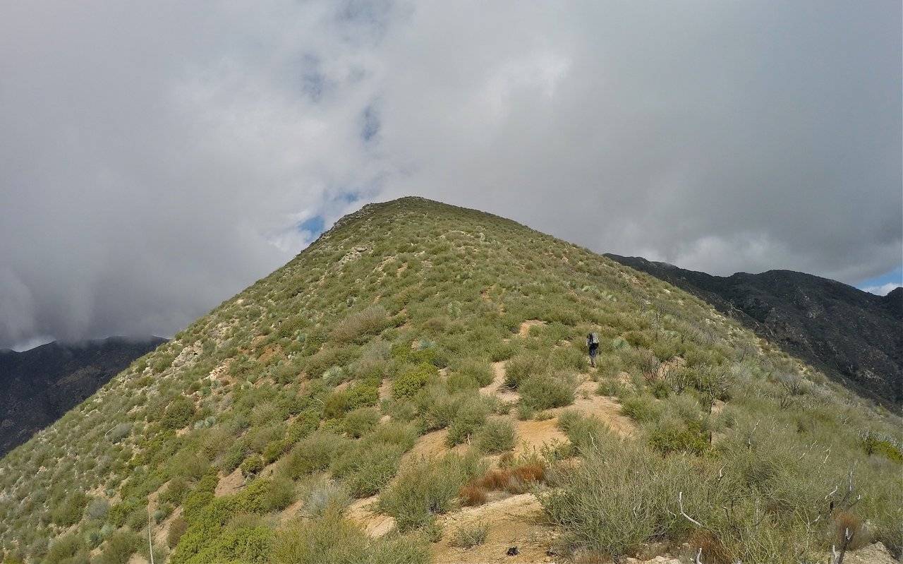
Starting to climb
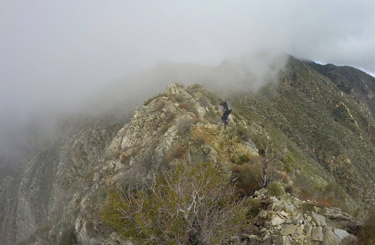
Clouds blowing across the ridge
Climbing straight up the ridge
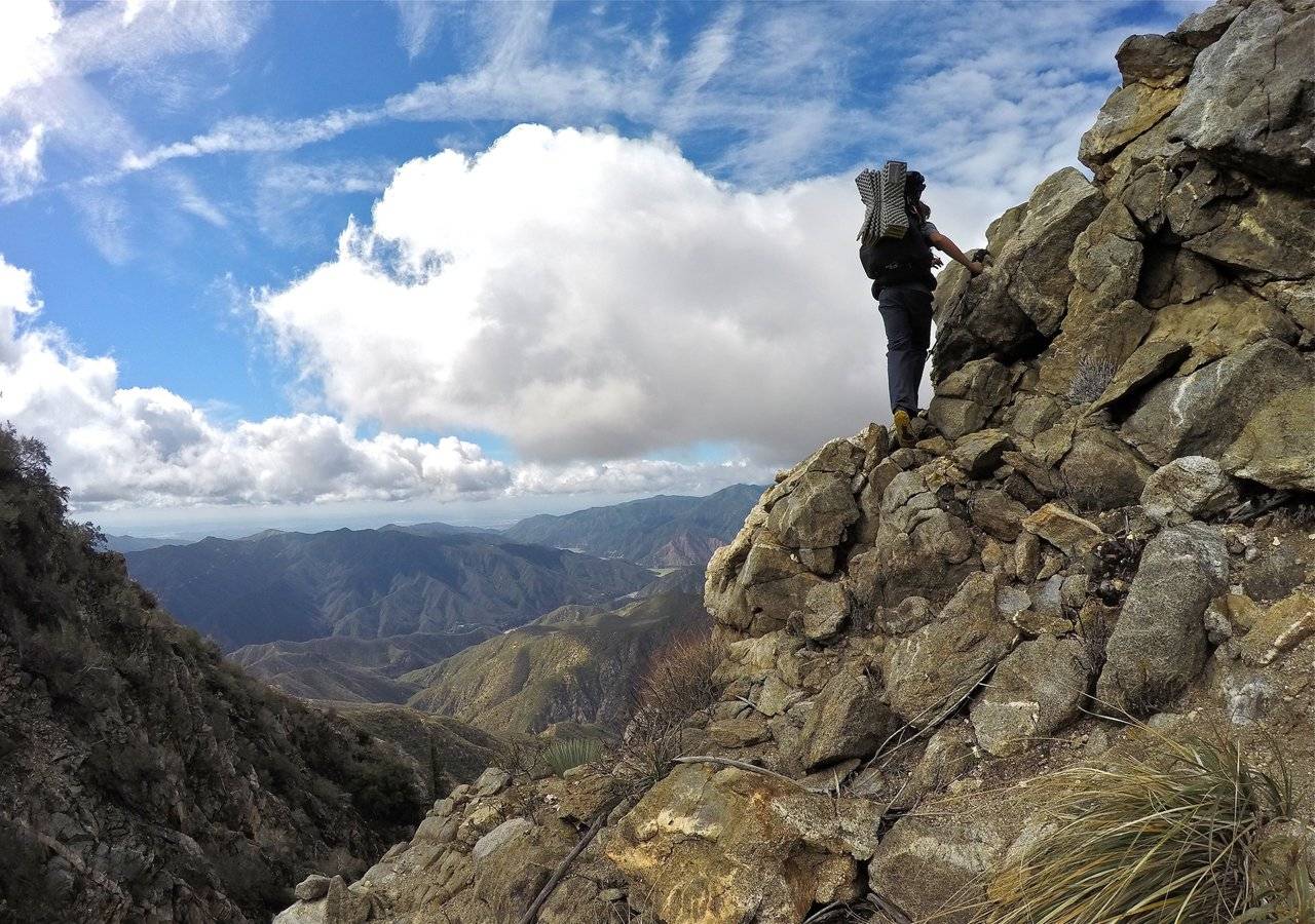
Matt making his way up some rocks
A big point along the ridge that we had to climb over
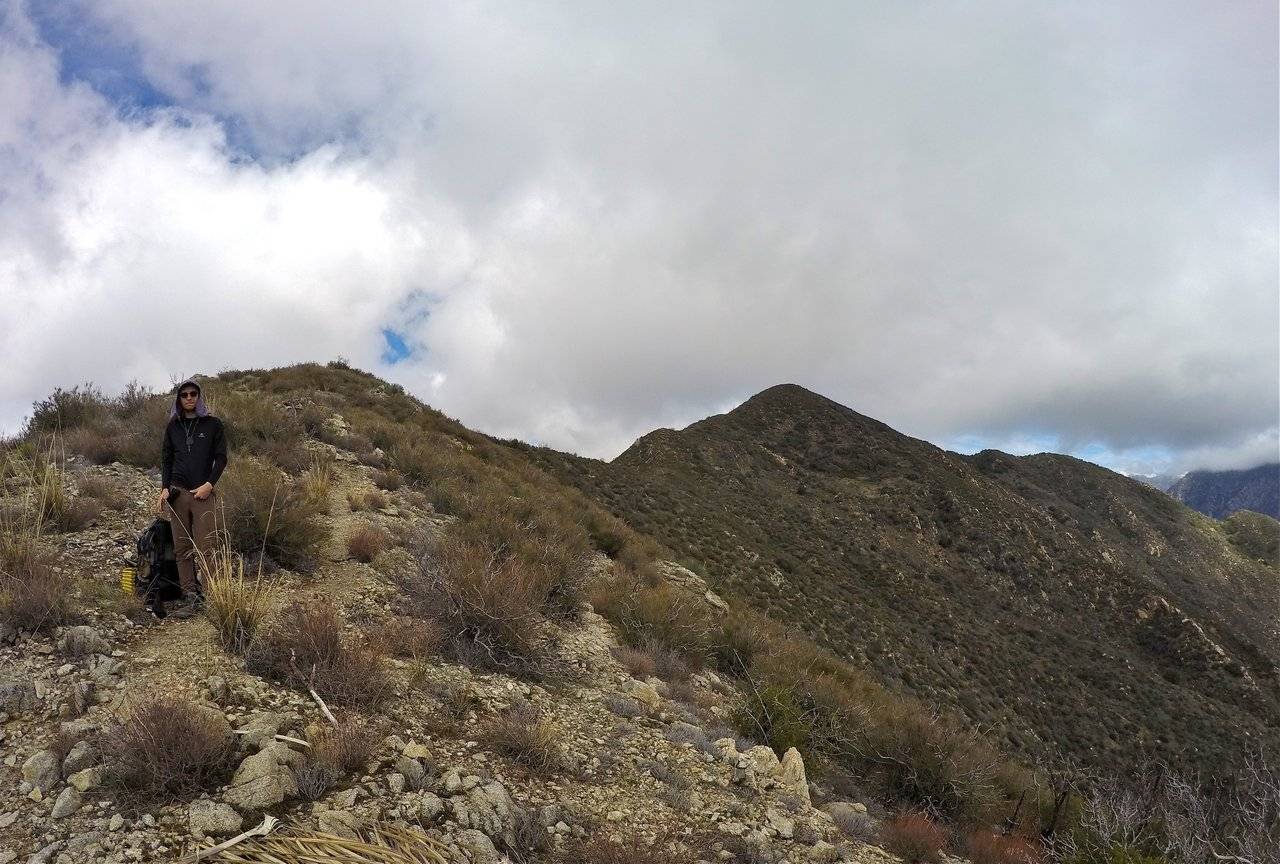
Ryan stopping for a quick break
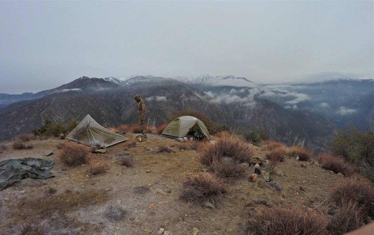
Although it was a tough climb we made good time and arrived at the summit in the early afternoon. We signed the summit register and I saw my signature in there from when I climbed it over 5 years ago. That was pretty cool to see! I had wanted to come back and camp up there ever since that day and now here I was!! We rested for a bit on the summit and then made some lunch. After lunch we took our stuff over to a nice flat area just off the north side of the peak that was perfect for us to setup camp! After getting camp all setup we relaxed and enjoyed the rest of the day watching the clouds blowing all around us. Sometimes completely engulfing us and sometimes breaking and opening up views across the canyon to Iron mountain and the Bridge to Nowhere way down below. Being in the clouds was really neat, but it was also really cold. And as the evening came the temperature dropped down below 30F(-2C)! We made our dinners (with Alan making his gourmet meal as usual) and then we got tucked into our sleeping bags early for a long cold night!
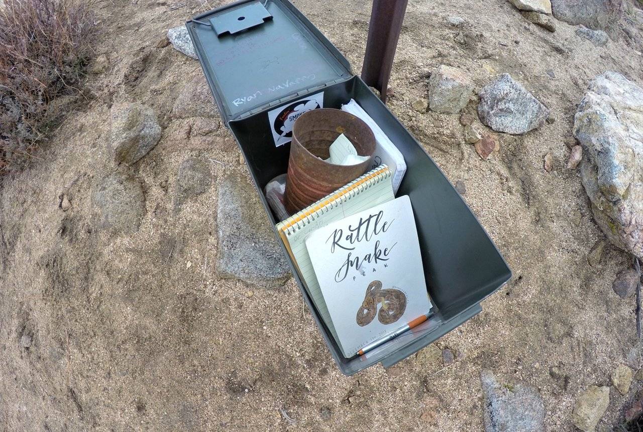
The summit register
Alan looking off the north side of the peak
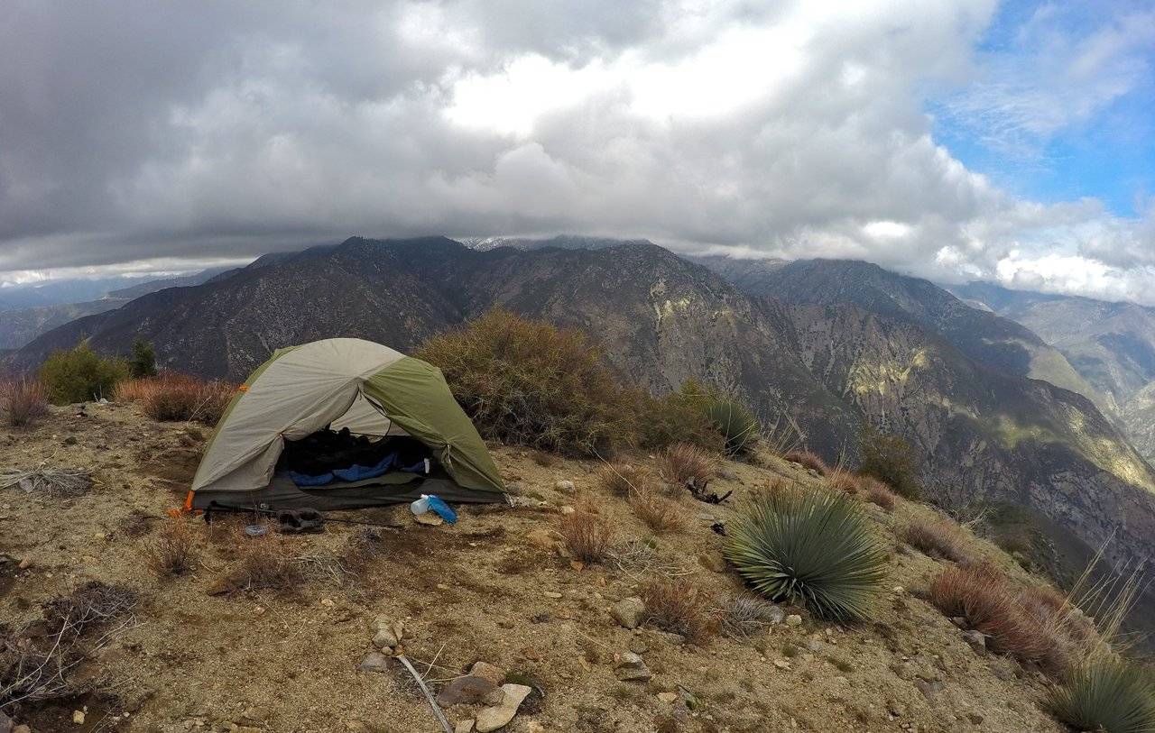
Getting my tent all setup
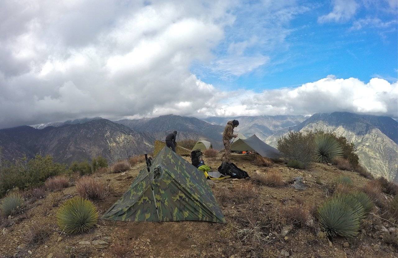
Setting up camp
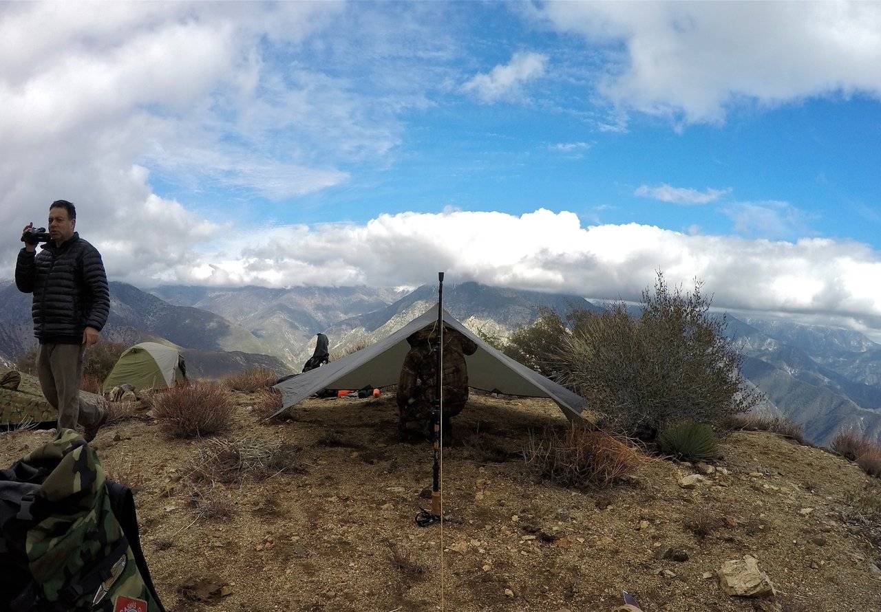
Alan getting some footage for his Youtube video
and Ryan setting up his tarp shelter
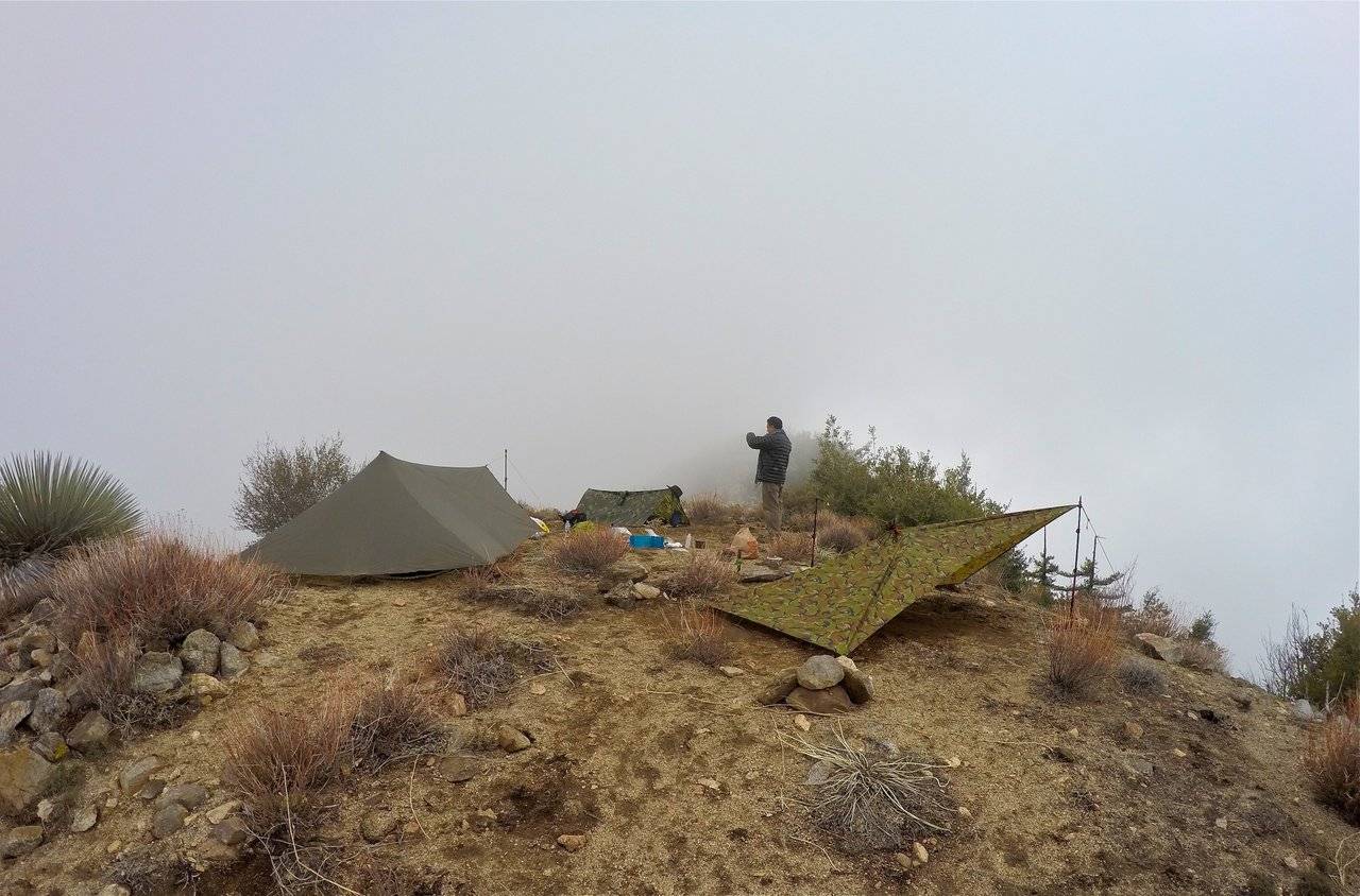
Camping in the clouds
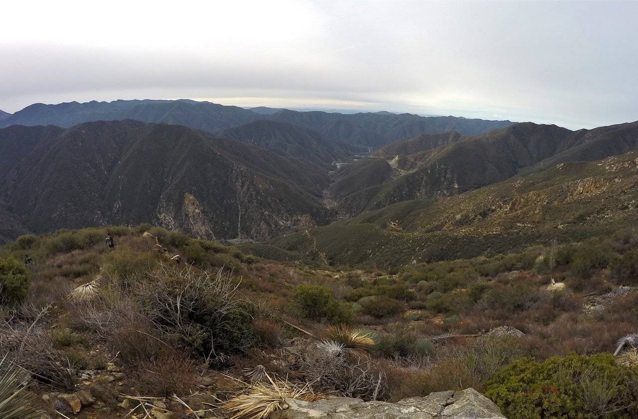
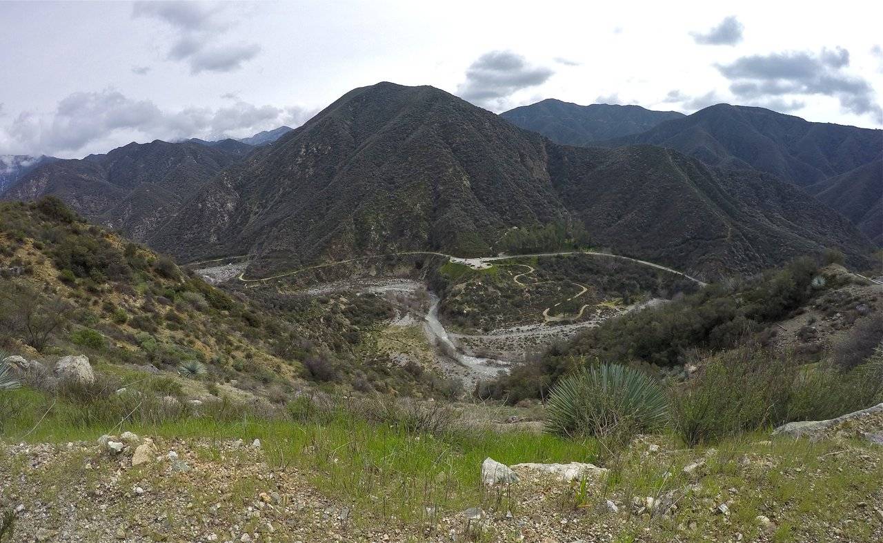
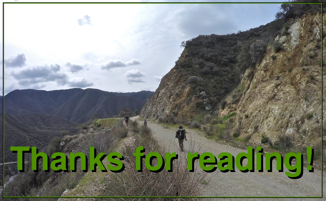
We woke up early the next morning. Cold but happy that the rain/snow that was forecasted never came! The clouds were high in the sky and we got some great views of the snow capped peaks in the San Gabriel high country and we even saw the beginning of a beautiful sunset! But before long the clouds were back to block our view of the sunrise. We packed up camp and started out early on our descent of the northeast ridge. This route was also brutally steep! The trail was less defined than the trail on the southeast ridge but with a little route finding here and there it was pretty easy to follow. The ridge had some really great views of Iron mountain, the Bridge to Nowhere, and the East Fork. At a certain point the trail dropped us off the south side of the ridge (still brutally steep) which then eventually connected with a trail that follows along the remnants of the upper part of Shoemaker road. From here the hike flattened out (finally some relief!) and then connected with the actual road at the "Tunnels to Nowhere"! We followed the road through the two tunnels and back to the Shoemaker road trailhead where we started. Ending yet another epic California Mountain Adventure!!
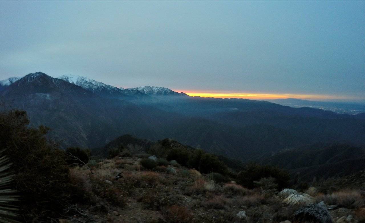
Early morning sunrise
Packing up camp
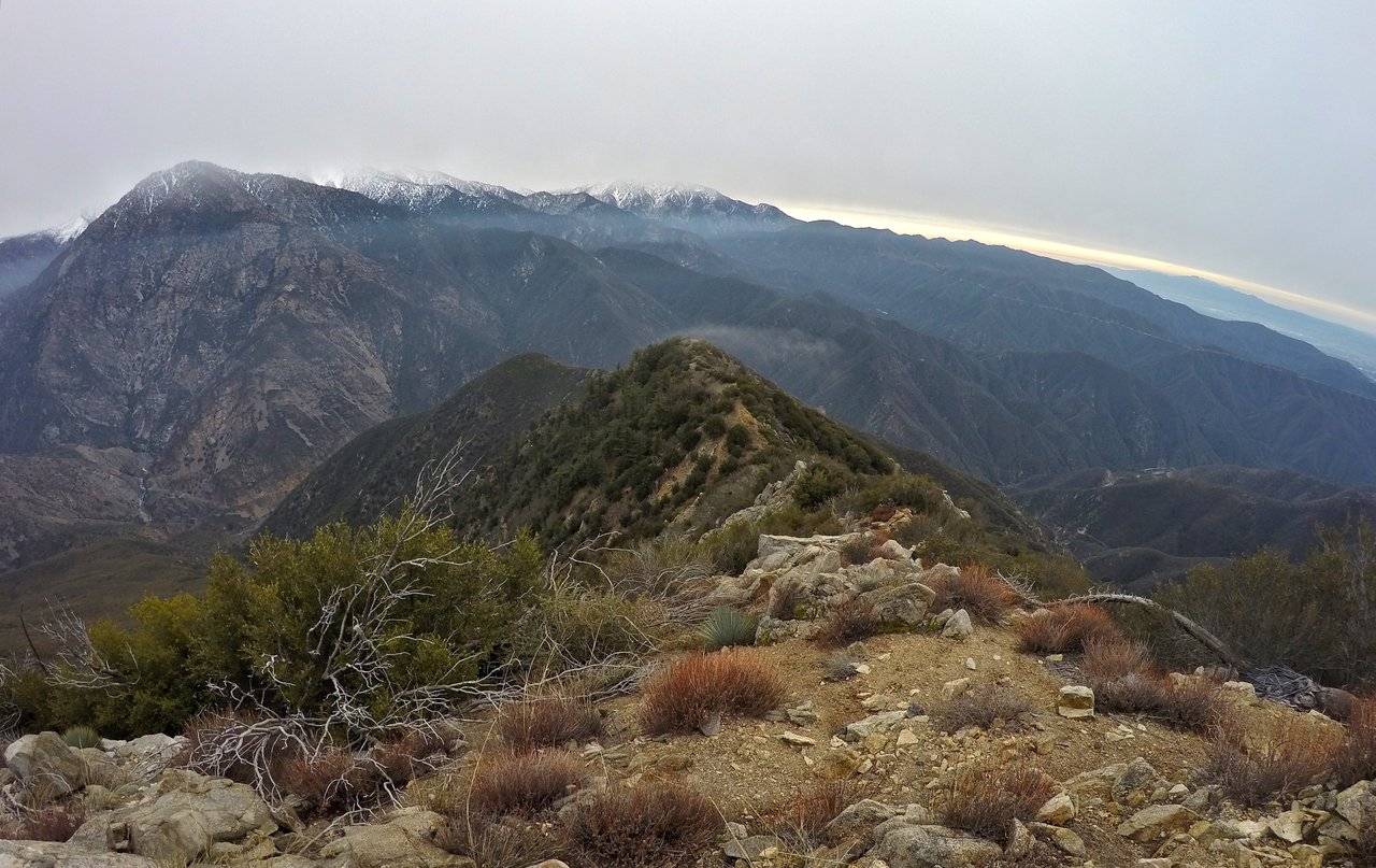
Looking down the northeast ridge
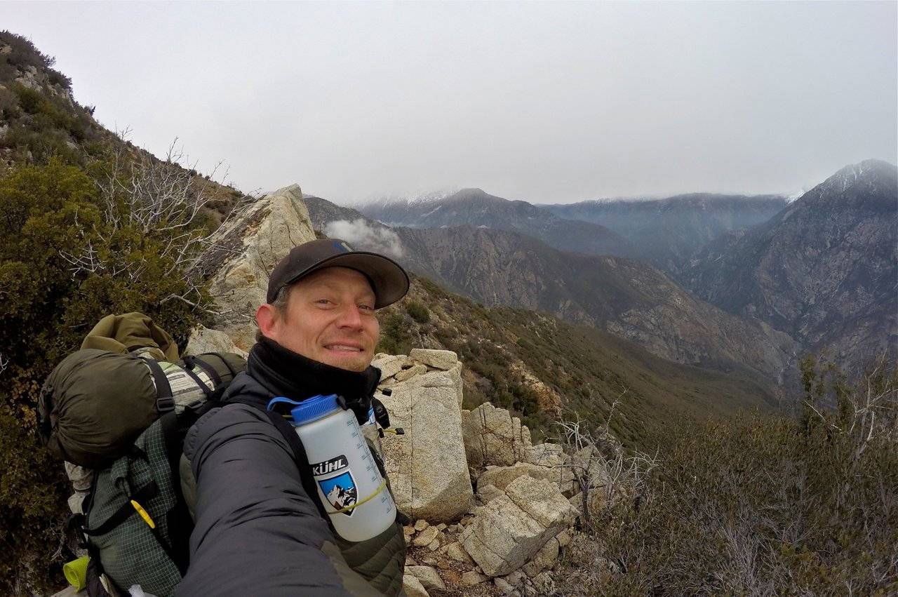
Selfie on the northeast ridge
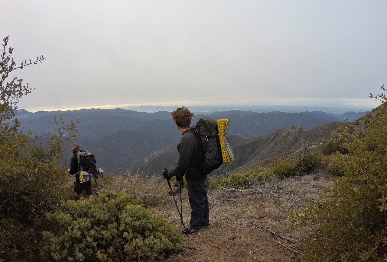
Ryan and Matt looking south from the ridge
Views looking up the East Fork
Views looking down the East Fork
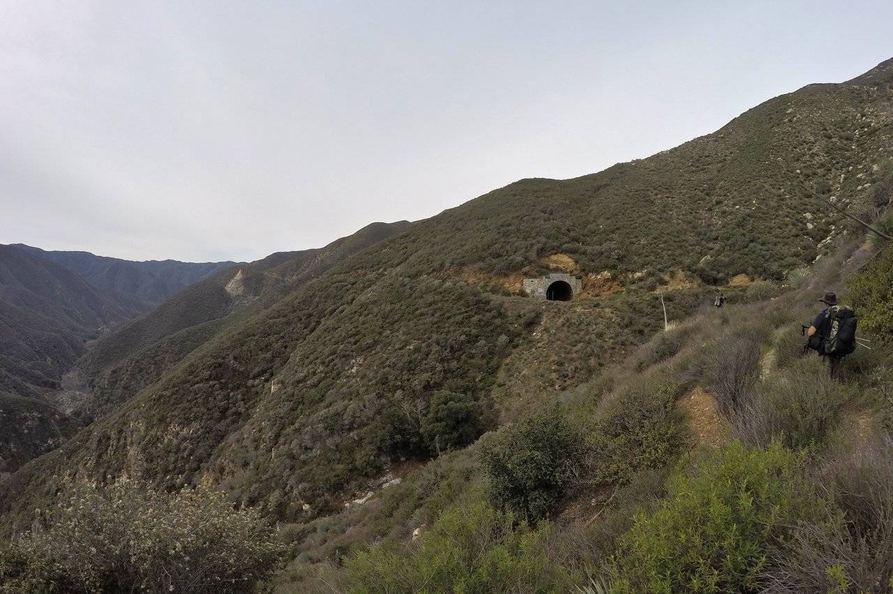
Approaching the "Tunnels to Nowhere"
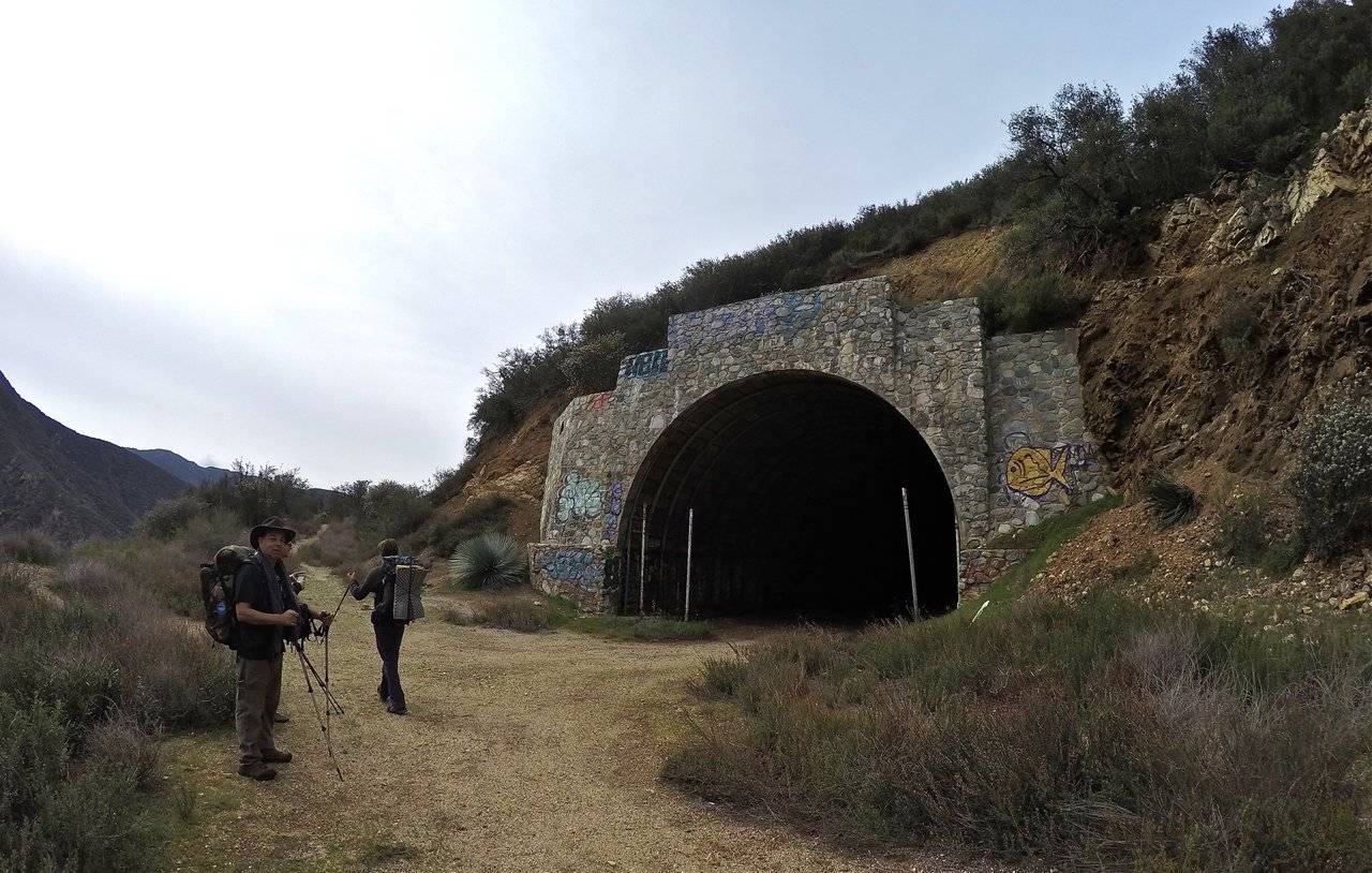
The first tunnel
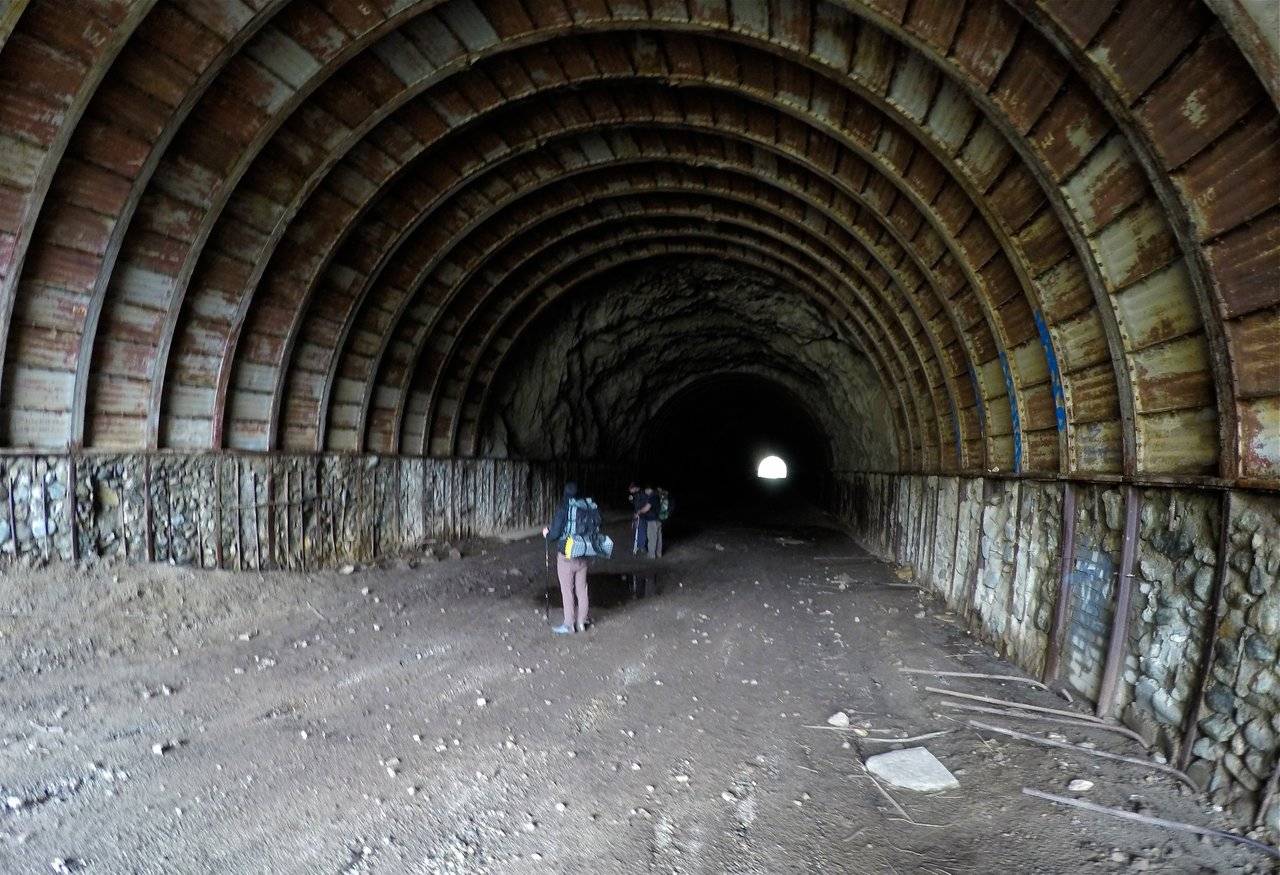
Inside the first tunnel
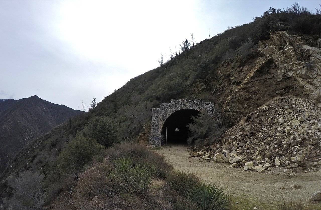
The second tunnel
Overlooking the East Fork from Shoemaker road
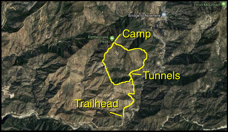
click to view map large
Be sure to check out Alan's video of our trip and subscribe to his Youtube channel to see more of his awesome adventures!!
And that's it for this California Mountain Adventure!
Steemit World Map
Contact me on Discord

#SoCalSteemit is building and supporting the Steemit community of Southern California. If you are from SoCal and are into creating quality content here on Steemit, we'd love for you to follow us @SoCalSteemit and join our group on Discord


Animation By @zord189

Ready to Blog & Earn?
With TravelFeed, easily start your own travel blog and earn as you go. It's the smart platform for travelers who want to profit from their passion. Create a free account


Don't Forget: Get Travel Health Insurance!
To make your trip a worry-free experience, TravelFeed recommends SafetyWing Nomad Insurance. It provides comprehensive health coverage while you travel, so you can focus on exploring, not the unexpected. Get a quote here


Travel Resources for your trip to United States
Recommended by TravelFeed
Flights: We recommend checking Kiwi.com to find the best and cheapest flights to United States.
Accomodation: Explore the best places to stay in United States on Booking.com, Agoda and Hostelworld.
Travel Insurance: Medical emergencies abroad can be pricey, but travel health insurance is not. We always use SafetyWing for affordable and reliable coverage.
Car Rental: For hassle-free car hiring, DiscoverCars is our trusted choice with a wide selection of vehicles.
Internet: Got an eSIM compatible phone? Airalo is perfect for reliable internet access during your trip. Just install it before you go, and you're set!
Day Trips & Tours: We recommend GetYourGuide for a variety of well-organized and enjoyable activities.
Travel Planner: Need a hand planning? Our free travel planner chatbot is your personal guide to United States. Chat now.
Disclosure: Posts on TravelFeed may contain affiliate links. See affiliate disclosure.
