
A hike through a gorge in the late autumn after a few rainy days is not really a good idea, because it is mostly wet, slippery and muddy there. | Eine Wanderung durch eine Schlucht im Spätherbst nach einigen Regentagen ist nicht wirklich eine gute Idee, weil es dann dort meistens nass, rutschig und schlammig ist. |
Adventure Water Way / Abenteuer Wasser Weg
Liebenfels - Sörg, Austria
But it was still an interesting and beautiful hike, because I had the entire gorge to the Waterfall Sörg for me alone. | Aber es war trotzdem eine interessante und schöne Wanderung, weil ich die gesamte Schlucht bis zum Sörger Wasserfall für mich alleine hatte. |
❖ click the image for fullsize view ❖
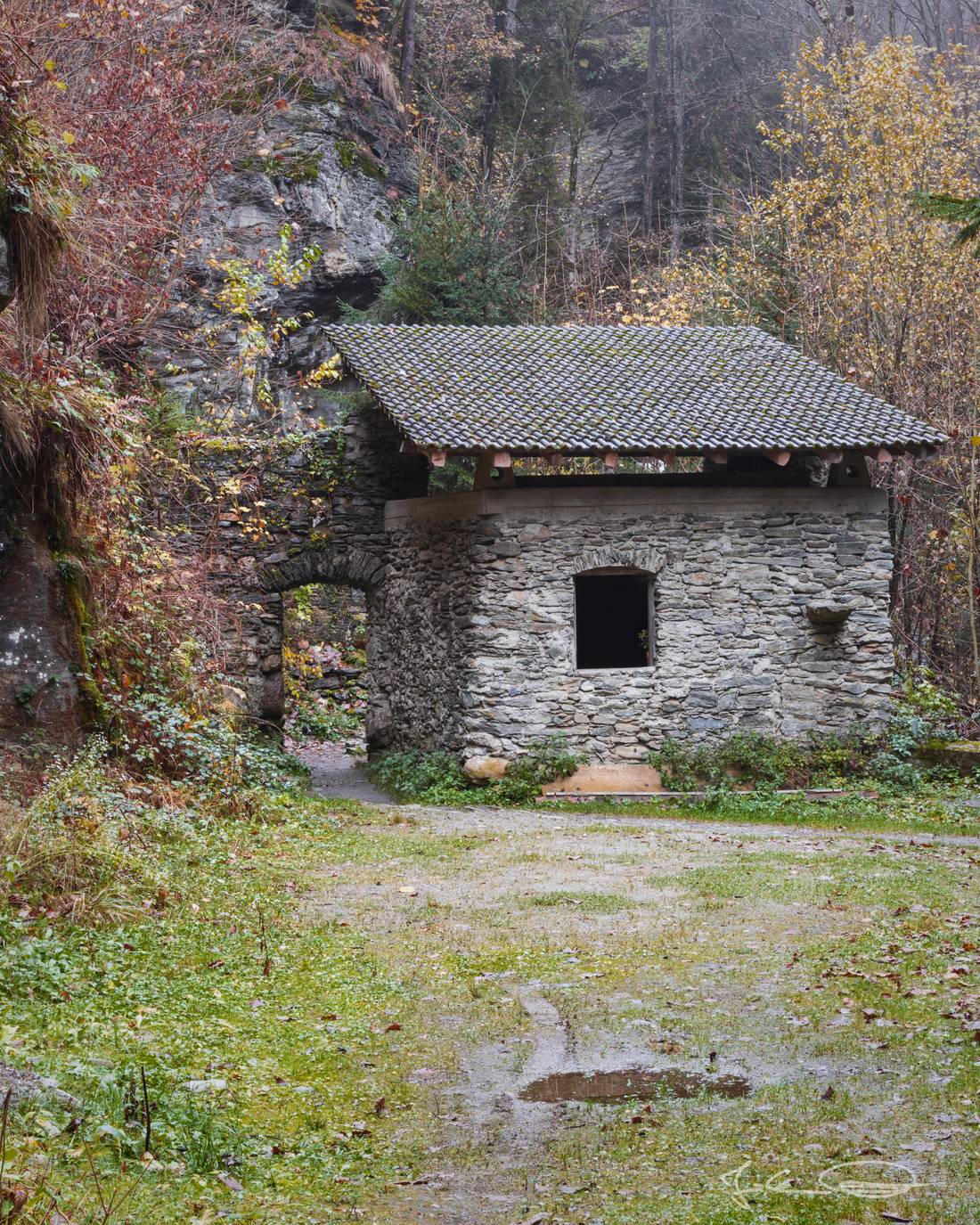
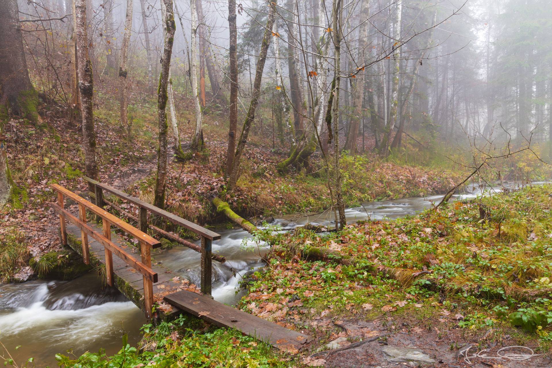
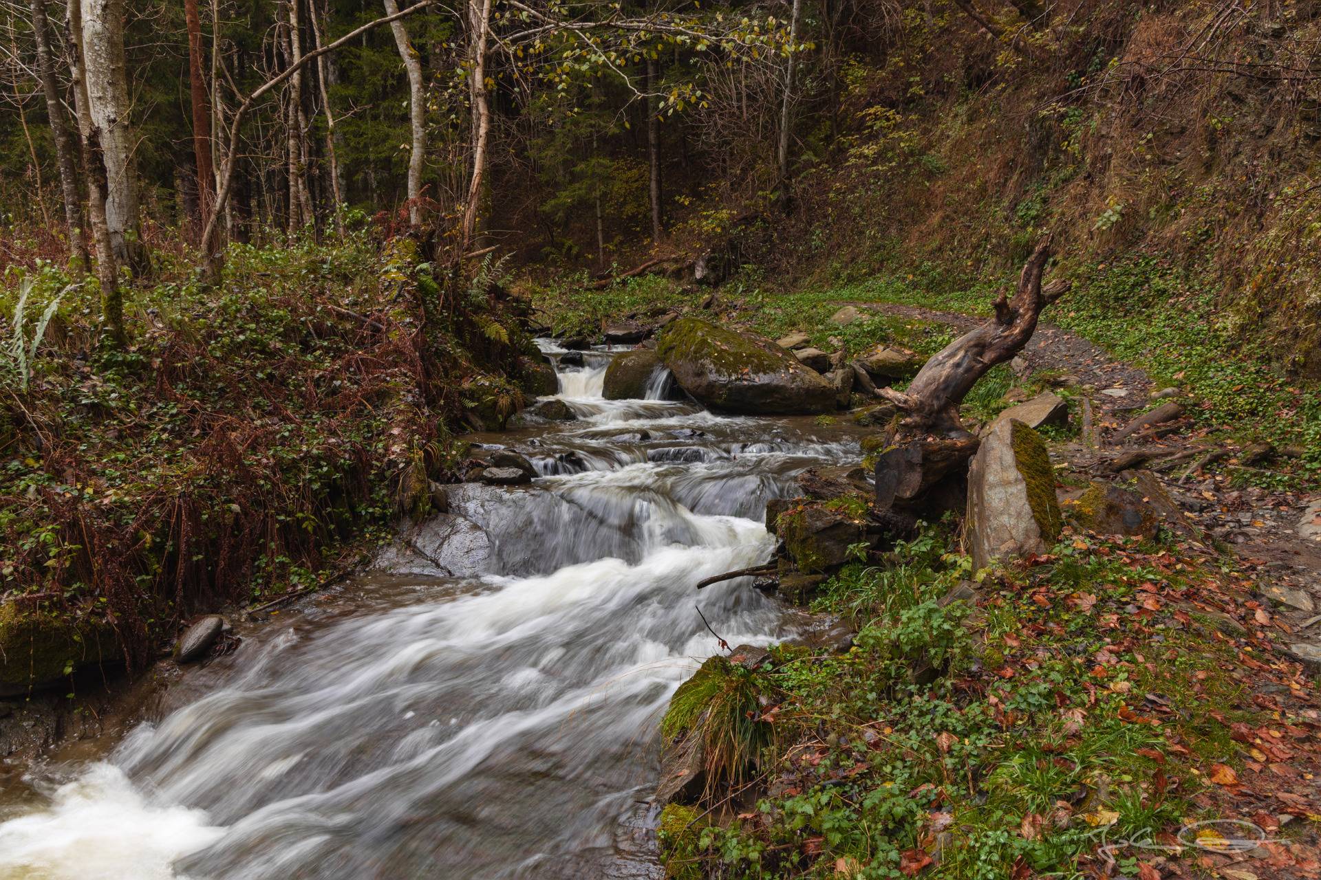
After the parking lot (gravel parking) in Glantschach near Liebenfels you walk a bit uphill on a forest road and within a few minutes you will get to an old mill ruins. The actual "Adventure Water Way" along the brook begins here. | Nach dem Parkplatz (Schotterparkplatz) in der Nähe von Glantschach bei Liebenfels geht man ein Stück über einen Waldweg bergauf und erreicht nach wenigen Minuten eine alte Mühlenruine. Dort beginnt dann der eigentliche Wasserweg entlang des Baches. |
 ▲click the image for fullsize view▲ | 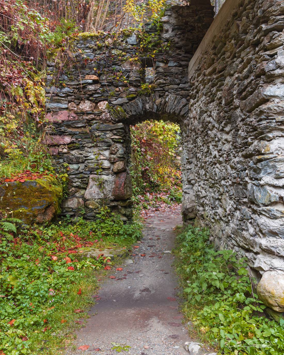 ▲click the image for fullsize view▲ |
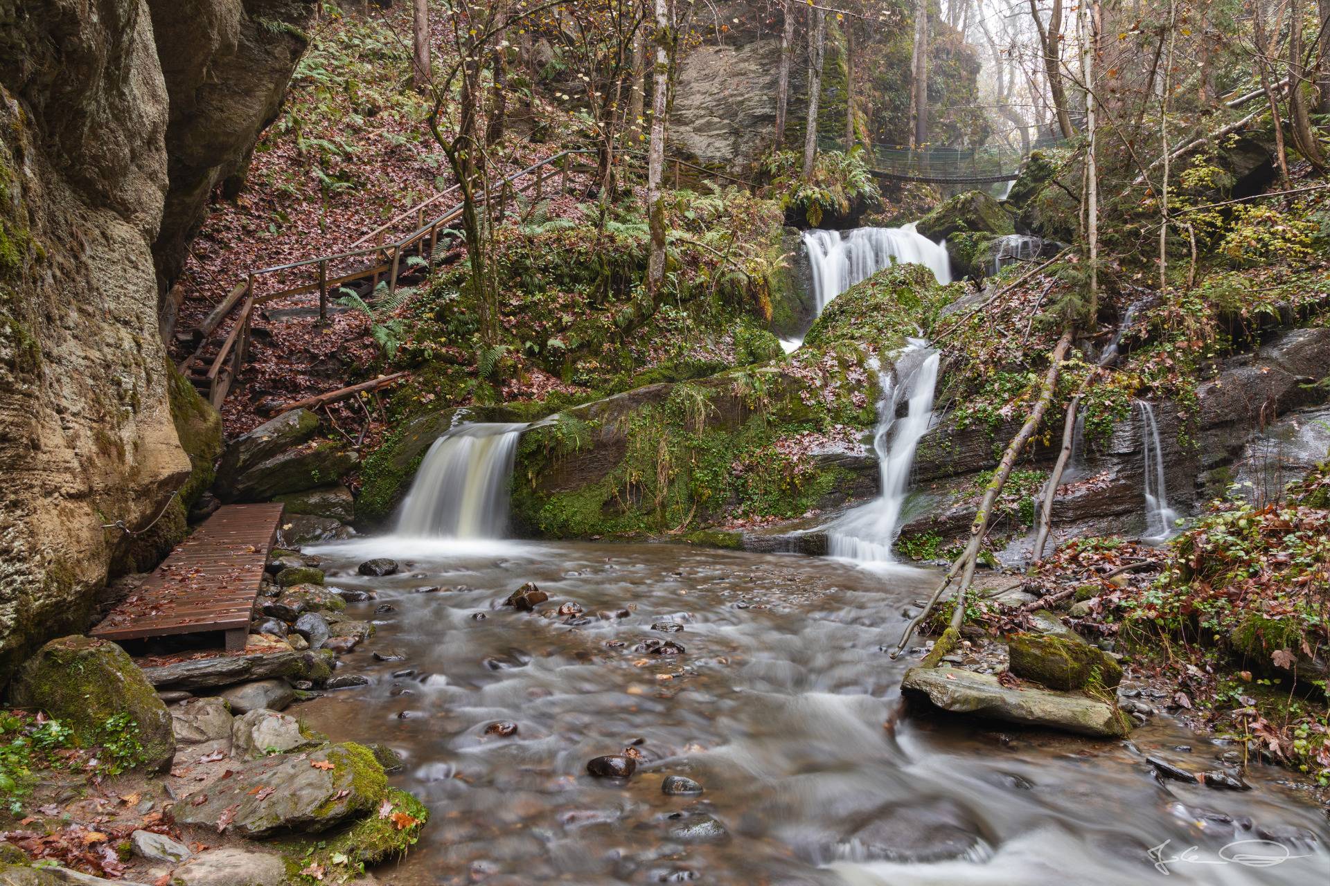
From then the path leads along the stream and waterfalls and soon after the suspension bridge, which is at the beginning of the path, and the "Teufelssteig" (Devils track, a steep track) you get to the first rest area. | Von nun an geht es dem Bach und Wasserfällen entlang und schon bald nach der Hängebrücke zu Beginn des Weges und dem Teufelssteig kommt man zum ersten Rastplatz. |
 ▲click the image for fullsize view▲ | 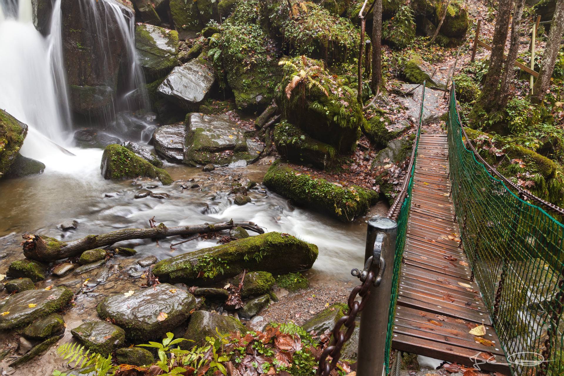 ▲click the image for fullsize view▲ |
 ▲click the image for fullsize view▲ | 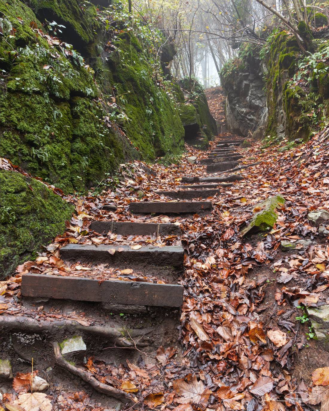 ▲click the image for fullsize view▲ |
 ▲click the image for fullsize view▲ | 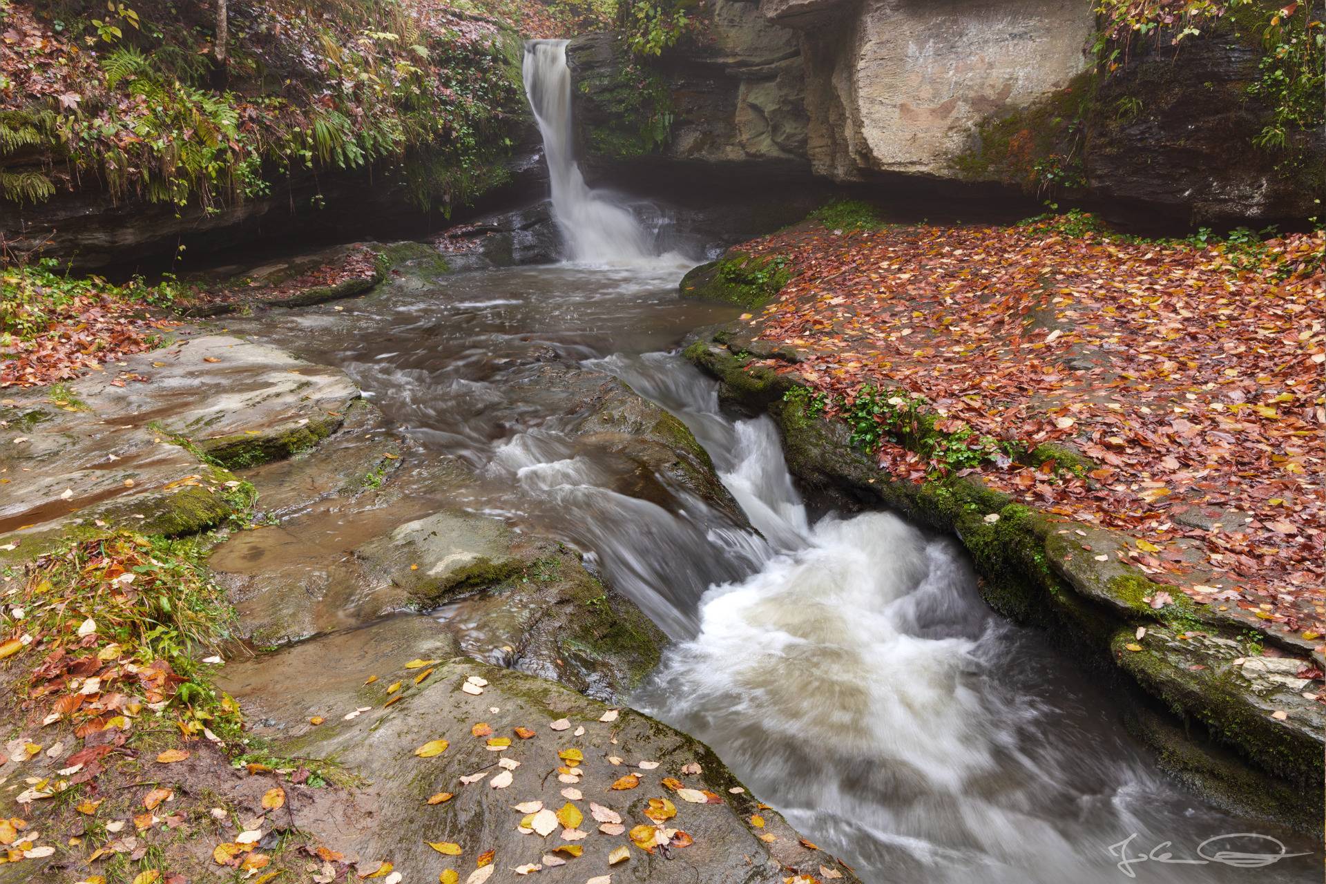 ▲click the image for fullsize view▲ |
On the way up there was always a very fine fog, which then almost disappeared on the way back. | Am Hinweg herrschte immer ein ganz feiner Nebel, welcher dann auf dem Rückweg fast verschwunden gewesen ist. |
 ▲click the image for fullsize view▲ | 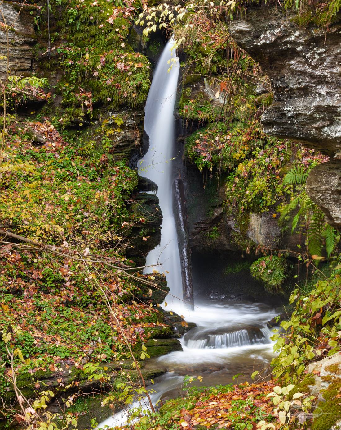 ▲click the image for fullsize view▲ |
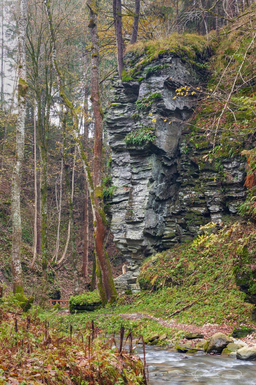
The path partly leads over old mill paths along the brook Harterbach from the village Glantschach to Hart. I only hiked to the Waterfall Sörg, because this was of course my desired destination. Back I went the same way, but there are several other possibilities to get back to the parking lot to Glantschach. | Man geht zum Teil über alte Mühlensteige entlang des Harterbaches von der Ortschaft Glantschach bis nach Hart. Ich bin nur bis zum Sörger Wasserfall gegangen, weil dieser natürlich mein eigenltiches Ziel gewesen ist. Zurück bin ich denselben Weg gegangen, aber es gibt auch andere Möglichkeiten, zurück zum Parkplatz nach Glantschach zu kommen. |
 ▲click the image for fullsize view▲ | 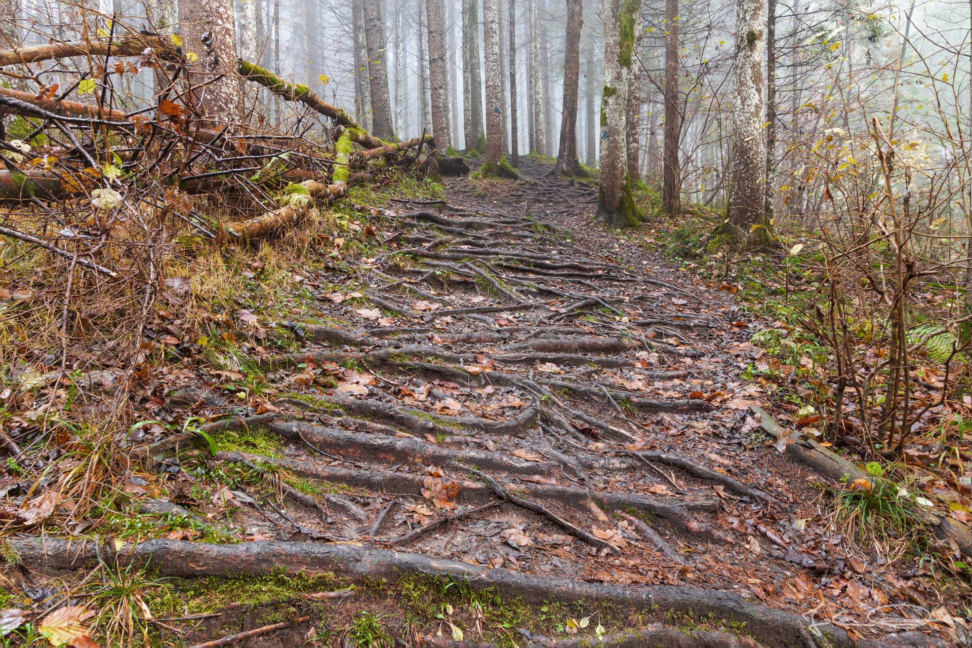 ▲click the image for fullsize view▲ |
❖ click the image for fullsize view ❖
Along the way, there are some interesting things to explore, and info-boards provide information about special features along the way. Of course, along the way you will find enough cozy places and also some inns to rest. | Entlang des Weges gibt es einige interessante Dinge zu erkunden, und Schautafeln informieren über Besonderheiten entlang des Weges. Natürlich findet man entlang des Weges genügend gemütliche Stellen zum Rasten und kann auch in einigen Gasthäusern einkehren. |
❖ click the image for fullsize view ❖
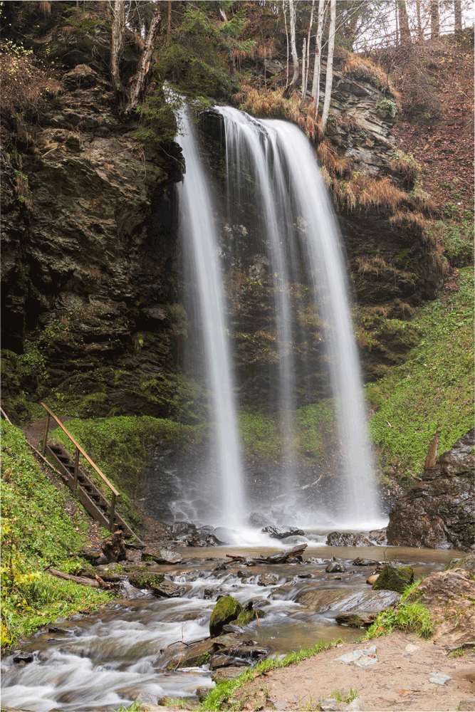
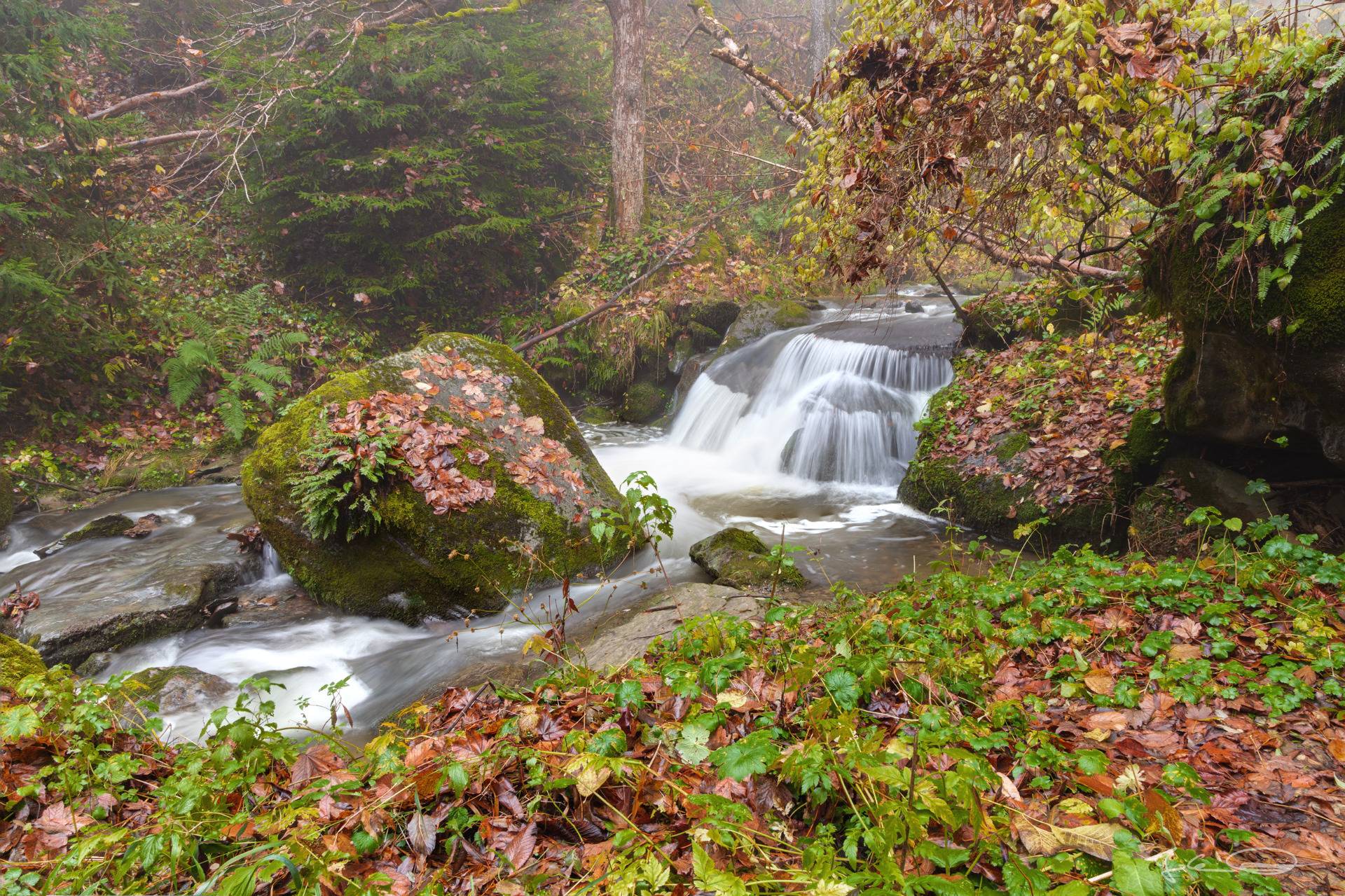
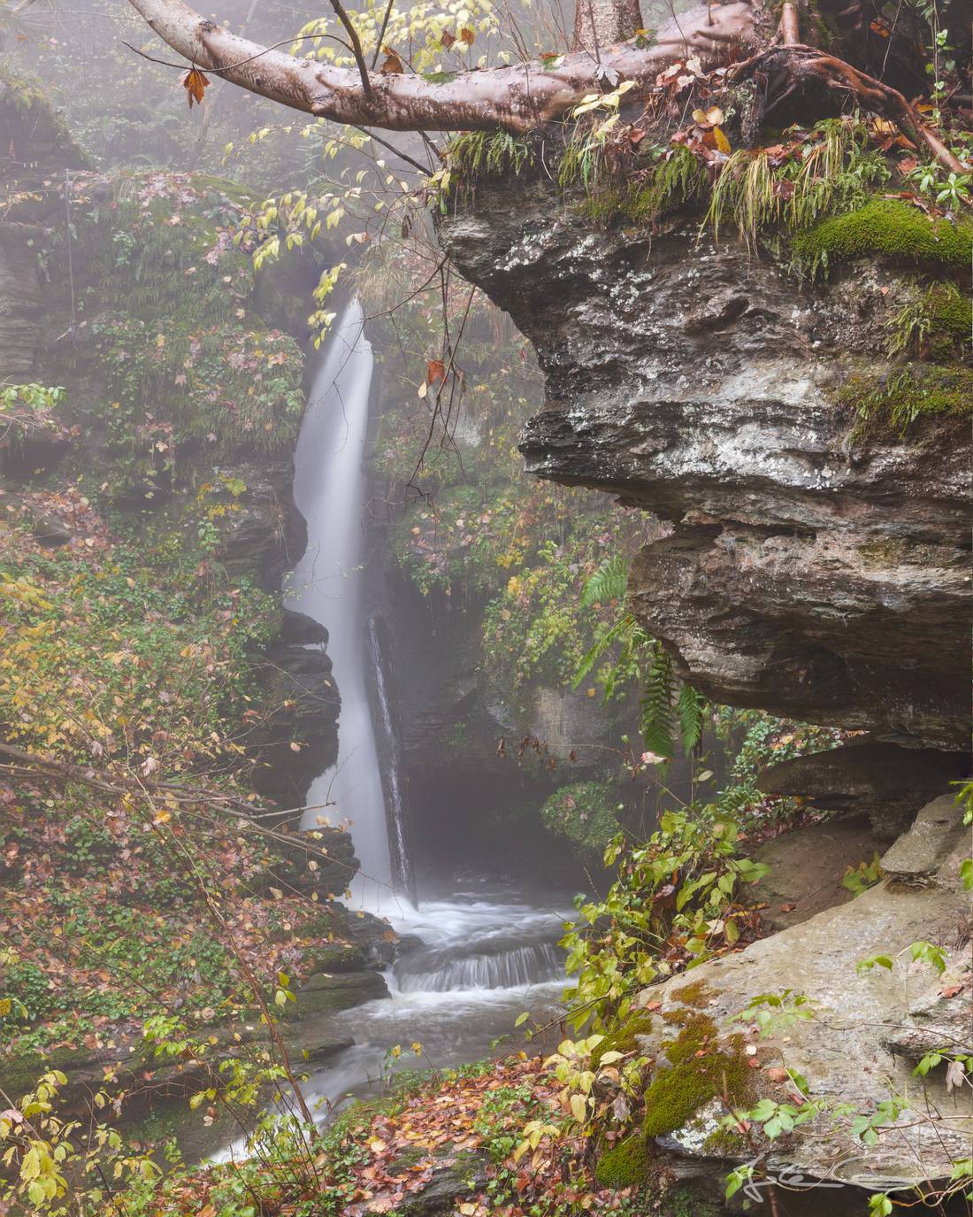
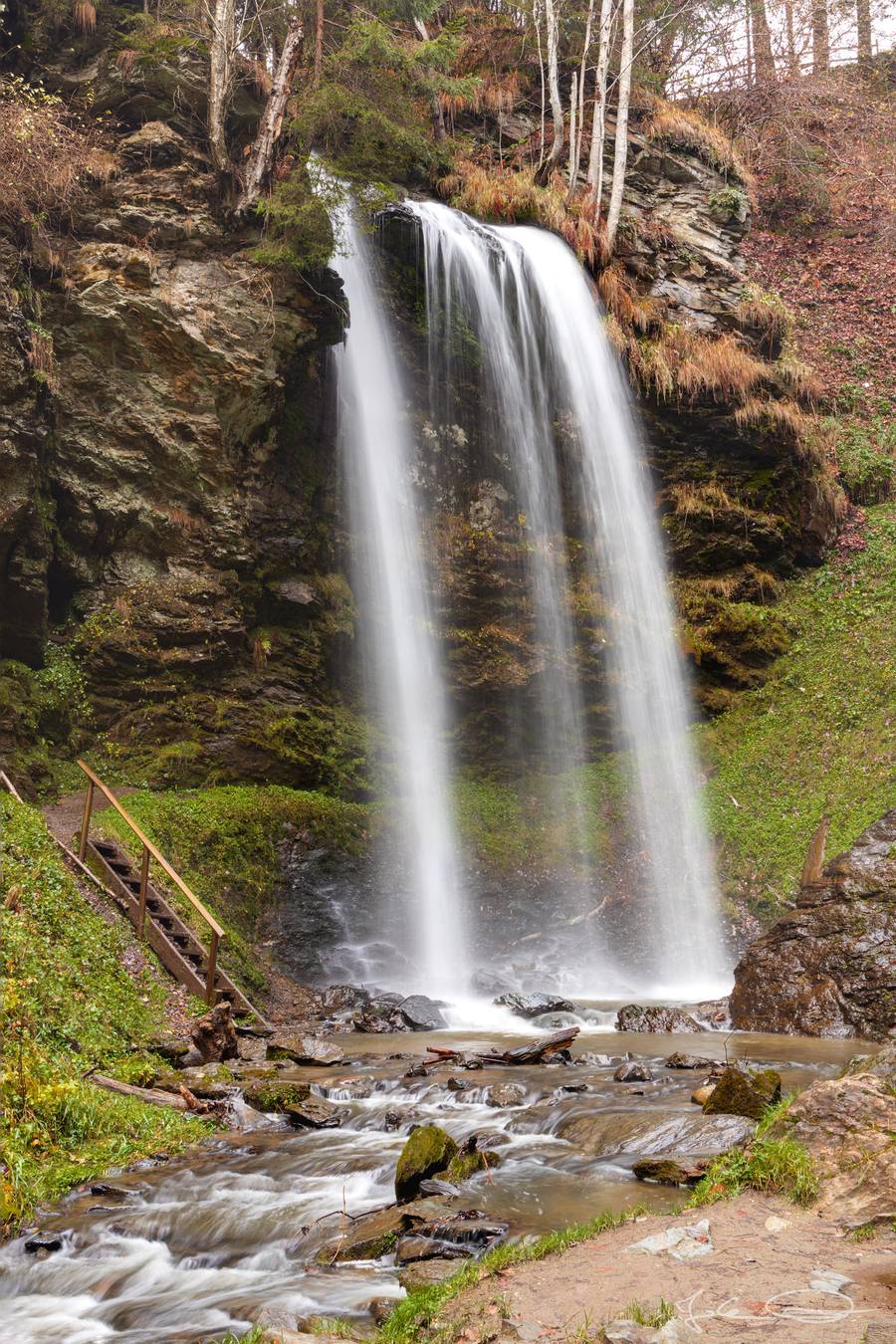
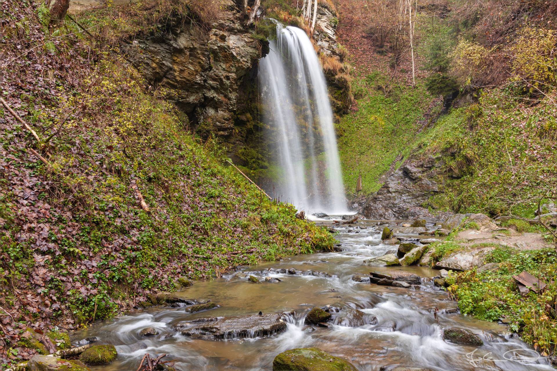
After the remains of an old mill ruin you go through the forest and then along the Harterbach again, until you finally reach the Waterfall Sörg. | Nach den Resten einer alten Mühlenruine geht man durch den Wald und dann wieder entlang des Harterbaches, bis man schließlich zum Sörger Wasserfall gelangt. |
Waterfall Sörg
❖ click the image for fullsize view ❖
Note: | Hinweis: |
❖ click the image for fullsize view ❖
I made two small reports about this hike a few days ago: | Zwei kleine Berichte über diese Wanderung habe ich bereits vor einigen Tagen gemacht: |
Information
There is no entry fee and the visit is at your own risk. Especially in late autumn and in winter and also after rainfall is increased risk of slipping and injury. Sturdy footwear is required in any case. | Der Eintritt ist frei und man geht den Weg auf eigene Gefahr. Gerade im Spätherbst sowie im Winter und auch nach Regenfällen besteht erhöhte Rutsch- und Verletzungsgefahr. Festes Schuhwerk ist in jedem Fall erforderlich. Ready to Blog & Earn? With TravelFeed, easily start your own travel blog and earn as you go. It's the smart platform for travelers who want to profit from their passion. Create a free account |
Length of the trail: 7.5 km (4.66 miles) | Länge des Weges: 7,5 km (4.66 Meilen) |
Location / Standort: |
About a year ago, @melvin7 made a few posts about this "Adventure Water Way", including beautiful photos, and it took me almost a year to drive the few miles to Liebenfels and walk the path myself. | Vor etwa einem Jahr hat @melvin7 ein paar Berichte über diesen "Abenteuer Wasser Weg" mit schönen Fotos gemacht, und ich habe fast ein Jahr gebraucht, um die paar Kilometer nach Liebenfels zu fahren und mir den Weg anzuschauen. Don't Forget: Get Travel Health Insurance! To make your trip a worry-free experience, TravelFeed recommends SafetyWing Nomad Insurance. It provides comprehensive health coverage while you travel, so you can focus on exploring, not the unexpected. Get a quote here |
All photos were shot with the Canon EOS R and one of these lenses: Canon RF 24-105mm f/4 L IS USM, Canon EF 70-200mm f/4 L IS II USM, Canon EF 16-35mm 1:4L IS USM, SIGMA 105mm 1:2,8 DG MACRO HSM, SIGMA 150-600mm F5-6.3 DG OS HSM C |
If you like my photos I would appreciate an upvote, nice comment or a resteem 😊 ... and maybe you would like to follow me, so you do not miss a post from me anymore.
Thank you for visiting my blog,
have a nice evening,
Photos and Text: Johann Piber | All rights reserved - do not use without my permission
#originalcontent #originalworks

    |
Travel Resources for your trip to Austria
Recommended by TravelFeed
Flights: We recommend checking Kiwi.com to find the best and cheapest flights to Austria.
Accomodation: Explore the best places to stay in Austria on Booking.com, Agoda and Hostelworld.
Travel Insurance: Medical emergencies abroad can be pricey, but travel health insurance is not. We always use SafetyWing for affordable and reliable coverage.
Car Rental: For hassle-free car hiring, DiscoverCars is our trusted choice with a wide selection of vehicles.
Internet: Got an eSIM compatible phone? Airalo is perfect for reliable internet access during your trip. Just install it before you go, and you're set!
Day Trips & Tours: We recommend GetYourGuide for a variety of well-organized and enjoyable activities.
Travel Planner: Need a hand planning? Our free travel planner chatbot is your personal guide to Austria. Chat now.
Disclosure: Posts on TravelFeed may contain affiliate links. See affiliate disclosure.
