As I ascended to Pico del Águila I imagined that when I reached the top I could touch the sky, and four hours later I was literally doing it.
This is the second episode of my "Collection of experiences" gathered during my stay in Colombia in the last six months, in which I dedicated myself to travel and play Ultimate Frisbee (reason why the title of the series bears that name).
If you want to read the first part of these trips, click here.
After the competition in Ocaña, I stayed one more week in Cúcuta; I felt so comfortable that I did not want to return so quickly to my country, although I already missed my family very much. It is that there I had many things that made me happy: frisbees, the affection of my friends and adventures, like this long walk.
I was looking for more precise information about El Pico del Águila, but I did not find it, apparently it is not a tourist area, the only thing I found on the mountain were references of the coal mines that are there, so everything that I will share is relative to me experience.
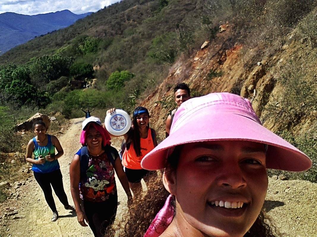
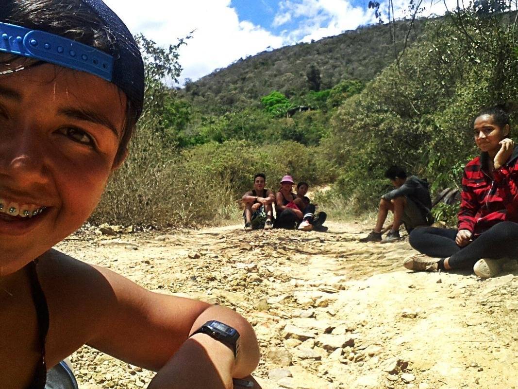
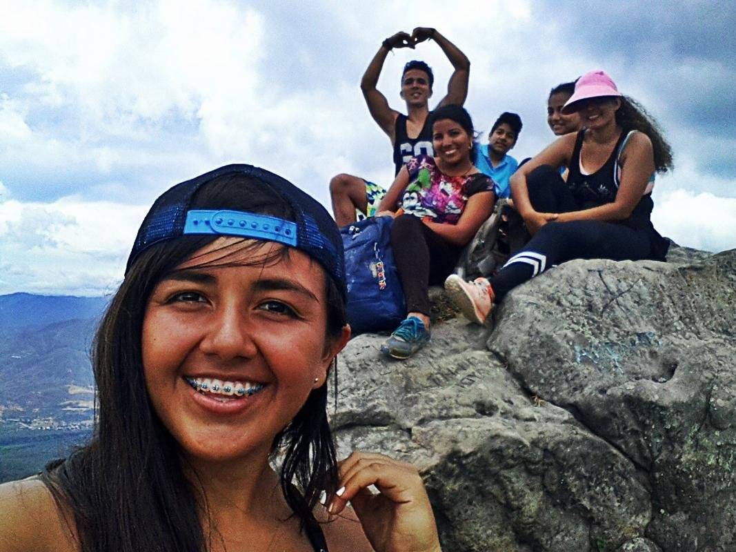
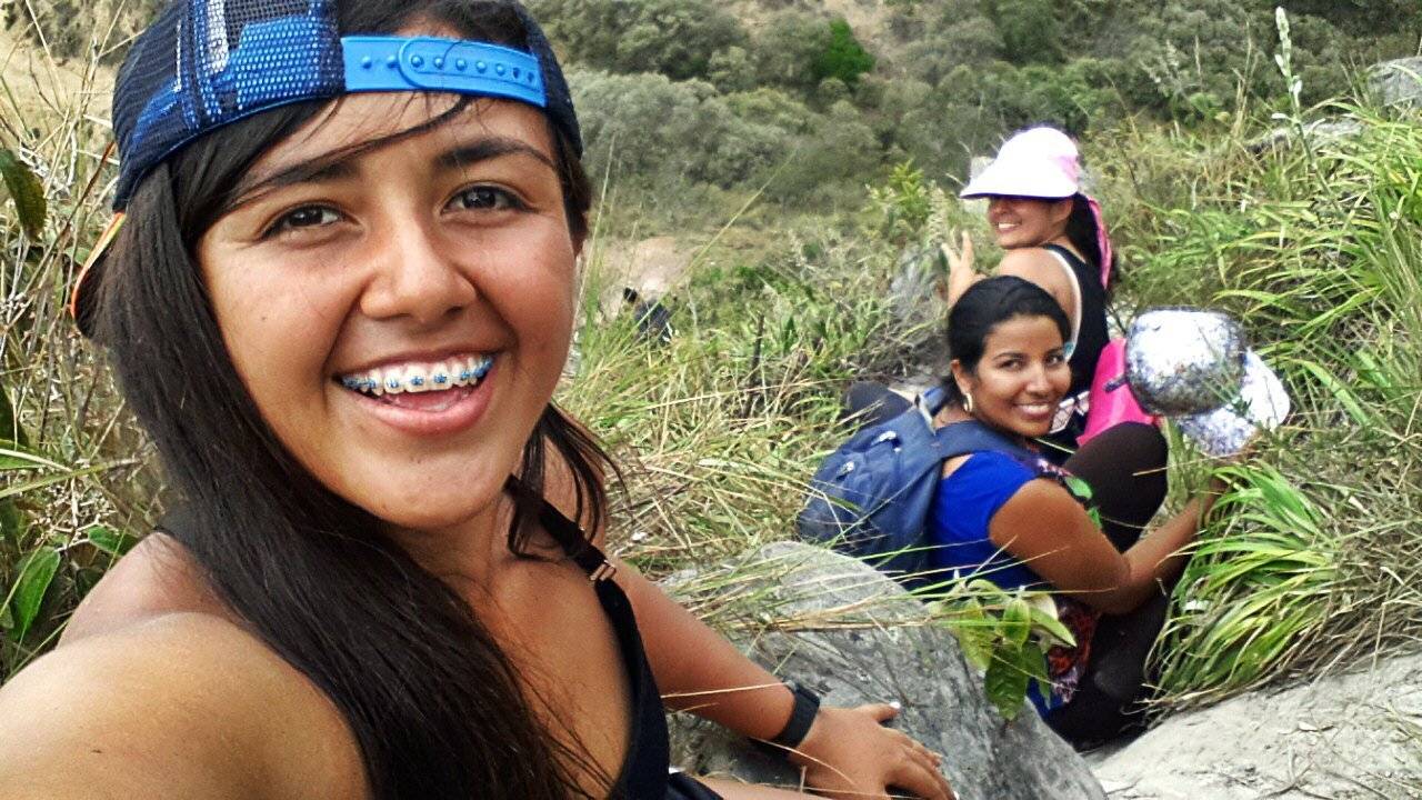
They were two of my friends from La Roca Ultimate Club, who organized the trip. For Brenda Cuellar, for me it was going to be the first time I was going to go up, but Astrid Robayo had already gone twice, so we took someone who "knew the way" (I use dates because we lost the same 😂); We were also accompanied by three more friends, the girls' family: Oriana, David and Ricardo.
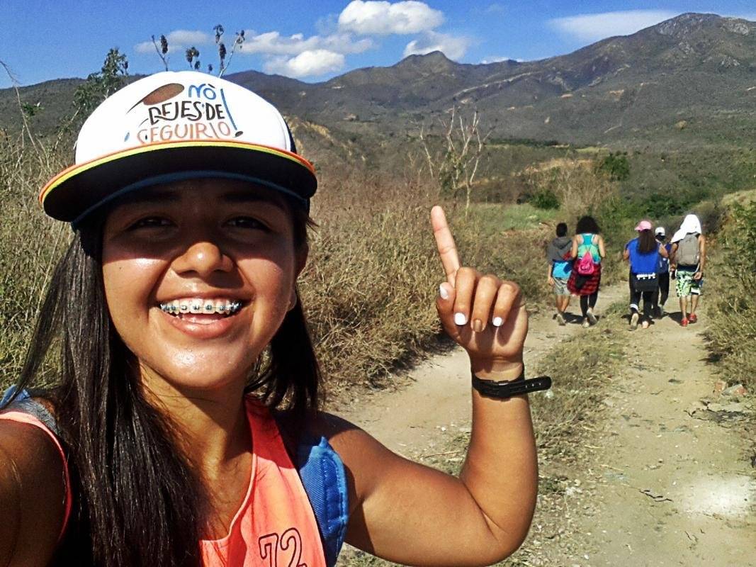
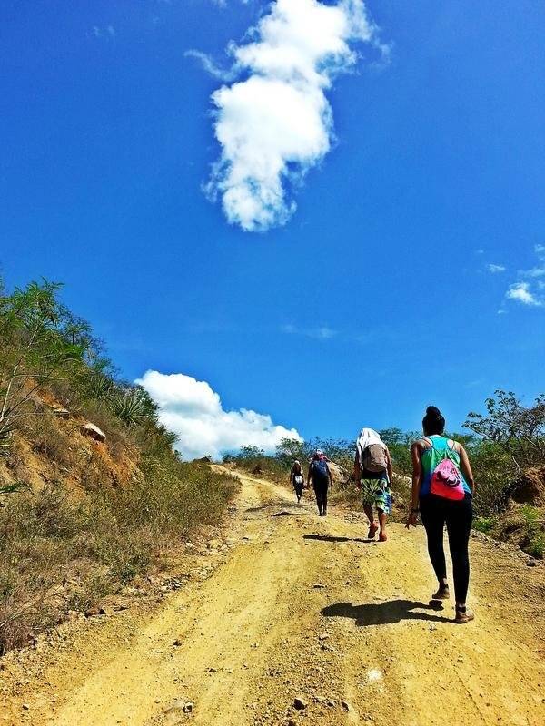
The feat was performed on a Tuesday, that day we woke up early because we had to get up early to return before it got dark. So we equipped ourselves with several liters of water, some food and we took our way.
The route we took to ascend to Pico del Águila was Avenida 10, located at the exit of Los Patios municipality in Norte de Santander. There is a path that leads to a section of the Pamplonita River, a recreational space where people usually bathe on weekends.
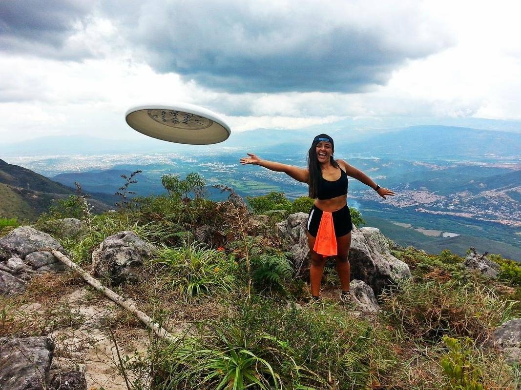
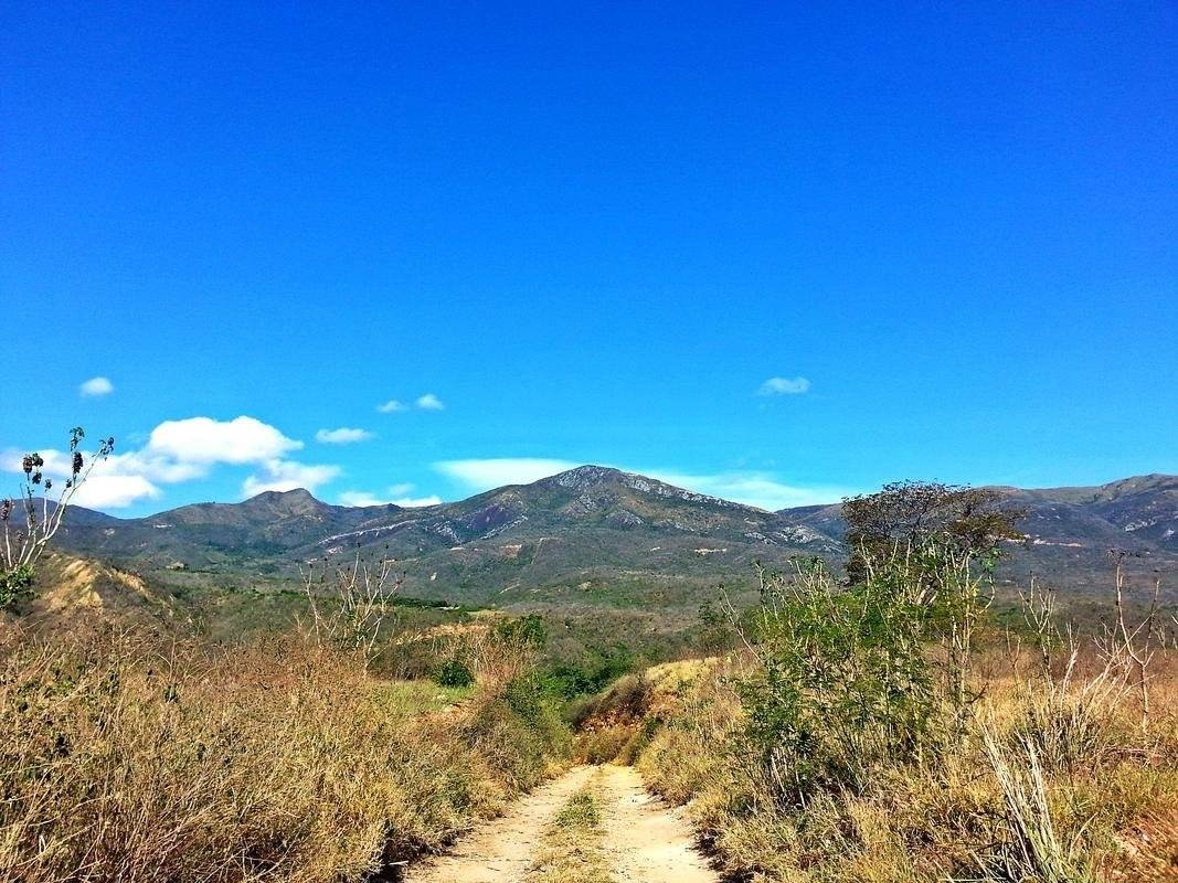
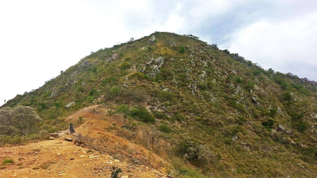
The mountains that point my finger were the ones that we had to cross to reach that plateau, a plateau about 50 meters high and about 15 meters wide at its top. This is characterized by having a rock at least two meters high that seen from afar simulates the peak of an eagle.
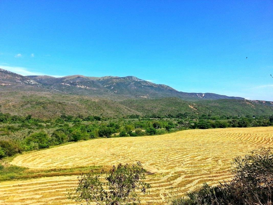
We were just beginning the tour and I was already surprised by the scenery that was presented in front of us. The extensions at the foot of the mountain are used for agriculture. It seemed to me a work of art, the forms that took place on earth due to the harvest, and I was struck by the contrast between that sand color and the intense blue of the sky.
As I mentioned, we got lost twice; We were guided only by common sense: "If the Peak is in that direction, let's go there", but that did not work for us the first time, because the road we took led us to the house of a peasant who had five dogs that made us run back.
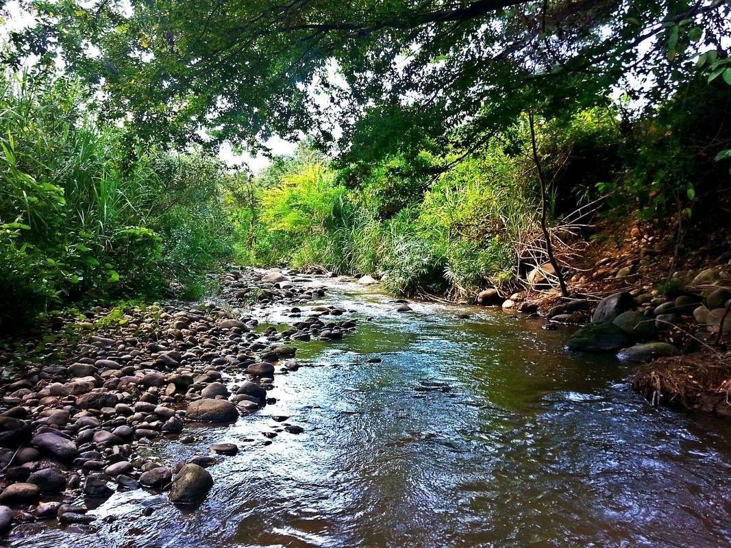
We took the other route that was left, that did direct us to where we wanted, and the journey got better and better. We only saw shrubs around us, but at the same time we heard the sound of the stones that the river dragged.
According to Astrid, the place was unrecognizable, assuring that the last time it was the access was much easier; but that did not stop us, and what a good choice because in a short stretch, a landscape appeared before us that ... left me speechless.
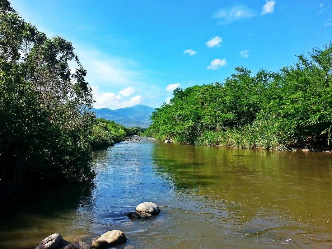
There was the Pamplonita River. The composition of the place had me excited, it was like being in a carnival because of the vividness of the tones between the vegetation and the sky, balanced with the neutrality of the water, and the silhouette of another mountain posing in the depth.
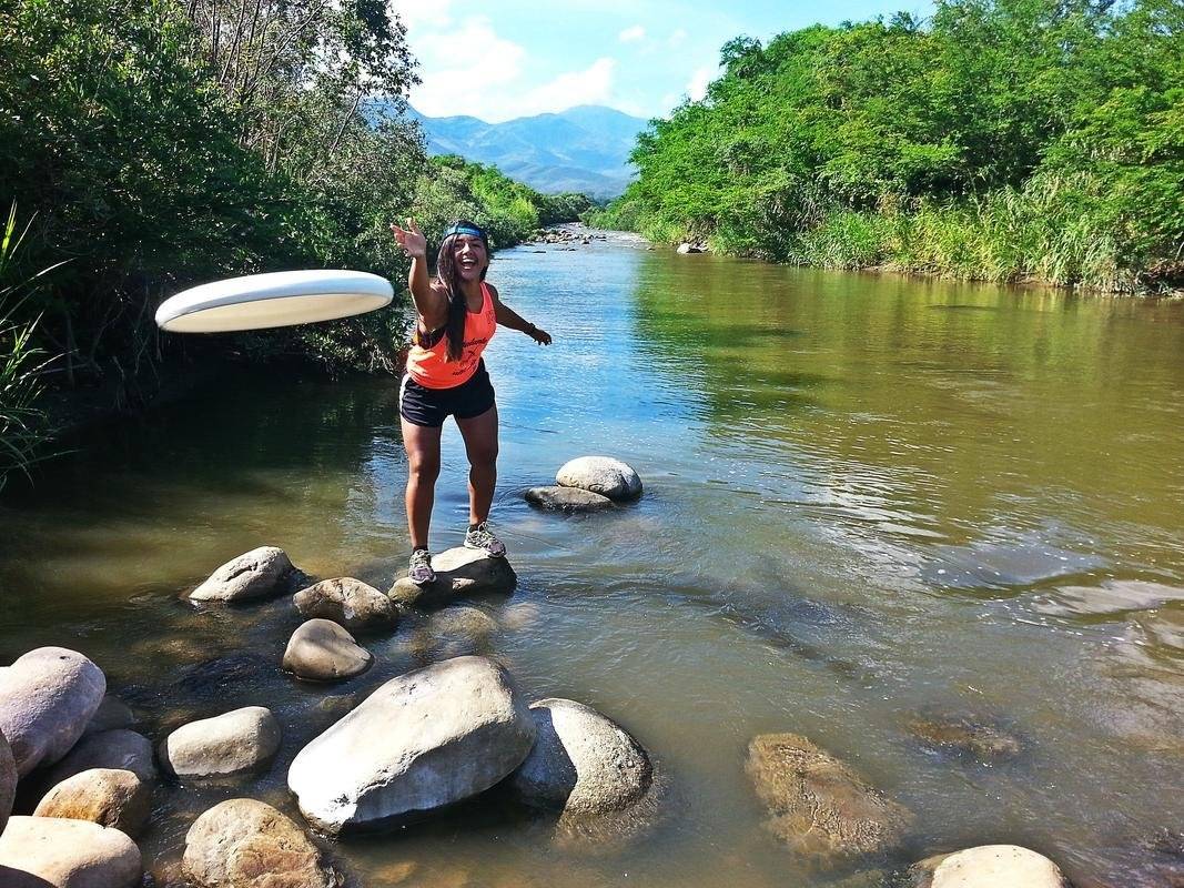
The weather was already 30 °, so we used to refresh ourselves, and also to take some pictures (and I throw my frisbee).
🚩 The real challenge
We thought that it was already challenging to be lost and almost bitten by those wild dogs, but really the fun was just beginning.
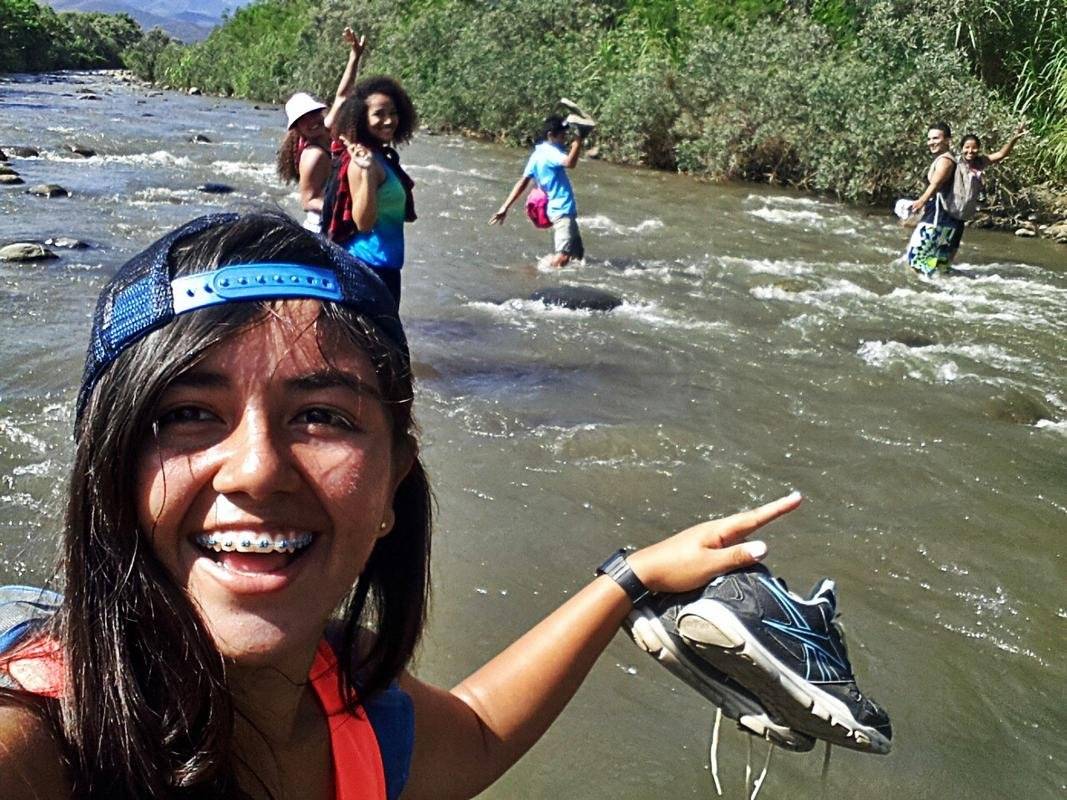
We did not get any dirt road to cross, so we had to go into the river, although the ground was very unstable due to the amount of rocks and there was a moderately strong current.
However, having to get into the water was one of the best situations that was presented. When the river reached almost to my knees I saw steam coming from my body, I thought I was disintegrating (well, no ... it's a joke, but that's how I imagined it 😅).
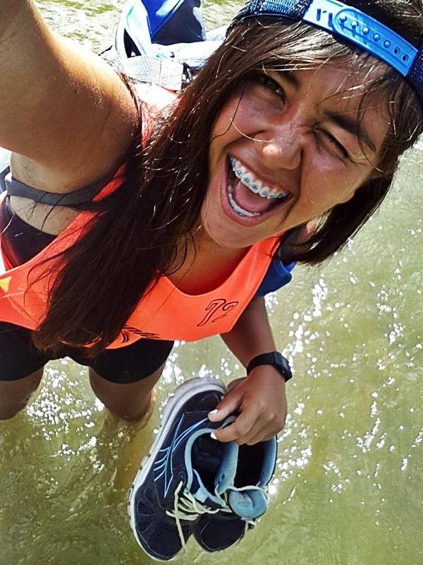
At that time we all worry about taking off our shoes so that they "do not get wet", but I'll give you the most important advice of this post: when you go on an expedition of this kind, forget about looking presentable at the end of the day, Instead, take the most comfortable and used clothing possible, and prepare yourself psychologically to enter into true contact with nature.
When crossing the river we went back to wearing our shoes, but we had not walked 30 meters when we found that all the passage we had to move was waterlogged. Obviously the only option was to continue, and you can imagine how the shoes were that "we did not want to get wet".
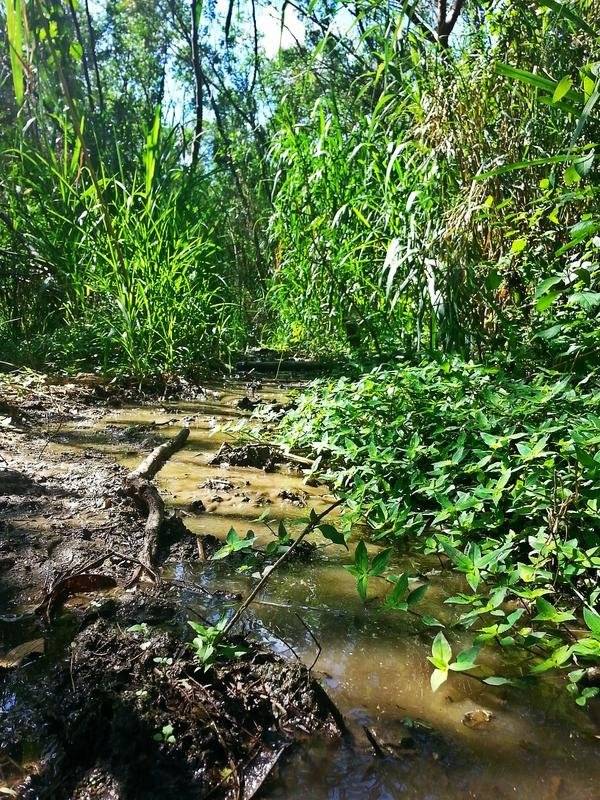
In the stretch between the Pamplonita River and the foot of the mountain there are many streams, which makes the walk quite cool; In the end you will not mind having walked on mud.
Already adapted to the environment something very curious happened to us: the only thing that continued to surround us was the bushes, but out of nowhere it made its way to a paddy field. It was as if we had been teleported from a very different place to another by just taking a step.
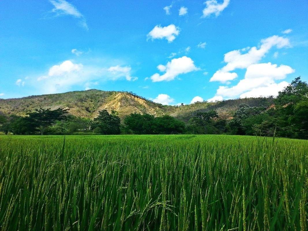
Once again we were hypnotized by the game of tonalities radiated by nature, but personally what surprised me the most was being in front of that impressive rice harvest. I had never seen one, and I wondered how it was possible that those tiny grains in those delicate twigs were the ones I bought in the supermarket. Do you realize the majesty of the matter? What a complex job for the peasants!
We left our perplexity and finally we went up the mountain! but a slope with such inclination plus a sun that was already in 32 ° are not the best combination for some novice hikers. However, between laughs the road lightened.
We had only two hours of travel, our energy was in a tailspin; the path was more strenuous than we thought, but we were already there, after what we had lived until then, the motivation to reach the top was greater.
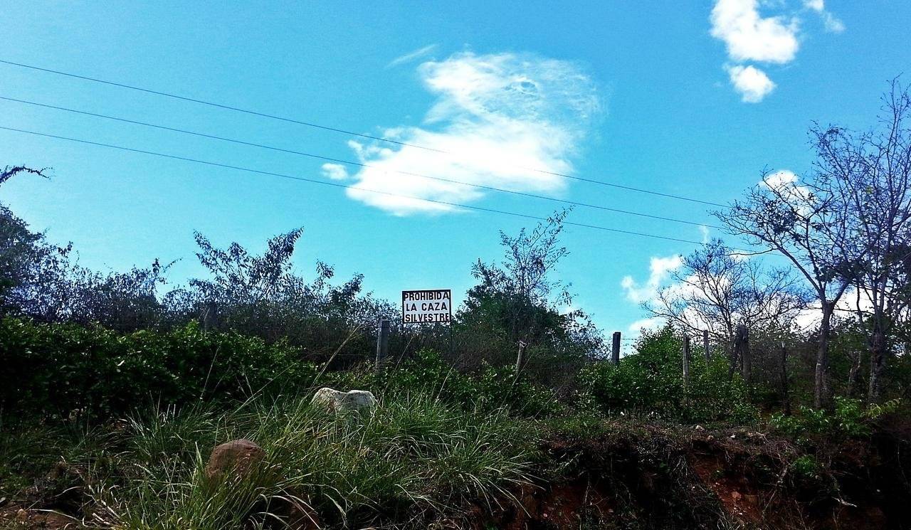
The main attraction of this mountain is the exploitation of coal that is made in it; besides that, it makes it special that a hydrographic basin descends along one of its slopes, as I observed in some posters. And it was very nice to know that even if it is a rural site, they promote the preservation of nature, for example, by prohibiting wild game.
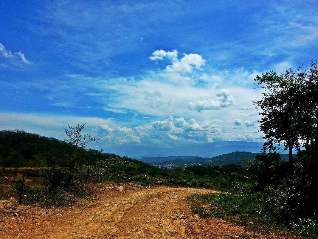
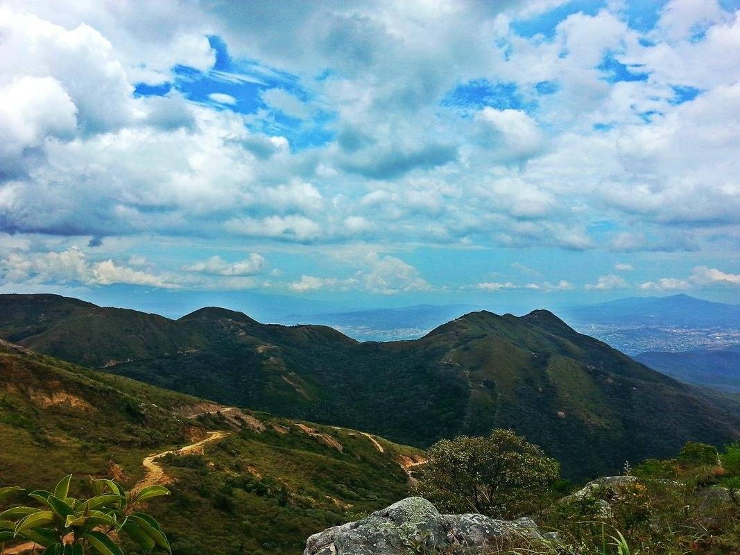
The more we walked the better we looked, we began to see the clouds closer and we could appreciate the vastness of Los Patios, the best part was that everything was extremely clean, there was no garbage anywhere.
I do not know how many kilometers we had traveled, but our legs started to fail, so every so often we would sit down to rest, but between one and the other break without realizing we were running out of water.
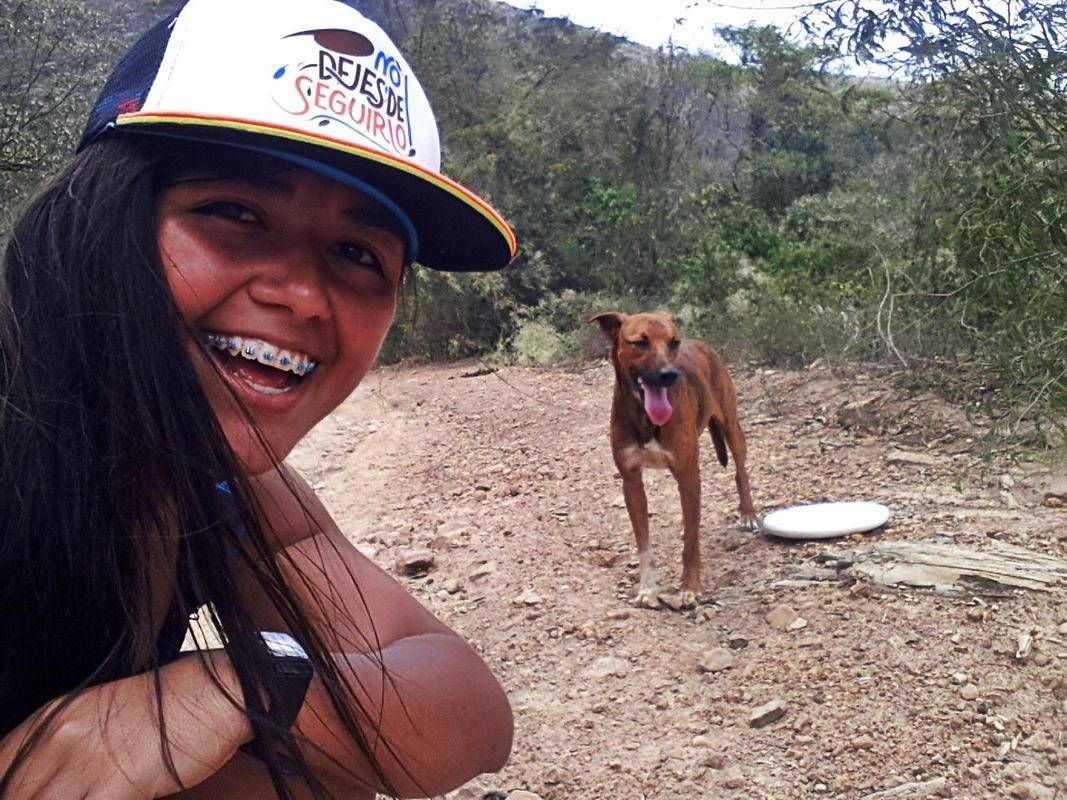
On the way we met this little friend, who unlike the first dogs with which we were face to face, did not attack us. On the contrary, he looked very friendly and above all thirsty, so we shared our hydration with him.
In the Ultimate Frisbee we promote the idea that "the disc is our friend", so we give it the greatest possible use. That's why he served as a drinker for the puppy.
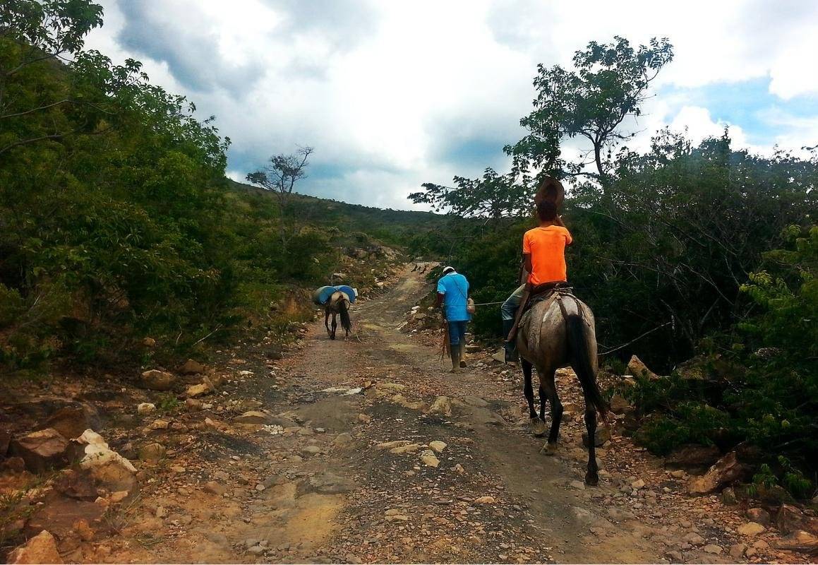
Now the mission was not only to reach the top, it was also to find water to be able to continue. We just saw some peasants leading a donkey carrying water, so we assumed that soon we would find some place to get it.
Ten minutes later we found a small farm where there was a well for ducks and they were filling it with water with a hose. Literally, we saw the sky! We asked permission and we bathed, we filled our containers, we ate a little under the shade of a giant tree, and we continued with the trip.
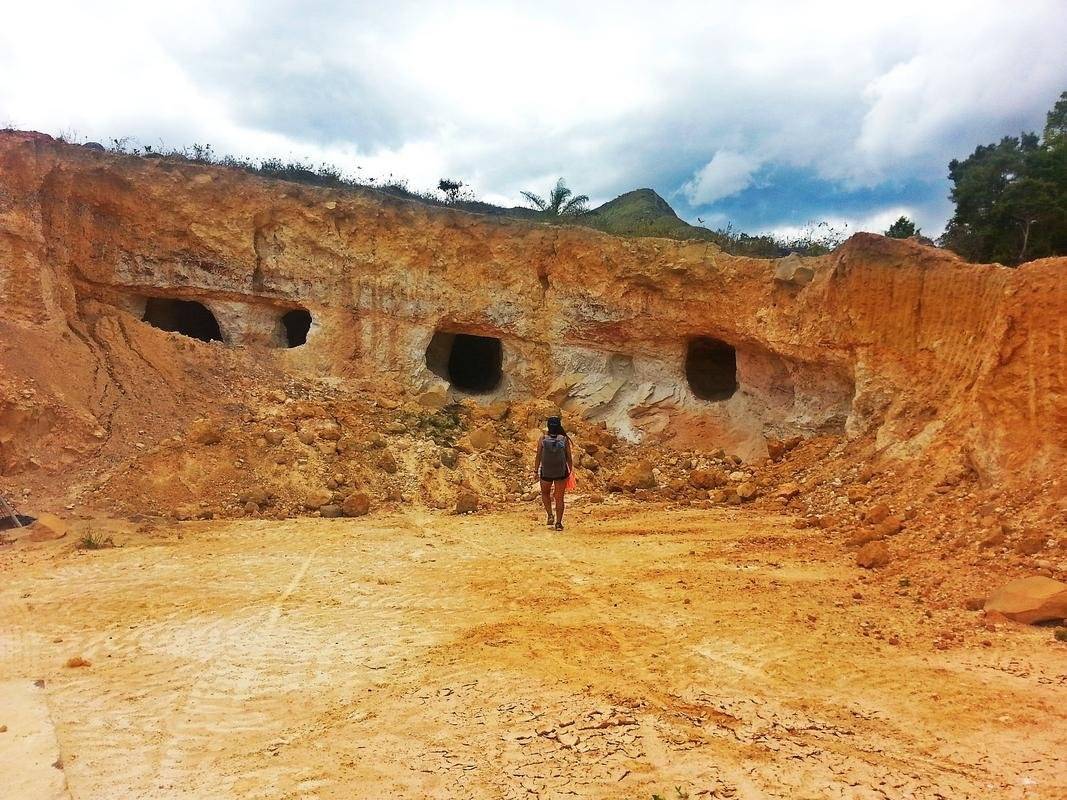
Later we came across these singular perforations in an area of the mountain, we do not know what it was, but for the rubble and the details of the facade that seemed cut with some machinery, we imagine that it is a product of the hand of man.
We entered them to explore them, they were not very deep, but there was an abnormal amount of dust.
From that point we were already half an hour or so to reach our goal. I already felt that I could touch the clouds, but while I did not reach them with my hands, I reached them with my frisbee.
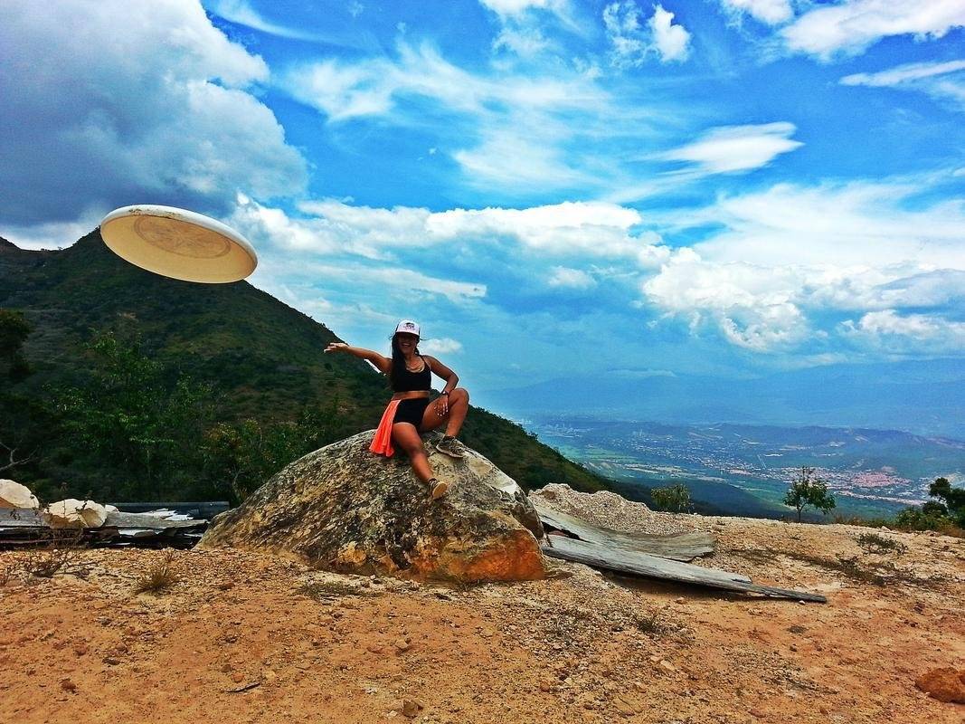
⛰️ We made the summit!
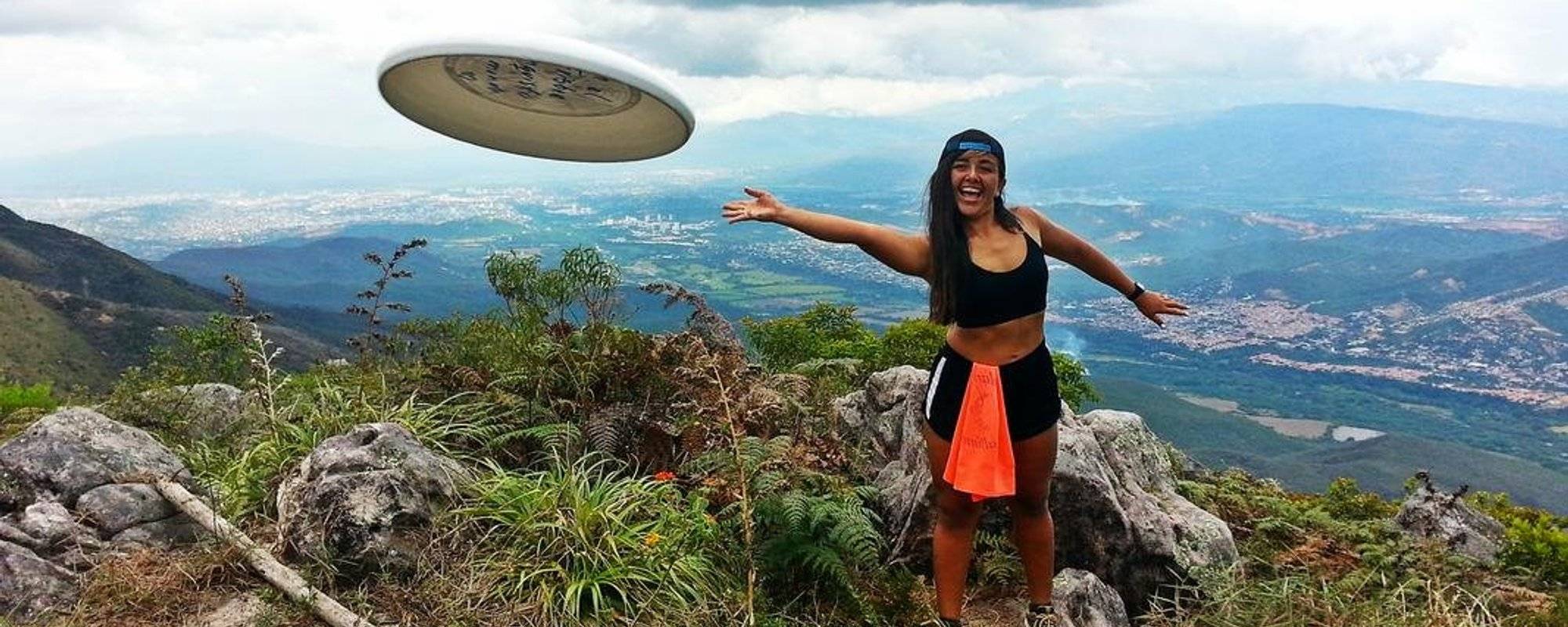
There came a point where, after 4 hours, we were already inertia and in silence ... When suddenly Astrid says "We arrived!", I sat on the floor without saying anything and began to observe my surroundings. The view was really amazing, but I'll be honest: I expected much more. A minute later she says "Come on!", And I did not understand anything.
See the hill of the photo? the real goal was to get up there; the pulse accelerated, my expectations revived and the adrenaline began to increase.
I must confess that I felt a little afraid because the plateau was very steep, and the only way to arrive was climbing. You should hold strongly on the plants and tread very well the ends of the stones.
At this point of the trip it is very important to be aware of the complexity of the place, we must be responsible and not expose ourselves if we know that we are not physically prepared.
I still close my eyes and I can reproduce in my mind the sublime moment in which I stood on the top.
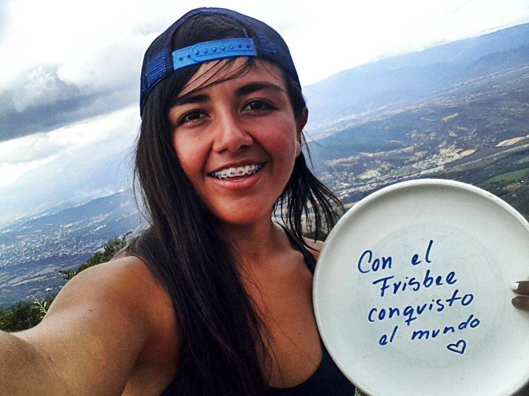
If you look closely at the photograph, at the bottom you can see the rice field we are crossing; I saw it and could not believe that we had overcome all that route.
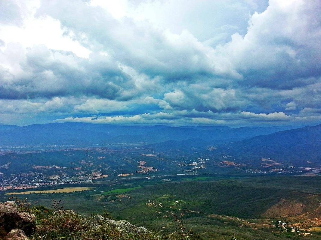
The day became cloudy, and the breeze was soft; Better said, the weather was perfect, as much as that view. From there we can see Los Patios, part of Cúcuta, Ureña and San Antonio del Táchira.
This great rock is to which the name of the plateau is due; It is what gives form to "Pico del Águila".
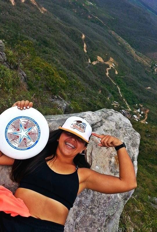
Being on it awakes you vertigo, but you will not want to get out.
That top slaps you, squeezes you and says "Wake up! This is living", contemplate the immensity React! You are just a small particle among such magnitude, go to discover the world!"
But the story does not end here.
After that majestic encounter, we came back to reality: if climbing was difficult, going down would not be easier. The good thing is that this time we could go sitting, although seeing down in some cases was not so pleasant.
We took the same way back, it took us two hours to return. Descending was much simpler; at a certain moment the mosquitoes broke loose, and perhaps that helped us to hurry more.
Ready to Blog & Earn?
With TravelFeed, easily start your own travel blog and earn as you go. It's the smart platform for travelers who want to profit from their passion. Create a free account
We ended that afternoon bathing in the river, between the cold water of the tributary and the last rays of the sun.
💡 Recommendations
If you dare to go hiking on this route, I advise you to equip yourself with:
- Much water.
- More water.
- Another little water
- Food. Especially fruits, or light foods.
- Comfortable clothes, and if possible the most used you have.
- Sunscreen.
- Repellent against mosquitoes.
- Conditioning physically a few days before.
- A first aid kit.
☁️ The sky is the limit
I constantly reflect on the effect the Ultimate Frisbee has had on my life, and I always conclude with complete certainty that this is the sport of superpowers, because it has positively transformed me in the last seven years. Let's say that the disc has been like the "light in my way".
Look where it took me this time! I know that there are much higher peaks, but arriving at Pico del Águila has a special value for me because it is the closest I've been to the clouds by my own means (I flew by plane, but that does not count).
Don't Forget: Get Travel Health Insurance!
To make your trip a worry-free experience, TravelFeed recommends SafetyWing Nomad Insurance. It provides comprehensive health coverage while you travel, so you can focus on exploring, not the unexpected. Get a quote here
Also, I was not the only one for whom the trip was quite significant. Brenda told us at the end of the trip, that when we started she thought that she would not be able to get up, but she took a mental risk that she would get to where her body would allow her and look what a surprise!
If you pass through Norte de Santander, I strongly recommend this route, it is very safe (if you take care of wild dogs and mosquitoes 😄); It's amazing how it connects you with nature.
I still see the mountain from Los Patios, I can not believe it was there.
📷 All the pictures were captured with the 8MP camera of my Samsung Galaxy SIII Smartphone.
✏️ (My native language is Spanish, sorry if I use any expression you do not understand, I try to translate the text as best as possible, but if you have any questions you can ask me).

Travel Resources
Recommended by TravelFeed
Flights: We recommend checking Kiwi.com to find the best and cheapest flights .
Accomodation: Find great stays on Booking.com, Agoda and Hostelworld.
Travel Insurance: Medical emergencies abroad can be pricey, but travel health insurance is not. We always use SafetyWing for affordable and reliable coverage.
Car Rental: For hassle-free car hiring, DiscoverCars is our trusted choice with a wide selection of vehicles.
Internet: Got an eSIM compatible phone? Airalo is perfect for reliable internet access during your trip. Just install it before you go, and you're set!
Day Trips & Tours: We recommend GetYourGuide for a variety of well-organized and enjoyable activities.
Travel Planner: Need a hand planning? Our free travel planner chatbot is your personal guide. Chat now.
Disclosure: Posts on TravelFeed may contain affiliate links. See affiliate disclosure.
