Warrumbungles National Park, NSW

Warrumbungles National Park, NSW

January 2022 · 3 min read · New South Wales
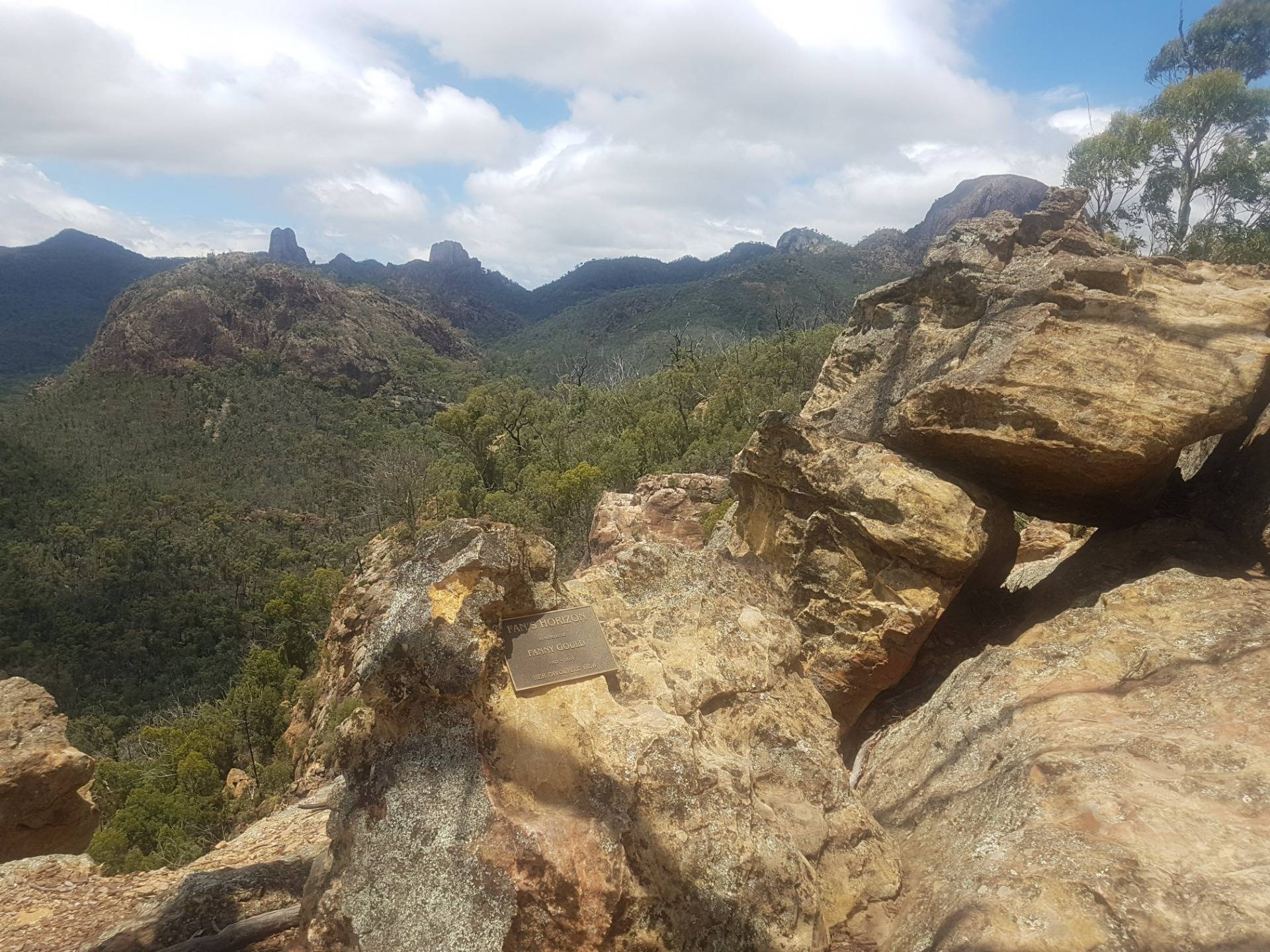
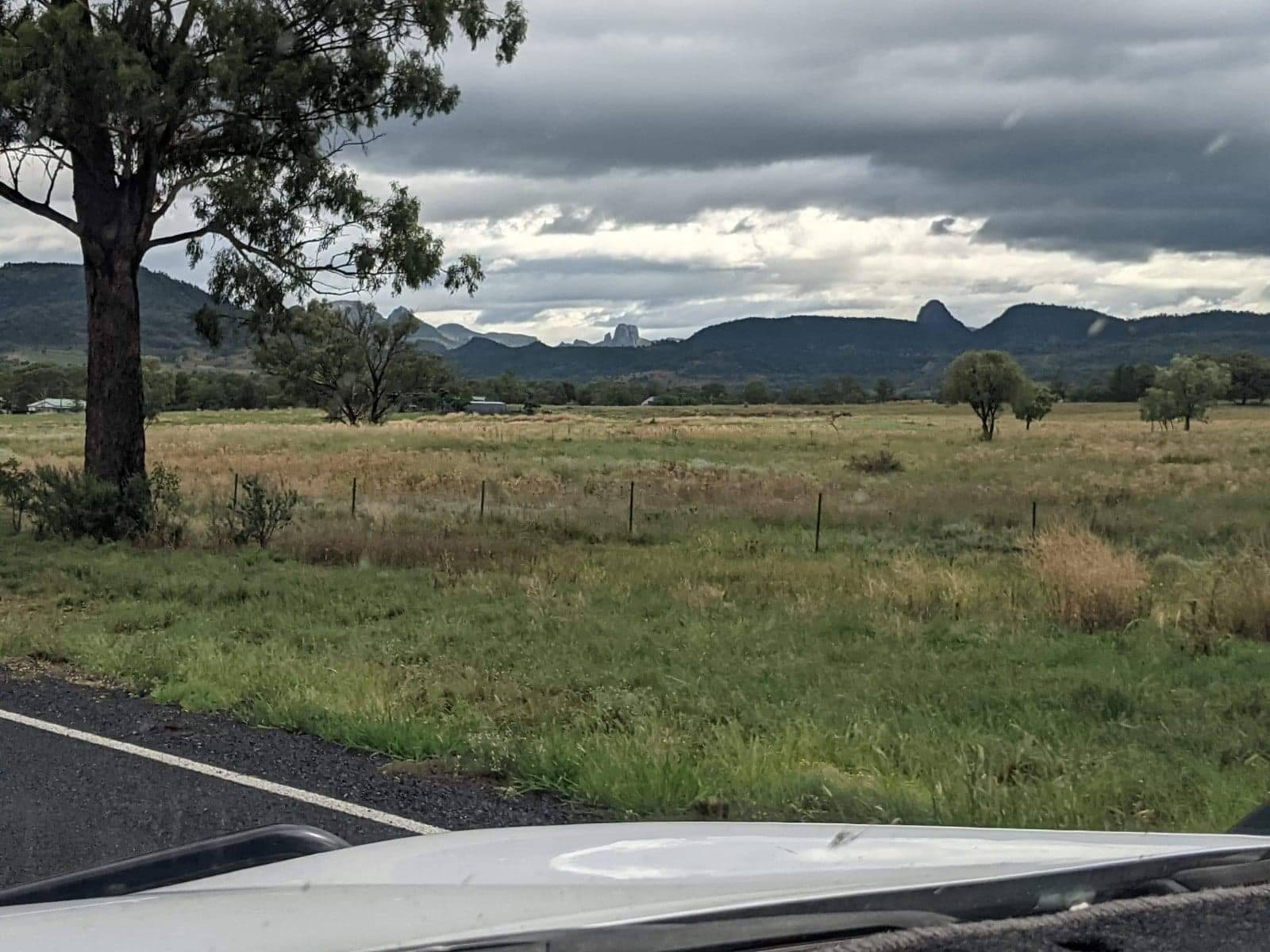
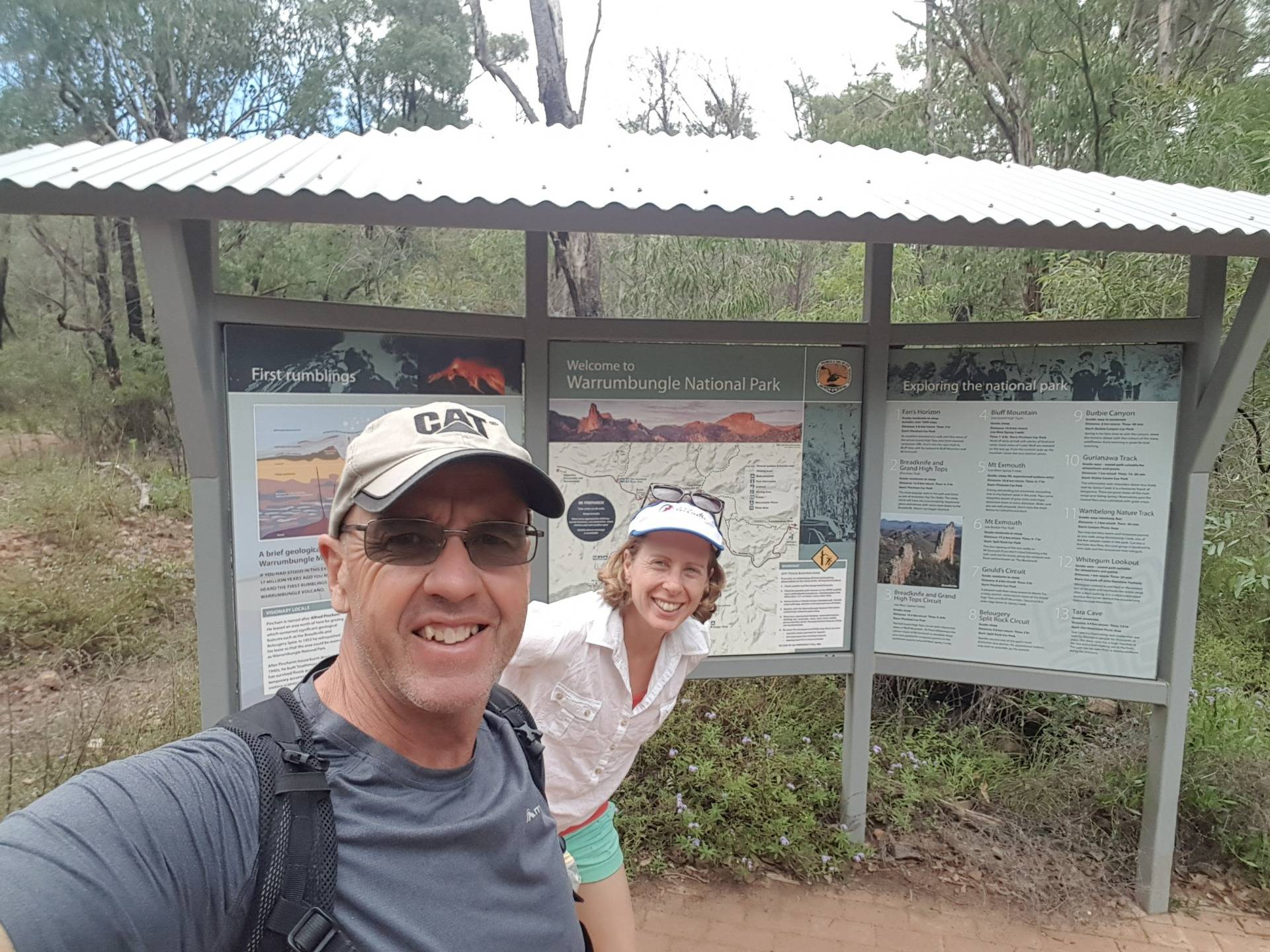
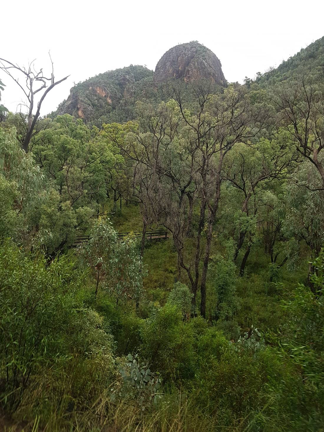
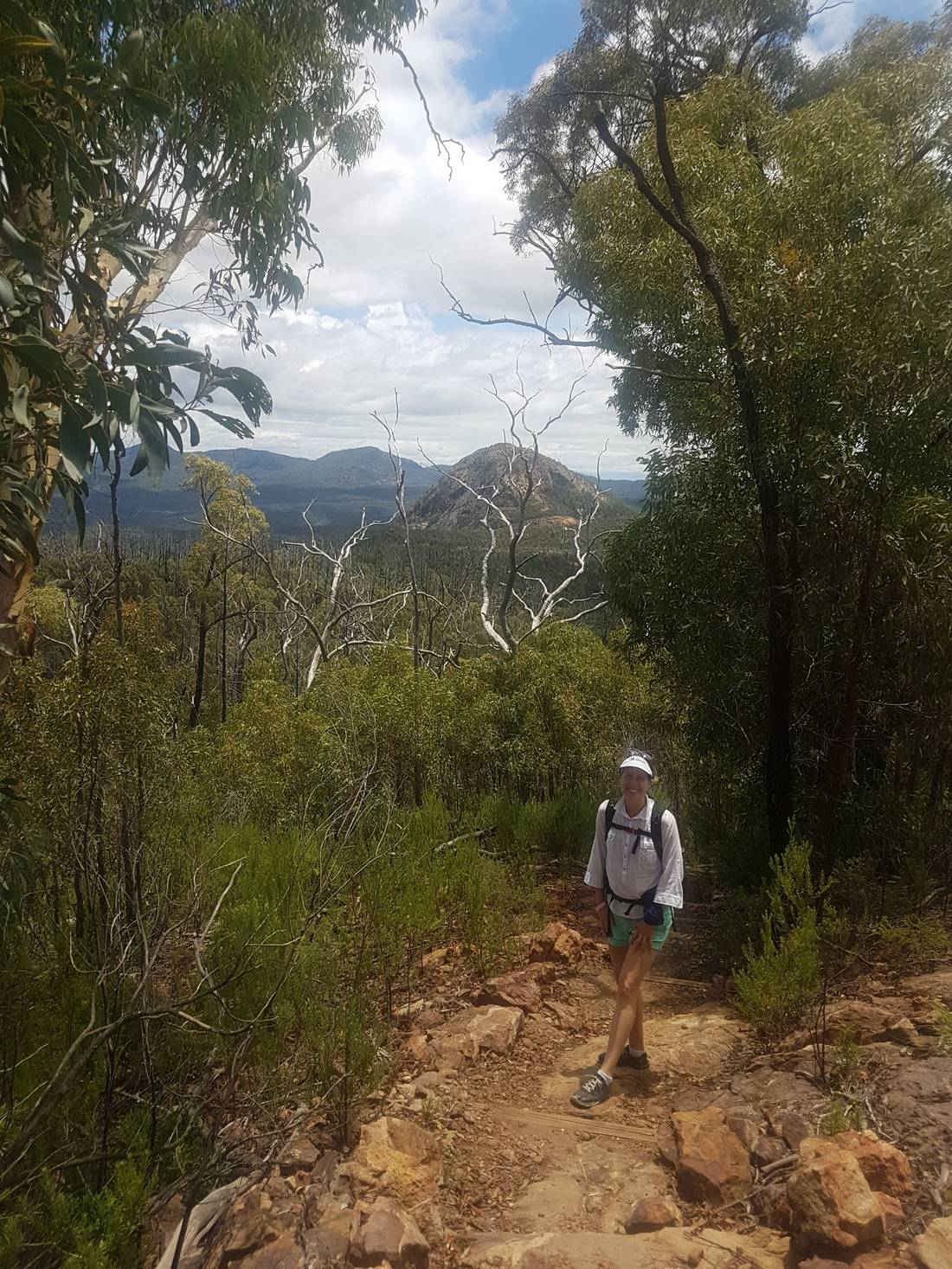
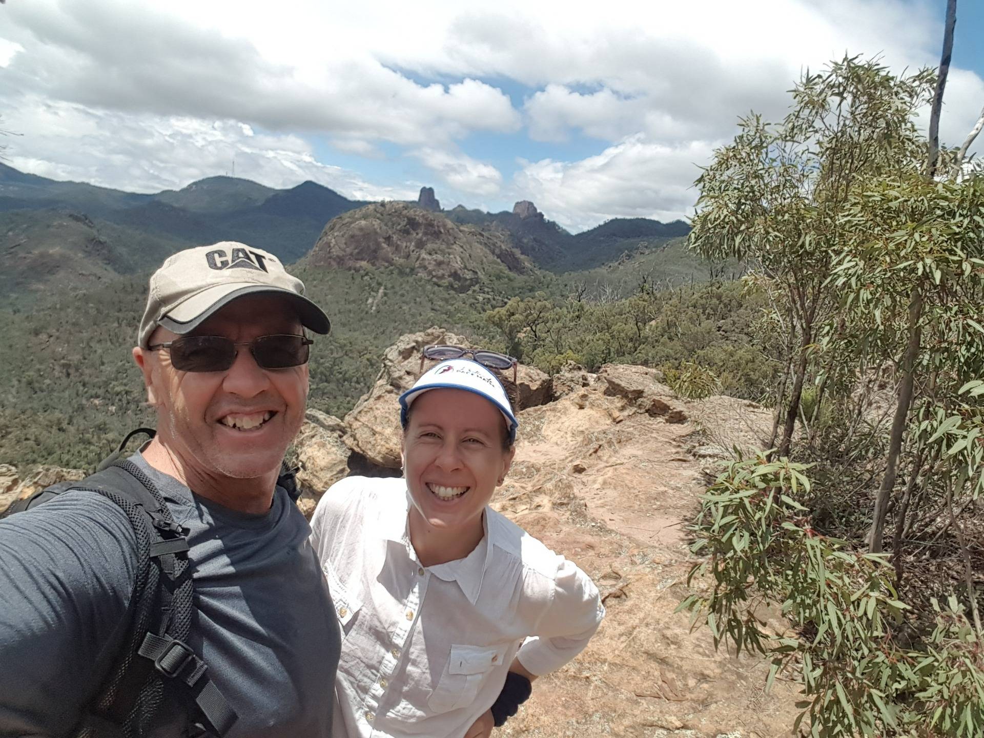
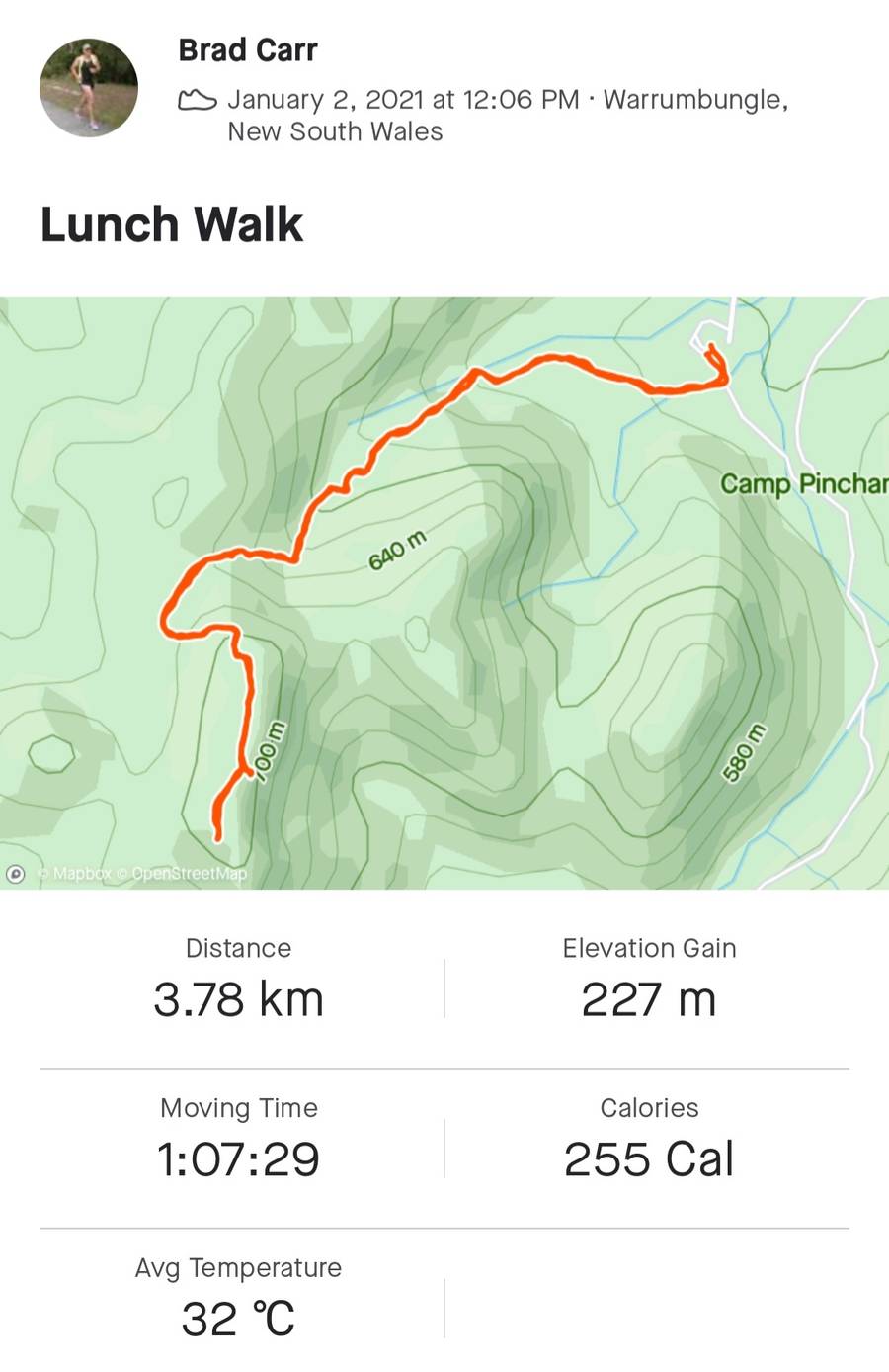
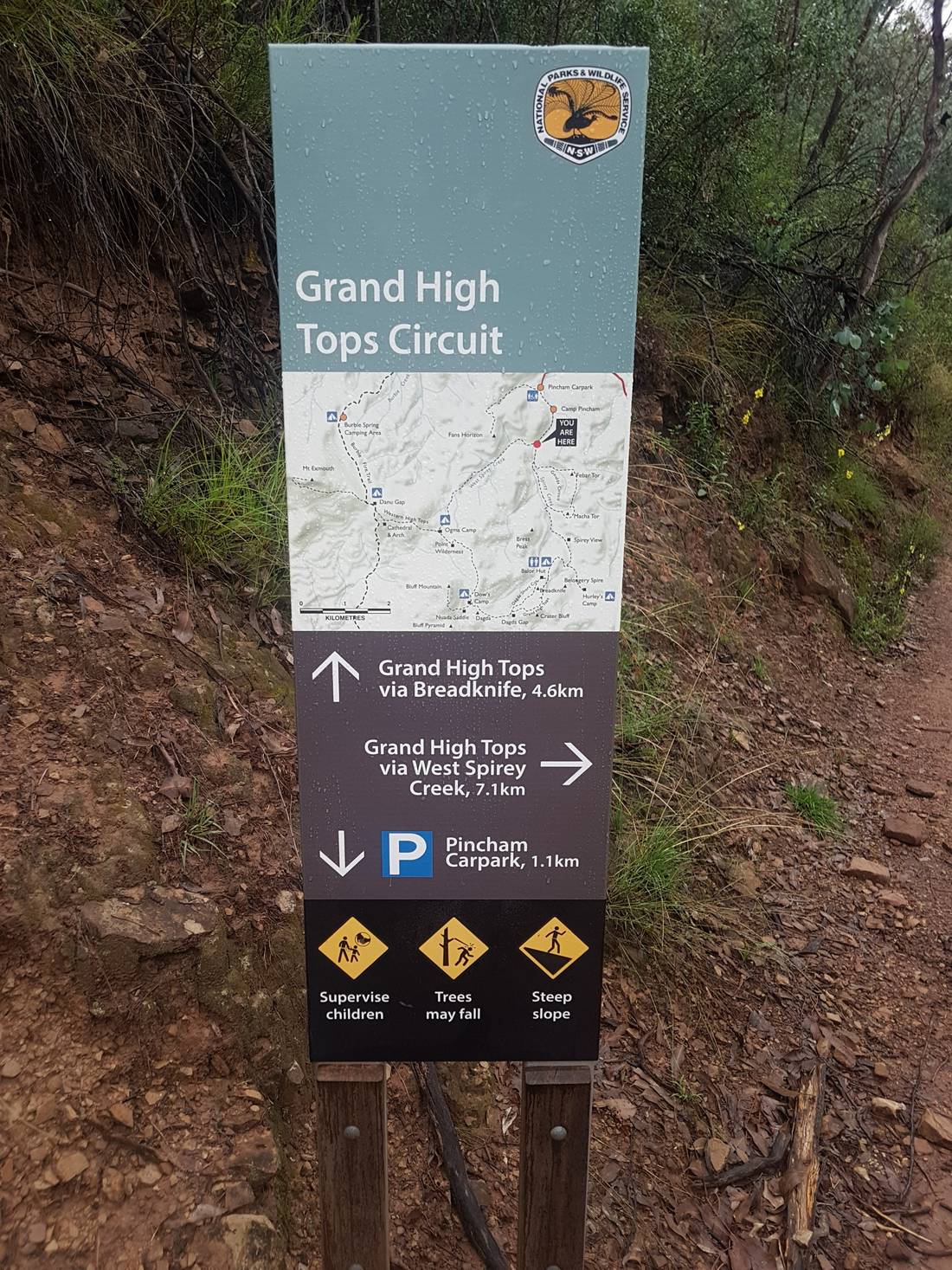
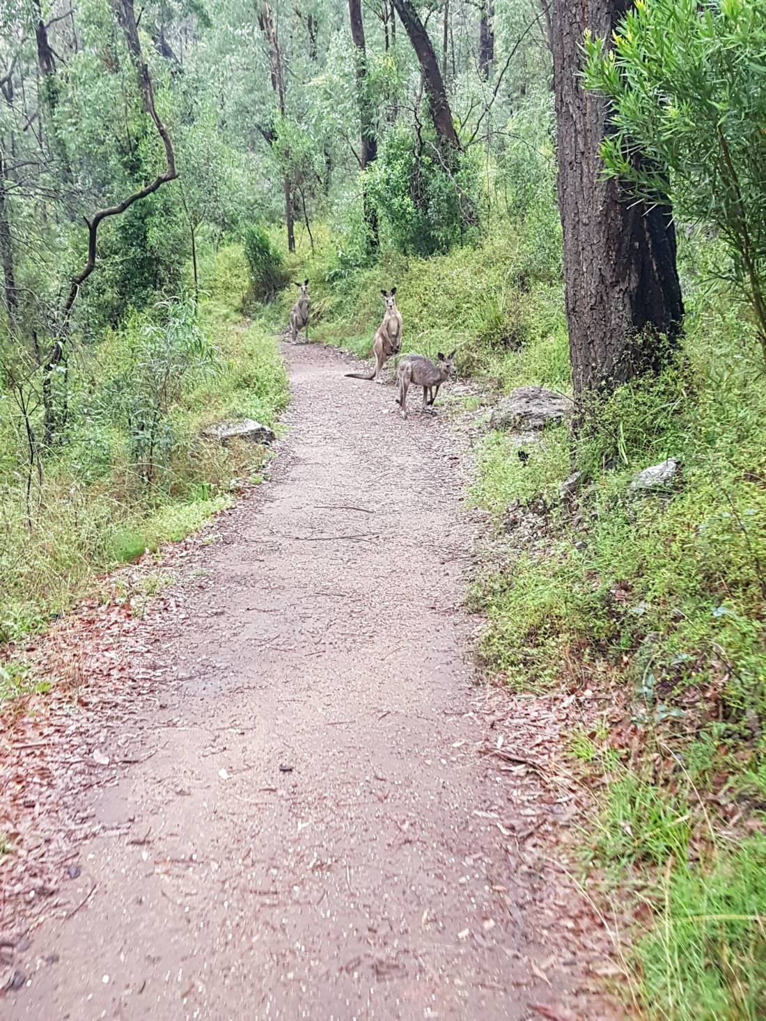
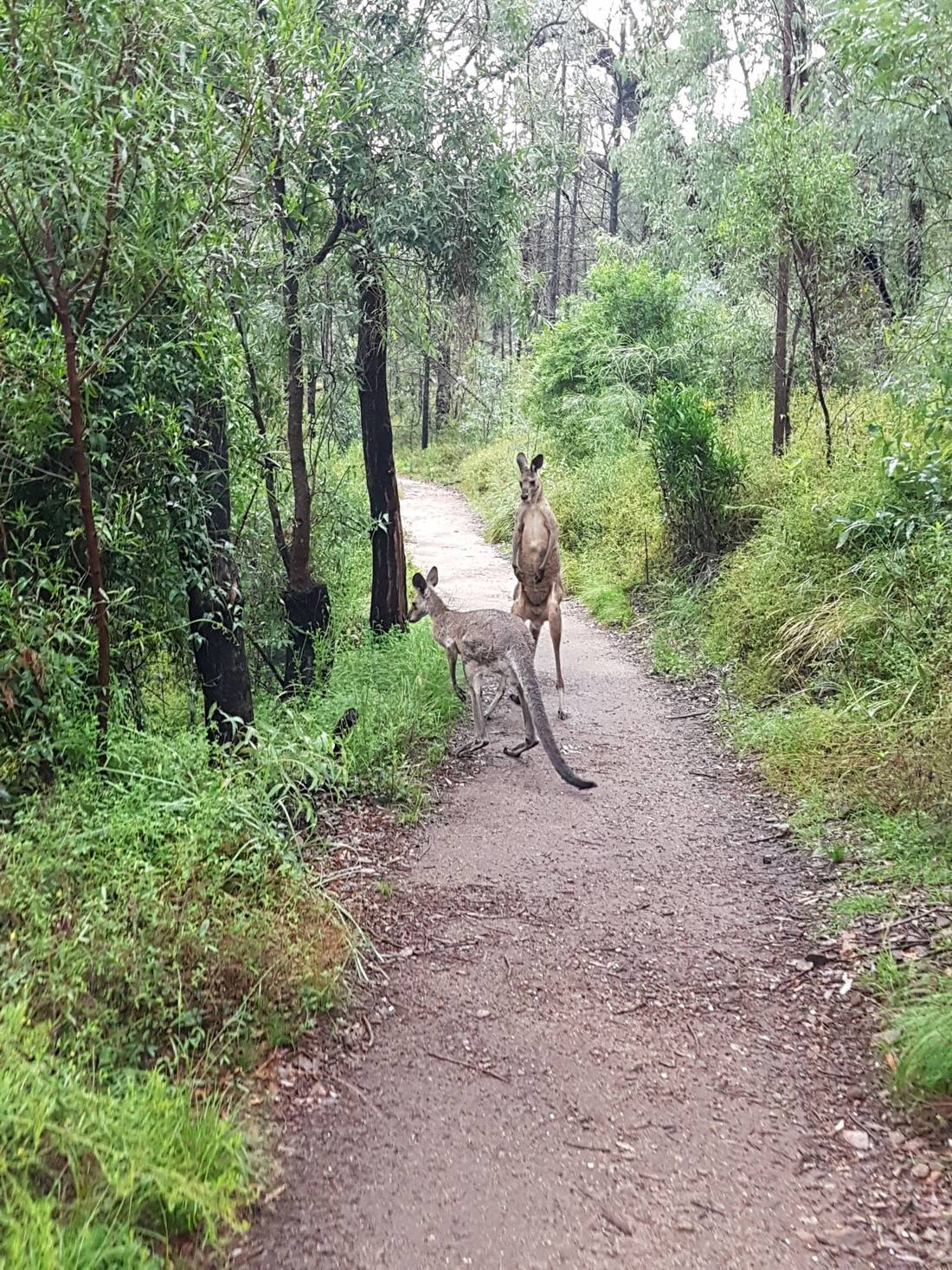
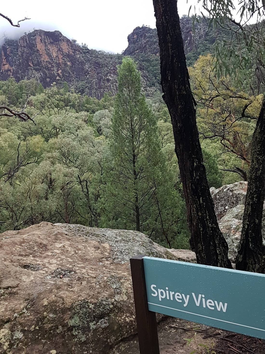
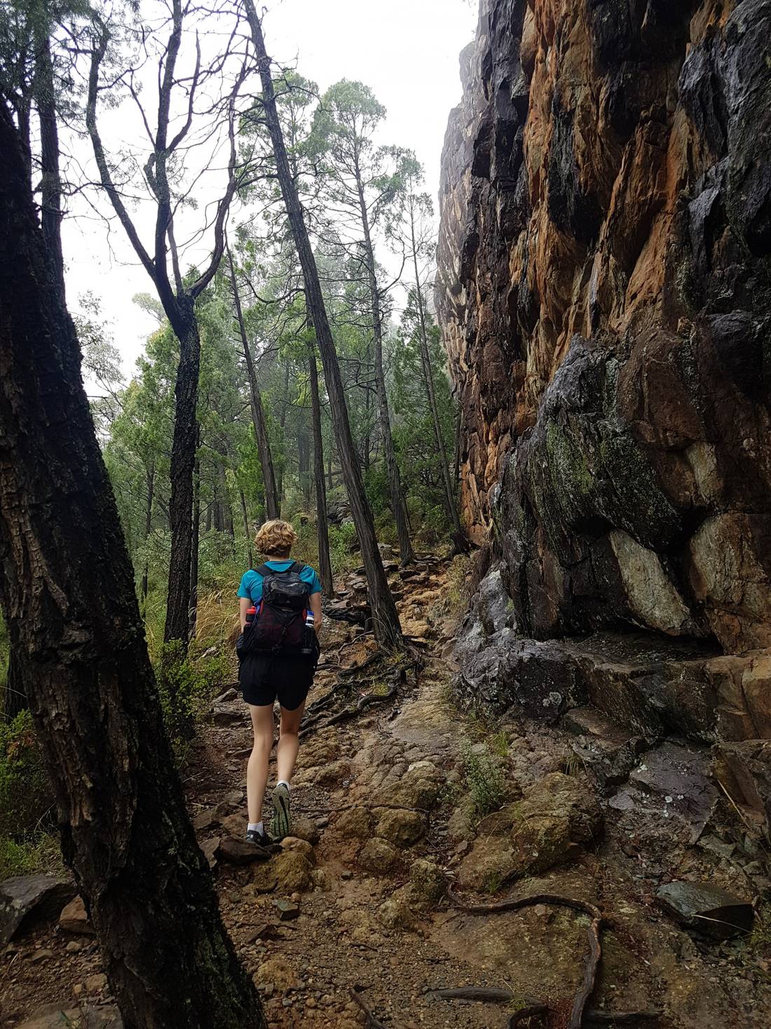
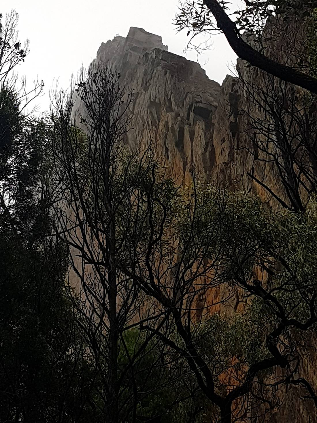
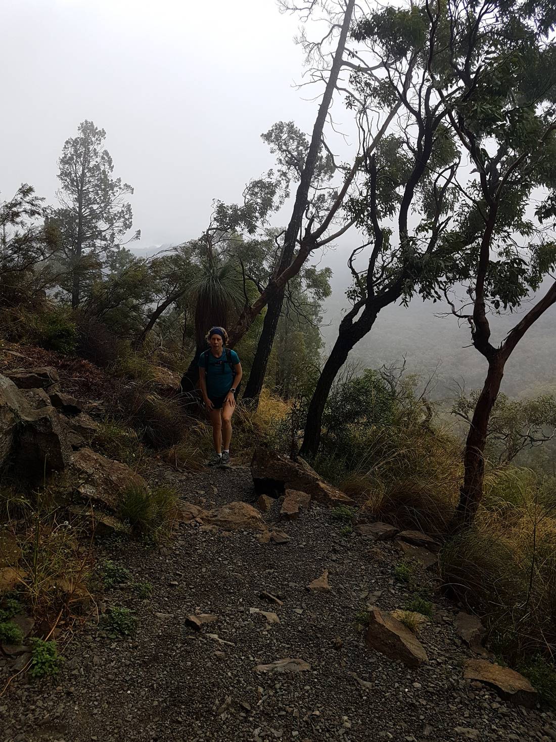
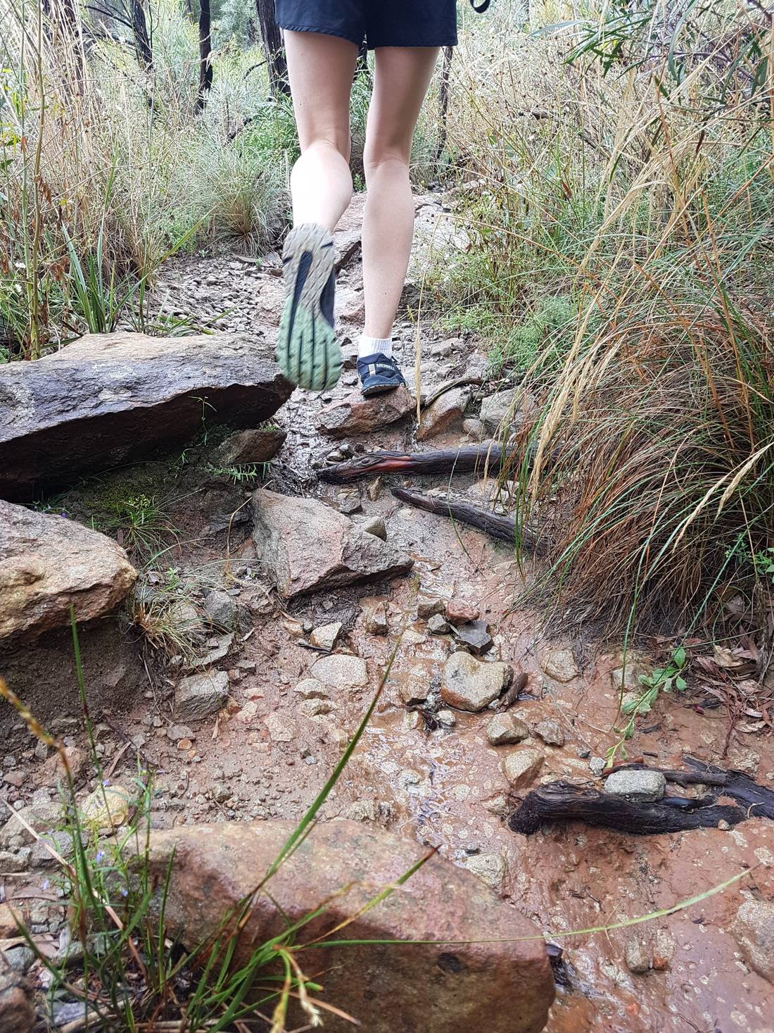
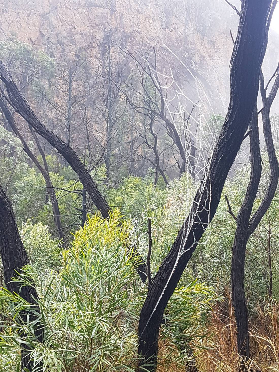
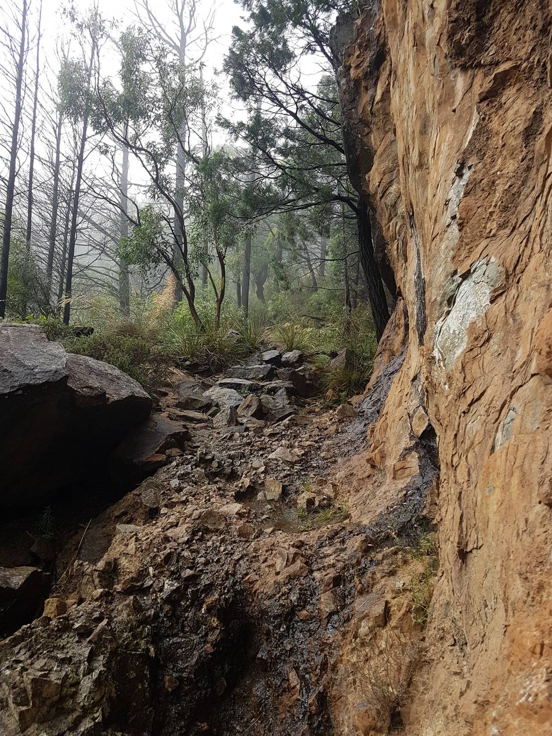
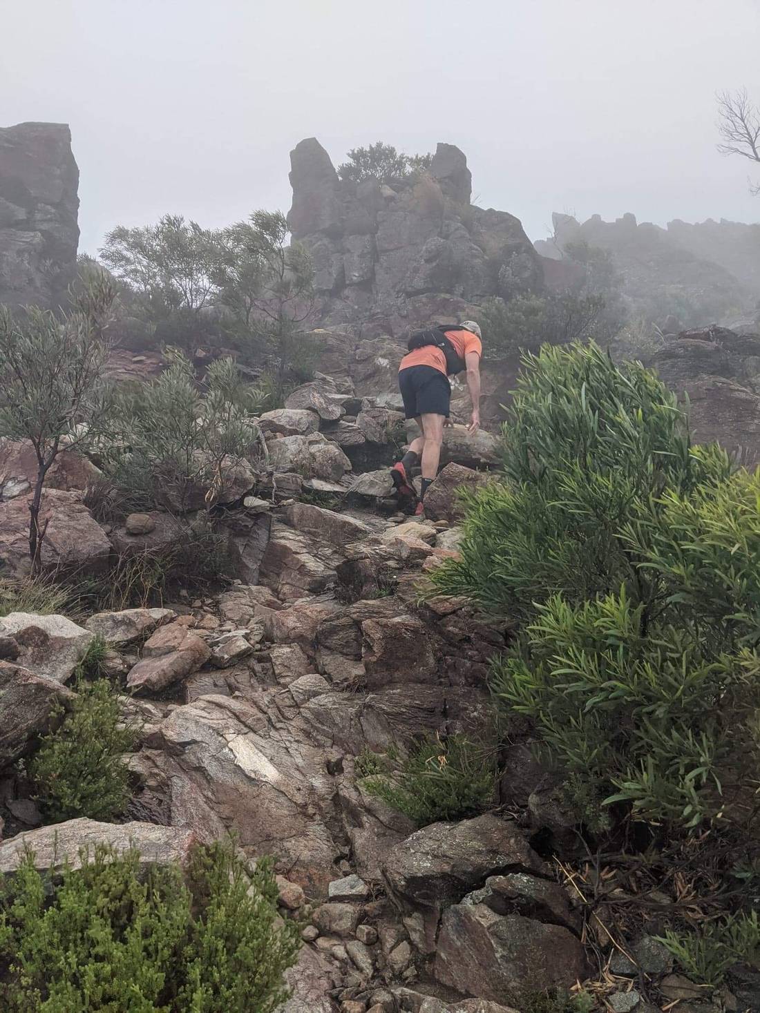
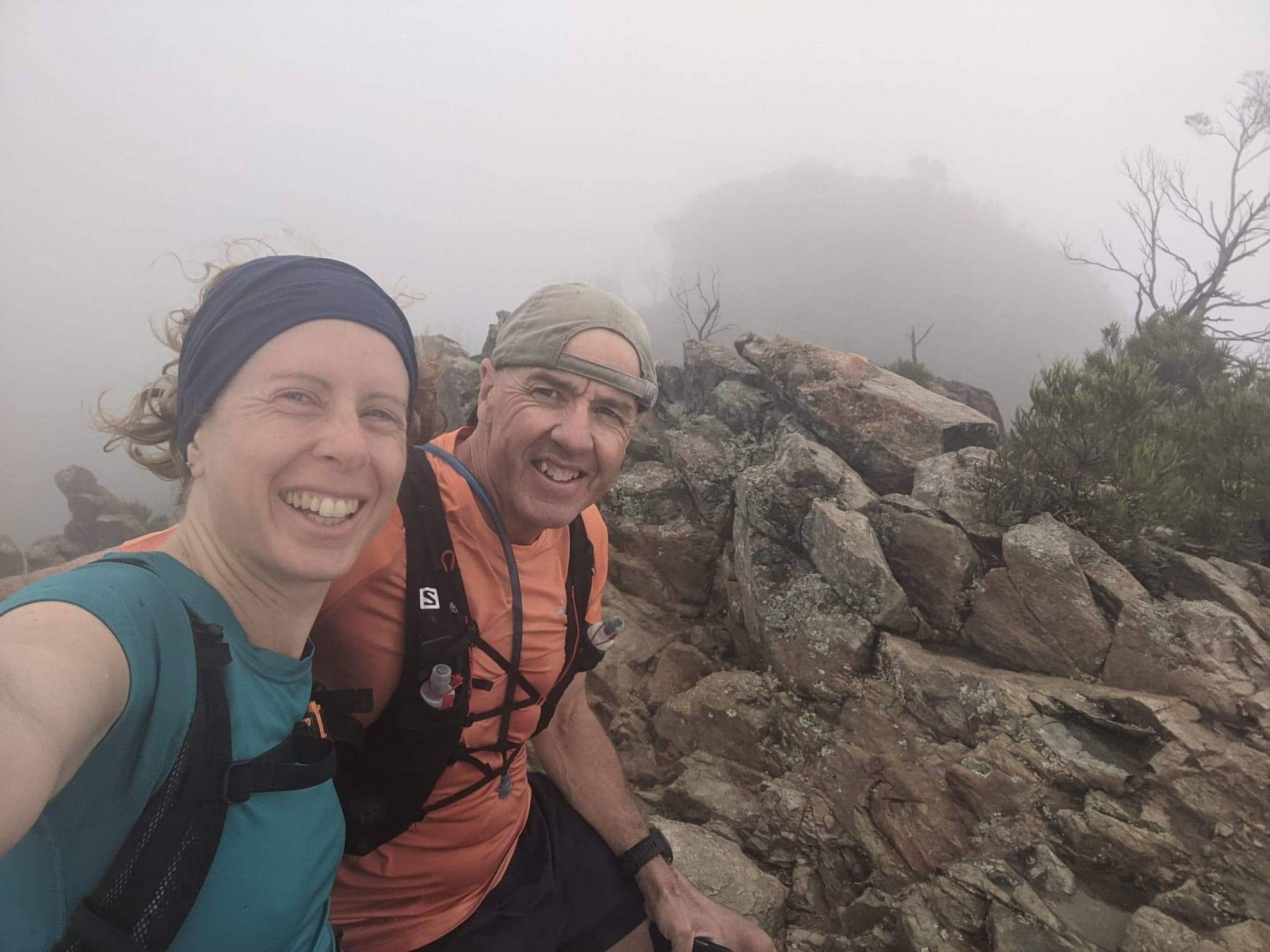
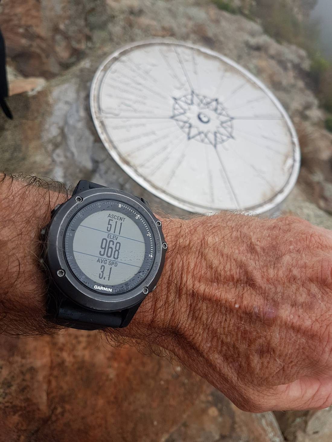
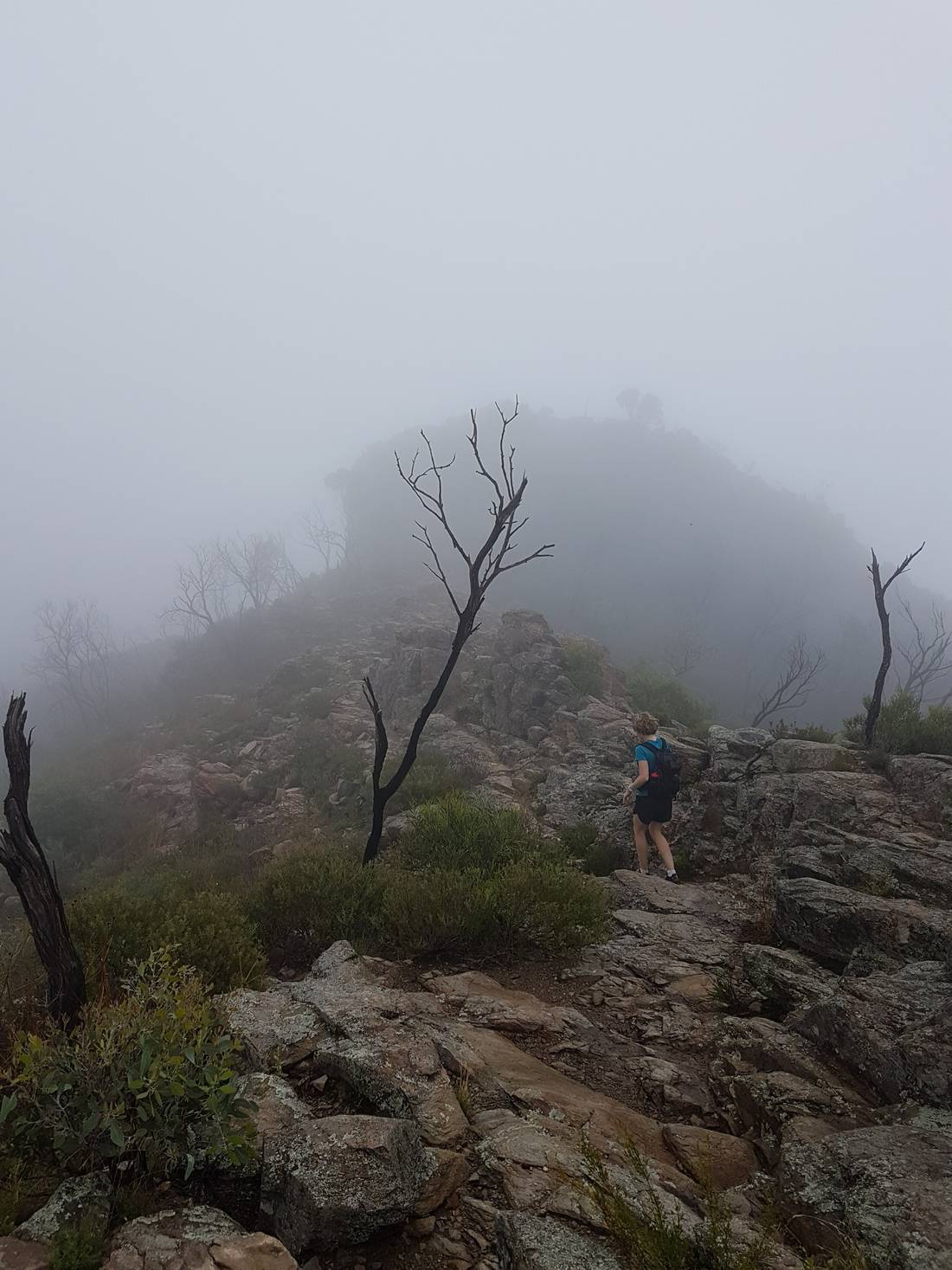
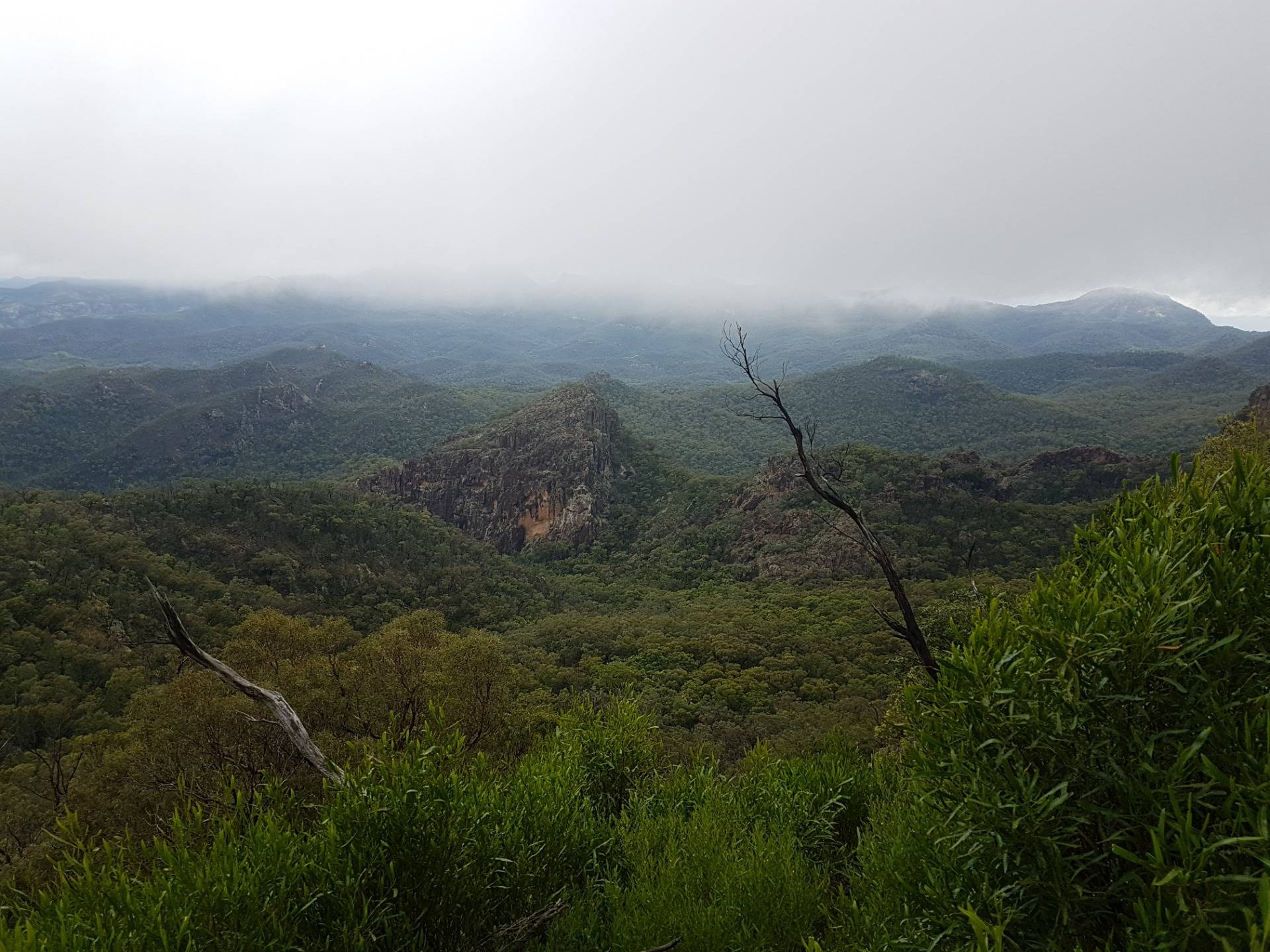
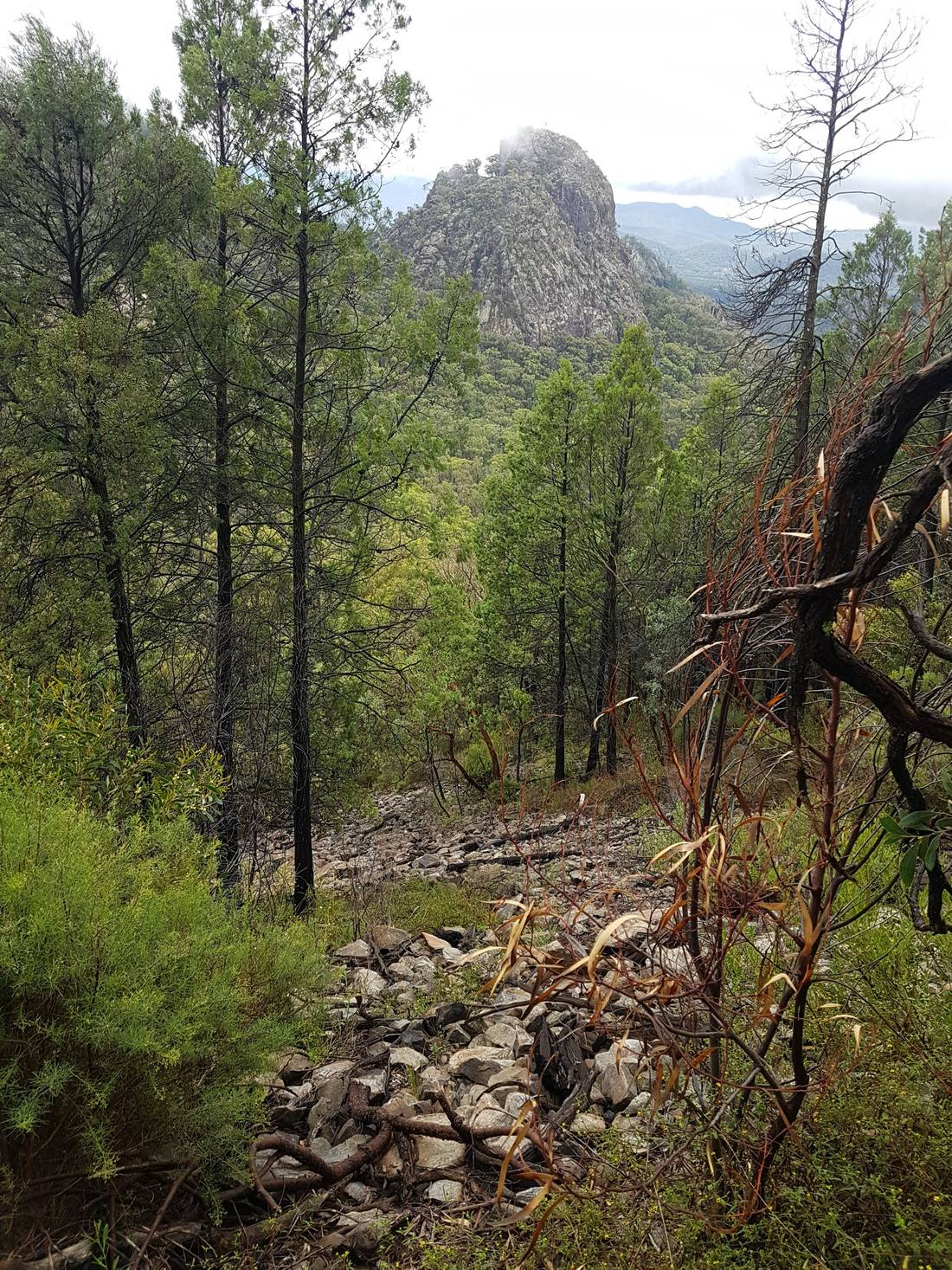
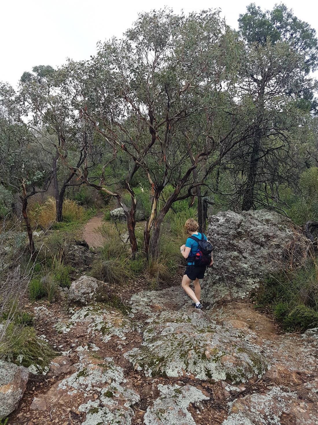
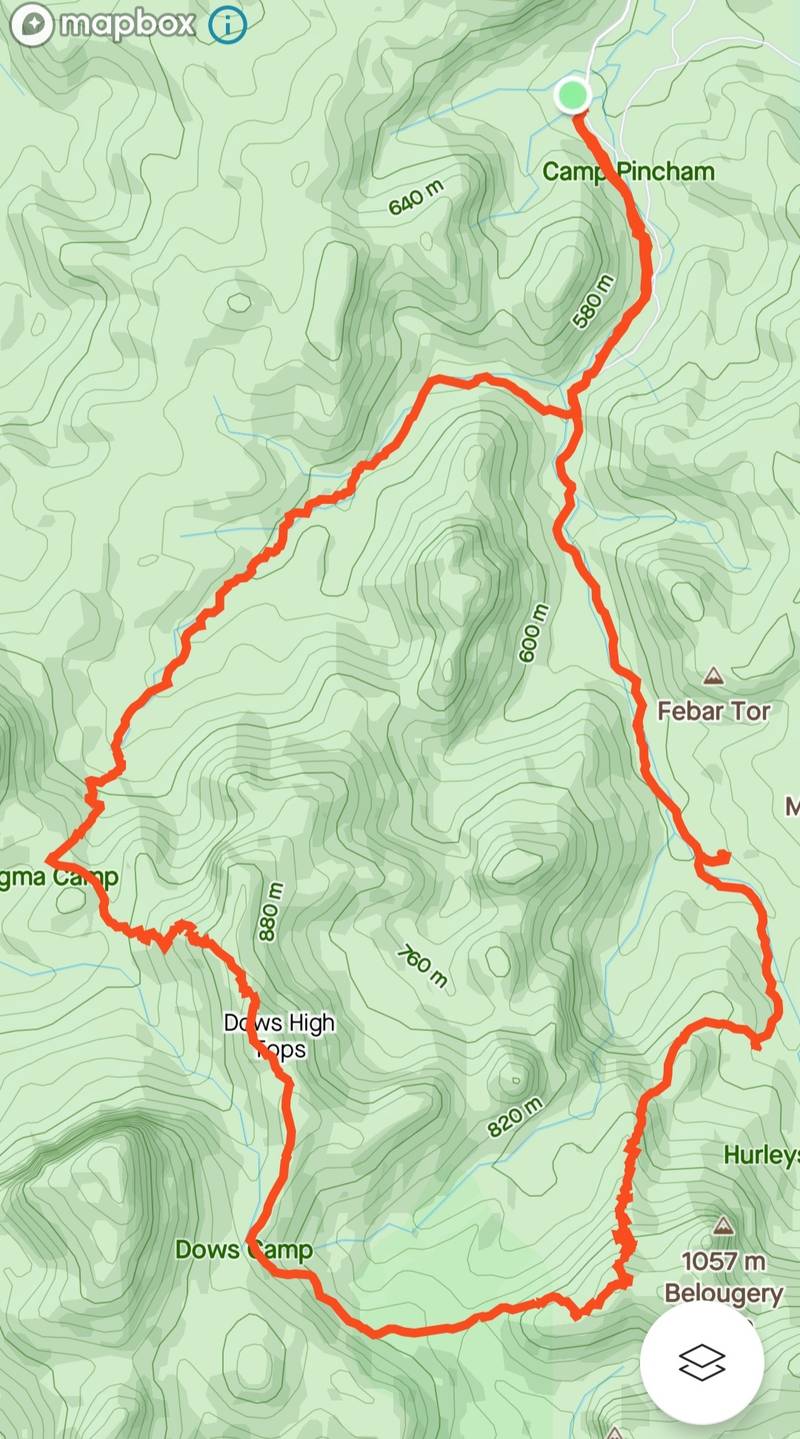
Driving into the national park from the south west and getting excited to see some mountains after driving for hours and hours through flat, farming country.
I had heard a lot about this place but this was our first visit. This National Park is Australia’s only dark sky park. Any lights installed had to be specially designed and only shine down. No light is suppose to leak up. They call it zero light pollution which is ideal for astronomers, star gazers and any birds that migrate at night. The National Parks Info Centre had some interesting info about it all.
I had heard a lot about this place but this was our first visit. This National Park is Australia's only dark sky park. Any lights installed had to be specially designed and only shine down. No light is suppose to leak up. They call it zero light pollution which is ideal for astronomers, star gazers and any birds that migrate at night. The National Parks Info Centre had some interesting info about it all.
We arrived after noon so we were only able to squeeze a short walk in on Day One.
The path was rocky and steep, but really well maintained. And it was hot!
Fans Horizons Lookout was spectacular. It was very unique and a different type of countryside in the Warrumbungles compared to the surrounding countryside.
There were lots of camping options in the National Park but we didn’t have all our camping stuff with us as this was part of a much bigger trip. So we stayed at Coonabarabran for a couple of nights, which was not too far down the road. (Map and data from my Strava app).
There were lots of camping options in the National Park but we didn't have all our camping stuff with us as this was part of a much bigger trip. So we stayed at Coonabarabran for a couple of nights, which was not too far down the road. (Map and data from my Strava app).
So, after a good night’s sleep we were back to try one of the most famous short hikes in Australia, one that we knew only as ”Breadknife”.
So, after a good night's sleep we were back to try one of the most famous short hikes in Australia, one that we knew only as "Breadknife".
Starting early increases your chances of seeing a few kangaroos.
They were somewhat used to humans, I think, so they didn’t scatter the moment they saw us, but did move on once we got close enough. And we had to get closer because that was our path to Breadknife.
They were somewhat used to humans, I think, so they didn't scatter the moment they saw us, but did move on once we got close enough. And we had to get closer because that was our path to Breadknife.
Spirey View lookout was 100 metres off the Grand High Tops Loop Walk. We couldn’t get the full view experience because there was some persistent cloud cover but it was still worth the little detour.
Spirey View lookout was 100 metres off the Grand High Tops Loop Walk. We couldn't get the full view experience because there was some persistent cloud cover but it was still worth the little detour.
More rocky, steep paths.
This was the Breadknife rock formation. I guess it’s called ”breadknife” because it’s thin and strong and juts out like giant knife would.
This was the Breadknife rock formation. I guess it's called "breadknife" because it's thin and strong and juts out like giant knife would.
Caroline with her hands on her legs, indicating that it was tough work getting up these hills.
You can see how wet, rocky and uneven the terrain was here. Still, it was hot (hence the bare legs).
The mist and clouds made everything damp, including this spider’s web.
The mist and clouds made everything damp, including this spider's web.
Yep, this is where the path went around the top of the ”Grand Tops”.
Yep, this is where the path went around the top of the "Grand Tops".
Navigation was a bit harder with all the mist but still a pretty easy, well worn path to follow as long as you paid attention. There was also a little bit of rock scrambling to finally get to the top. A great hike for experienced bushwalkers but not for newbies.
Not the view we had been hoping for but still, another peak climbed.
My watch said we were close to 1,000 metres above sea level. We don’t get that high in Australia very often.
My watch said we were close to 1,000 metres above sea level. We don't get that high in Australia very often.
On the way back down, via West Spirey Creek.
Was nice to get out of the cloud cover and get to see some of the amazing views.
More views across to other mini peaks. Snapped this one while we were walking.
The challenging, meandering paths continued. Thankfully, it was a lot easier on the lungs on the way back down.
13.95 kilometres hiked with 661 metres of elevation gain, in 4 hours 14 minutes. (Map from my Strava app).

We loved it here so much. We definitely want to come back and do more in this area! 

What's your favourite place you've hiked?


Share this post

Travel, Write, Earn
Join TravelFeed and start earning from your own travel blog!

Comments

crackyup
@crackyup
· January 2022

Really good photos, looked like a great view to

new.things
@new.things
· January 2022

Thanks mate, I am lucky they make really good camera phones now !LOL

consciouscat
@consciouscat
· January 2022

Wooooooo! I so !LUV d this trip. But it was darn hot at times !LOL