This is a tale of two hikes I did back in fall of 2011 and spring of 2012. The hikes are located close to each other on the Washington State side of the Columbia River Gorge.
Wind Mt Hike
Sometime between 200 and 1,000 years ago, young members of local tribes began hiking up the slopes of Wind Mountain, where they fasted, made piles of rocks and awaited visions from their guardian spirits. Source
The fact that Wind Mt was a vision quest site for native inhabitants really intrigued me and was something I needed to see. This was a bit of a rough patch in my life but ended up being a time that I now remember as a more serious start to a new way of life. Trying to give up material things and ridding myself of a lifetime of societal programming that said "This is the way things must be". Enough about my mid-life crisis though. On with the 2.5 mile round trip hike. :)
Click images for larger view
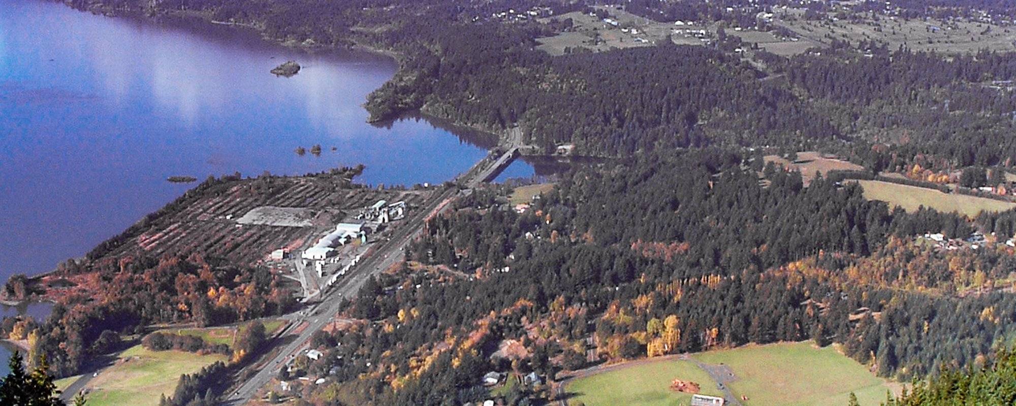
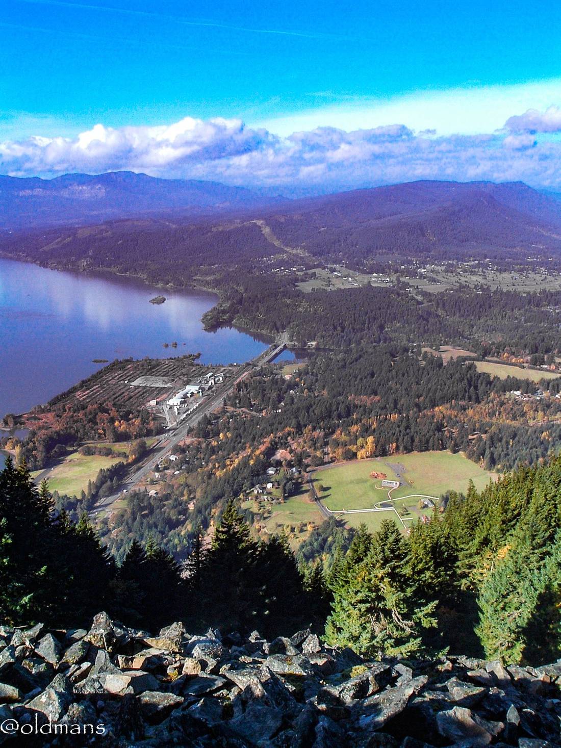
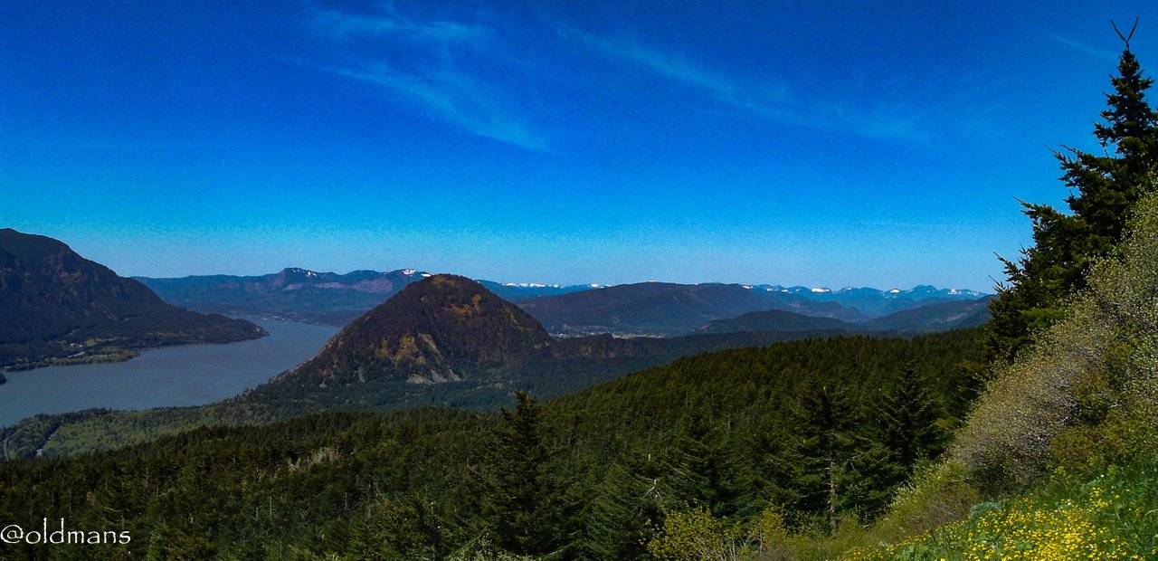
Looking down the steep talus slope from the summit towards the small community of Home Valley. HWY 14 can be seen crossing the Wind River as it empties into the Columbia River. On the grassy plateau in the distance on the right is the town of Carson.
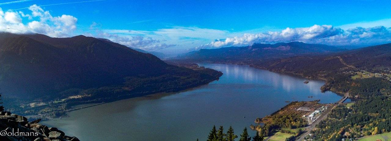
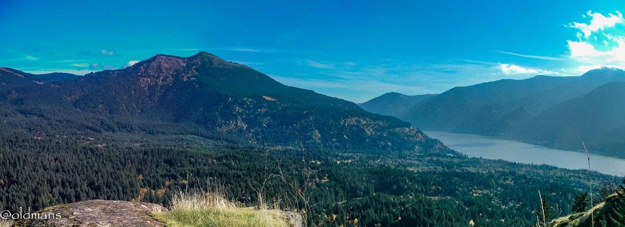
Another westerly view from the top showing the Columbia River flowing toward Portland OR and Vancouver WA. In the distance you can see the cliff faces on the right side and the land down below where the river appears to end. This is an area known as Bridge Of The Gods. There is an existing modern bridge there but in ancient times a landslide occurred damming the river and creating a natural land bridge for a period of time. More information about the geologic history and the Native American legends here.
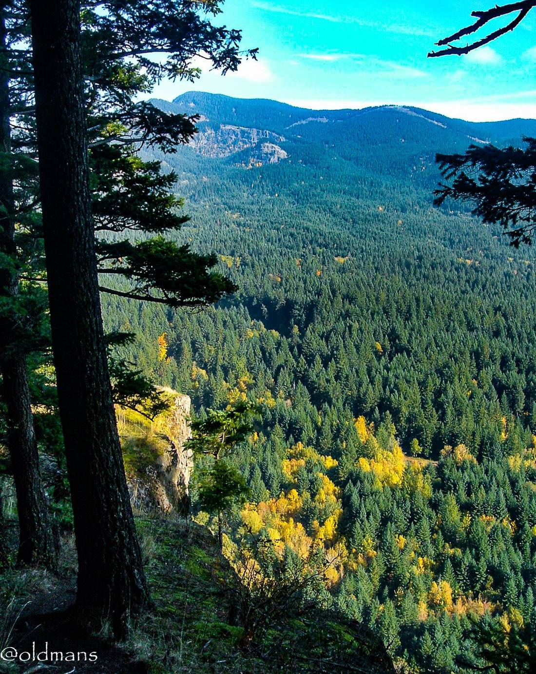
A couple shots of the fall colors on a little side trail I took on the way back down the mountain.
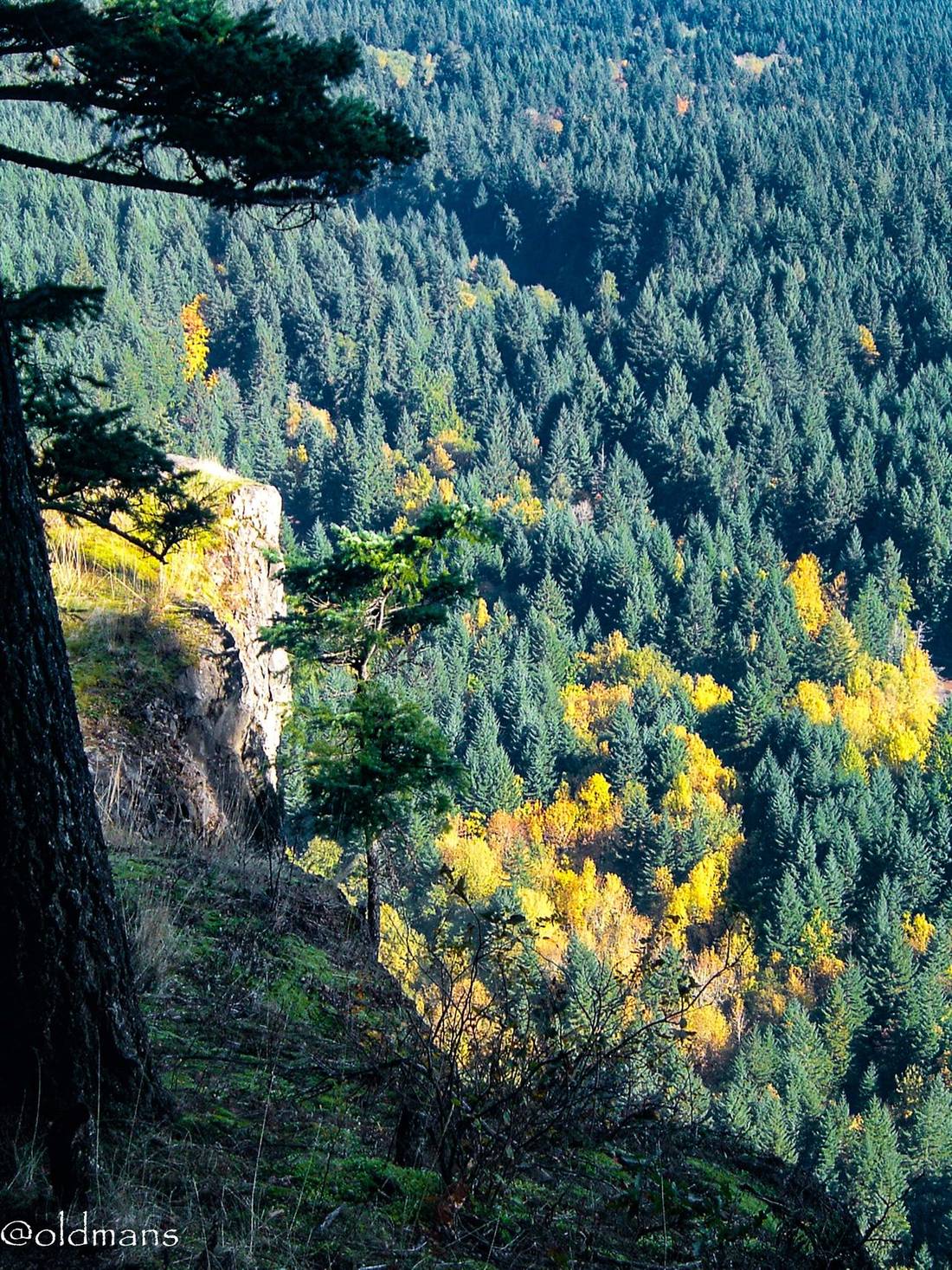
I am usually pretty nervous about exposed drop offs, so this was a little experiment for me in getting out of my comfort zone. Although I've made a lot of changes in my life, exposed drop offs are still a thing I don't really care for. :)
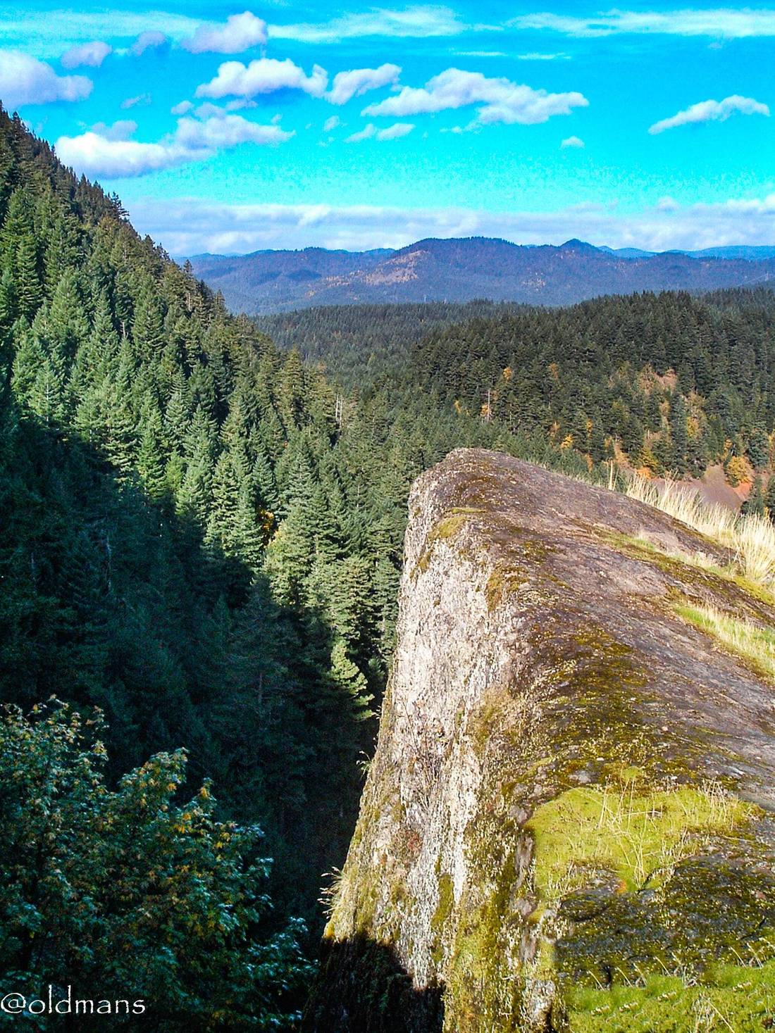
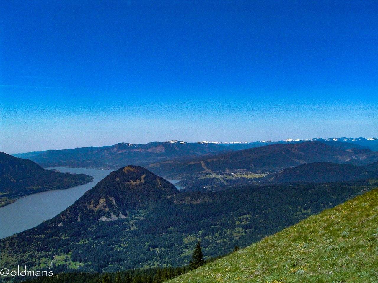
An easterly looking shot from the side trail looking up the Columbia River. The highest point center left of the image is Dog Mt the subject of the second part of this post.
Dog Mt Hike
I did this hike with my adult children in spring of 2012. This is an approximate 7 mile round trip hike with an elevation gain of 2800 feet. The trail head is at river level and is pretty much uphill the entire way, quite steep in some spots. It can be almost as hard going down as coming up. :)
A look at the Oregon side of the river. One of the first views on the way up as you emerge from the forest.
A westerly view of Wind Mt.
Another higher view about an hour later as I struggle towards the top. The gray areas on the lower left side of Wind Mt is where the side trail was I mentioned earlier in the post.
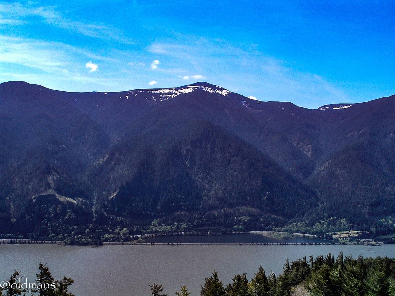
A shot of Mt Adams from the top.
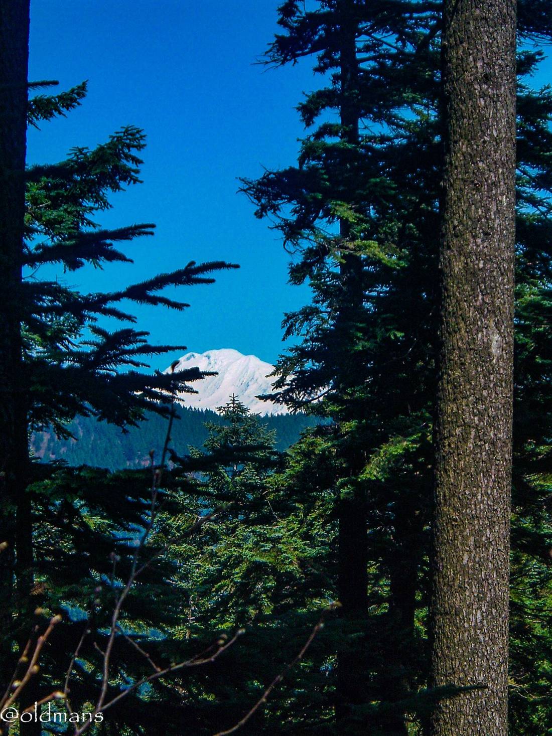

Mt St Helens
Don't Forget: Get Travel Health Insurance!
To make your trip a worry-free experience, TravelFeed recommends SafetyWing Nomad Insurance. It provides comprehensive health coverage while you travel, so you can focus on exploring, not the unexpected. Get a quote here
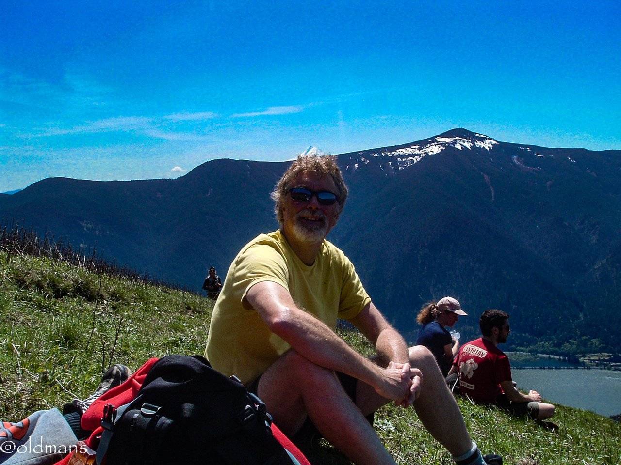
Me wearing a Mt Hood dunce cap. :) As you can see it is quite a popular trail and you can run into a lot of people at the top. Especially when the wild flowers are blooming. Things got so crazy at the trail head that they had to start a shuttle service from Stevenson WA to keep people from parking on HWY 14. I would probably never go up there again because of this but at least I can say I did it once. :)
Click images for larger view
Photos taken by me with a FUJIFILM FinePix A210 with some Lightroom post processing.
Thanks for looking and enjoy your day!
Travel Resources
Recommended by TravelFeed
Flights: We recommend checking Kiwi.com to find the best and cheapest flights .
Accomodation: Find great stays on Booking.com, Agoda and Hostelworld.
Travel Insurance: Medical emergencies abroad can be pricey, but travel health insurance is not. We always use SafetyWing for affordable and reliable coverage.
Car Rental: For hassle-free car hiring, DiscoverCars is our trusted choice with a wide selection of vehicles.
Internet: Got an eSIM compatible phone? Airalo is perfect for reliable internet access during your trip. Just install it before you go, and you're set!
Day Trips & Tours: We recommend GetYourGuide for a variety of well-organized and enjoyable activities.
Travel Planner: Need a hand planning? Our free travel planner chatbot is your personal guide. Chat now.
Disclosure: Posts on TravelFeed may contain affiliate links. See affiliate disclosure.
