[ENG]

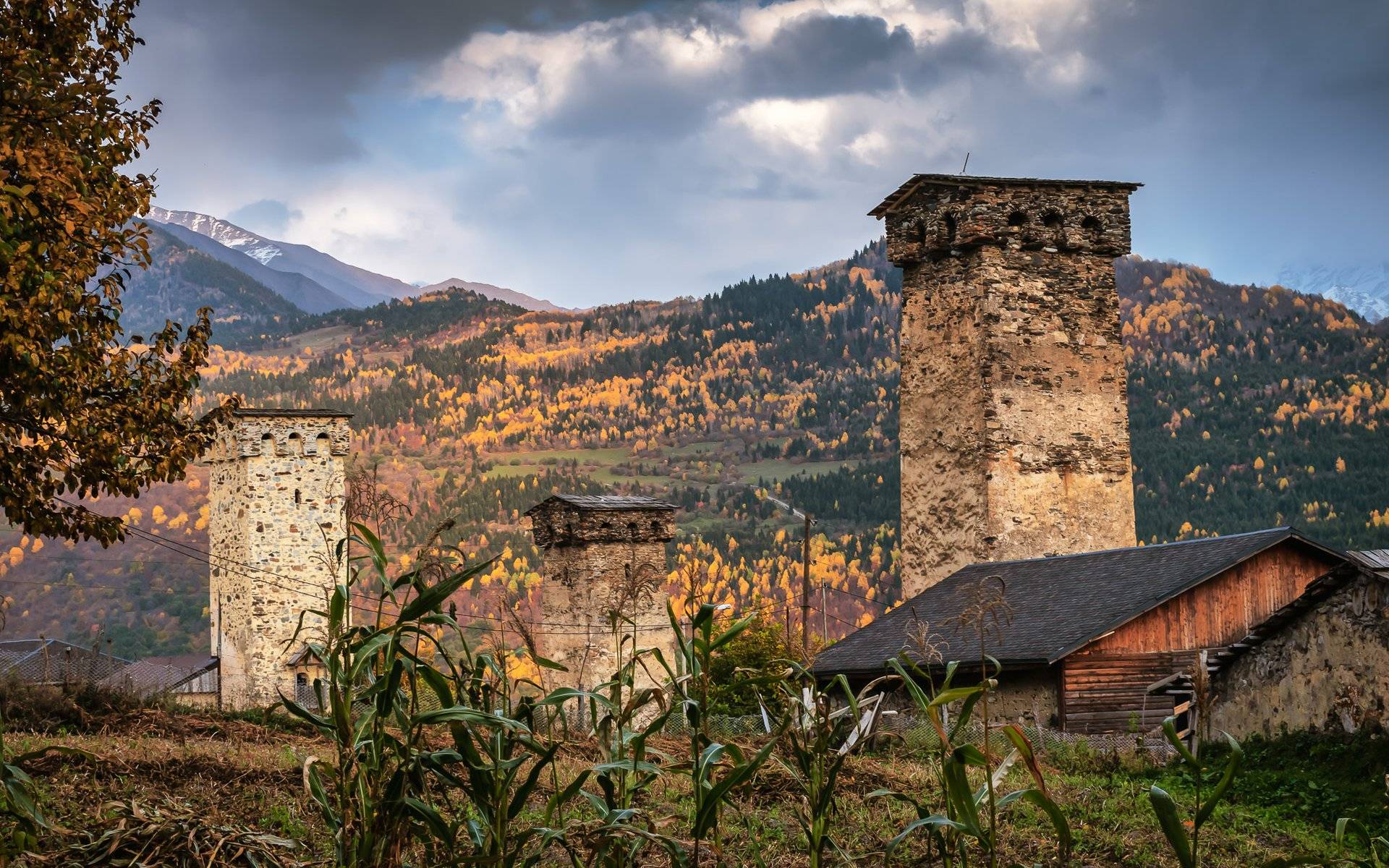
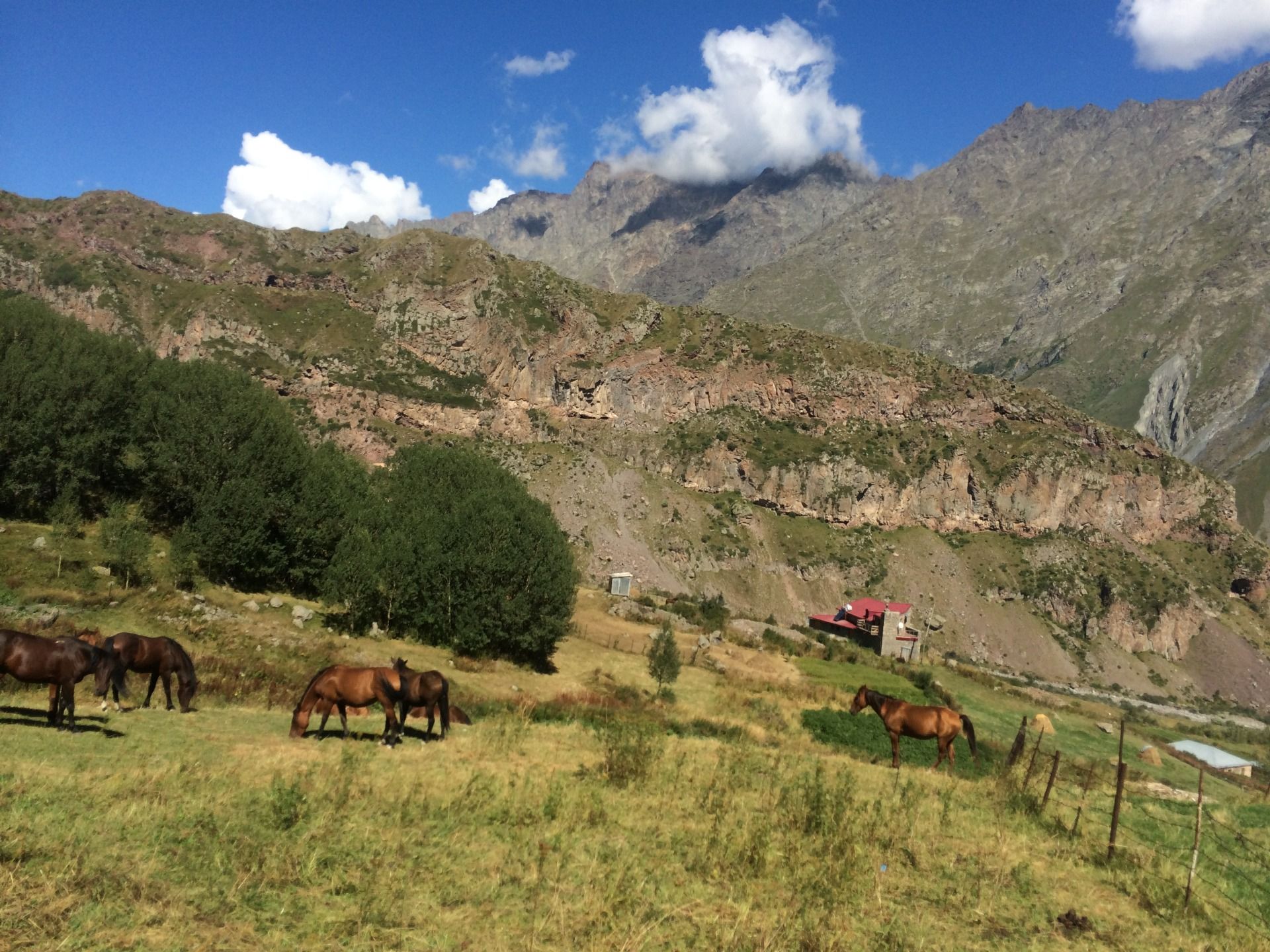
The knowledge that we acquire so meticulously at school turns out to be completely useless or simply very incomplete. The best example is Geography. At school they taught me that there are 7 continents Africa, South and North America, Antarctica, Australia, Europe and Asia, while the current narrative says that Eurasia and Asia are one continent, and the division between them is very conventional. It is possible that the knowledge transferred in this way in the 1990s resulted from the need to separate from Russia also geographically, that we are Europe and Russia is Asia. I don't know, maybe yes, maybe no, but the truth is that if we want to separate Europe from Asia, we know that we draw the line along the tops of the Ural mountains and the tops of the Caucasus mountains. And another mistake! Reading Wikipedia: “The most commonly accepted geographical border runs as follows: from the Kerch Strait to the north, the eastern shore of the Sea of Azov and the Gulf of Taganros to the mouth of the Don River; further up the Don to the mouth of the Manych, then Manych and the Kumsko-Manyckie Depression to the middle section of the Kuma River; then its lower course in an easterly direction as far as the mouth of the Caspian Sea. So what about this border in the Caucasus? It is very strange, because it is enough to come to Georgia for a moment to see that there is no better, more natural border than the Caucasus.
[PL]
Wiedza, którą tak skrupulatnie zdobywamy w szkole, z czasem okazuje się zupełnie bezużyteczna, albo po prostu bardzo niekompletna. Najlepszym przykładem jest Geografia. Mnie w szkole uczyli, że istnieje 7 kontynentów Afryka, Ameryki Południowa i Północna, Antarktyda, Australia, Europa i Azja, natomiast obecna narracja głosi, że Eurazja i Azja jest jednym kontynentem, a podział między nimi jest mocno umowny. Możliwe, że tak przekazywana wiedza w latach 90 wynikała z potrzeby oddzielenia się od Rosji również i geograficznie, że my to Europa, a Rosja to Azja. Nie wiem, może tak, może nie, ale prawdą jest, że jeśli chcemy oddzielić Europę od Azji, to wiadomo, że linię tyczymy po szczytach gór Ural, oraz po szczytach gór Kaukaz. No i kolejny błąd! Czytując Wikipedię: ”Najczęściej przyjmowana granica geograficzna przebiega następująco: od Cieśniny Kerczeńskiej na północ, wschodnim brzegiem Morza Azowskiego i Zatoki Taganroskiej do ujścia rzeki Don; dalej w górę Donu do ujścia Manyczu, następnie Manyczem i Obniżeniem Kumsko-Manyckim do środkowego odcinka rzeki Kumy; potem dolnym jej biegiem w kierunku wschodnim aż do ujścia do Morza Kaspijskiego”. To co w takim razie z tą granicą na Kaukazie? Dziwne to jest i to bardzo, bo wystarczy choć na chwile przyjechać do Gruzji, aby przekonać się, że nie ma lepszej, bardziej naturalnej granicy niż Kaukaz.
[ENG]
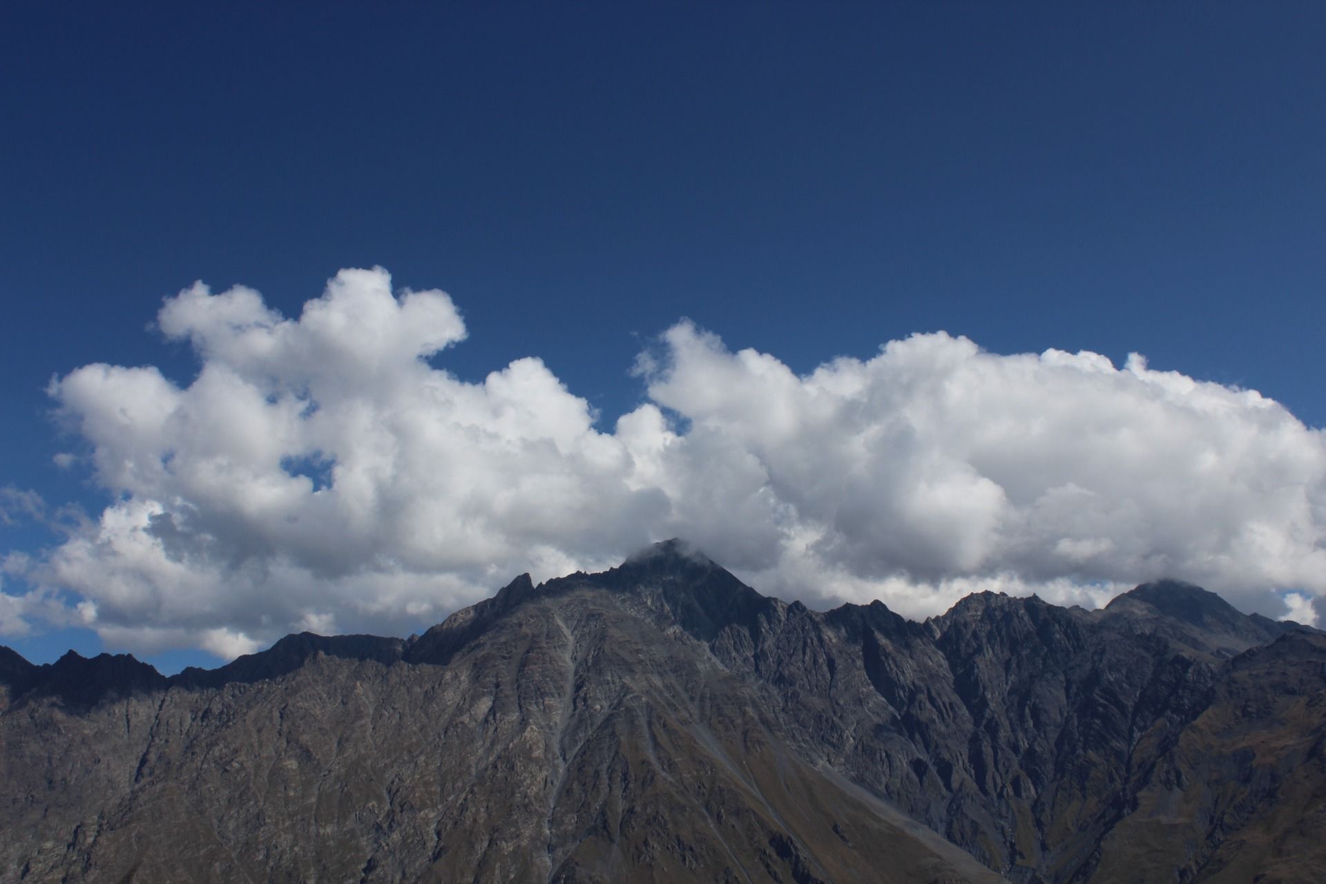
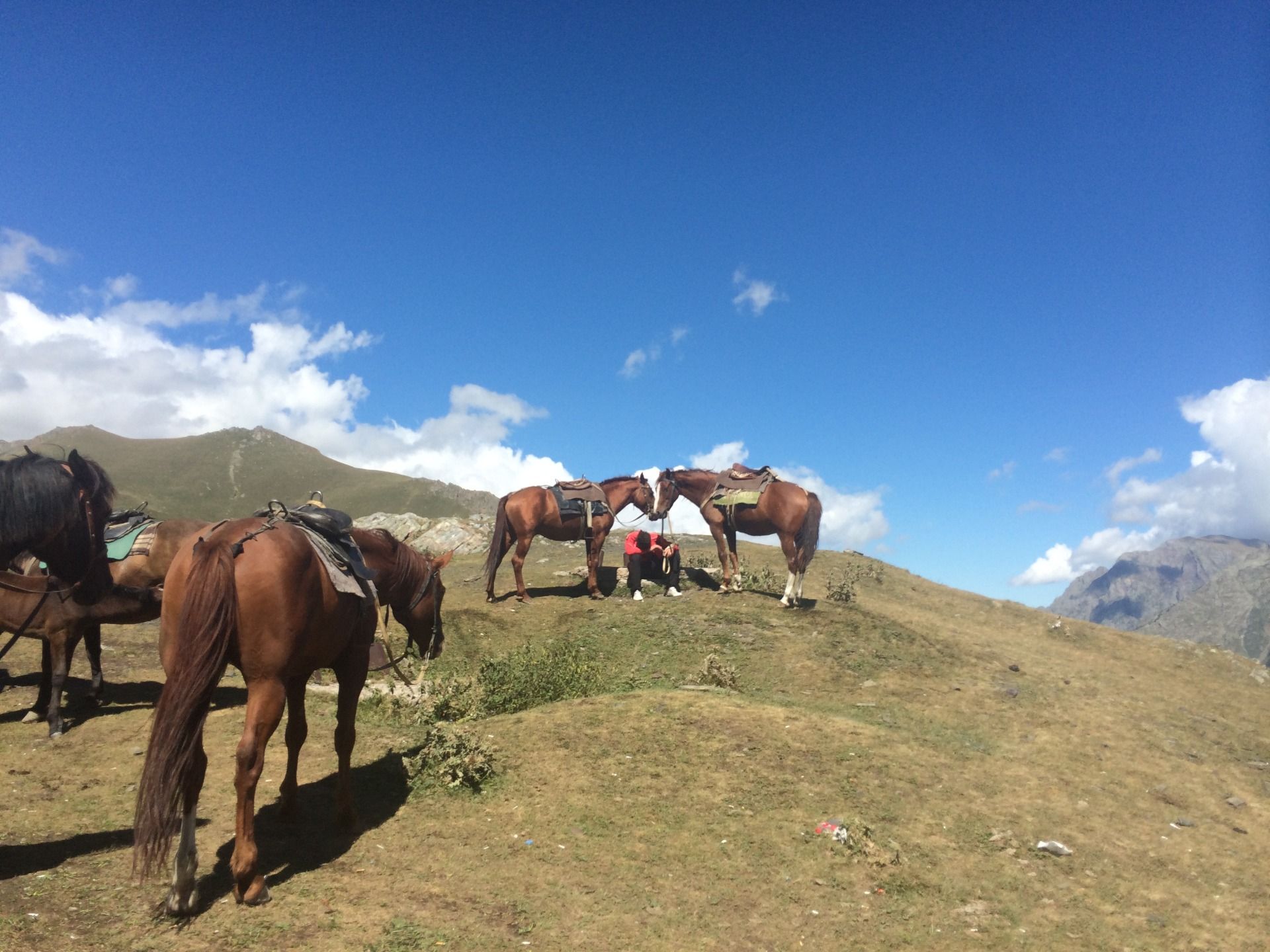
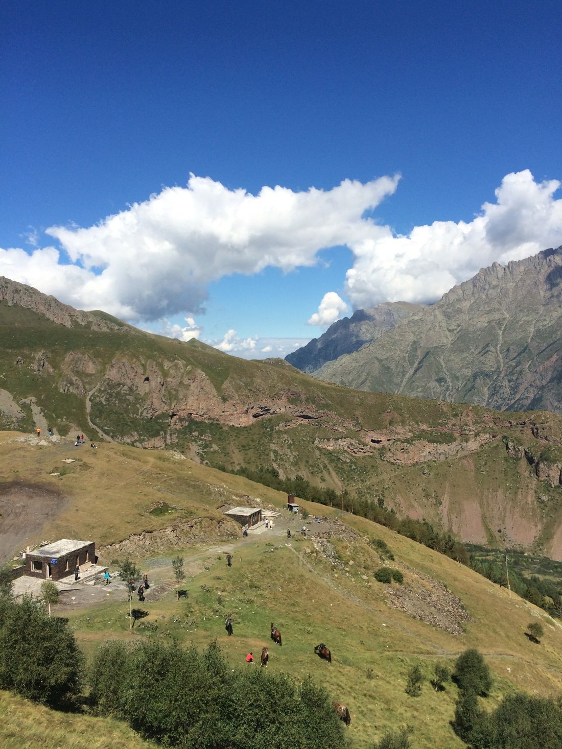
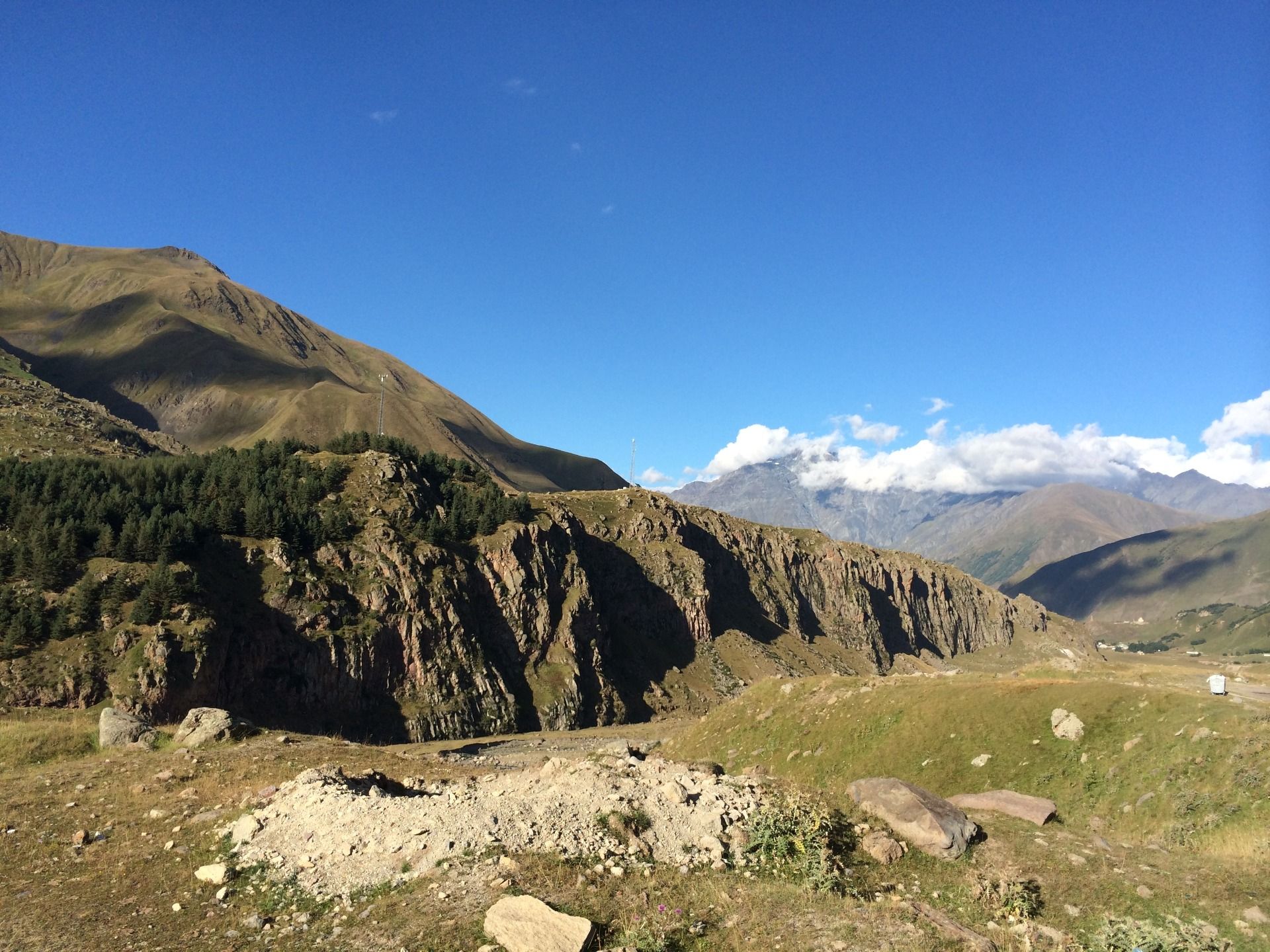
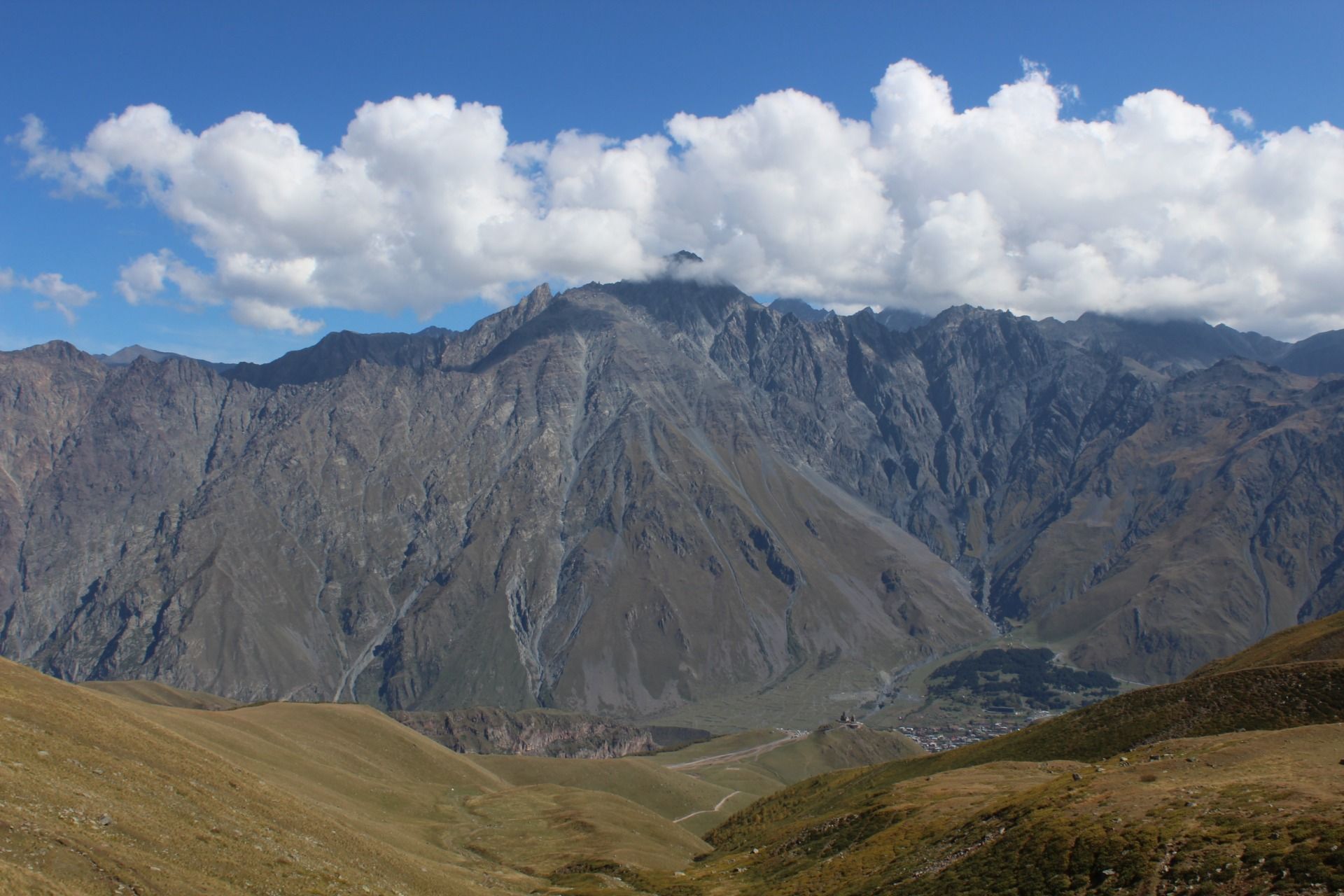
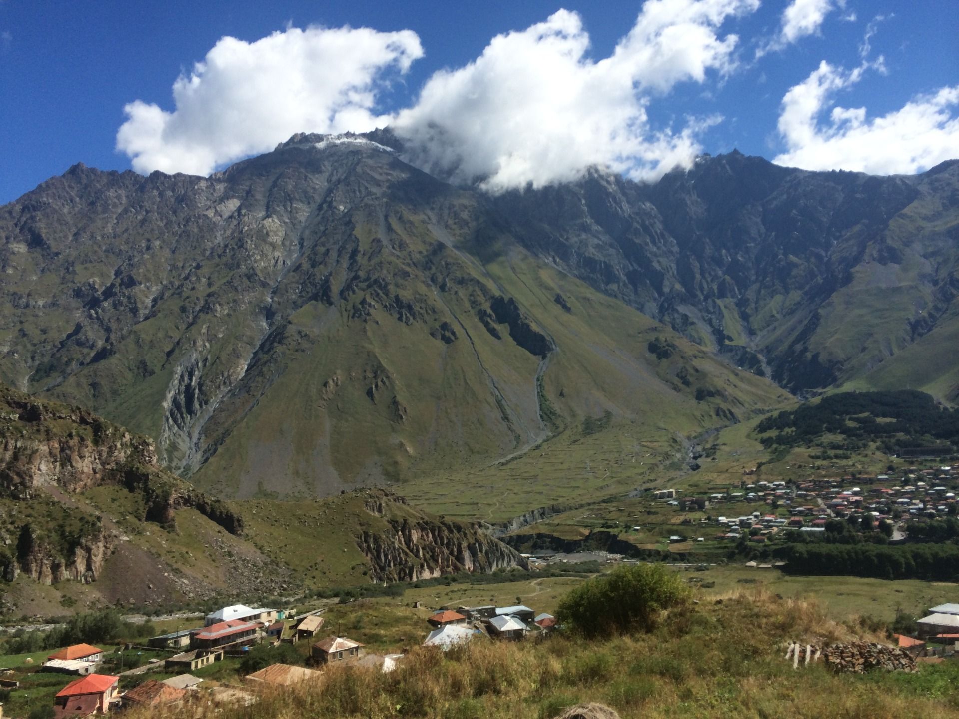
The Caucasus Mountains are so inaccessible, so impenetrable that the largest city in the Caucasus is the Georgian city of Kazbegi, recently called Stepantsminda. The city has only 1,500 inhabitants and lives on two things. The first pillar on which the whole of Stepantsminda is based is transport, because the city is located on the famous Georgian military road, which is the only reasonable road connection between Russia and Georgia. Every single TIR from Russia that carries some goods to Georgia must pass this road, and in the middle of the Caucasus, right next to the border crossing, there is Stepantsminda. The mass of drivers stopping here are not the only visitors to Stepantsminda. An equally large group, if not larger, are tourists, because Stepantsminda is for Georgia what Zakopane is for Poland, Innsbruck for Austria or Zermatt for Switzerland. A city in the mountains, literally. I will never forget my first stay in this city, when we got there late at night and then you couldn't see anything. Waking up in the morning, the first place I went to was the bathroom with a small window facing east. When I was brushing my teeth and accidentally looked through this small window, my jaw dropped so much that foam from the mouth fell on my feet ... Directly outside the window began a real mountain wall - Mount Kuru 4058 meters above sea level and Mount Shino 4043, and between them dozens of intermediate slightly lower peaks and only a few hundred dregs from where I'm brushing my teeth. Between the town and the highest peaks, the relative difference is over 2000 meters, and considering that these peaks start before me, it makes an amazing impression.
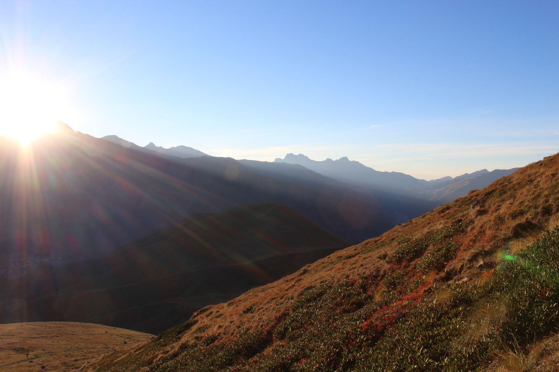
What you can see on the west side of the city deserves a separate story and will certainly find its description in the next entry.
[PL]
Góry Kaukaz są tak niedostępne, tak nieprzebyte, że największym miastem leżącym w Kaukazie jest gruzińskie miasto Kazbegi od niedawna zwane Stepancminda. Miasto liczy zaledwie 1500 mieszkańców i utrzymuje się z dwóch rzeczy. Pierwszy filar na którym opiera się cała Stepancminda to transport, bo miasto leży na słynnej gruzińskiej drodze wojennej, czyli jedynym rozsądnym połączeniu drogowym między rosją a Gruzją. Każdy jeden TIR z rosji który wiezie jakiś towar do Gruzji musi przejechać właśnie tą drogą, a w samym środku Kaukazu tuz przy przejściu granicznym znajduje się właśnie Stepancminda. Masa kierowców, zatrzymująca się tutaj, to nie jedyni goście odwiedzający Stepancmindę. Równie liczną grupą, o ile nie większą, są turyści, bo Stepancminda, dla Gruzji jest tym czym Zakopane dla Polski, Innsbruck dla Austrii czy Zermatt dla Szwajcarii. Miasto pośród gór, i do dosłownie. Nie zapomnę nigdy mojego pierwszego pobytu w tym mieście, kiedy to dojechaliśmy tam już późno w nocy i wówczas nie było widać niczego. Rano obudziwszy się, pierwsze miejsce do którego poszedłem była łazienka z małym okienkiem z widokiem na wschód. Gdy myłem zęby i przypadkiem spojrzałem za to małe okienko to dołowienie tak mi szczeka opadła, że aż piana z ust spadła na moje stopy… Bezpośrednio za oknem zaczynała się prawdziwa górska ściana góra Kuru 4058 metrów nad poziomem morza oraz góra Shino 4043, a pomiędzy nimi dziesiątki pośrednich trochę niższych szczytów i to zaledwie kilkaset mętów od miejsca w którym właśnie myję zęby. Między miasteczkiem a tymi najwyższymi szczytami różnica względna wynosi ponad 2000metrów, a biorąc pod uwagę, że te szczyty zaczynają się już przede mą robi niesamowite wrażenie.
To co widać po zachodniej stronie miasta, zasługuje na osobną opowieść i na pewno znajdzie swój opis w kolejnym wpisie.
 Mtskheta-Mtianeti