[ENG]
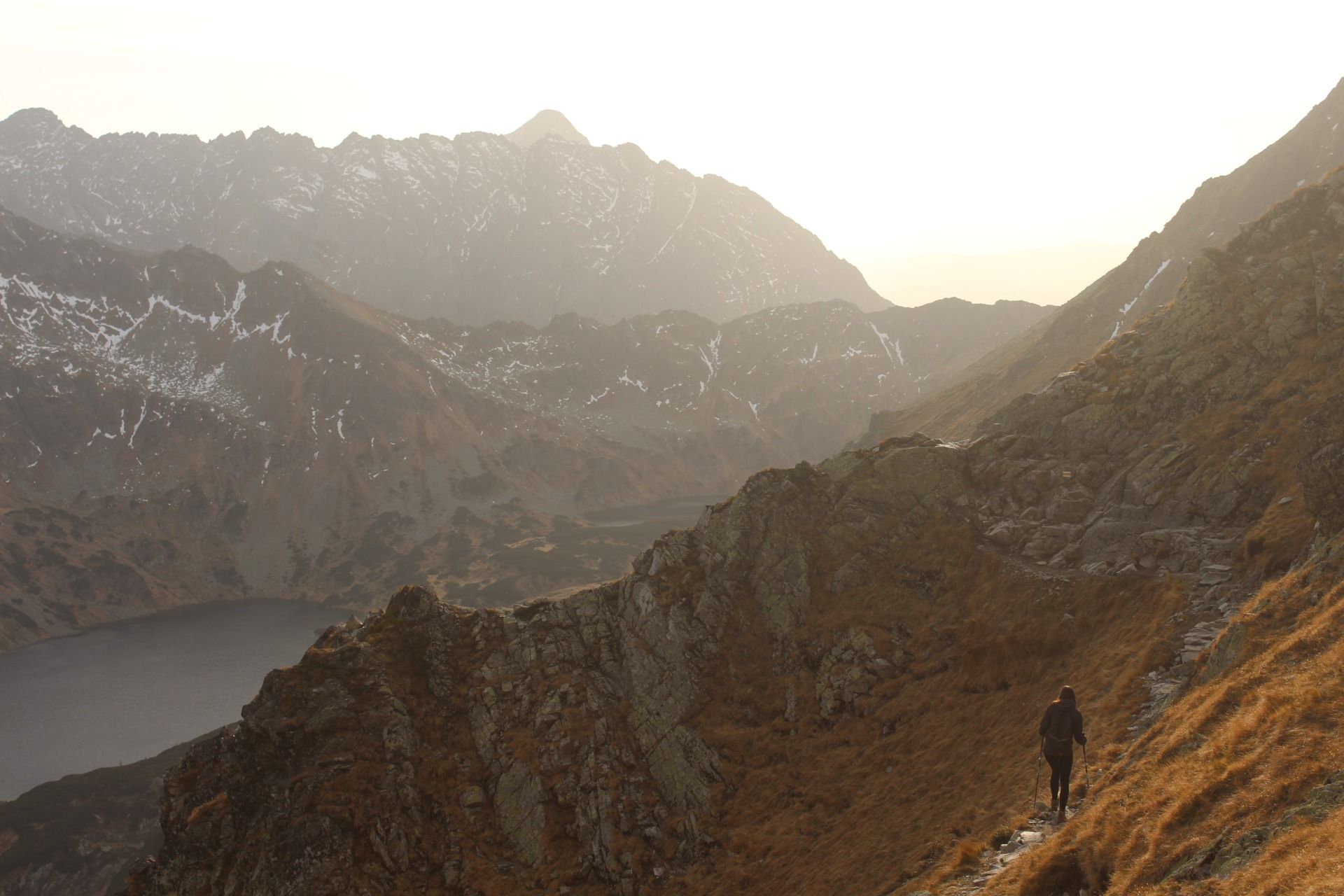
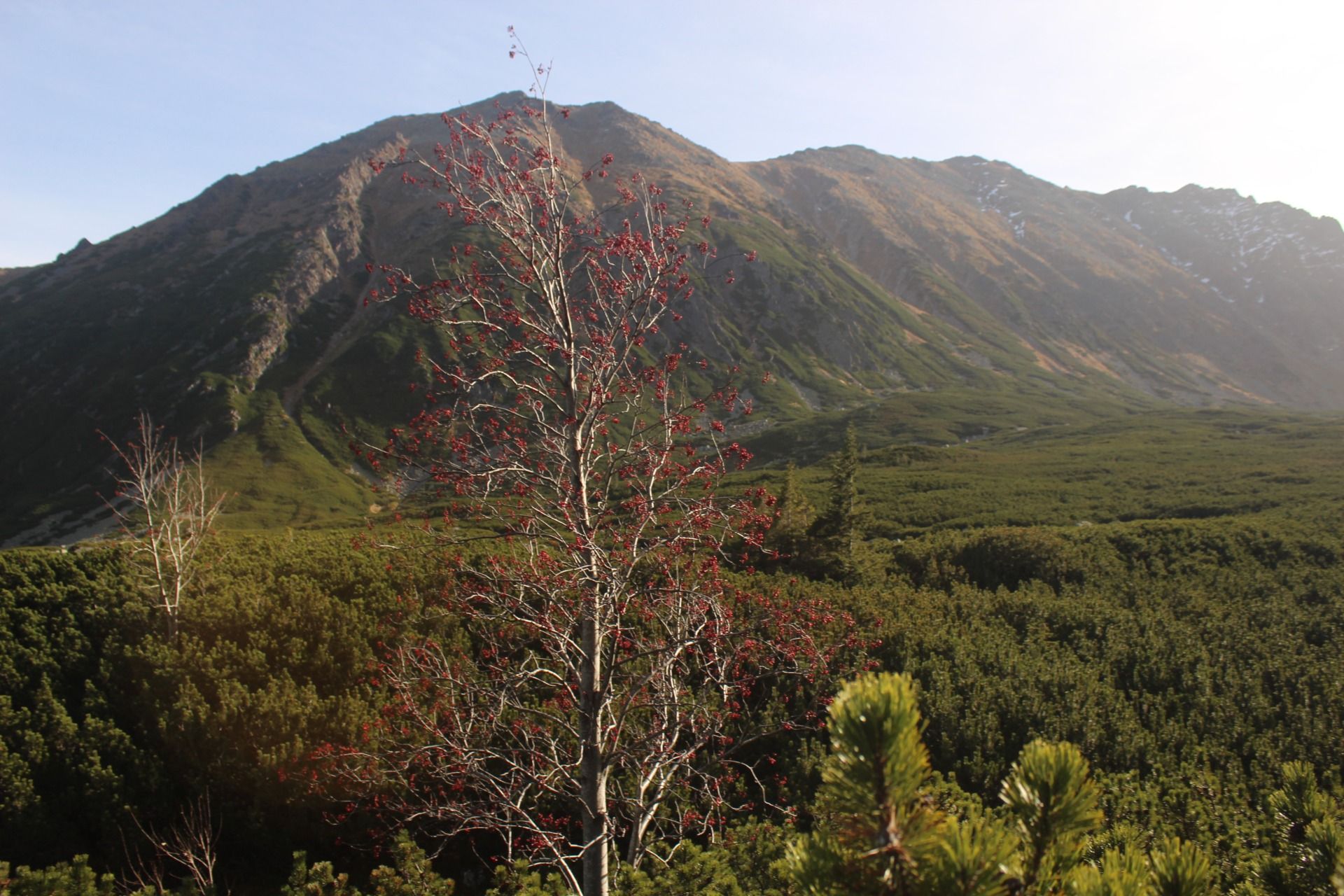
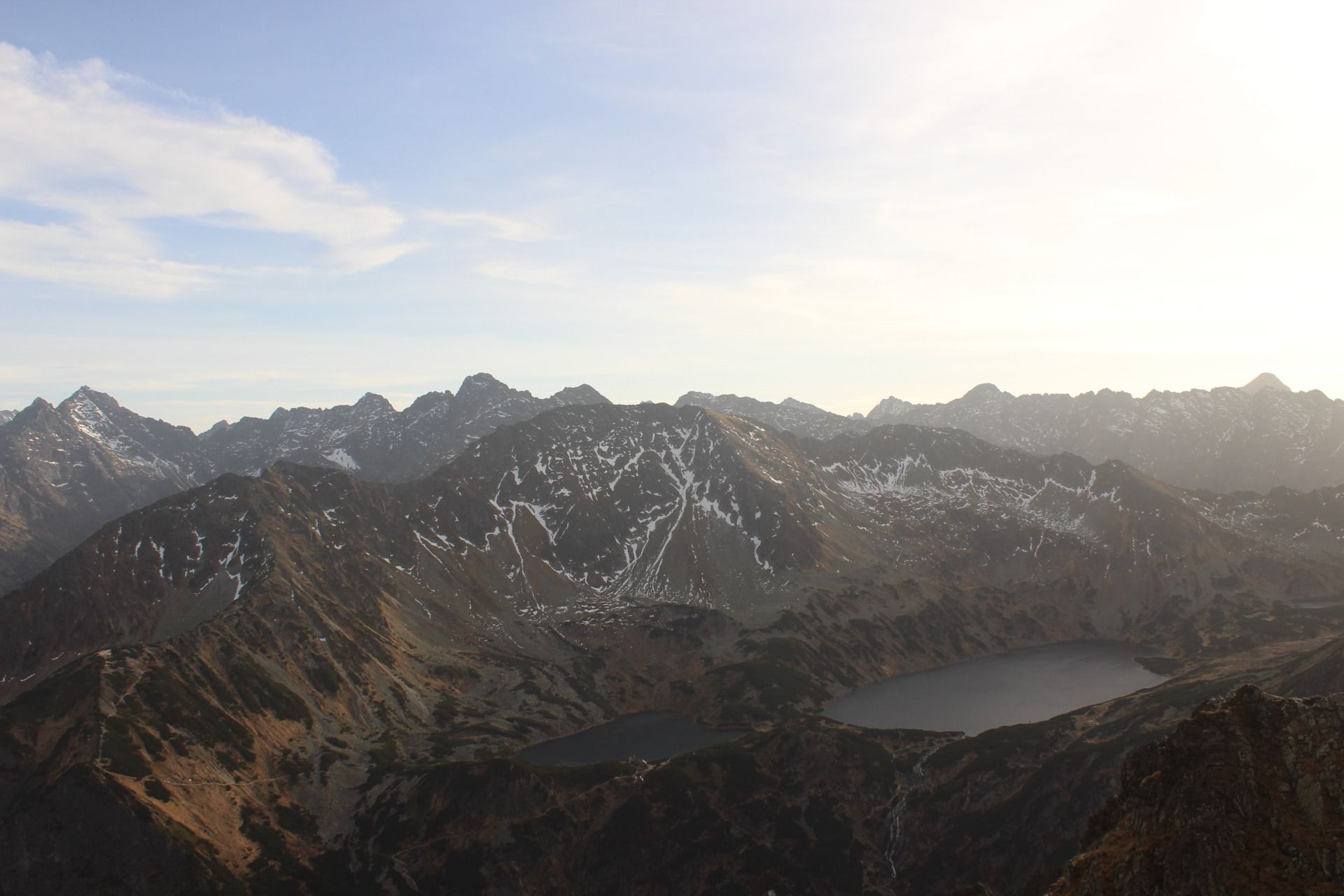
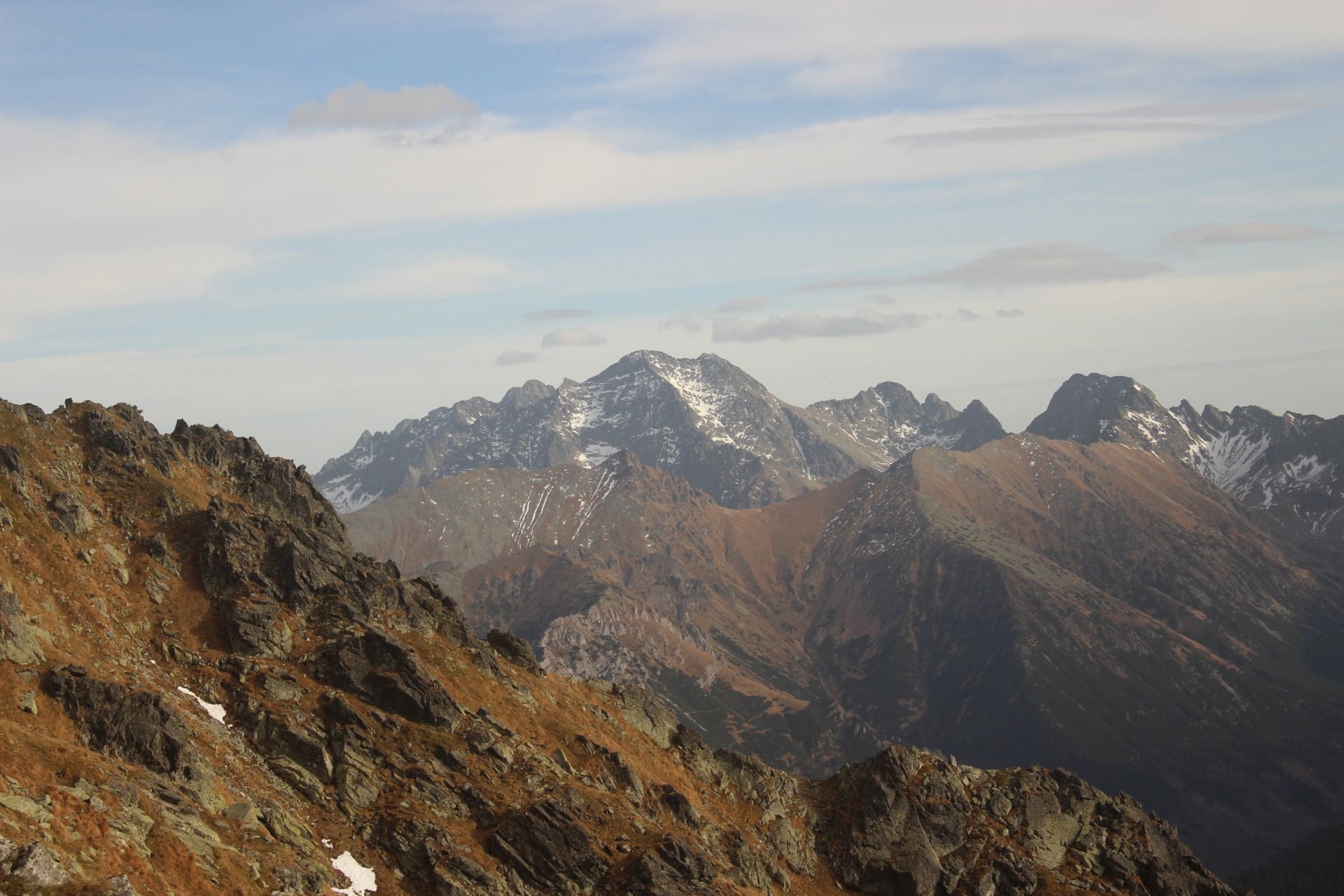
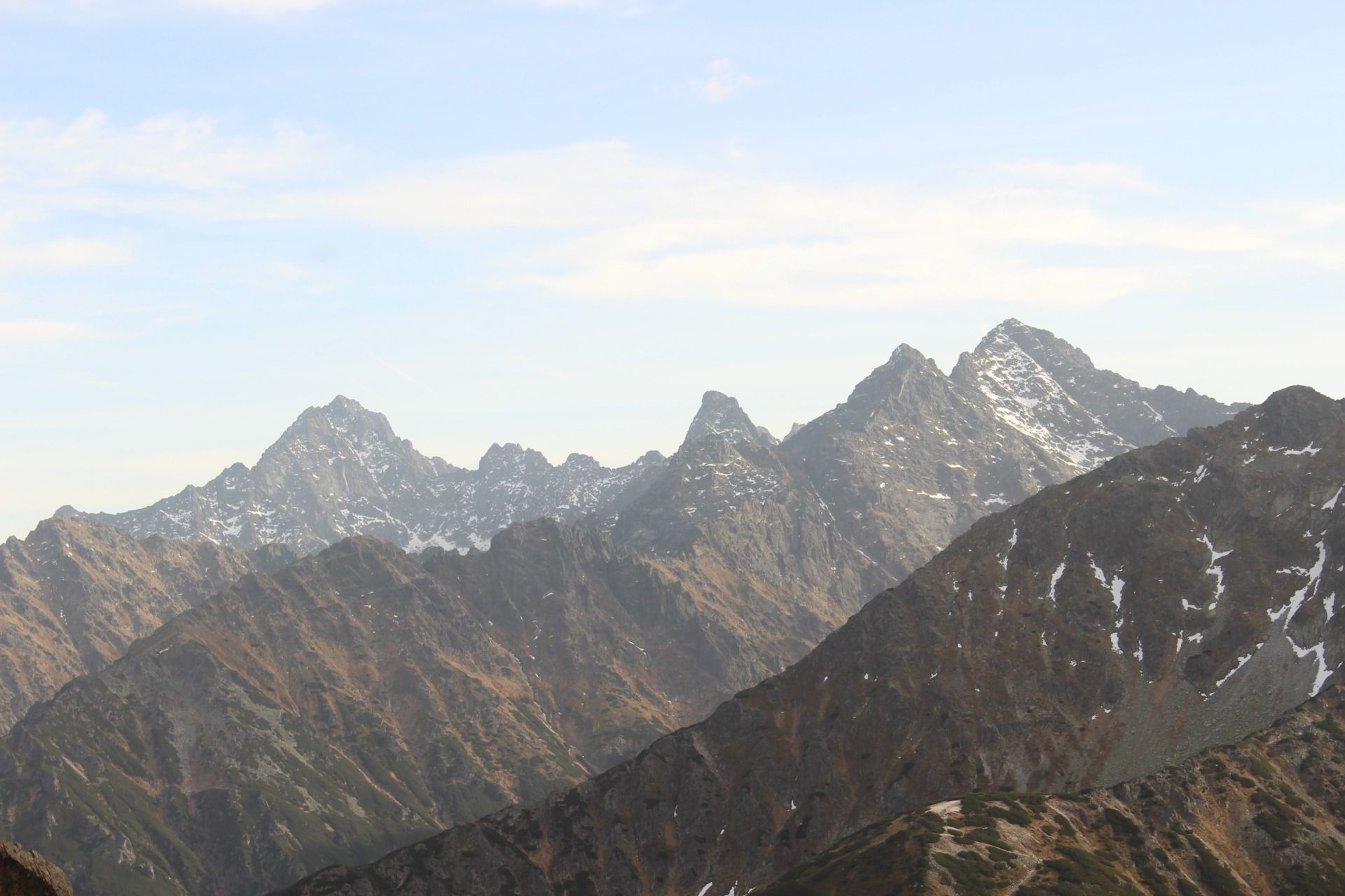
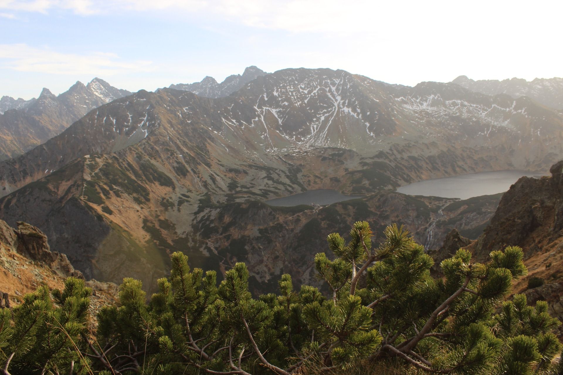
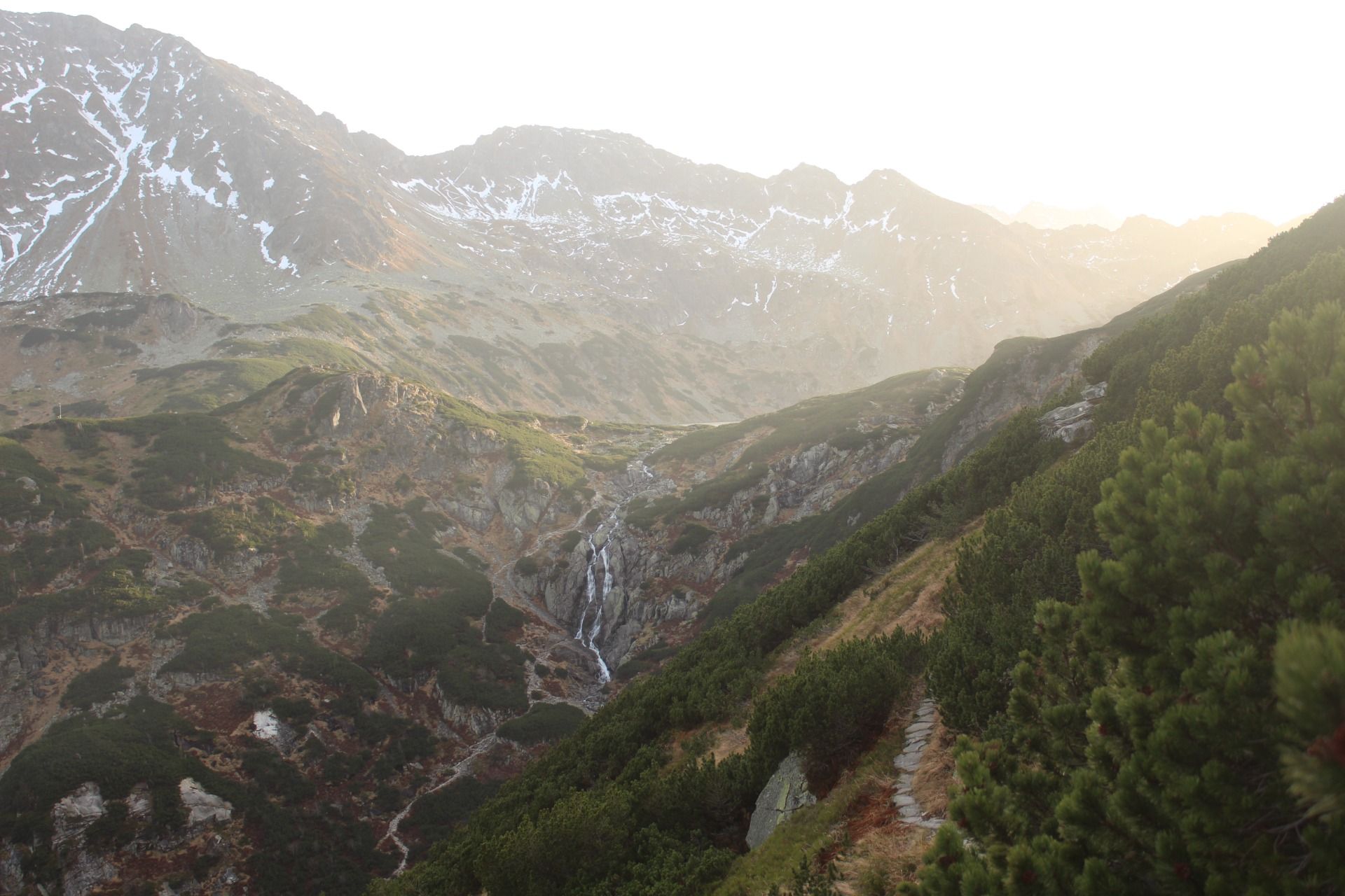
Recently, we rarely visit the Polish Tatra Mountains in the summer, mainly due to the large number of tourists visiting our highest mountains during the warm months, but we do take summer trips to the Tatra Mountains from time to time. Our last trip to the Tatra Mountains took place in the fall of 2022, and our destination was the Krzyżne Pass. The pass, located at an altitude of 2,112 m, is located in the central part of the High Tatras, between Pańszczyca and the Roztoka Valley, and is also the extreme point of the Orla Perc trail.
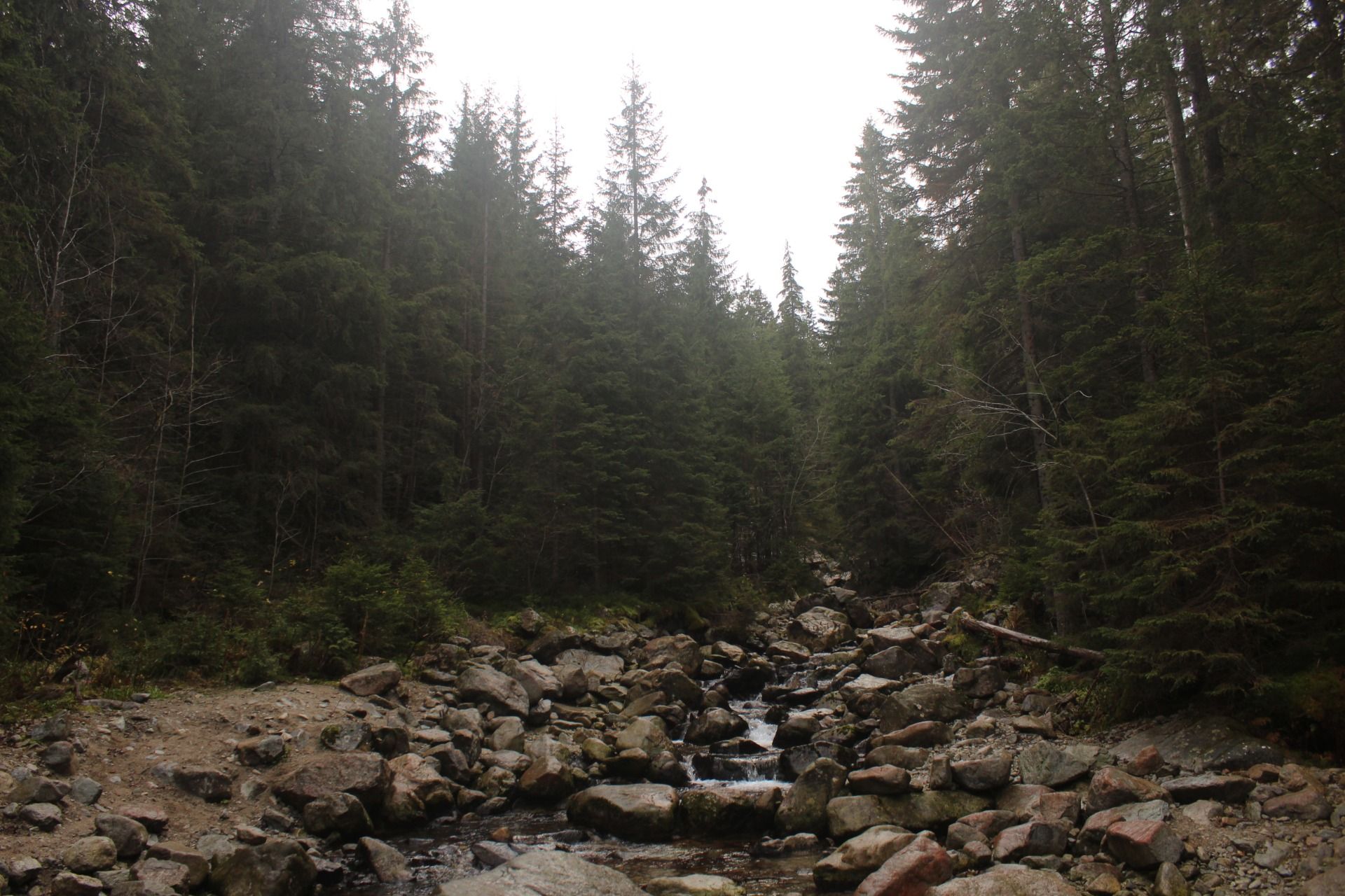
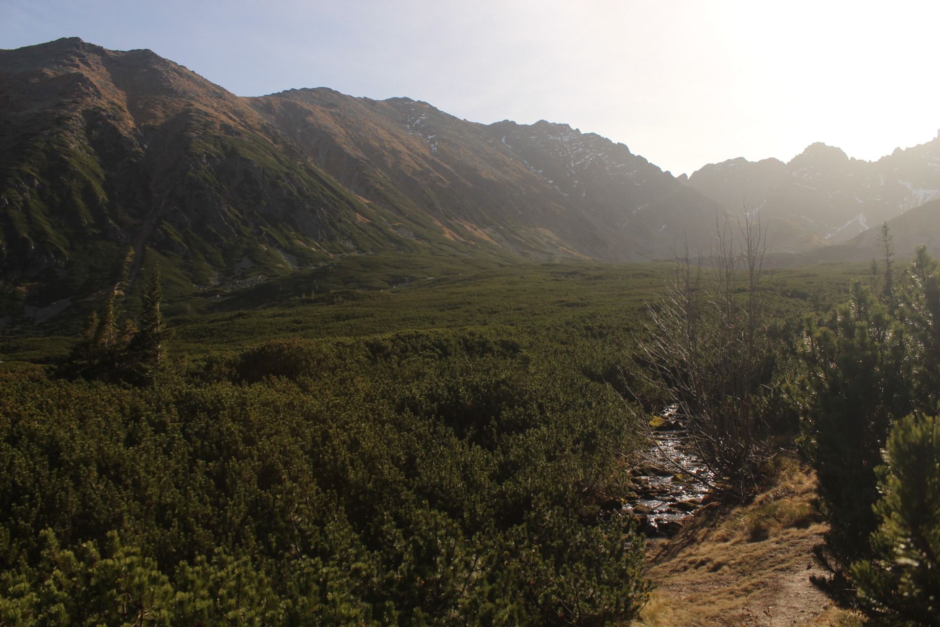
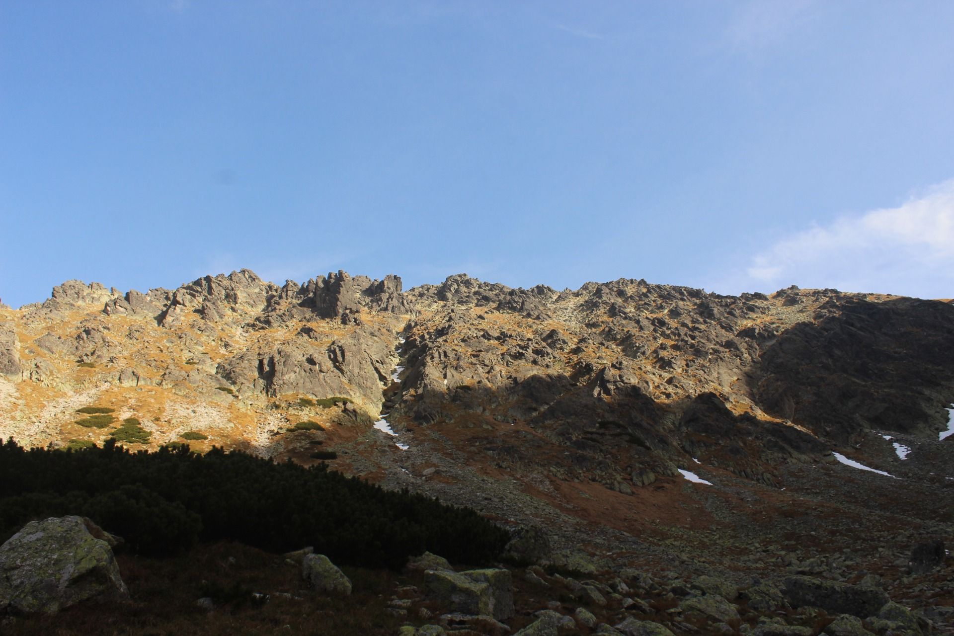
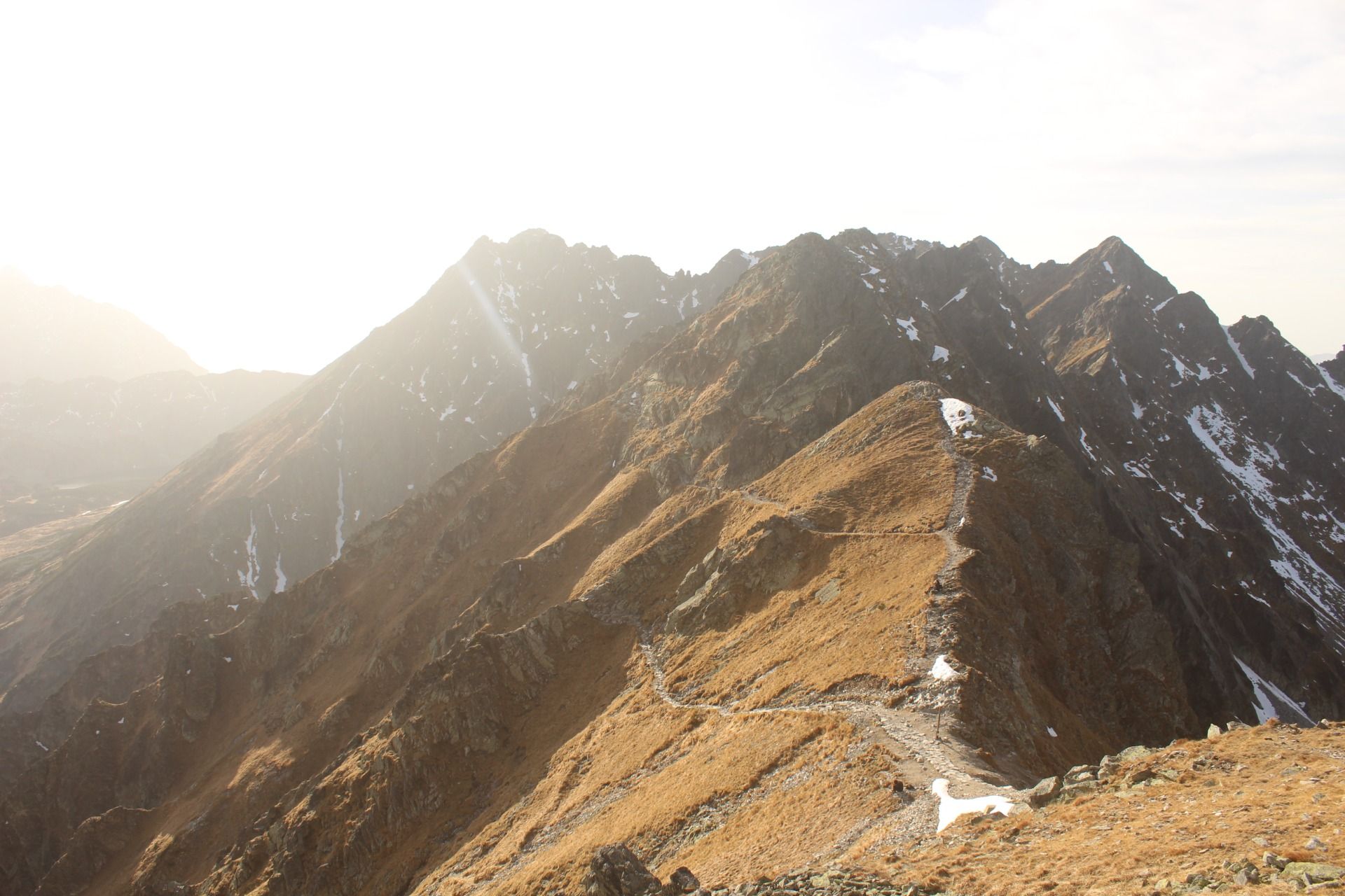
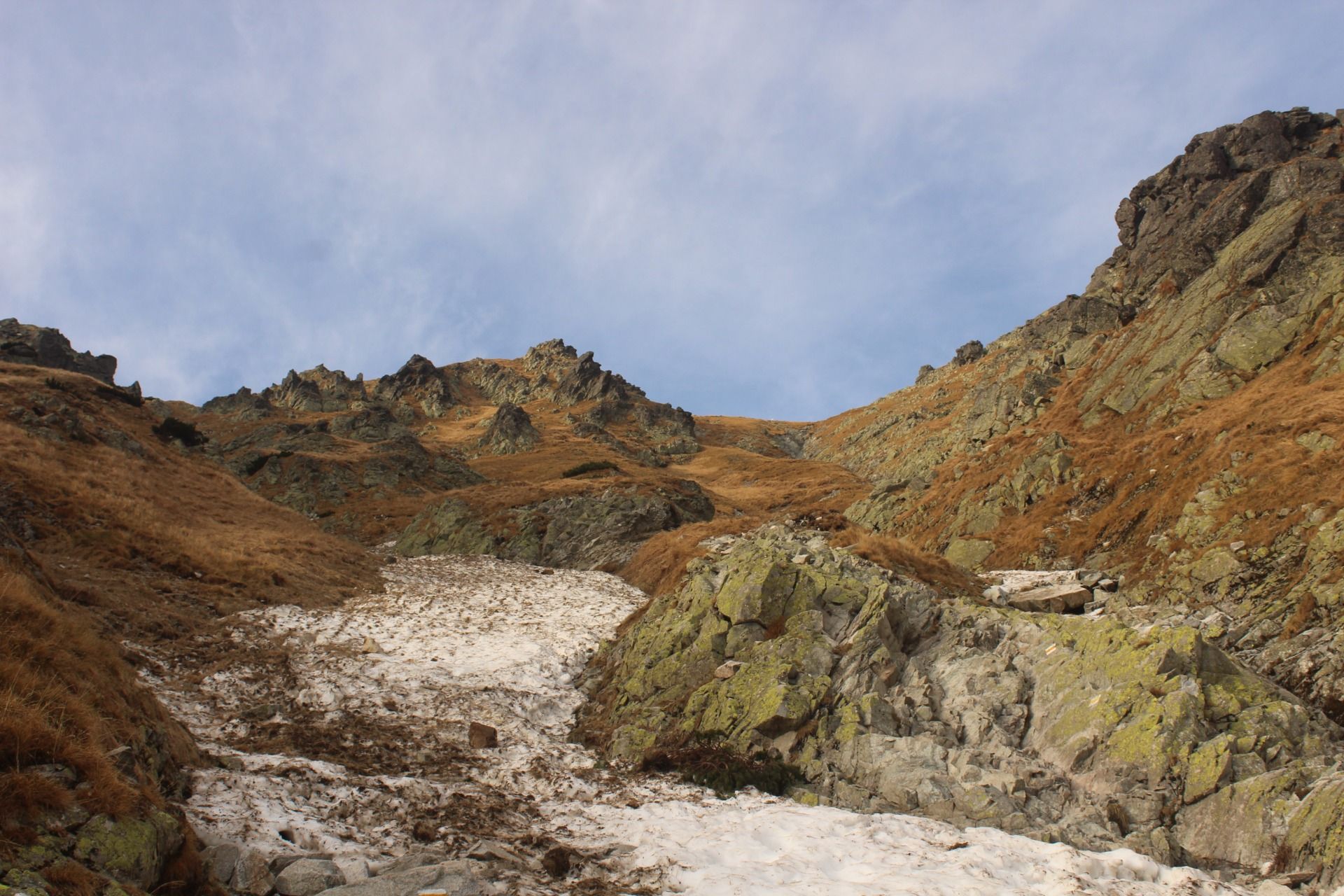
We started the trip at the car park in Palenica Białczańska, from where we went not like 100 percent of people walking there, i.e. along the main road towards Morskie Oko, but immediately turned onto the blue trail leading to Rusinowa Polana. Within a kilometer, maybe two, we made a few dynamic turns and suddenly we went around the extremely annoying peak called Gęsia Szyja and found ourselves on the green trail leading straight to Murowaniec. Up to this point, we had been walking through lush spruce forests, where, unfortunately, every now and then we came across huge swaths of trees fallen by the storm. This section of the trail was relatively gentle and it took us about 1.5-2 hours to complete this part. We then turned to the yellow trail, which was more challenging, leading through steep slopes and rocky paths. This is where the real mountain adventure began, requiring caution and strength. It took us about 1.5 hours to climb up and we only covered 2.5 miles. To justify it, I will say that in this short fragment the elevation gain was 500 meters.
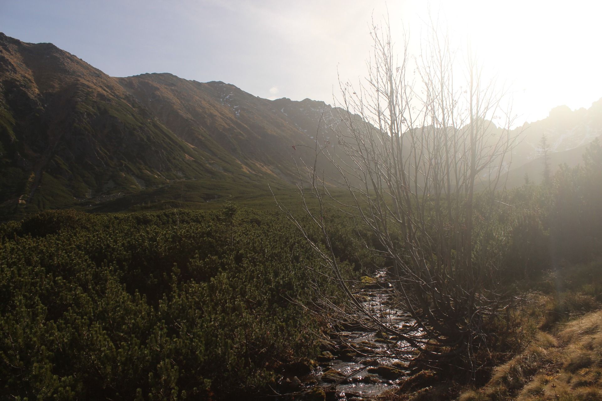
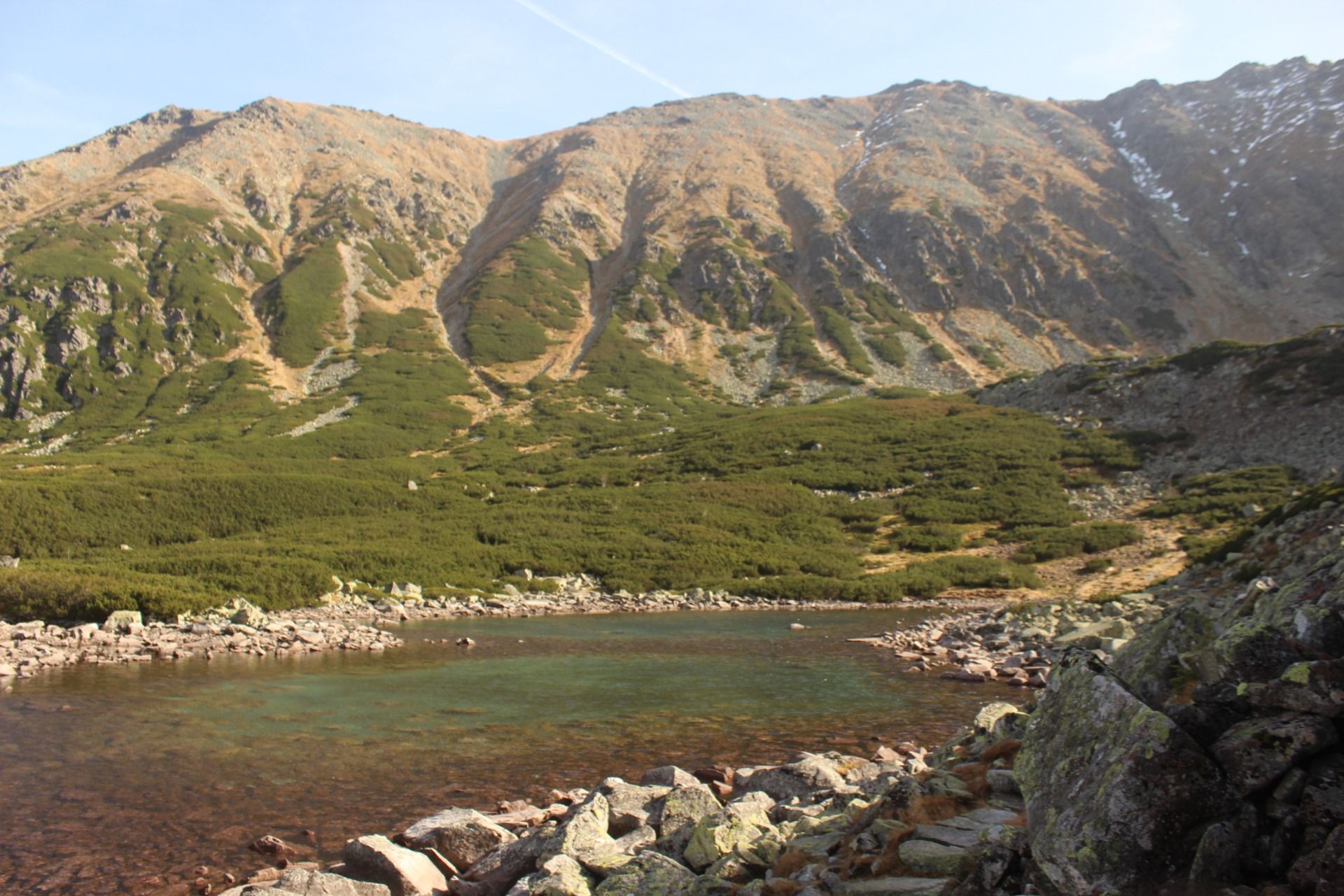
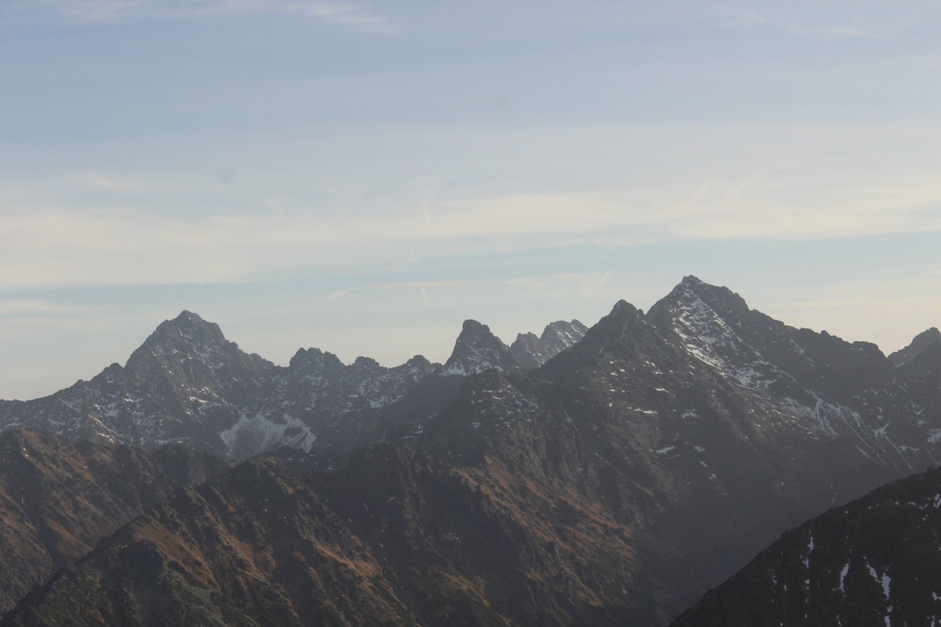
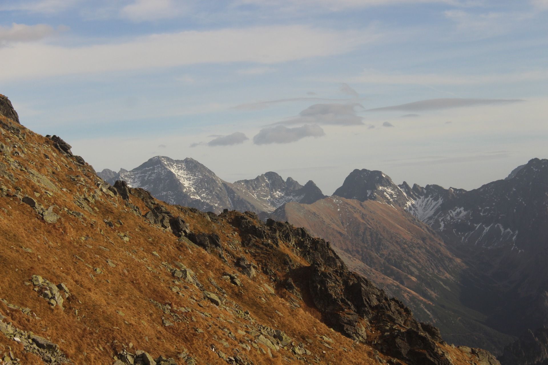
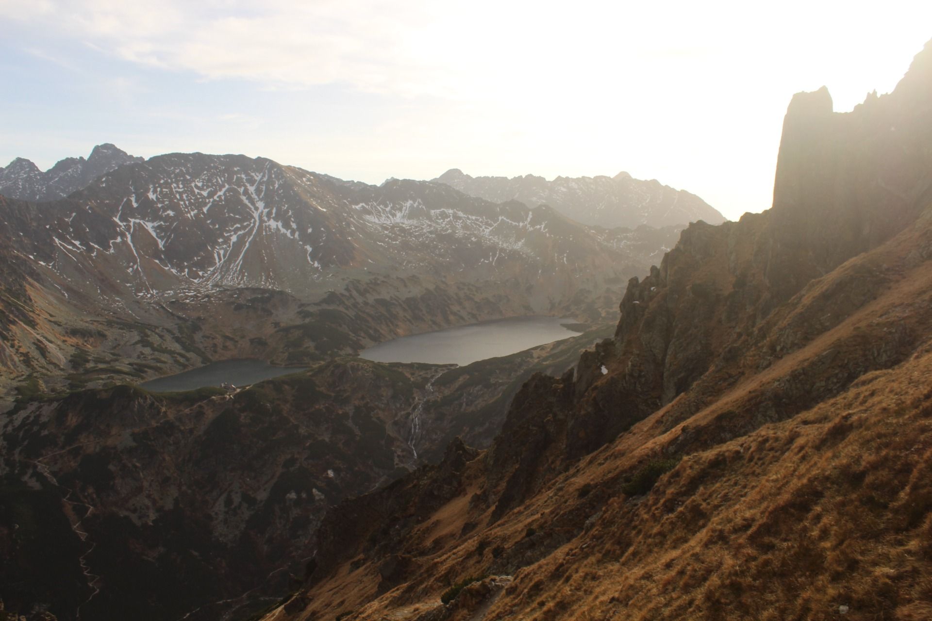
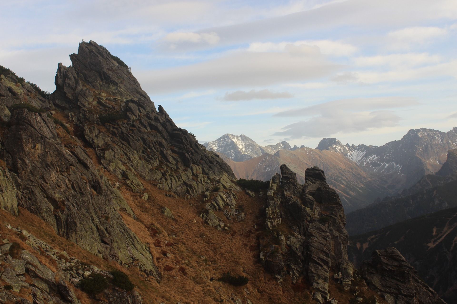
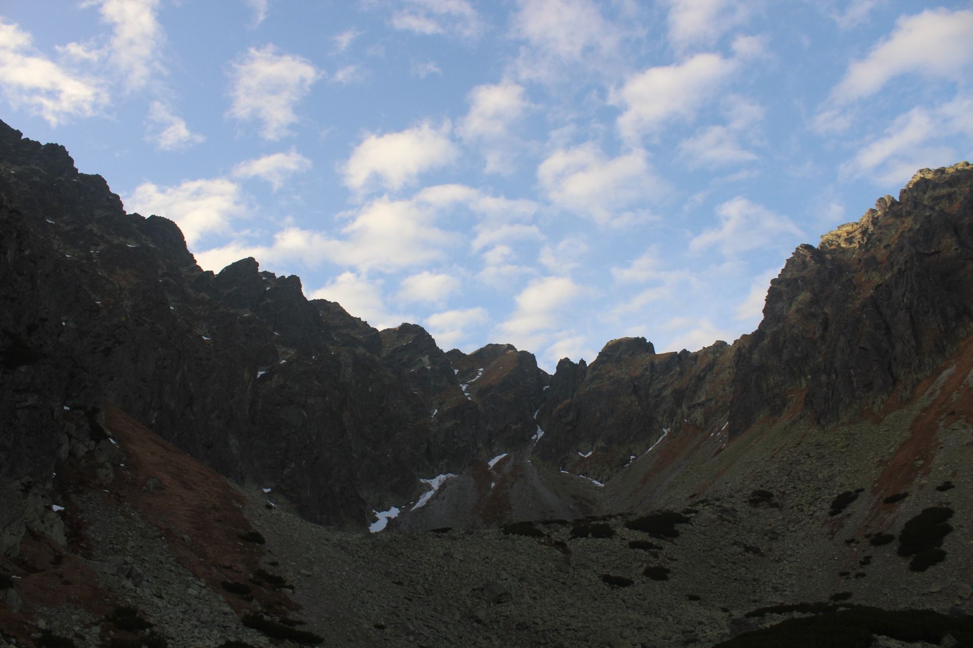
After reaching the Krzyżne Pass itself, our efforts were rewarded with breathtaking views. We took a 30-minute, maybe 20-minute break and started an even steeper descent down towards the Five Ponds Valley. When we reached the PTTK shelter, we didn't have much time for a regenerative meal. After only 5 minutes, we set off on our way, we still had almost 8 kilometers to go, which usually takes an average walker 2.5 hours, and the road was supposed to take us along the Roztoka Valley to the parking lot in Palenica Białczańska.
[PL]
Ostatnio rzadko pojawiamy się w polskich Tatrach w lecie, głownie z uwagi na duża liczbę turystów odwiedzających w trakcie ciepłych miesięcy nasze najwyższe góry, ale jednak raz na jakiś czas robimy sobie letnie wycieczki w Tatry. Nasz ostatni wyjazd w Tatry miał miejsce jesienią 2022, a za cel wycieczki obraliśmy sobie Przełęcz Krzyżne. Położona na wysokości 2112 m przełęcz znajduje się w centralnej części Tatr Wysokich, pomiędzy Pańszczycą a Doliną Roztoki, a także jest skrajnym punktem szlaku Orlej Perci
Wycieczkę rozpoczęliśmy na parkingu samochodowym w Palenicy Białczańskiej, skąd skierowaliśmy się nie tak jak 100 procent osób chodzących w tym miejscu czyli wzdłuż głównej drogi w kierunku Morskiego Oka, tylko od razu skręciliśmy na niebieski szlak Wiodący na Rusinowa Polanę. Na odcinku kilometra, może dwóch zrobiliśmy kilka dynamicznych skrętów i już nagle obeszliśmy dookoła niezwykle upierdliwy szczyt zwany Gęsią Szyją i znaleźliśmy się na zielonym szlaku prowadzącym prosto do Murowańca. Do tego momentu szliśmy po bujnych lasach świerkowych, gdzie niestety co chwile trafialiśmy na ogromne połacie powalonego przez wichury drzewostanu. Ten odcinek szlaku był stosunkowo łagodny i czas przejścia tego fragmentu zajął nam około 1,5-2 godzin. Następnie skręciliśmy na żółty szlak, który był bardziej wymagający, prowadząc przez strome zbocza i kamieniste ścieżki. Tutaj zaczęła się prawdziwa przygoda górska, wymagająca ostrożności i siły. Wspinaczka w górę zajęła nam około 1,5 godziny, a przeszliśmy zaledwie 2 i pół kilometra. Na usprawiedliwienie powiem że na tym krótkim fragmencie przewyższenie wynosiło 500 metrów.
Po dotarciu na samą Przełęcz Krzyżne nasz trud został nagrodzony zapierającymi dech w piersiach widokami. Zrobiliśmy sobie 30 minut, no może 20 minut przerwy i rozpoczęliśmy jeszcze bardziej strome schodzenie w dół w kierunku Doliny Pięciu Stawów. Gdy doszliśmy do Schroniska PTTK nie mieliśmy za wiele czasu na posiłek regeneracyjny. Po raptem 5 minutach ruszyliśmy w dalsza drogę przed sobą mieliśmy jeszcze do przejścia niemal 8 kilometrów, co zwykle statystycznemu piechurowi zajmuje 2.5 godziny a droga miała nas wieźć wzdłuż Doliny Roztoki do parkingu w Palenicy Białczańskiej.


Travel Resources for your trip to Poland
Recommended by TravelFeed
Flights: We recommend checking Kiwi.com to find the best and cheapest flights to Poland.
Accomodation: Explore the best places to stay in Poland on Booking.com, Agoda and Hostelworld.
Travel Insurance: Medical emergencies abroad can be pricey, but travel health insurance is not. We always use SafetyWing for affordable and reliable coverage.
Car Rental: For hassle-free car hiring, DiscoverCars is our trusted choice with a wide selection of vehicles.
Internet: Got an eSIM compatible phone? Airalo is perfect for reliable internet access during your trip. Just install it before you go, and you're set!
Day Trips & Tours: We recommend GetYourGuide for a variety of well-organized and enjoyable activities.
Travel Planner: Need a hand planning? Our free travel planner chatbot is your personal guide to Poland. Chat now.
Disclosure: Posts on TravelFeed may contain affiliate links. See affiliate disclosure.