
Sometimes I wonder why I like hiking in the mountains so much. As a born Dutchman who still lives in the Netherlands, mountains are not exactly my natural habitat. The largest elevation on our country (which we, with typical optimism, call Vaalserberg, i.e. Vaalsermountain) is a little over 300 metres. For the largest part our country is flat. The village where we live is about 10 metres above seelevel, where I work is more or less exactly at seelevel, and in between I cross a part that is about 5 metres below seelevel. Up and down 15 metres, that is about the most I travel for the largest part of the year. Well, perhaps I can add four metres to that, as our house is three floors high.
This year our travel brought us to a litlle over 3200 metres. From the vantagepoint we hade there we could look more than a one and a half kilometre down. For a Dutchman, that is almost an incomprehensible distance to look down in.
Still, we got there by cable car, and that feels a bit like cheating. Beautiful as it was up there, I enjoy even more going to places where you can only go on foot. The real challenge is to go to a peak or a coll where the only way to come, is to go by foot and climb all the way up yourself. Those places are a lot less crowded, which adds to their beauty, and the people you do meat there, are the people who understand the joy of getting there by sheer physical effort (and the accompanying exhaustion).
Though we had some beautiful hikes already, I wanted for our last hike to go a little higher than we had gone before. Not in absolute height but in height difference to climb. First I wanted to go from Montgenèvre to Mont Chaberton, a peak at over 3100 metres. The height difference to conquer would be some 1200 metres. That idea however was downvoted unanimously by my wife and kids. So I settled for a hike from Pont de l'Alp to Col de la Ponsonnière. Judging from the map it promised to be the type of hike we love the most: you only get tjere on foot. And the height distance would bea little over 900 metres. The last 80 or so I would walk on my own as my wife and kids were determent to stay at the Lac de la Posonnière, some 80 metres below the coll. More than high enough, was there verdict.
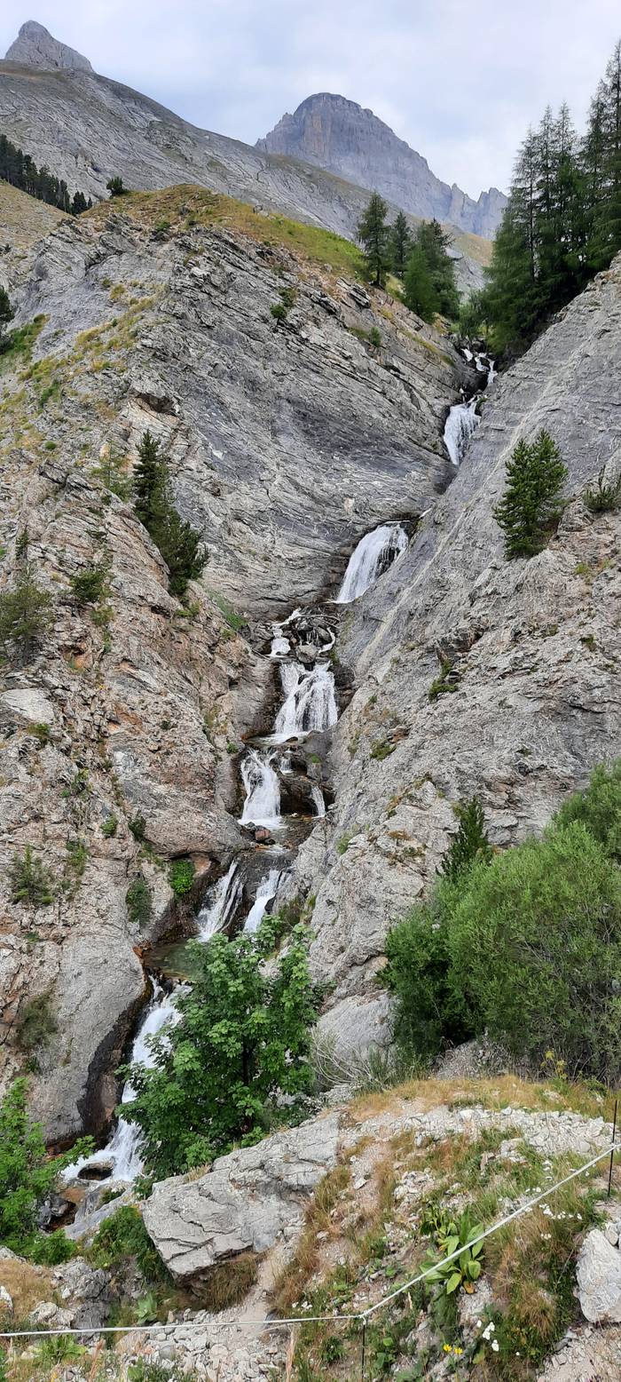
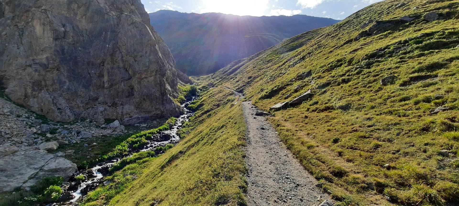
At the start of that hike there is a cascade to enjoy. The water falls down in several steps between two enormous slabs of rock.
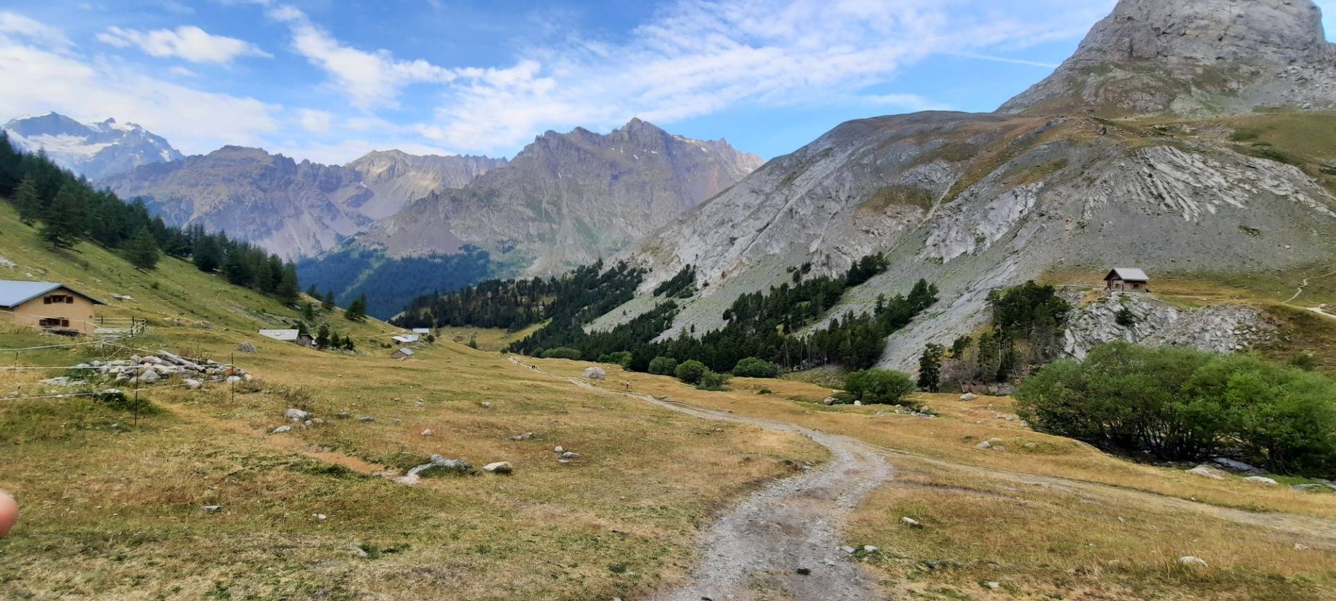
As you work your way upwards, there are a few settlememts scattered around the slopes. Though 'settlement' is probably too large a word for just a few houses, or even one, here and there.
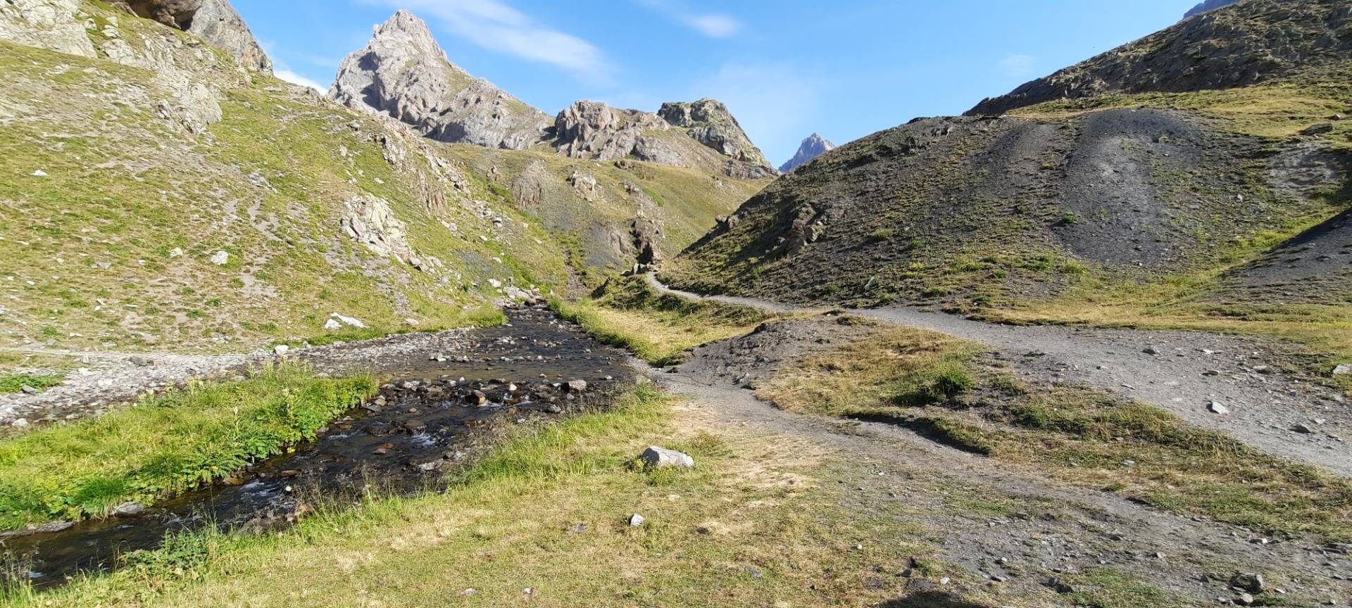
A height difference of 900 metres takes about two and a half hour to conquer. Of course, this is dependent on the horizontal distance you need to walk as well. The way to do this, is to adopt a slow steady pace and to ensure your breathing is steady and deep. If you go to fast and you start panting you exhaust yourself morre than you should. A hike like this takes a large part of the day, so we take food and drink with us. The largest part of this is carried by me. With over 12 kilos of food and drink on your back, it ia al the more important to keep a steady pace that is neitjer too fast nor too slow.
Walking like this, is almost like meditating. I'm concentrating on my steps, and on my breathing, and I let my mind wander. As these place can only be reached by foot, it is really quite up there. There's just the sound of our own talking, of the water in streams, the wind up or down the slope, the song of the birds, and the occasional whistle of a mountain marmot.
For me it is a perfect way to relax. Relaxation by effort. Hmm, this last sentence works better (visually and audibly) in Dutch: ontspanning door inspanning.
And of course, the higher up in the mountains we get, the better the views we see become. That's an added bonus. Though you could turn this around and say that the almost mindful relaxation you get is an added bonus for the views you climb to.
Of course, we were lucky in having this wonderful weather to walk in. Mountains in clouds are certainly beautiful as well. The walking however can be dangerous, if the clouds turn to mist, or the rains starts to pour heavily, or, worst case scenario, you end up in a thunder storm.
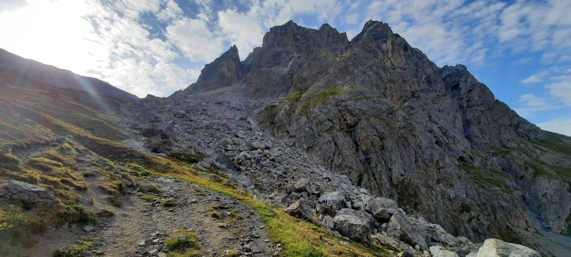
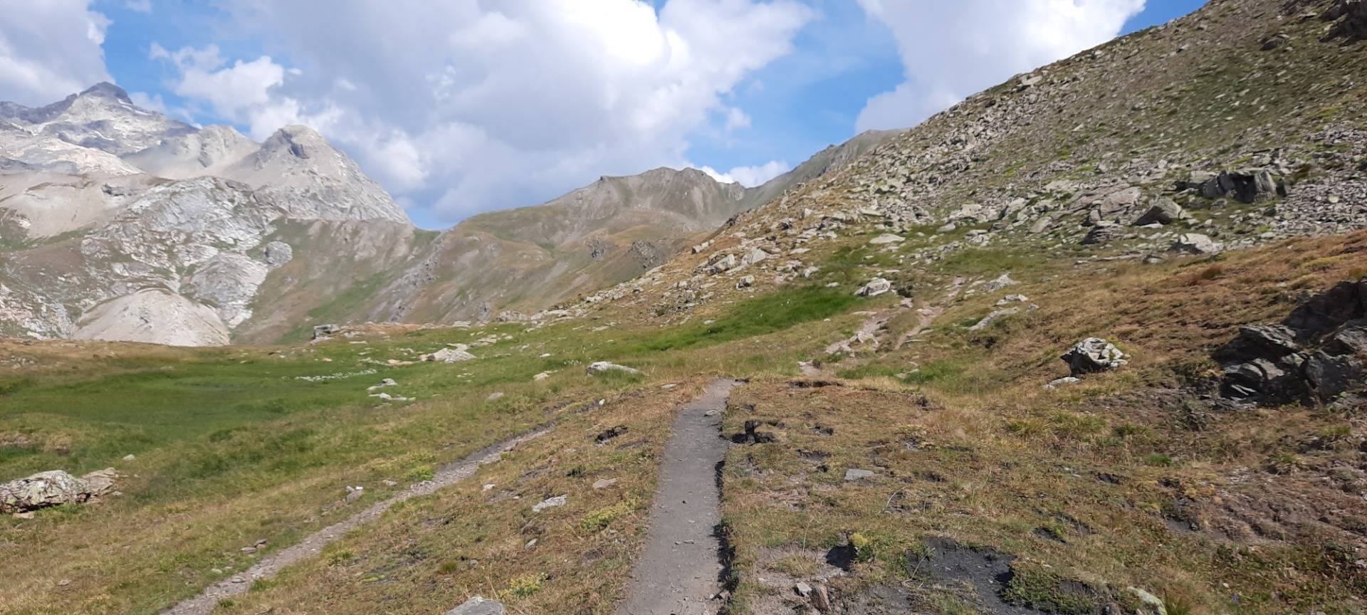
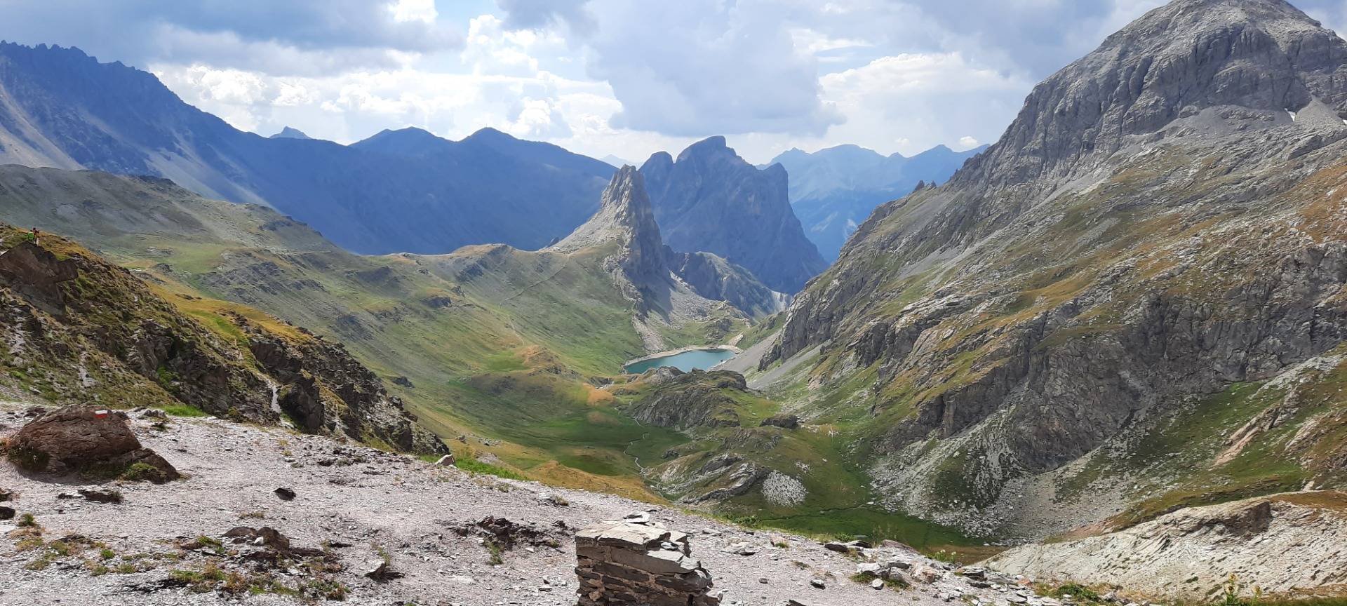
Here you can see the final stretch to walk to the Col de la Ponsonnière. The col itself it the little dent in the mountainline a little left from the middle of the following image.
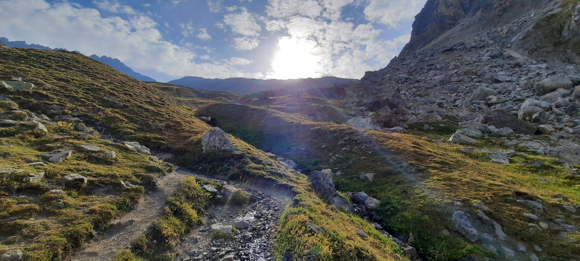
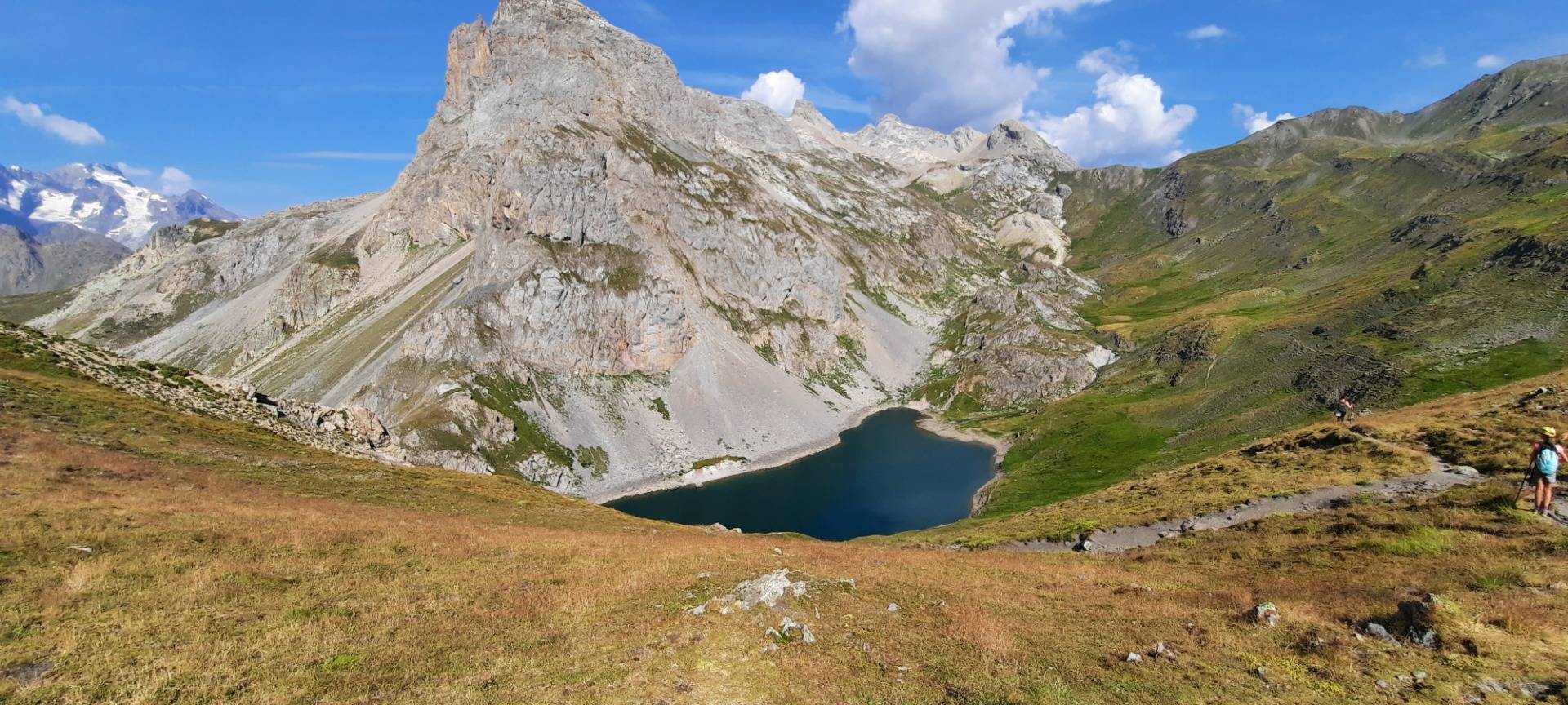
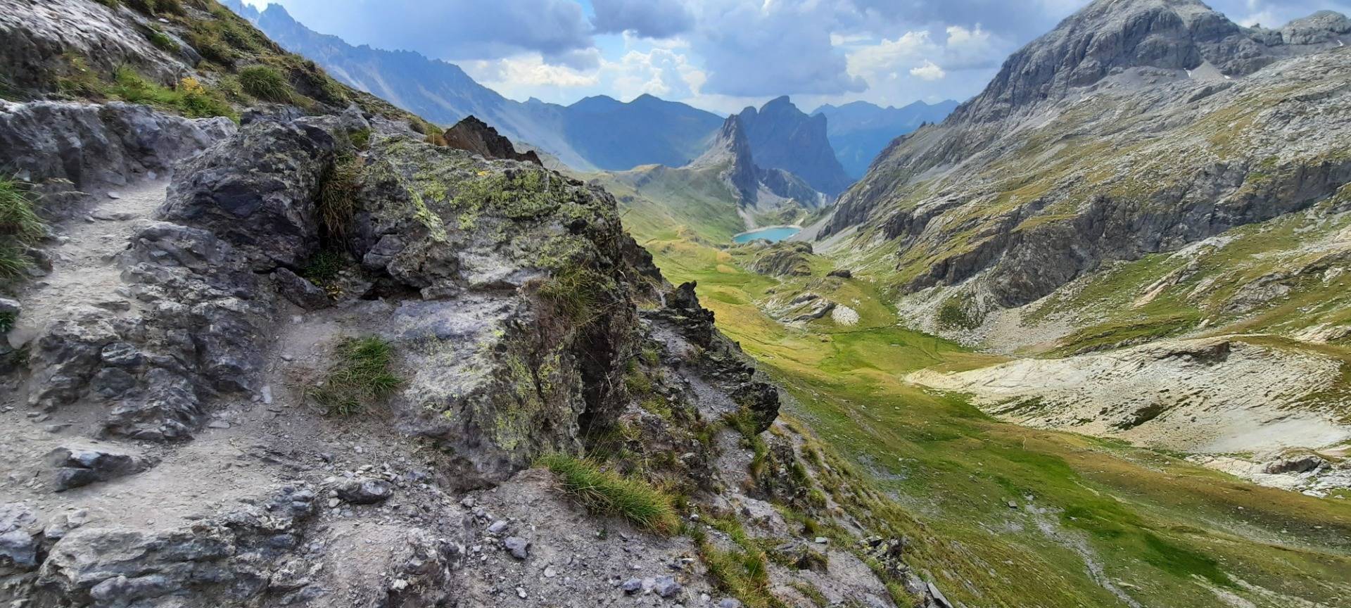
Finally, after three hours (I sat down a little while with my family at tje Lac first) I reached the col. The view was astonishing. The nice thing of a col is that you can view the valley you came from and of course the valley you can descend into from the col. Here's the view in the direction I came from.
Ready to Blog & Earn?
With TravelFeed, easily start your own travel blog and earn as you go. It's the smart platform for travelers who want to profit from their passion. Create a free account
And here's the view of the direction I could descend to.
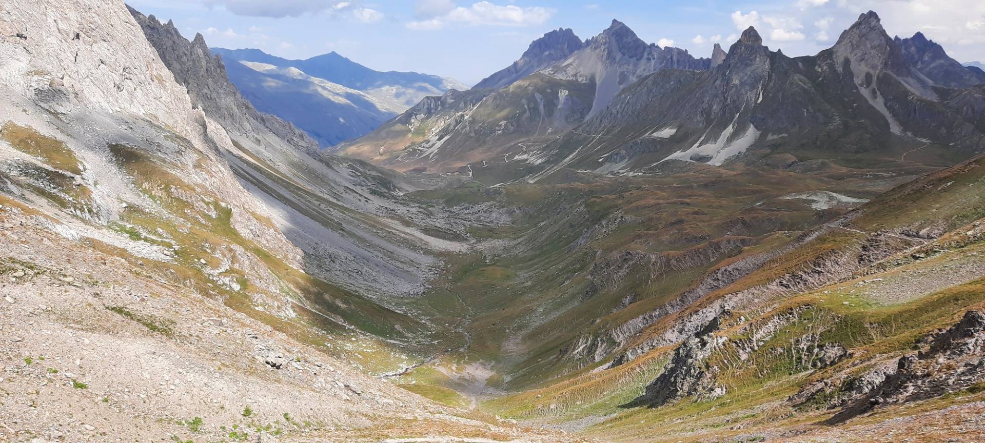
As you can see, there's hardly any sign of human habition in these parts of the mountains. There are paths to walk and a single dirt track road in the distance. But no villages, or cities, no concrete or tarmic roads and no sounds of traffic. And save the four other hikers up there, no humans. A beautiful, quiet place, to look around, to listen to the natural sounds, to just be.

Don't Forget: Get Travel Health Insurance!
To make your trip a worry-free experience, TravelFeed recommends SafetyWing Nomad Insurance. It provides comprehensive health coverage while you travel, so you can focus on exploring, not the unexpected. Get a quote here
On my way back, a little below the col, the view was perhaps even better because it shows (to my eyes) the grandness of nature, of the world. The rocks I had to climb over, the valley some 300 metres below, the Lac Grand in the depth in the distance, and the dark grey, almost blue mountain ranges beyond that. A world to enjoy, a world to feel small in, a world to conquer, a world to be human in.
That's why I love hiking in the mountains.
(Images were made by me)
Travel Resources for your trip to France
Recommended by TravelFeed
Flights: We recommend checking Kiwi.com to find the best and cheapest flights to France.
Accomodation: Explore the best places to stay in France on Booking.com, Agoda and Hostelworld.
Travel Insurance: Medical emergencies abroad can be pricey, but travel health insurance is not. We always use SafetyWing for affordable and reliable coverage.
Car Rental: For hassle-free car hiring, DiscoverCars is our trusted choice with a wide selection of vehicles.
Internet: Got an eSIM compatible phone? Airalo is perfect for reliable internet access during your trip. Just install it before you go, and you're set!
Day Trips & Tours: We recommend GetYourGuide for a variety of well-organized and enjoyable activities.
Travel Planner: Need a hand planning? Our free travel planner chatbot is your personal guide to France. Chat now.
Disclosure: Posts on TravelFeed may contain affiliate links. See affiliate disclosure.
