Day Twenty Eight: With my "excellent adventure" coming to an end, today I set out on the "home stretch" and drove through a very pretty part of the country.
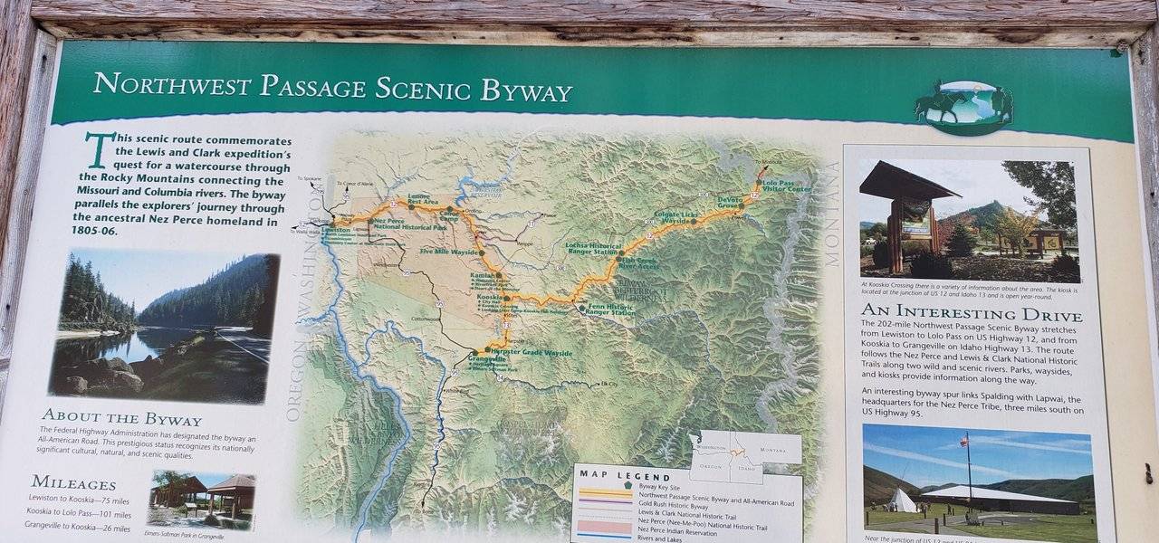
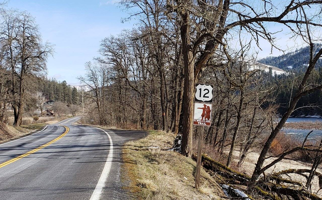
This section of highway is referred to as the Northwest Passage Scenic Byway and makes it way border to border across the State of Idaho.
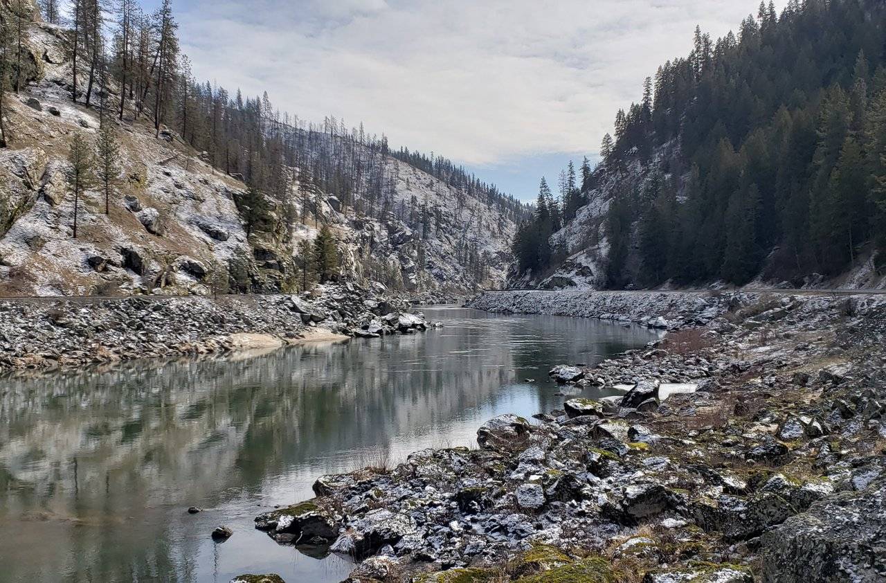
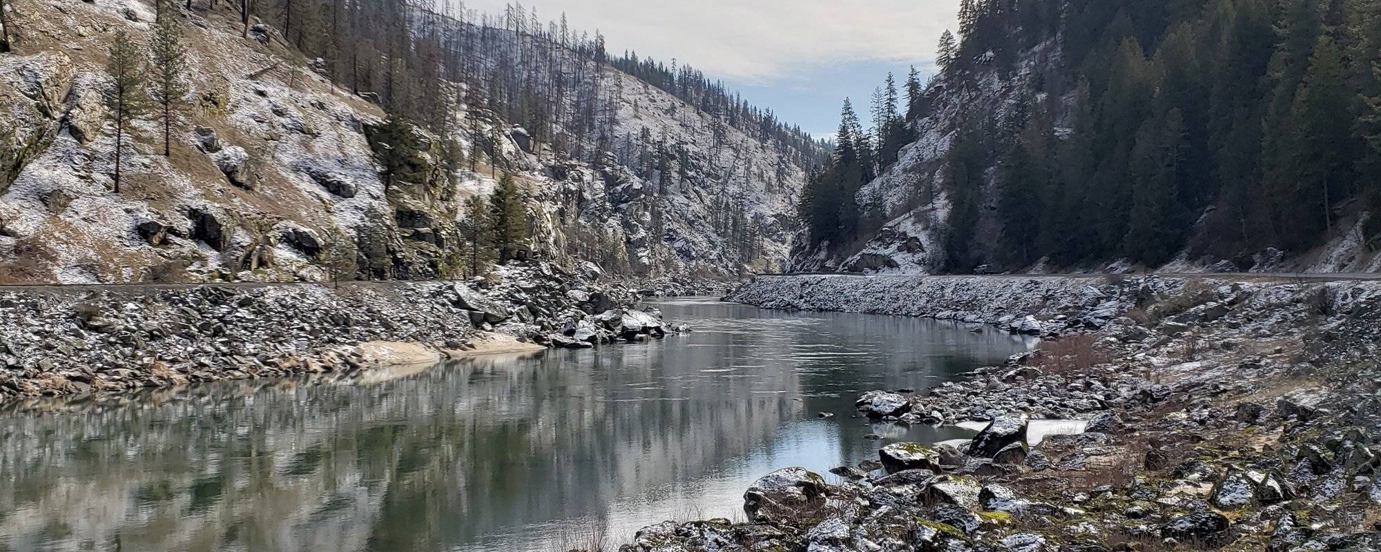
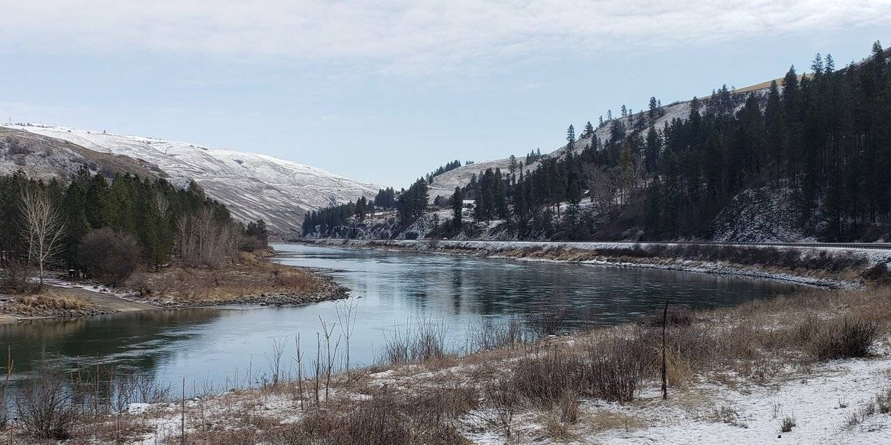
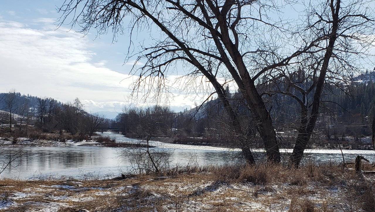
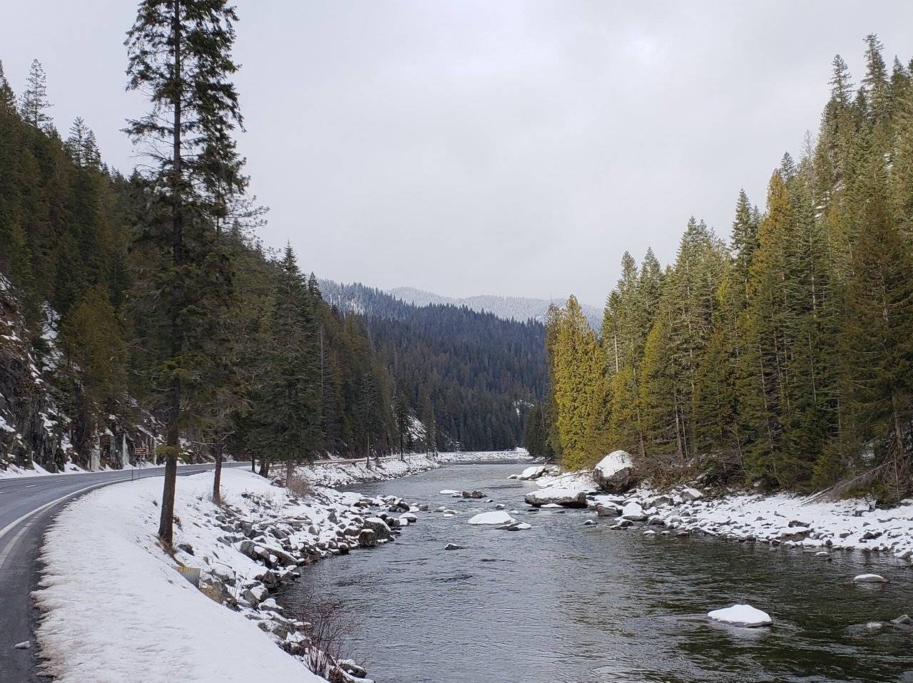
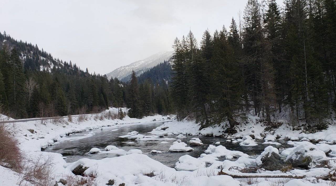
Photo: Wintry Day on Clearwater River on U.S. Highway 12 East of Orofino, Idaho
The name comes from a different reference to the Lewis and Clark Expedition that I covered in some detail on my Travelogue, Day 23 post. They came down through this country, on their journey to find the best way to the Pacific Ocean, in 1805 and returned back up through here in 1806.
On a wintry day in February 2019 - over two hundred years later - let's take a closer look!

Northwest Passage Scenic Byway
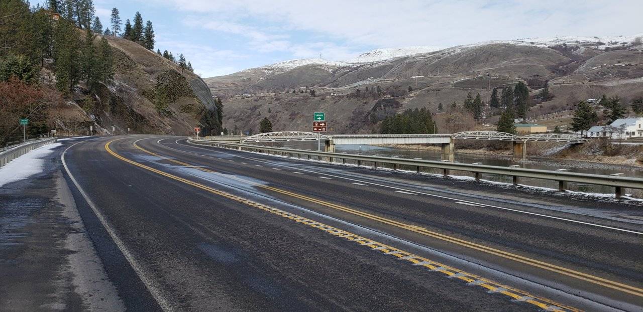
Setting out in the morning from Lewiston, Idaho I had the benefit of the best weather since I had arrived in the area.
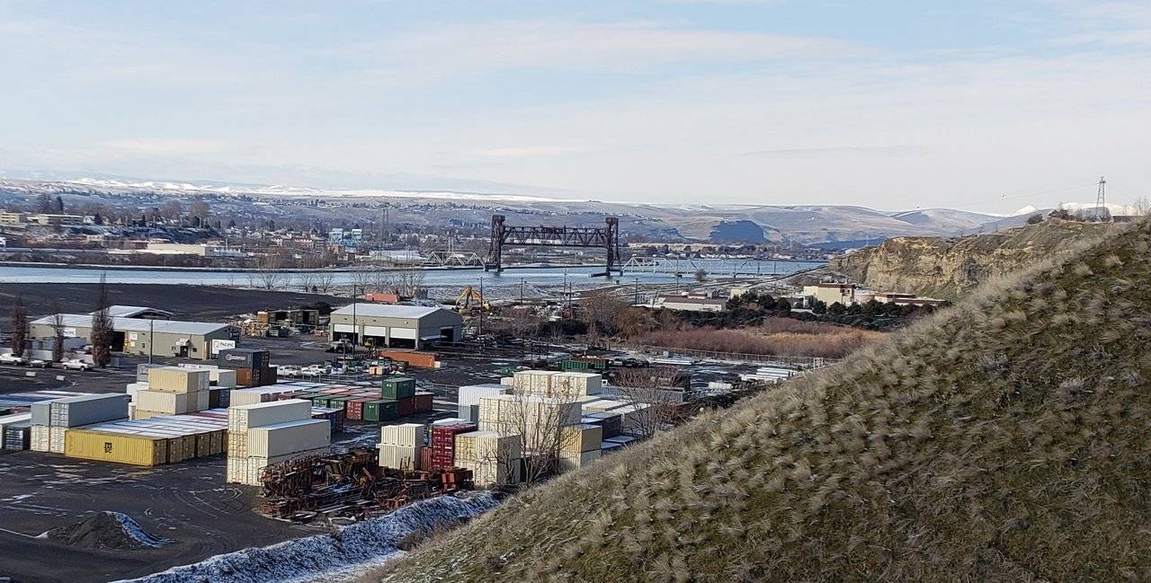
Photos: Leaving Lewiston and Heading Up the Clearwater River
With one final look at the confluence of the Snake and Clearwater Rivers in Lewiston and all the ocean-bound commerce along through the area, I was on my way up the Clearwater River and across the State of Idaho.
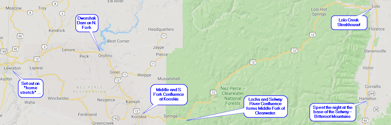
Illustration: Map of Day Twenty Eight Route
Soon after leaving Lewiston, you enter the Nez Perce Indian Reservation. You are on the reservation from that point until well past Kooskia, where you enter the Nez Perce - Clearwater National Forest.
Once past the confluence of the Lochsa and Selway Rivers at Lowell, Idaho, you are then following the separately named Lochsa Scenic Byway way on up into the high country until crossing the divide at Lolo Pass. Then you descend down the other side of the pass into Montana ...
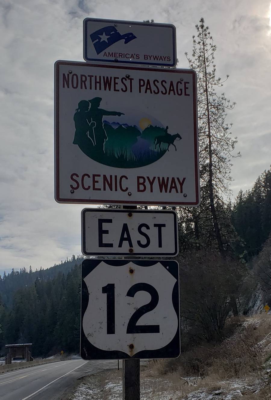
Photos: Signs for Northwest Passage Scenic Byway
Here is another view of the country we will be looking at today. Note the reference to trying to find a "watercourse through the Rocky Mountains connecting the Missouri and Columbia rivers."
Today, we find this amusing and clearly underscores the "unchartered territory" referenced by them, as they left their winter camp in 1805. They obviously had no idea about the Continental Divide. But they soon learned!
With that, please "walk with me" through these areas along this beautiful stretch of highway.
Photos: At Lenore, Beginning of Evergreen Trees
The lower stretches of the Clearwater River are largely devoid of trees. Certainly of evergreen trees. That begins to change at Lenore, as shown above.
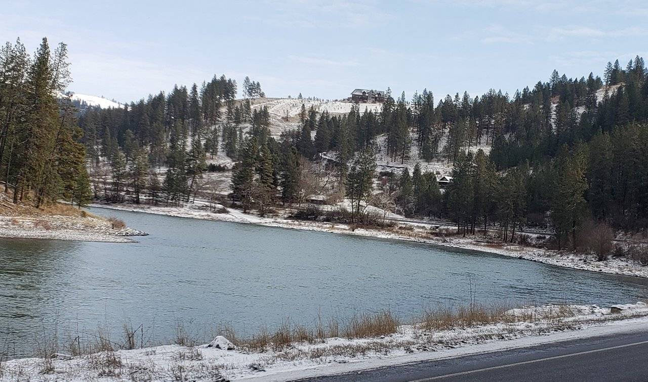
Photo: Beautiful Home
The area is appealing to many, who spend a lot of money to build homes like we see above, on the hill overlooking the river below. I have no idea what the cost per square foot of a home like this would be, but given the distance from any sizable population centers and sources of supply, I am sure it is considerably higher than the same home being built near a city.
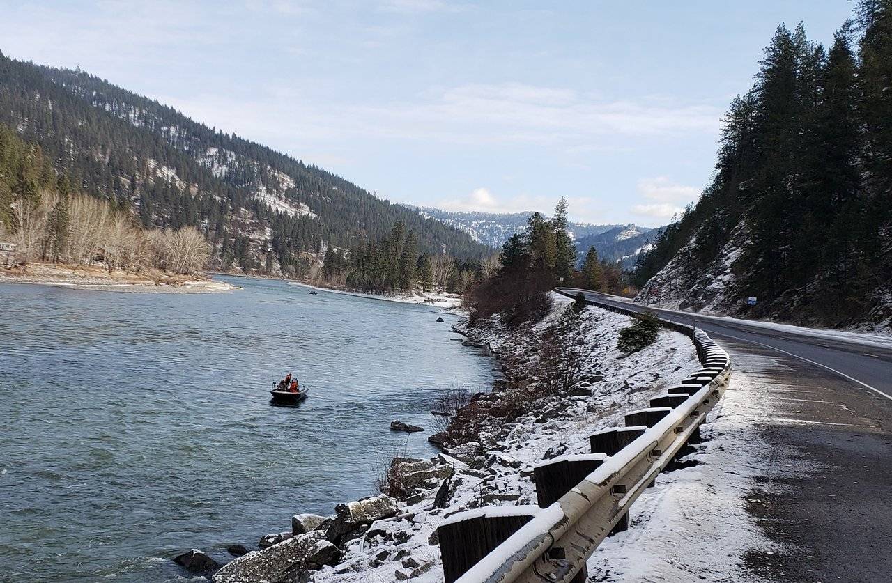
Photo: Fishing in February!
It is also appealing to those who simply can't get enough fishing in, so they have to brave the cold, wintry conditions in February. Hope they don't get wet, as they would be in trouble in a hurry!
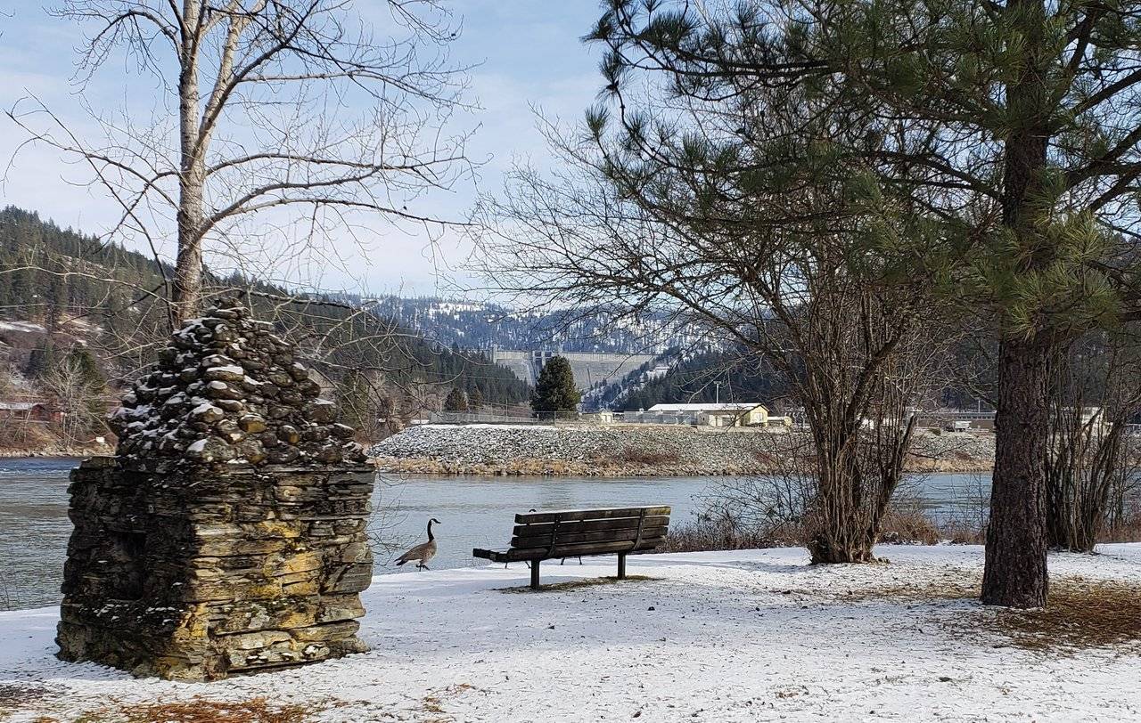

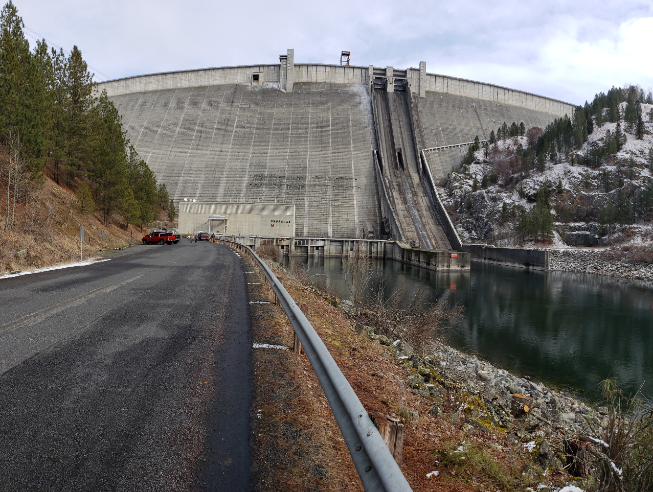
Photos: Dworshak Dam on North Fork of Clearwater River
Completed in 1973, the Dworshak Dam is "the third tallest dam in the United States and the tallest straight-axis concrete dam in the Western Hemisphere."
Source: Wikipedia - Dworshak State Park
It provides many very popular recreational opportunities, given how far back into the mountains of central Idaho it extends. There is also a lot of clean, hydroelectric power generated by it.
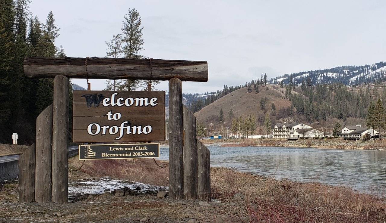
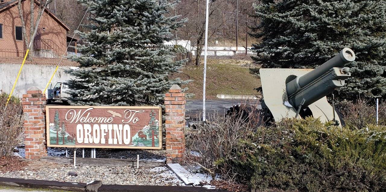
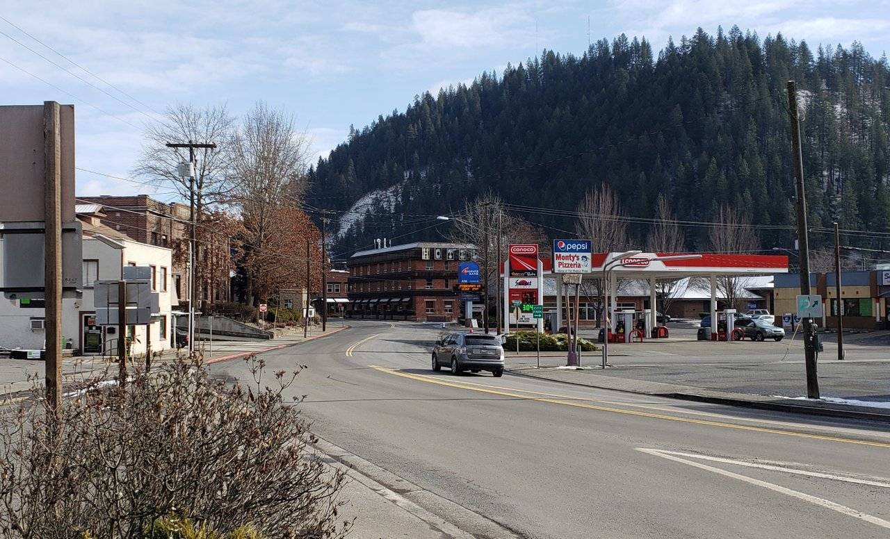
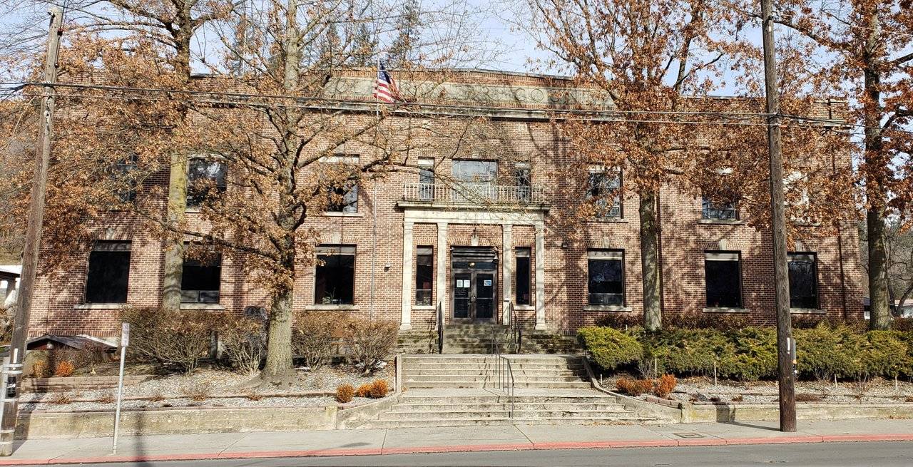
Photos: Town of Orofino, Idaho
The nearby town of Orofino is one of the oldest in this part of the state. Long a center of the logging and timber industry, it sits just off U.S. Highway 12 across the Clearwater River in a little side canyon.
Serving as the county seat of Clearwater County, its Courthouse was built in 1911.
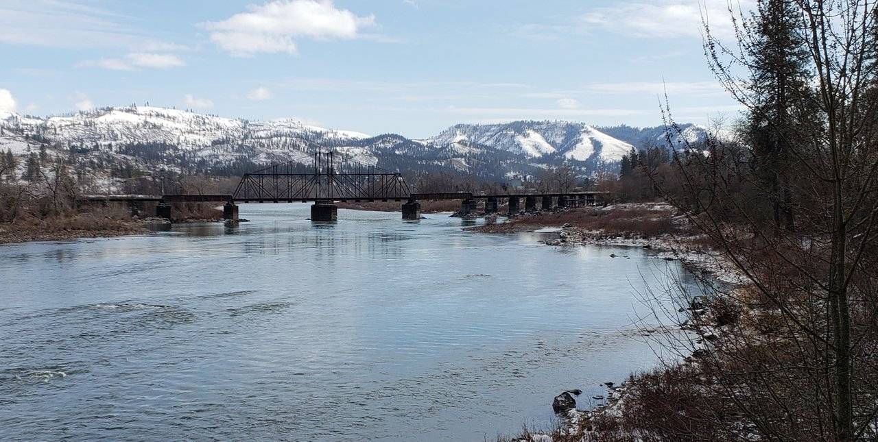
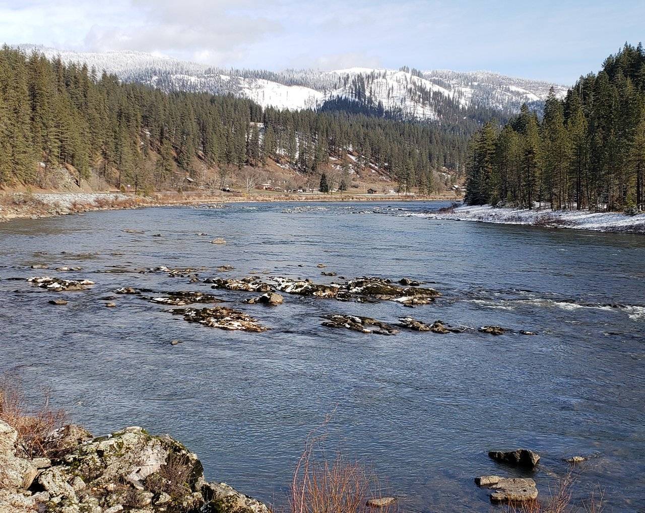
Photo: Clearwater River between Orofino and Kamiah, Idaho
Continuing on up the canyon, with the increase in elevation, I began to find snow that had not yet melted. I thought the first image above was particularly striking, given the light that was shining down and the little bit of "dusting" of snow on the ground.
The second image is of a bridge across the river, to support all of the logging and timber operations, as I was getting closer to Kamiah.
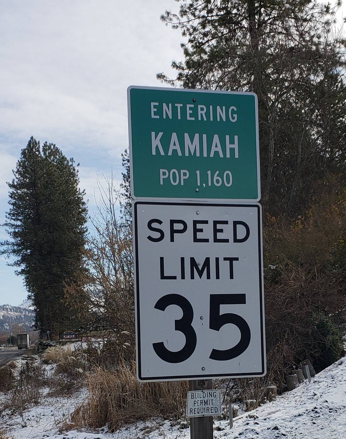
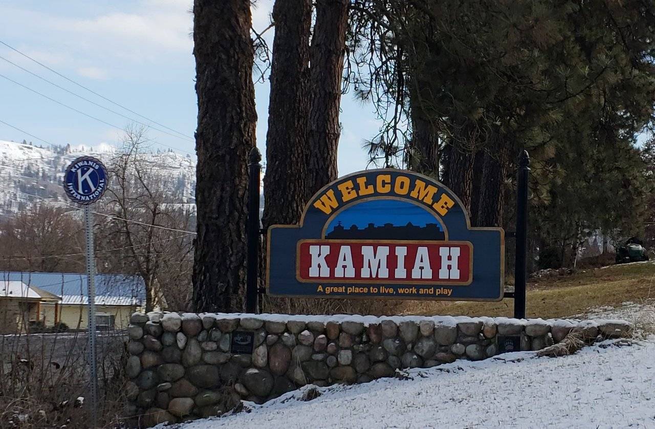
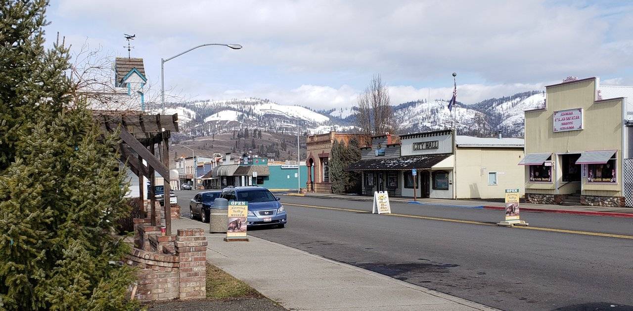
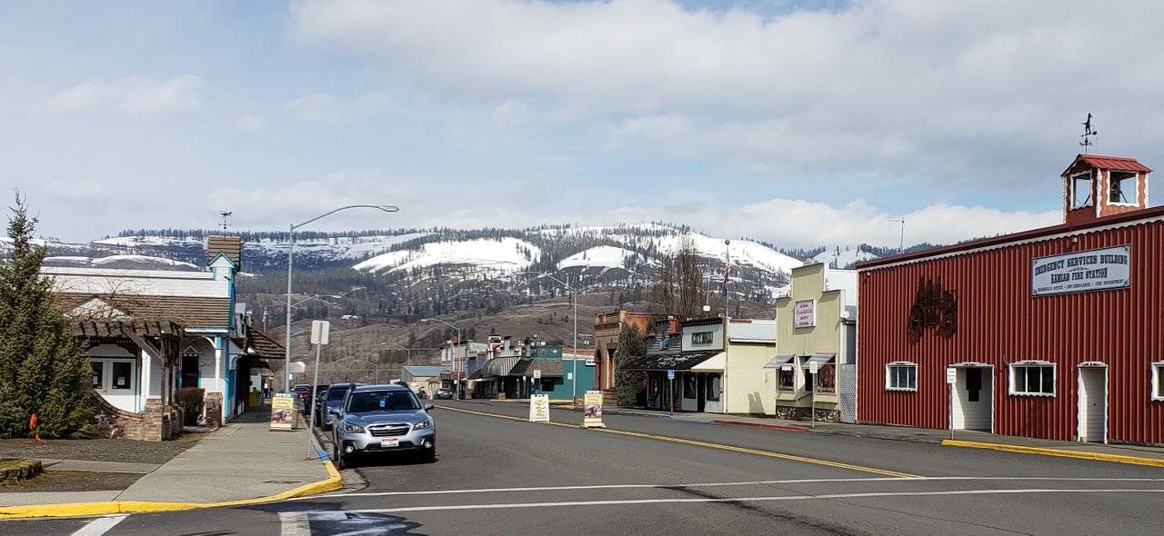
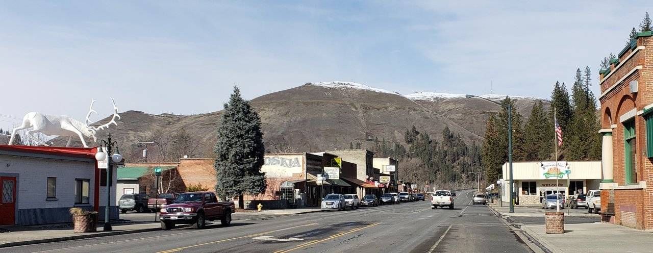
Photos: Town of Kamiah, Idaho
While a very pretty little town, Kamiah also had the "feel" of a busy commercial hub for this part of Idaho and all of the logging and timber operations in the surrounding mountains.
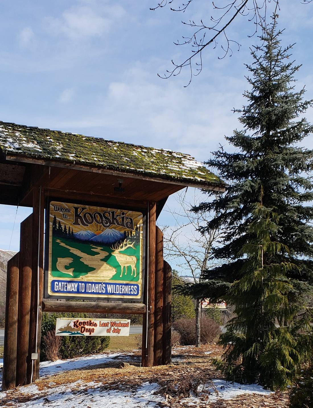
Photos: Town of Kooskia, Idaho
The town of Kooskia sits on the confluence of the South and Middle forks of the Clearwater river. A highway south out of town connects this area to Grangeville and the Camas Prairie farming community around it. The drive from Kooskia to Grangeville is considered part of the Northwest Passage Scenic Byway, but I did not have time to drive down that way. Maybe another time!
Kooskia is the last little town along this highway, as continuing on you begin to enter national forest and the Wilderness Areas set aside in the mountains east toward Montana - like the spectacular Selway-Bitterroot Wilderness.
Back out on U.S. Highway 12, at the turn-off to Kooskia, a very nice set of displays have been set up to inform those passing by about this area.
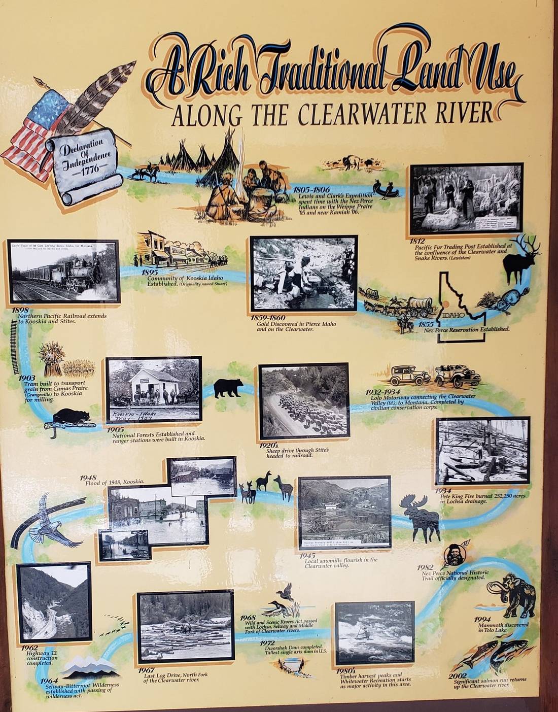
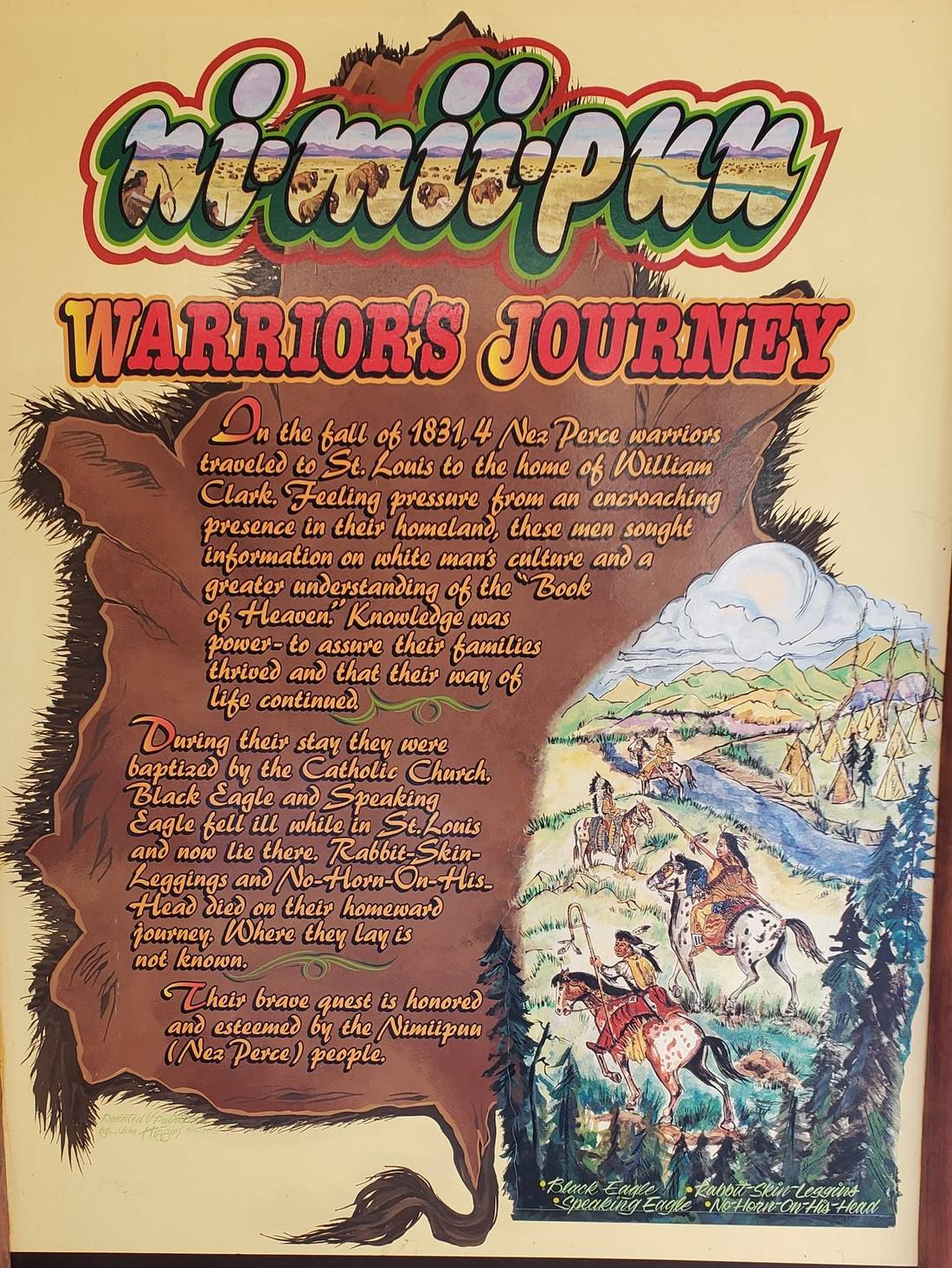
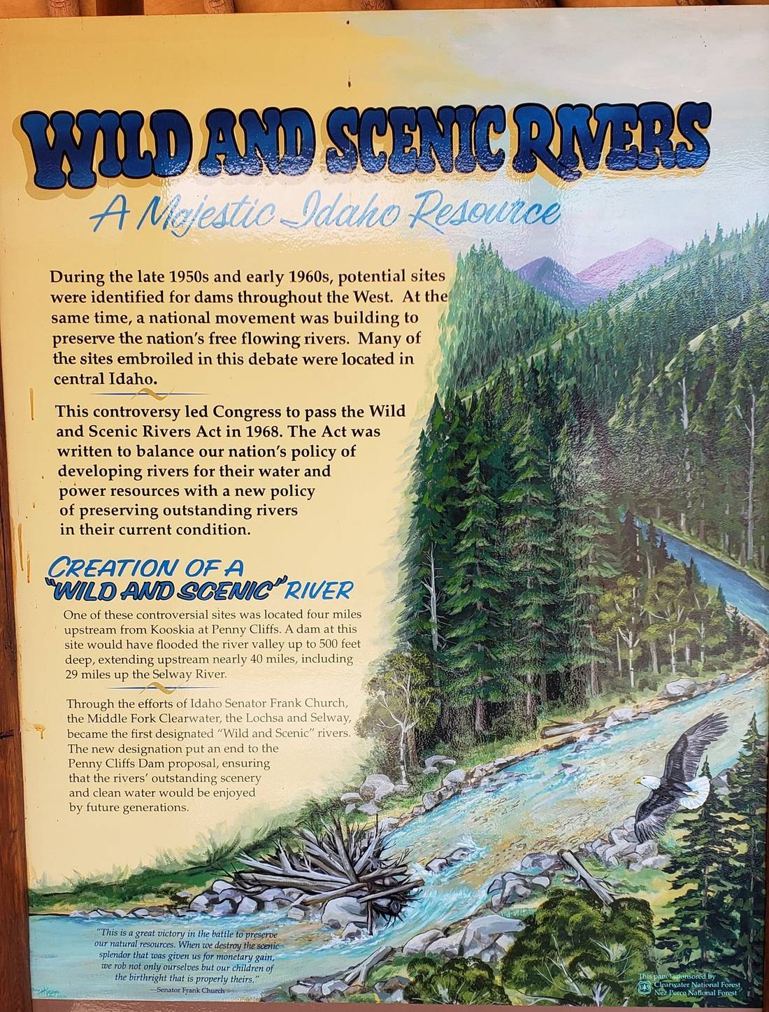
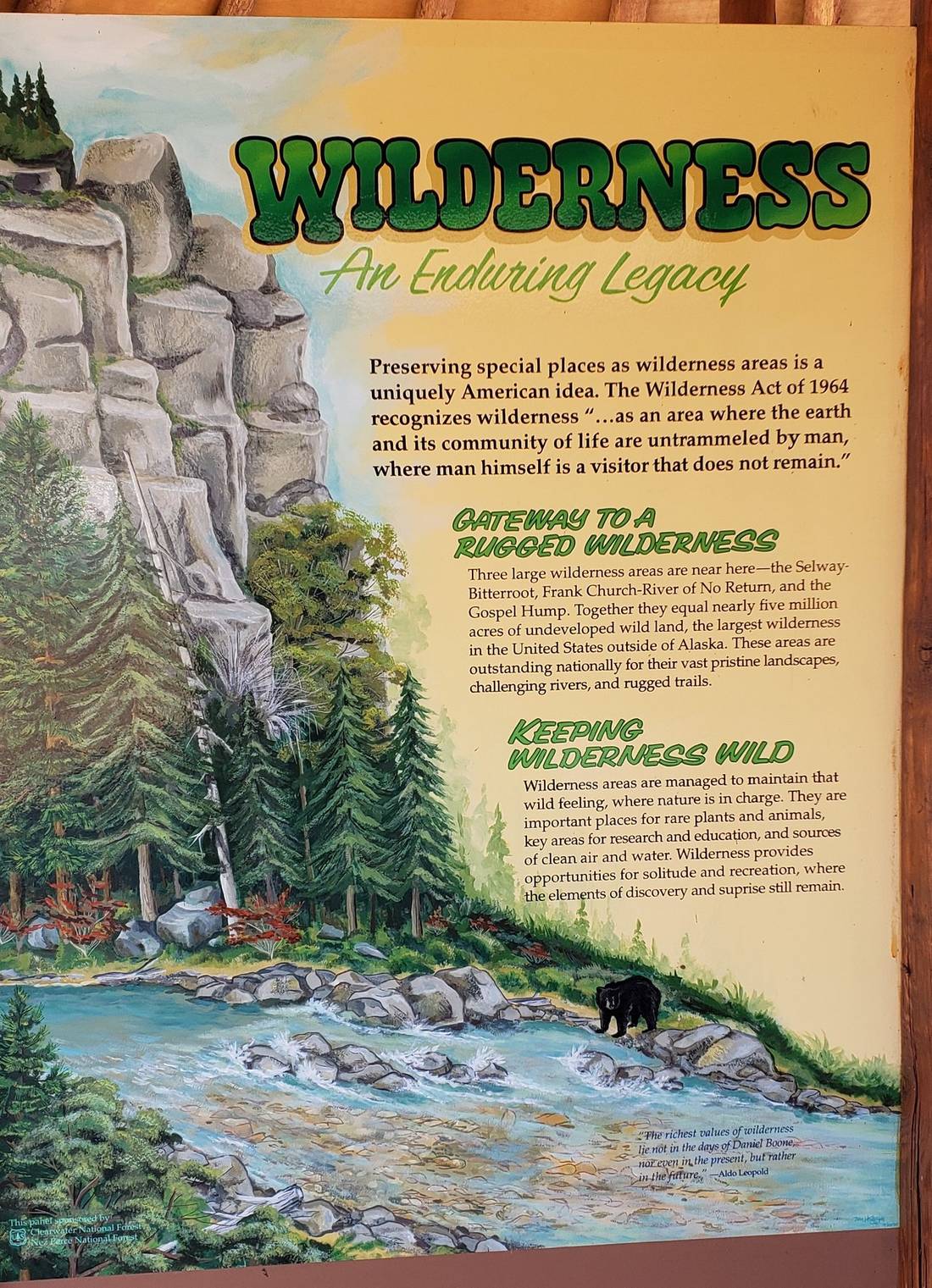
Photos: Roadside Displays near Kooskia, Idaho
Both informational and poignant, I am only presenting some of the many at this stop. If passing through this area someday, you'll want to stop and check them out!
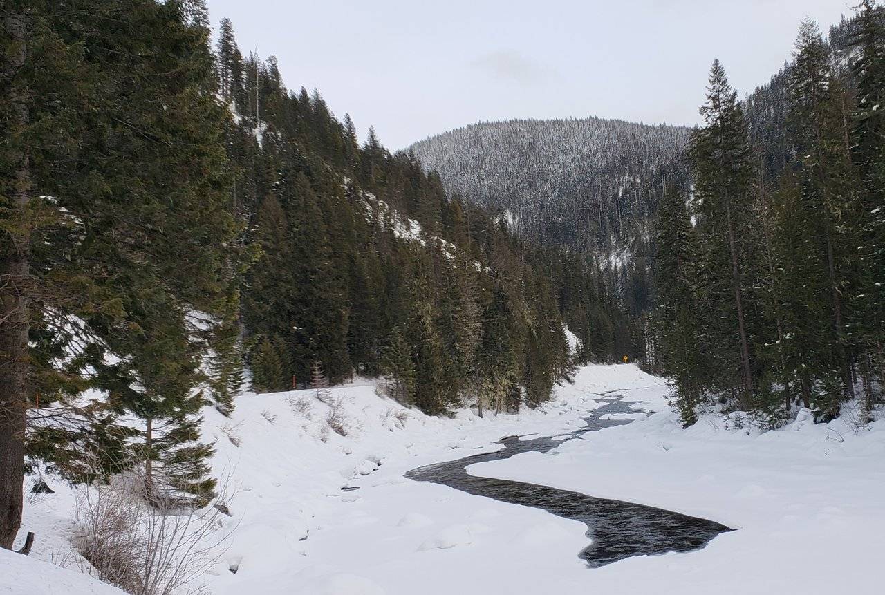
Photos: Upper Clearwater River Scenes
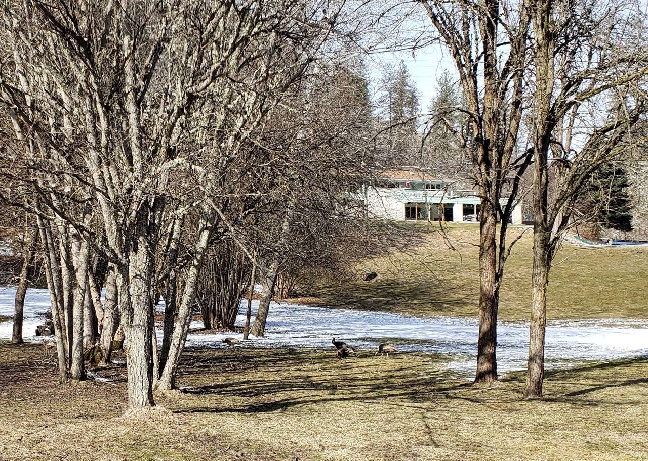
Leaving the Kooskia area and continuing on up the canyon and higher into the mountains, there were still plenty of places where people had created residences for themselves. Where the river had enough clearance on the banks to allow it ...
Having read earlier about all of the wild turkeys in this area, I was blessed to see some! I actually saw turkeys in a number of different places, but this was the only time they were close enough to get some reasonable pictures.
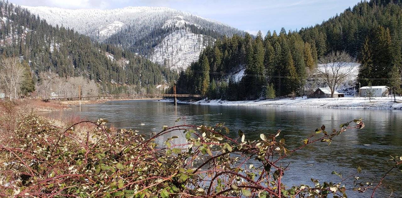
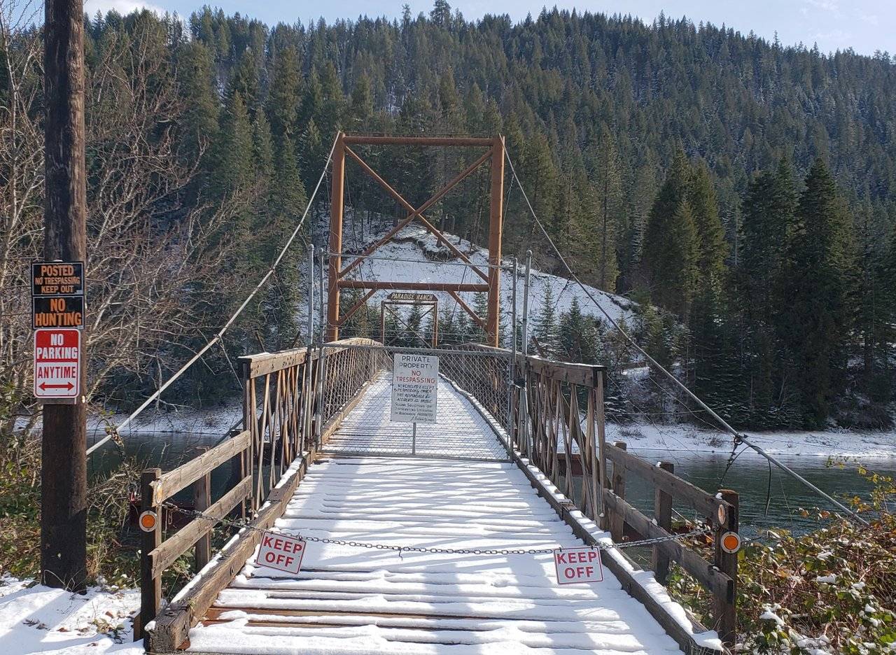
Photos: "Paradise Ranch" on the Clearwater River
Earlier in this post, I commented on the expense of building way up in these remote areas. Well, how about "Paradise Ranch" shown above? On the other side of the river from the highway. Before you can even start construction, you have to be able to get over there ...
So ... Once built, an appealing name may lead one to want to visit. Right? Well, I would not suggest making the attempt, as these people appear desirous of keeping "Paradise" to themselves. For starters, much to the dismay of many around the world, the American people are the mostly heavily armed on earth. I won't get into that here, as my experience is this aspect of American history is poorly understood. At least I know my countryman, @janton, understands ... 😉
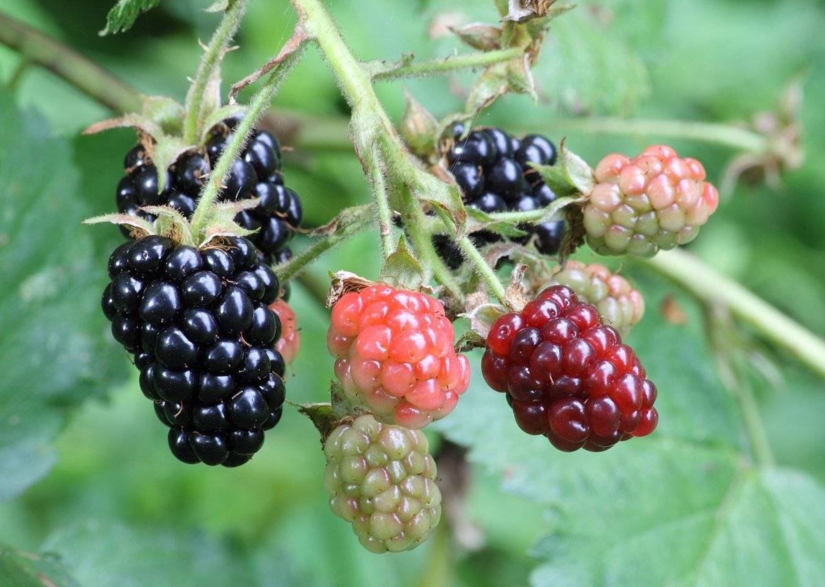
Before moving on, I would like to draw your attention, dear reader, to the blackberry bushes in the foreground of the first picture above. While we wouldn't want to call them "weeds," it is remarkable how these bushes thrive in this region. They are everywhere near most waterways.
Source: Wikipedia - Blackberry
They truly can be "pesky" for some property owners, as they are very difficult to eradicate, if one takes the trouble to attempt it. They do produce a delicious fruit, though, if you can learn how to "extract" them from their bushes while keeping the "shredding" of their thorns to a minimum.
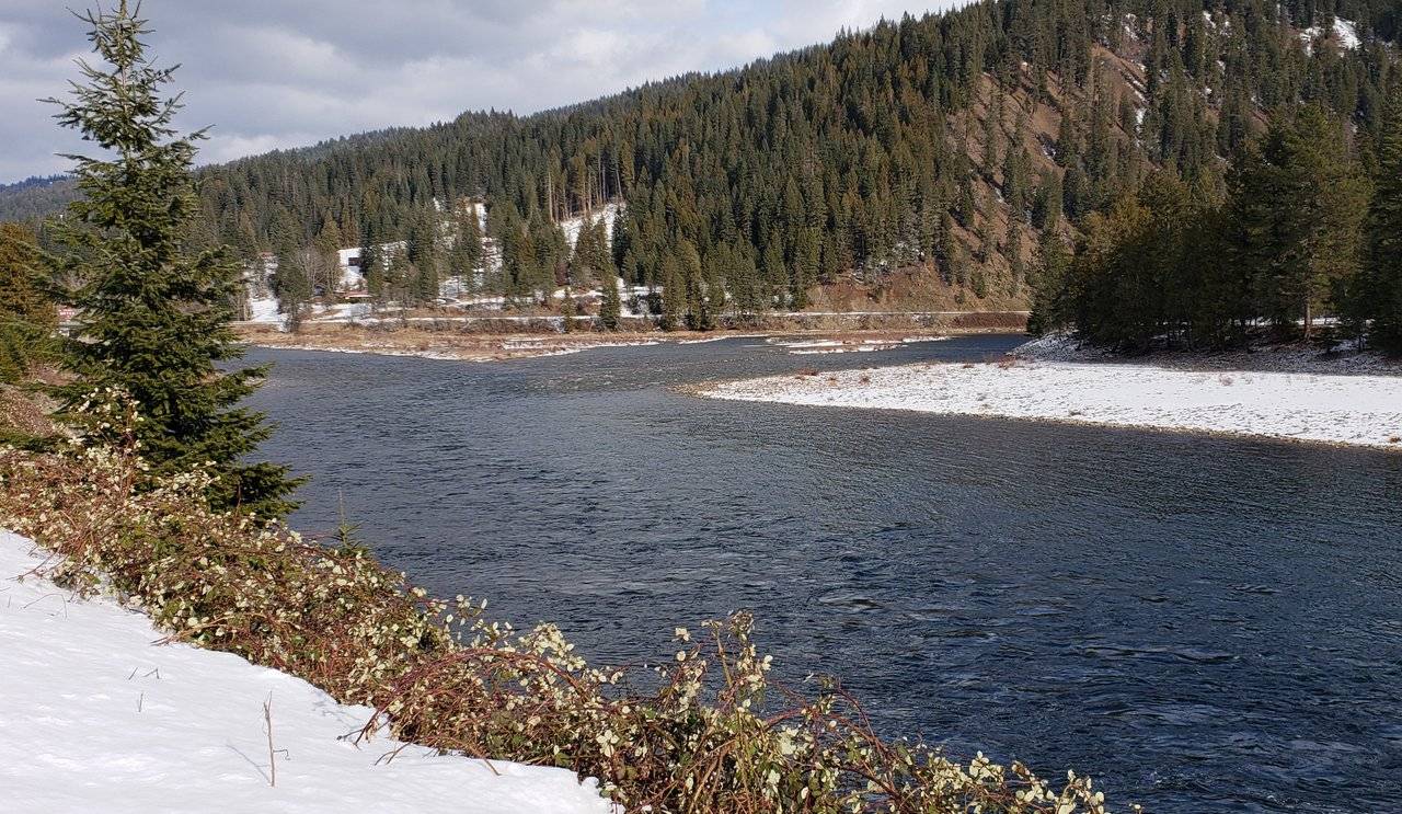
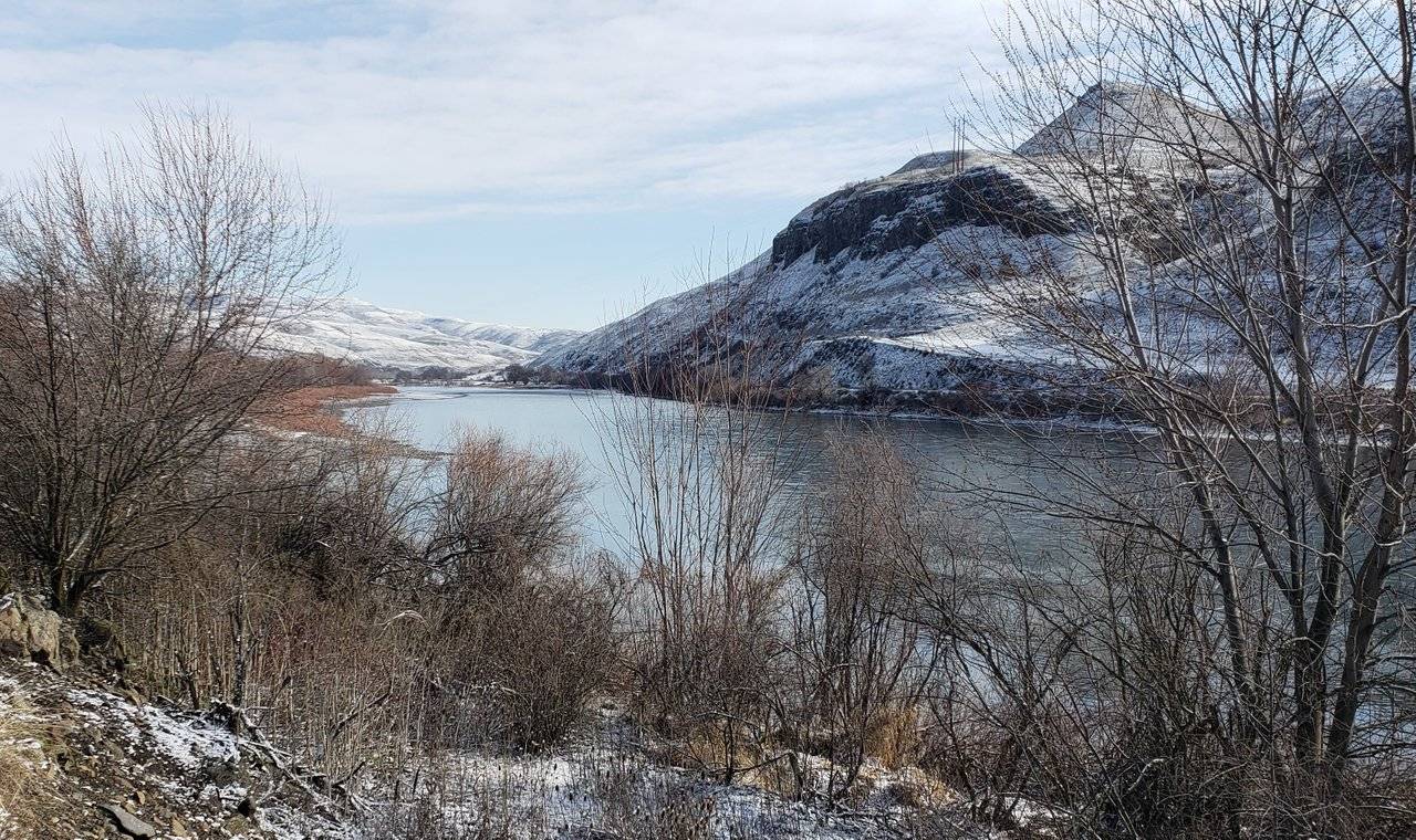
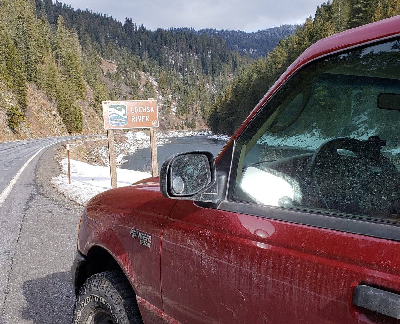
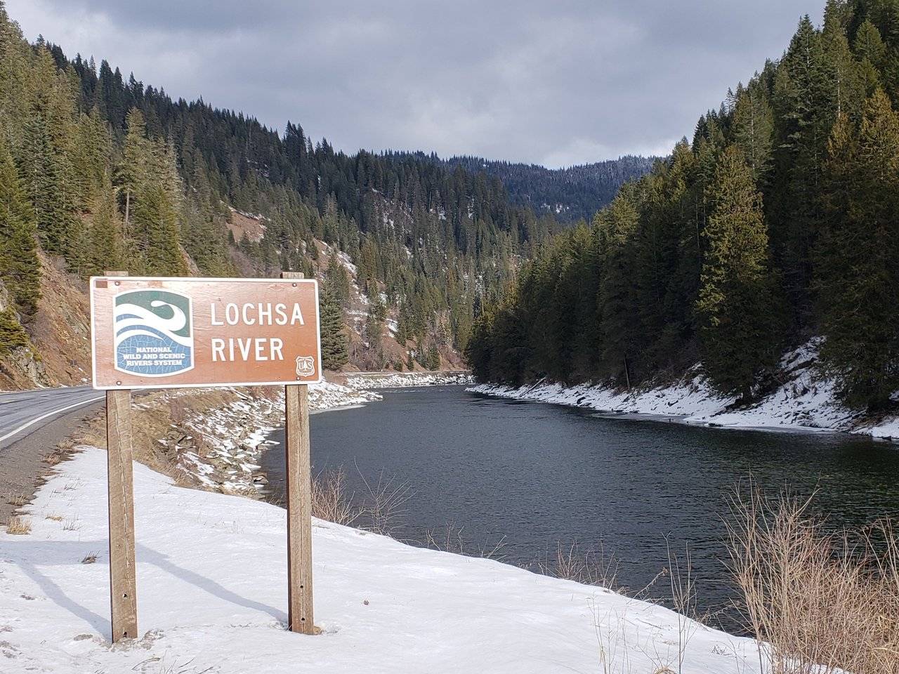
Photo: Confluence of Lochsa and Selway Rivers at Lowell, Idaho
I finally reached the end of the Middle Fork of the Clearwater River, as shown above. Actually better is I reached the beginning, as this confluence results in becoming the Middle Fork. Not common, as generally the "primary" river retains its name all the way to its headwaters.
- Note: Again, dear reader, in the foreground of the photo above, you see blackberry bushes thick along the banks of the river.
From this point forward, I was entering the Lochsa River Scenic Byway and given that it really is its "own world," I have elected to cover it separately.
Lochsa River Scenic Byway
Part of what sets this waterway apart is you are traveling through an area largely protected by wilderness areas established by the U. S. Congress. All along the way, you see reference to trailheads on both sides of the river heading up into the mountains.
Photos: @roleerob was here! Entering Lochsa River Scenic Byway
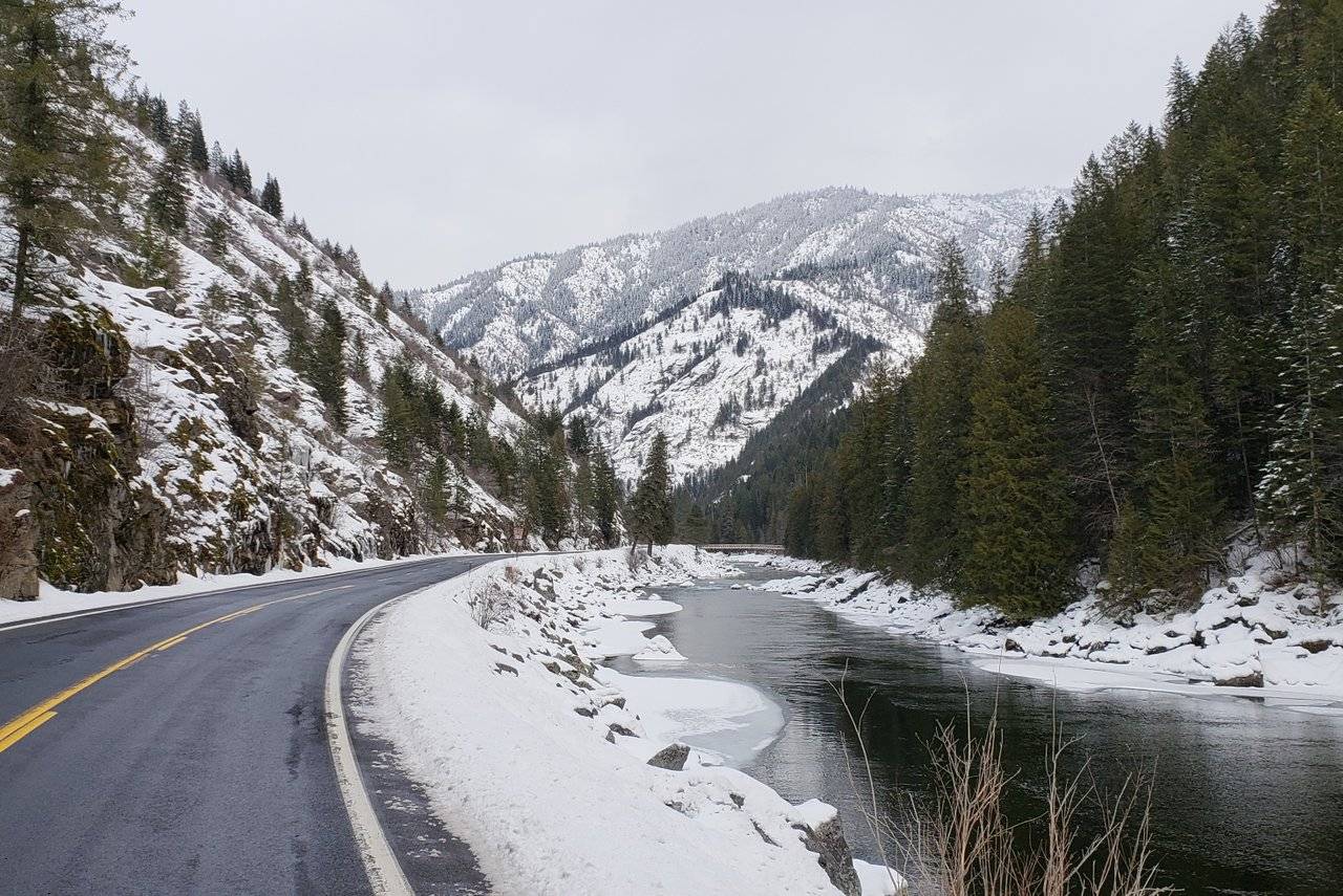
Another significant change was the rate at which I was climbing higher in elevation. And with that, as you will see, the weather changed significantly.
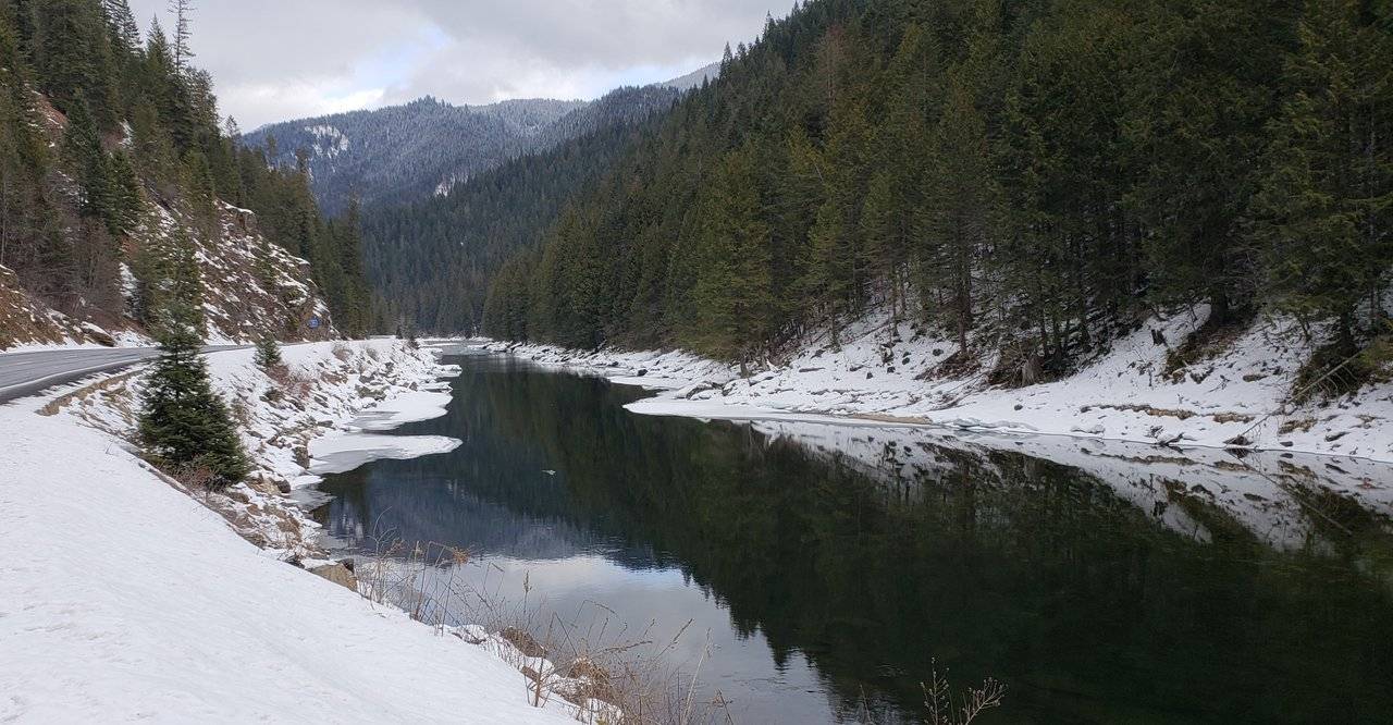
Photo: Lochsa River in Idaho. Beginning of icing over.
It didn't take long before the river had ice along its edges and the banks were pretty well snow covered.
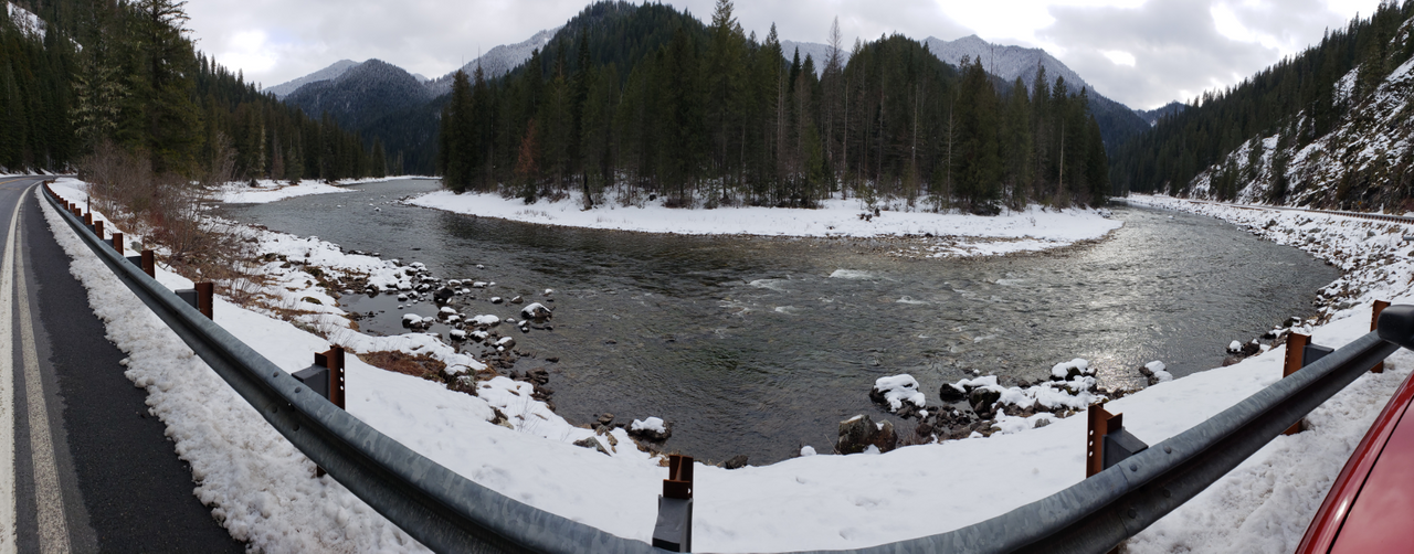
Photos: Higher and higher on the Lochsa River
And the hairpin curves in that canyon?! 😧 No, this second picture above is just me trying out the "Panorama" mode on my trusty smartphone ... 😊
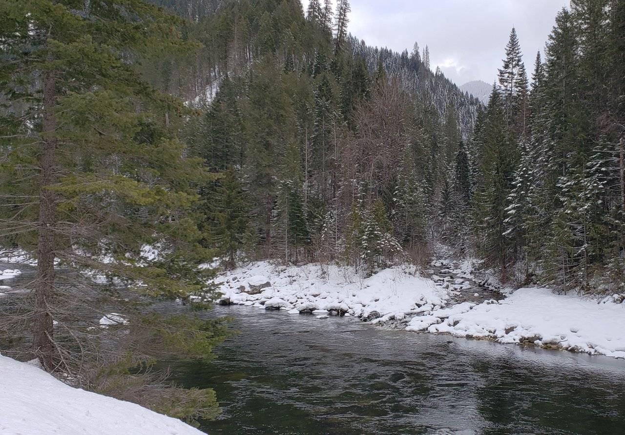
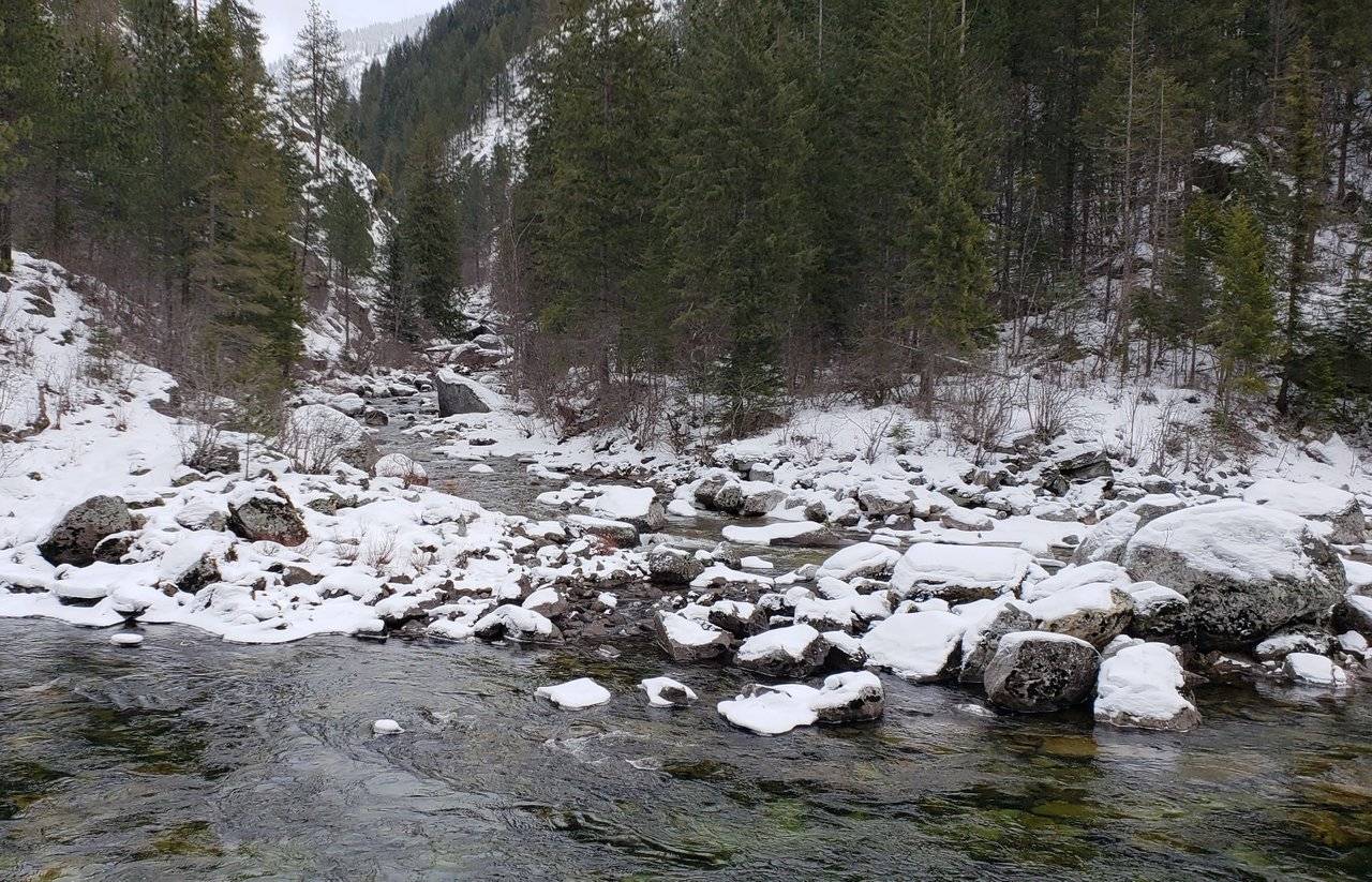
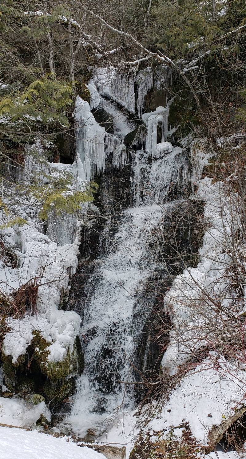
Photos: Tributaries of the Lochsa River
At regular intervals, all the way up through the ~ 75 miles (121 km) of driving up this canyon, there were tributaries coming down from higher elevations. They were beautiful!
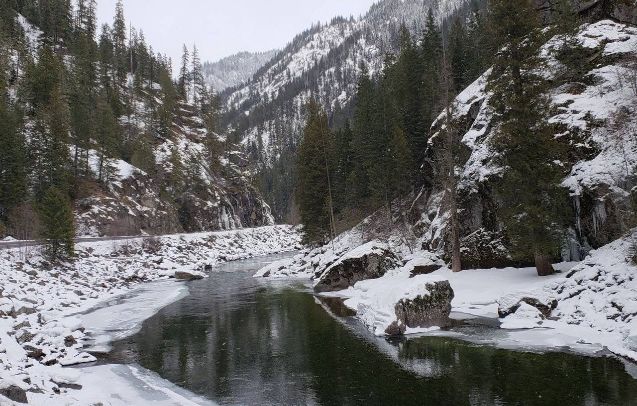
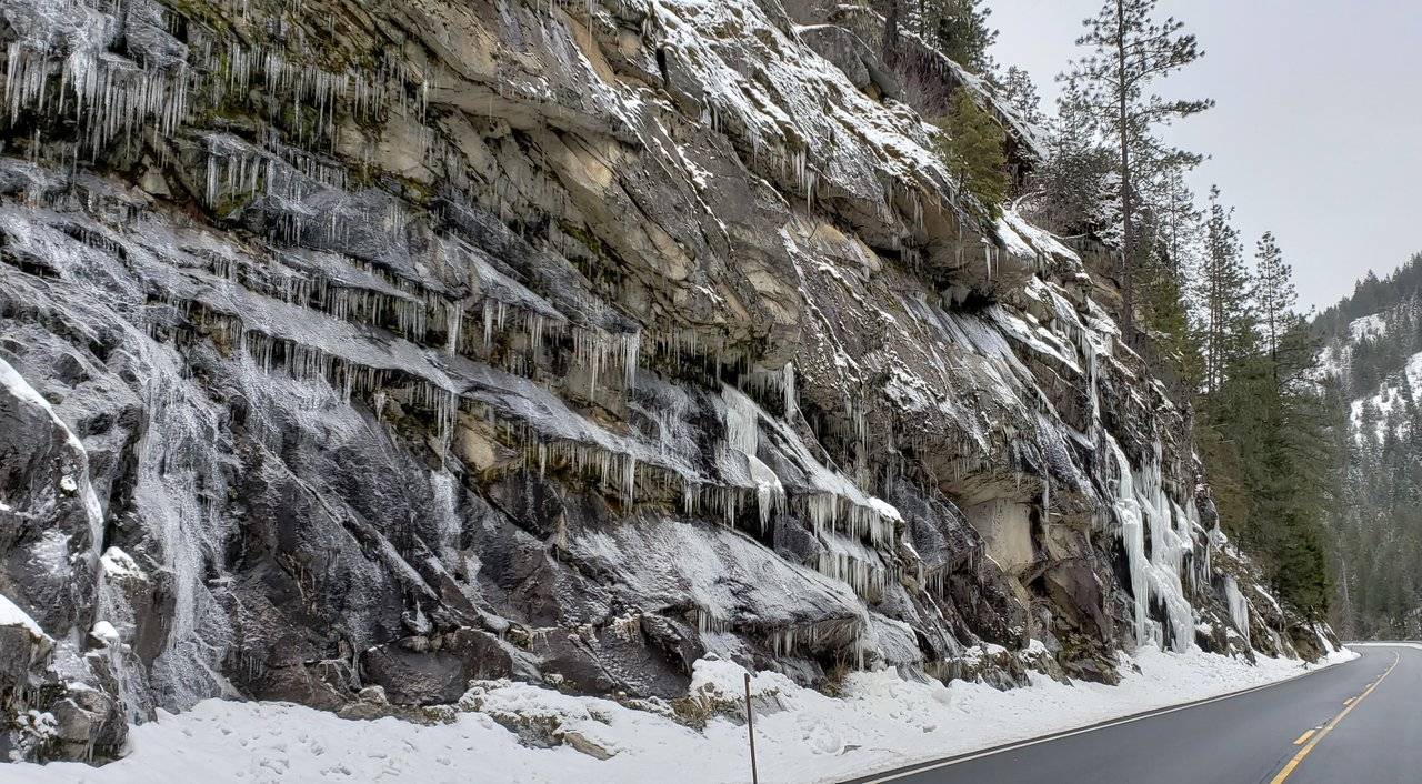
Photos: Steadily Icing Over on the Lochsa River
Winter can be a very hostile season, but it also clearly has its own special beauty. These views would have been enhanced considerably by some sunshine. But , it wasn't meant to be ...
Photos: Final Stages of Icing Over on the Lochsa River
These are the last pictures I took of the river, as beyond it much of the time I was just looking out at snow ... Laying on top of ice, under which the river was still flowing!
Photos: Summit of Lolo Pass
Reaching the summit of Lolo Pass, I was very interested to know what the elevation was, but as you can see, there was just a bit of snow in the way of finding out.
So ... Then, thinking I would enjoy going through the Visitor's Center, to see what they had to say about all I had driven through, I learned it was closed. I did not have any interest in fighting through any more snow to see what their hours were. I just drove on ...
Later, a quick check revealed the elevation of Lolo Pass is only 5,233 feet (1,595 m), which isn't much where I live. For perspective though, we need to keep in mind I left the Lewiston, Idaho area earlier in the day which only has an elevation of about 700 feet (213 m), even though almost 500 miles (805 km) from the ocean.
I did enjoy doing a bit of research later on and finding the Lewis and Clark Expedition crossed through the mountains, right at the point of Lolo Pass, on 13 September 1805. They found the subsequent trek, through the mountains (I just drove my truck through) now protected by wilderness, to be the hardest single part of their expedition. They barely survived it.
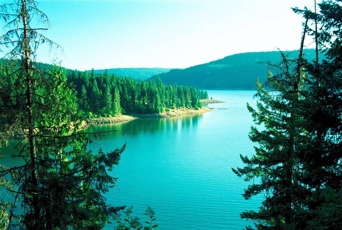
For some idea of how beautiful this area can be, here is a summertime picture:
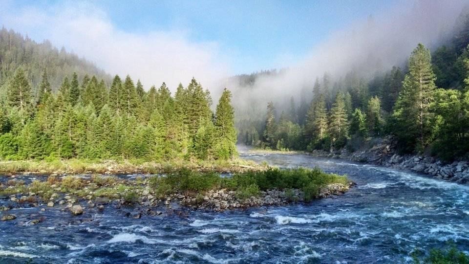
Image Source: Reddit
Whether you like fishing, hiking, backpacking, whitewater rafting, or simply driving through and stopping from time to time to just sit and soak it all in, this is a spectacular part of America to experience for yourself, if you ever have the opportunity.
Postscript on Day Twenty Eight
Meanwhile, "back at the ranch," I still wasn't to my final destination. Heading down the other side of Lolo Pass into Montana, the roads and weather got worse.
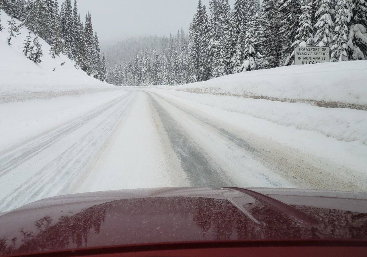
Photo: East side of Lolo Pass into Montana
Overall, it was another long day on the road, particularly as the day wore on and it got colder, more overcast, and started snowing again.
Reaching Hamilton, Montana in the dark, I unloaded my truck with snow falling and the temperatures rapidly heading to sub zero ...
The weather was definitely starting to take its toll.
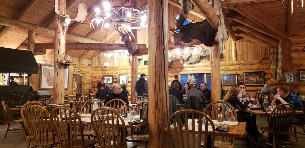
Photos: Dinner at Lolo Creek Steakhouse
With the day nearly done, driving by the Lolo Creek Steakhouse at dusk, my mind was on other things, but out of the corner of my eye I noticed how many people appeared to be there. On a Monday night. A good sign!
So ... Once again, "obeying my gut" I turned around and went back for dinner. Glad I did! 👌 Being a good carnivore, I have eaten at a lot of steakhouses over the years and this was one of the best ever.
On top of that, as can been seen, the atmosphere is great inside this restaurant made of logs from the nearby Lolo pass area and expertly hand-notched in assembling. Amazing craftsmanship!
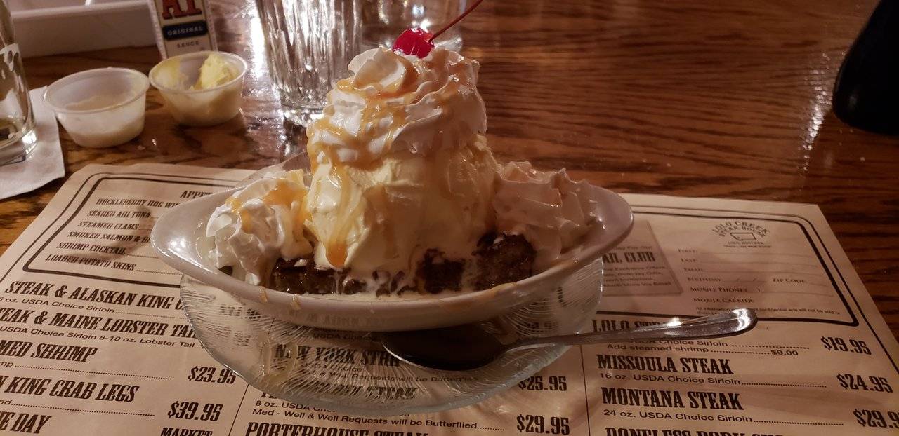
Photos: Dessert at Lolo Creek Steakhouse
When it comes to dessert, I usually pass. Sometimes, I'll take a look at the dessert menu saying, "I'll see if there is something on there I can't live without" ... 😊 Well, I am quite sure I could live without all of it, particularly if I want to maintain my "svelte girlish" figure ... 😉
Given what kind of day it had been toward the end, though, I surrendered to a coconut macaroon sundae. Yes, it was as good as it looks. And yes ... I ate the whole thing!
Part of the challenge of any trip is arriving at your destination to find cooperating weather conditions. Think rain and / or wind in the summer. In my case, it was snow and wind in the winter.
Not wanting to dwell on it really, I am still grateful for the opportunity to have seen such beautiful scenery in wintry conditions. The few times when the sunlight broke through a little bit to improve the lighting for picture taking and memory making was helpful.
Closing
Now on the "home stretch of "@roleerob's excellent adventure," it seems like a long time ago that I was posting about the "dead of winter" from the deserts of Arizona and the Pacific Coast of California. Well ... Still very appealing to me, anyway ...
Thanks for going along with me, dear reader. I’d love to hear any feedback you may be inspired to provide.
Until "next time," all the best to you for a better tomorrow, as we all work together to build our Steem Community! 👍 😊
Respectfully,
Steemian @roleerob
Posted using SteemPeak and “immutably enshrined in the blockchain” on Friday, 22 February 2019!
Ready to Blog & Earn?
With TravelFeed, easily start your own travel blog and earn as you go. It's the smart platform for travelers who want to profit from their passion. Create a free account
"R2R" Note: My "shorthand" way of referring to what I first wrote about in my Reflections: My "Road to Recovery" Trip post. "Road to Recovery" <=> "R2R" ... 😉
Image sources, unless otherwise noted: My trusty smartphone!


Don't Forget: Get Travel Health Insurance!
To make your trip a worry-free experience, TravelFeed recommends SafetyWing Nomad Insurance. It provides comprehensive health coverage while you travel, so you can focus on exploring, not the unexpected. Get a quote here
If you liked this post, you might enjoy others in my "Road to Recovery" Travelogue series:
- Travelogue, Day 1: Ribeye, Colorado
- Travelogue, Day 2: Navajo Nation and Canyon de Chelly - Awarded by c-cubed, c-squared, steemitworldmap, traveldigest, and trufflepig! 😊
- Travelogue, Day 3: Mogollon Rim, Copper Belt, and Sonora Desert - Awarded by trufflepig again!
- Travelogue, Day 4: Catalina State Park in Tuscon, Arizona - Awarded by c-squared, steemitworldmap, and traveldigest! 😊
- Travelogue, Day 5: Baboquivari, Sacred Peak in Arizona - Awarded by steemitworldmap and trufflepig! 😊
- Travelogue, Day 5: Organ Pipe National Monument in Arizona - Awarded by c-squared, steemitworldmap, traveldigest, and trufflepig! 😊
- Travelogue, Day 6: Reaching the Ocean - Awarded by travelfeed and trufflepig! 😊
- Travelogue, Day 7: Sabbath Rest and Morro Bay, California - Awarded by steemitworldmap, traveldigest, and trufflepig! 😊
- Travelogue, Day 8: Hearst Castle in San Simeon, California - Awarded by steemitworldmap and traveldigest! 😊
- Travelogue, Day 9: Monterey Peninsula of California - Awarded by steemitworldmap and travelfeed! 😊
- Travelogue, Day 10: Redwood Hill Farms and Sonoma County, California - Awarded by steemitworldmap and traveldigest! 😊
- Travelogue, Day 10: Sonoma Coast State Park of California - Awarded by steemitworldmap and traveldigest! 😊
- Travelogue, Day 11: Mendocino, California - Awarded by steemitworldmap and traveldigest! 😊
- Travelogue, Day 12: Redwood Forests of Northern California - Awarded by steemitworldmap, traveldigest, and trufflepig! 😊
- Travelogue, Day 13: Crater Lake National Park in Oregon in Winter ... - Awarded by steemitworldmap, traveldigest, and trufflepig! 😊
- Travelogue, Day 13: Rogue River Gorge in Oregon - Awarded by steemitworldmap and traveldigest! 😊
- Travelogue, Day 20: Oregon Scenic Byway to Pendleton - Awarded by O.C.D., c-cubed, c-squared, and trufflepig! 😊
- Travelogue, Day 21: The Blue Mountains and the Palouse - Awarded by c-squared! 😊
- Travelogue, Day 23: Lewiston, Idaho and the Famous Lewis & Clark Expedition - Awarded by c-squared, steemitworldmap, and traveldigest! 😊
- Travelogue, Day 24: Saint Maries, Idaho and Lake Couer 'd Alene - Awarded by O.C.D., c-squared, steemitworldmap, and traveldigest! 😊
- Travelogue, Day 26: Palouse Scenic Highway and Farmington, Washington - Awarded by O.C.D., c-squared, steemitworldmap, and traveldigest! 😊
Travel Resources for your trip to United States
Recommended by TravelFeed
Flights: We recommend checking Kiwi.com to find the best and cheapest flights to United States.
Accomodation: Explore the best places to stay in United States on Booking.com, Agoda and Hostelworld.
Travel Insurance: Medical emergencies abroad can be pricey, but travel health insurance is not. We always use SafetyWing for affordable and reliable coverage.
Car Rental: For hassle-free car hiring, DiscoverCars is our trusted choice with a wide selection of vehicles.
Internet: Got an eSIM compatible phone? Airalo is perfect for reliable internet access during your trip. Just install it before you go, and you're set!
Day Trips & Tours: We recommend GetYourGuide for a variety of well-organized and enjoyable activities.
Travel Planner: Need a hand planning? Our free travel planner chatbot is your personal guide to United States. Chat now.
Disclosure: Posts on TravelFeed may contain affiliate links. See affiliate disclosure.
