Day Twenty Nine: Continuing on with the "home stretch" of my "excellent adventure," I woke up this morning 🌄 to the coldest temperatures yet. It was below zero (-18 °C) in Hamilton, Montana, where I spent the night.
The cold is one thing. The lack of visibility quite another. Hamilton is a beautifully situated town at the base of the Bitterroot Mountains and at the heart of the Bitterroot River valley. I had really been looking forward to getting some pictures of wintry scenes in the area.
But ... Wasn't to be in the storm into which I had arrived the night before ...
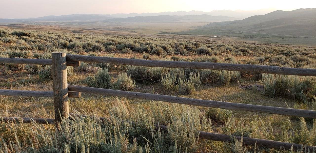
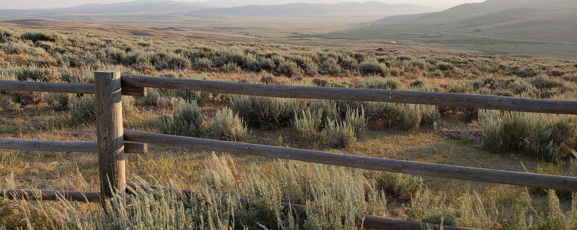
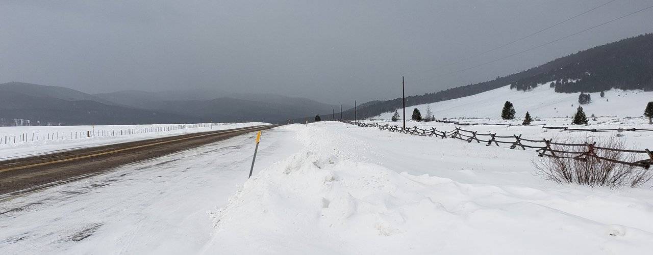
Photo: Big Hole Valley, Montana
So ... Moving on to the main feature of this post, no, dear reader, that is not the Big Hole Valley in the winter. But it is a picture I took of it when I was last through there, so ... It counts! 😉
Back to the winter, let's take a closer look at this historical valley, which takes us back in time ...
- Note: As with the photo above, sprinkled throughout in the post which follows, dear reader, you will find more of the photos I took on a previous trip through this valley.

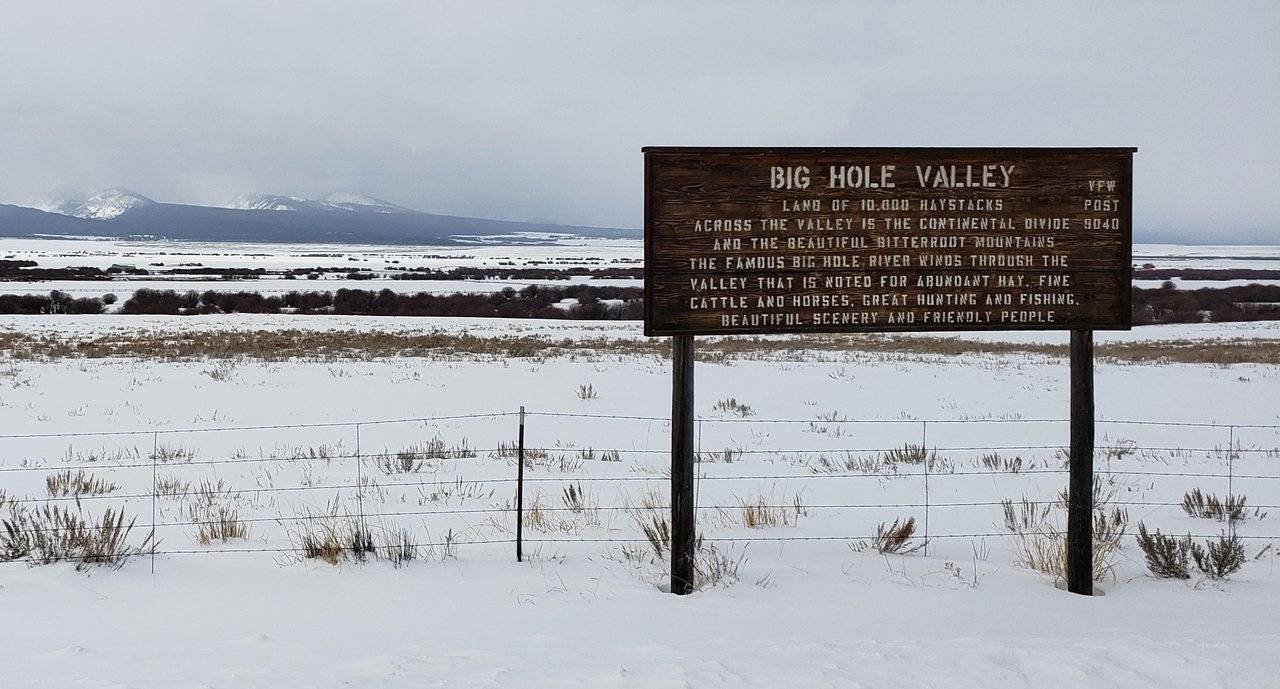
Big Hole Valley, Montana
Big Hole Valley is an amazing place to visit. Given how remote it is you feel like you are traveling back in time, when you go there. As with many places you have experienced with me, dear reader, on my "excellent adventure," you have to want to go the Big Hole Valley, as it is not on the way to anywhere.

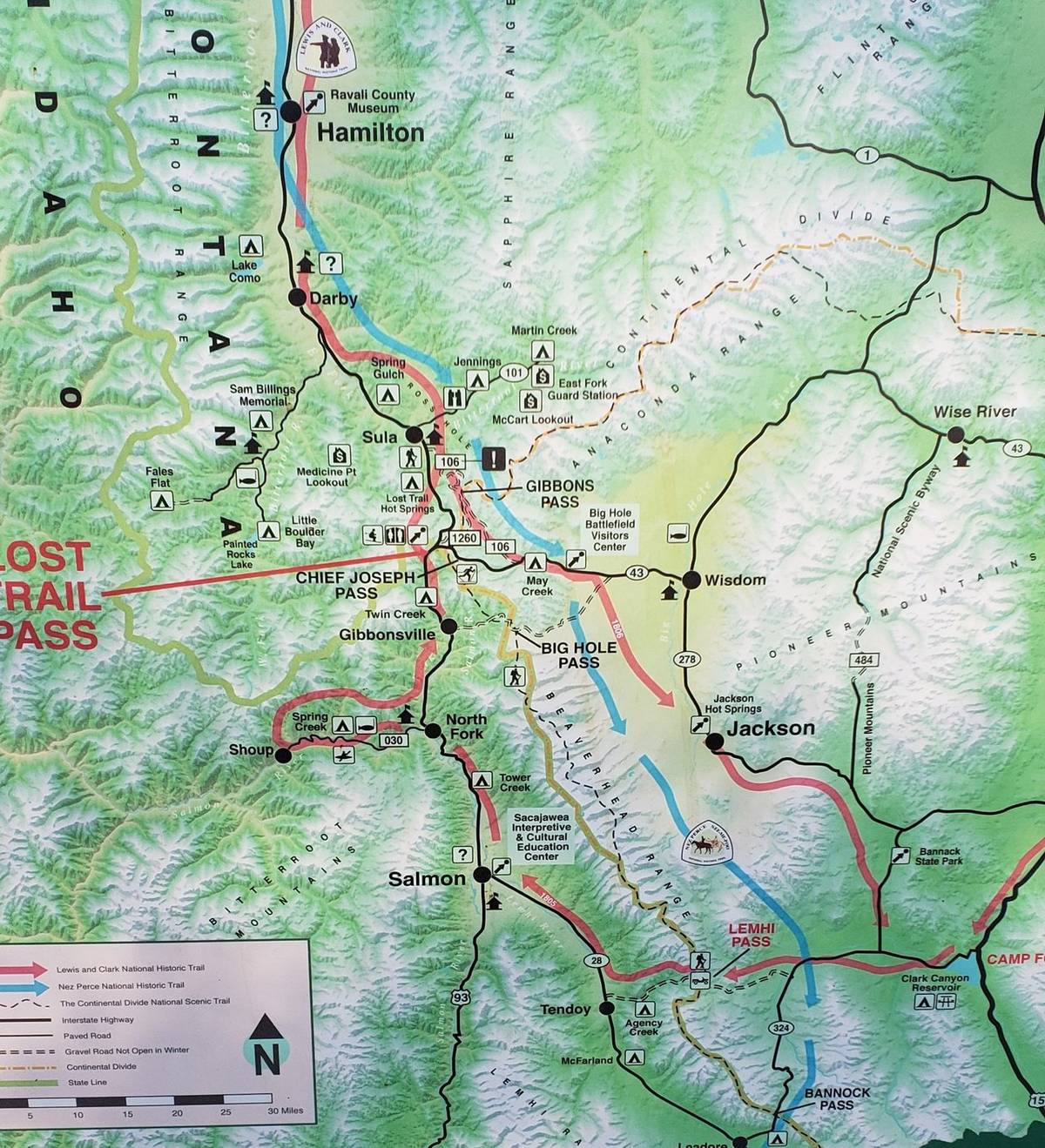
Illustration: Partial Map of Day Twenty Nine
This map shows that the primary transportation route through this region is Interstate 15. And this is on the other side of the Pioneer Mountains east from the Big Hole Valley.
Before moving on into the valley, let's take a closer look at some of the historical information about it:
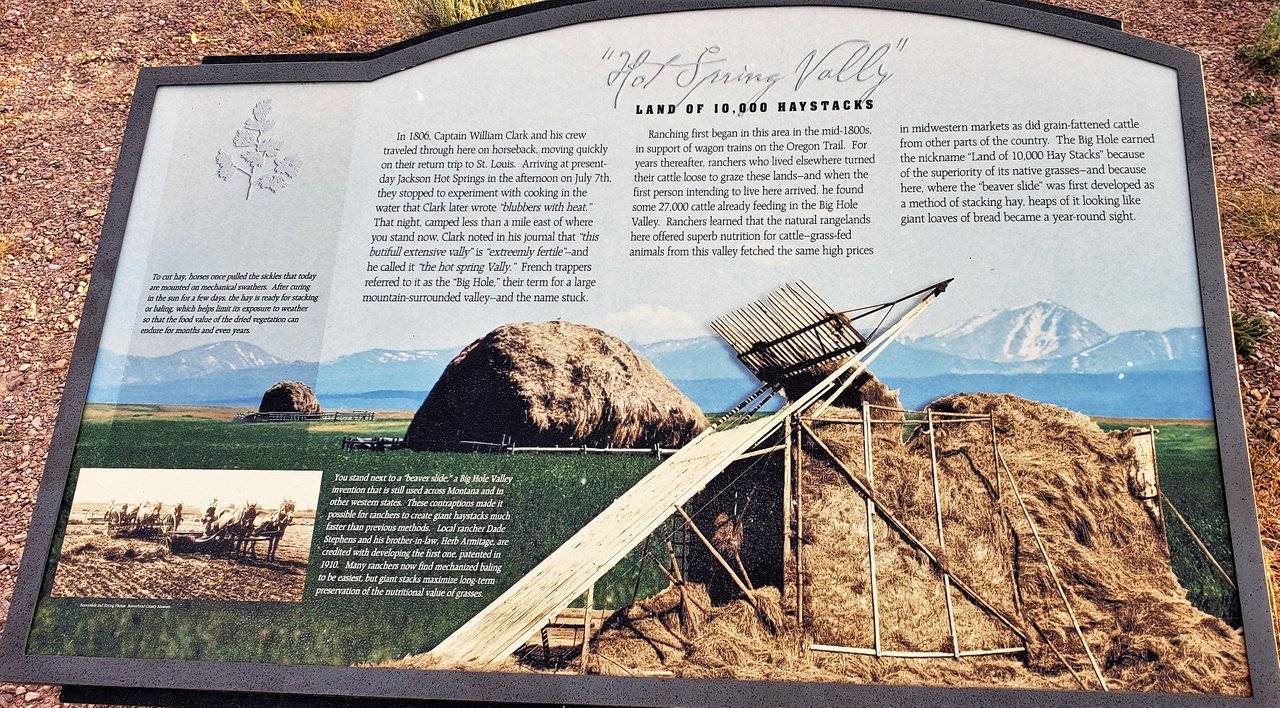
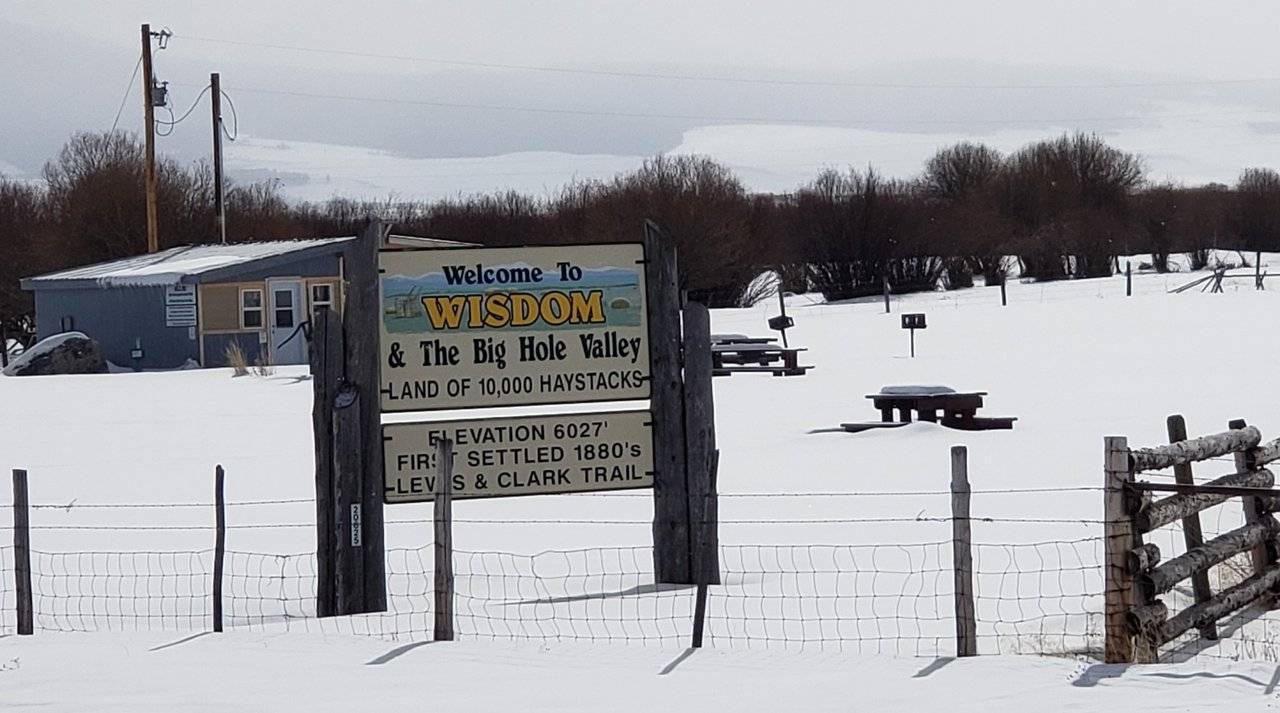
Photos: Historical Information
"Land of 10,000 Haystacks" is quite descriptive. While a bit hard to make out in this second photo, here is what it has to say about the history of the superb grasses in this valley:
"Ranching first began in this area in the mid-1800s, in support of wagon trains on the Oregon Trail. For years thereafter, ranchers who lived elsewhere turned their cattle loose to graze these lands - and when the first person intending to live here arrived, he found some 27,000 cattle already feeding in the Big Hole Valley. Ranchers learned that the natural rangelands here offered superb nutritution for cattle - grass-fed animals from this valley fetched the same high prices in midwestern markets as did grain-fattened cattle from other parts of the country."
So, the incredible nutritional value found in these grasslands led to there being (emphasis added was mine) an amazing number of cattle already here, when the first settler arrived. Couldn't help thinking of one of our favorite movies - Open Range - starring Robert Duvall, Kevin Costner, and Annette Bening. 😉
As you come down from Lost Trail Pass on Montana State Highway 43 into the Big Hole Valley, one of the first attractions you see is the Big Hole National Battlefield.
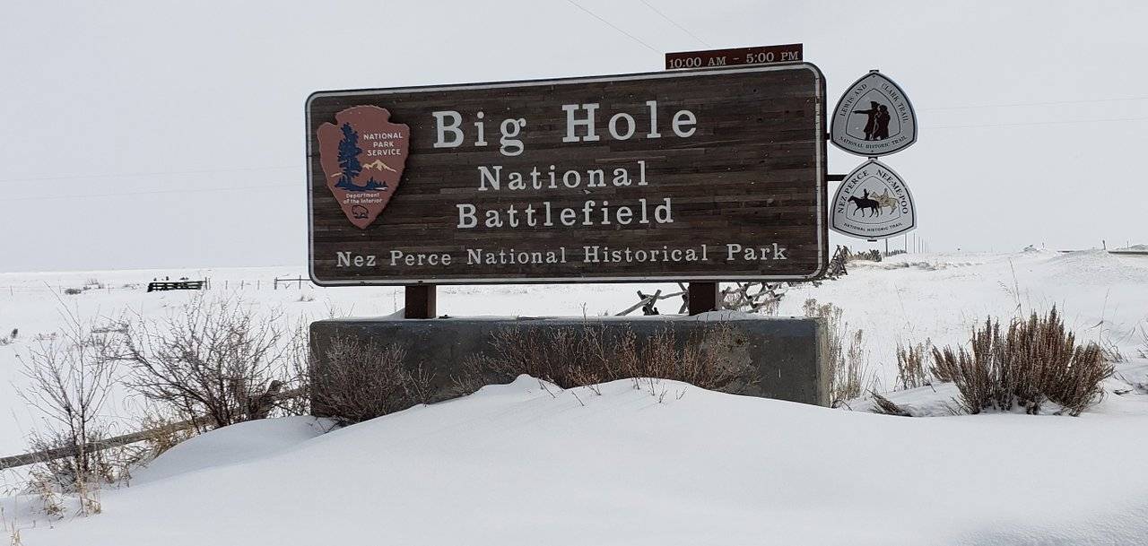

Photos: Big Hole National Battlefield
Big Hole National Battlefield is the site of an historic battle between U. S. Army, allied with some Montana citizen volunteers, and the Nez Perce people led by the famous Chief Joseph. This link provides a lot of historic detail, in which you may be interested.
So ... I was very interested in visiting it, but ... Closed due to bad weather?! 😧 C'mon! I made it there okay, as the first photo shows what I came down through. Why couldn't the people hired to have this place open do the same thing? Where's the commitment? Okay, I feel better now ... 😉
Once again, it just ... wasn't ... meant to be ...
Continuing on down further into the valley, you come to one of the two towns.
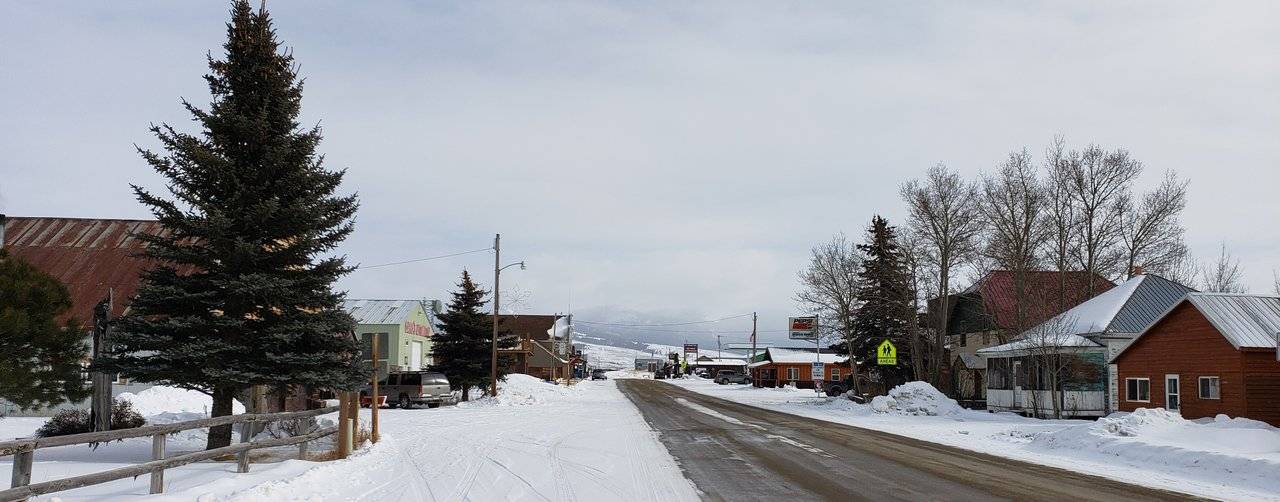
Photos: Town of Wisdom, Montana
From the Bitterroot Mountains down into the valley along the Big Hole river, you come into this little town. In the background of the first two photos, you see the Pioneer Mountains.
In the last U. S. Census in 2010, this "sprawling population center" had a grand total of 98 people in it ... 😉
Most of the people in this valley, which are still pretty few in number, live on the outlying ranches.
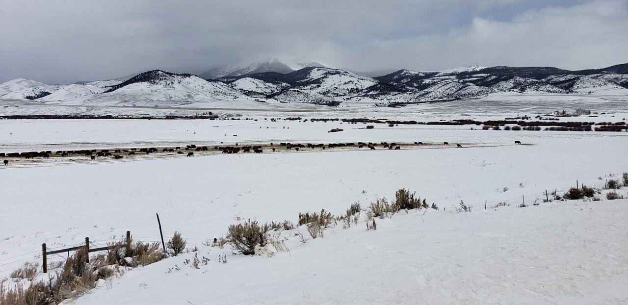
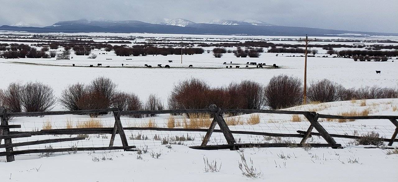
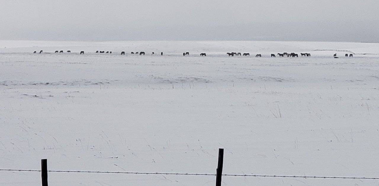
Here are some of the ranches in the Big Hole Valley:

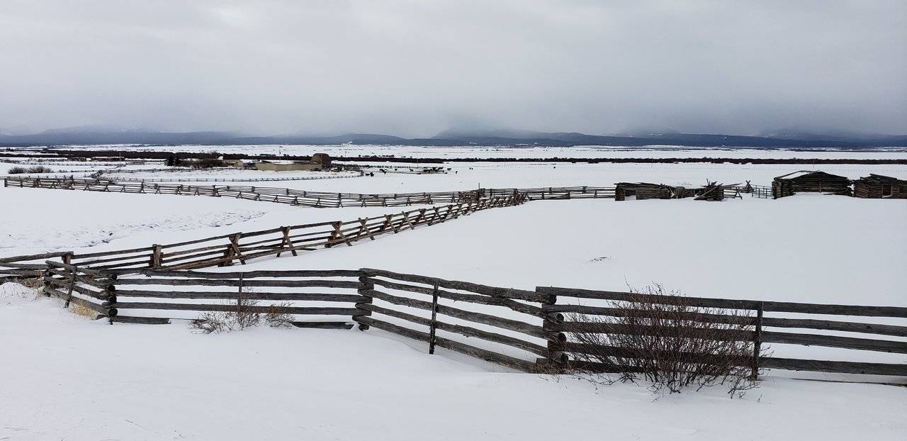
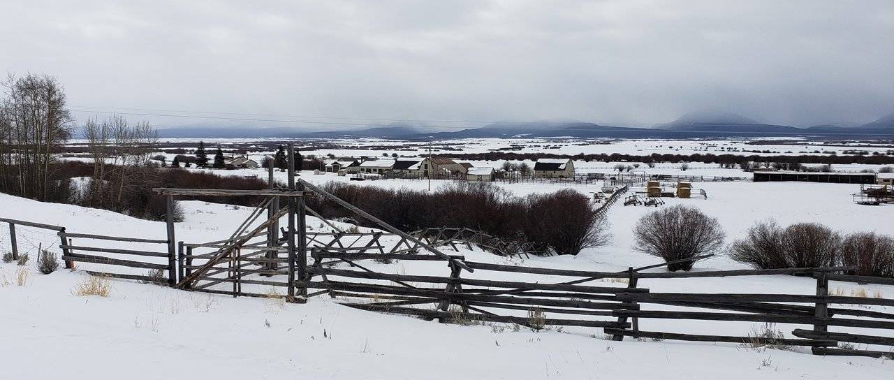
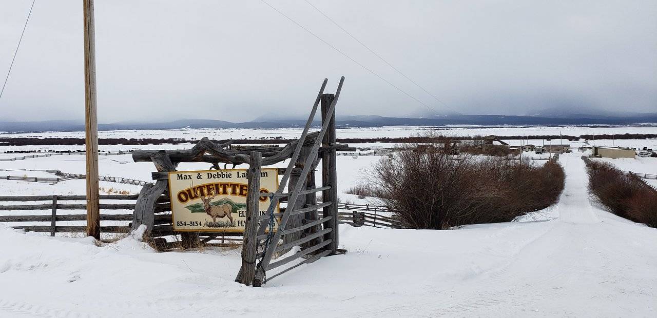
Photos: Ranches in Big Hole Valley, Montana
When you drive through this area, you are left with the distinct impression there are far more cattle and even horses, than there are people. I think it would be a safe bet to make that the people who live out here are rugged individualistic Americans.
What are these people doing out here? What their forefathers did generations before them. Living "close to the land" and tending large herds of cattle and horses. Think of the effort that takes. Just to get started, look at these fences subdividing the pastures. I can only imagine what it took to go up into the mountains to get the timber needed and then bring them down to build these fences ...
Back to the "land of the 10,000 haystacks," here are some pictures to help with some perspective:
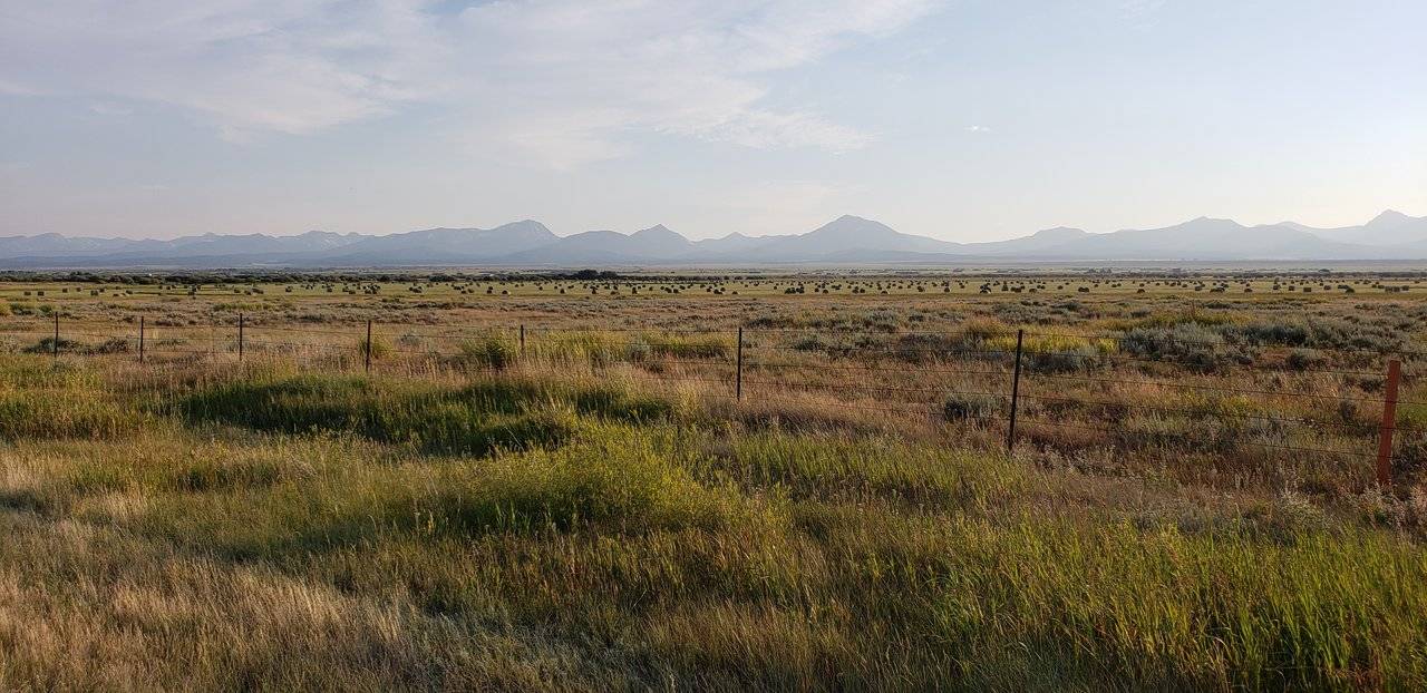
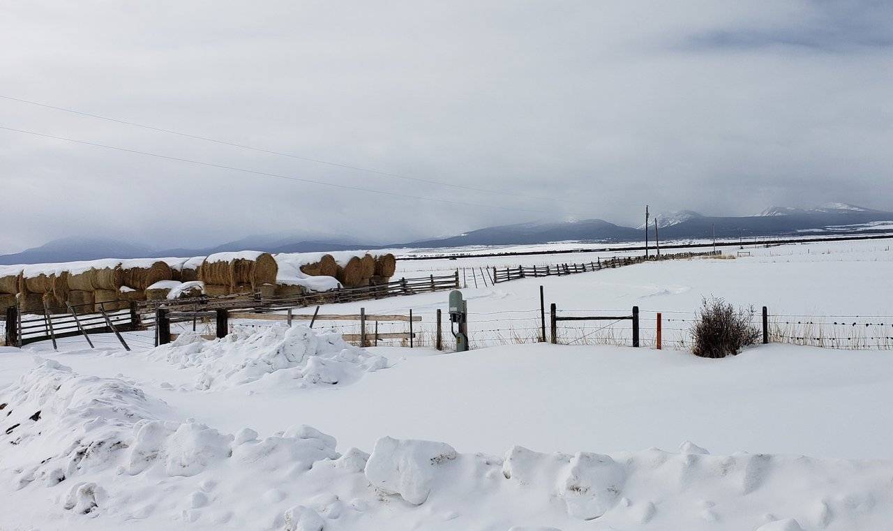
Photos: Grass Hay in Big Hole Valley, Montana
Production of their grass hay is vital to ongoing success of these ranches, in caring for their livestock. In this first photo, you see the hay once it has been raked up into the round bales that are favored here - best for grass hay (no alfalfa, as found in other hay). In the second photo, you see how they are stacked until needed in the winter.
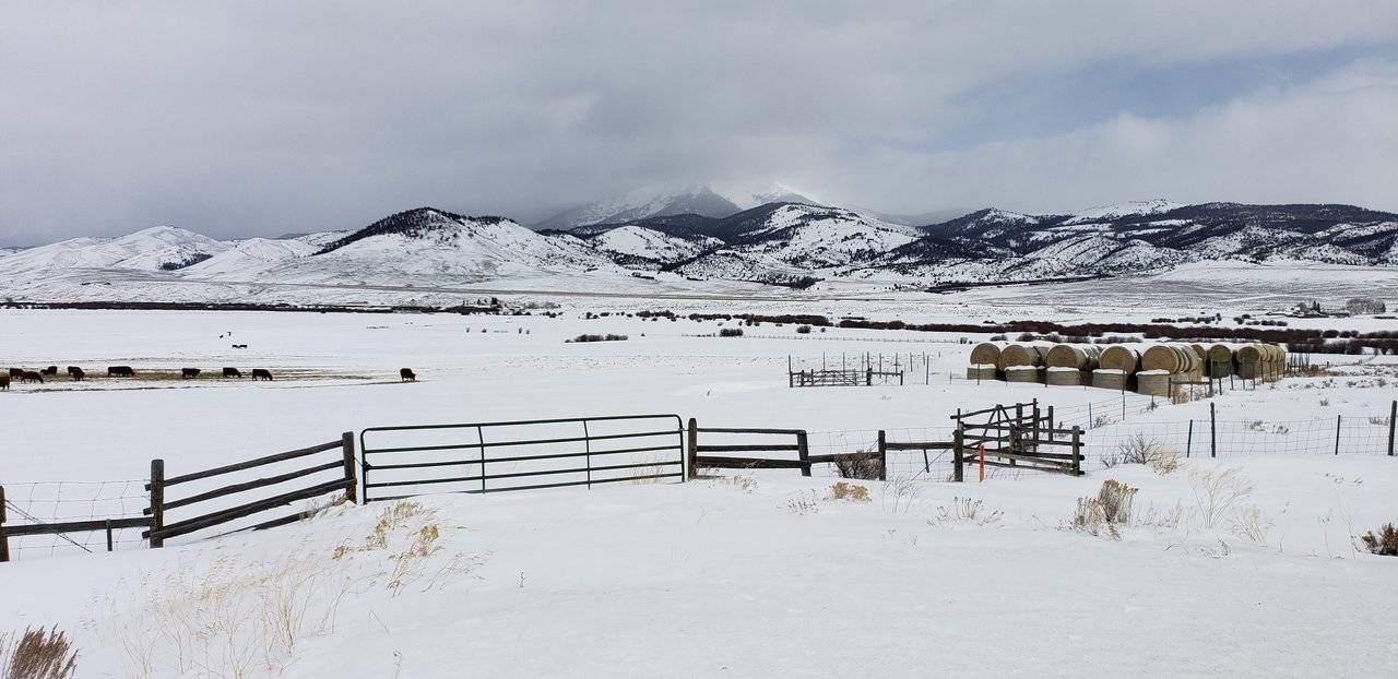
Photos: Feeding Livestock in Big Hole Valley
Needed in the winter? To do what? Keep all the livestock alive! I don't know the schedule, i.e. if once daily is sufficient or twice daily, but these ranchers have to go out in whatever winter weather exists to get these bales of hay distributed across their fields for their livestock to eat.
Imagine what effort that takes! In severe winter storm conditions, this can become literally a life-or-death struggle, as the ranchers know their livestock are dependent upon them for their food. If they can eat, it is remarkable what weather conditions these animals can withstand. Even the young animals, some of them still nursing ...
You talk about hardy / tough ... Apt description for both the animals and the people who care for them! The next time you are sitting in your favorite fast food establishment, enjoying a hamburger, perhaps some of these images and descriptions will come to mind on "what it takes" ...
Heading south out of the little town of Wisdom, you are driving on Montana State Highway 278. The only other town in this big valley is Jackson:
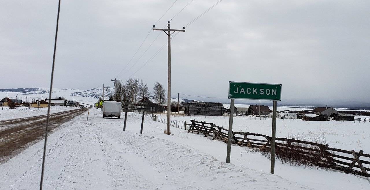
Photo: Town of Jackson, Montana
Given the wary look I was receiving by some of the people as I pulled into town and the fact there is very little to it, I did not take more than this picture. I am sure there are even fewer people here, than in the town of Wisdom up the road.
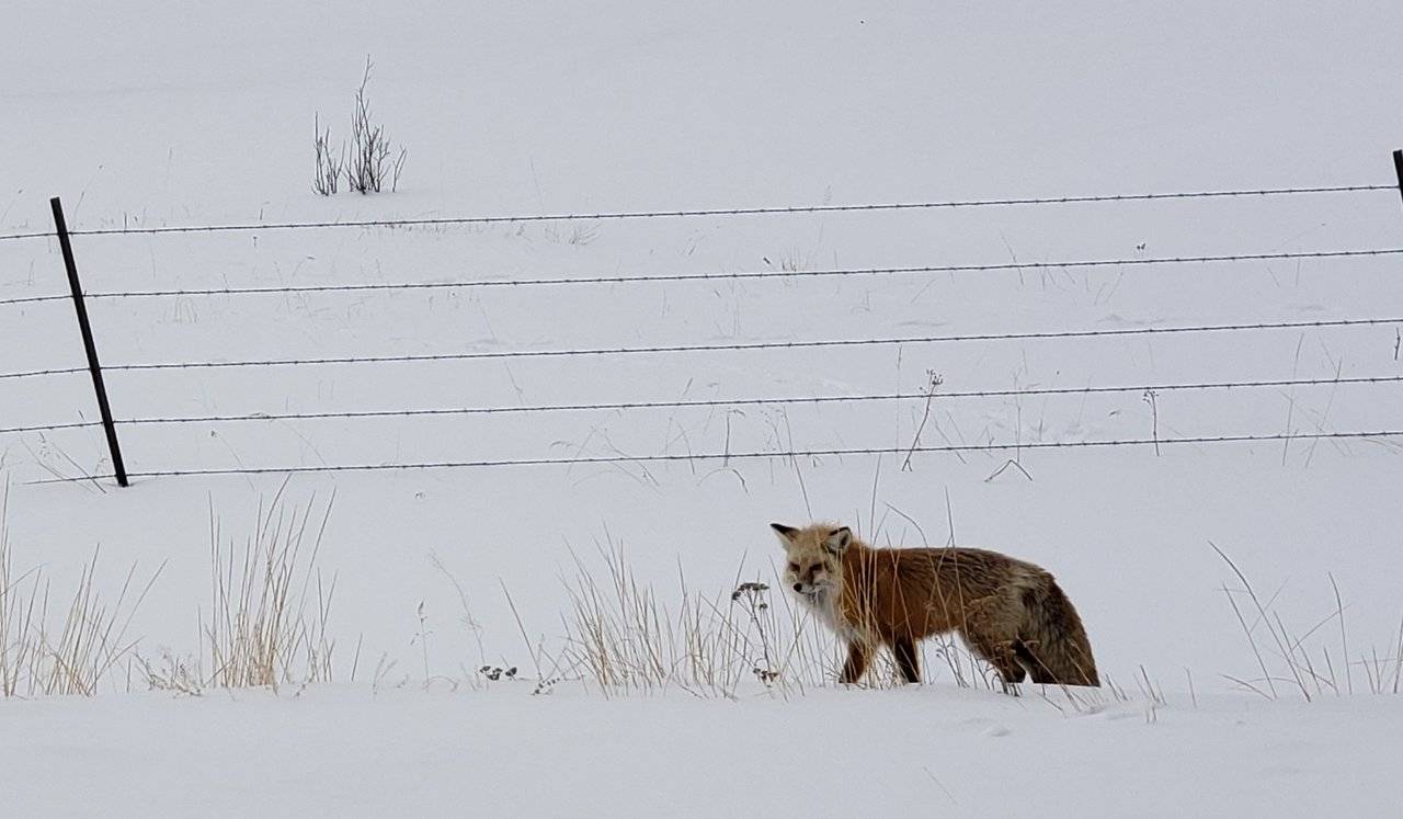
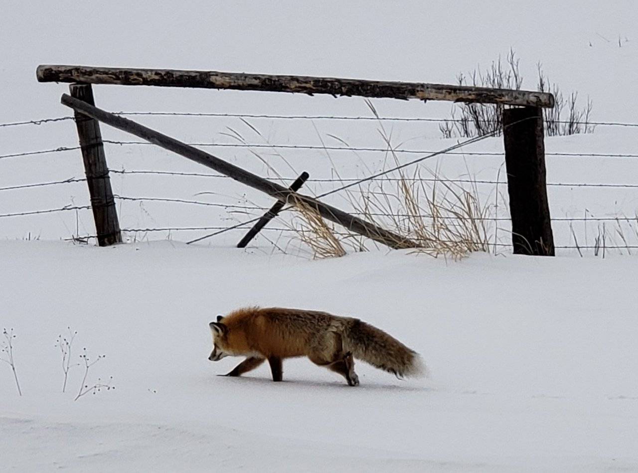
Photos: Red Fox in the Big Hole Valley
Just past the town of Jackson, out of the corner of my eye, I noticed a color behind some bushes, which seemed out of place. On slowing down to check it out, this little red fox appeared!
While I have unfortunately seen dead ones alongside country roads, I do not recall ever seeing a live one, before now. It surprised me how little notice it appeared to give me being there just a short distance away. I am thankful for that, though, so I could take these pictures!

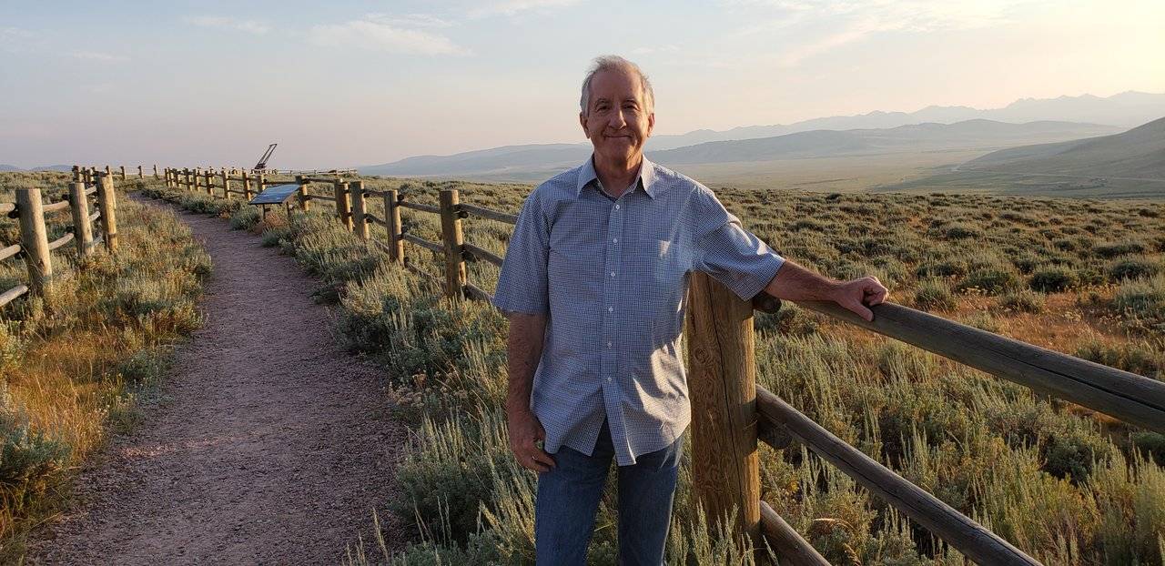
Photos: @roleerob was here!
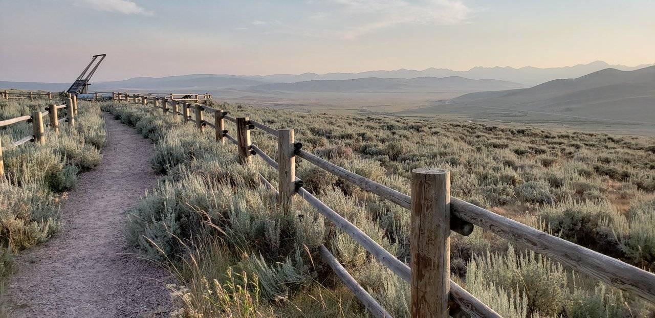
South End of the Big Hole Valley, Montana
One last final look at the South end of the Big Hole Valley was provided at a very nicely done little overlook, just before you cross over Big Hole Pass on Montana Highway 278. As we can see, the time of the year you choose to visit does have a little bit to do with your perspective as to how nice it is ... 😉
I trust you have enjoyed seeing this part of America which is not well known to most. As this series of posts on my "excellent adventure" indicate, dear reader, I do like history. And this little valley has a lot of it.
If your travels ever bring you anywhere close to it, I hope you now have some motivation to drive through it and experience it for yourself.
Traveling To and From the Big Hole Valley
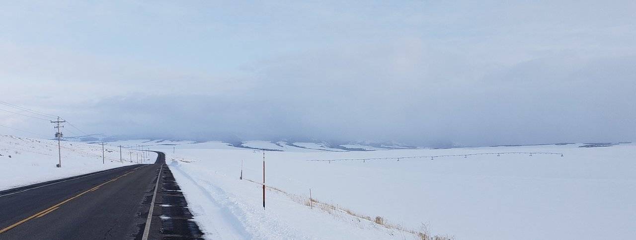
Leaving Hamilton in the morning, this is the first picture I took:
Photo: Wintry Day in Hamilton, Montana
It was very cold and the cloud cover was covering most of the surrounding mountains. I knew seeing the Bitterroot Mountains and the Bitterroot River valley was just not going to happen ...
Hamilton is a wonderful town in rural America, so I was saddened that I really couldn't even get started to do justice to bring it to you, in this post.
Source: City-Data Website for Hamilton, Montana
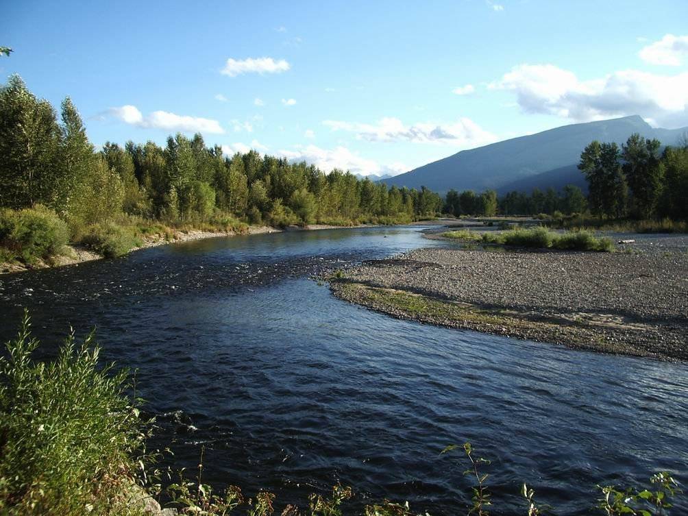
Just to "whet your appetite" should you ever be anywhere near here, this picture shows the Bitterroot River from the Hamilton City park! 😊
Before heading up into the mountains and over Lost Trail Pass, I drove through the little town of Darby:
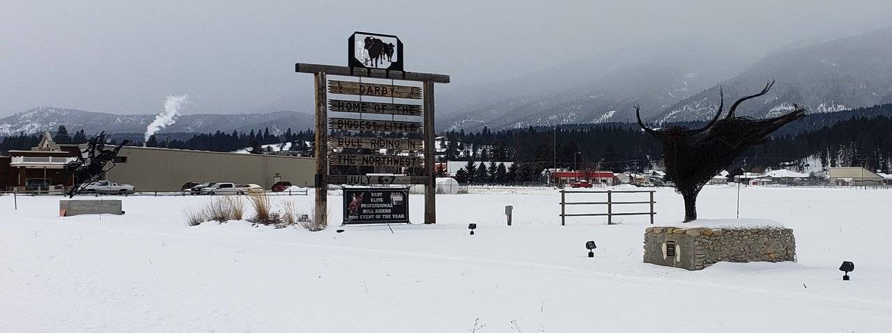
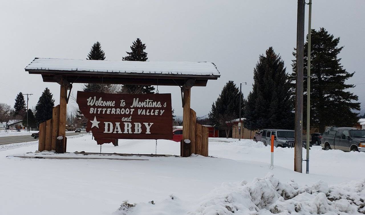
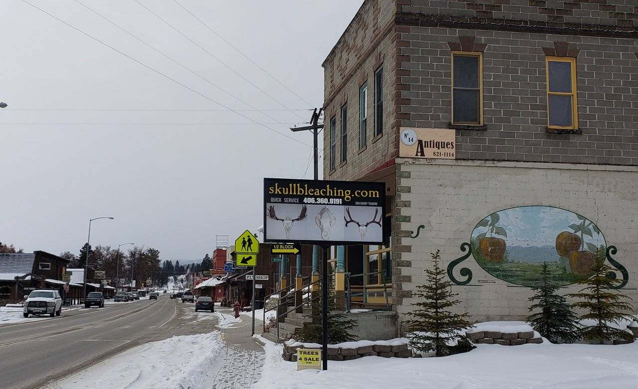
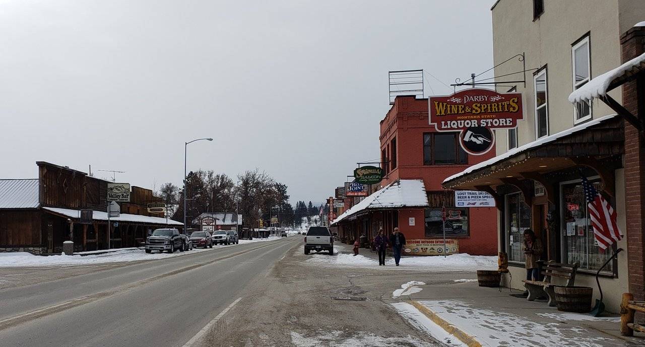
Photos: Town of Darby, Montana
Skull bleaching?! Yikes!! Whatever that is, they do it quickly ... 😉
Like many towns in America, whether thriving or not, you are very likely to find a "wine & spirits" business that is doing okay ...
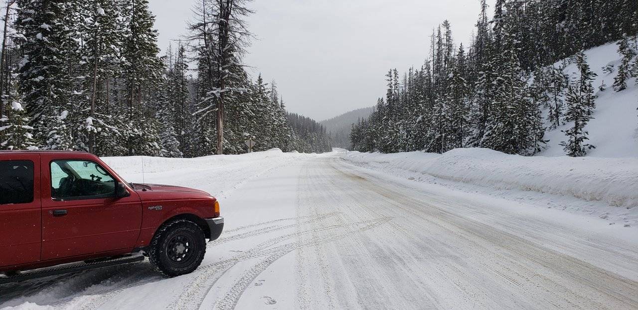
Once leaving Darby, I continued on up U.S. Highway 93 to the Lost Trail Pass.
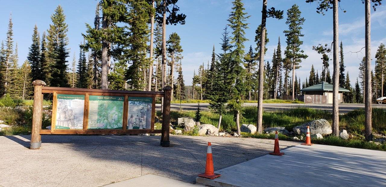

Photos: Lost Trail Pass
Here we see, in "happier times" what this pass looks like and, then, what I saw going through here on Day Twenty Nine. The vast majority of people travelling these roads continue on down into the beautiful country along the famous Salmon River - the "River of No Return" - in Idaho on U. S. Highway 93.
Not our @roleerob (I've been down in the Salmon River area many times ...)! He took the "road less traveled" on Montana State Highway 43 down into the Big Hole Valley.
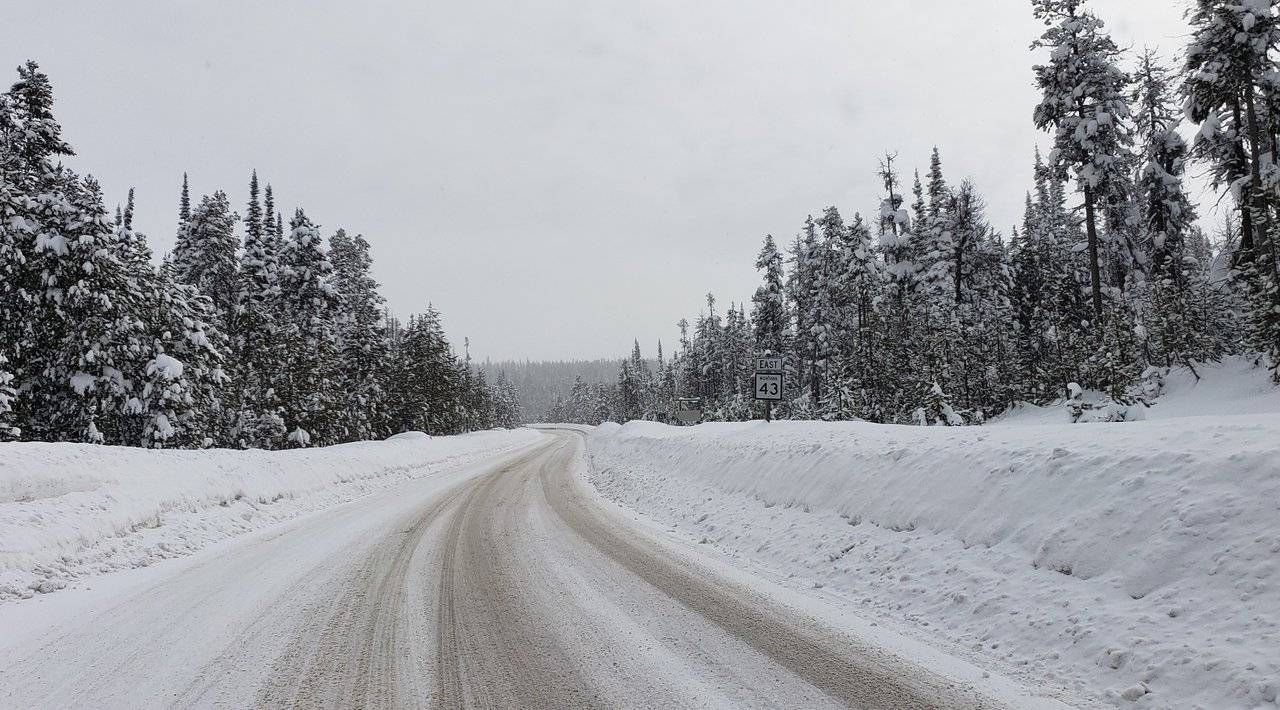
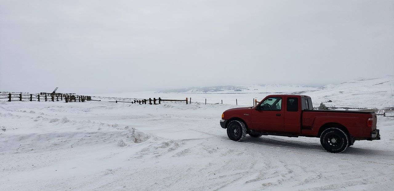
Photos: Hwy 43 into Big Hole Valley, Montana
You'll note, dear reader, how rude I was creating a "traffic jam" blocking all that traffic 😧, while I stopped on the highway to get out and take some pictures. "You gotta do what you gotta do," if you are gathering materials for your Steem blockchain posts! 😉
With that, on down into the Big Hole Valley as detailed above ...
Leaving the Big Hole Valley, I next came to a surprising sign:

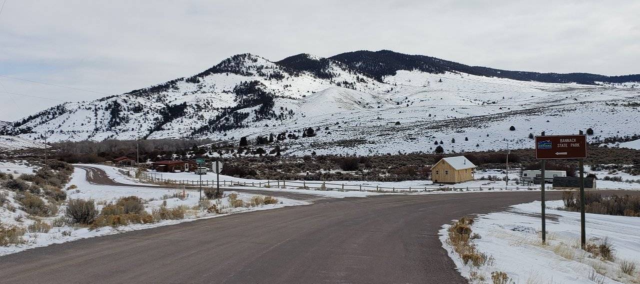
Photos: Bannock State Park
Now, as an American well acquainted with the West, my perspective on "nothing" and say, my dear European friend @delishtreats' view of "nothing" I am sure are quite different. However, even for me, looking out to the South, I really could see almost nothing ...
Nonetheless ... 😉 Not knowing when I would ever be this way again, I turned around and went on down this very rural road to find out what Bannock State Park was all about.
Well, there truly is nothing there - it is literally a ghost town! Established in 1862, at the height of a gold rush, it was the first capital of ... not the State of Montana, but the Territory of Montana, i.e. before it became a state ...
I think for many, the idea of a ghost town is hard to fathom. In my "old life," however, working for 20 years in the mining industry, I have seen many. Before the days of the "social safety nets" we take for granted today, the reason for the creation of these was pretty basic. When the mining prospects "dried up," then you either "moved on down the highway" or literally faced starving to death. No one was going to be there to "bail you out." Except perhaps some benevolent neighbors ... I can imagine that the more people "moved on" the greater the pressure became on those who had yet to make up their minds ...
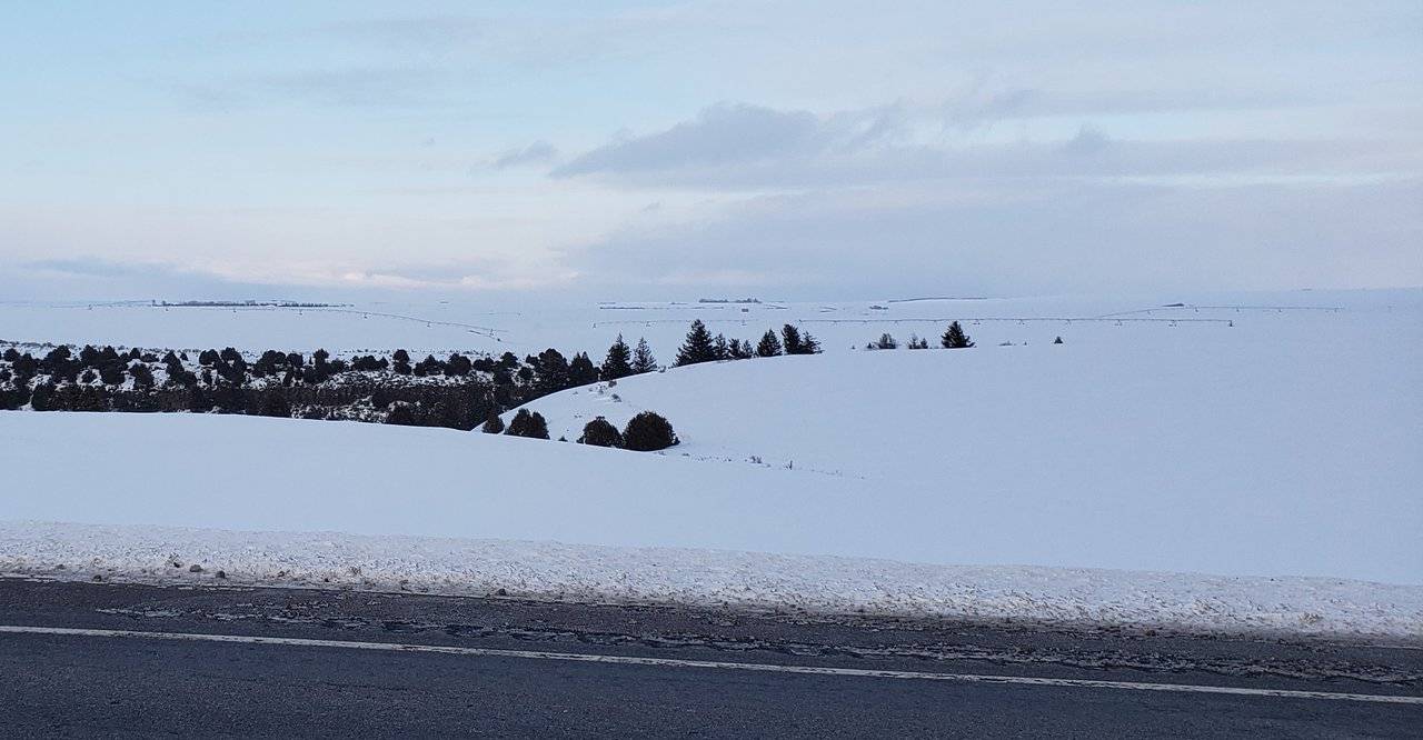
Once reaching Interstate 15, I got a fresh reminder about why Montana is referred to as "Big Sky Country." You are traveling through one of the largest and most diverse states in America. In many places, you can see a long, long way off ...
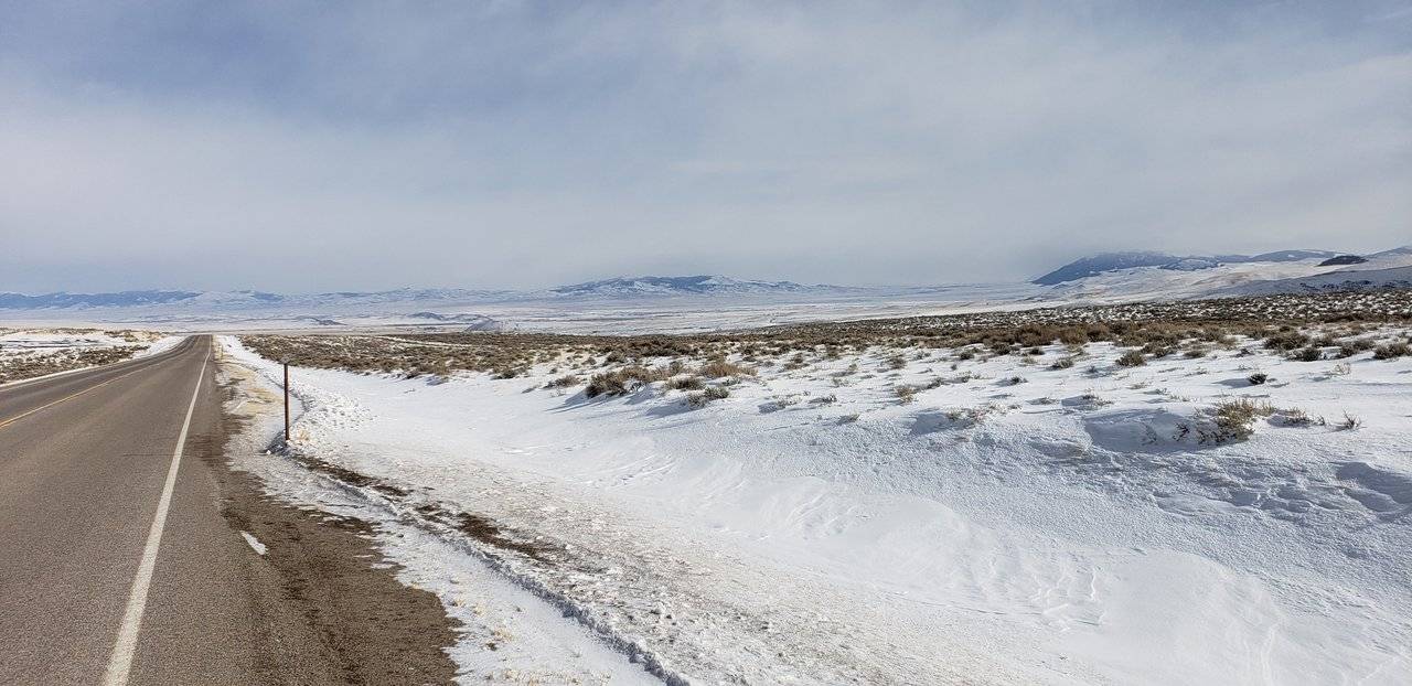
Photo: Montana - "Big Sky Country"
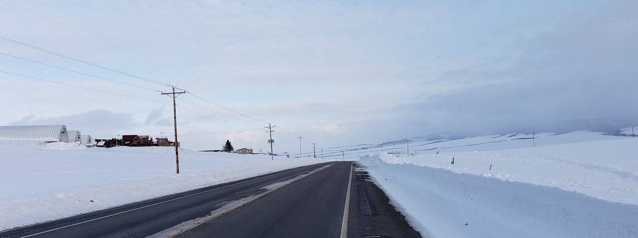
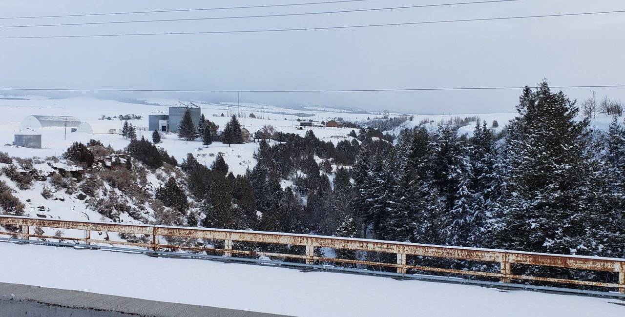
Moving on down into Idaho, I needed to leave Interstate 15 to get to my final destination for the day - Jackson Hole, Wyoming.
Illustration: Route for Second Half of Day Twenty Nine
This route takes you through another very productive farming region of America - the "potato capital" of the country, i.e. Idaho. I put this in quotes, as I am sure it can be debated. For example, Maine at one time held this title, but I believe it was forfeited long ago. Here's a link to 2018 stats ...
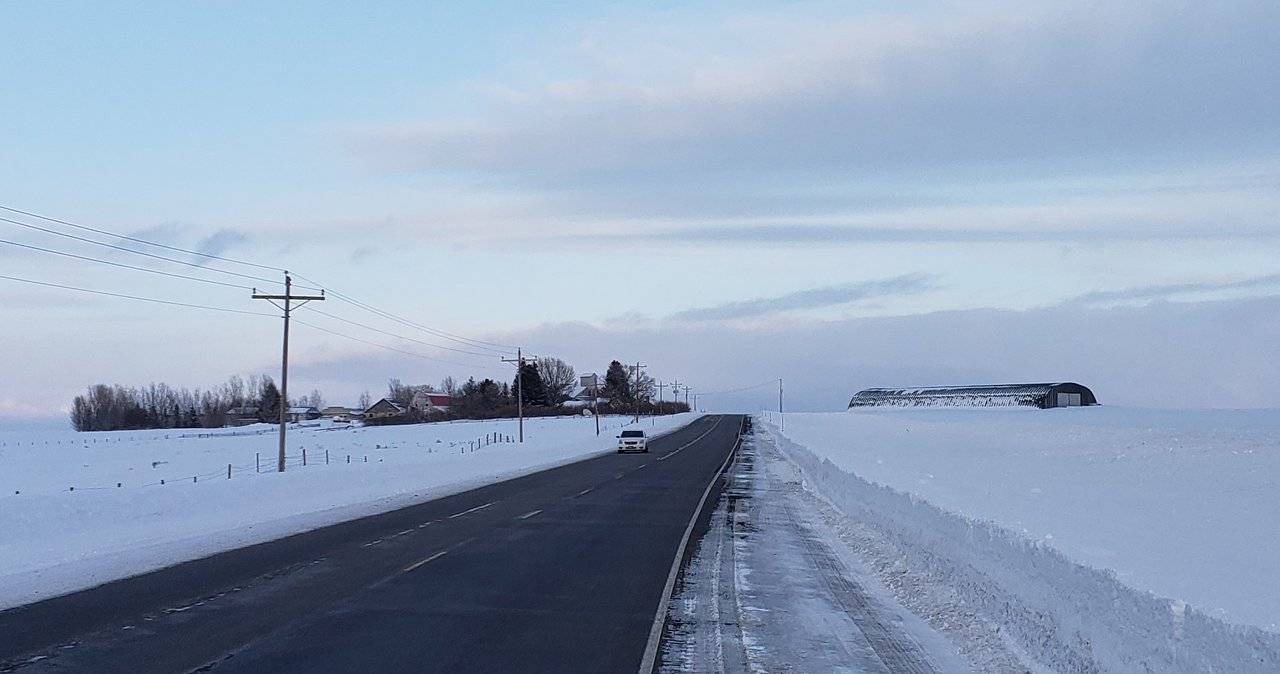
Photos: Potato Farming in Idaho's Fremont County
This part of Idaho is almost a miniature version of the Palouse Region of Washington I posted on a few days ago. In particular, they share the trait of having very deep, rich volcanic soil. And rolling hills. There is, however, one very notable difference ...
While this may not be familiar to my readers, the irrigation pivot systems in these photos are unmistakable indications of the need for irrigation to produce this crop in Idaho. There simply is not enough rainfall in this area.
This whole region could easily support its own post. It sits on the western side of the famous Grand Tetons and has many attractions. I had neither the opportunity to take more pictures, nor was this the right time of year to properly cover the subject.
Postscript on Day Twenty Nine
Against the optimum for my traveling, this day ended with driving in the dark again (detour to Bannock probably should have been skipped ...). Finishing up in Jackson Hole, Wyoming, after crossing over Teton Pass - a "dangerous road" according to this website, while also listed as one of "the world's most spectacular roads."
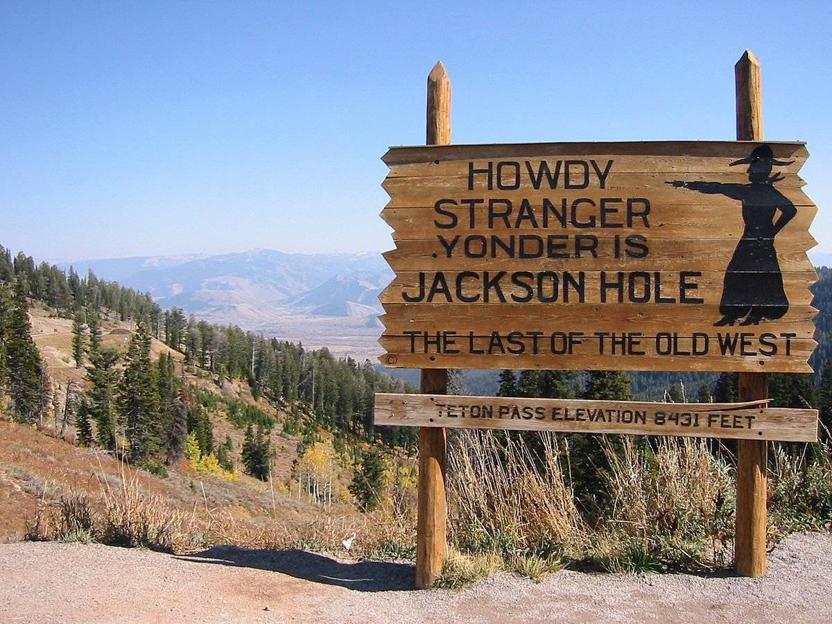
Source: Wikipedia - Teton Pass, Wyoming
At an elevation of 8,431 feet (2.570 m), driving over it in the dark, with it being snowpacked and icy up and down over steep grades, I'd put it more in the former category, than the latter. At least on this trip over it ...
It definitely is beautiful, in the right conditions, and you are crossing over into one of the most beautiful places in America. Jackson Hole, Wyoming sits in close proximity to the internationally famous Grand Tetons and Yellowstone National Park.
- Trivia Note: It was remarkable to me how many vehicles were on this stretch of highway leaving Jackson Hole 😧 and heading into Idaho. While I don't know for certain, I believe it was workers in the Jackson Hole area leaving for the evening to get to their homes on the other side of this pass. Jackson Hole is a very expensive place to live. If true, I would hate to think what it is like commuting back and forth to work every day across this pass ...
It was snowing by the time I arrived in Jackson Hole and the forecast was for more of the same in the morning. The "ceiling" of the resulting cloud cover was very low. I was unable to see the Grand Tetons from the Idaho side of them looking east. At the end of the day, I was facing the prospect of not being able to see them at all on this trip ... 😞
Closing
All things considered, within the limitations of taking a trip like this in the winter, another great day in "@roleerob's excellent adventure." Definitely ready to be back home, though, and out of needing to drive so much in this weather!
Thanks for going along with me, dear reader. I’d love to hear any feedback you may be inspired to provide.
Until "next time," all the best to you for a better tomorrow, as we all work together to build our Steem Community! 👍 😊
Respectfully,
Steemian @roleerob
Posted using SteemPeak and “immutably enshrined in the blockchain” on Saturday, 23 February 2019!
Ready to Blog & Earn?
With TravelFeed, easily start your own travel blog and earn as you go. It's the smart platform for travelers who want to profit from their passion. Create a free account
"R2R" Note: My "shorthand" way of referring to what I first wrote about in my Reflections: My "Road to Recovery" Trip post. "Road to Recovery" <=> "R2R" ... 😉
Image sources, unless otherwise noted: My trusty smartphone!


Don't Forget: Get Travel Health Insurance!
To make your trip a worry-free experience, TravelFeed recommends SafetyWing Nomad Insurance. It provides comprehensive health coverage while you travel, so you can focus on exploring, not the unexpected. Get a quote here
If you liked this post, you might enjoy others in my "Road to Recovery" Travelogue series:
- Travelogue, Day 1: Ribeye, Colorado
- Travelogue, Day 2: Navajo Nation and Canyon de Chelly - Awarded by c-cubed, c-squared, steemitworldmap, traveldigest, and trufflepig! 😊
- Travelogue, Day 3: Mogollon Rim, Copper Belt, and Sonora Desert - Awarded by trufflepig again!
- Travelogue, Day 4: Catalina State Park in Tuscon, Arizona - Awarded by c-squared, steemitworldmap, and traveldigest! 😊
- Travelogue, Day 5: Baboquivari, Sacred Peak in Arizona - Awarded by steemitworldmap and trufflepig! 😊
- Travelogue, Day 5: Organ Pipe National Monument in Arizona - Awarded by c-squared, steemitworldmap, traveldigest, and trufflepig! 😊
- Travelogue, Day 6: Reaching the Ocean - Awarded by travelfeed and trufflepig! 😊
- Travelogue, Day 7: Sabbath Rest and Morro Bay, California - Awarded by steemitworldmap, traveldigest, and trufflepig! 😊
- Travelogue, Day 8: Hearst Castle in San Simeon, California - Awarded by steemitworldmap and traveldigest! 😊
- Travelogue, Day 9: Monterey Peninsula of California - Awarded by steemitworldmap and travelfeed! 😊
- Travelogue, Day 10: Redwood Hill Farms and Sonoma County, California - Awarded by steemitworldmap and traveldigest! 😊
- Travelogue, Day 10: Sonoma Coast State Park of California - Awarded by steemitworldmap and traveldigest! 😊
- Travelogue, Day 11: Mendocino, California - Awarded by steemitworldmap and traveldigest! 😊
- Travelogue, Day 12: Redwood Forests of Northern California - Awarded by steemitworldmap, traveldigest, and trufflepig! 😊
- Travelogue, Day 13: Rogue River Gorge in Oregon - Awarded by steemitworldmap and traveldigest! 😊
- Travelogue, Day 20: Oregon Scenic Byway to Pendleton - Awarded by O.C.D., c-cubed, c-squared, and trufflepig! 😊
- Travelogue, Day 21: The Blue Mountains and the Palouse - Awarded by c-squared! 😊
- Travelogue, Day 23: Lewiston, Idaho and the Famous Lewis & Clark Expedition - Awarded by c-squared, steemitworldmap, and traveldigest! 😊
- Travelogue, Day 24: Saint Maries, Idaho and Lake Couer 'd Alene - Awarded by O.C.D., c-squared, steemitworldmap, and traveldigest! 😊
- Travelogue, Day 26: Palouse Scenic Highway and Farmington, Washington - Awarded by O.C.D., c-squared, steemitworldmap, and traveldigest! 😊
- Travelogue, Day 28: Northwest Passage Scenic Byway. In winter ... - Awarded by O.C.D., c-squared, and steemitworldmap! 😊
Travel Resources for your trip to United States
Recommended by TravelFeed
Flights: We recommend checking Kiwi.com to find the best and cheapest flights to United States.
Accomodation: Explore the best places to stay in United States on Booking.com, Agoda and Hostelworld.
Travel Insurance: Medical emergencies abroad can be pricey, but travel health insurance is not. We always use SafetyWing for affordable and reliable coverage.
Car Rental: For hassle-free car hiring, DiscoverCars is our trusted choice with a wide selection of vehicles.
Internet: Got an eSIM compatible phone? Airalo is perfect for reliable internet access during your trip. Just install it before you go, and you're set!
Day Trips & Tours: We recommend GetYourGuide for a variety of well-organized and enjoyable activities.
Travel Planner: Need a hand planning? Our free travel planner chatbot is your personal guide to United States. Chat now.
Disclosure: Posts on TravelFeed may contain affiliate links. See affiliate disclosure.
