Last summer, I took this beautiful hike in Bacharnsdorf (municipality of Rossatz-Arnsdorf) in the Wachau valley in Lower Austria.
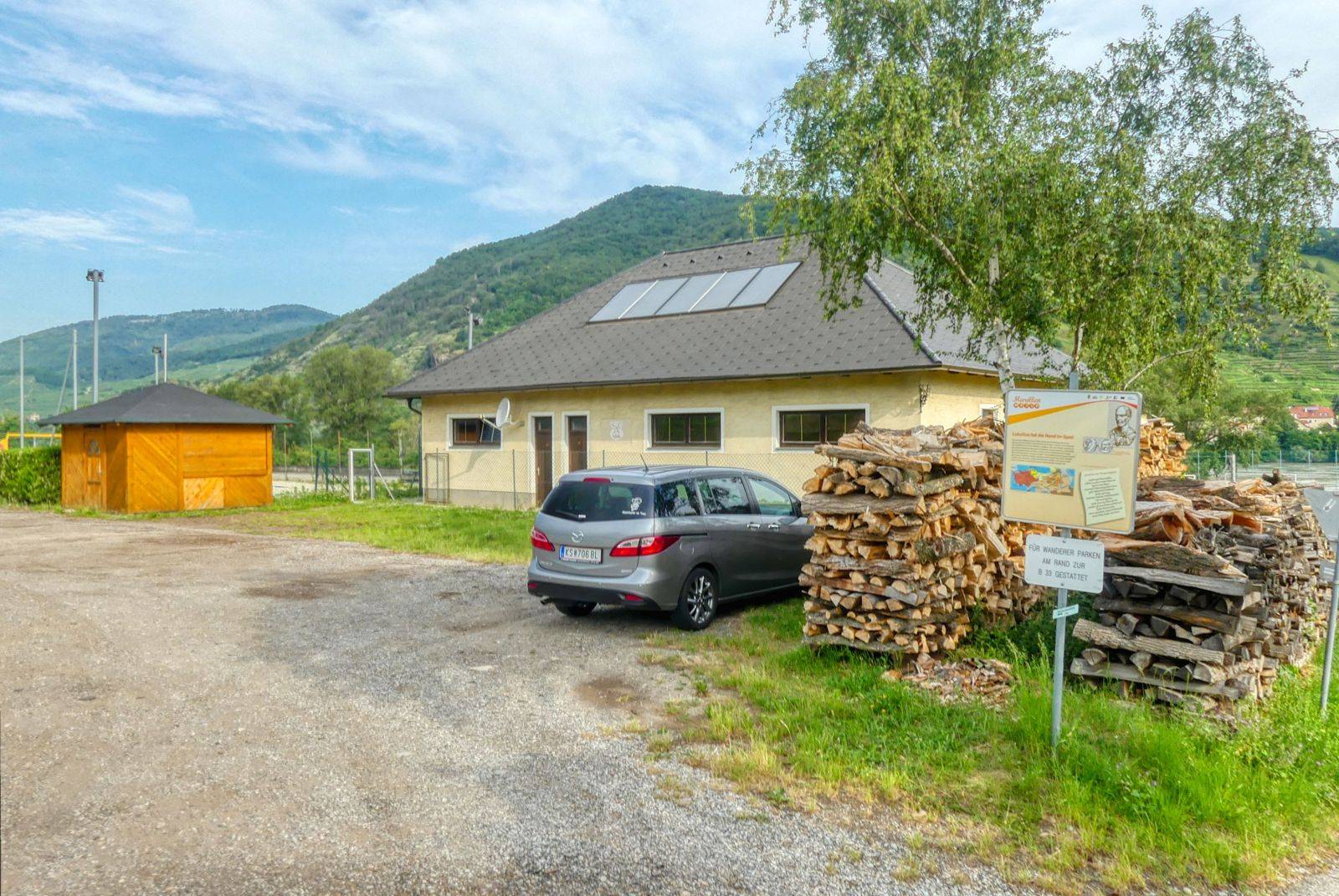
The hike starts at the sports ground of Bacharnsdorf. From there you walk down to the Danube river.
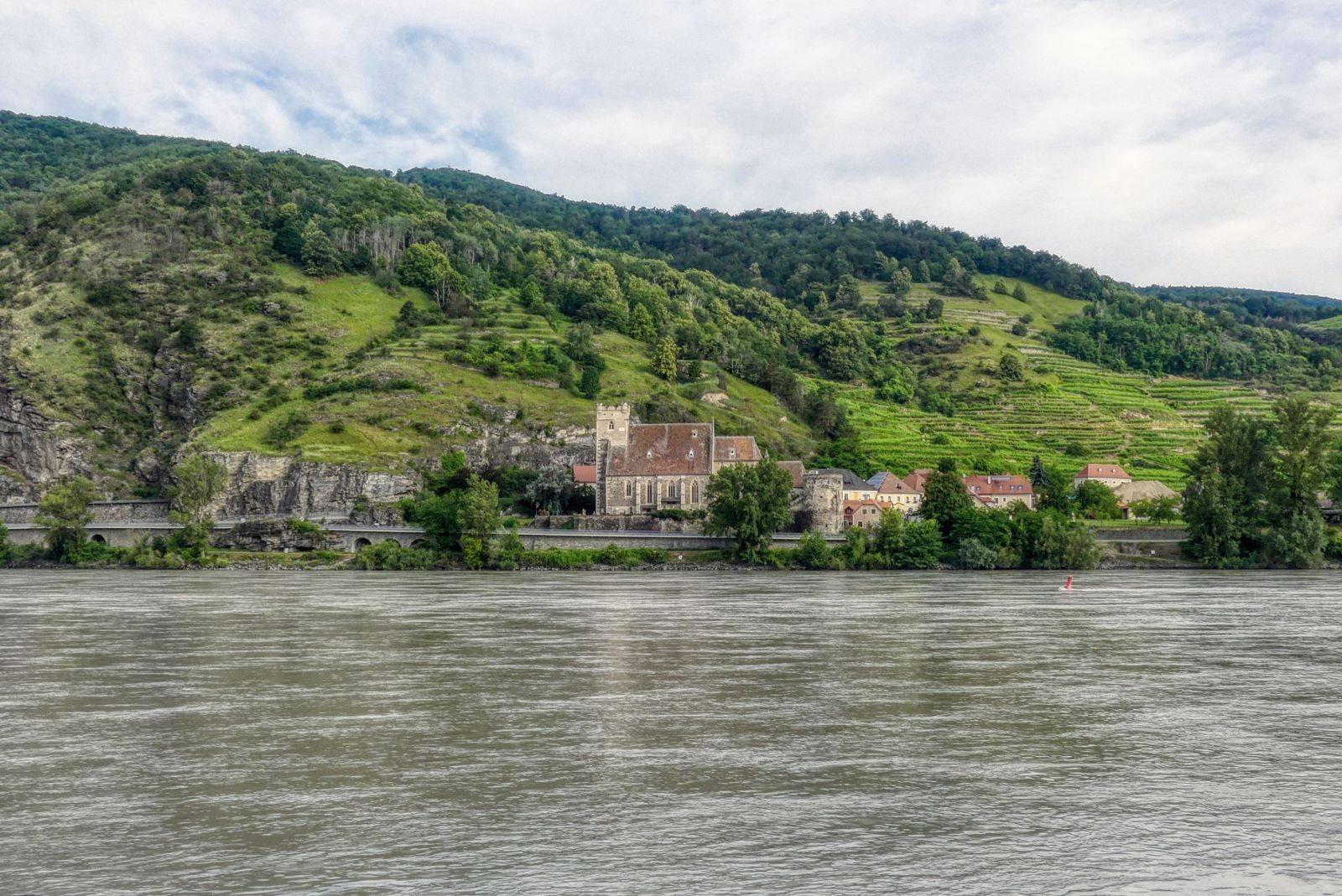
On the opposite side of the river you can see the fortified church of St. Michael. You continue your walk along the Danube in easterly direction and then turn right and walk up in the little village that has less than 40 inhabitants.
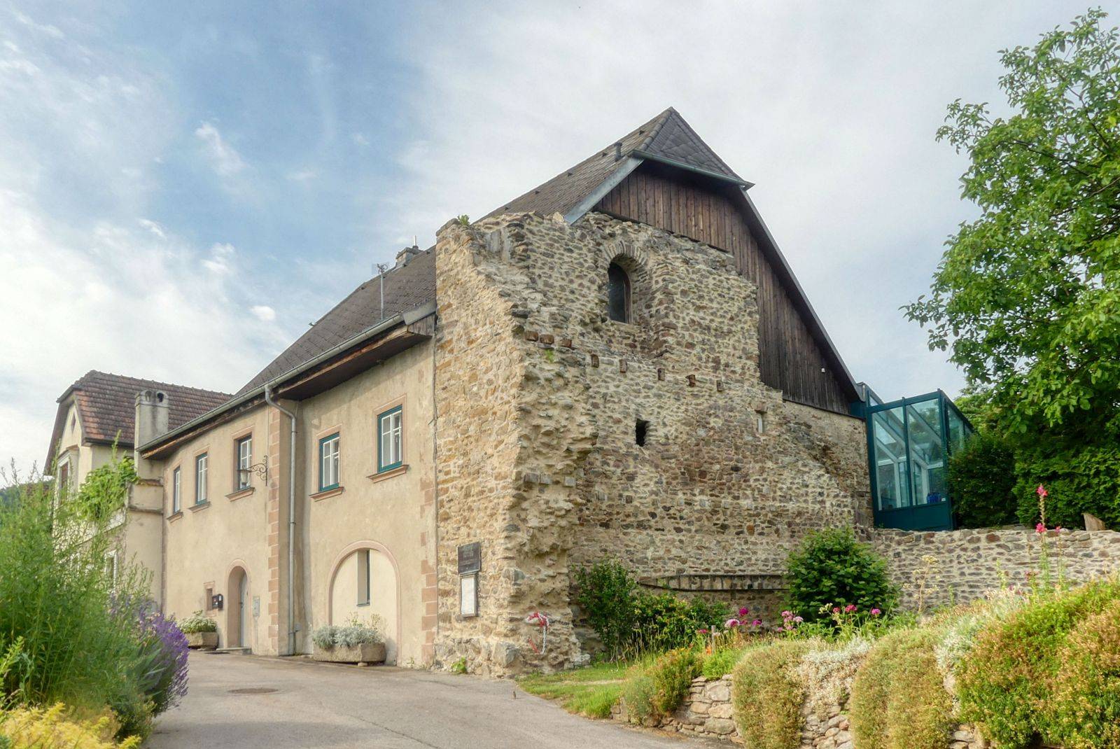
Here you see the remains of an Ancient Roman that has been built in the 4th century AD.
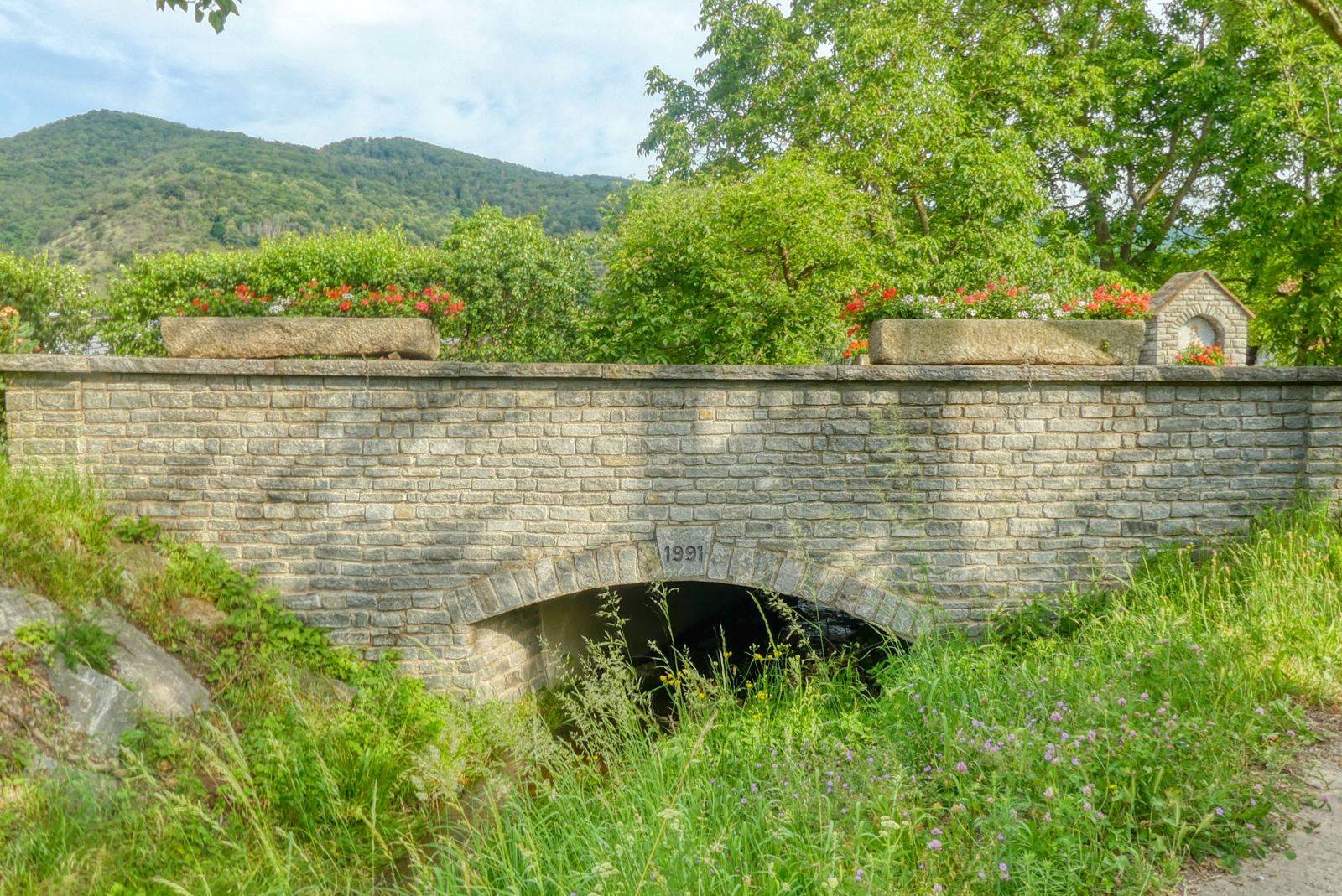
Then we cross the main street B33 at the bridge and head south left of the small creek that is called "Dürrenbach".
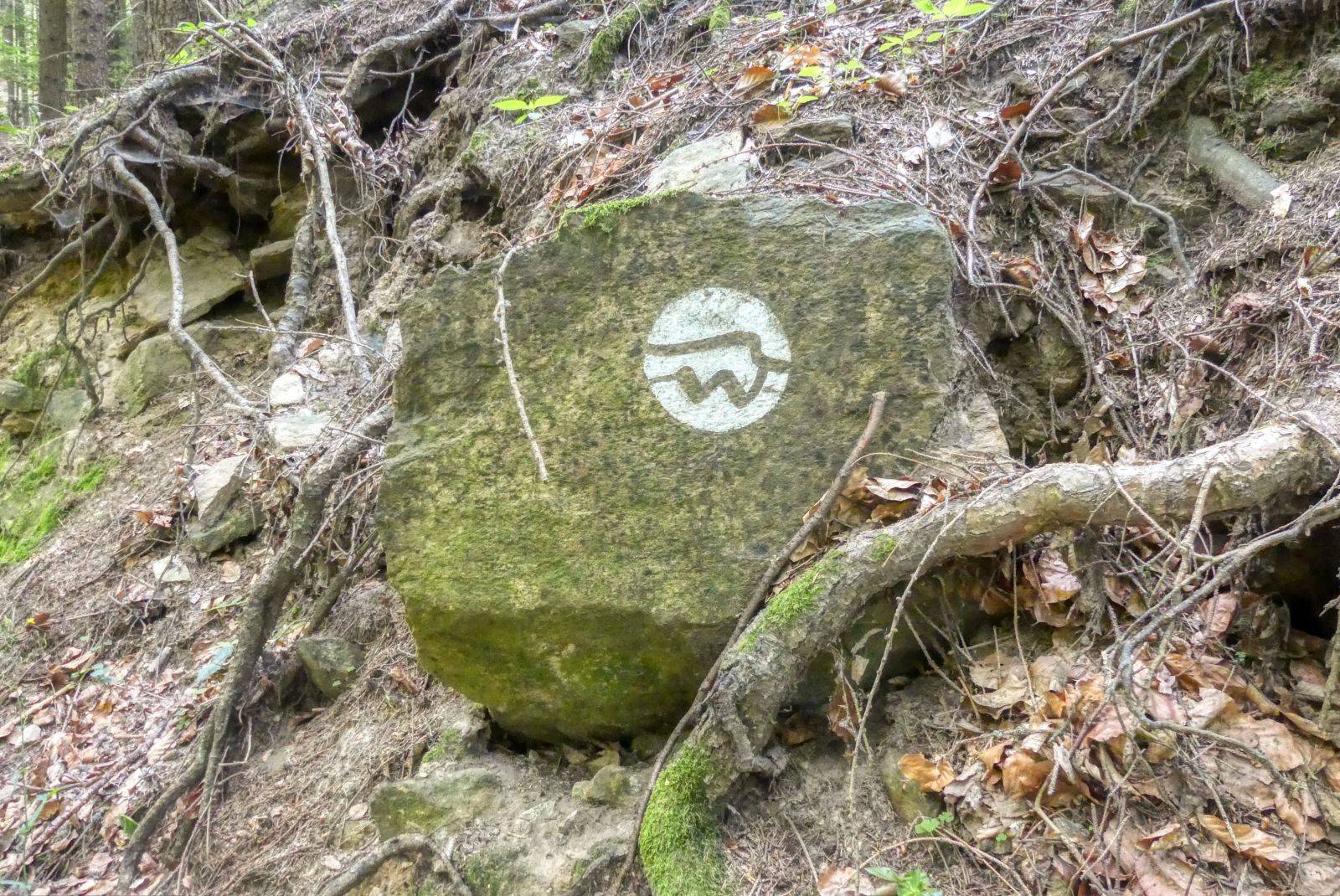
Now, you can use the Welterbesteig logo - a white circle with a symbolized wave and a "W" - for your orientation.
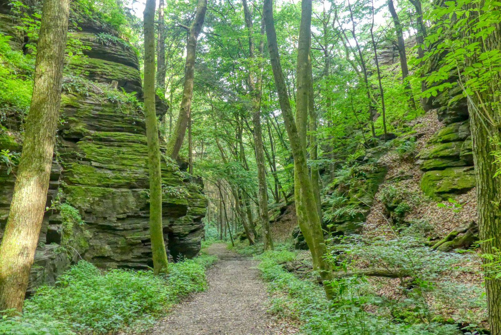
You can see amazing granite formations along the way.
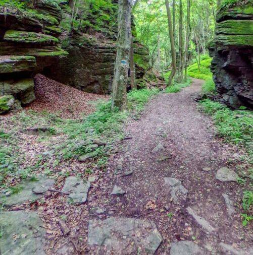
The hiking trails runs along Ancient Roman roads. Sometimes you can see these kind of rock slabs with that the Romans paved the roads.

Ready to Blog & Earn?
With TravelFeed, easily start your own travel blog and earn as you go. It's the smart platform for travelers who want to profit from their passion. Create a free account
After about one hour you reach this junction. There you turn sharp right and walk downwards to the north again.

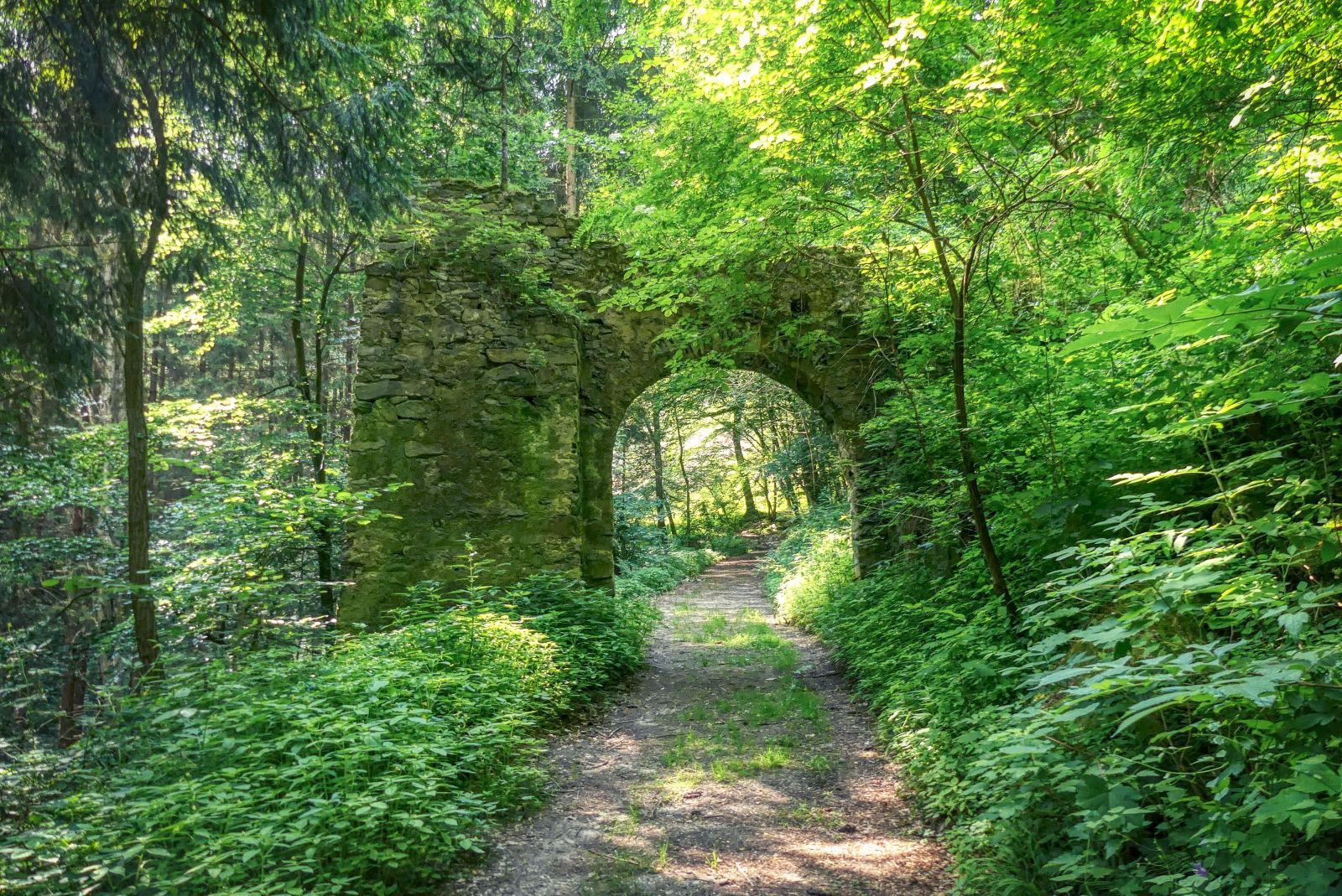
Just five minutes later you reach the "Türkentor" ("Turks' Gate"). This gate was once part of a fortification built in the 16th century as protection against the invaders from the Ottoman Empire.
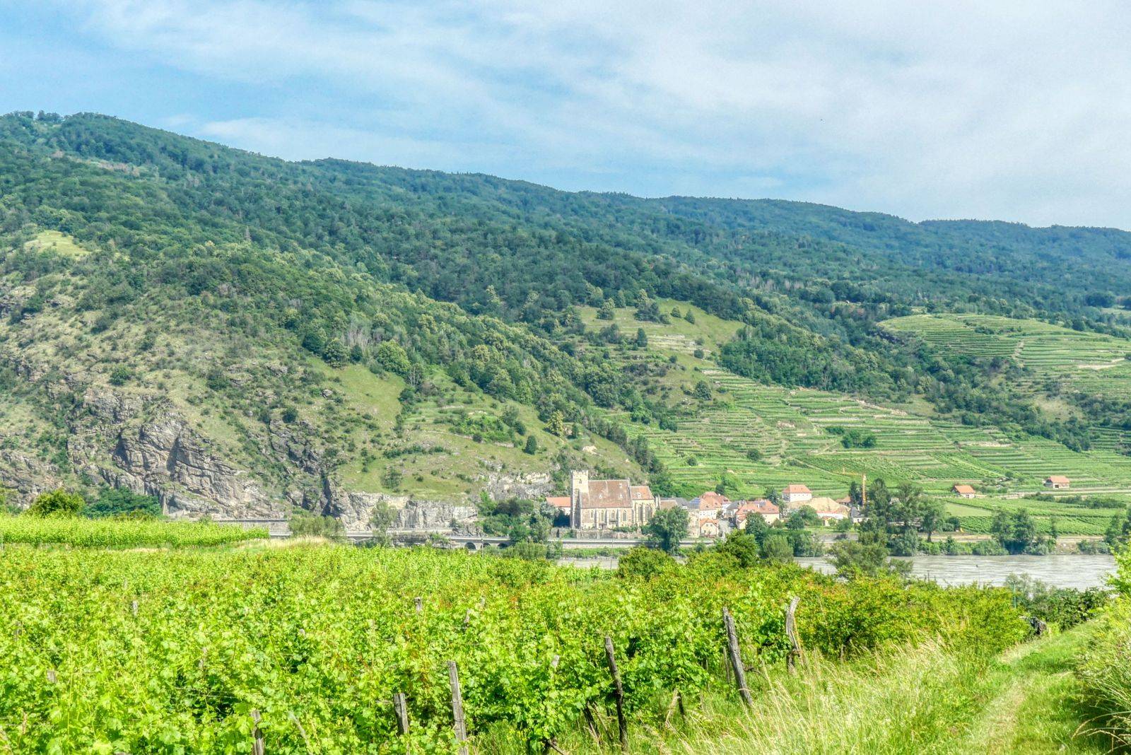
A little bit later you come to the vineyards and see the Danube again.
Don't Forget: Get Travel Health Insurance!
To make your trip a worry-free experience, TravelFeed recommends SafetyWing Nomad Insurance. It provides comprehensive health coverage while you travel, so you can focus on exploring, not the unexpected. Get a quote here
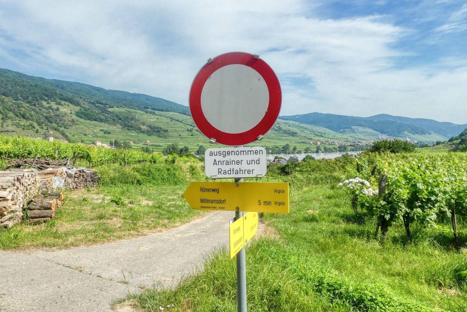
Then you reach this crossroads. Here you turn right and go back to Bacharnsdorf again.
The whole hike took me about two hours. I recommend wearing high top hiking shoes because the tracks can be slippery or even muddy.
A detailled German description including more photos and a detailled map can be found on my weblog schmatz.blog!
Travel Resources for your trip to Austria
Recommended by TravelFeed
Flights: We recommend checking Kiwi.com to find the best and cheapest flights to Austria.
Accomodation: Explore the best places to stay in Austria on Booking.com, Agoda and Hostelworld.
Travel Insurance: Medical emergencies abroad can be pricey, but travel health insurance is not. We always use SafetyWing for affordable and reliable coverage.
Car Rental: For hassle-free car hiring, DiscoverCars is our trusted choice with a wide selection of vehicles.
Internet: Got an eSIM compatible phone? Airalo is perfect for reliable internet access during your trip. Just install it before you go, and you're set!
Day Trips & Tours: We recommend GetYourGuide for a variety of well-organized and enjoyable activities.
Travel Planner: Need a hand planning? Our free travel planner chatbot is your personal guide to Austria. Chat now.
Disclosure: Posts on TravelFeed may contain affiliate links. See affiliate disclosure.
