
In this story I want to present one of the most exhausting hikes I did during the Summer of 2019 - a hike to the summits of Seekopf (671 m above sea level) and Hirschwand (620 m) near Rossatz-Arnsdorf in Lower Austria.
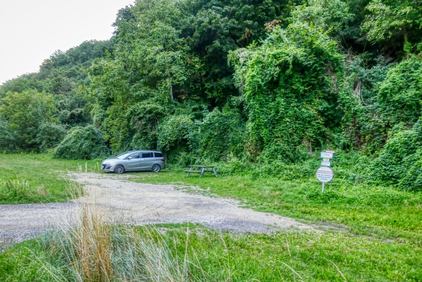
Starting point is a parking space for hikers near Oberkienstock at the B33.
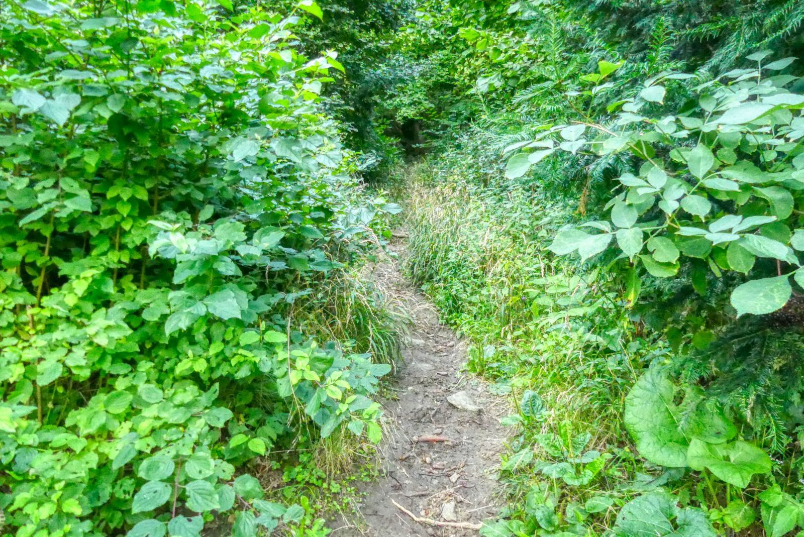
From here you walk up a very steep and narrow path called "Meurersteig", named after Julius Meurer, a famous Austrian alpinist.
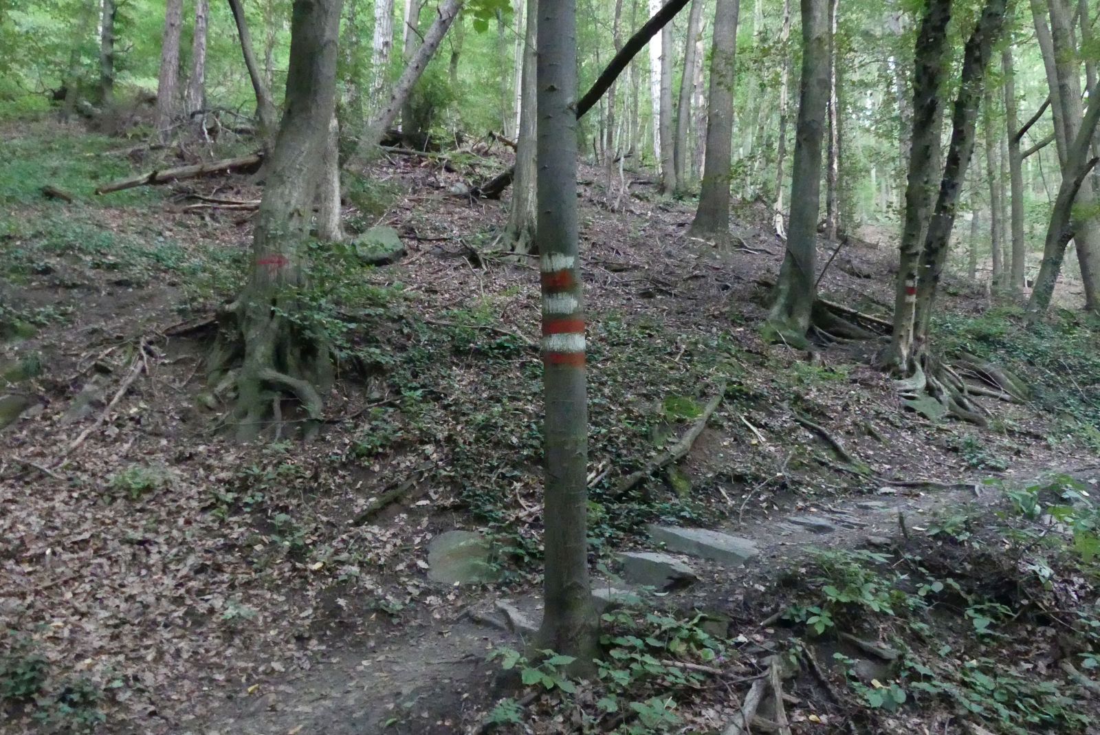
Follow the red-white-red or white-red-white marks on trees or rocks because the trail is sometimes hard to find.
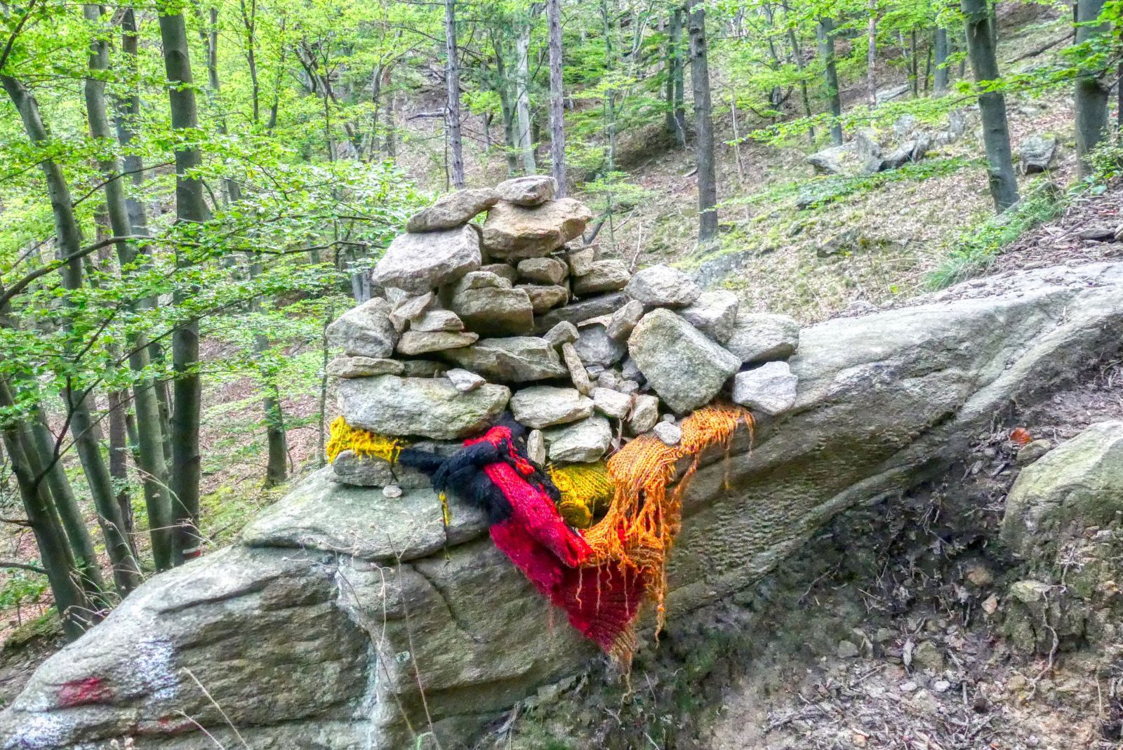
During your hike you often see these "Stoamandl" (Austrian dialect for German "Steinmännchen", meaning small men built with stones).
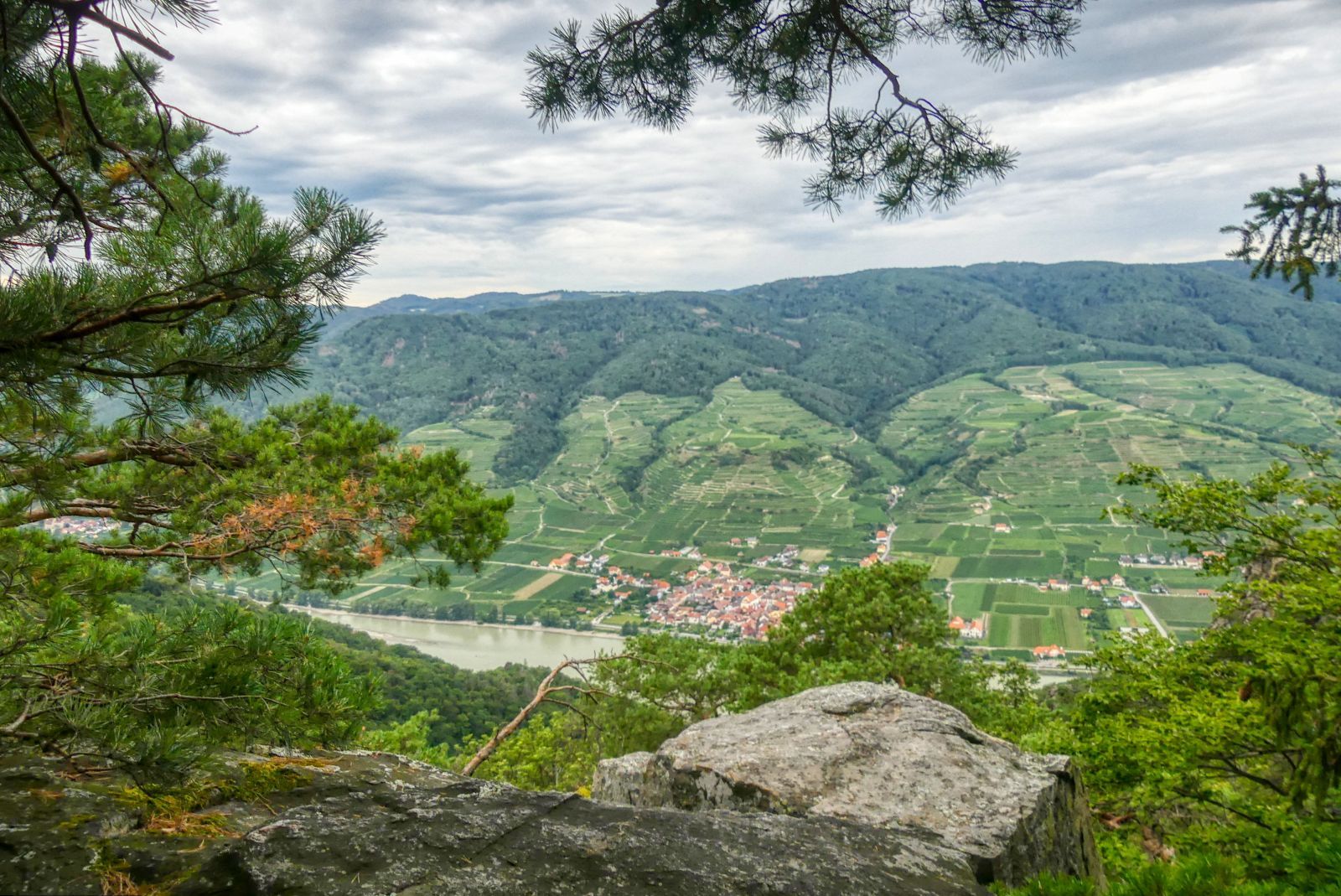
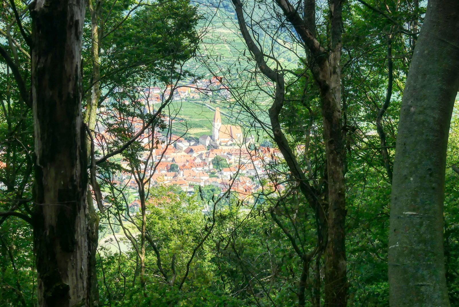
After approximately one hour walking upwards you'll have a nice view down to the valley for the first time.
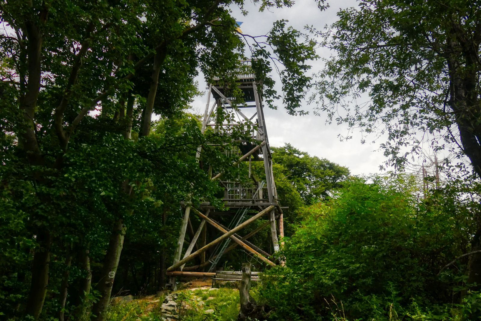
Then, after a total hiking time of 1.5 hours, you reach the first target of your hike - the lookout tower on the summit of the Seekopf. The lookout tower has been erected in 1882 for the very first time, but destroyed by a storm soon. In the years 1991-93 the Jankerlclub - a local hiking club - built a new tower.
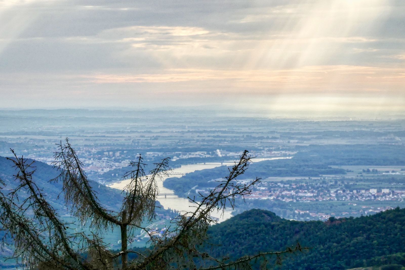
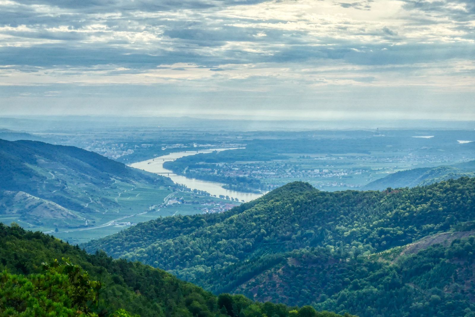
The ladders that lead upwards are steep and might be slippery after a rain. But if you dare to climb up you have a wonderful view in all directions. Here's a photo I made in eastern direction. You can see the towns of Krems an der Donau on the left and Mautern an der Donau on the right side - and all three bridges that leads over the Danube.
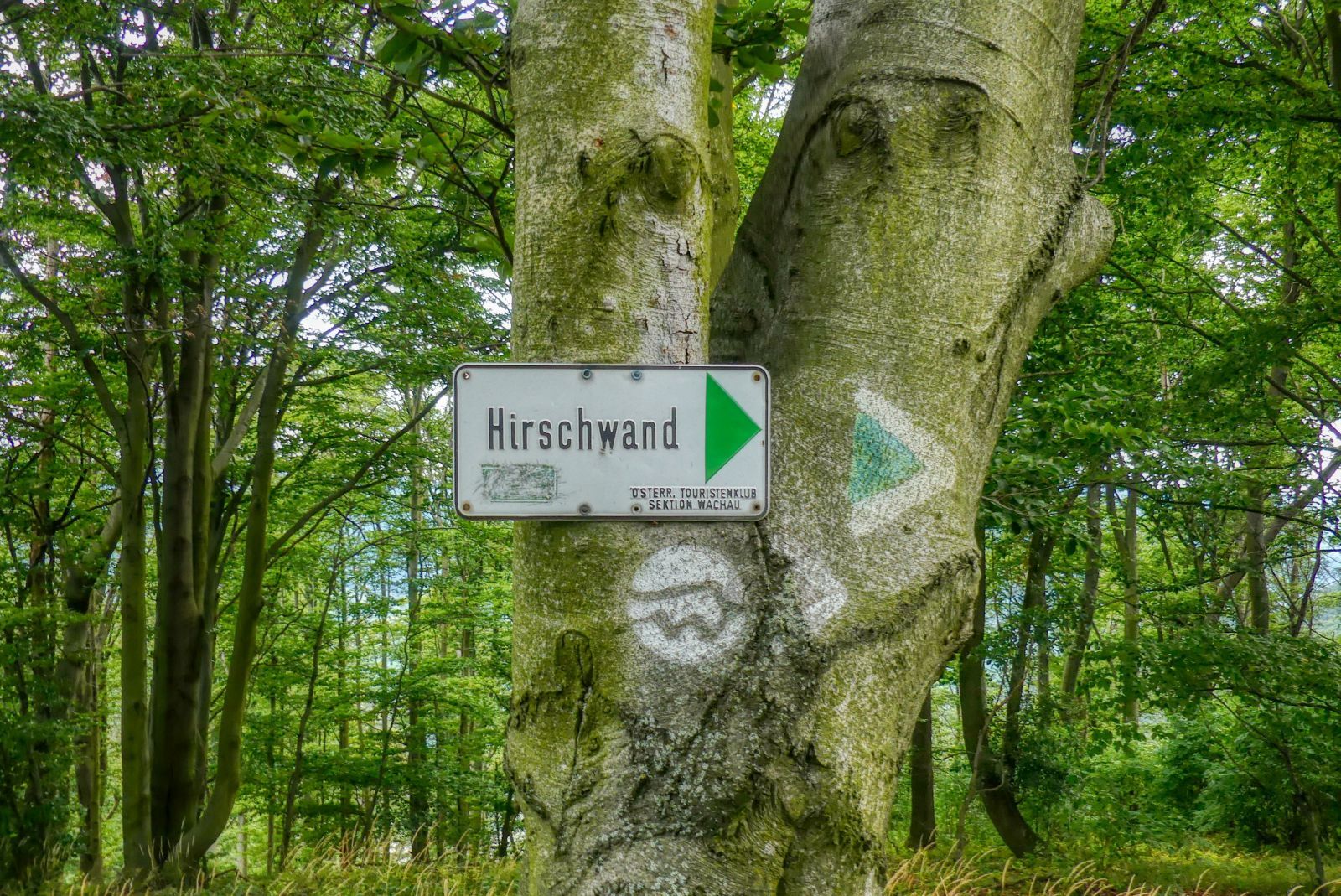
The next summit to reach is the Hirschwand. Follow the white-green-white stripes on the tree or the Welterbesteig logo - a white circle with a symbolized wave and a "W".
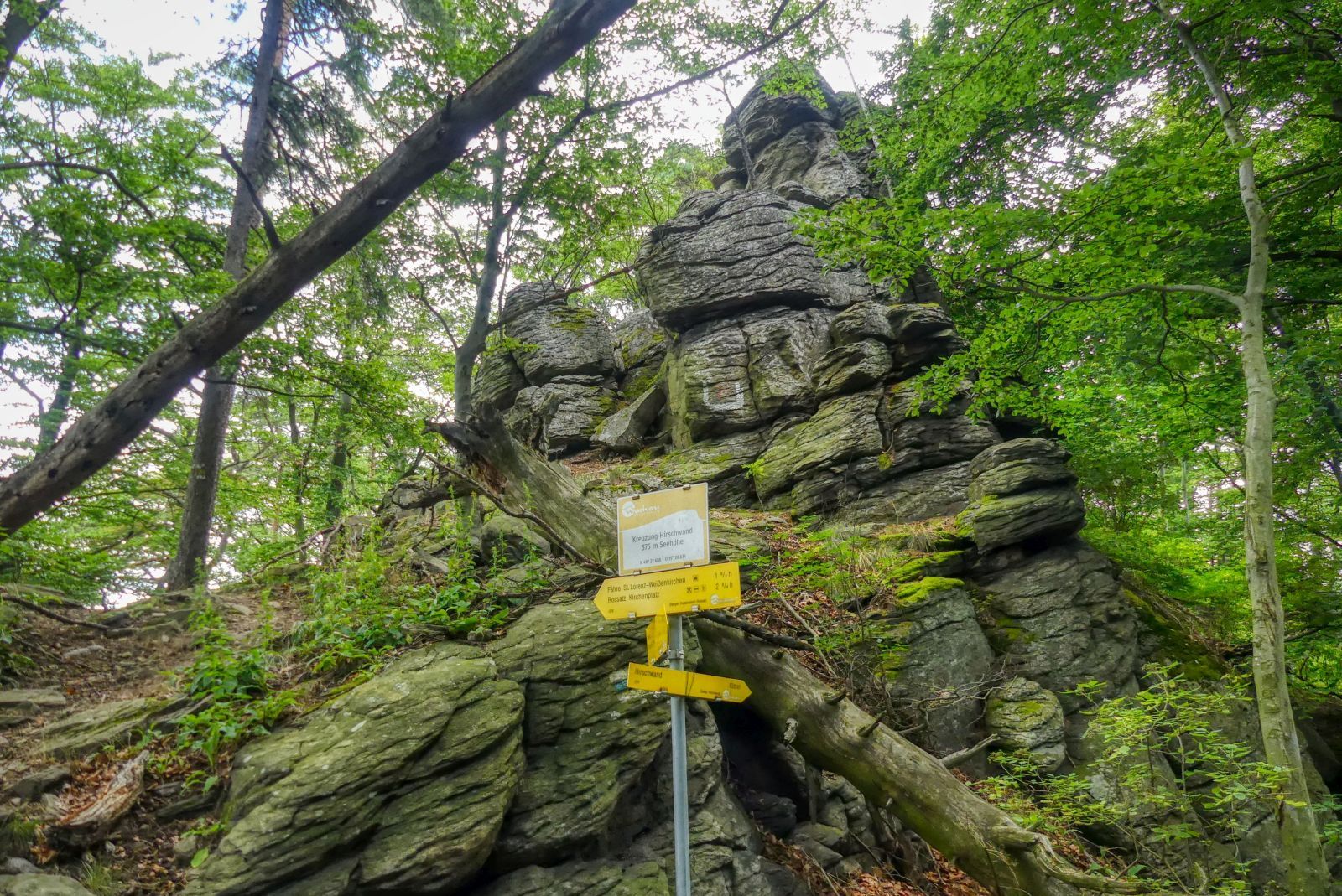
After 10 minutes you reach the "Kreuzung Hirschwand", here you can take a turnoff to the Hirschwand.
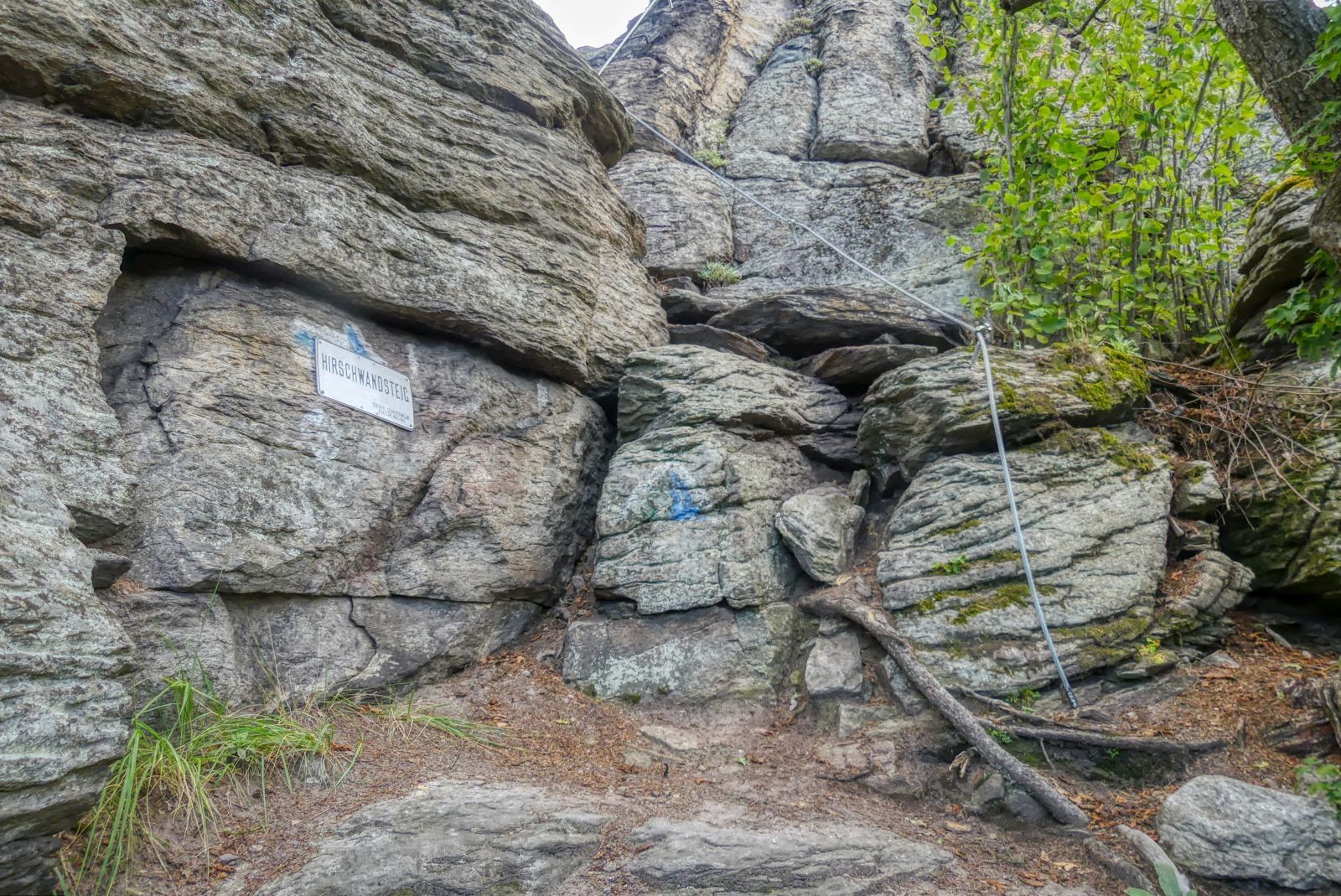
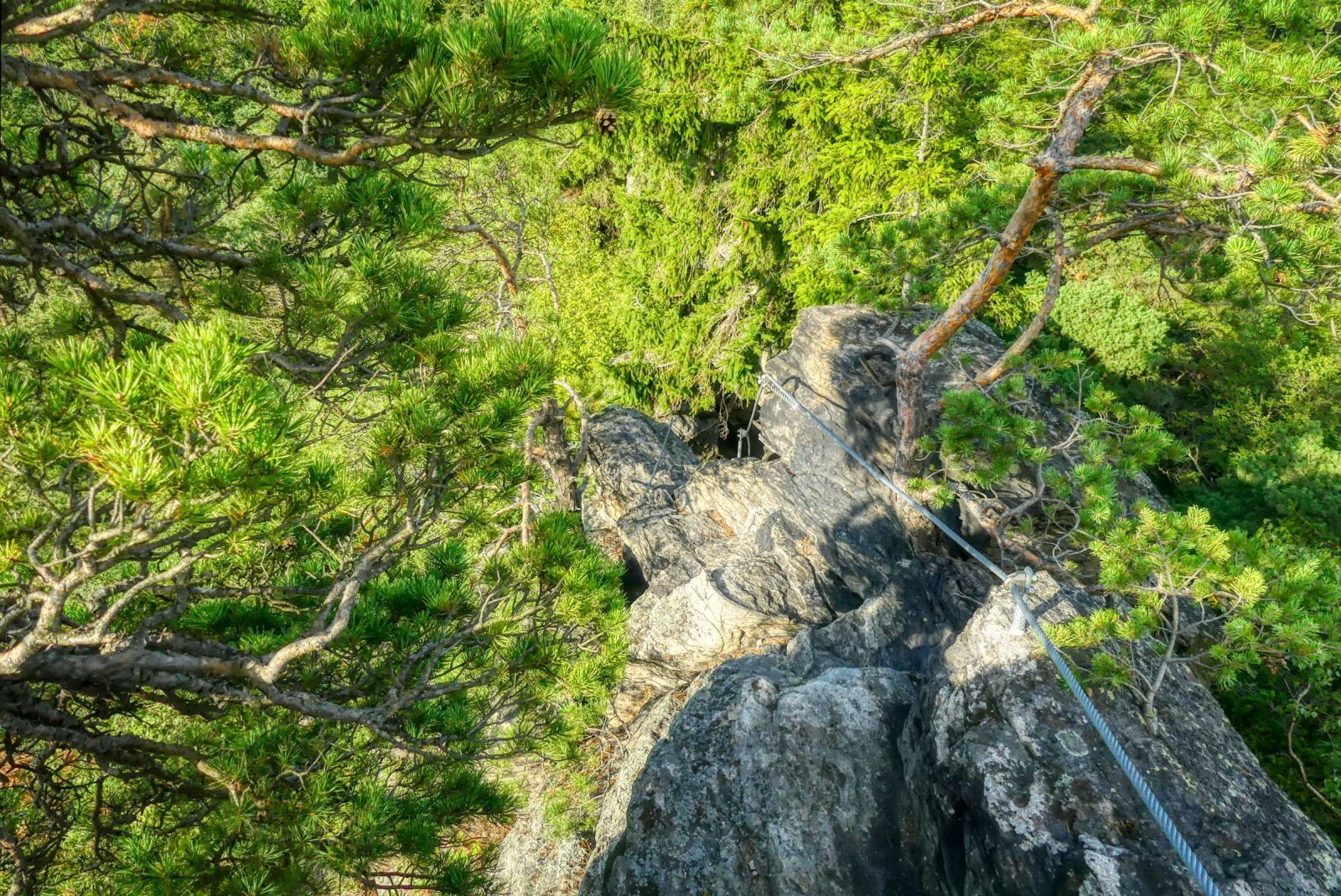
There are two via ferrata (climbing trails) up the Hirschwand. I chose the "easier" one - the "Hirschwandsteig".
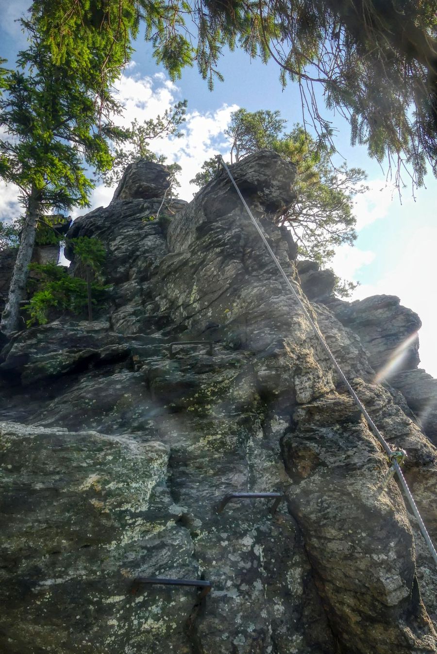
Still, it is very steep and I recommend using a via ferrata set.
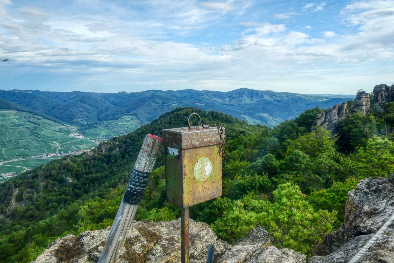
On the summit you find an iron box with a "Gipfelbuch" inside, a book in that everyone who reached the summit can sign and write a little message.
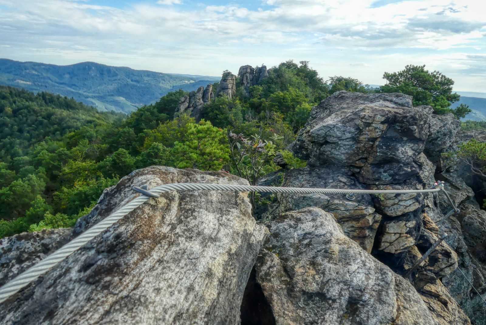
So this is a view to the more difficult via ferrata.
Also from this summit the view is amazing.
But you can't stay on top forever, at some point of time you have to get down which first seems more dangerous and exhausting than getting up.
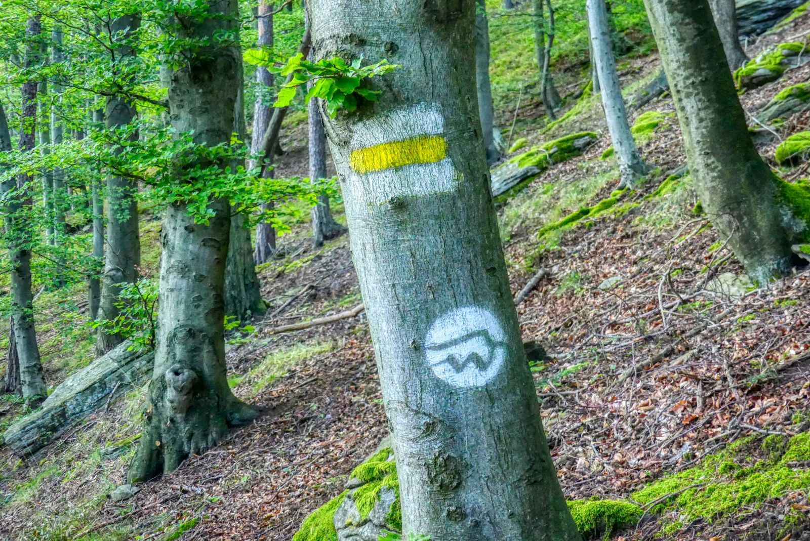
Go back to the "Kreuzung Hirschwand" and then follow the white-yellow-white marks on the trees (or the logo of the Welterbesteig).
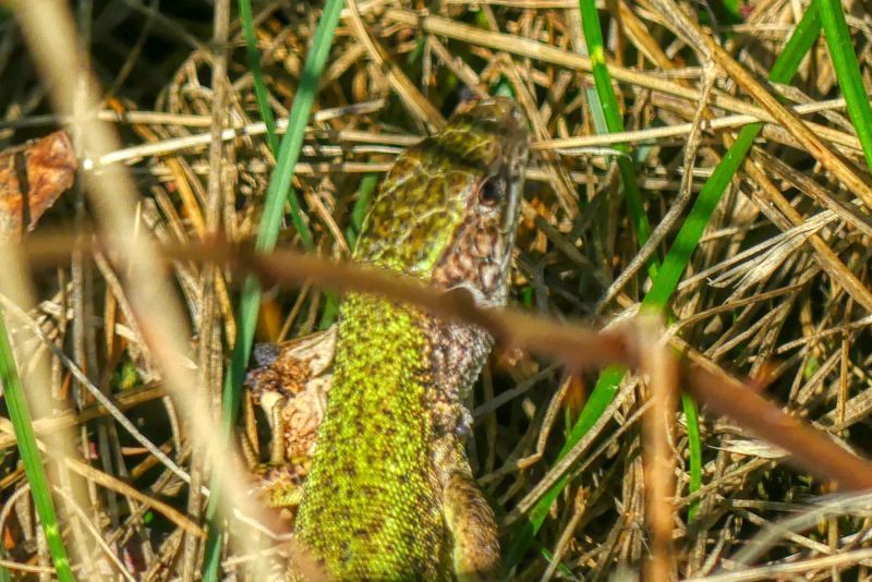
If you are lucky you can see some green lizards. Don't worry, they do not bite and they are very shy!
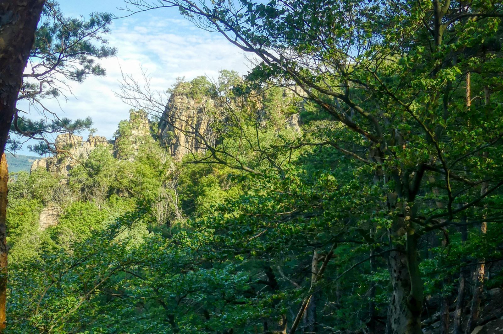
You then walk through a nature protection area called "Steinerne Rieß" and see amazing rock formations.
What you sometimes cannot see are the trails. So it is a good idea to navigation app like Bergfex on your smartphone. Two more advices: First: Google Maps does not show many hiking trails in this area. Second: GPS needs a lot of energy so take power bank with you as well!
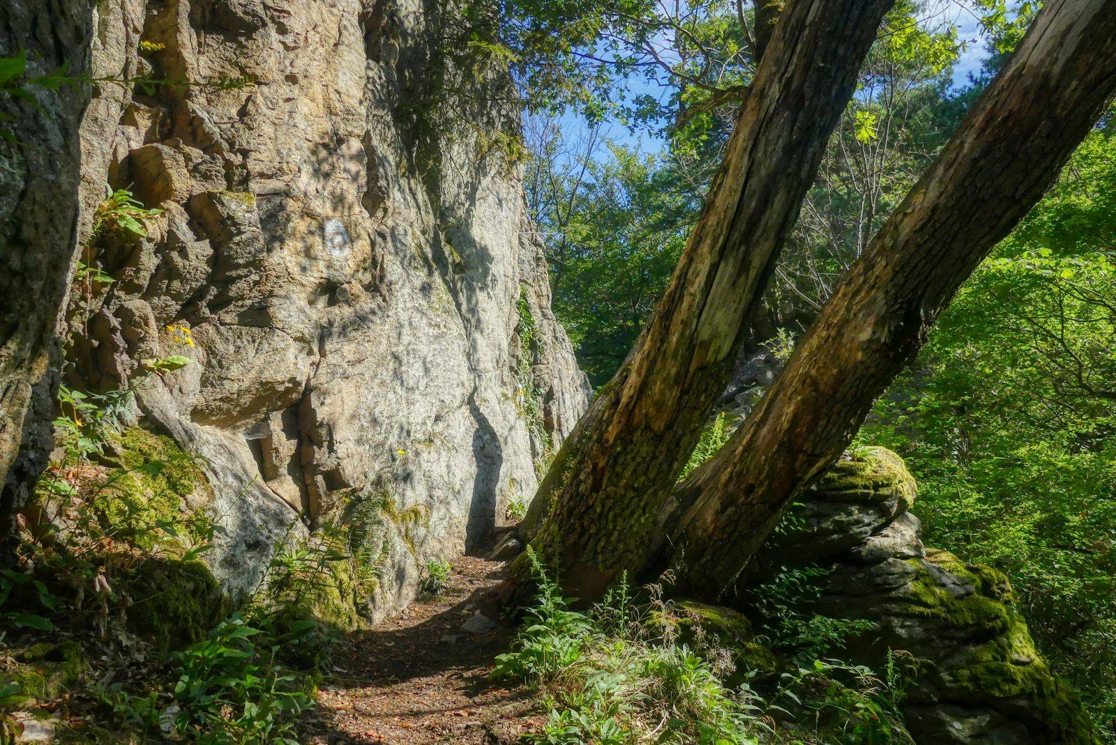
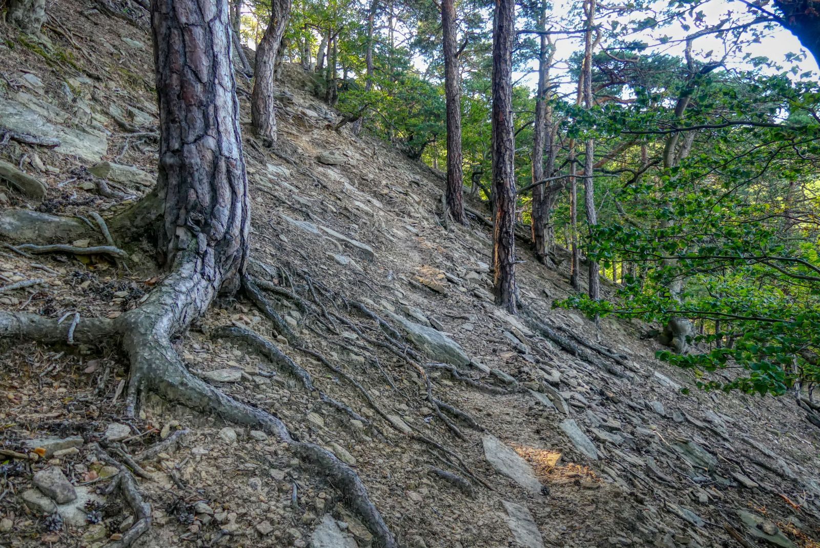
At some points the trail is directly next to a rock formation, but do not worry - there is no need for climbing anymore!
About one hour after you have left the summit of the Hirschkopf you look down to the valley again. Here the path becomes less narrow and finally opens into a forest road.
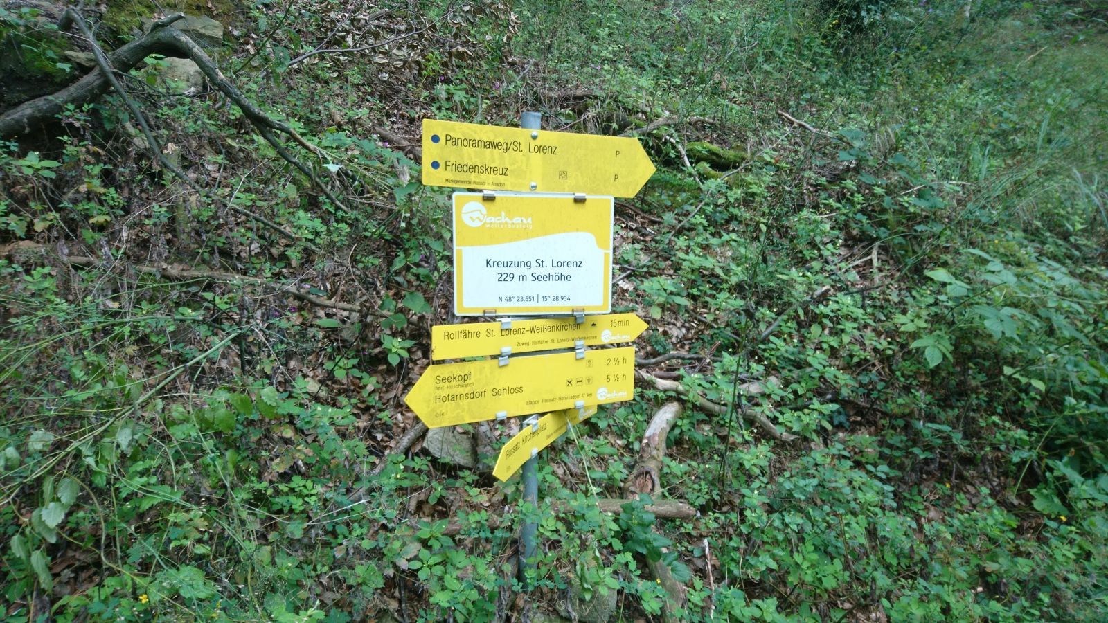
Then you reach the "Kreuzung St. Lorenz". Here you stop following the forest road and take the more narrow path in the direction of "Friedenskreuz".
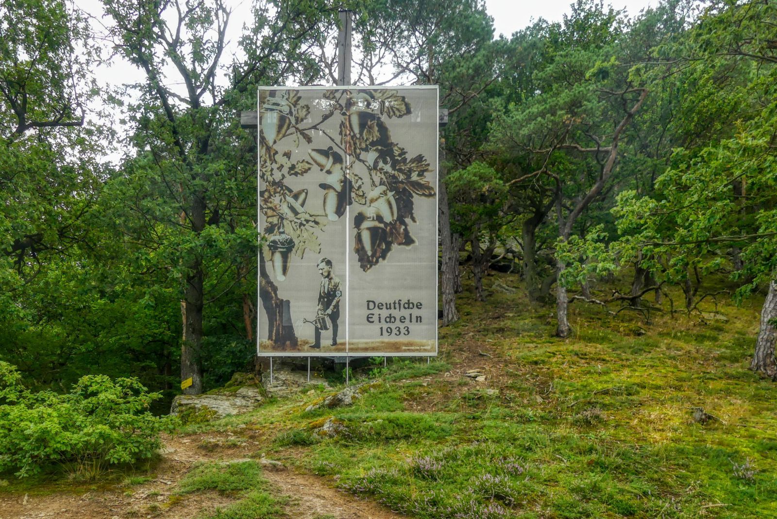
The "Friedenskreuz" is a memorial against National Socialism created by the Austrian artist Martin Krenn and based on a photomontage by John Heartfield, a German artist (born as "Helmut Herzfeld") that had to flee from the National Socialists.
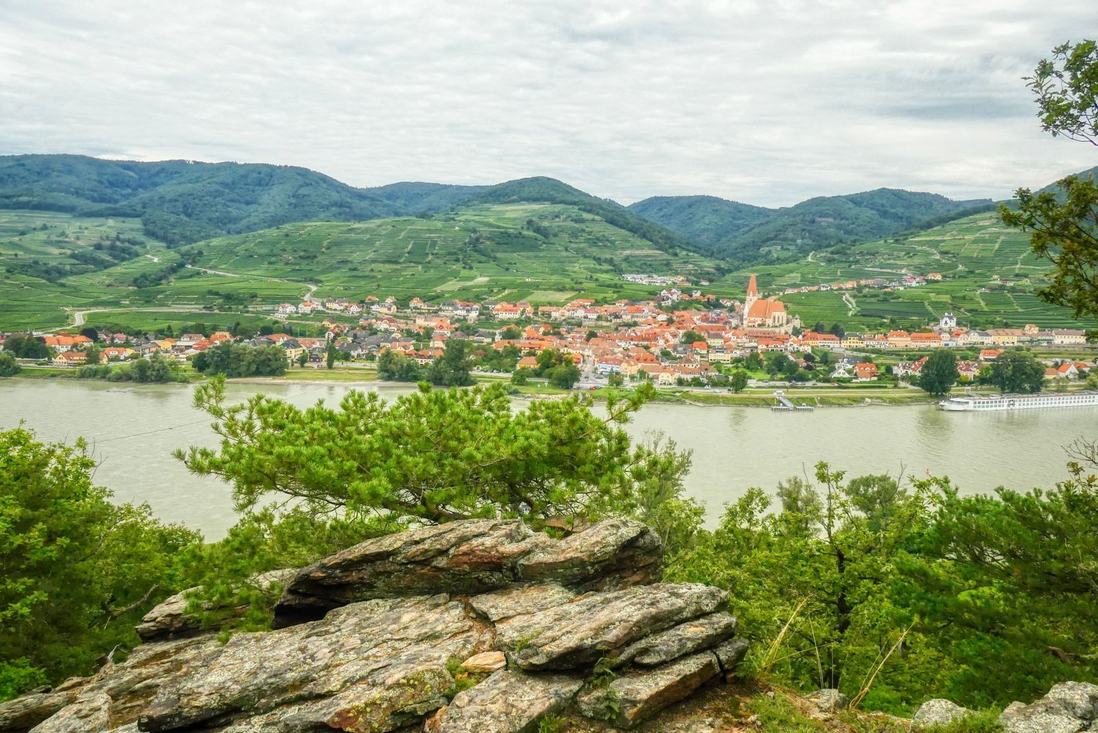
But you also have a beautiful view on Weißenkirchen in der Wachau from this point.
Then you walk down and finally reach the B33 at St. Lorenz, a very small village that belongs to the municipality of Rossatz-Arnsdorf.
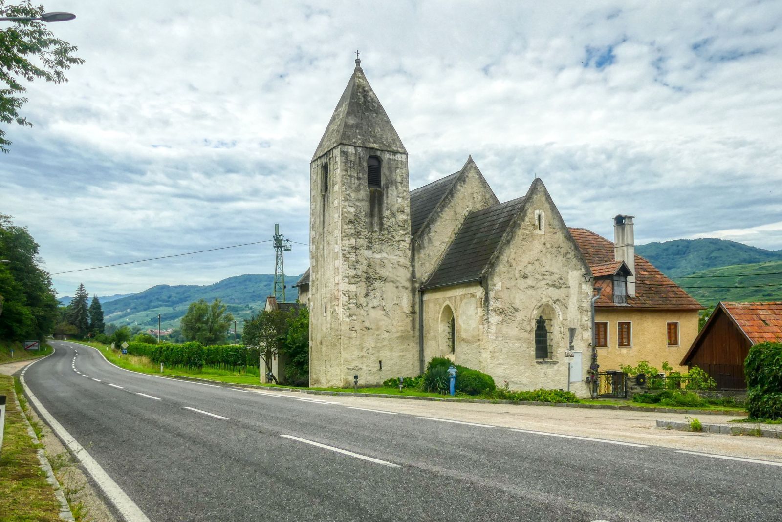
The small medieval church of St. Lorenz is more than 800 years old and one of the oldest churches in Wachau valley.
Then you walk back to the parking space where you have started.
All in all it is a very nice, but also extremely difficult hike for that I needed about 6 hours. I recommend using high top hiking shoes (no sneakers!), hiking sticks and a via ferrata set. Take at least 1 liter of water with you and something to eat. There are no mountain huts or even restaurants on the way! If you use your smartphone for navigation (which I recommend), take also a power bank with you!
A detailled German description including more photos (also panoramic images) and a detailled map can be found on my weblog schmatz.blog!