Hello Hiveians and welcome back!
Today is a relatively short post from my recent weekend adventure!
So first, a little backstory. I get a text from a friend asking if I want to go camping last minute. I then get told that a group is hiking Mt. Washington, the highest mountain in New England, but if I want to go, I need to leave the next morning.
I've hiked a lot in the White Mountains, but I've never gotten around to summiting Washington, so I was interested, despite it being last mine, I commit.
I'm also informed that they're going up the Huntington Ravine route, which is the #1 on a list called the Terrifying 25, as in the most frightening hikes in the White Mountains. I won't lie, I had a bit of hubris. I usually hike in sandals, I've hiked Angels Landing, as you've seen here, which is a crazy scary hike, I did not take this hike very seriously, despite a few warnings. And I end up kicking myself all day for that.
So the day is here, and it's time to head North. I decided to leave my amazing climbing shoes that I bought for Utah because I'm obviously the greatest hiker ever and no mountains here in New England could ever give me a challenge, right? (sarcasm)
I also decided to bring my drone backpack, which is not a good hiking backpack, but again, it's me, the greatest hiker of all time, what could go wrong?
We drive up, we get a dinner, and it's off to the campground. I pop my tent up, get settled and then shortly go to bed for an early morning wake up.
Today is the day. I am convinced to wear my dilapidated ancient hiking boots I grabbed last minute instead of sandals, I pack 2 cameras and a few lenses into my bag, and we're on the road at 7:30am. We stop to get a bite to go for breakfast and it's off to Mt.Washigton. We meet up in the parking lot and then begin our hike.
Still, I don't fully grasp what I've gotten myself into. I have my worn and bit too small hiking boots, a bulky drone backpack, and only one bottle of water. I'm sure it'll be fine.
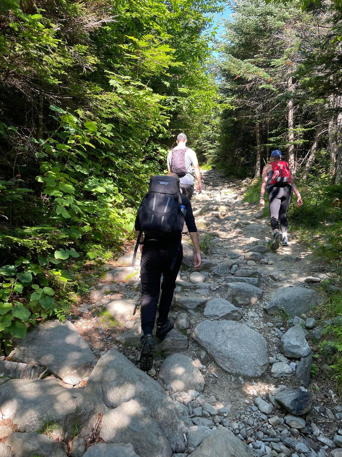
We begin up the entry trail and even this is pretty tough and I can feel the weight of bag, and see the pace of the group I'm with, which is quite quicker than me.
Skip ahead a bit, and we come to the fork where you catch the trail for Huntington Ravine and you see this sign: (didn't get a photo of the bottom sign so took this one of the top sign)
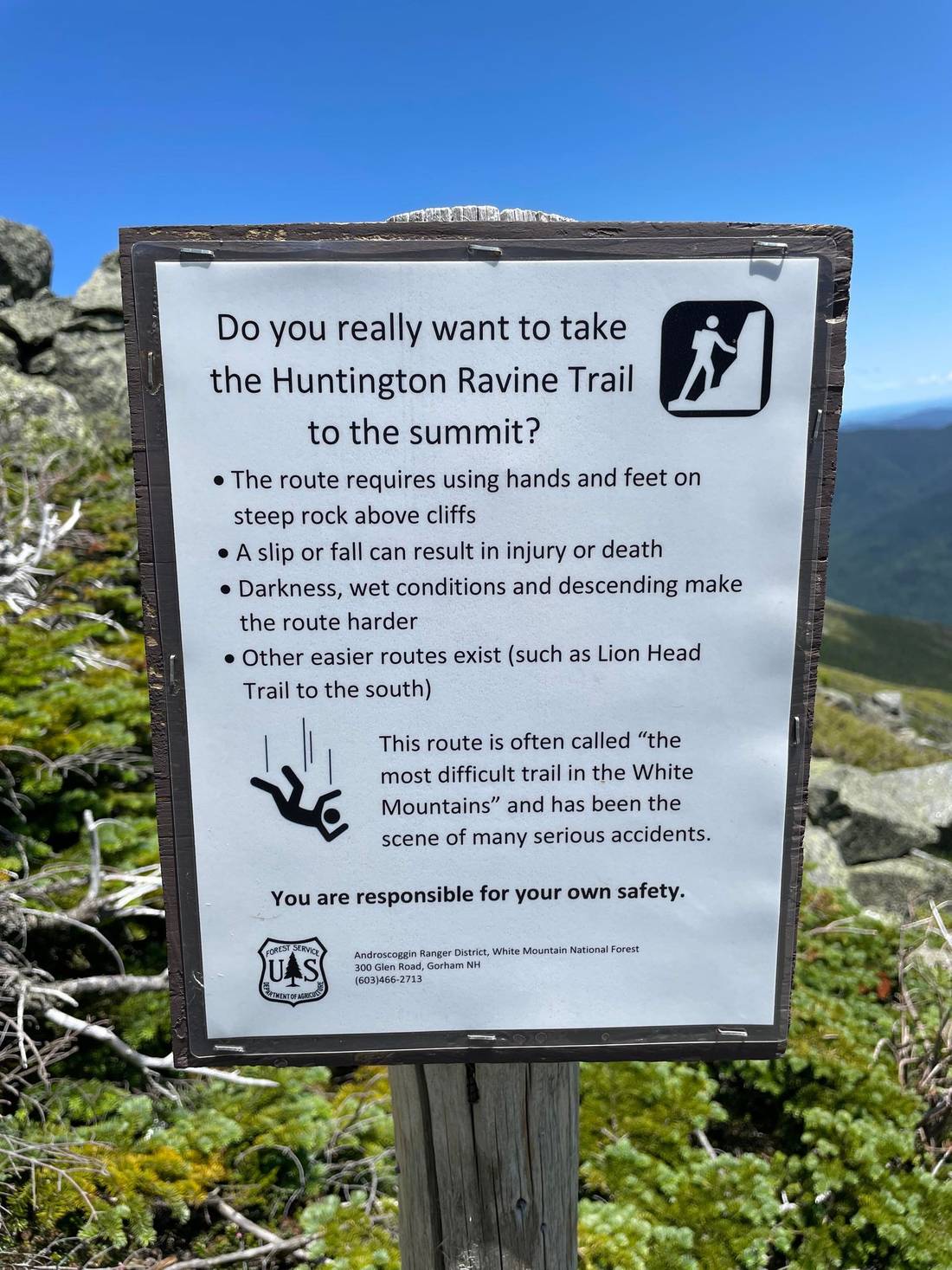
This is when things start to sink in that I might be in a bit over my head. But I continue on.
I start getting a bit anxious, thinking of how stupid I was to bring such a bulky heavy bag, and leave my amazing climbing shoes home in exchange for worn out 15 year old boots. And the group was moving fast, and just keeping up was wearing me out. I wanted to turn back. But I kept going.
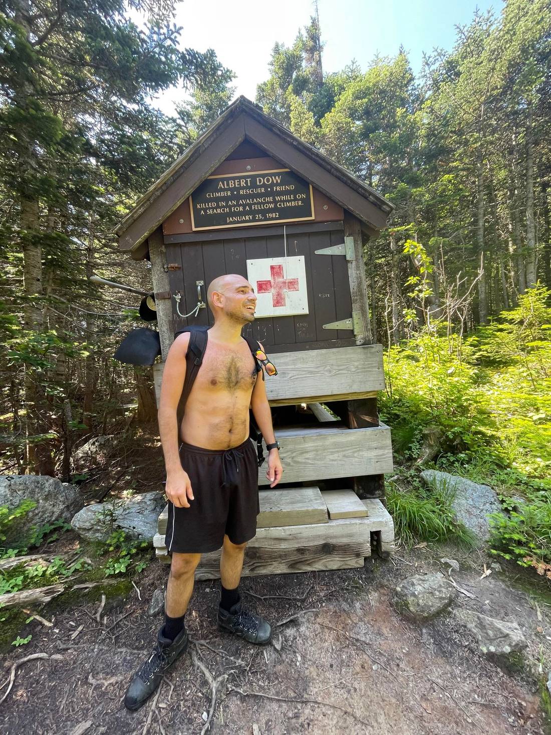
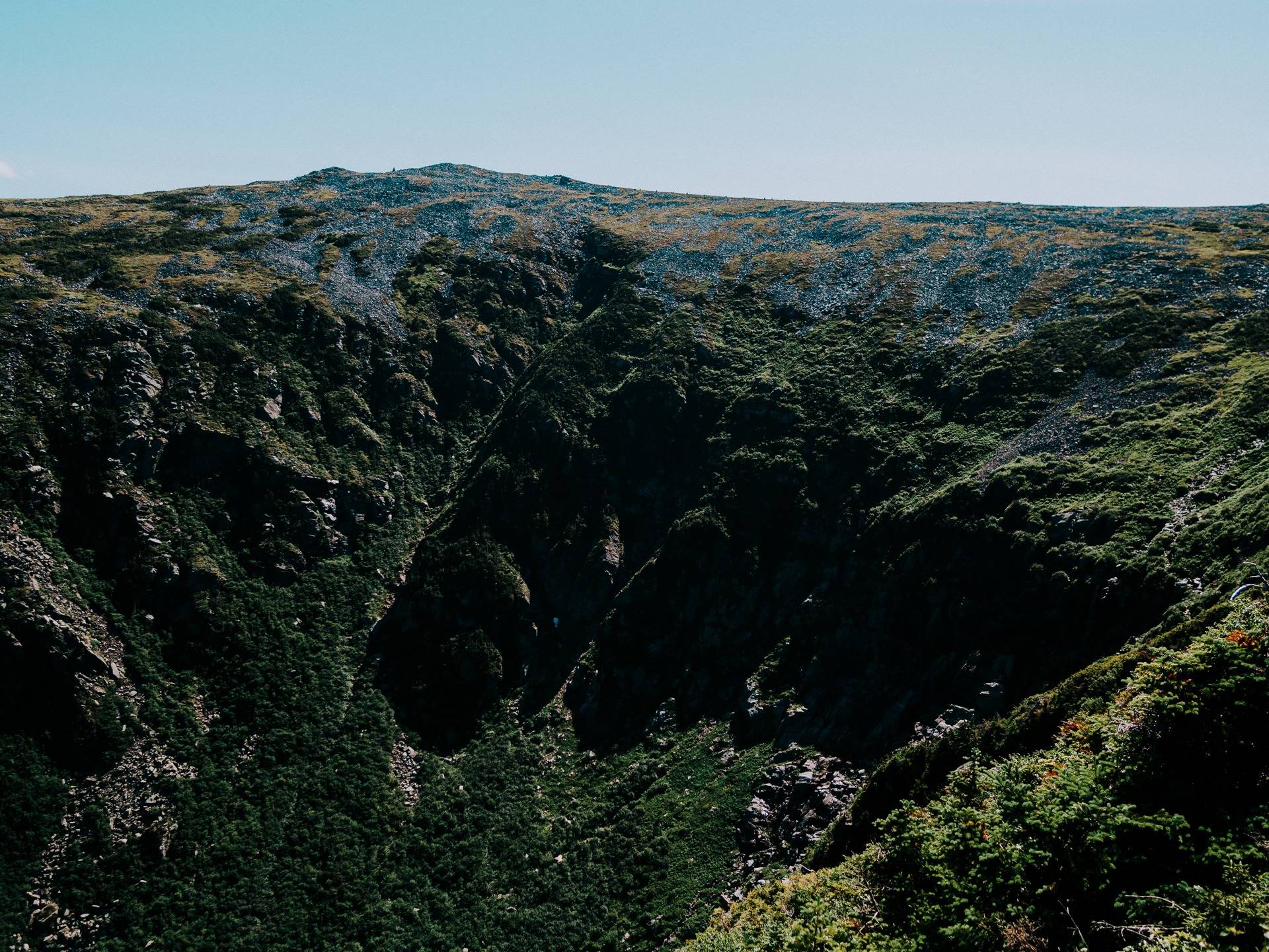
And then on the way up a bit further, I saw a place I may need later on depending on how the hike goes.
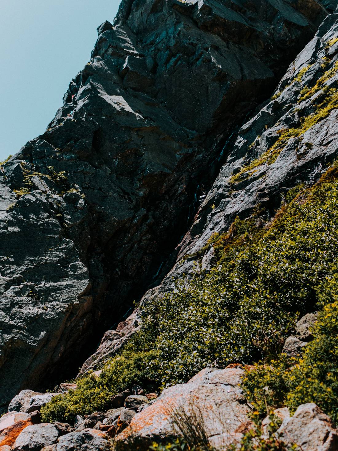
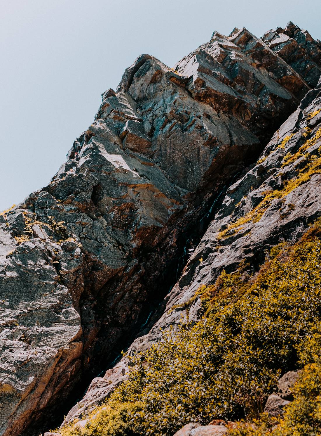
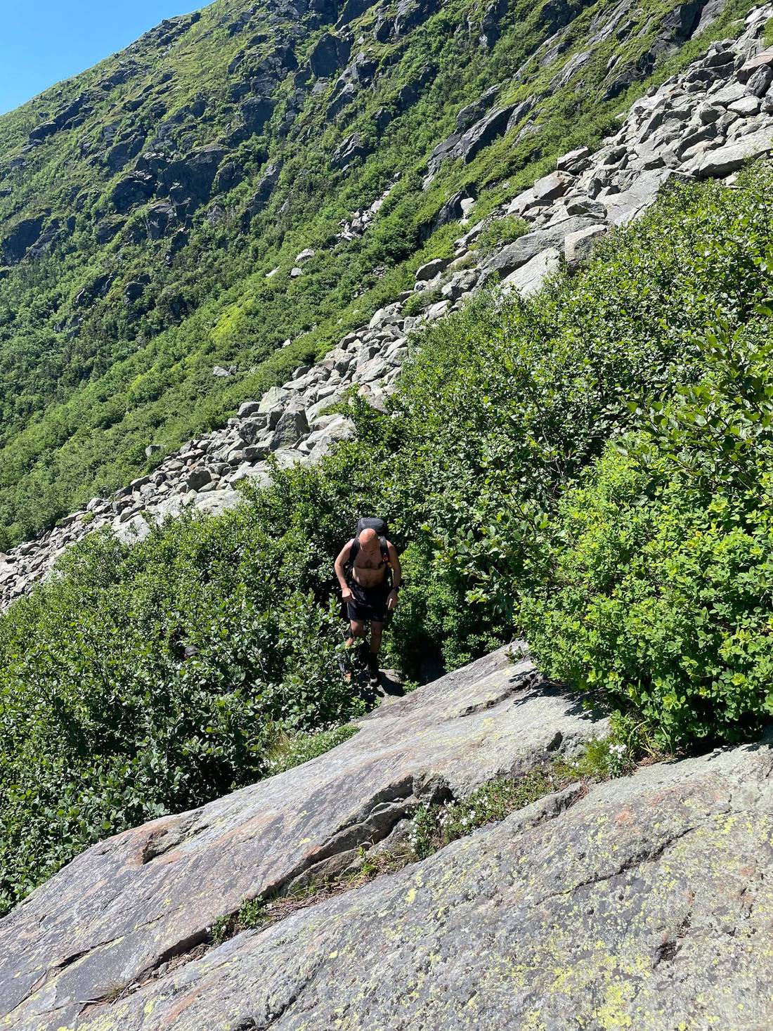
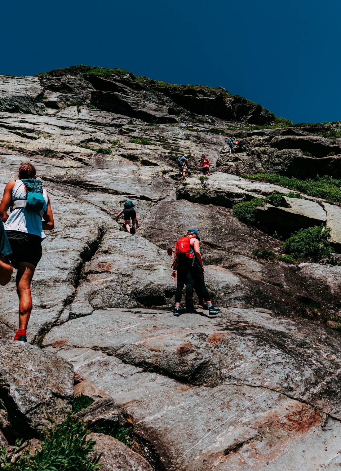
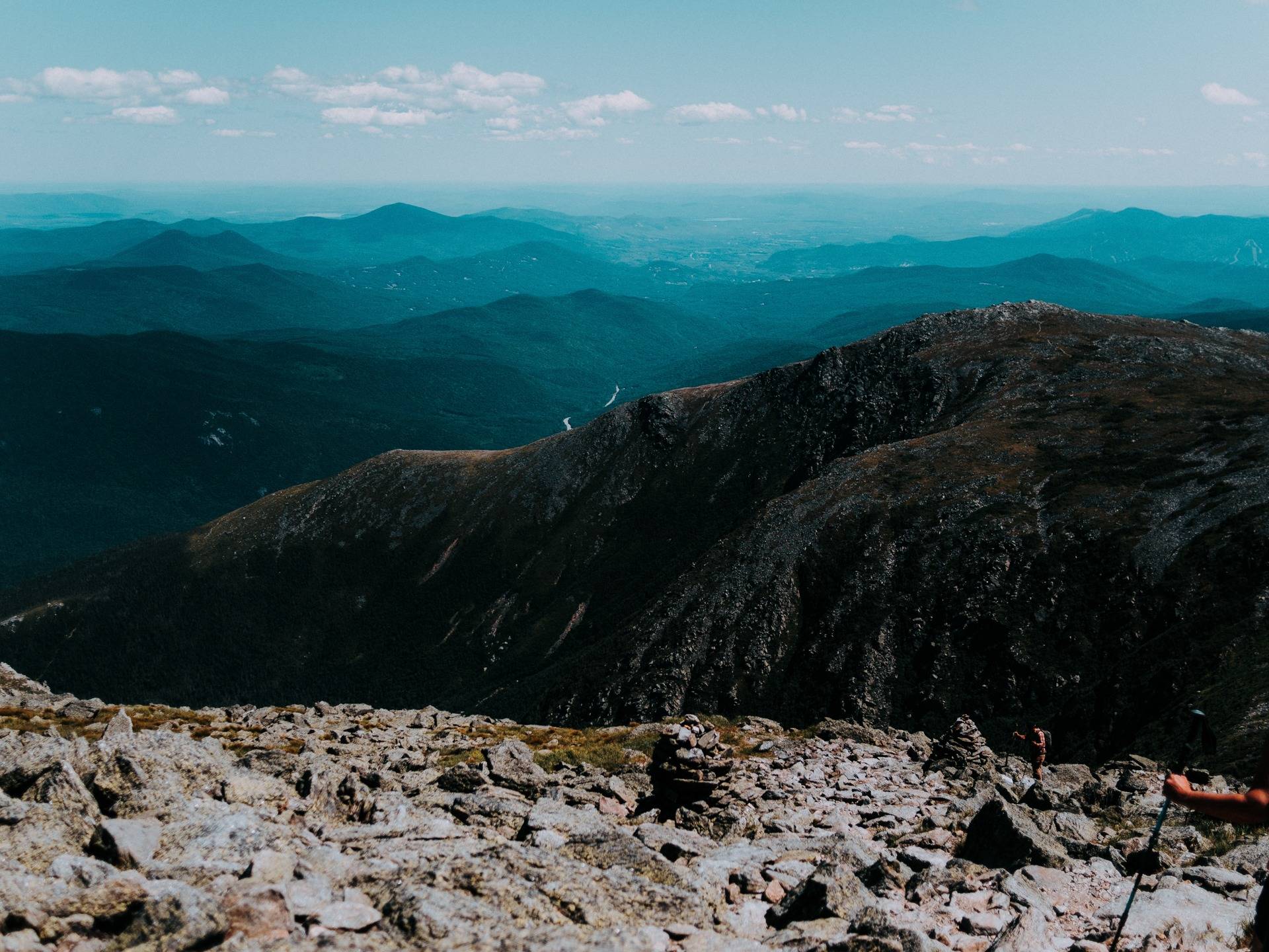
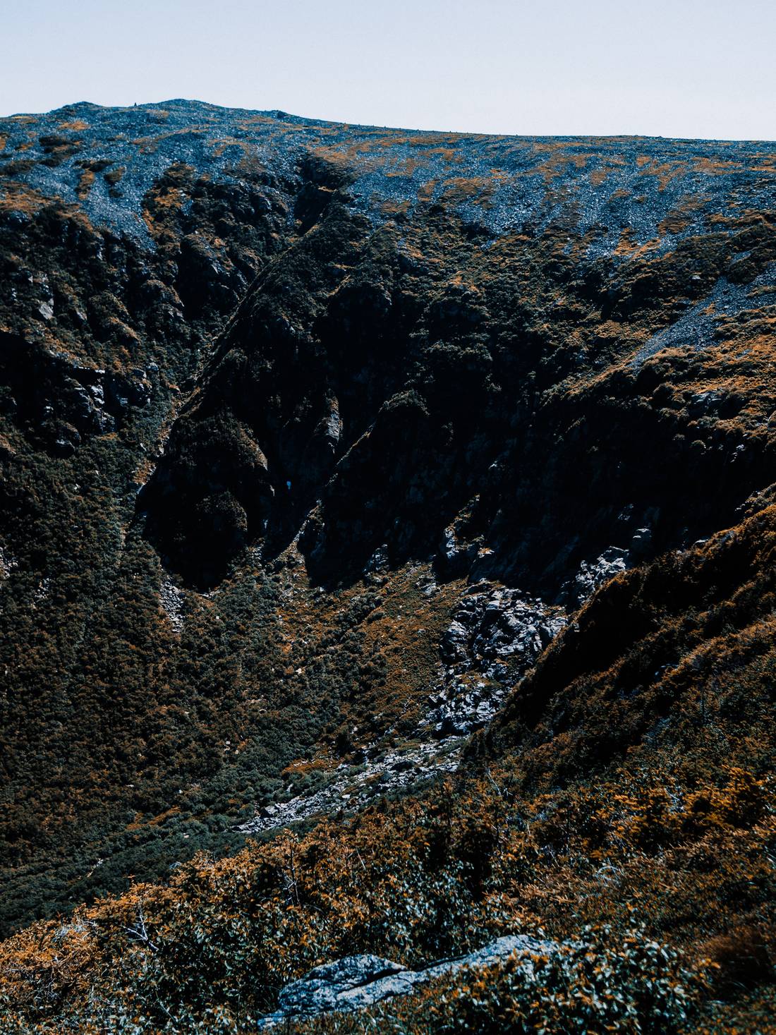
A bit more up the trail and the forest begins to break and we begin to enter the first part of the Ravine. It was time to cross the boulder field.
Also, good time to mention that I didn't get to take too many photos on this trip, as I was trying very hard to not die, and the group was moving quickly. So this post will have less photos than usual unfortunately. With that said, after crossing the boulder field, I could begin to see where we'd be going next, and oh boy, did it look scary.
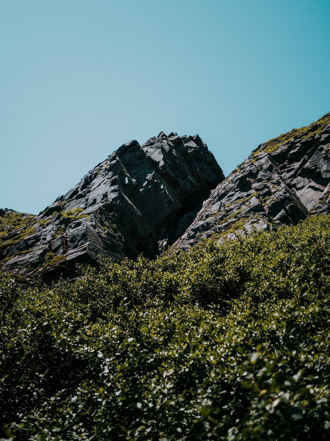
Or so I thought. The area I was looking at here, on the left, was actual rope rock climbers, and not where we'd be going, but not too far off. There was also a beautiful waterfall coming down there as well. A little further up and there's a much better view.
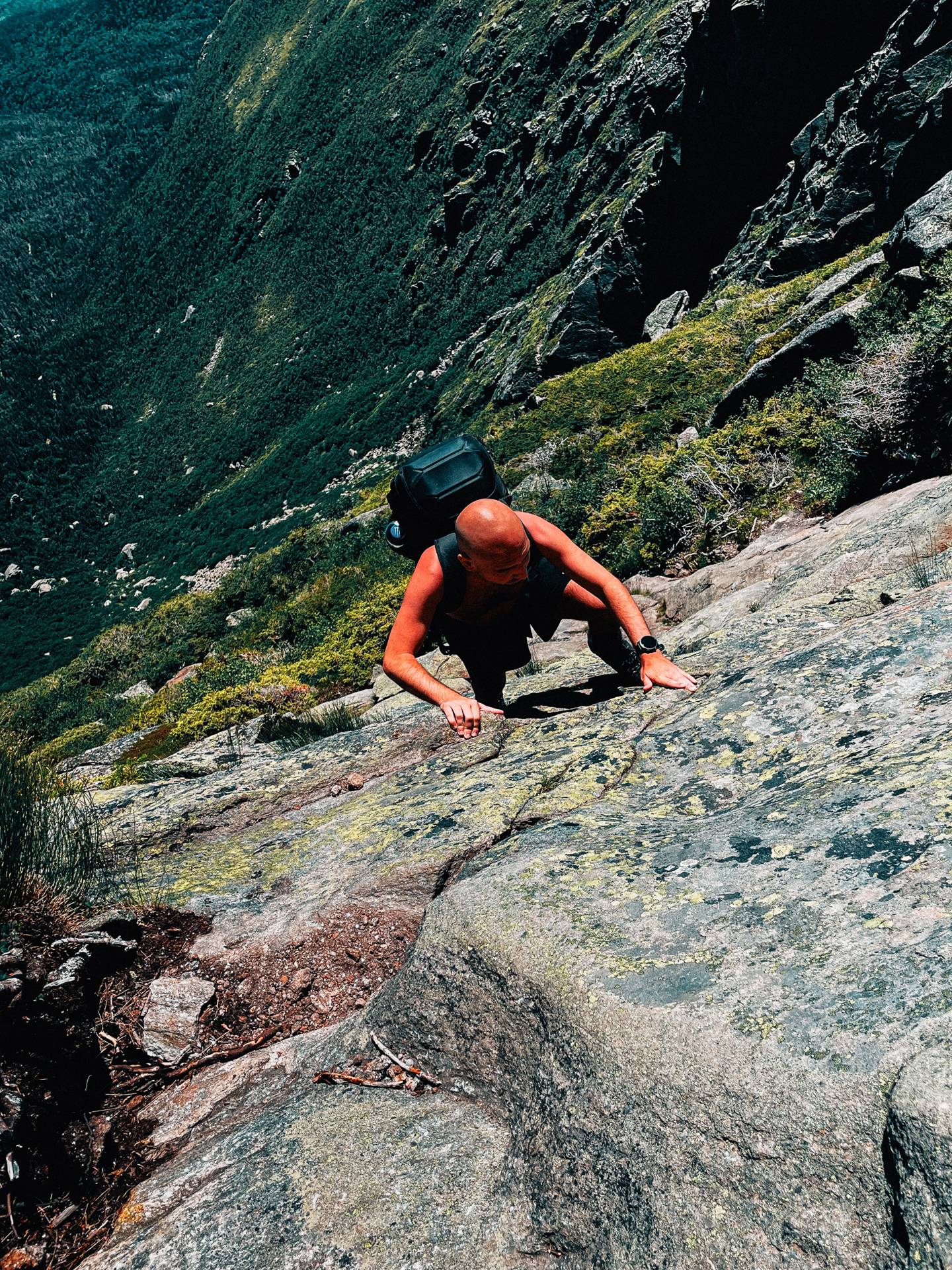
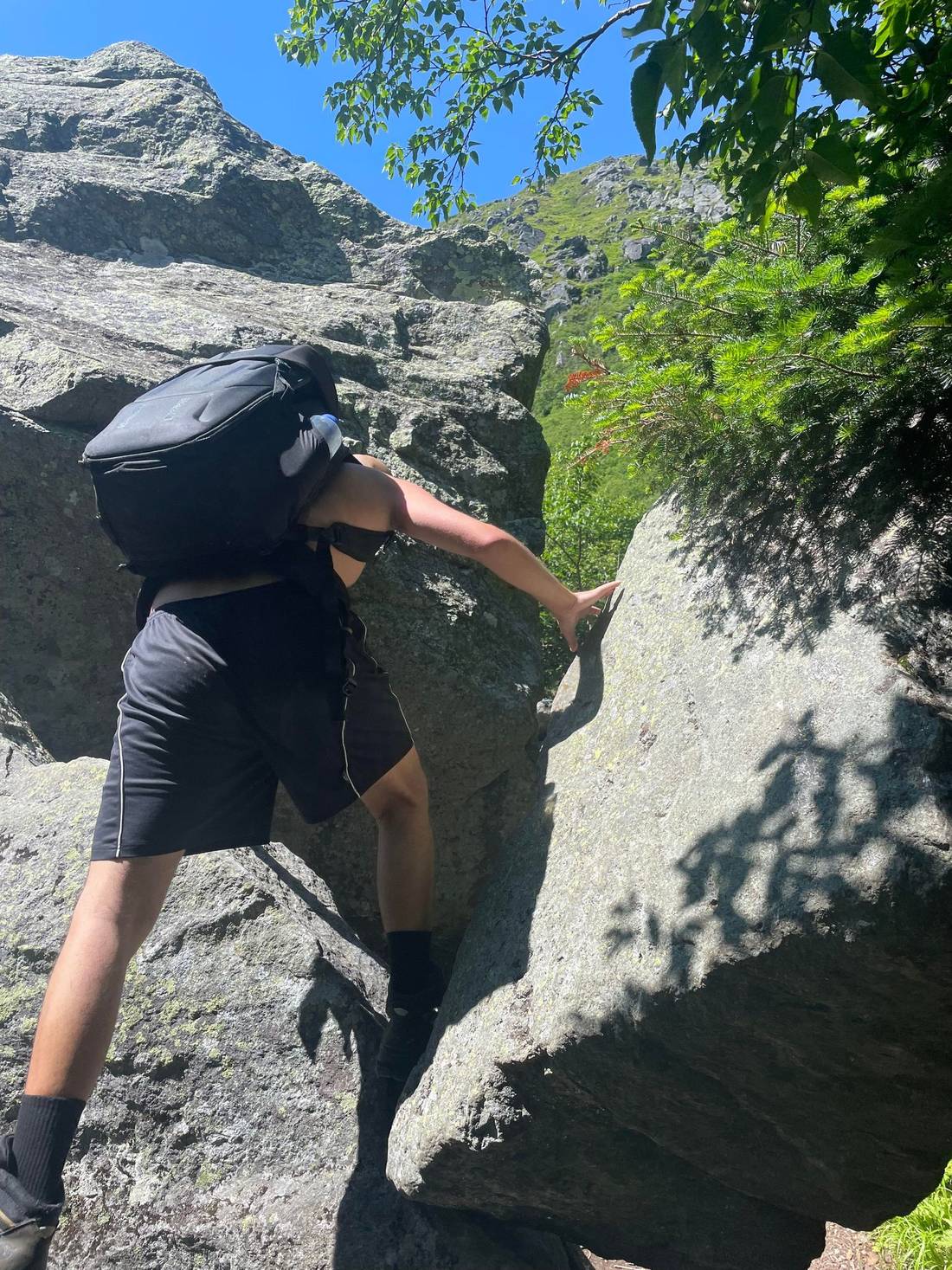
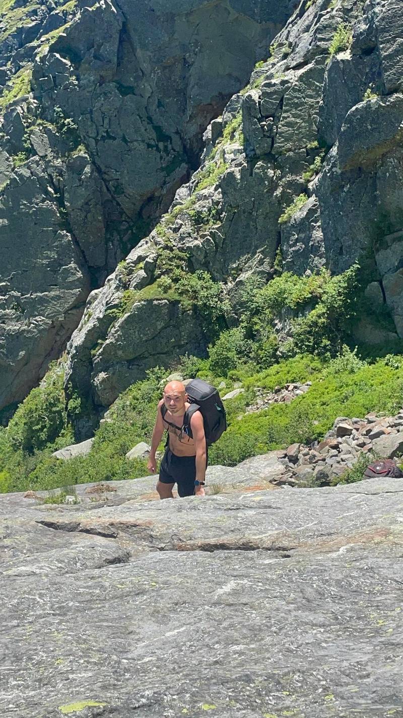
This is where it starts to get tough. Like rock climbing tough. Also, bushwhacking through pointy brush as well.
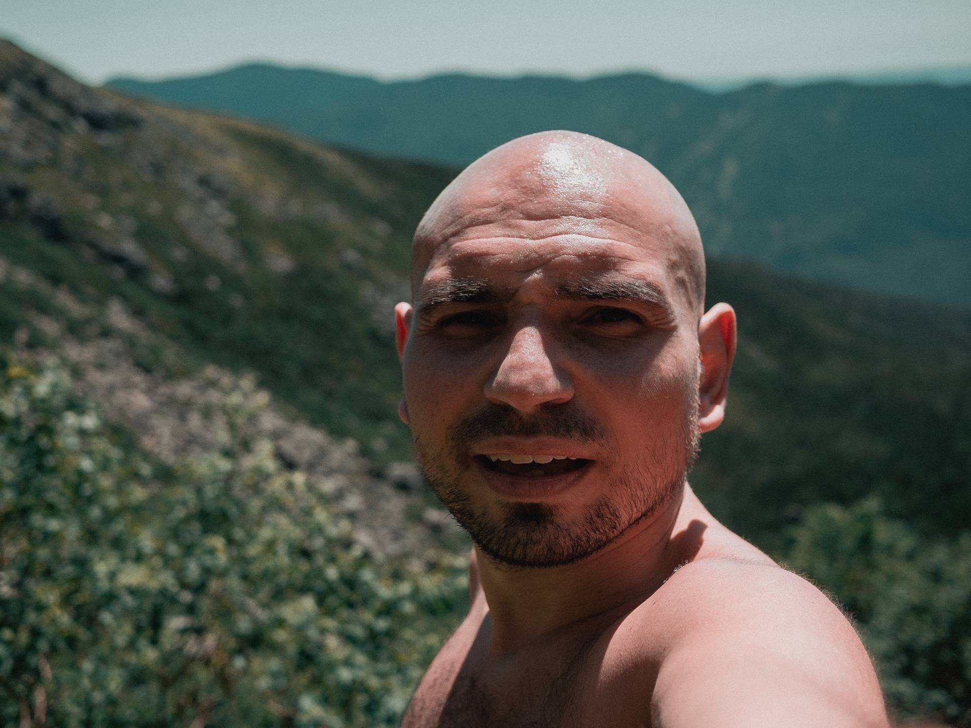
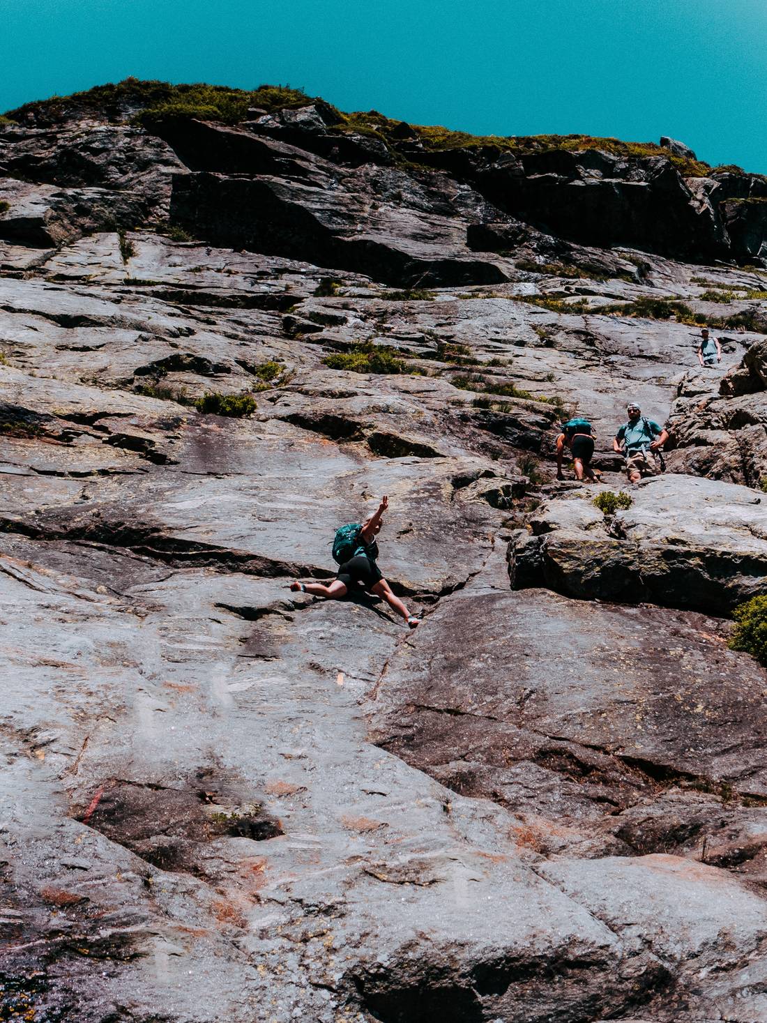
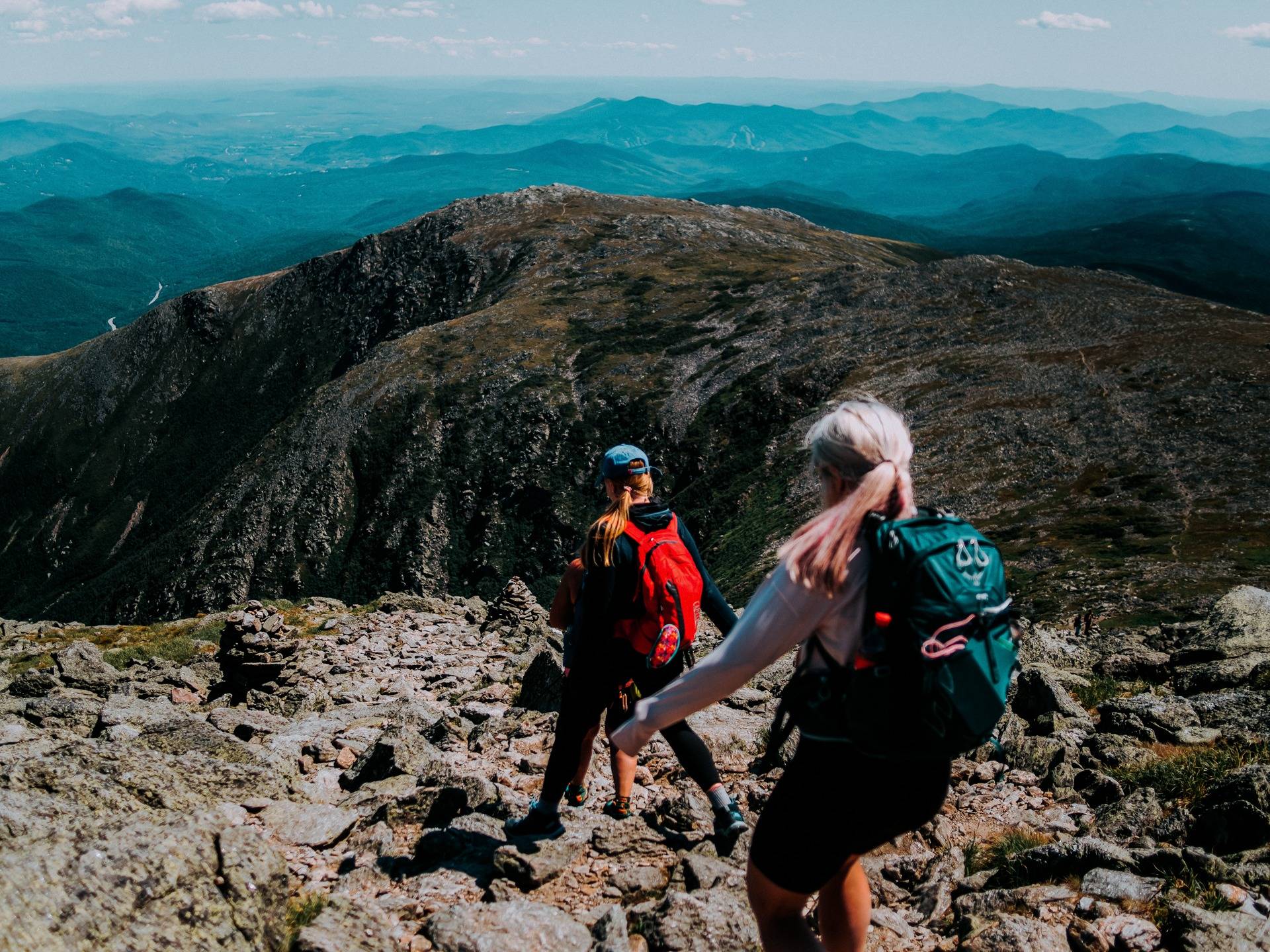
We continue the climb a bit more then take a small break and I get the chance to take a few selfies.
And then we continued, onwards and upwards.
And then we reached it, The Wall. It's a roughly 35 foot stretch of pretty much vertical rock wall.
With my heavy bag and worn shoes, I was not feeling great about this. Neither were a few other couples hiking near us, but we actually helped them and talked them through it. And then it was my turn. I looked up to see my friend doing a split on the wall and thought if she can do this, so can I. I also thought, I can't go back now anyways, so there's that.
I take it one step at a time, make sure my footing is good, and slow and steady make my way up. Although, I did consider going barefoot a few times when I felt my shoes slipping. But I didn't. After that, I figured the worst was over, but there was still a few more technical areas to make it over, such as this dizzying one.

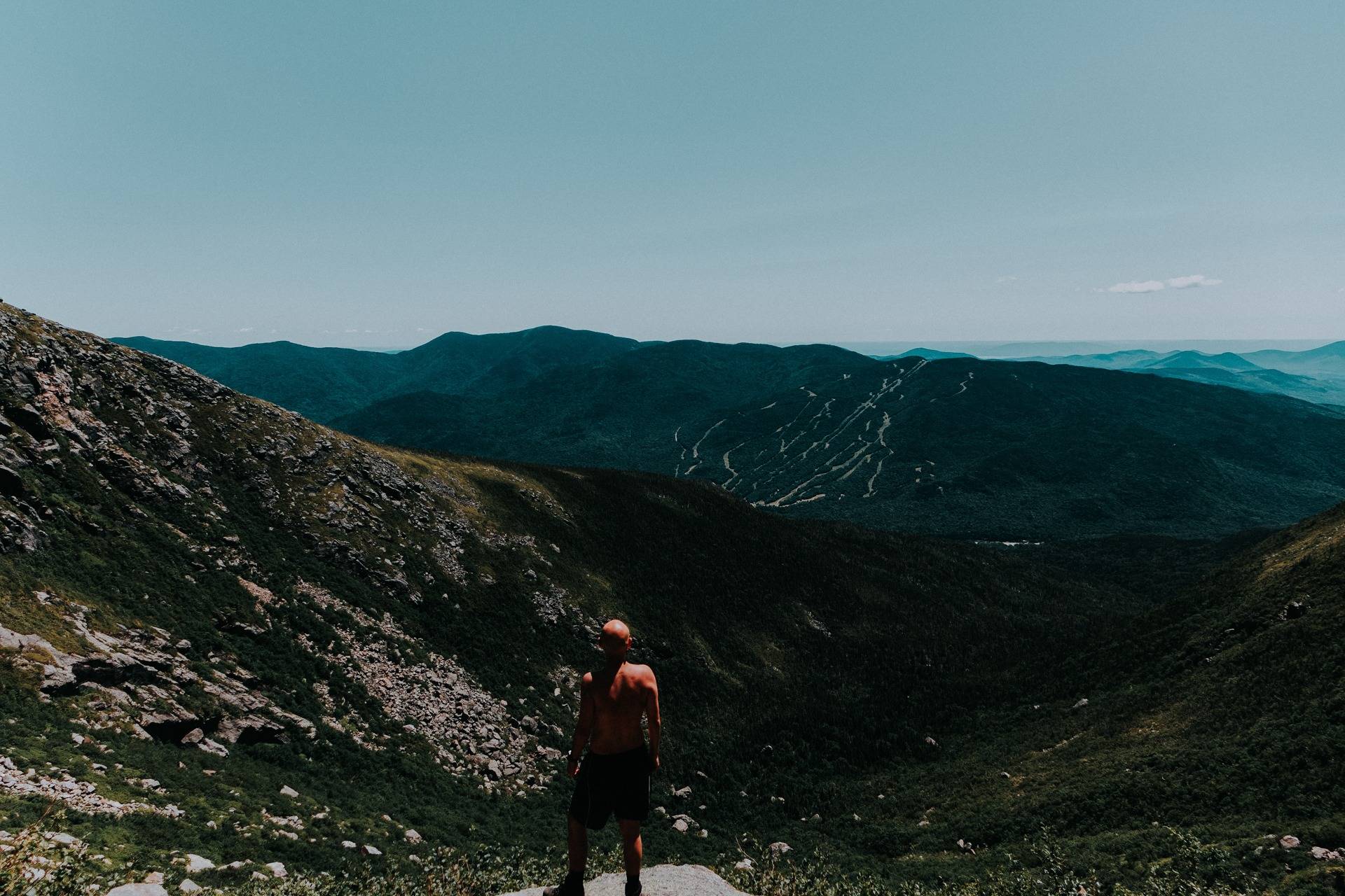
And now, for the most part, the worst is behind us, but I am dead tired.
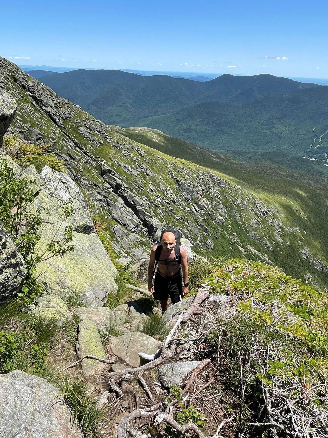
I lag behind the group because I am tired, I ran out of water, and also couldn't eat because my mouth was so dry, and the heat was getting to me. I slowly make my way up towards the summit. But it was slow going.
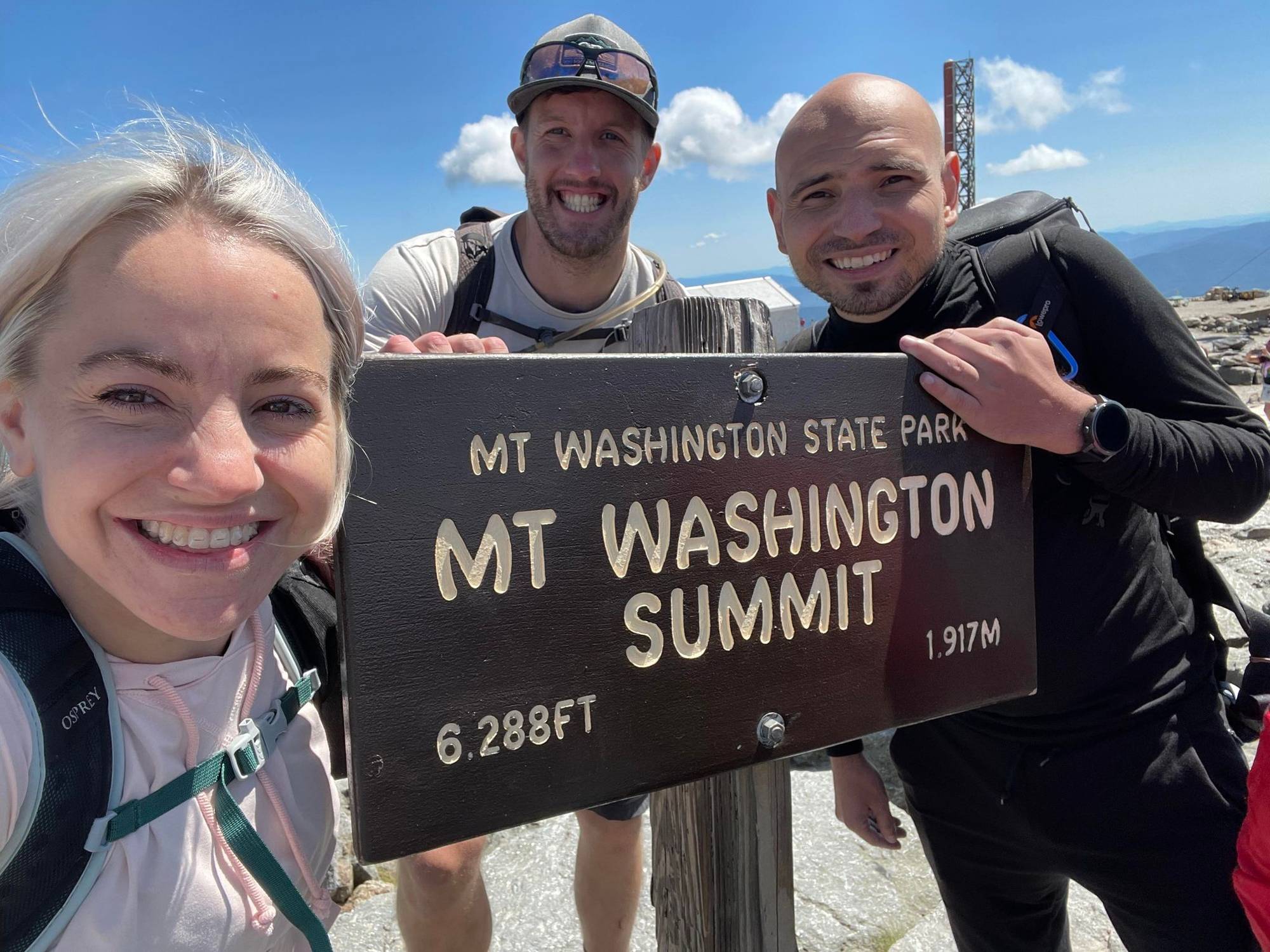
I eventually muster the strength to make it up, make it to the Observation center and get some ice cold water and snap back to life! We hang there for a bit, rest up, snack and then get the all important summit selfie. After waiting in line of course.
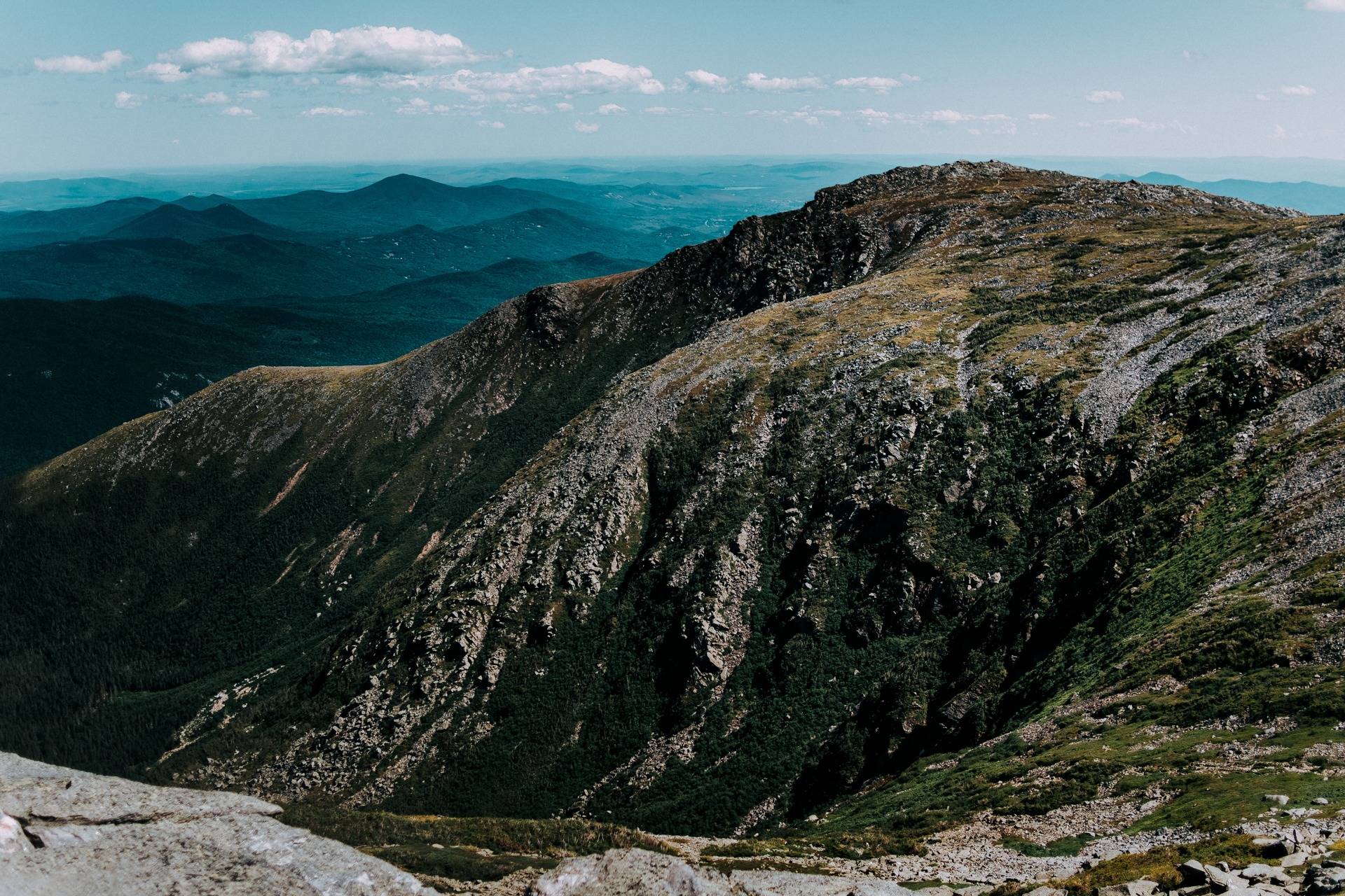
From there, we began our descent. It too was long and grueling, even though we took the "easier" route down, but no matter which way you go, it is STEEP. So here's a few more photos from the way down.
In the end, I climbed up about 4,300 feet of elevation gain, and did about 10 miles. It was difficult and long but worth it. I also got a bit of humility to remind me to always take hikes like these seriously and prepare properly.
So what did you think? Have you ever hiked anything crazy like this? Another fun fact, Mt. Washington is known as home to the worst weather and highest winds in the world!
Oh, and one last thing, that night at camp we didn't put the trash away, so we got woken up to by a bear rummaging trough all of our stuff, so that was great :)
Catch you in the next one,
Sean