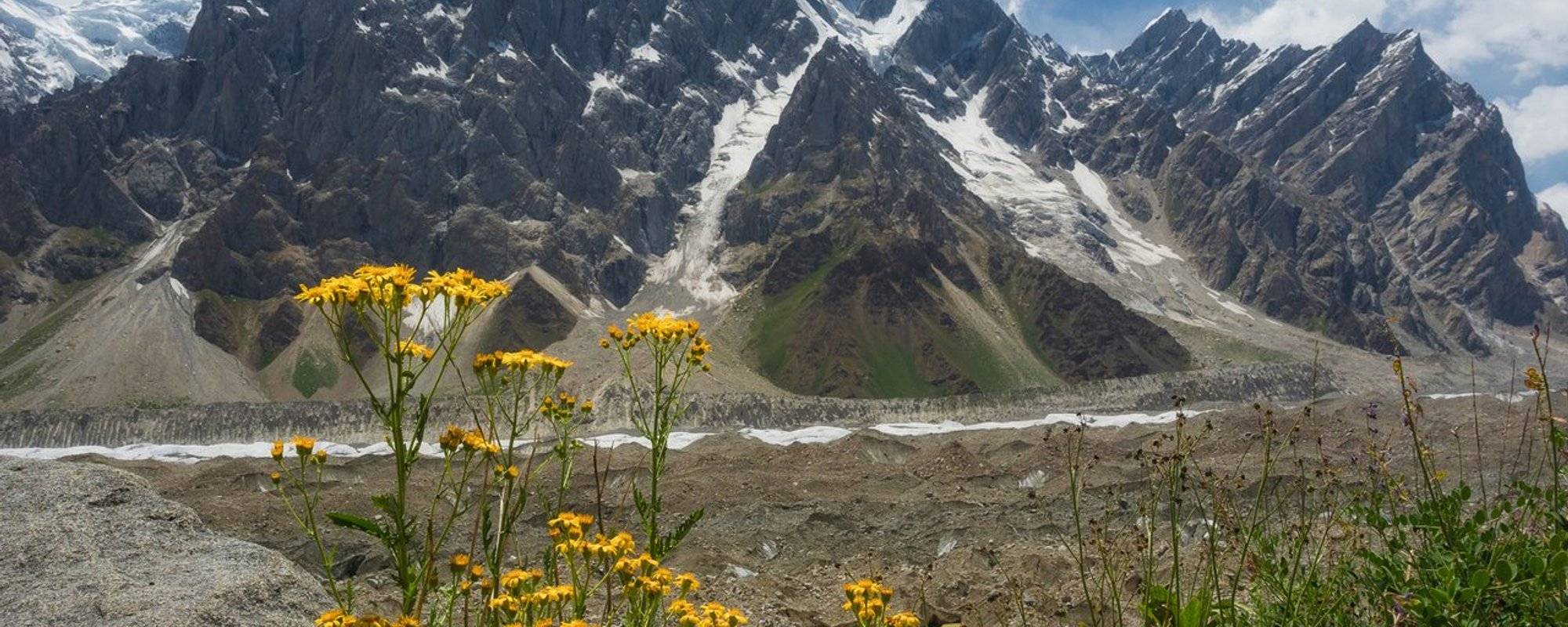
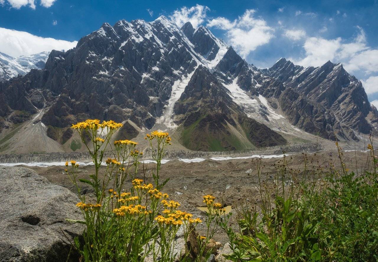
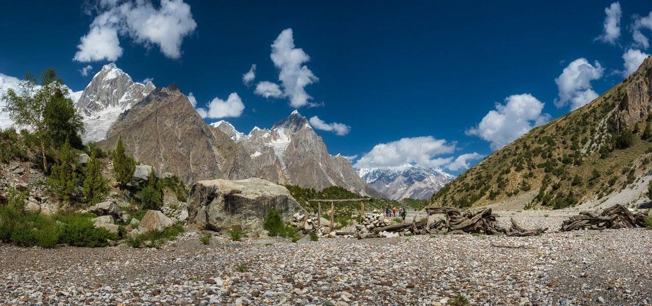
We are sitting on the top of the moraine after a tiring hike along mountain paths along the glacier. It was promised as a small easy trekking, from which we will return back to the shepherd's village for lunch — but it seems that something went wrong (we? :)), lunch time has already come, and we are only sitting at the end point, and it’s not that the road was very light and short. Probably, Bayram planned the travel time, assuming it on his own, and although we have been trekking for the second week in different mountains, but still not as good as the Pakistanis. We checked our watches — it turns out that we have covered more than 14 km. Hot, sun-roasted and, frankly, already tired, we turn back.
I usually handle the heat pretty well, but not this time. We no longer have water, and Bayram, leaving us, said that it would be about an hour the way, but I was a little suspicious of these words...
We go back, and I take little pictures now — I am trying to save both for some reason quickly discharging batteries and my strength.
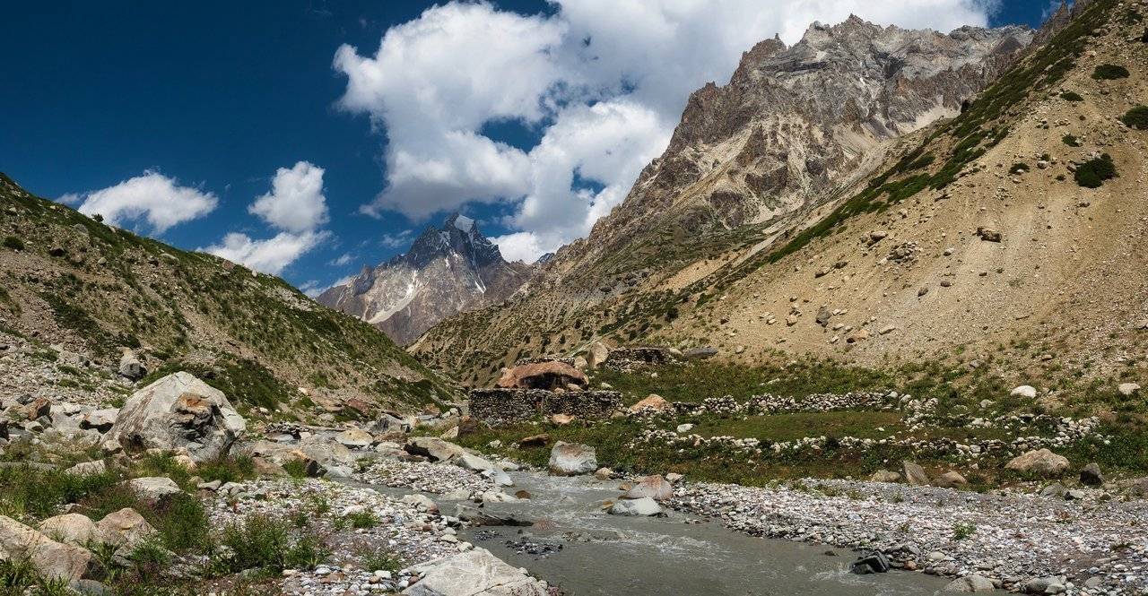
We got to the houses by a dirty stream, and where the clear water is — it is not clear. It's good when your group has a leader as strong and tireless as a moose. Dima ran to look for water, and we sat down by the stream and began to come to our senses. I took off my shoes, socks and dropped my feet in the dirty water: it's great, my legs feel much better, but I want to drink more and more.
We look — Dima waves from a distance after a while. Only it is not clear whether he found water or simply tells everyone to follow this path further. Part of the group went there, even offered to take my empty bottle, but I slowed down something and stood, waiting for an understanding of further actions in order to at the same time pick up Volodya's things, who was the first to run there with empty bottles. As a result, it turned out that Dima had found the water right there, but quite far away, there was no sense for me to go there, so I, without thinking twice, climbed under the nearest stone and decided to rest in its shade until everyone returned.
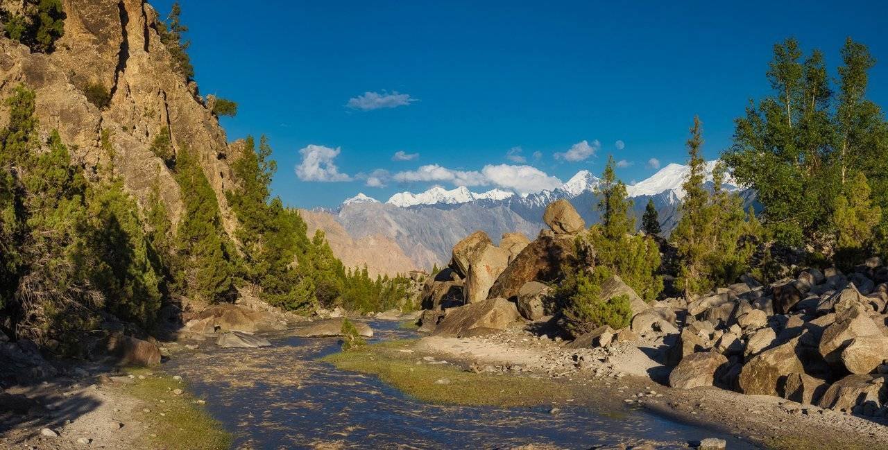
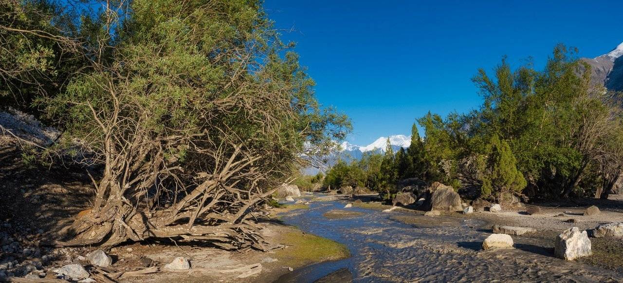
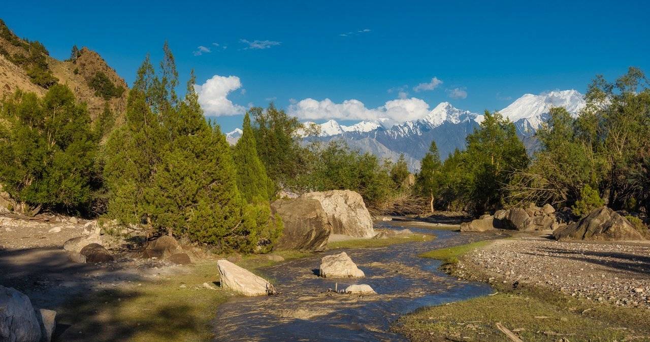
Move on. Thirst with water flowing nearby is terrible. Especially if you walk under the hot sun, and at the same time hear and see the water from all sides, both in the form of streams and in the form of snow caps of mountains.
I walk and different types of drinks, cold and even hot, constantly appear in my head. I scroll through them, sort them by rank — whichever one I drank first. I remembered Pina Colada again. Now it would be great!
When we reached the gravel plain with streams again, I asked for a break to launch the drone. But everyone wanted so much to go home, to the water and shadow, that in the end I just decided to lag behind so as not to detain everyone. And Dina shared the rest of her water with me.
The drone rises and I shoot in the direction where we return — in the direction of the village.
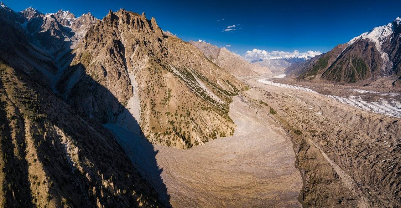
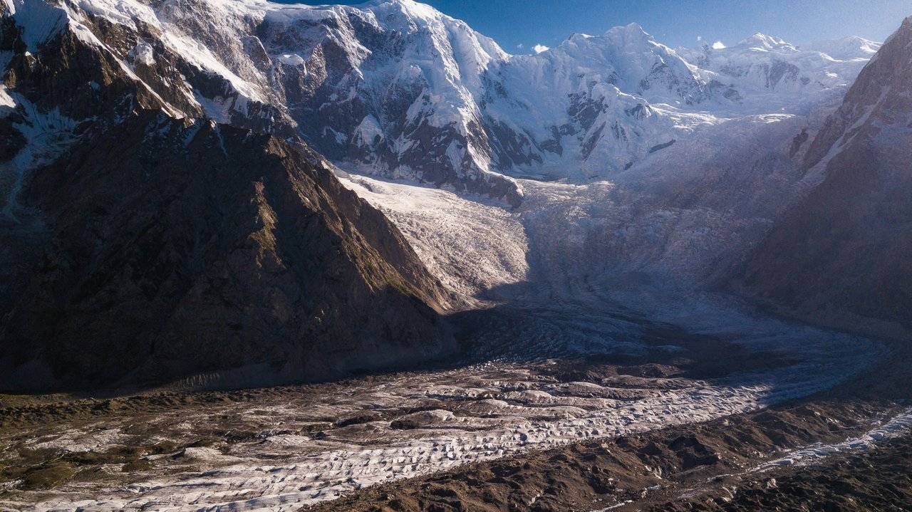
The streams running down from the peaks intertwine intricately and beautifully. I see small shadows in the middle from above: these are our guys stomping home.
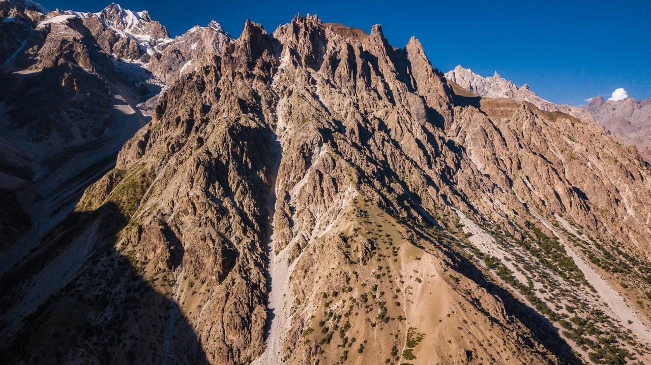
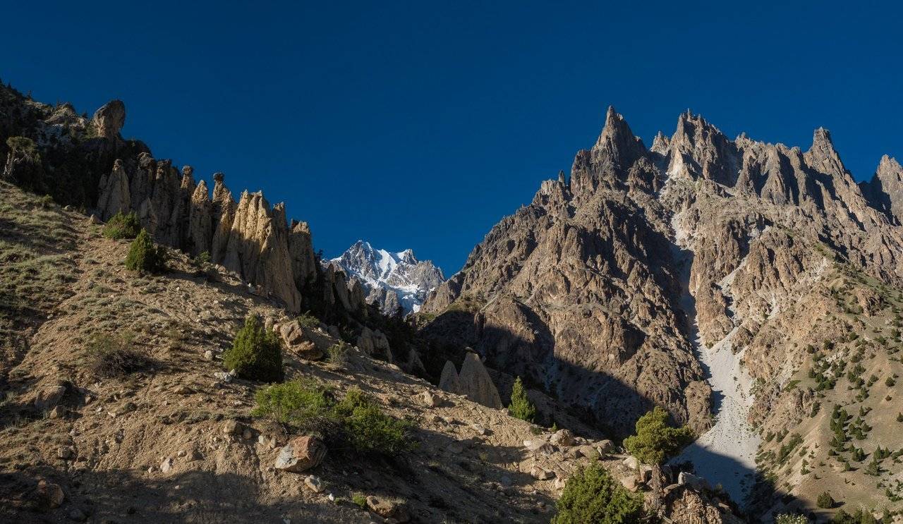
The rocky peak above them resembles a castle with towers on top of a mountain. Nice. It's good that I decided to fly here.
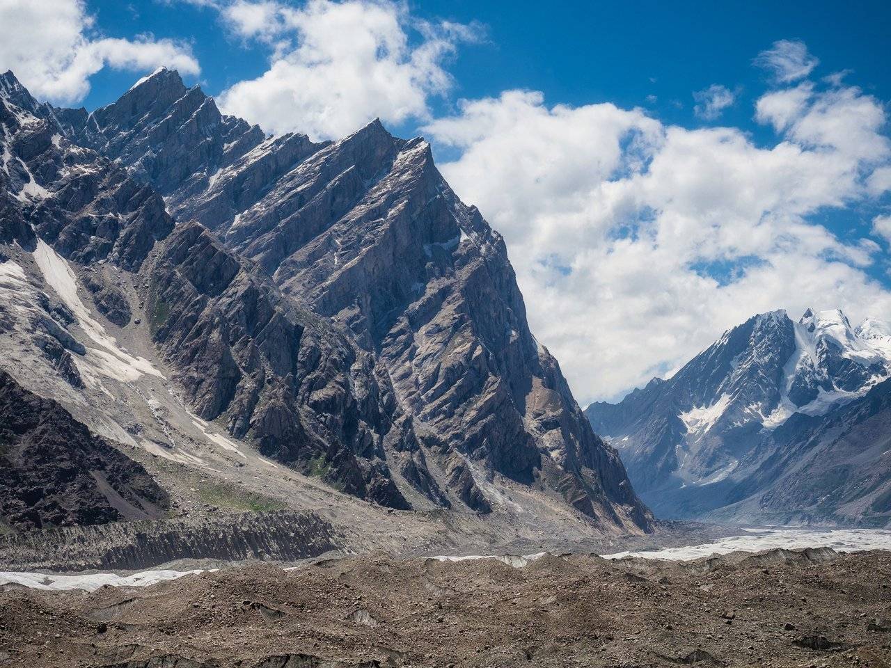
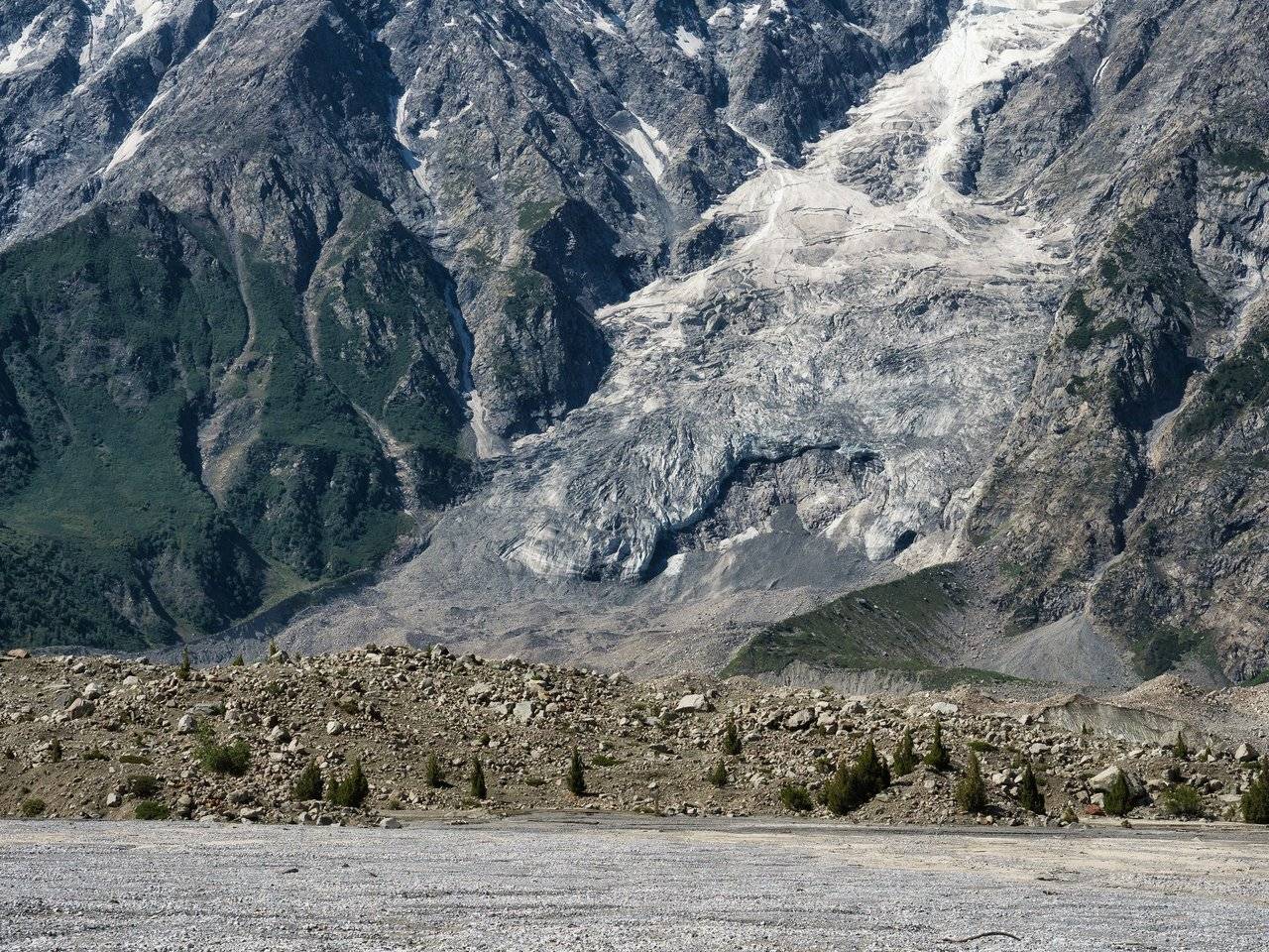
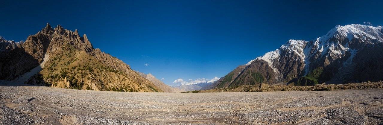
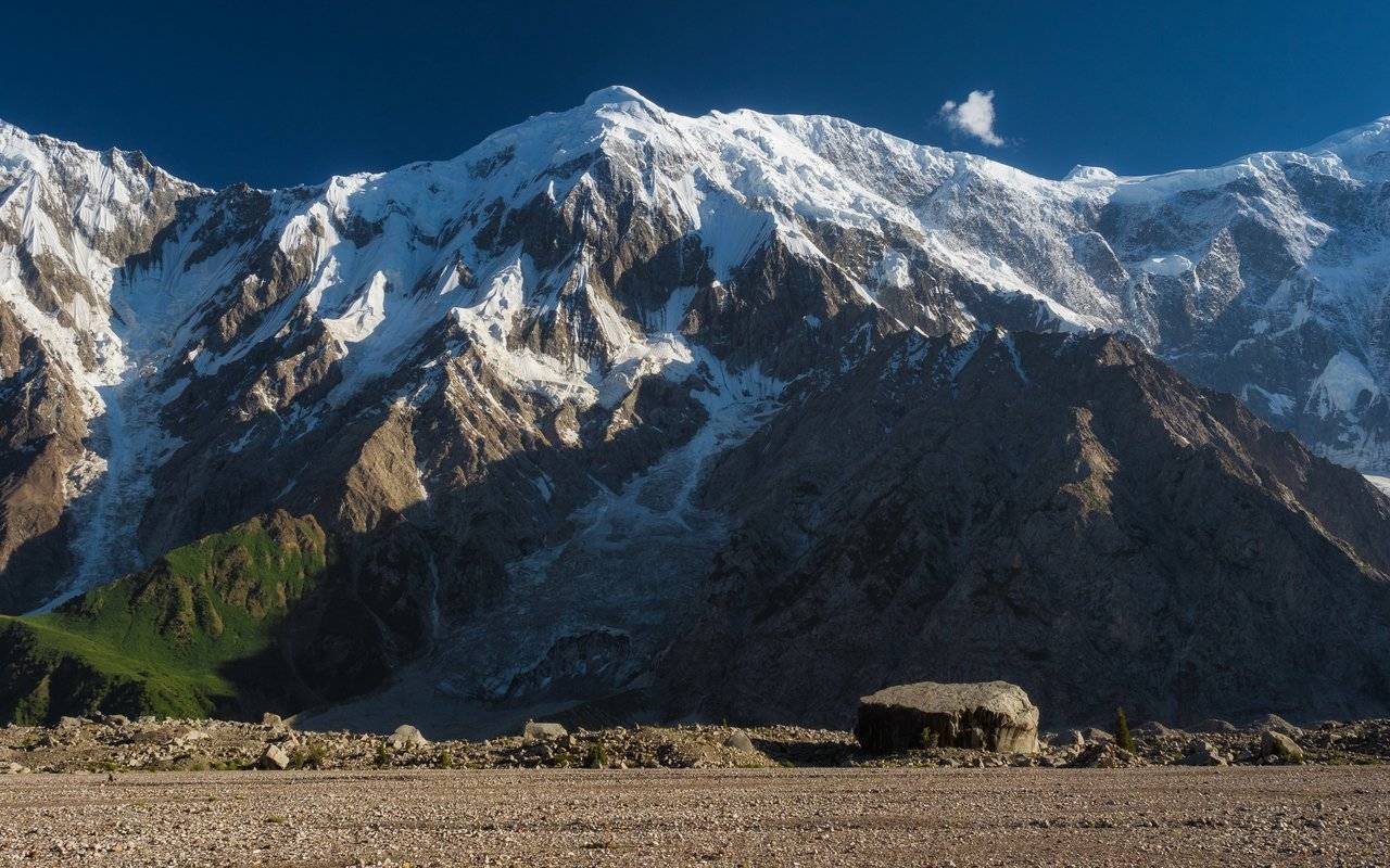
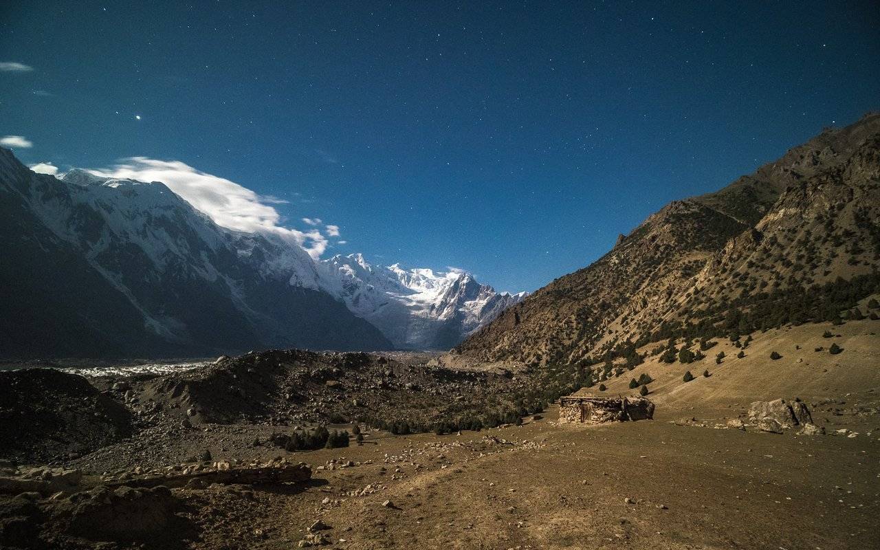
And here is the Batura glacier, along which we are walking today.
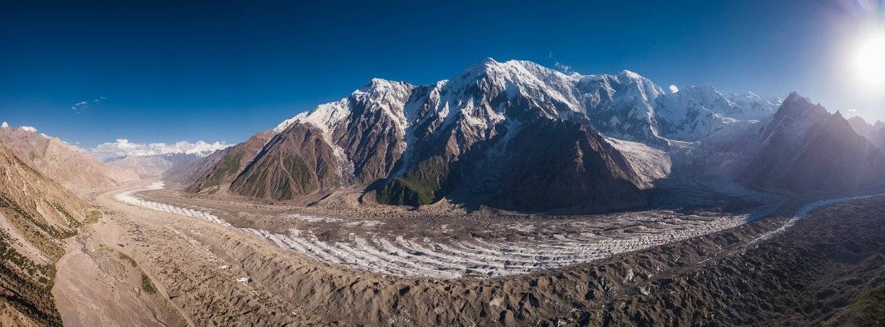
Ice streams slowly slide down from each peak, feeding the glacier.
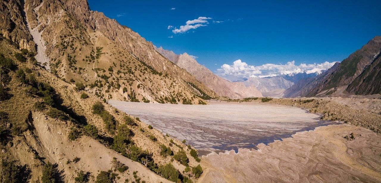
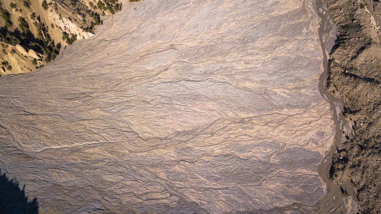
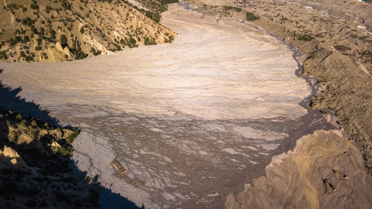
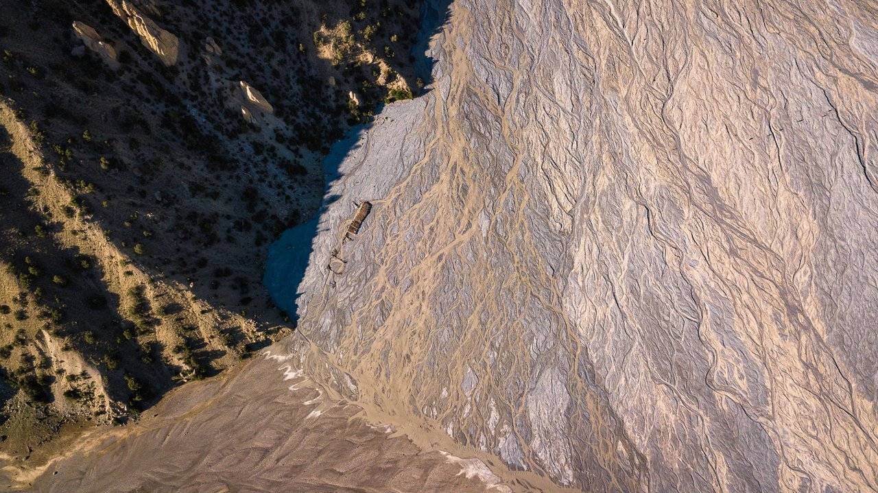
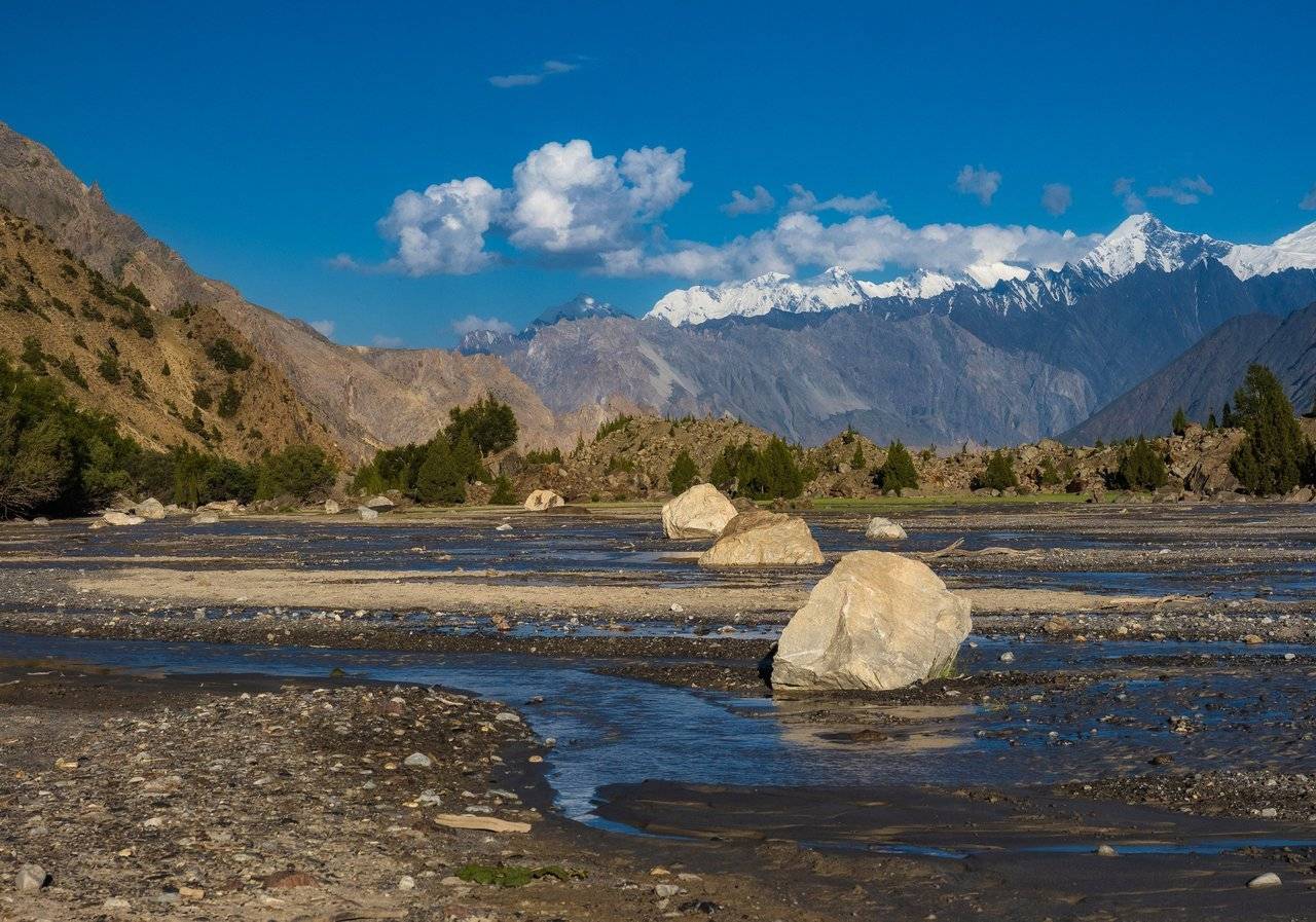
Looking again at the large plain with streams, I see the remains of houses from above. Once people tried to live in this place, having built houses near the slope, next to a mountain stream running out of the gorge. There is water, firewood, and the view of the mountains is absolutely wonderful. And everything would be fine if it were not for a dangerous natural phenomenon — a mudflow. Most likely, due to the rapid melting of glaciers, a mud stream mixed with stones demolished dwellings, leaving only a few logs on the ground and decorating the surface with hundreds of intertwining streams.
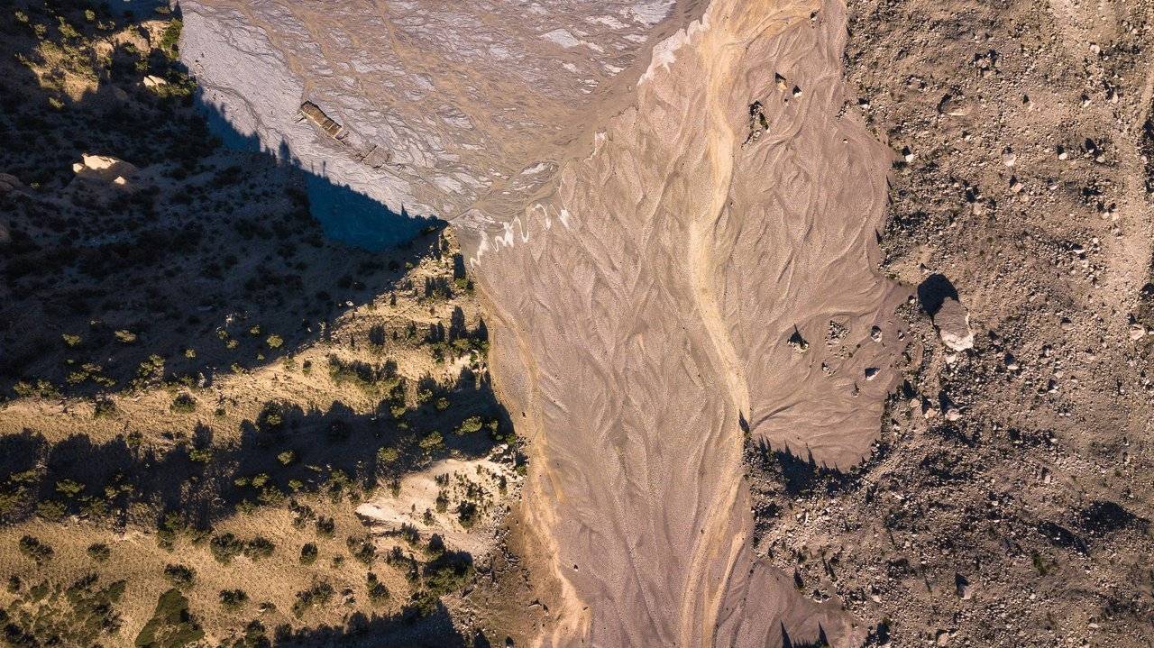 |  |  |
The dots in the upper right corner of the picture are our group, languishing with thirst, crawling towards the camp :)
Having finished flying, I set off and only then clearly realized that I was left alone. During these half an hour, the whole group definitely ran ahead, and I don't have any chance of catching up with them. I walked alone in the valley between the huge seven-thousanders, having finished my last sip of water, and tested new sensations for myself.
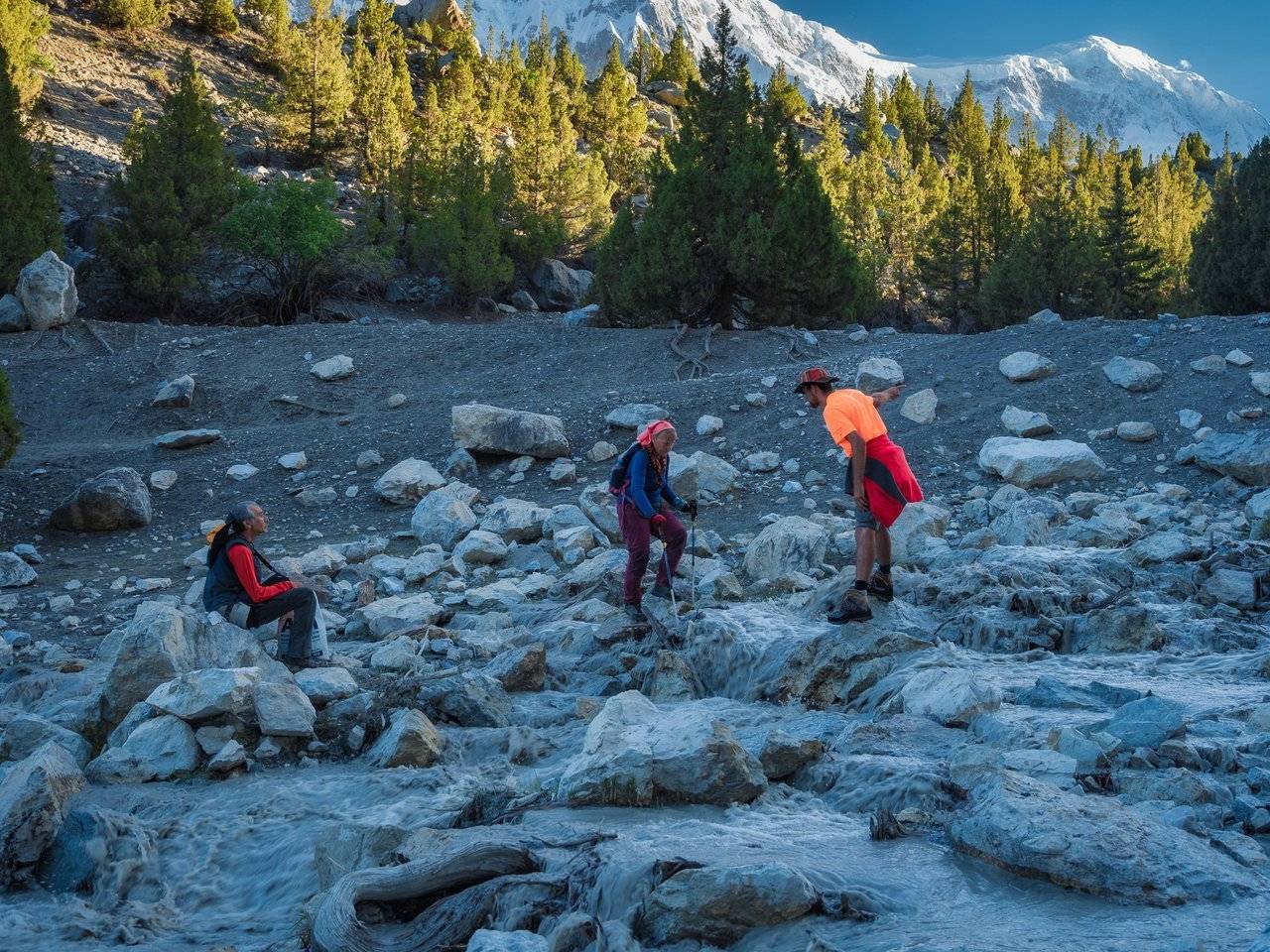
But after a large plain, after a while I suddenly saw a bright spot of an orange T-shirt — Dima was waiting for me.
I cheered up, and we continued to walk together, catching up with the rest.
When greenery appears around, and a friend is nearby, somehow everything immediately becomes cozier and more pleasant :)
I wish I could suddenly be on this snowy ridge! It would not be so hot anymore, and there is where to get water...
Looking up, we noticed a group of stone "honey agarics" above. Very pretty.
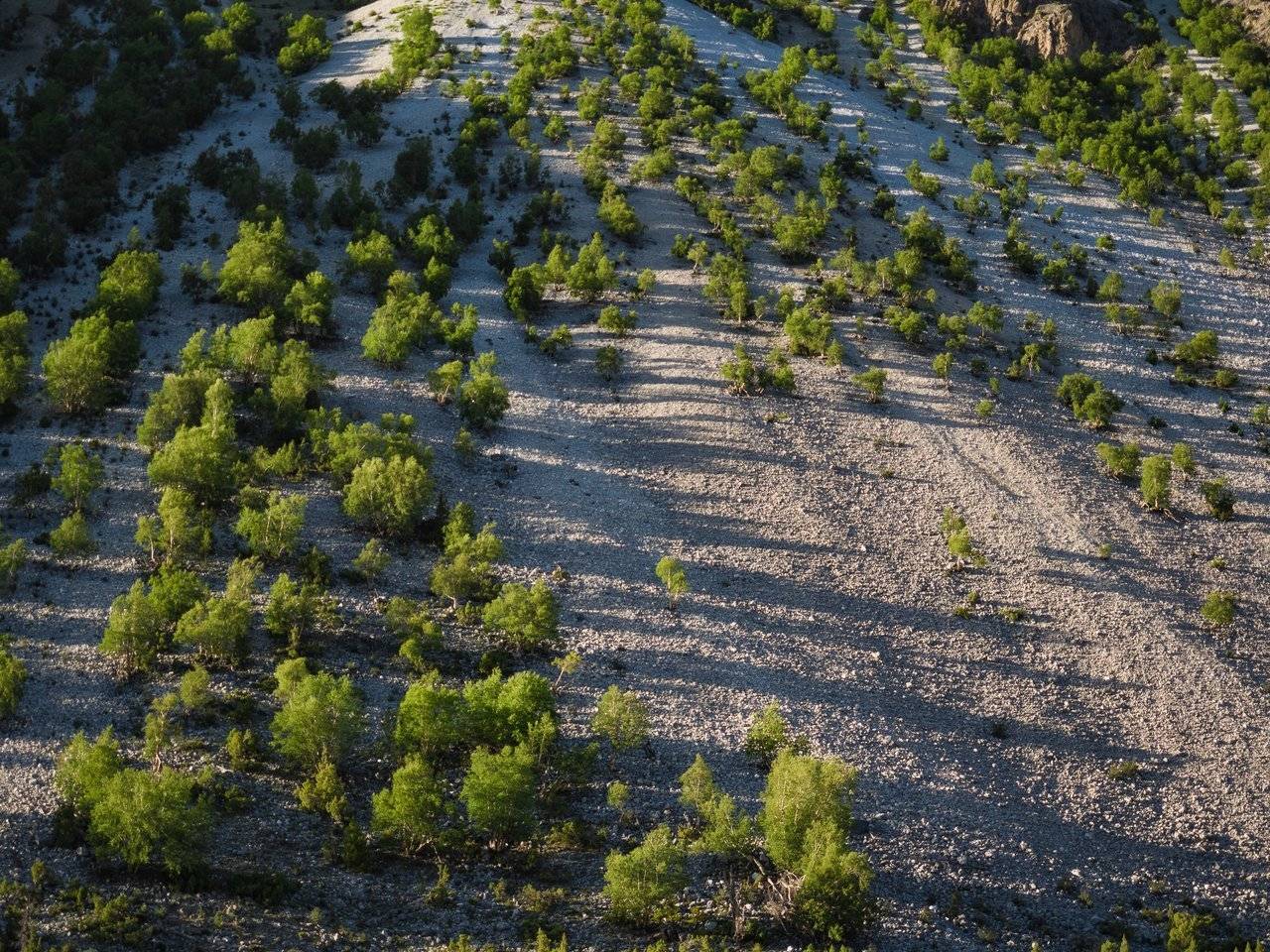
On an unstable rocky slope, along which mudflows can slide at any time, trees still manage to grow quite often. Well, maybe they will at the same time hold these gravel placer together with their roots more reliably.
These stones are clearly left here after the last landslide. It must be scary when such heavy stones playfully jump up and down on the move and rush down along with the rubble.
Due to today's hot weather, the glaciers around began to melt much more actively, and the small river turned into a turbulent muddy stream, sometimes overwhelming the log-bridge.
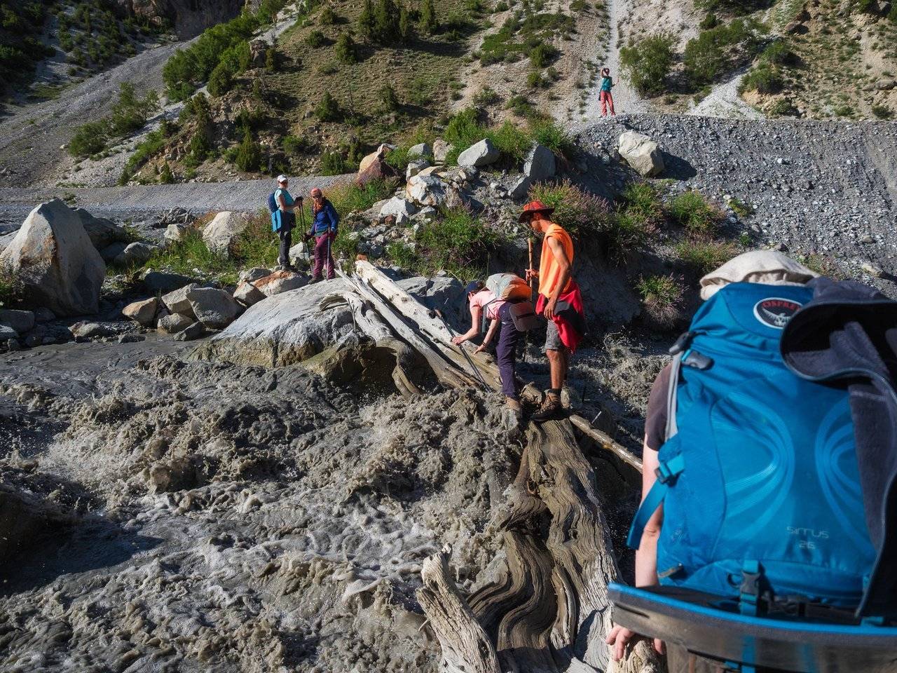
In the morning we got over here quite simply, but now the water strives to throw us off the log, which has become wet and rather slippery.
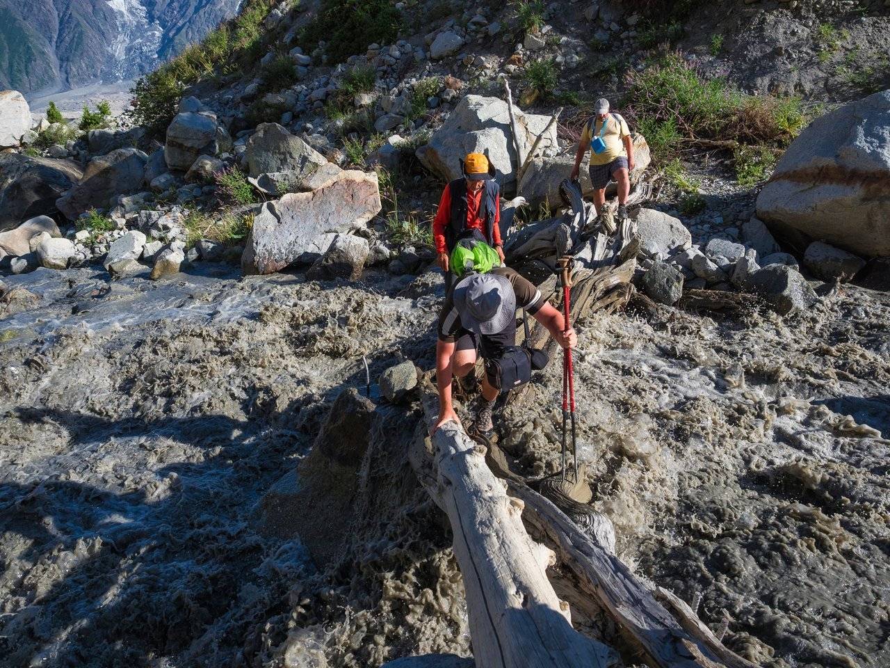
Where there was a stream in the morning that could be jumped quite easily in many places, now there is also a serious stream. We understand that we will have to return and look for a crossing somewhere upstream.
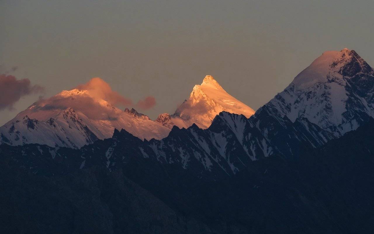
How nice it is to see a village in the distance! We do not have time to get there by sunset, so I take pictures from the hill. The peak on the right, whose summit is covered by a cloud, is called Momhil Sar (7414 m), the summit to the left is Lupghar Sar (7200 m). But I could not find the names of the other peaks.
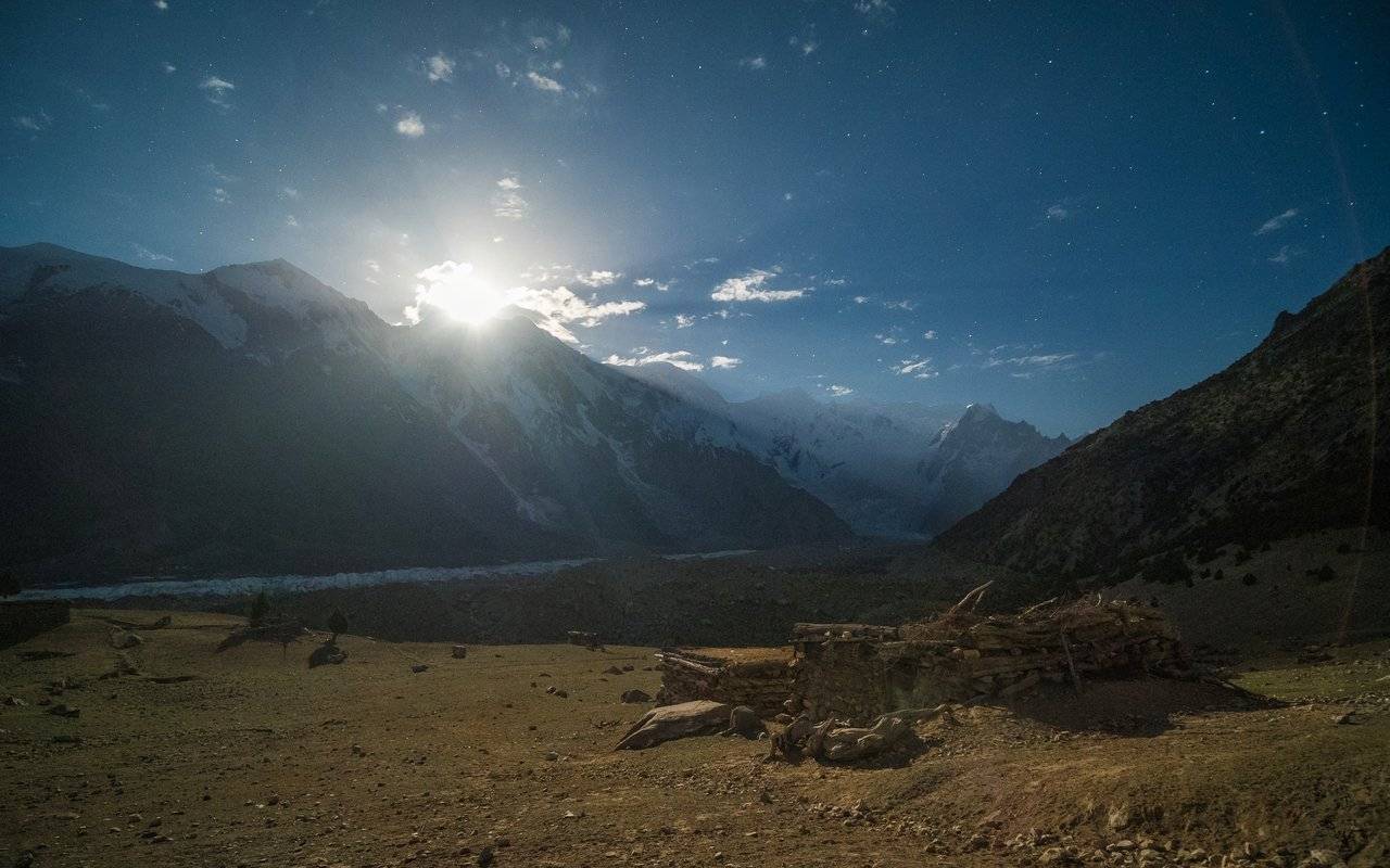
The last climb is the most difficult one. The huts approach very slowly, but we climb step by step.
I see @kibela near the house. From time to time on the way, I envied her — to be honest, I would also like to stay in the hut and walk in the vicinity during the day, maybe go to the meadow or in the other direction... I am telling her briefly about the track, how tired I am and how I'm thirsty. We got to the local water pipe — got drunk, washed, changed clothes. There are mosquitoes in the hut, I ask her to close the door, forgetting that there are still a lot of cracks in the walls. The door, which previously closed normally, now resists. What happened?
It turns out that when we left, she went on to sleep in the hut. And the shepherds passing by with the herd saw the unlocked door and closed it with a latch. There was almost no one left in the village, and no one came close to this house. Bayram freed her about an hour before our arrival, when he came to visit her. So she sat all day in confinement and almost without drinking — when I left in the morning, I took almost all the water. She tried to get out, almost opened the door, but still decided not to break it completely — after all, this is someone else's house. Poor thing, she too had a hard time!
Oleg, who was given the nickname Big Boss, the phone fitness program that day said: "This is your best day!" Of course, there was so much hiking in the mountains!
It turns out that today we have covered about 29 km, gaining 400 m of altitude. Many hours of walking in the heat, some of which we walked near the water, but without it.

Ready to Blog & Earn?
With TravelFeed, easily start your own travel blog and earn as you go. It's the smart platform for travelers who want to profit from their passion. Create a free account
And Bayram gave pasta for dinner! With carrots and chili peppers. It turned out to be a very spicy dish, even I felt good. In addition, I received a double portion — one of us was weak in the stomach and did not want to eat at all. Black tea with ginger and sleep sooner — but only after a night photoshooting with the stars!
Tomorrow at dawn I decided not to get up, and and lying down in my sleeping bag turned off the alarm clock: I really need to recover from today's "small, easy" track. After all, tomorrow we will cross the glacier Batura in the opposite direction — we will go back to civilization, and the path here through it was not easy, I remember.
To be continued...
Parts of the journey:
Don't Forget: Get Travel Health Insurance!
To make your trip a worry-free experience, TravelFeed recommends SafetyWing Nomad Insurance. It provides comprehensive health coverage while you travel, so you can focus on exploring, not the unexpected. Get a quote here
- The Land of High Mountains: Pakistan. Day 1. Arrival and Transfer to the Mountains
- The Land of High Mountains: Pakistan. Day 1. Trekking to Fairy Meadows
- The Land of High Mountains: Pakistan. Day 2. Acclimatization
- The Land of High Mountains: Pakistan. Day 3. Trekking to Nanga Parbat Base Camp - Start
- The Land of High Mountains: Pakistan. Day 3. Trekking to Nanga Parbat Base Camp - Finish
- The Land of High Mountains: Pakistan. Day 4. From the Himalayas to the Karakoram
- The Land of High Mountains: Pakistan. Day 5. The road to Mount Rakaposhi - Hakapun or further?
- The Land of High Mountains: Pakistan. Day 5. The road to Mount Rakaposhi - Base Camp
- The Land of High Mountains: Pakistan. Day 6. Minapin Glacier and Ice Bridge
- The Land of High Mountains: Pakistan. Day 7. How to Get to the Eagle's Nest?
- The Land of High Mountains: Pakistan. Day 8. Hike to Ladyfinger Peak
- The Land of High Mountains: Pakistan. Day 8. Walk in Karimabad to Altit and Baltit Forts
- The Land of High Mountains: Pakistan. Day 9. Karimabad and the Sacred Rocks of Hunza
- The Land of High Mountains: Pakistan. Day 9. Attabad Lake, Hussaini Bridge and Passu Cathedral
- The Land of High Mountains: Pakistan. Day 10. Crossing the Batura Glacier: the Beginning
- The Land of High Mountains: Pakistan. Day 10. Crossing the Batura Glacier: Finish
- The Land of High Mountains: Pakistan. Day 11. Shepherd's Village of Yashpert and Bayram Stories
- The Land of High Mountains: Pakistan. Day 11. The Vicinity of the Yashpert Village. Hidden Meadow
- Pakistani Goats
- The Land of High Mountains: Pakistan. Day 12. Trekking to Nowhere
- The Land of High Mountains: Pakistan. Day 12. Trekking to Nowhere - The Way Back
- The Land of High Mountains: Pakistan. Day 13. Trekking to the Passu Valley
Camera: OLYMPUS E-M1 Mark II and DJI Mavic 2 Pro
It's better to watch the photos in high resolution — just click on them and open in a new window.
You can also see my photos in my blog LJ and in my profile on NatGeo

Travel Resources for your trip to Pakistan
Recommended by TravelFeed
Flights: We recommend checking Kiwi.com to find the best and cheapest flights to Pakistan.
Accomodation: Explore the best places to stay in Pakistan on Booking.com, Agoda and Hostelworld.
Travel Insurance: Medical emergencies abroad can be pricey, but travel health insurance is not. We always use SafetyWing for affordable and reliable coverage.
Car Rental: For hassle-free car hiring, DiscoverCars is our trusted choice with a wide selection of vehicles.
Internet: Got an eSIM compatible phone? Airalo is perfect for reliable internet access during your trip. Just install it before you go, and you're set!
Day Trips & Tours: We recommend GetYourGuide for a variety of well-organized and enjoyable activities.
Travel Planner: Need a hand planning? Our free travel planner chatbot is your personal guide to Pakistan. Chat now.
Disclosure: Posts on TravelFeed may contain affiliate links. See affiliate disclosure.
