![På toppen af Danmark / Hiking at the top of Denmark / Wyprawa na koniec Danii [EN/PL]. Part/Część 2](https://img.truvvle.com/?src=aHR0cHM6Ly9pbWcudHJhdmVsZmVlZC5pby9zbnVma2luJTJGMjAyMS0xMi0xMi0yMC0xMi04NDYtaW1nXzEyODgtanBn&width=3840)
[ENG] A sand buried church, wandering dunes (ie. it's the dunes that are wandering, not I...), the very top of Denmark, navy seal, bunkers from WWII - I saw all of these during my Nordsøstien (North Sea Trail) hike on cold Saturday in December. Join me in my hike "På toppen af Danmark". This is part two of my article (see part one first).
[POL] Kościół zasypany przez piasek, wędrujące wydmy, najsampółnocniejszy koniec Danii, foka na straży, bunkry z IIWŚ - to wszystko w czasie jednego dnia na szlaku Nordsøstien (Szlak Morza Północnego) w grudniową sobotę. Zapraszam na drugą część wędrówki "På toppen af Danmark" (najpierw polecam lekturę pierwszej).
Plan
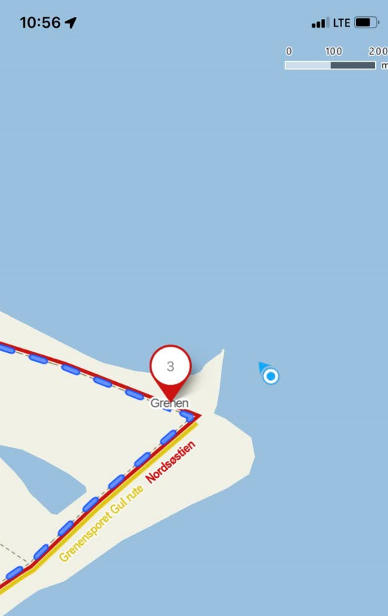
[POL] Mój plan to pętla 22km z północnym przylądkiem Danii jako główną atrakcją. Początek i koniec to ciekawe miejsce na południe od Skagen - kościół zasypany przez piasek (Den Tilsandede Kirke). Parkuję (parking darmowy) pod zasypanym kościołem i tuż po wschodzie słońca (czyli o 9:00...) ruszam w trasę. Będę szedł - mniej więcej - ścieżkami w ramach Nordsøstien (część Szlaku Morza Północnego w północnej Danii).

[ENG] My plan is a 22km loop with Denmark's northernmost tip as my main destination. My start and finish points is the parking (free) at the Sand Buried Chruch (Den Tilsandede Kirke) , just south of Skagen. I will - mostly - follow trails that make up Nordsøstien (part of the North Sea Trail in northern Denmark).
På toppen af Danmark
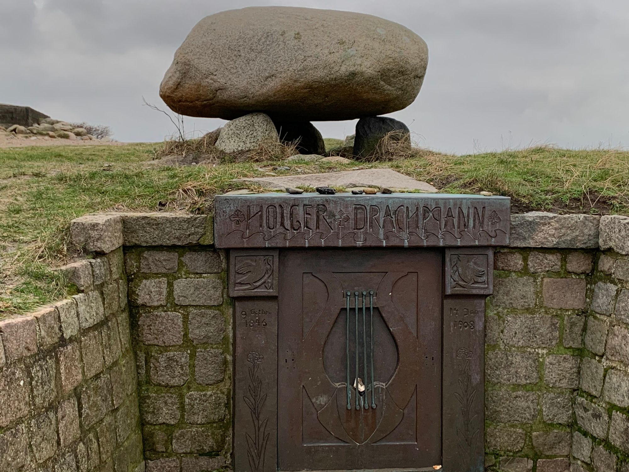
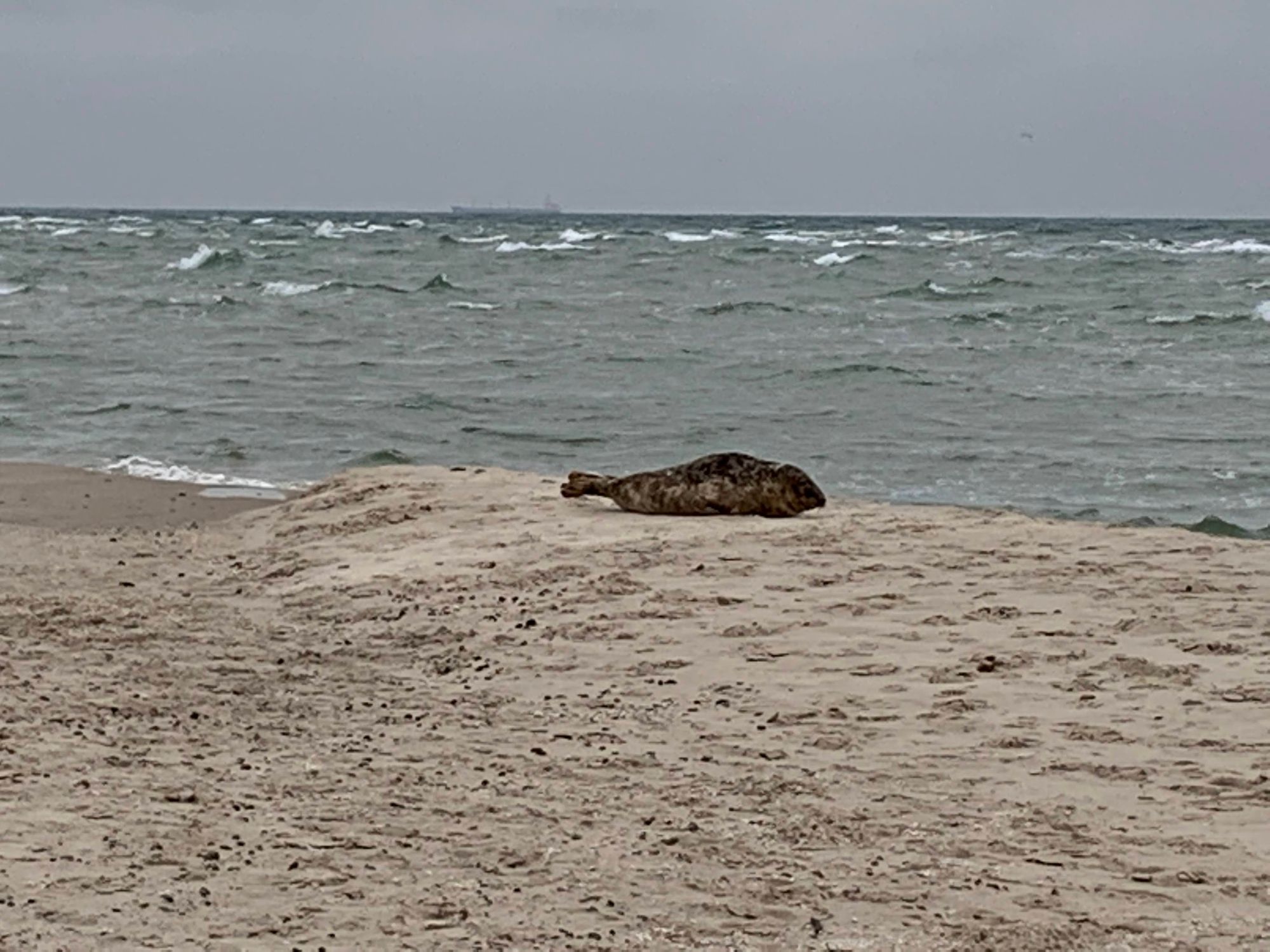
[POL] Idąc na północ, mijam grób Holgera Drachmanna, duńskiego poety z XIXw, który zakochał się w Skagen. Od teraz przez dłuższy czas nie będę widział ruin/pomników/budowli. Będzie tylko natura. Na początek foka (lub foko-podobne zwierzę - znawców poproszę o komentarz). Zrobiłem zdjęcie z daleka. Zbliżałem się powoli (była na mojej drodze na sam koniuszek Danii) a foka tylko leniwie mi się przyglądała. No to podszedłem naprawdę blisko. Nazwałem ją sobie "Navy Seal" - strażnik(-czka?) północnego końca Danii.
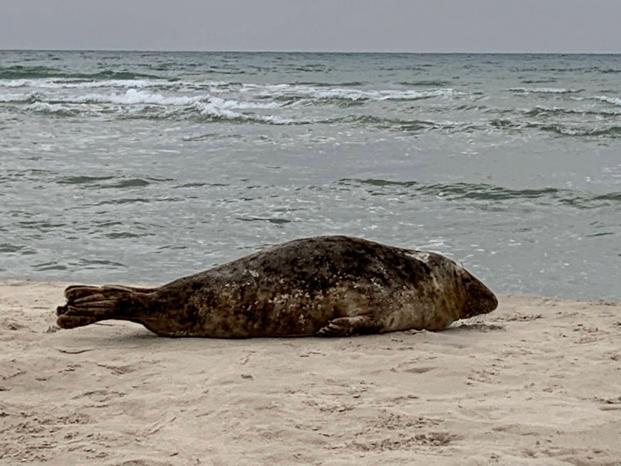
[ENG] Heading north, I passed by the grave of Holger Drachmann, XIX-century Danish poet who fell in love with Skagen. This is the last human made object I will see for the next 1.5hrs. Now I will see only nature. The first exhibit of which was at the very top of Denmark. A large seal was there, not paying much attention to the few people passing by. I first took a photo from afar, but then moved really near. The animal watched me, but couldn't care less. I called "Navy Seal" - the guardian of Denmark's northernmost tip.
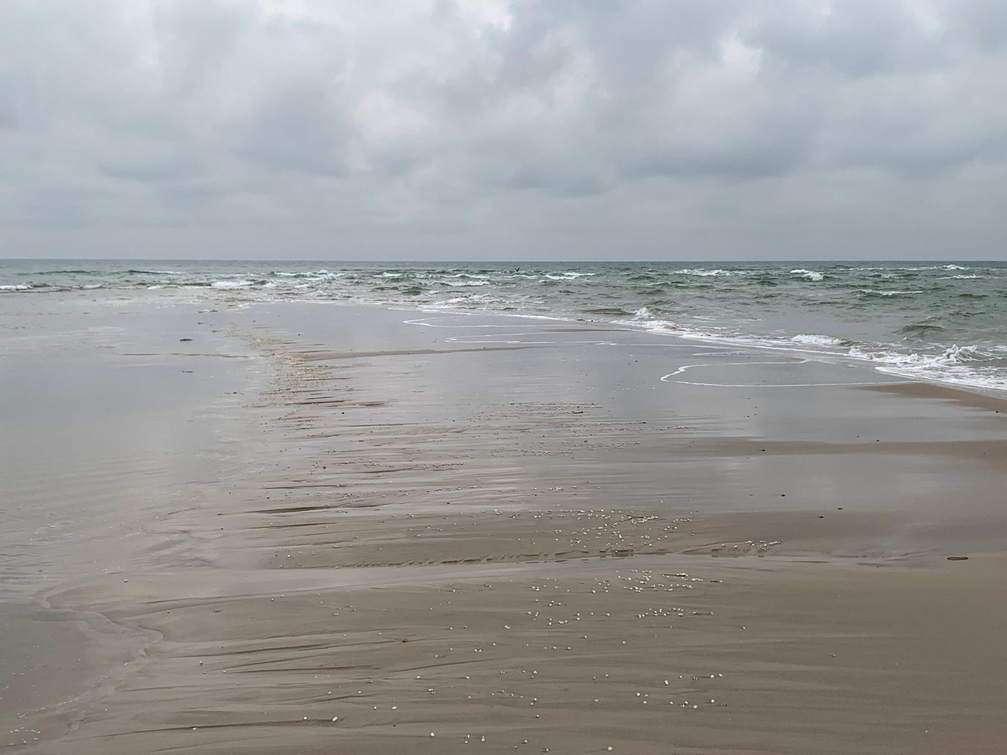
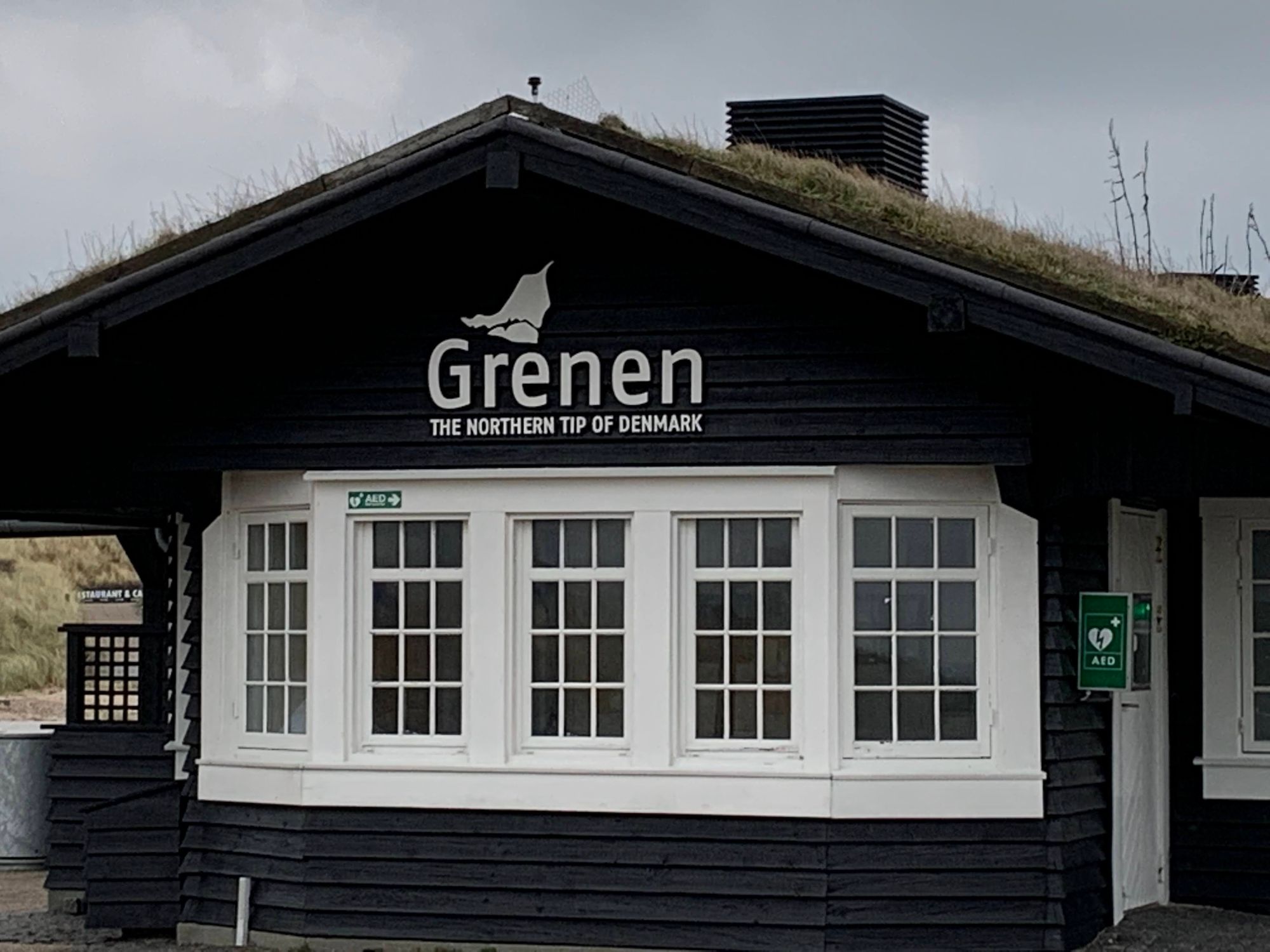
[POL] Północny cypel Danii wchodzi dość daleko w morze. Latem poszedłbym dalej po płyciźnie i miałbym fotkę z jedną stopą w Kattegat, a drugą w Skagerrak. Jest grudzień, butów nie ściągam, ale wszedłem w morze na tyle daleko, że wg GPS chodziłem po wodzie.
[ENG] Denmark's northernmost tip goes quite into the ocean. In summer I'd take my shoes off and I'd wade in the shallow water until I had one foot in Kattegat and the other in Skagerrak. But it's December so I only go as far as my trekking shoes would allow. Still, the GPS thinks I am walking on the water.
West Coast Story
[POL] Planując wyprawę obawiałem się kawałka trasy, który był teraz przede mną. Kilka kilometrów plażą brzmi fantastycznie, prawda? Aczkolwiek niekoniecznie w grudniu. I niekoniecznie po doświadczeniach ostatnich dni, z sztormowym wiatrem od wschodu i południowego wschodu. Dzisiaj jednak pogoda postanowiła nie przeszkadzać. Morze jest spokojne, nie pada, nie wieje i - jak na grudzień - jest dość ciepło. Czeka mnie długi, samotny, przyjemny spacer. "Stary człowiek i morze" ;-) (w komentarzach można się oburzyć na użyty przymiotnik...)
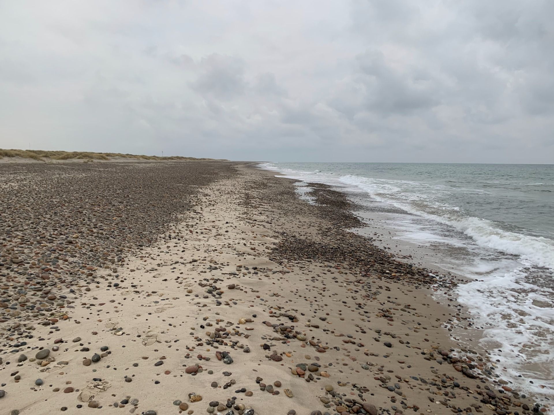
[ENG] I had been apprehensive about the following part of my hike. Several kilometres along an ocean coast might sound like a fantastic walk. However, it was December and recent stormy easterlies with rain/snow were still in my fresh memory. Nevertheless, the weather decided not to interfere. The day was calm, almost no wind, no precipitation and - as for December - relatively warm. So I had a long, lonely and pleasant walk by the seaside ahead of me. "An old man and the sea" ;-)
[POL] zwykle chodzę po górach, więc zmysły mam wyostrzone na wypukłości terenu, drzewa, nieliczne zabudowania. A tu NIC. Po prawej PŁASKO (ocean). Po lewej PŁASKO (plaża, trochę dalej niskie trawy). NIC. Nie ma na czym oka zawiesić. I ludzi też (prawie) nie ma.
[ENG] I normally hike in mountains. Therefore my senses are tuned for hills, trees, occasionally buildings. But here there is NOTHING. At my right - FLAT ocean. At my left - FLAT beach and some low grass afar. NOTHING. Even people are few and far in between.
Listen to the ocean / posłuchaj oceanu
Klit
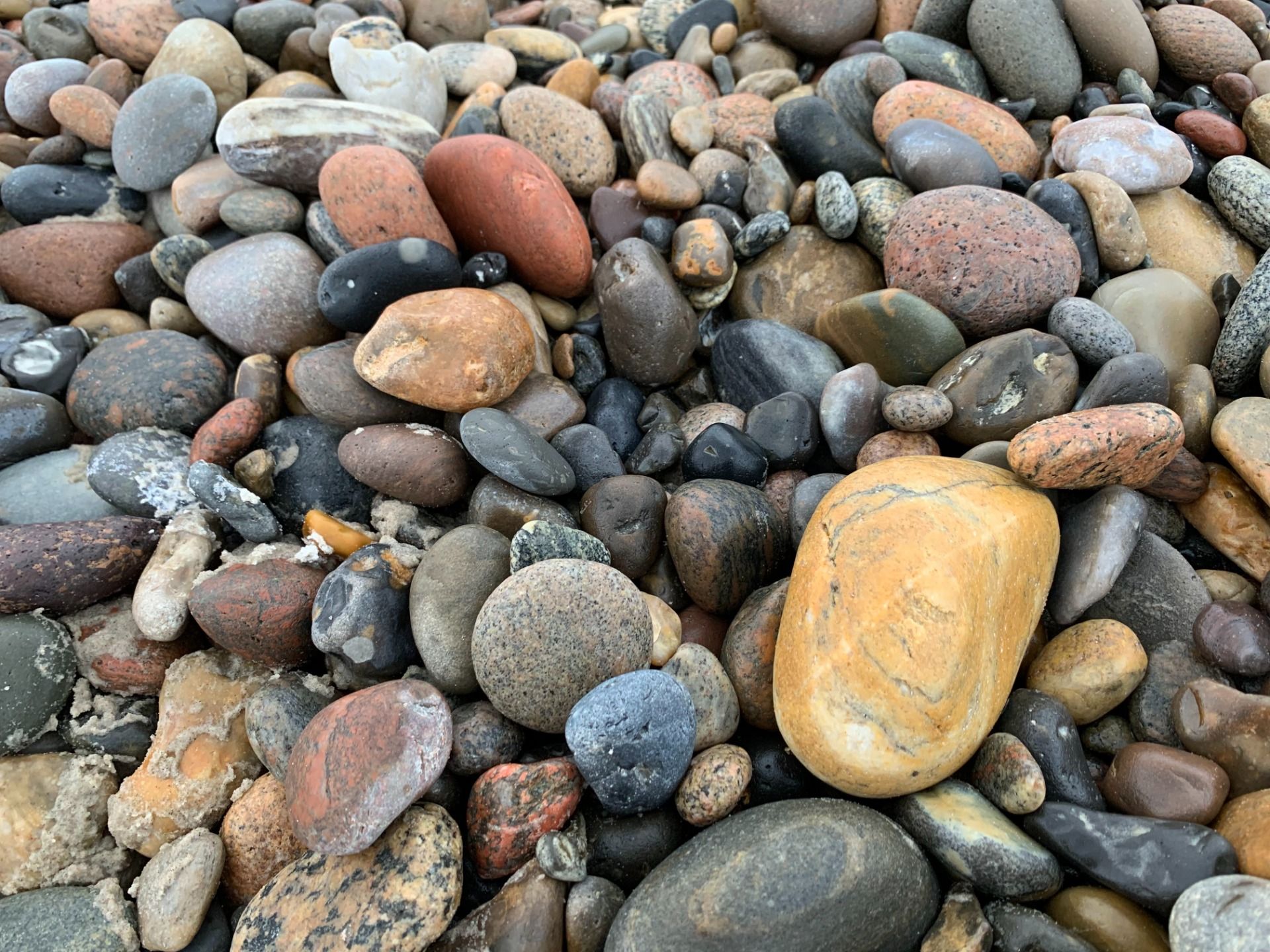
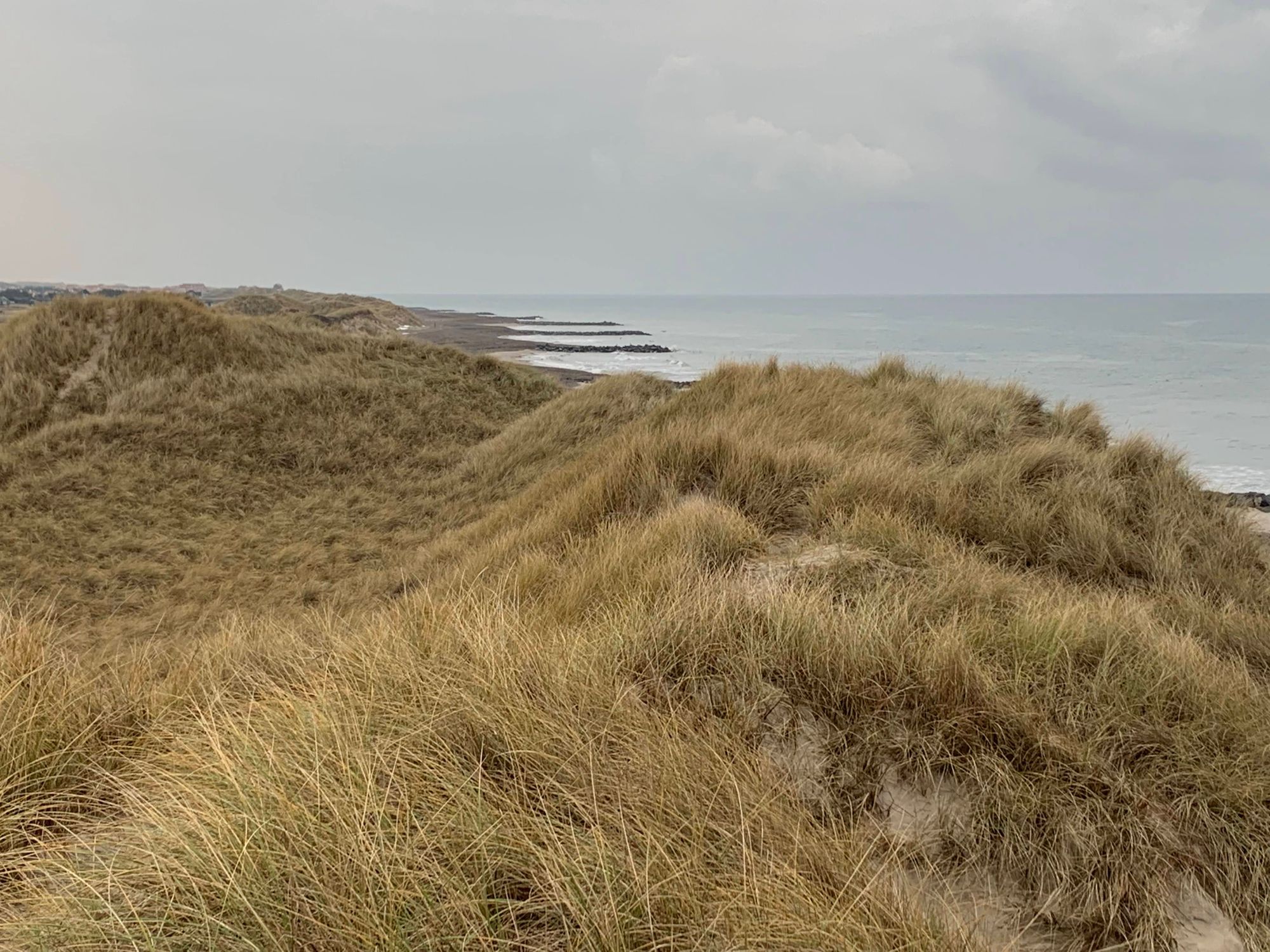
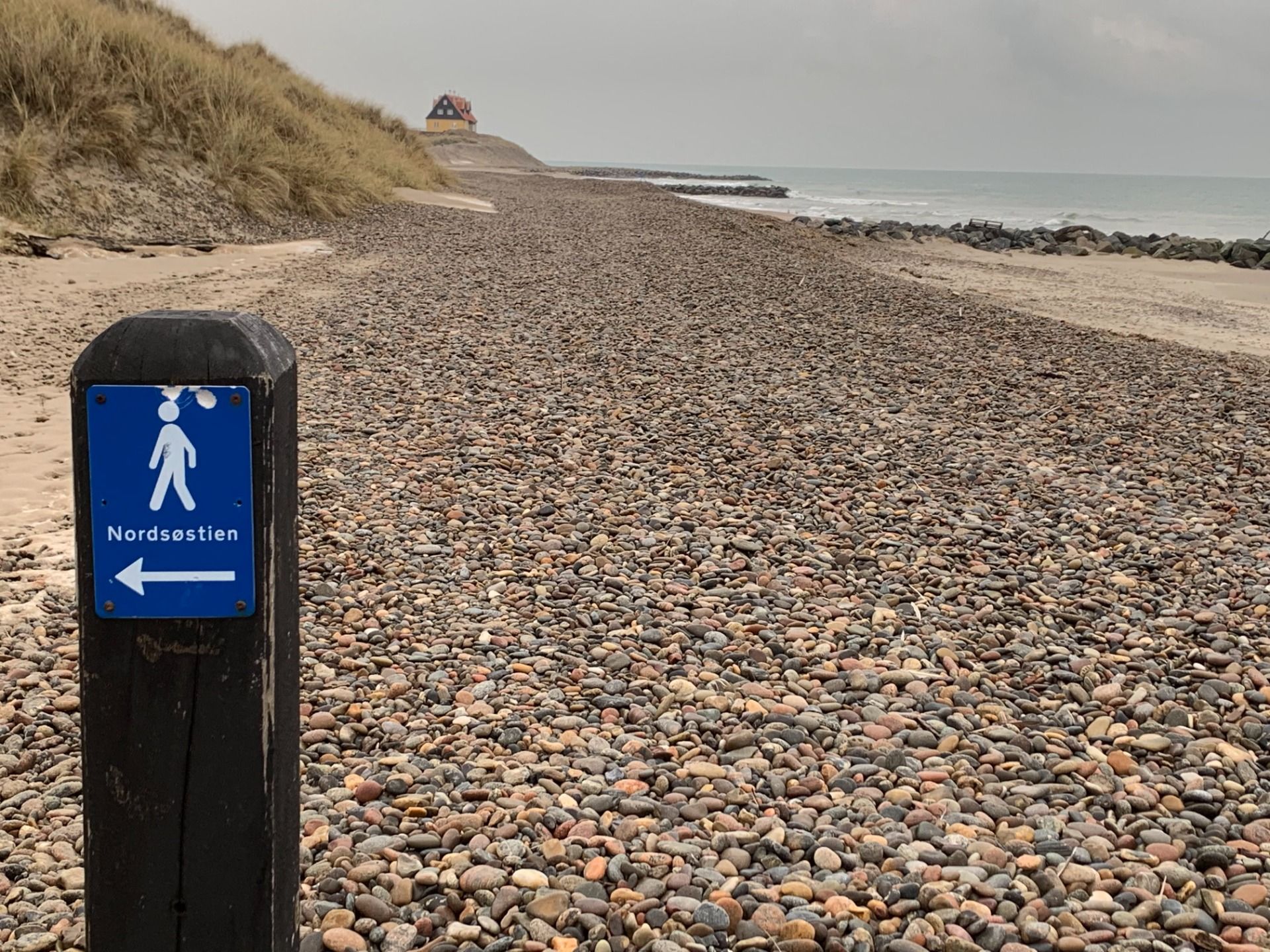
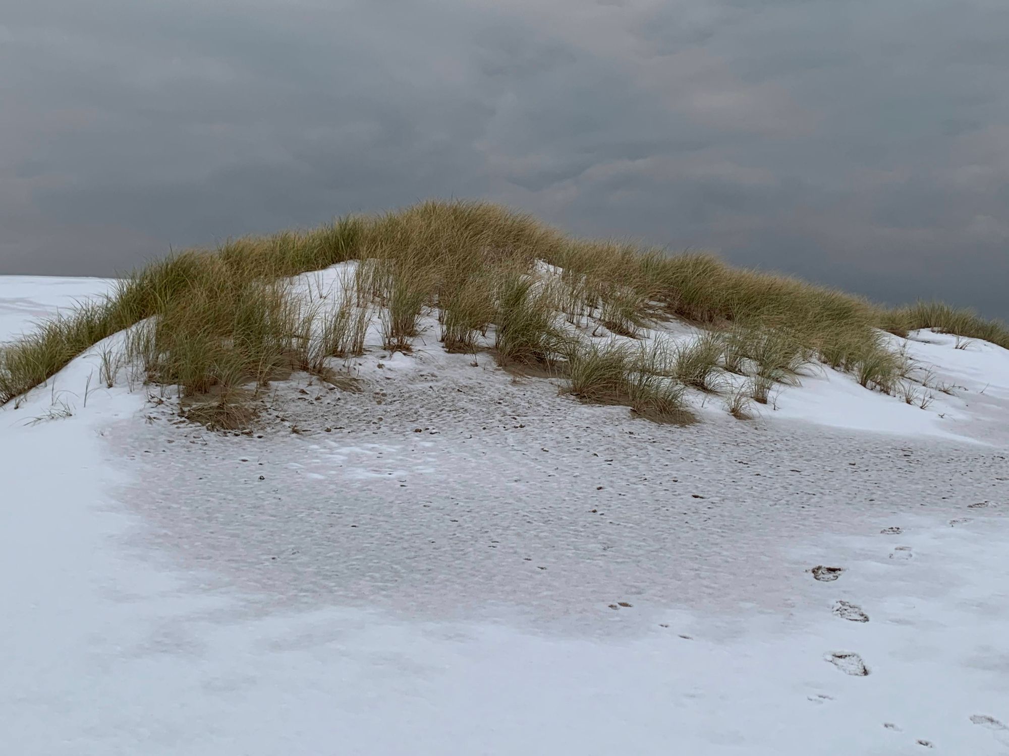
[POL] Znudzony nicością, zaczynam bliżej ją studiować. Na początek zauważam ptaki. Mewy i kormorany (?). Grają w "jak nisko potrafisz lecieć nad falami i nie zmoczyć skrzydeł". Mewy wydają się w tym lepsze. Zwracam uwagę na kamienie. Są okrągłe (ale odkrycie!) - te górskie są zwykle ostre. I zauważam, że plaża nie jest jednolita. Trochę ciemnego piasku, fragmenty kamieniste - kolorowe i czarne. Czasem jakieś przedmioty wyrzucone na brzeg. I czasem brzeg po lewej zaczyna się podnosić, wydmy (dun. "klit") wydają się zbliżać do wody. Nicość zaczyna mi się podobać!
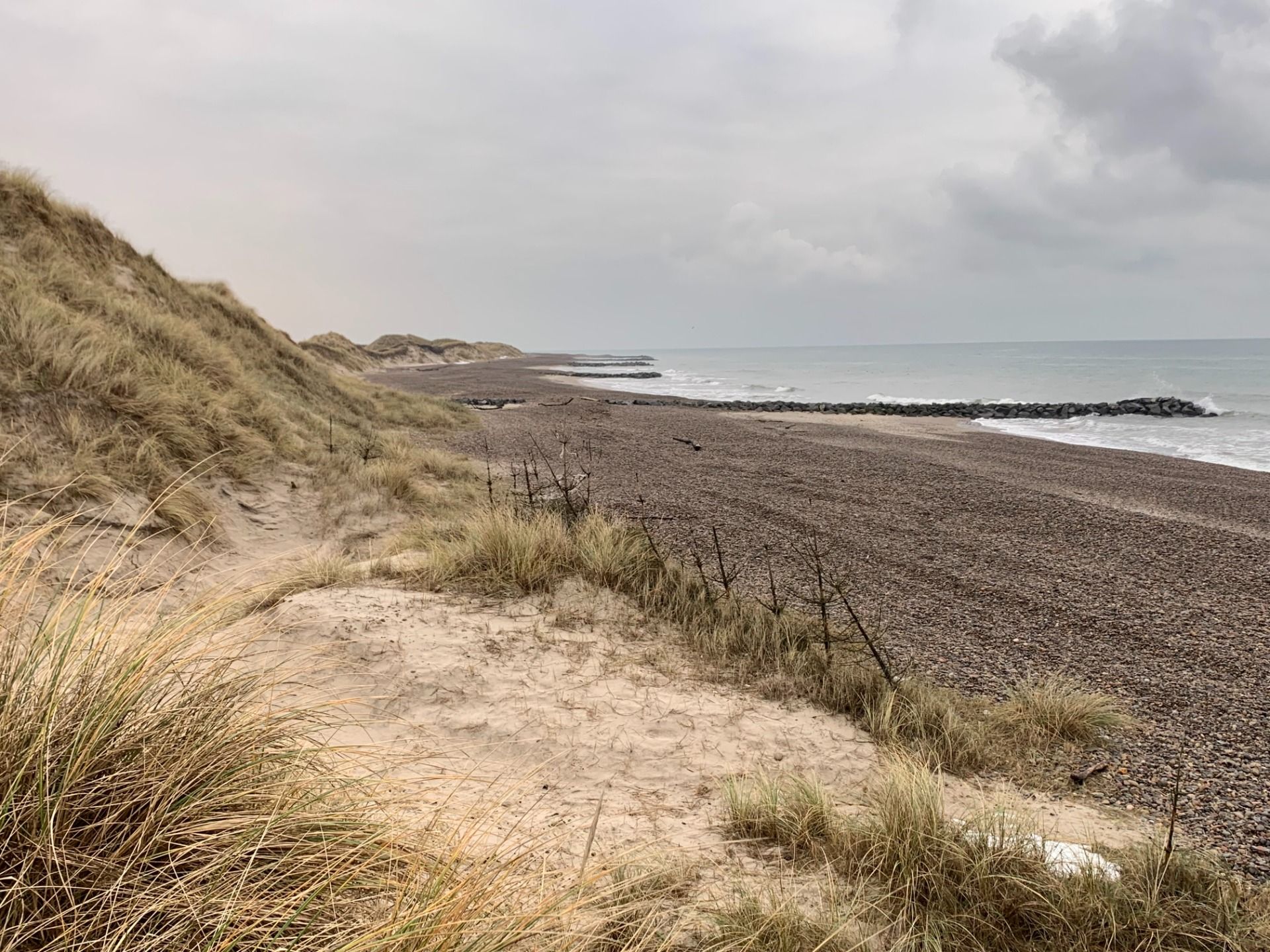
[ENG] Bored by "nothingness", my senses start to tune in. At first, I notice birds. Seagulls and cormorants (?). They play a game of "how low can you fly without making your wings wet". The seagulls seem to be better at it. Then I notice the stones. They are round (what a discovery!) and unlike those in mountains - without any sharp edges. I also notice the different surfaces - dark sand, colorful stones, black stones. Then I start to see objects washed on the shore. With time, the horizon to my left narrows down - the dunes ("klit" in Danish) seem to approach the ocean. I begin to like the nothingness.
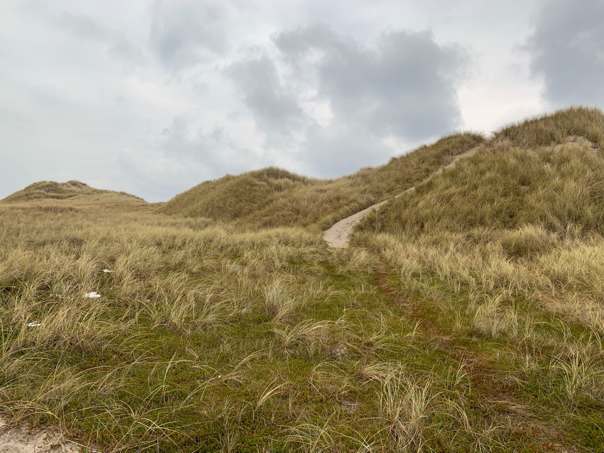
[POL] W pewnym momencie wydmy podeszły dość blisko do oceanu. I podniosły się, tworząc coś w rodzaju klifu (ale nie tak wysoki jak w Gdyni). Dotarłem do miejsca, gdzie plaża była zagrodzona w poprzek. Pomimo, że szlak prowadził dalej plażą, pomyślałem, że przejdę kawałek wydmami. Było jak w Beskidzie Niskim (zachowując proporcje wysokości): góra - dół - góra - dół. Wydmy pokryte trawą były cudownie miękkie w porównaniu z kamienistą plażą. Fajnie!
[ENG] My thoughts on nothingness were interrupted by the dunes, which came really close to the ocean. There was even a part where the beach was fenced. Even the trail clearly was following the coastline, I decided to walk a bit along the dunes. Up, down, up, down - feels like mountains. Plus softness of the grass made it a nice respite after stones on the beach. Luv it!
Højen
Come to an end, come to an end. Why do all good things come to an end?
(Nelly Furtado)
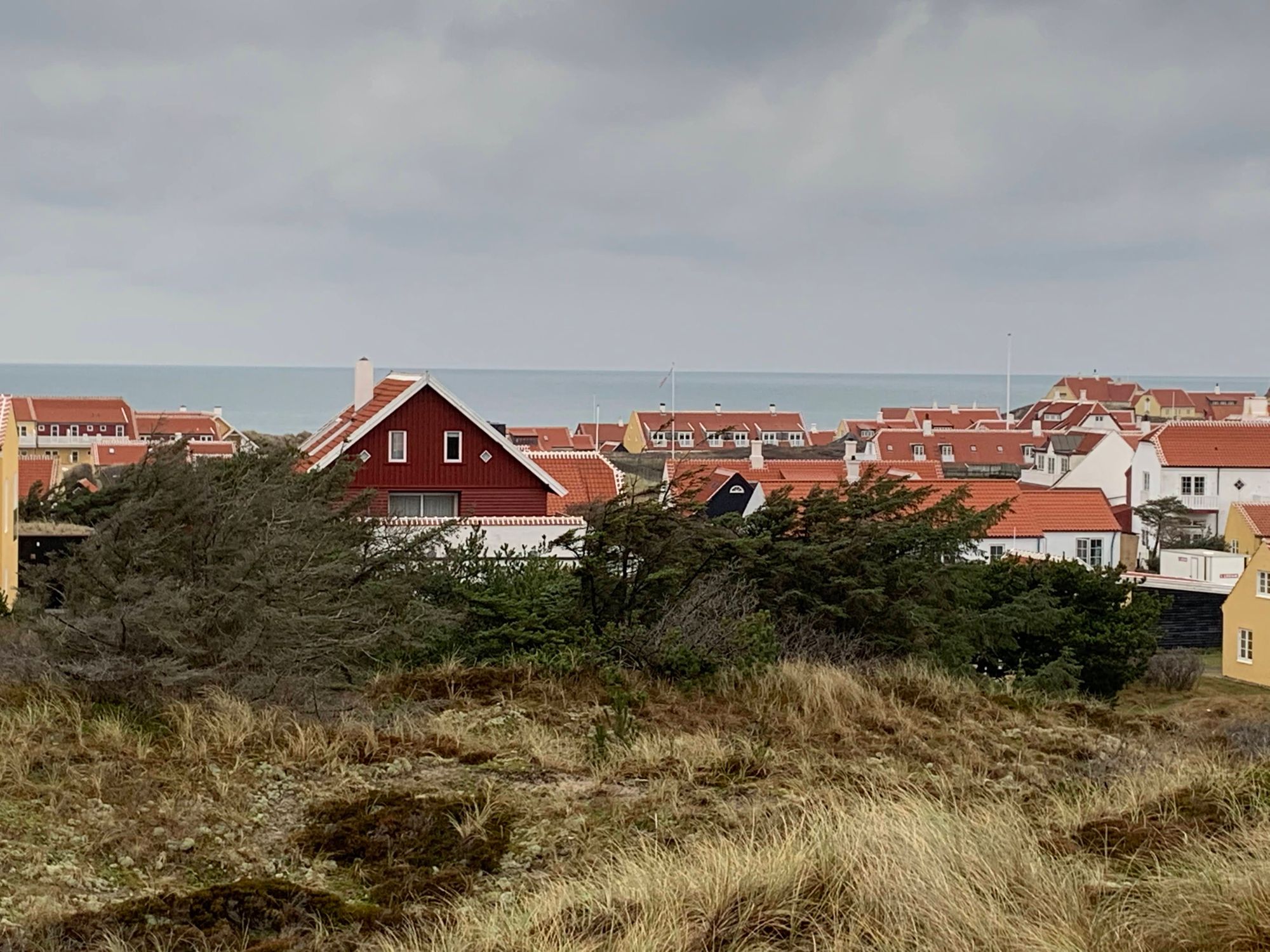
[POL] Koniec przyjemności. Naprawdę to napisałem?! Szlak skręca w lewo, czyli w głąb lądu. Trzeba teraz przejść przez niewielką osadę Højen. A potem już tylko powrót do auta.
[ENG] All the good things come to an end. The trail turns left - inland. I will now pass thru a little stead of Højen. Afterwards it will be only getting back to my car.
[POL] Szlak trochę kręci uliczkami, ale z daleka widać dziwny obiekt. Dzieło sztuki? Wieża widokowa? Zaciekawiony zostawiam na chwilę szlak i wchodzę na wydmę by sprawdzić cóż to jest.
[ENG] The trail winds around the stead. I saw a strange construction on the horizon. The trail goes nearby, so I needed to go only a bit off to check the object. Piece of art? Viewing tower?
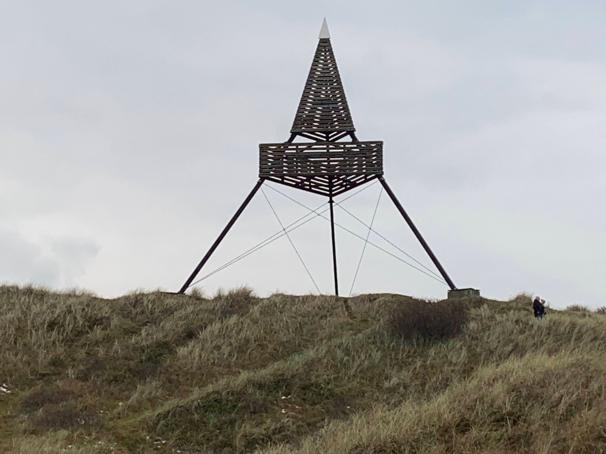
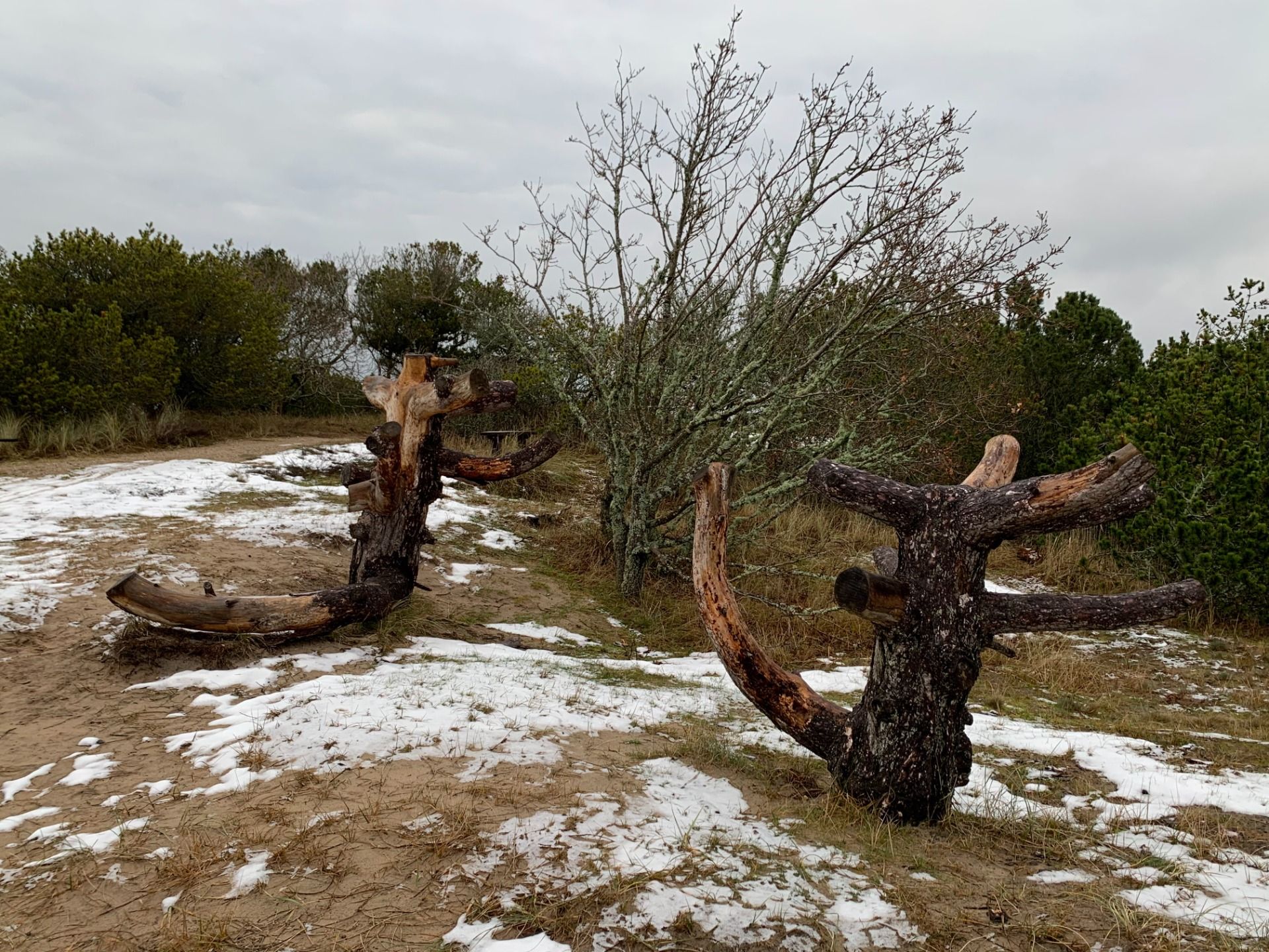
[POL] Obiekt okazuje się być punktem triangulacyjnym. W czasach przed GPS, budowano takie punkty aby poprawnie zmierzyć odległości. Kraj dzielono na trójkąty pomiędzy trzema takimi punktami, suma powierzchni trójkątów dawała w przybliżeniu powierzchnię kraju.
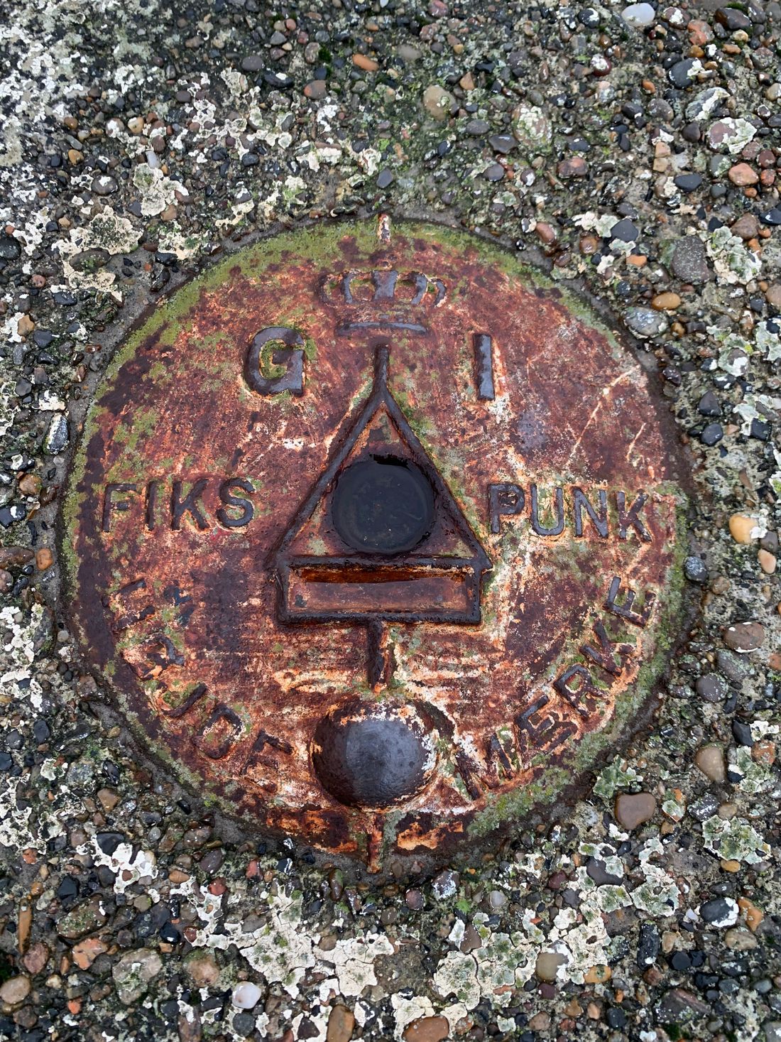
[ENG] It turns out to be a triangulation tower. In pre-GSP times, these were essential to correctly measure distance and country's area. A territory was divided into triangles (hence the name) and the sum of all triangles gave an idea about the total area
Bakken
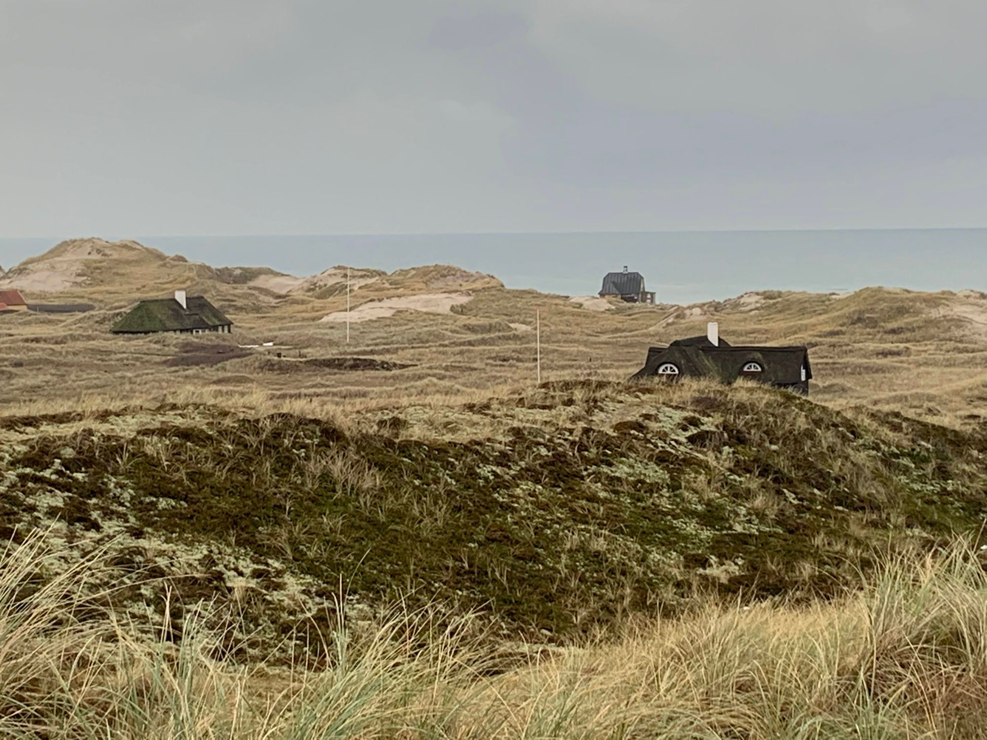
[POL] Reszta mojej wędrówki będzie pod hasłem "Bakken", czyli wzgórza. W zasadzie to nawet nie wzgórza - chodzi po prostu o wydmy, które występują także w głębi lądu. Te wydmy zasypały kościół, o którym pisałem w pierwszym odcinku "På toppen af Danmark". Jak się tam dostały?
[ENG] The rest of my hike will be marked by "bakken" - hills. Technically, they are not hills. It's dunes, which here happen to be also far from the water. These are the same dunes that buried the church I mentioned in the first part of my "På toppen af Danmark" story. How did they get there?
[POL] Żeby rozwiązać tę zagadkę, wracam do auta i jadąc na południe w stronę Frederikshavn zbaczam kilka kilometrów na zachód (w prawo od drogi nr. 40). Moim celem jest miejsce o nazwie "Råbjerg Mile".
[ENG] To solve the mystery, I got back to my car and driving south towards Frederikshavn I diverted a few kilometres to my right (west). My destination is called "Råbjerg Mile".
Råbjerg Mile
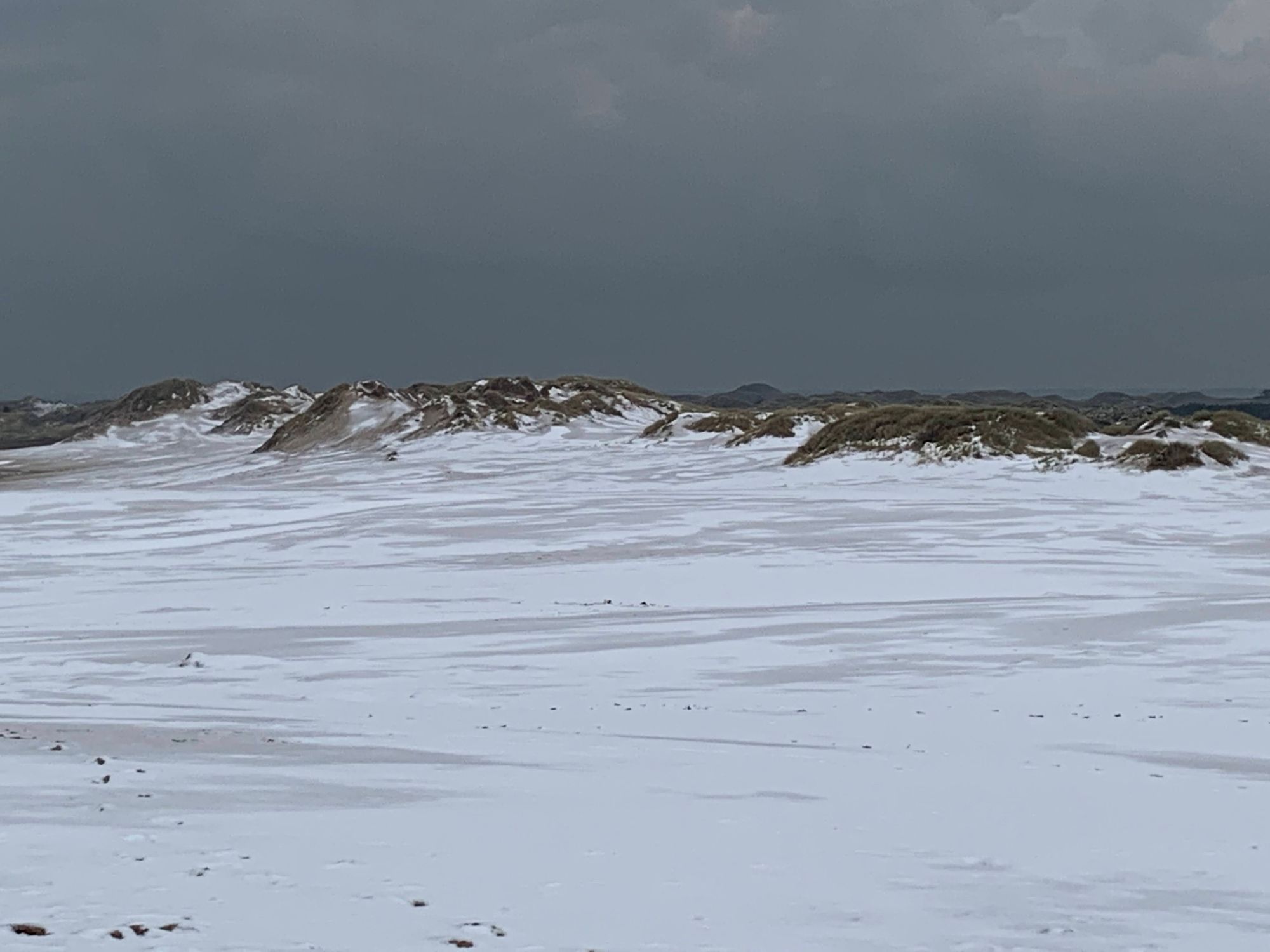
[POL] Råbjerg Mile to fenomen natury w północnej Danii. Wąski pas lądu pomiędzy dwoma morzami poddany jest wiatrom. Te wieją tu głównie z zachodu. I wieją porządnie. Zabierają ze sobą wydmy znad wybrzeża Atlantyku (Skagerrak, zachodnie wybrzeże) i przenoszą je nad Bałtyk (Kattegat, wschodnie wybrzeże). W ten sposób powstają wędrujące wydmy. Efektem ubocznym są wydmy z dala od wody i... zasypany kościół.
[ENG] Råbjerg Mile is a natural phenomenon in northern Denmark. A narrow strip of land between two seas is subject to winds. Mostly westerlies and quite strong. The winds "take" dunes from the Atlantic coast (Skagerrak) and "move" them inland, towards the eastern coast (Kattegat). Thus migrating dunes are formed. Their side effect is a sand buried church, for example.
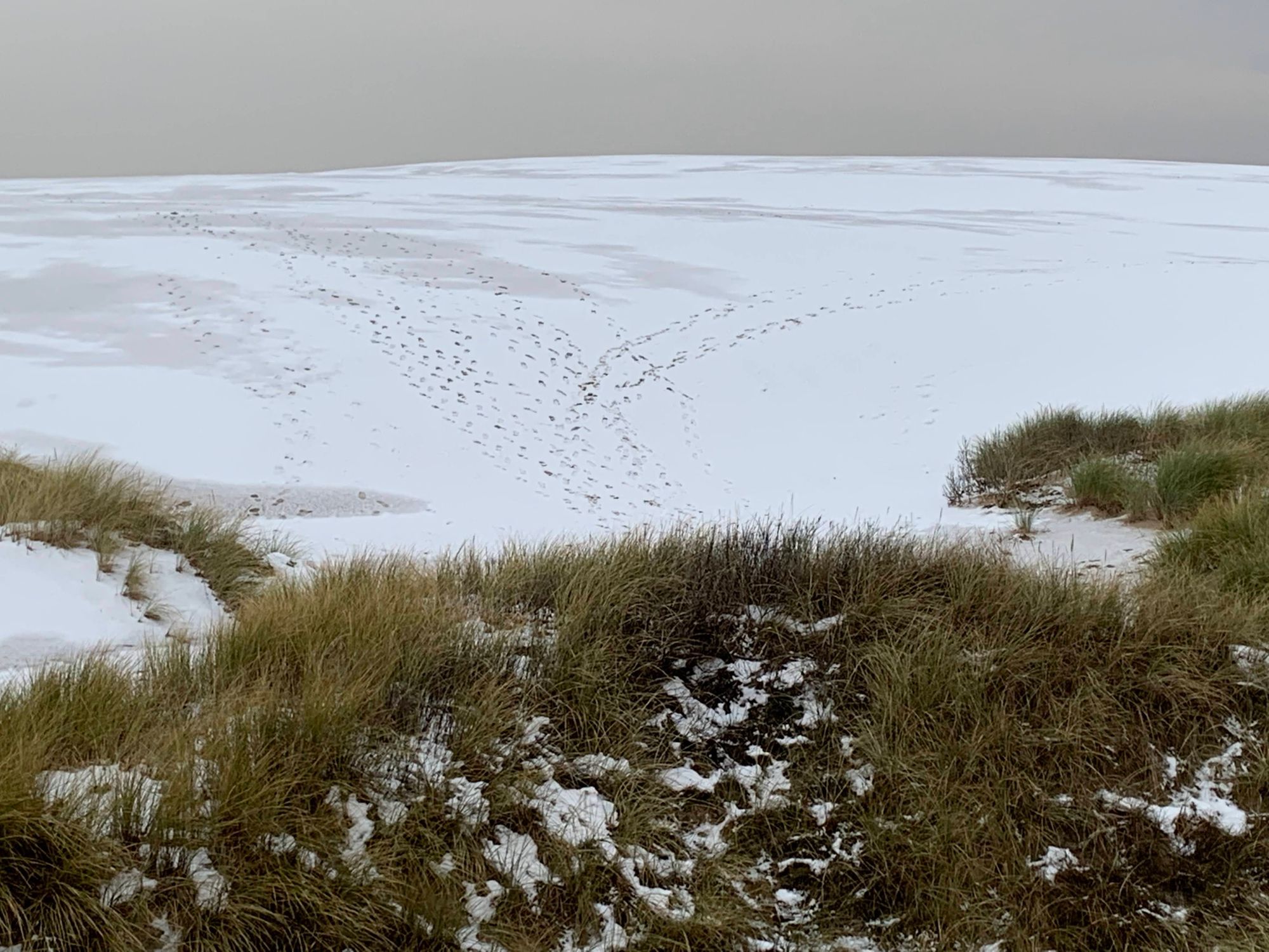
[POL] Dawno temu miałem okazję być tutaj w czasie lata. Wtedy wędrując po wydmach można odnieść wrażenie, że jesteśmy na pustyni. Dzisiaj wydmy pokryte są śniegiem. Ale na tyle cienką warstwą, że nie mam wątpliwości, że chodzę po piasku.
[ENG] I had been here in summer years ago. Then walking on the dunes is like being on a desert. Today the sand is covered by snow. But the layer of snow is thin enough to leave no doubts that there's sand under my feet.
Wrap Up
[POL] Sporo jak na jedną wyprawę, prawda? To mniej więcej połowa mojej trasy. Odsyłam do pierwszej części "På toppen af Danmark", w której był kościół zasypany przez wydmy, senne Skagen, bunkry na plaży i Szara Latarnia. A jak będziecie w północnej Danii, to odwiedźcie Saeby.
[ENG] Quite a few attractions for one hike, isn't it? It's about half of my hike that day. See the first part of my blog post "På toppen af Danmark". I started at a sand buried church, went thru sleepy Skagen and walked along the beach of Kattegat, seeing WWII bunkers and the Grey Lighthouse. If you happen to be in northern Denmark, pay a visit to Saeby.