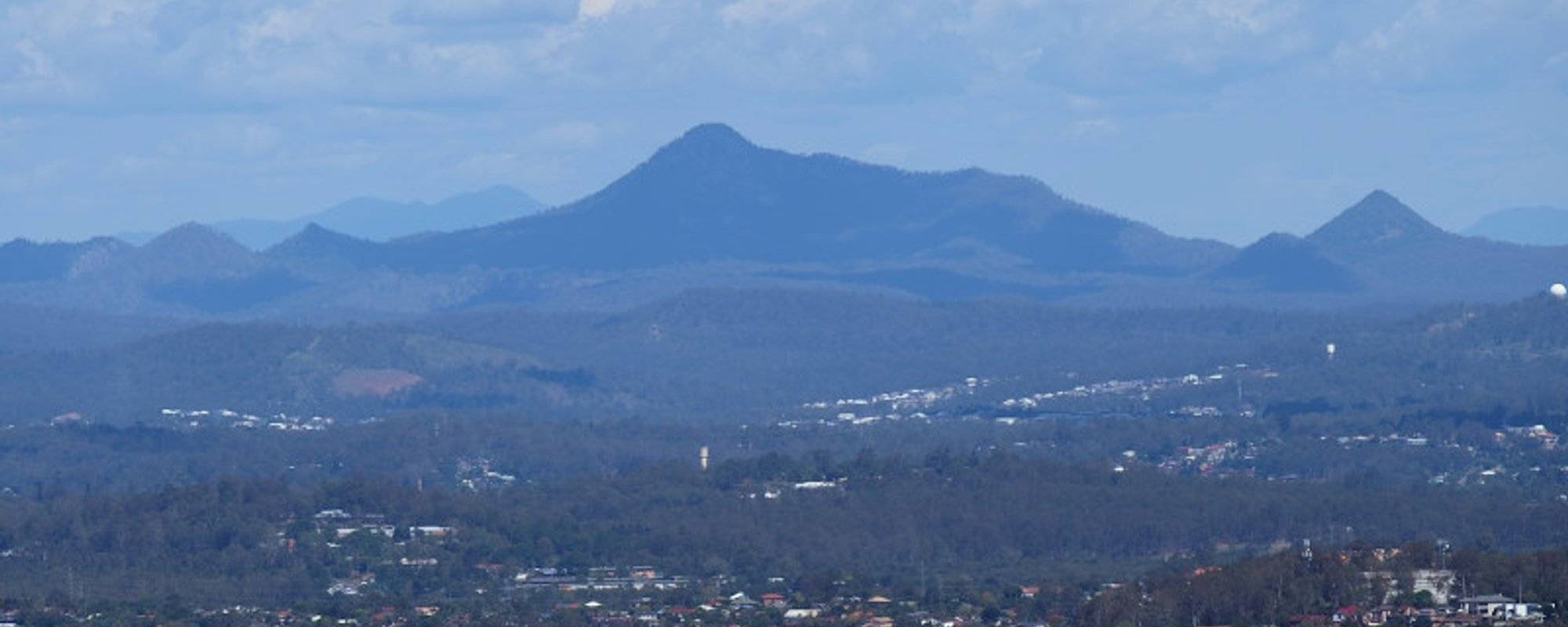
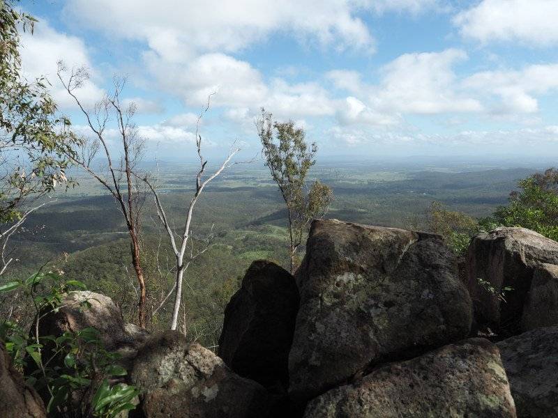
Flinder's Peak is in the center of this view from Mt Cootha in Brisbane's North Western suburbs
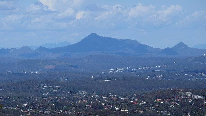
One of Brisbane's lesser known attractions is Flinder's Peak on the outskirts of the cities southwestern suburbs. It is an hour drive from the CBD (Central business district) and can be seen as a rather prominent peak from much of the city.
In world term's Flinders Peak it rises to a relatively diminutive 680 meters above sea level, but as it's base is near sea level it does actually meet the definition of "mountain" given in many geography text's (i.e an eminence greater than 600m ). It is nonetheless a beautiful location and worthy of a visit.
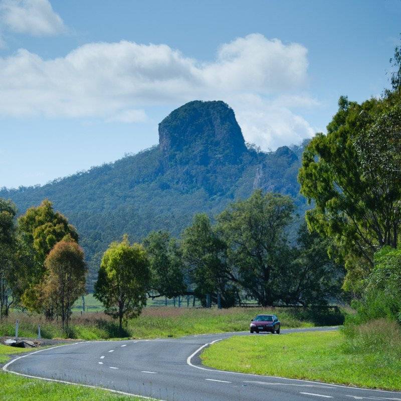
Flinder's Peak is part of the Teviot Range which contains a number of other interesting features, including Ivory's rock pictured below.
Ivory rock seems to almost be toppling over in this view on the road out to Flinders Plum Picnic Area
My walk to the Summit
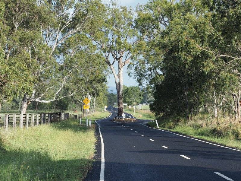
There is a walking track to the summit of Flinder's Peak which starts at the Flinders Plum Picnic Area. The Picnic Area is actually a nice spot itself and can be reached by turning off the Ipswich to Boonah Road near the town of Peak Crossing. It's well signposted but you know you're on the right road when you see the tree in the middle of the road.
Why chop down a tree when you can build the road around it!
After reaching the turn off the sealed road transitions to gravel, but this is only for 2-3km. You then arrive at the picnic area as shown in the photo below.
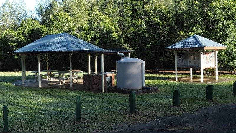
Flinders Plum Picnic Area, the starting point for a number of walks including Flinders Peak
I attempted to walk on Easter Sunday, and although I got to the summit and back in one piece the 7km and the 550m vertical climb took their toll because not only was my general fitness not great but I took insufficient water and too much camera gear! I would recommend taking at least 2 litres of water for this trip. In any case, it was well worth the trip and the views were spectacular.
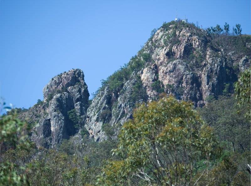
Near the start of the track, there is a good clearing that allows you to view the mountain itself. This here is a telephoto view showing the top from a previous weekend, with the radio tower at the top.
Telephoto shot to the peak from near the beginning of the track. How hard can it be?
Not too long after setting off you get the first views back across the surrounding area. At this point, the trail has been relatively easy apart from a small amount of rock scrambling.
Nice views can be had less than hour into the walk, although the summit itself takes another 2 hours
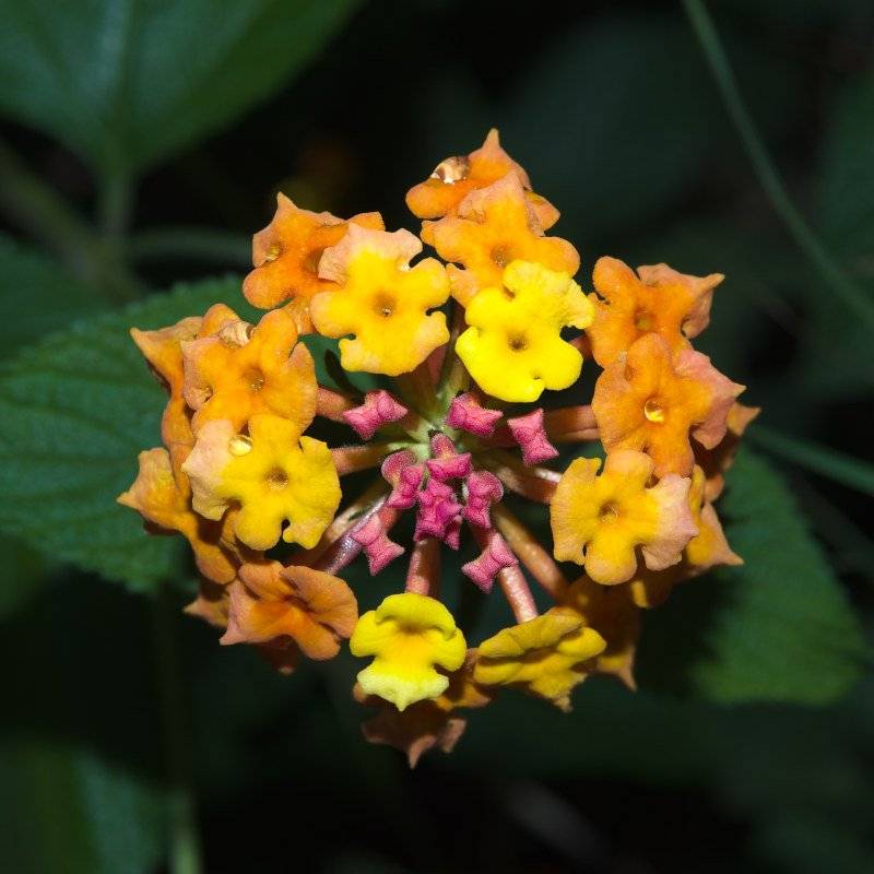
The next section is steep, and I'm glad I took a photo stop to regain my stamina. Too slow to catch a kangaroo that was nearby I settled on photographing Lantana flowers. Lantana may be considered a weed, but the flowers are still very pretty.
I've been getting some ideas from youtuber Rob Trek for flower photography. These are Lantana flowers
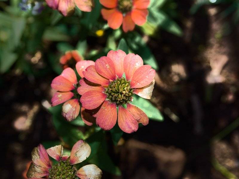
I don't know what these flowers are, maybe somebody can help me identify them in the comments.
Anyone knows what type of flower this? Pity about the missing petal - oh well gives it a bit of character
After 2 hours of climbing a ridge line is reached which is crested by boulders. This means there is a lot of scrambling over boulders, which is not too difficult but just slows down the pace. At this point, the most physically difficult part of the climb is completed, although because of my general poor fitness I was close to the point of turning around.
This is part of a boulder field that runs along a ridge running to the shoulder of the summit peak
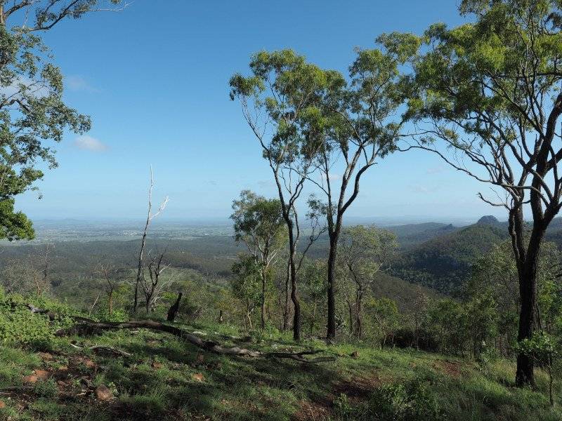
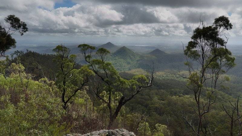
After scrambling across rocks and a few ups (and downs) you come to a lovely lookout. This is a great time to take a breather for the final push to the top. The extinct volcanic peaks are Mt Goolman (453m), Mt Blaine (455m) and Mt Perry (351m).
There is fine lookout about 30 minutes prior to reaching the summit
The final push is very steep, with a small part requiring a good foothold to get up a 60-degree rock face. But finally, you come to a helipad and a radio tower located at the top of the mountain. The views are great, although there was little light rain about that reduce visibility.
Ready to Blog & Earn?
With TravelFeed, easily start your own travel blog and earn as you go. It's the smart platform for travelers who want to profit from their passion. Create a free account
The summit area finally. Beautiful views from here.
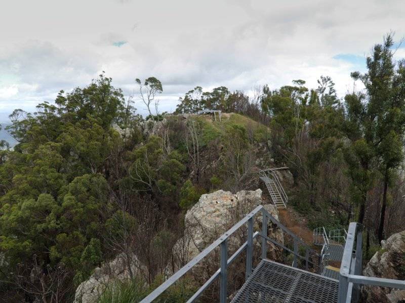
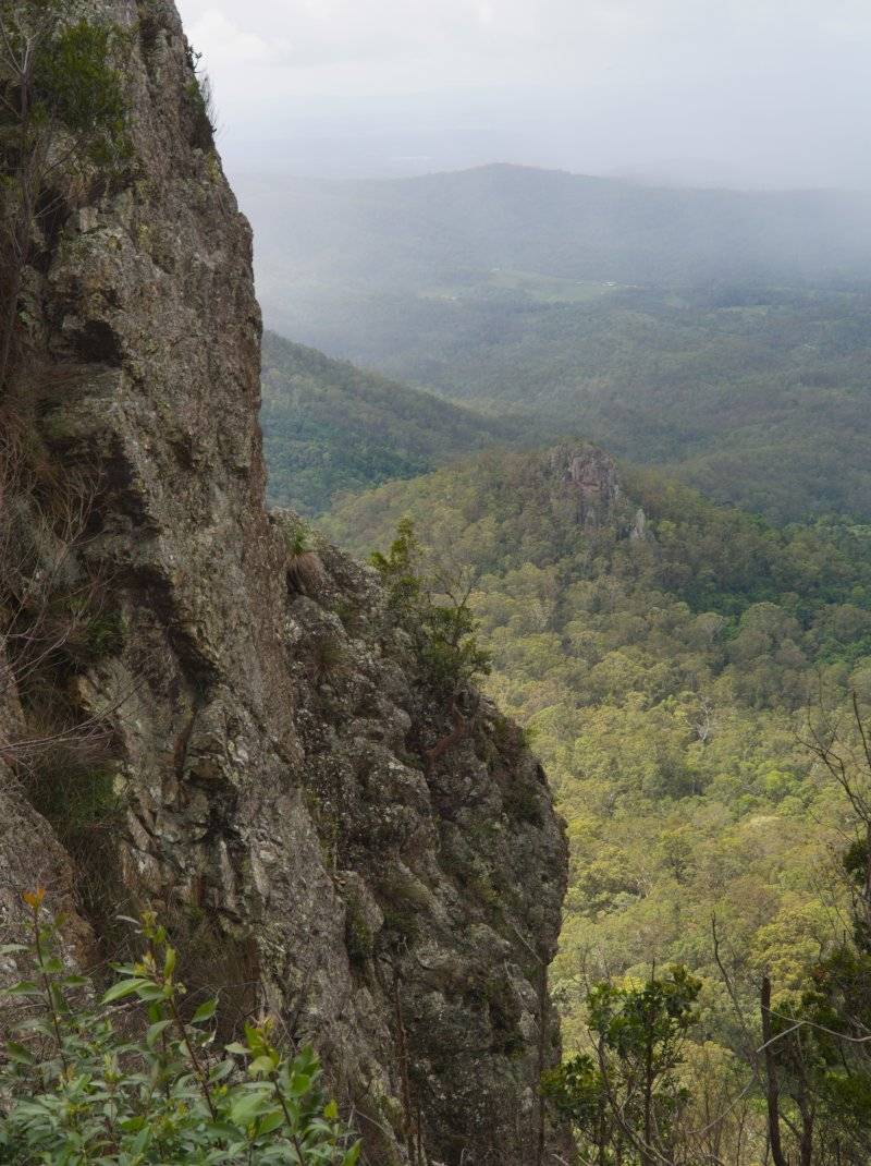
There are reminders to stay on the track all the way up, for environmental and safety concerns. When near the summit there are some pretty steep cliffs.
Its probably a good idea to stick to the track, there are some cliffs just off track like this one near the summit!
Because of the position of the sun in the sky and the hazy/rain about it was difficult to make out Brisbane itself from the top. On a clear day, you would get fantastic views of the city. Anyway here is my attempt through the haze, on the way back down from the top.
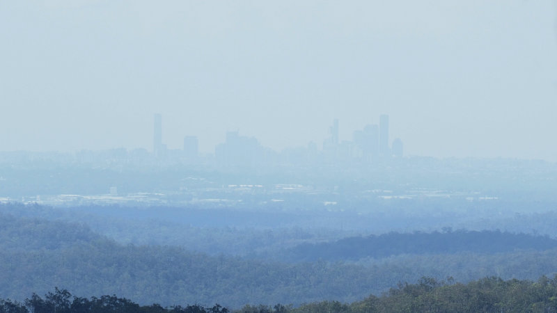
The view in the direction of Brisbane was very hazy, but here it is
Don't Forget: Get Travel Health Insurance!
To make your trip a worry-free experience, TravelFeed recommends SafetyWing Nomad Insurance. It provides comprehensive health coverage while you travel, so you can focus on exploring, not the unexpected. Get a quote here
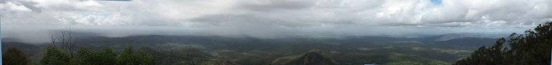
Here is a quick panorama stitch I did from the station at the top of the mountain. Click here or on the image for a larger version.
All up this walk took me almost 6 hours with very frequent stops. However, a person with normal fitness should expect to do it in 4-5 hours. For Brisbanites and people visiting Brisbane, I would absolutely recommend this for a day trip. For reference here are some useful links:
- Aussie Bushworking Track Notes
- QTOPO topographic Map which is better quality than google maps.
PHOTO NOTES: The majority of these images were made with an Olympus OMD EM5 mk2 and 12-40 2.8 lens.
Travel Resources for your trip to Australia
Recommended by TravelFeed
Flights: We recommend checking Kiwi.com to find the best and cheapest flights to Australia.
Accomodation: Explore the best places to stay in Australia on Booking.com, Agoda and Hostelworld.
Travel Insurance: Medical emergencies abroad can be pricey, but travel health insurance is not. We always use SafetyWing for affordable and reliable coverage.
Car Rental: For hassle-free car hiring, DiscoverCars is our trusted choice with a wide selection of vehicles.
Internet: Got an eSIM compatible phone? Airalo is perfect for reliable internet access during your trip. Just install it before you go, and you're set!
Day Trips & Tours: We recommend GetYourGuide for a variety of well-organized and enjoyable activities.
Travel Planner: Need a hand planning? Our free travel planner chatbot is your personal guide to Australia. Chat now.
Disclosure: Posts on TravelFeed may contain affiliate links. See affiliate disclosure.
