Day 3 was my favorite day and I'm not sure I can fit it all in this post. The day started out by waking up in our hotel. We got on the road early with no plans or idea what the day held in store.
Heading North
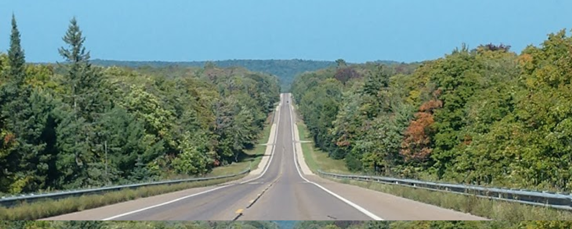
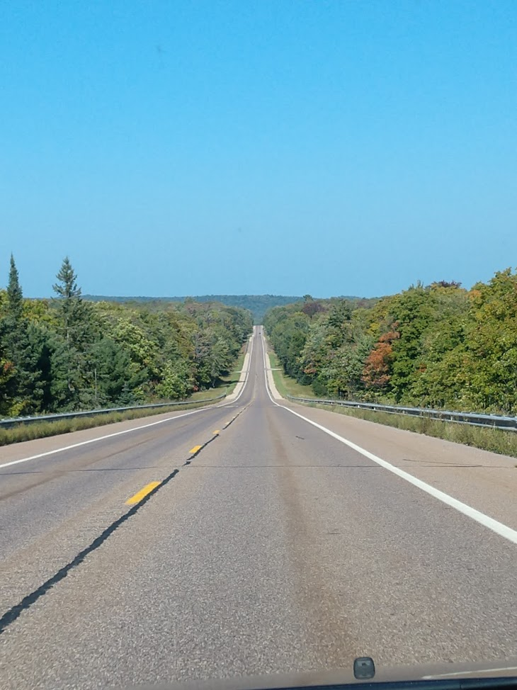
We headed back to Hwy 2 East, then hit Hwy 41 North. It was more of the Hiawatha National Forrest and absolutely beautiful.
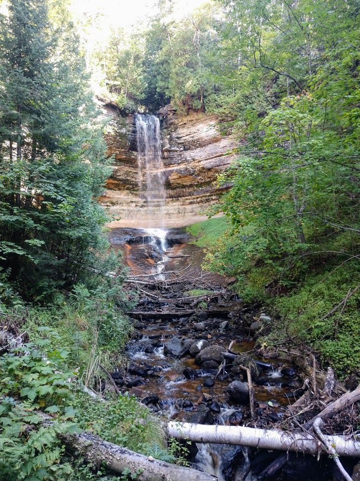
This waterfall wasn't named, but was much larger than the "biggest falls" in the Lower Peninsula.

Next Stop: Munising
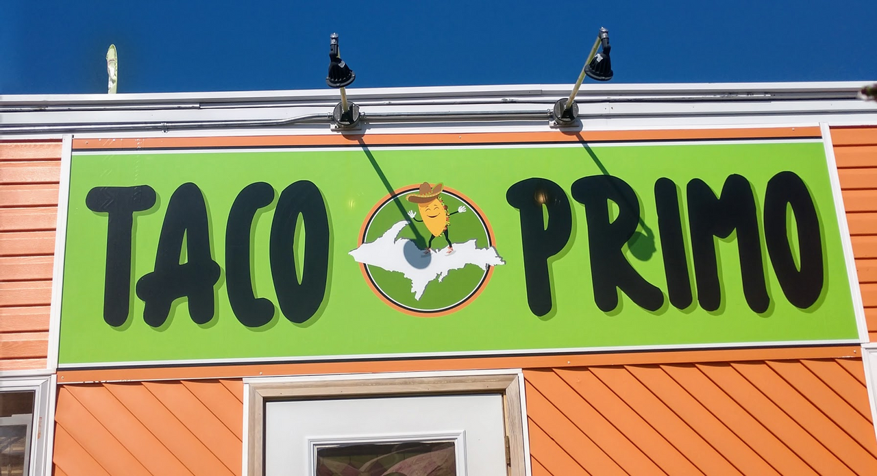
It was a little after noon by the time we rolled into town. First thing I spotted was a Taco Shack.....and that was our first stop of the day. (Who can say No to a Dancing Taco?)
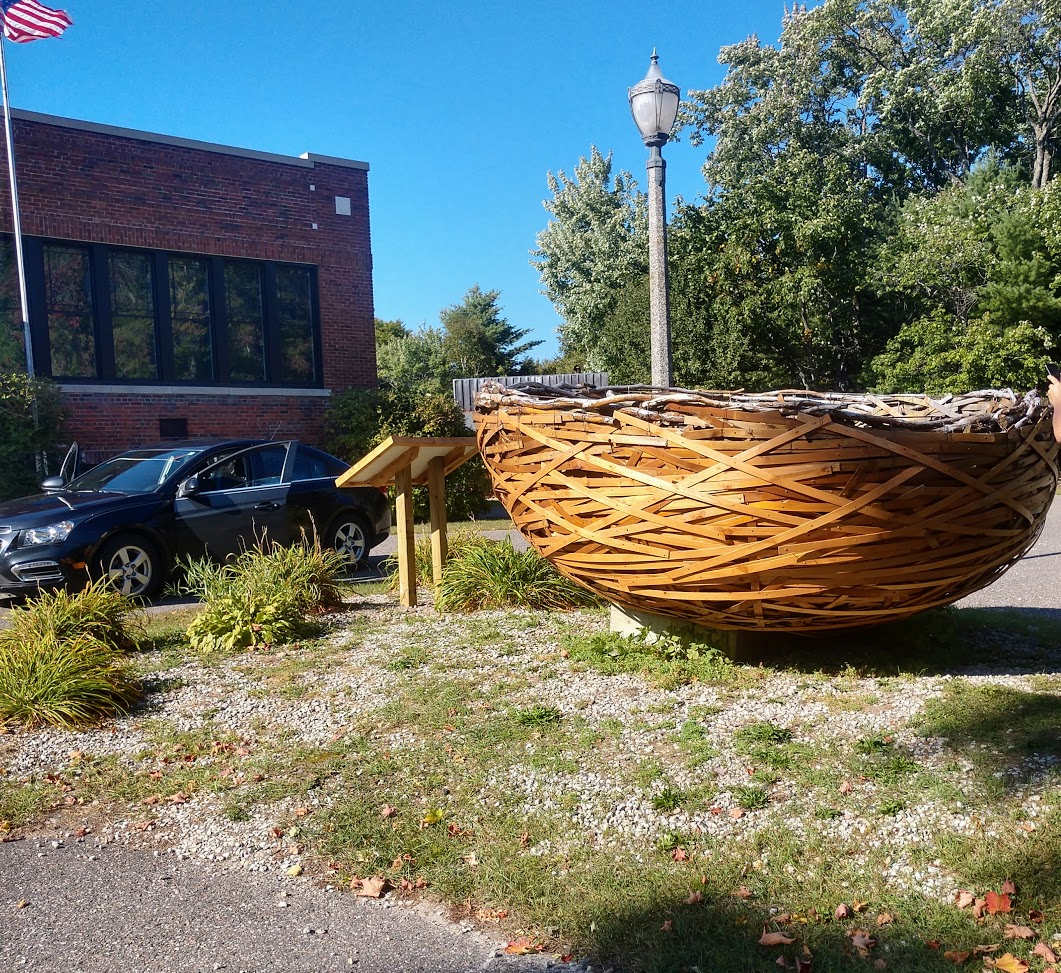
As soon as we left from our lunch, a crazy roadside attraction was staring us in the face. It was a giant random Wicker Basket. This thing was huge and deserved a stop.
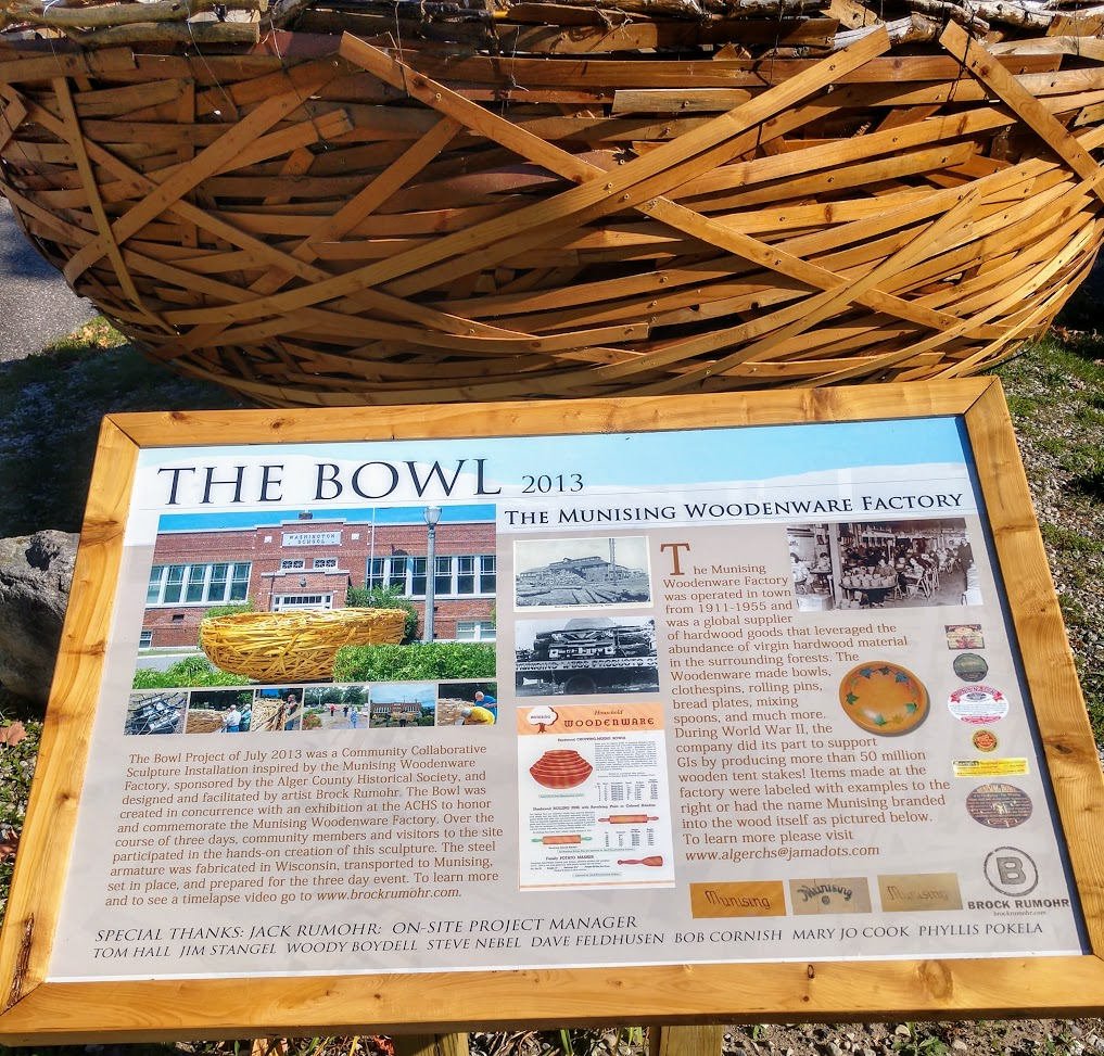
I think my car could have fit inside of this bowl.
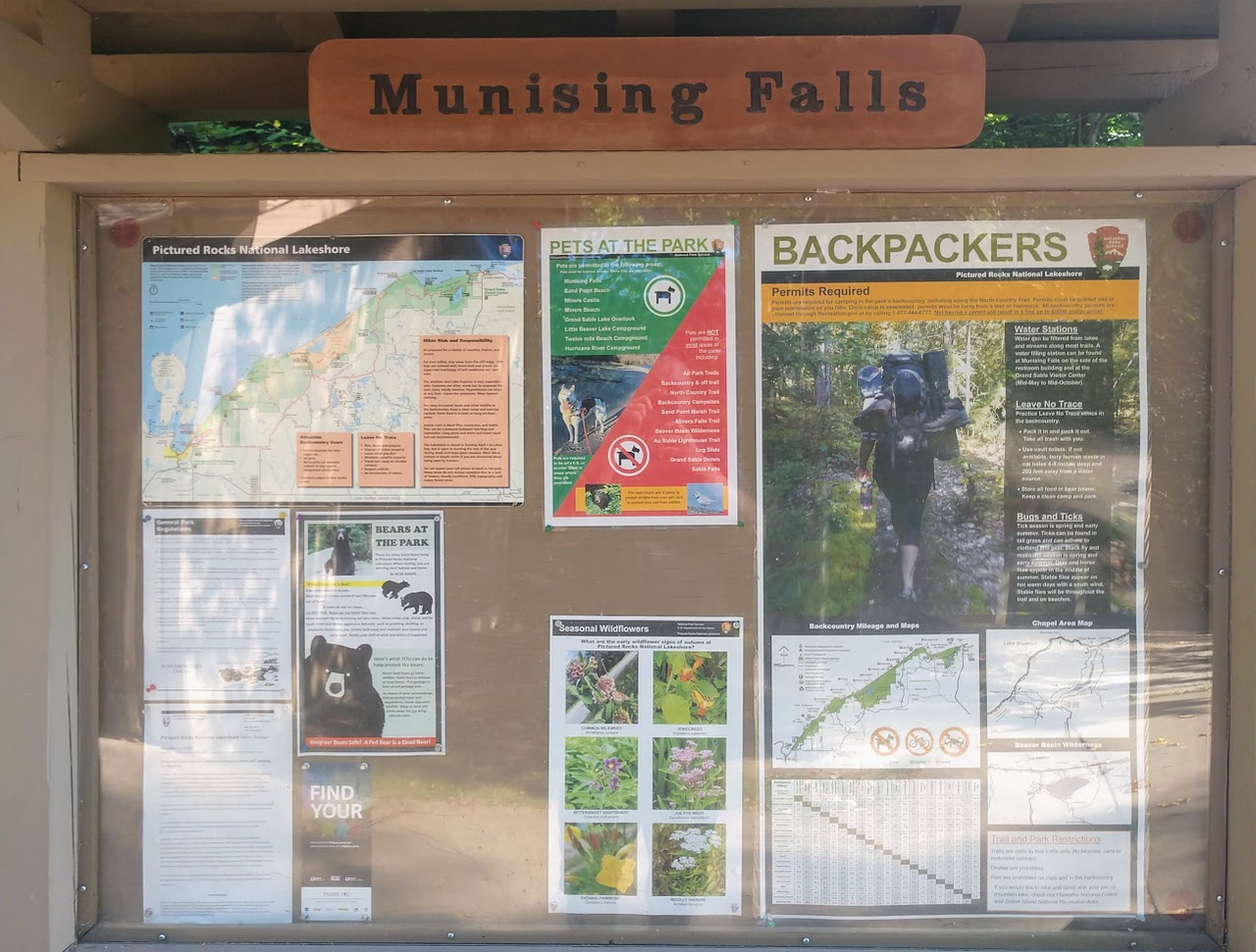
Munising Falls
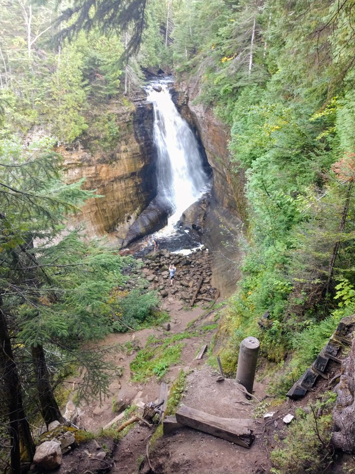
Not far up the road, we stopped again. Progress was slow but we couldn't pass up seeing all these great attractions. Munising Falls was just over a half mile hike back into the woods. It was well worth the hike back as the falls were a cool sight to see.
The Upper Peninsula of Michigan is the host to over 200 Waterfalls. Some of them do not have names but are still impressive. Here is a look at the 2nd waterfall of the day.
Pictured Rock Lakeshore
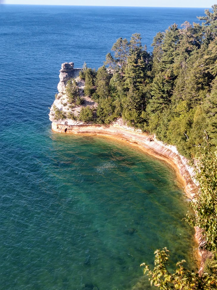
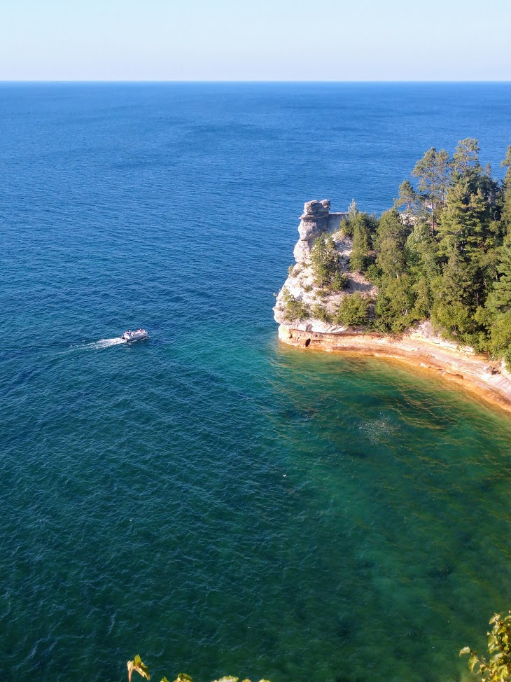
A little drive down the road and we came to Miners Beach. This sits in the middle of the lakeshore and is breath taking. From the observation tower we could see what is called Miners Castle. It's a rock formation that when looked at from the water, resembles a castle.
We didn't get a chance to take the boat tour of Pictured Rock, but will be doing it in the future. Here you can see the formation.
The observation tower sat on a 300ft cliff above the water. To get an idea of how big and far away it was, take a look at this pontoon boat.
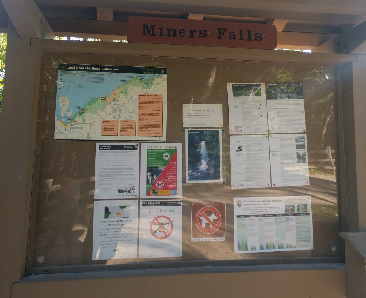
Miners Falls
This hike was a little farther into the woods. It was just over a half mile in each direction to walk back to the falls. These falls were very impressive. If you look at the bottom of the pic you can see people standing down there taking pictures. We didn't make the walk down to the falls because we weren't really dressed for the 350ft descent.
Back on the Road
By now it was later in the afternoon. At 6pm the temp was still 80 degrees, which is unusual for this time of year.
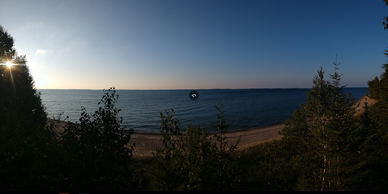
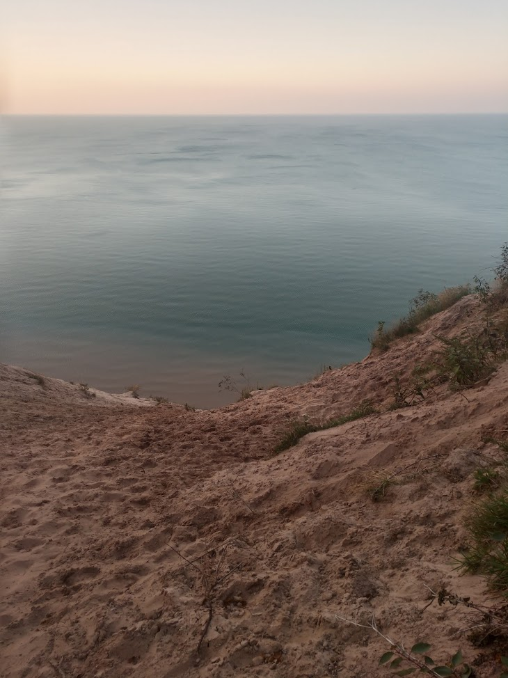
On our way we went. What was the next thing we would run across? It was 12 mile beach. The name pretty much says it all. The beach is 12 miles of awesome white sandy beach on the shores of Lake Superior. We went down and dipped our toes in the water and relaxed for a minute. The breeze blowing in off the lake was cool and refreshing.
On a 80 degree day we looked up and down the beach. As far as the eye could see there was no one......at all. I really need to move up to this area. It's perfect and I love the population density. Through out the UP they claim 19 people per square mile. If you take out the top 5 cities, those numbers drop drastically. Here is a look out across lake Superior.
Last stop for the day!
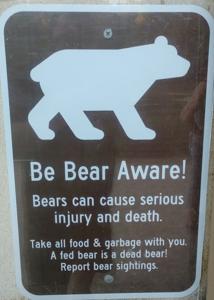
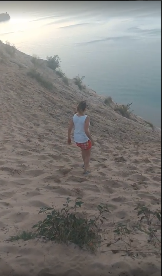
Our last stop for the day was a place called Log Slide. This was probably the most dangerous place we went on the trip. Between being in the middle of the most bear populated area in Michigan and the 500ft drop off to the water, we had to watch our step. All the signs also made it blatantly obvious.
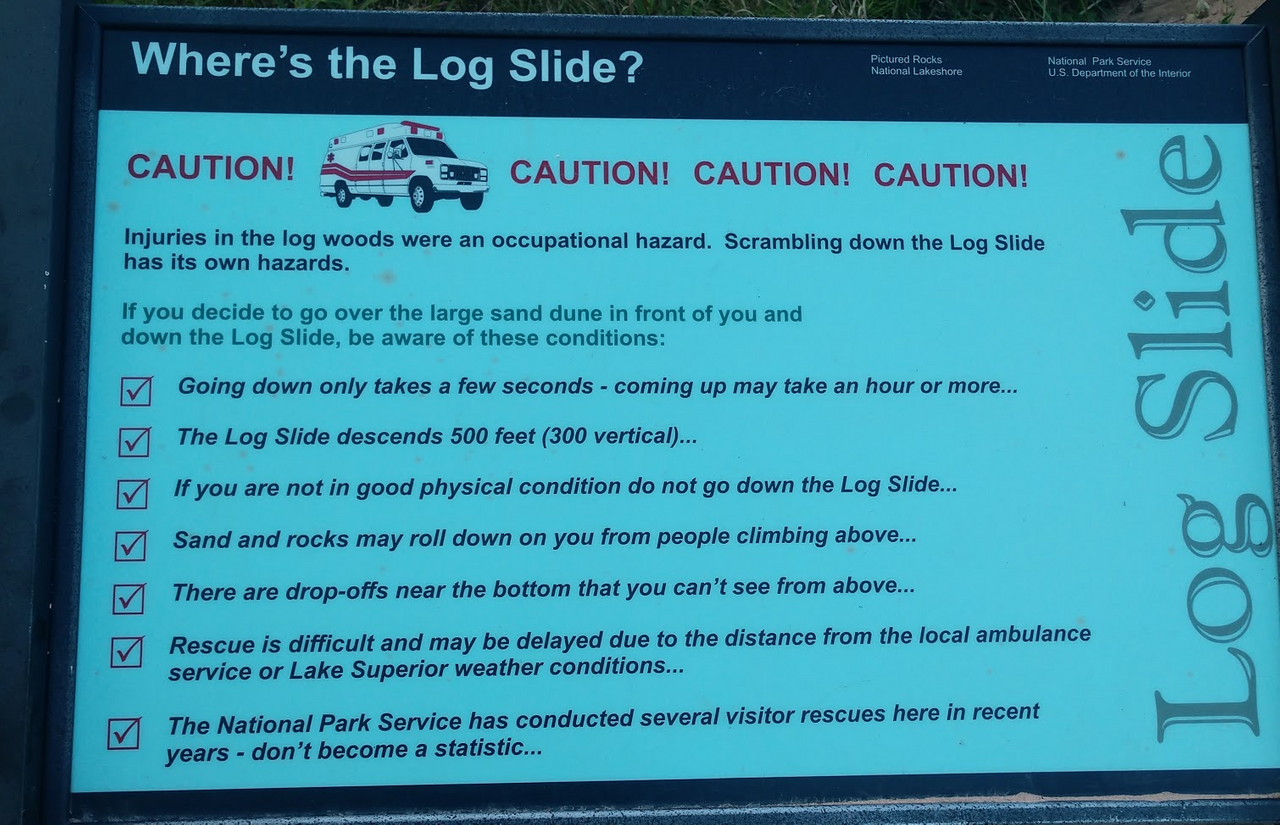
The pictures don't do it justice. It's so hard to picture the drop off. This lady actually ran down it while we were there. I couldn't believe it and ended up getting a video I'll be posting at a later time.
Ready to Blog & Earn?
With TravelFeed, easily start your own travel blog and earn as you go. It's the smart platform for travelers who want to profit from their passion. Create a free account
Ready to set up camp for the night
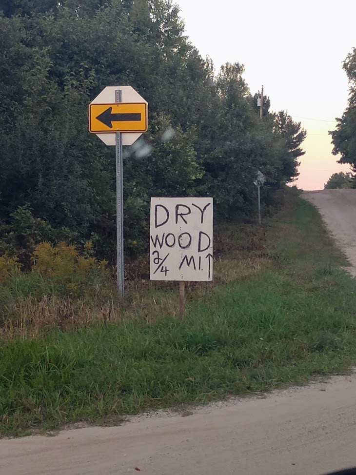
We had seen plenty of things for the day and were heading to set up camp. We found a nice little State Park near Grand Marais. On the way there we saw a sign. I think it was pointing to Canada. This was a hybrid form of the Standard and metric system. LOL
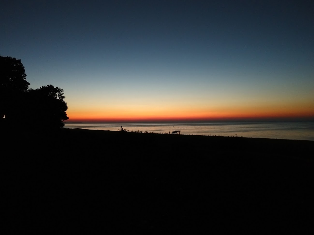
Shortly after this we were sitting around the campfire relaxing to this amazing sunset.
Don't Forget: Get Travel Health Insurance!
To make your trip a worry-free experience, TravelFeed recommends SafetyWing Nomad Insurance. It provides comprehensive health coverage while you travel, so you can focus on exploring, not the unexpected. Get a quote here
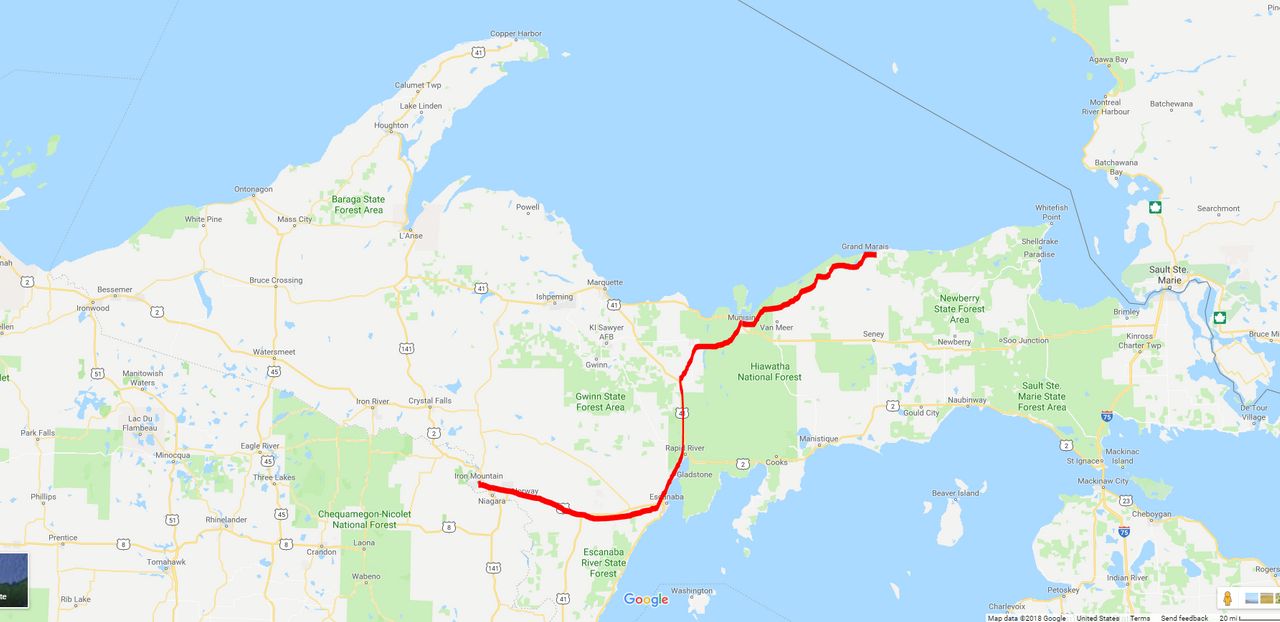
That wraps up day 3. This is by far the longest post I've ever written on here and I hope you enjoyed it. On Day 4 we will adventuring in places that my GPS didn't even recognize, but more on that tomorrow. Here is what Day 3 looked like on the map.
Proud member of #steemsilvergold. The best group of folks on the blockchain.

Travel Resources for your trip to United States
Recommended by TravelFeed
Flights: We recommend checking Kiwi.com to find the best and cheapest flights to United States.
Accomodation: Explore the best places to stay in United States on Booking.com, Agoda and Hostelworld.
Travel Insurance: Medical emergencies abroad can be pricey, but travel health insurance is not. We always use SafetyWing for affordable and reliable coverage.
Car Rental: For hassle-free car hiring, DiscoverCars is our trusted choice with a wide selection of vehicles.
Internet: Got an eSIM compatible phone? Airalo is perfect for reliable internet access during your trip. Just install it before you go, and you're set!
Day Trips & Tours: We recommend GetYourGuide for a variety of well-organized and enjoyable activities.
Travel Planner: Need a hand planning? Our free travel planner chatbot is your personal guide to United States. Chat now.
Disclosure: Posts on TravelFeed may contain affiliate links. See affiliate disclosure.
