![ULOG #49: Atok, Benguet: Highest point and Spanish Trail [with videos]](https://img.truvvle.com/?src=aHR0cHM6Ly9pbWFnZXMuaGl2ZS5ibG9nL3AvNVNoenNLbktGN3Zxand4Zno4R05RUVU3UnY2bUR1OU1iaGY5dE1xTGdLckpwUVBkcnlZeWQ2R1FIbW9LQTlmVXFDdEhTWXlkdkNkNFJlcU10SnF6TERDNUZ5RjJIRnJmYTVVSnZycGsyeFl2bTcyTEVYZVJqM3FMbU5RTHBQb2ZoSkI1aEVGRENxUThUQnpTeTRQQm1ETjMvP2Zvcm1hdD1tYXRjaCZ3aWR0aD0yMDAwJmhlaWdodD04MDAmbW9kZT1jb3Zlcg&width=3840)
Atok is one of the municipalities of Benguet, some 50 plus kilometers from Baguio City. Just like most of the municipalities of the Cordilleras, they grow vegetables and flowers.
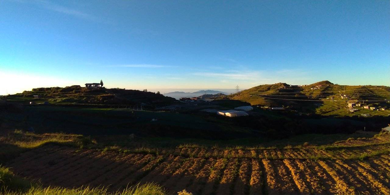
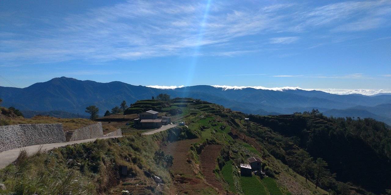
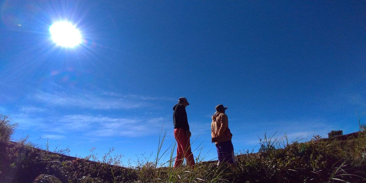
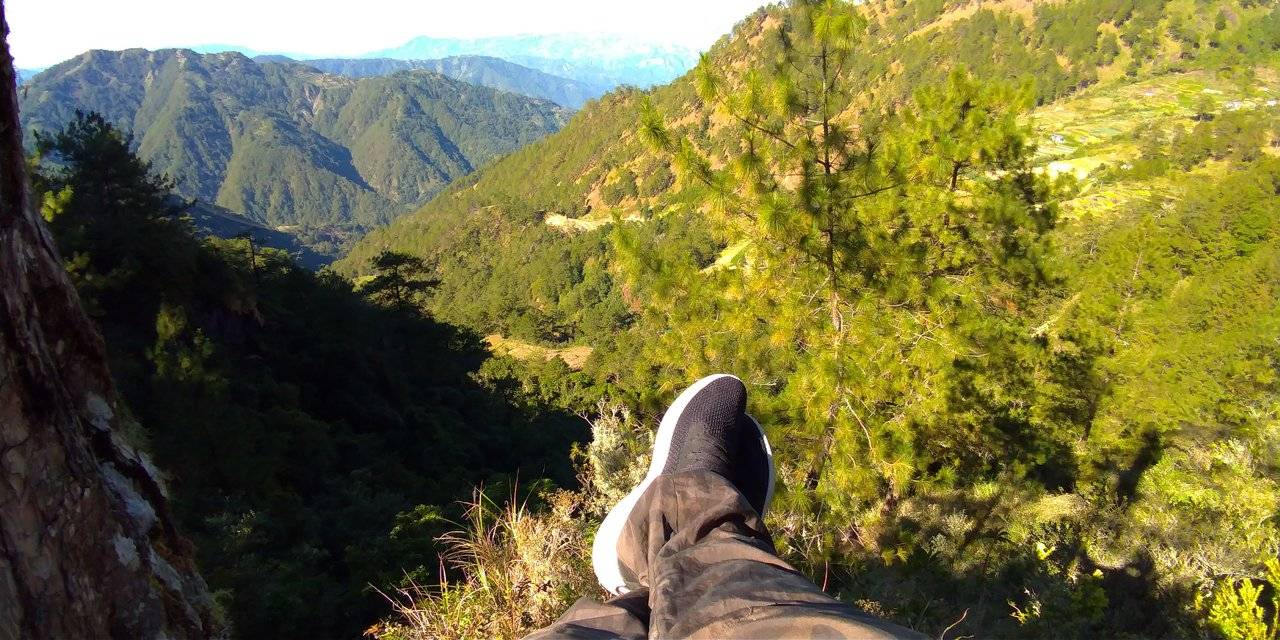
Sunrise at Highest Point
We have been planning on visiting this place and I am glad that we were able to do it. We can go here anytime but I wanted the experience to be more memorable so why not spend a sunrise there instead, which we did.
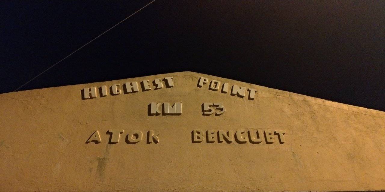
The Highest Point is named as such because it is the highest part of the highway system in the Philippines with an elevation of 7,400 feet above sea level. This is located at Cattubo, Atok, Benguet and part of the Halsema Highway.
We had to travel 2 hours to reach this place. We have to be up and travel and be there before the sun comes up. During these months, the temperature is colder. I was expecting it to be colder than here in our place and I was right. Good thing we had our thick gears on.
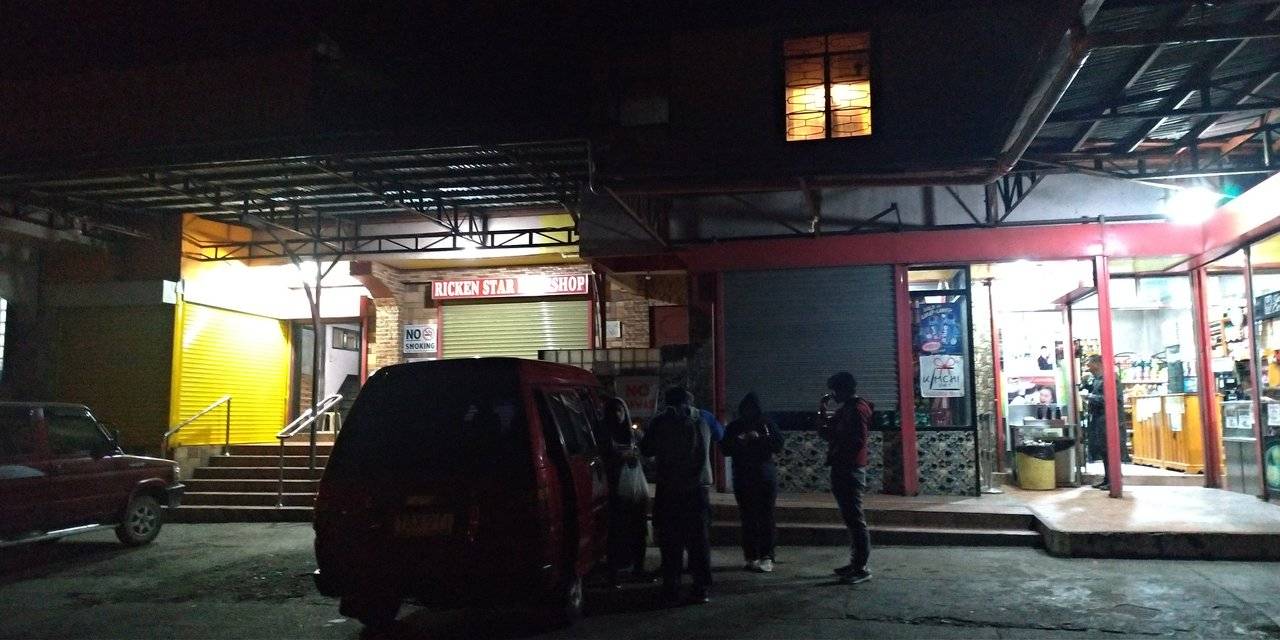
At this stopover, we ate cup noodles and instant oats to warm our bellies. This is about 5 minutes away from the highest point view deck. Thank goodness there is one store open at that time. There are only few travelers at night traversing Halsema Highway so it is understandable that the stores are closed. I was surprised at this particular store because they were selling imported food that I am not familiar with. It was very tempting to buy but items sold in places such as these are pricey.
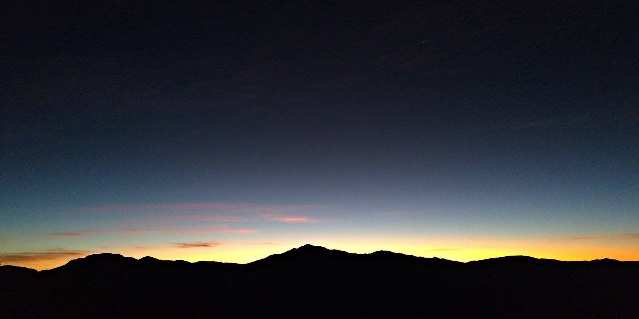
We had a lot of time to spare when we reached the view deck which was good so we can witness sunrise at its best.
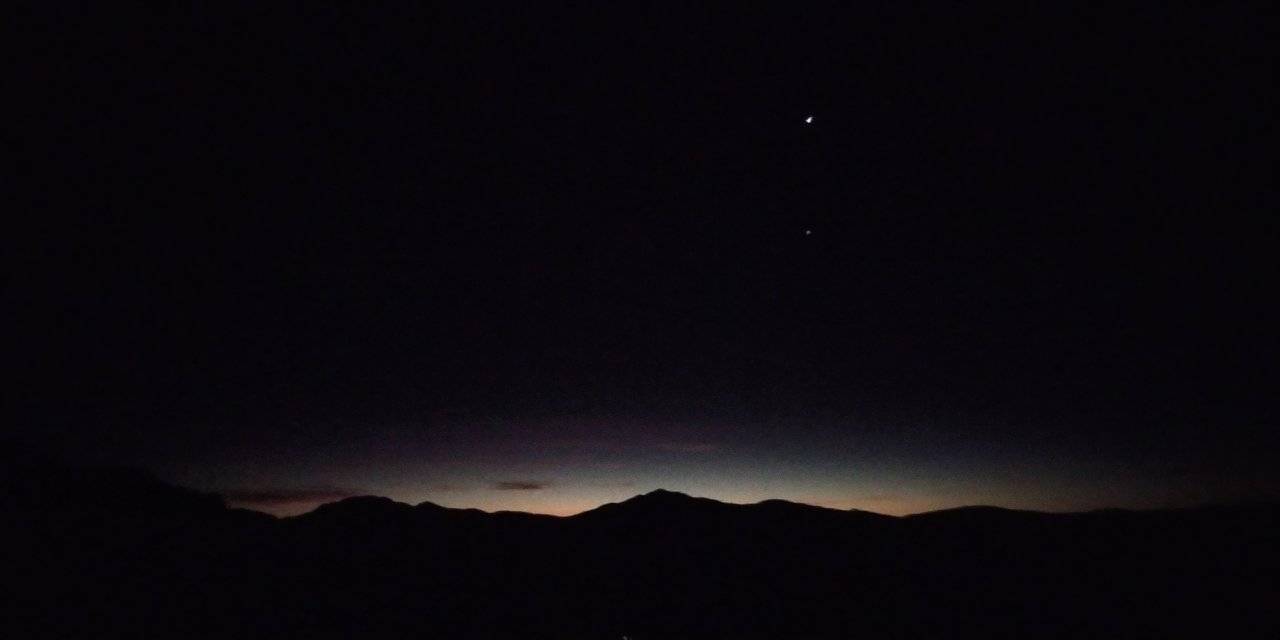
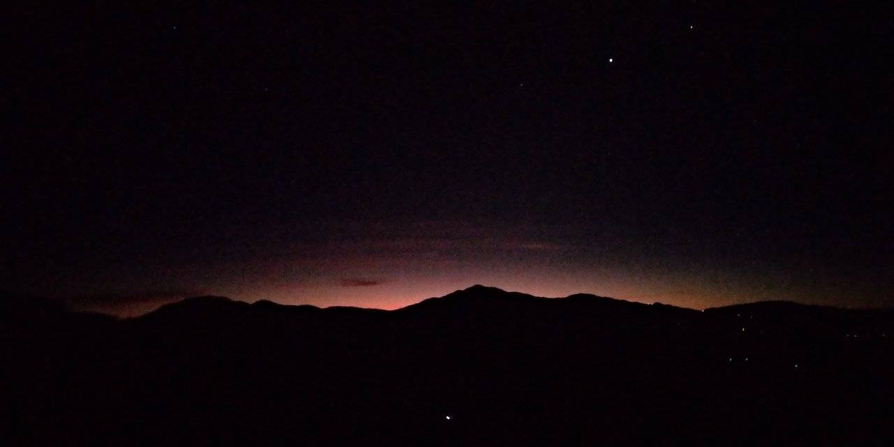
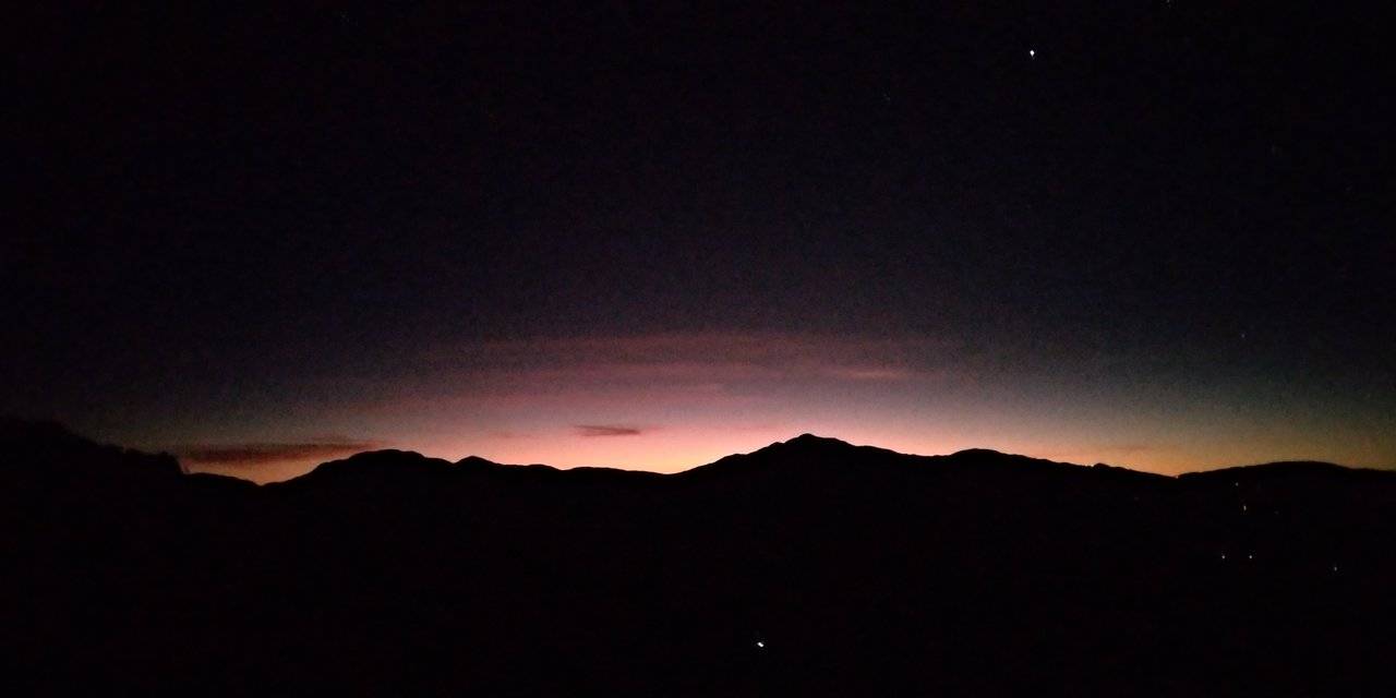
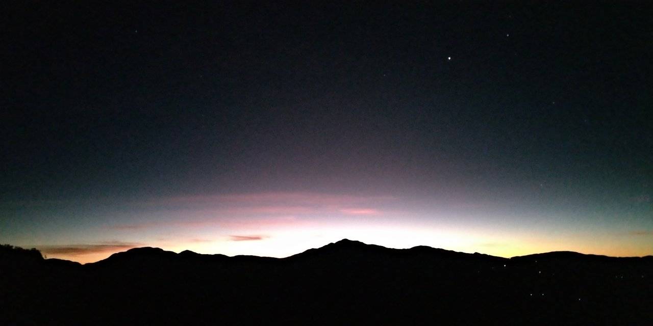
It is during these times that you feel alive. Witness as the colors change. Hear the earth come alive. Feel the cold and be warmed by the thought that you are here breathing.
Some days you cannot see what is below the view deck for the entire mountain is covered in mist and fog. Sea of clouds at its finest. I was actually expecting that kind of scene. Maybe next time we come visit that will be the transformation I will witness.
After taking more photos, we went back to the stopover to buy food for breakfast. We planned on going to the flower farm. We visited our relatives first and had our breakfast there.
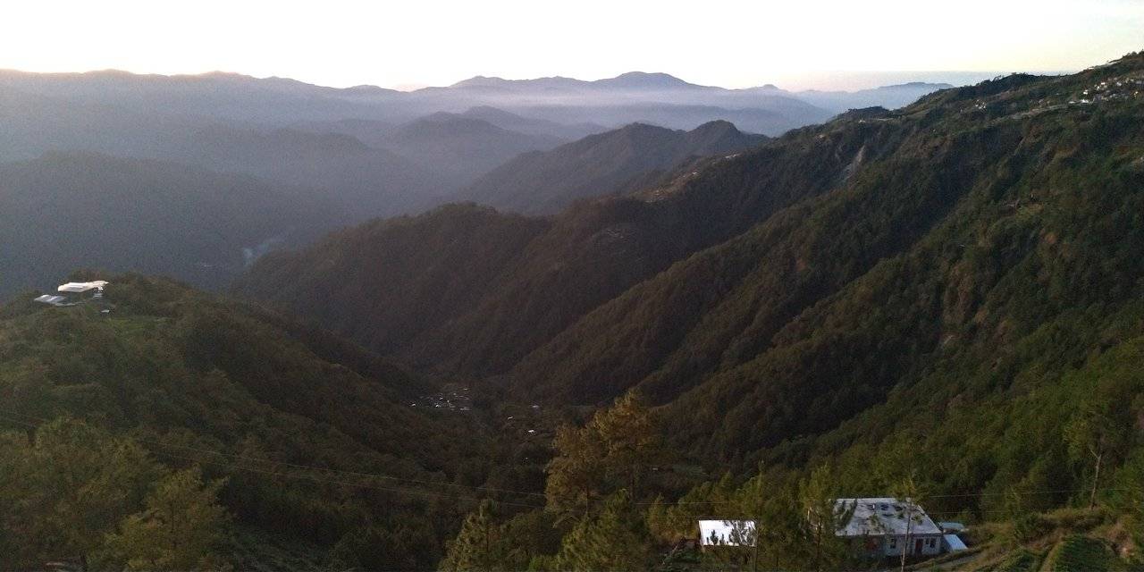
Along the way, farms upon farms of vegetables can be seen. It was a rolling scenery of vegetable salad.
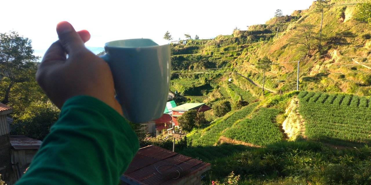
It was one of the best places to have a warm freshly brewed coffee while enjoying the scenery. The smell of fresh cold air is invigorating. No amount of coffee can top that. As the day went by, the sun warms everything and it was golden. What a perfect day!
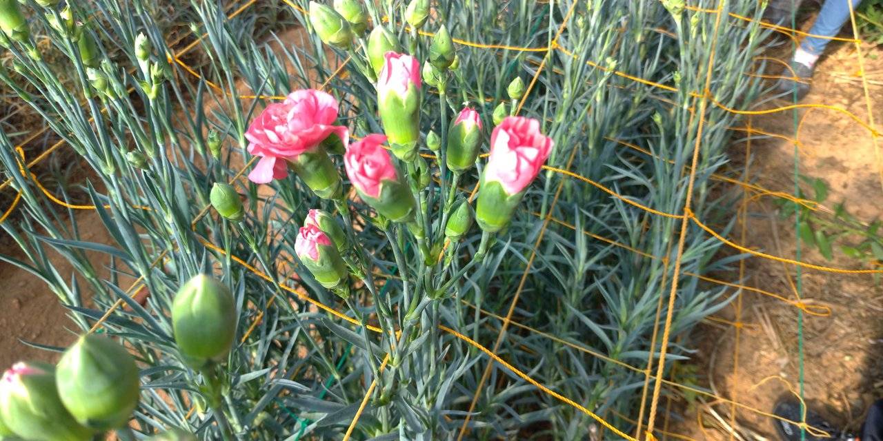
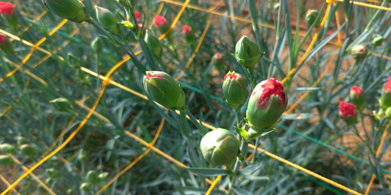
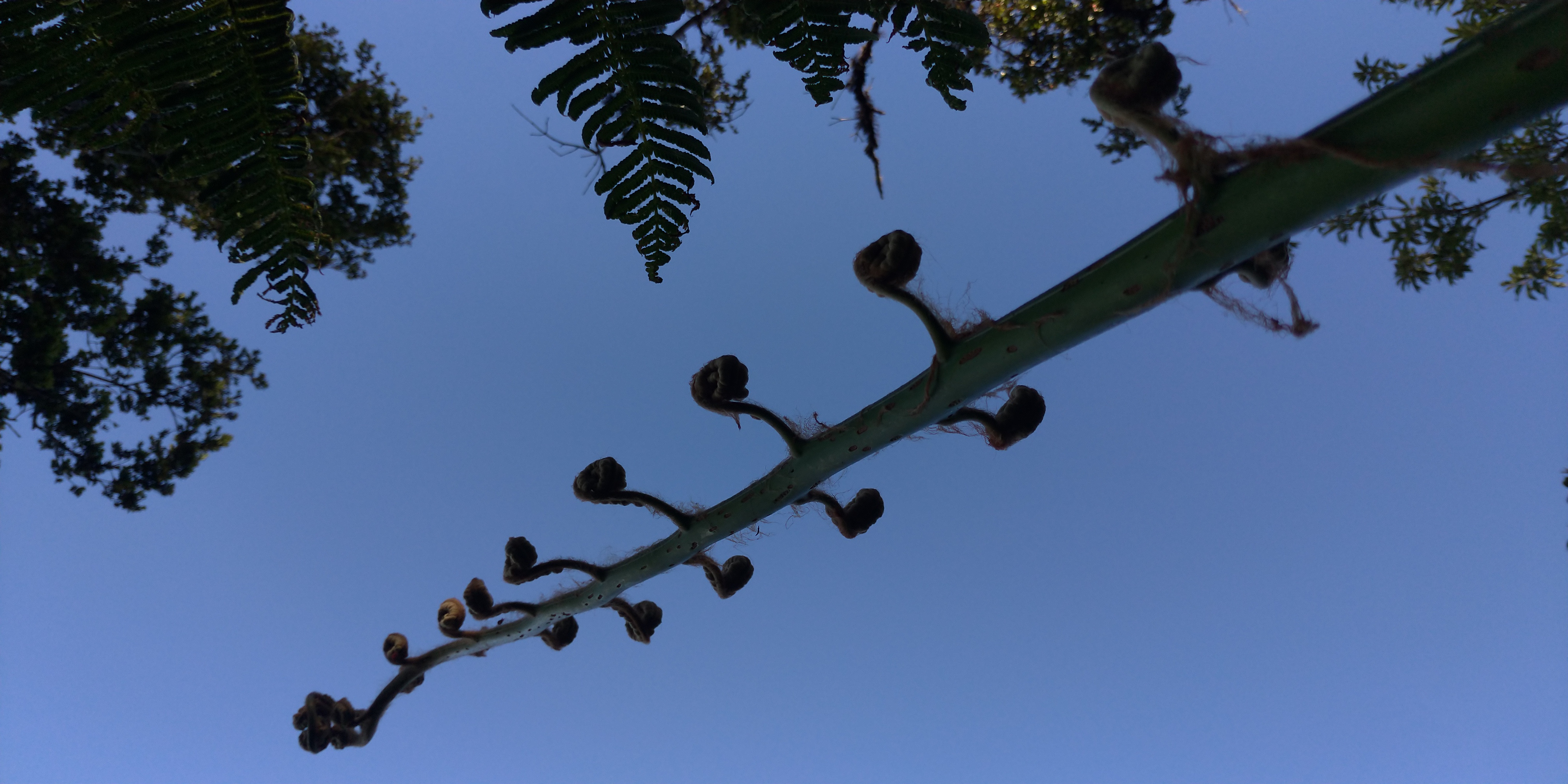
While there, we then decided to walk to the Spanish Trail instead of going to the flower farm because this time around there are not enough flowers in bloom to see. So we packed our bags and off we went to the trail instead. Here are some of the flowers we saw on our way.
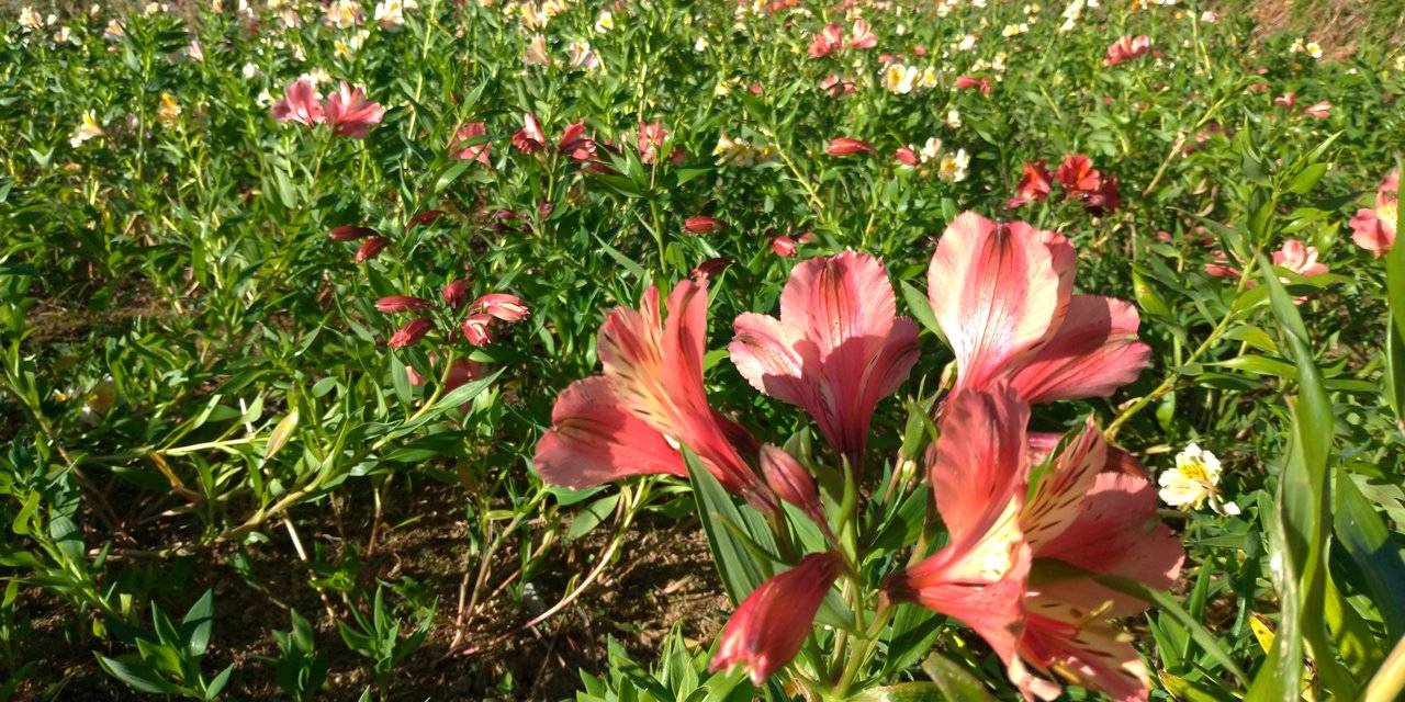
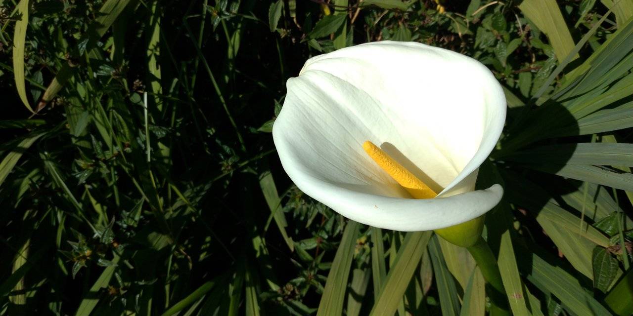
We stopped by one of the greenhouses hoping to see flowers in bloom. There were not as many flowers in bloom yet but there are definitely colorful ones.
Here in Atok you will also see Sakura trees but that is something I have yet to see.

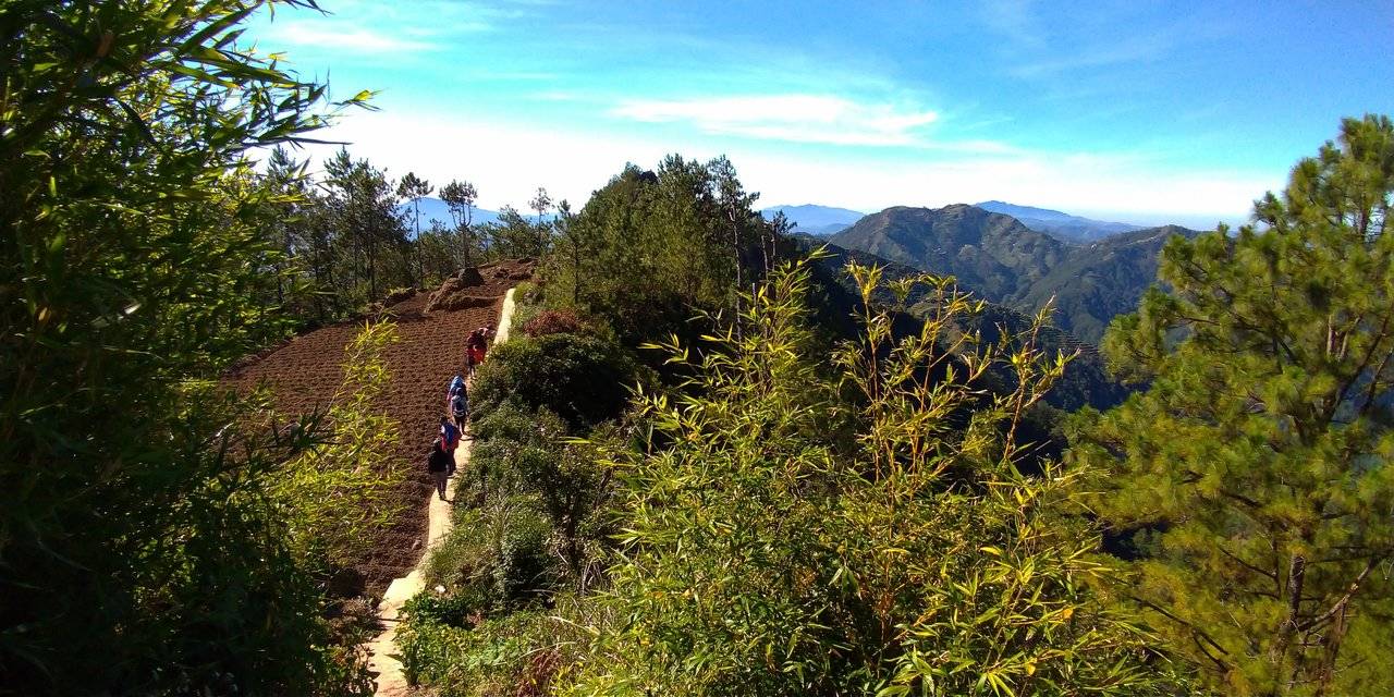
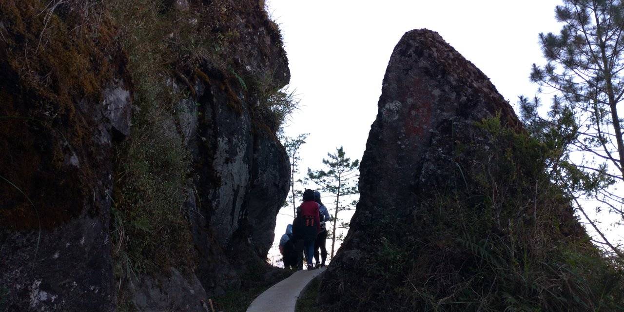
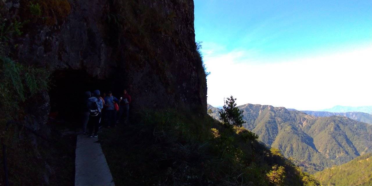
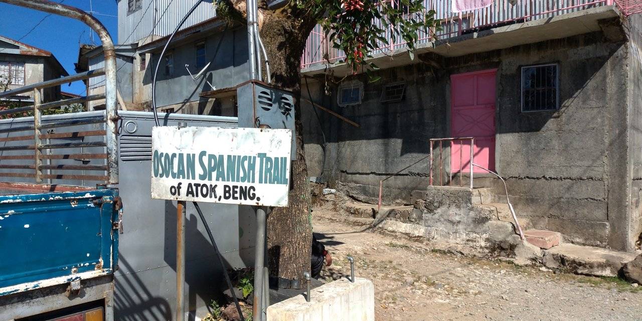
Osocan Spanish Trail
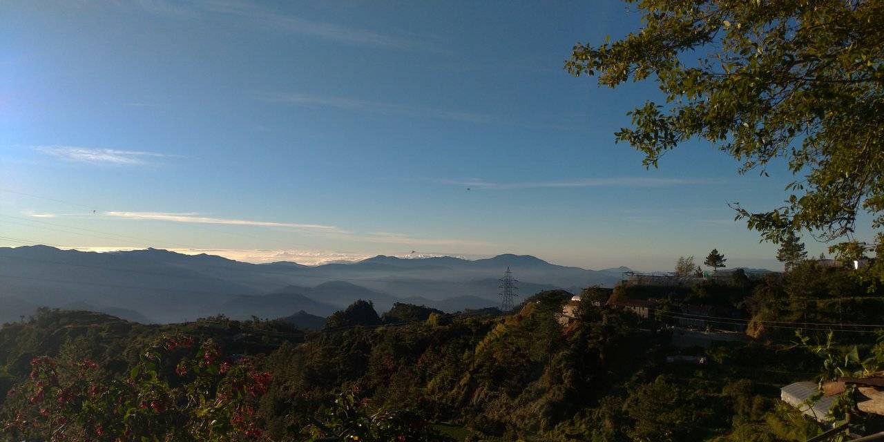
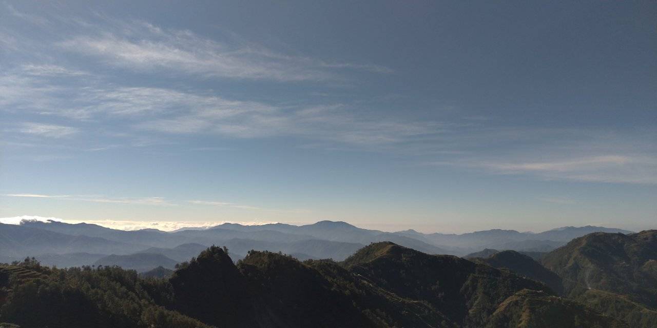
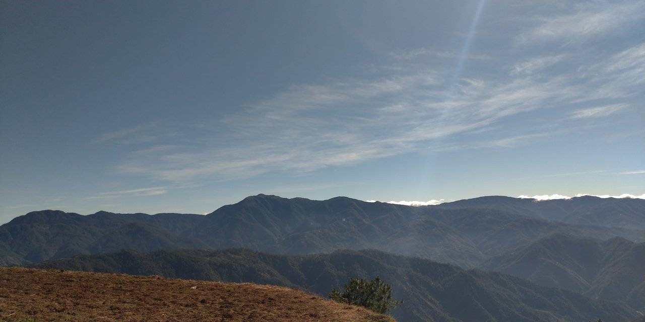
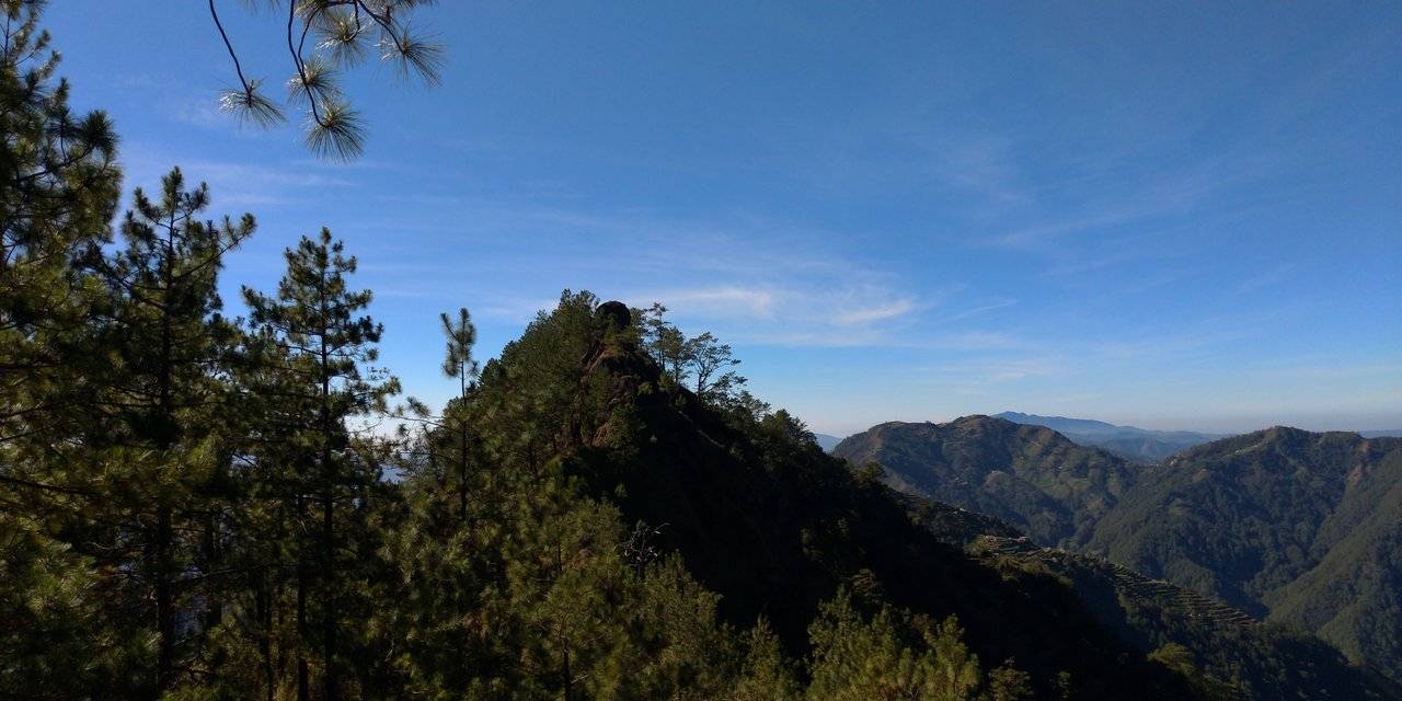
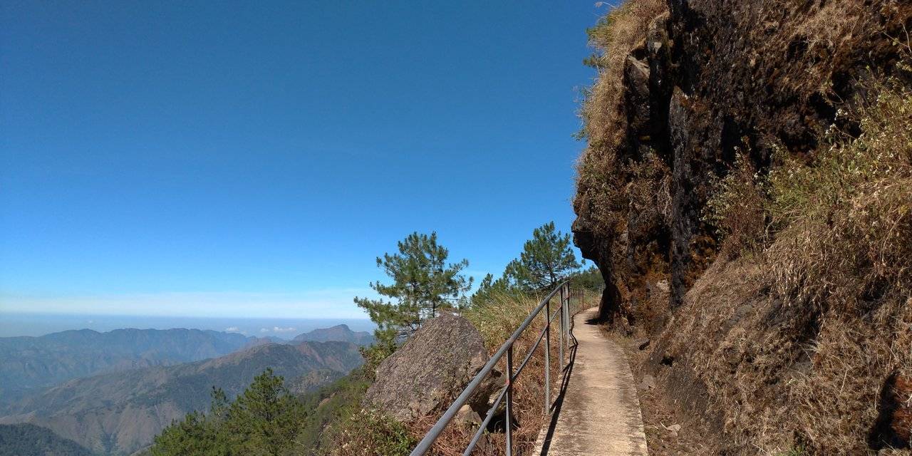
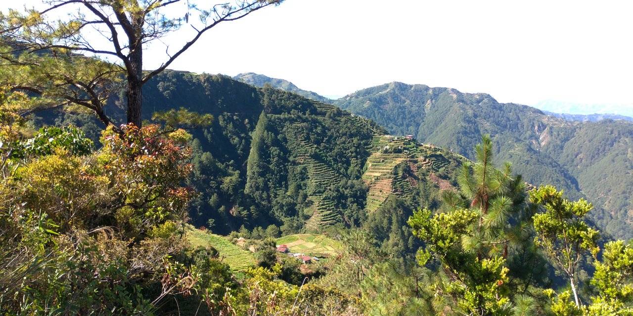
En route to the trail are more gardens of vegetables. Some of them are located at the side of the mountains. Along the way we saw potatoes, carrots, cabbages, etc. What I was overwhelmed by are the mountain ranges that you see surrounding this place. The views are exhilarating.
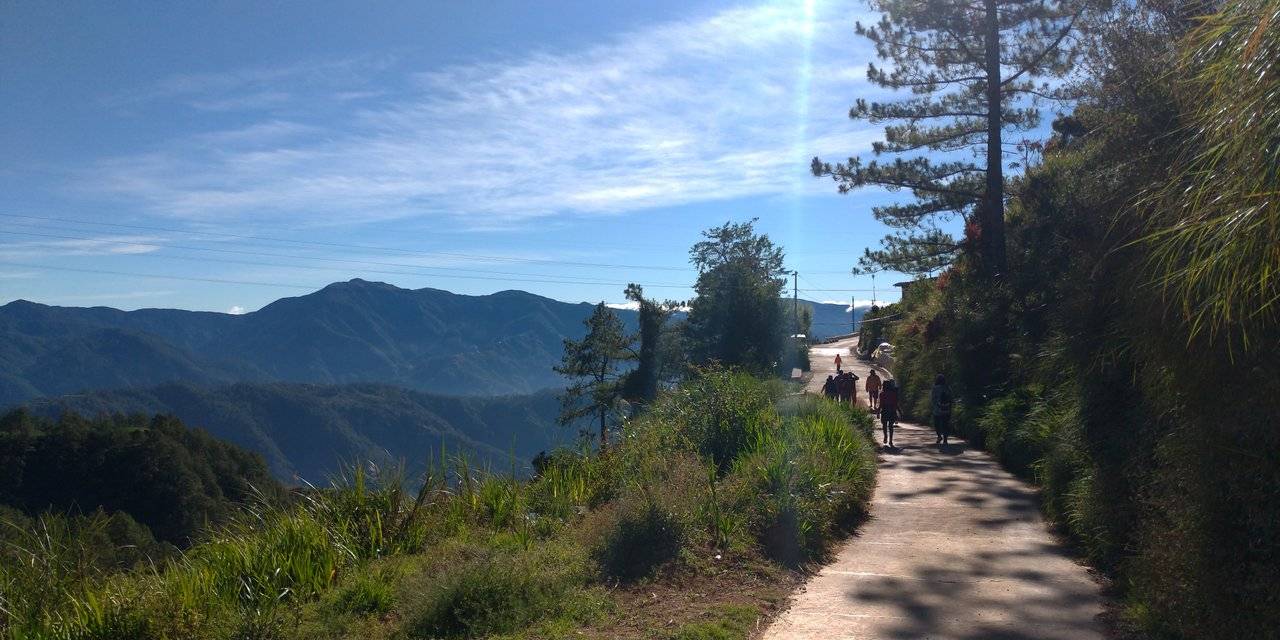
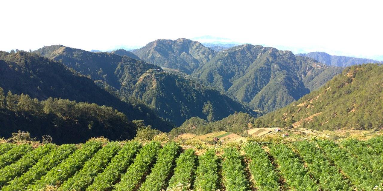
In the far distance, one can even see the top of the highest mountain in Luzon which is Mt. Pulag. This mountain is located in Kabayan, Benguet. Yet at another distance one can see Sto. Tomas or Mt. Cabuyao in Tuba, Benguet.
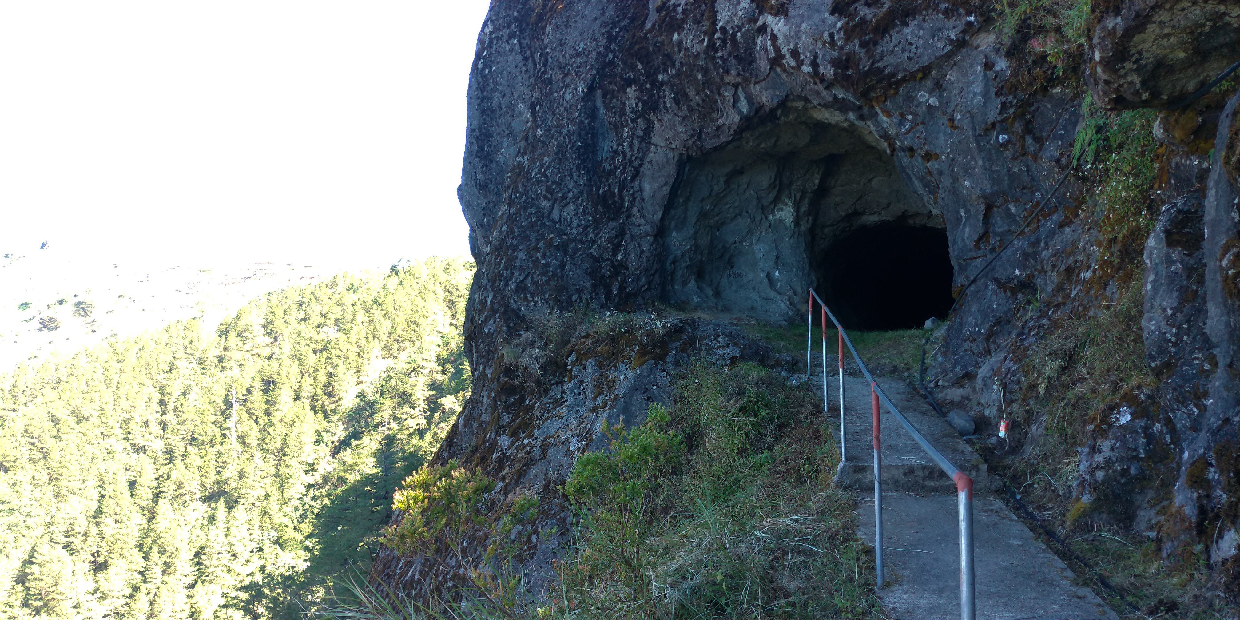
Because the municipality wants to promote this as a tourist spot, a footpath has been constructed to make walking easier.
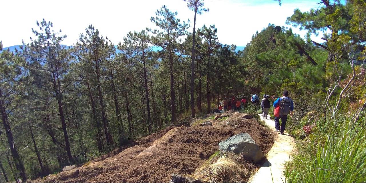
It was already an easy path to take but the footpath made it more easier. Some handrail must be installed in some critical areas though because it can be slippery. One misstep and you might fall down the cliff.
Ready to Blog & Earn?
With TravelFeed, easily start your own travel blog and earn as you go. It's the smart platform for travelers who want to profit from their passion. Create a free account
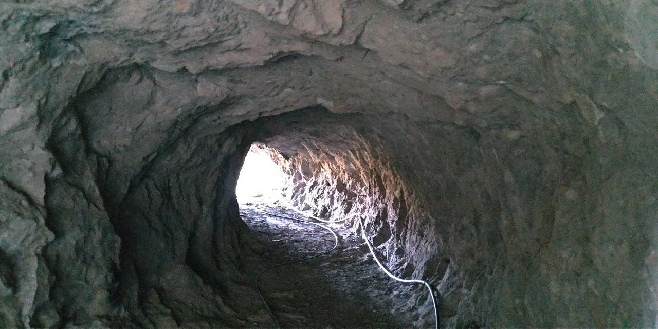
The Spanish Trail was constructed during the Spanish regime. There are three tunnels of about 10 meters long made by carving these out of the mountains. It is between Km. 46 and Km. 47. It is really not that established yet as a tourist spot but I think it is better that way to preserve this place. The trail was used then as a horse trail or foot path before the Halsema Highway was built and it is still in use today by the locals. There were no horses left though.
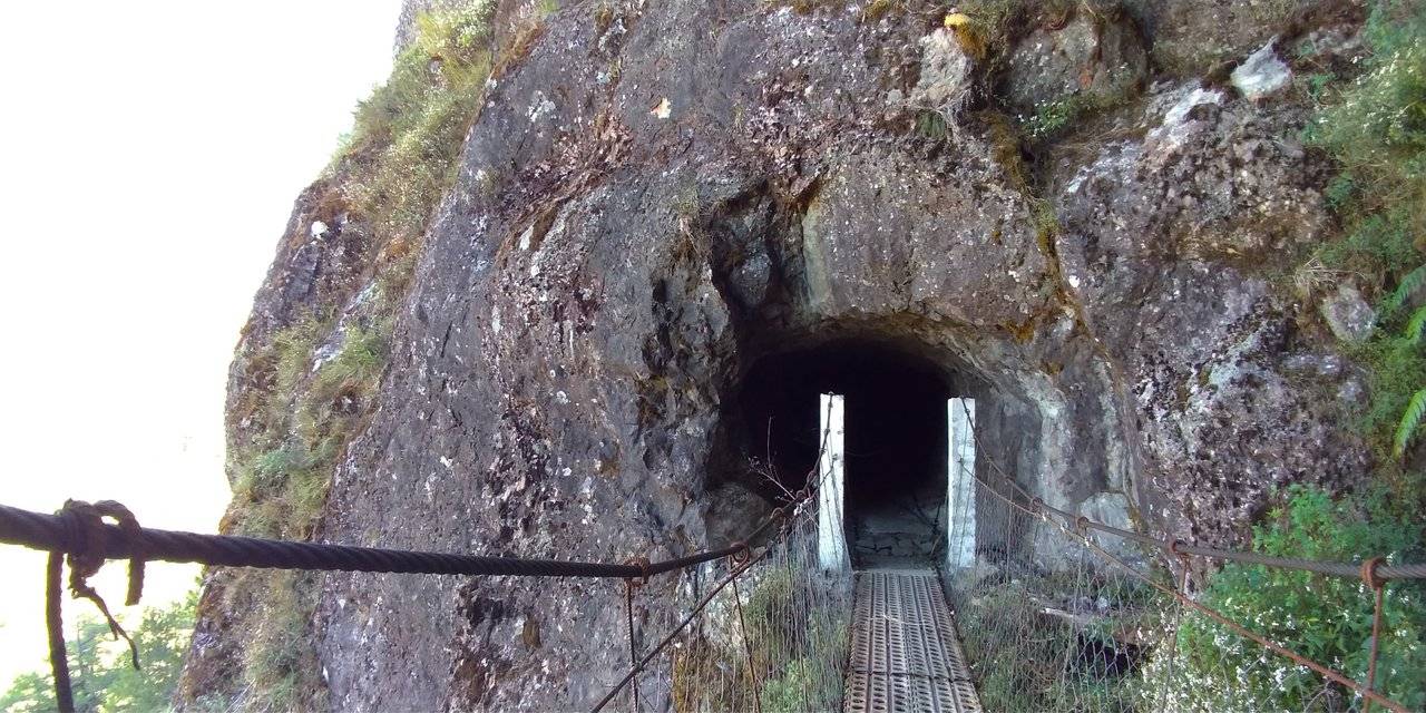
What makes this worth it are the scenic views as well as the history behind it, walking where the ancients have walked. It is around 3 km walk with some mossy forest along the way. It is just an easy walk, easier going down. It is not that hard if you go uphill because the change in terrain is not that steep. There are only a few areas for that.
Don't Forget: Get Travel Health Insurance!
To make your trip a worry-free experience, TravelFeed recommends SafetyWing Nomad Insurance. It provides comprehensive health coverage while you travel, so you can focus on exploring, not the unexpected. Get a quote here
If you think you have not had enough of mountain ranges and garden terraces, then come visit Atok and walk the Spanish Trail. You will not regret it.
See that big Christmas tree in the photo above? I believe that is the biggest yet - at least at a distance it looks like one. It is a convergence of trees that took the shape of a giant Christmas tree.
If you plan to visit this place, take any bus going to Halsema Highway (via Sagada, Bontoc, etc). Ask to be dropped off Osocan Spanish Trail. You can enter via the highway and then after trekking the trail you can go to the flower farm or you can do the other way around. This is just a half-day itinerary and while there you can stop by the highest point.
Travel Resources for your trip to The Philippines
Recommended by TravelFeed
Flights: We recommend checking Kiwi.com to find the best and cheapest flights to The Philippines.
Accomodation: Explore the best places to stay in The Philippines on Booking.com, Agoda and Hostelworld.
Travel Insurance: Medical emergencies abroad can be pricey, but travel health insurance is not. We always use SafetyWing for affordable and reliable coverage.
Car Rental: For hassle-free car hiring, DiscoverCars is our trusted choice with a wide selection of vehicles.
Internet: Got an eSIM compatible phone? Airalo is perfect for reliable internet access during your trip. Just install it before you go, and you're set!
Day Trips & Tours: We recommend GetYourGuide for a variety of well-organized and enjoyable activities.
Travel Planner: Need a hand planning? Our free travel planner chatbot is your personal guide to The Philippines. Chat now.
Disclosure: Posts on TravelFeed may contain affiliate links. See affiliate disclosure.
