On the second day of our adventure trip to the South Tyrolian Dolomites, we decided to go for an even higher mountain than the 2744 meter high Paternkofel that we had climbed the day before (link to the post about day 1). With an altitude of 2957 meters, the so called Schusterplatte has been the highest mountain summit I have reached so far. And like the day before, it was once again a hike not only through beautiful rock formations, but also through reminders of one of the darkest times in human history.
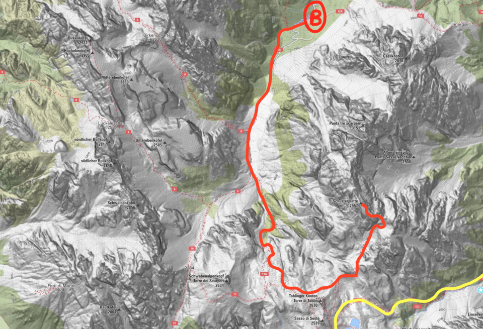
Our second hike started one valley further west than the first one, in the so called "Innerfeldtal". Since 2010, you are not allowed to drive into the valley with your car during main tourism season due to regulations for nature protection purposes. However, there is a rather cheap shuttle bus you can take to get a few kilometers further into the valley, making hiking tours better timeable. The bus drives on a regular basis between 8am and 6pm, at the free parking area right next to the road SS52 there should be more than enough place for you to find a free spot. After taking the bus to the place "Antoniusstein" (marked with B in the map below), the tour can start.
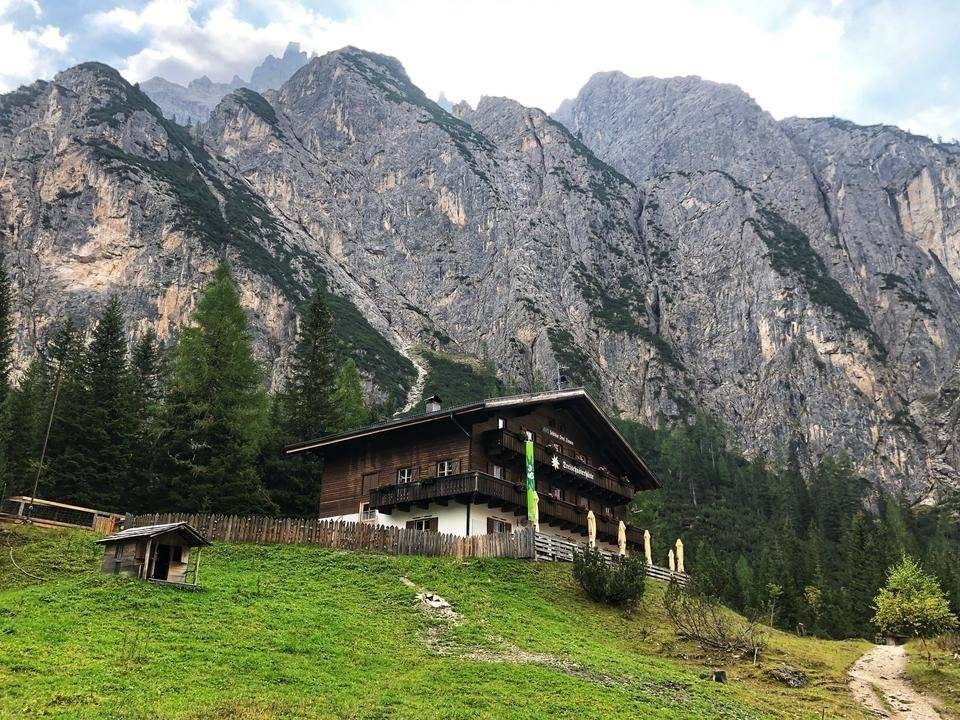
Like the day before, the day started with a walk towards the end of the valley, passing another marvelous mountain lodge on your way. The so called Dreischusterhütte is situated right next to massive rock formations and a sheep-filled meadow, which you have to cross in order to continue the hike.
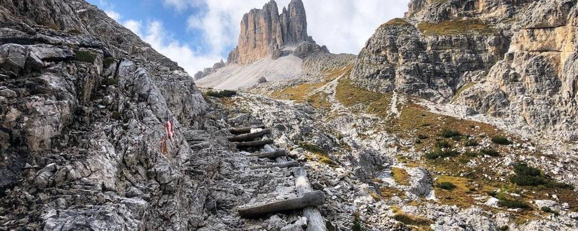
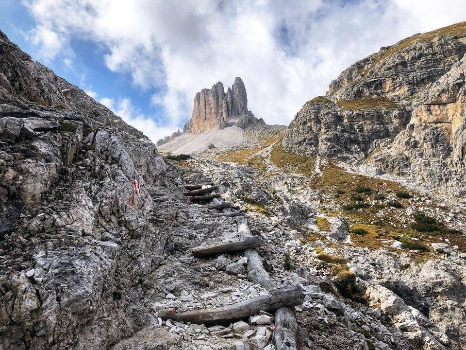
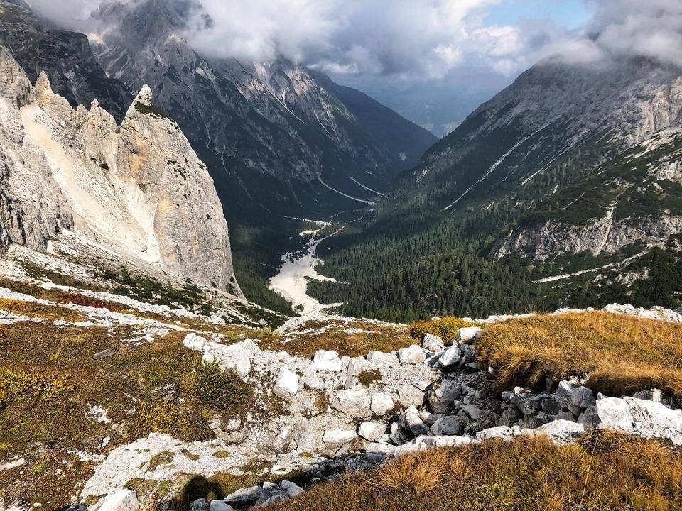
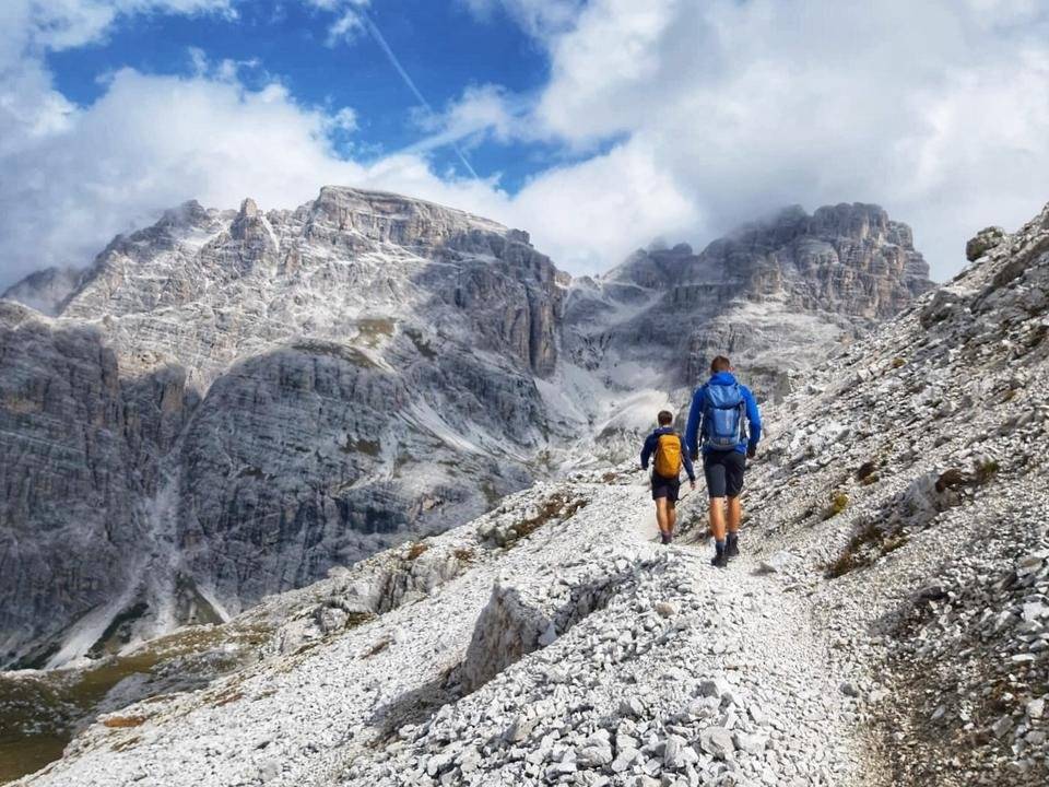
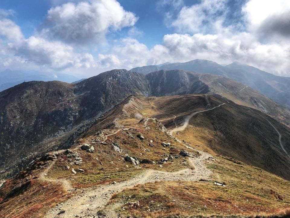
After around 30 minutes of rather flat walking, the climb to the Schusterplatte started - way over 1500 meters of elevation were still in between our feet and the peak. On your way to the top plateau, the panorma view across the Dolomites got better with every step we set upwards. Behind every corner, new giant rock monuments rose on the horizon.
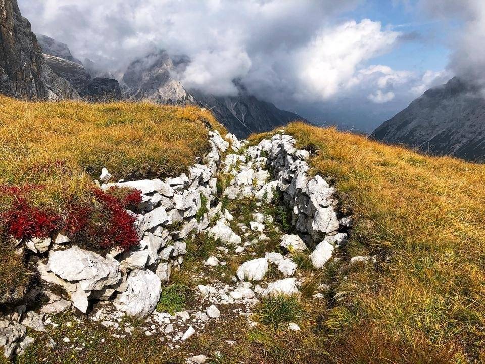
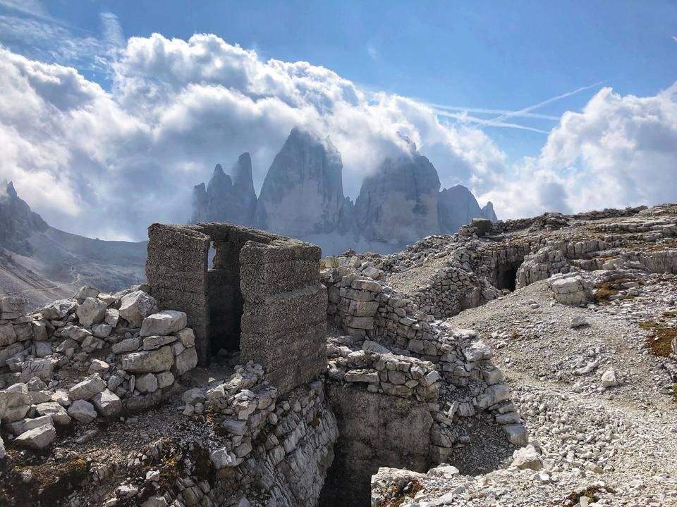
But the higher we got, the more we got reminded of the dark historic events that took place in this scenic area. Between the beautiful rocks, there were dozens of tunnels and trenches made by man around a century ago. It really was a strange feeling, as every step we took could have been the place where one of our anchestors got either killed by former colleagues or the brutal forces of nature.
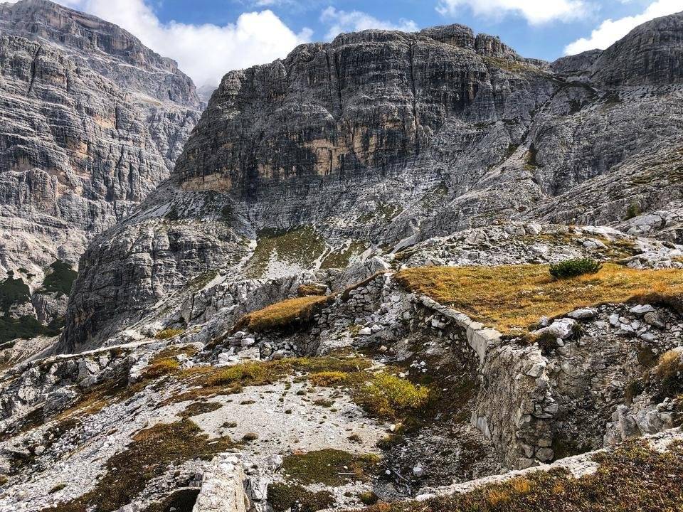
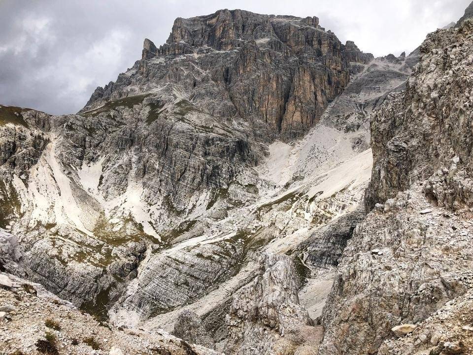
Looking it the area, it is quite understandable, why this area was so well secured in particular. Standing on the plateau, you can overlook the whole Innerfeldtal - whoever had his cannons and soldiers placed up here, obviously "enjoyed" a heavy advantage in warfare.
I have digged out two more videos from Youtube with some original pictures of those times, just to give you a little impression of how things were back then. We (hopefully) will never be in the position to really imagine what those people must have felt back a hundred years ago.
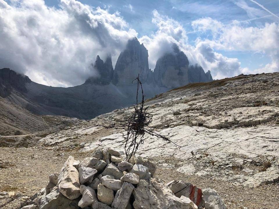
Looking at the following pictures, it is hard to believe that men shot at each other in front of such a scenic panorma.
However, the following cross made out of barbed wire (tons of it are still lie around) leaves no doubt that those trenches and bunkers were not made just for fun.
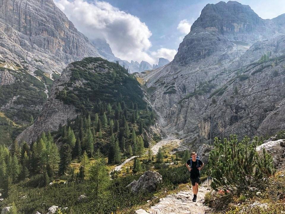
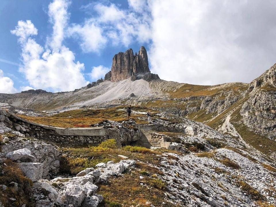
Despite the fascination of these historic site, we couldn't look around for to long, as there was still quite a heavy hike in front of us.
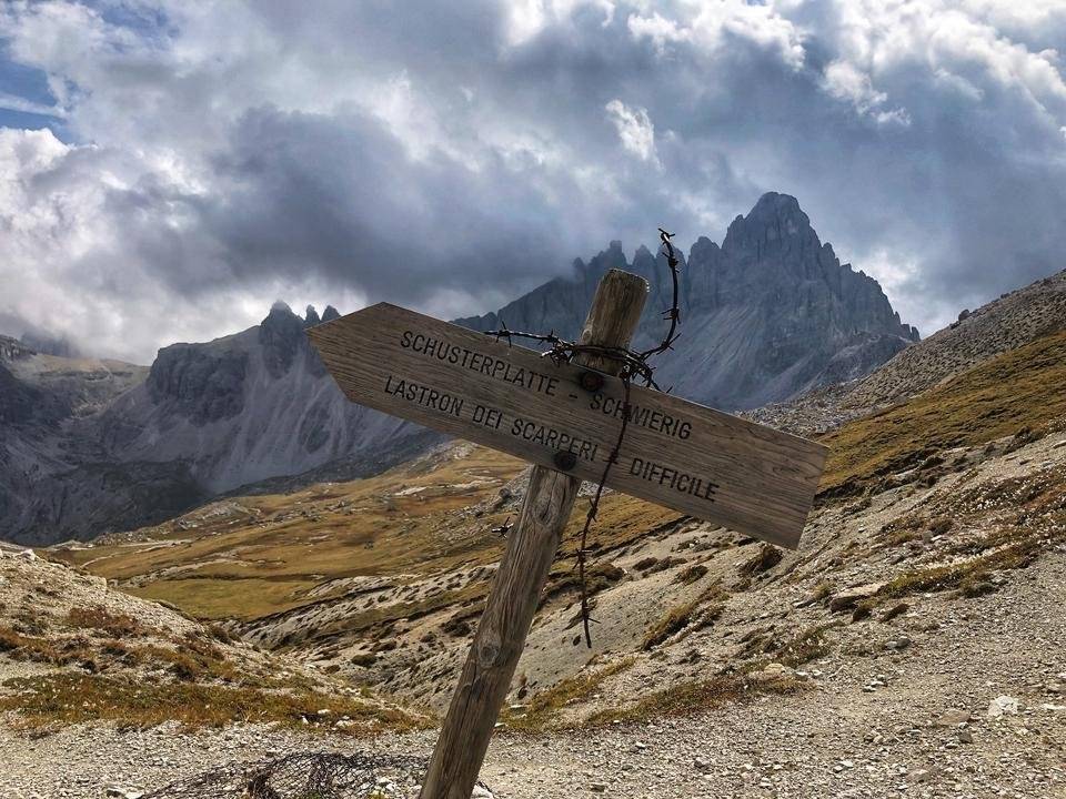
On paper, it didn't look like a too heavy hike, "only" around 500 more meters of elevation were still ahead of us. However, it turned out to be quite a heavy passage, as we had to walk up seemingly endless curves of serpentines through large fields of gravel, followed by some rock climbing.
Unfortunately, fog caught as again on the last few hundred meters, making the climb even harder. Unlike the day before, we luckily had no troubles finding the right way, as kind hikers in the past had built some small stone pyramids to mark the way.
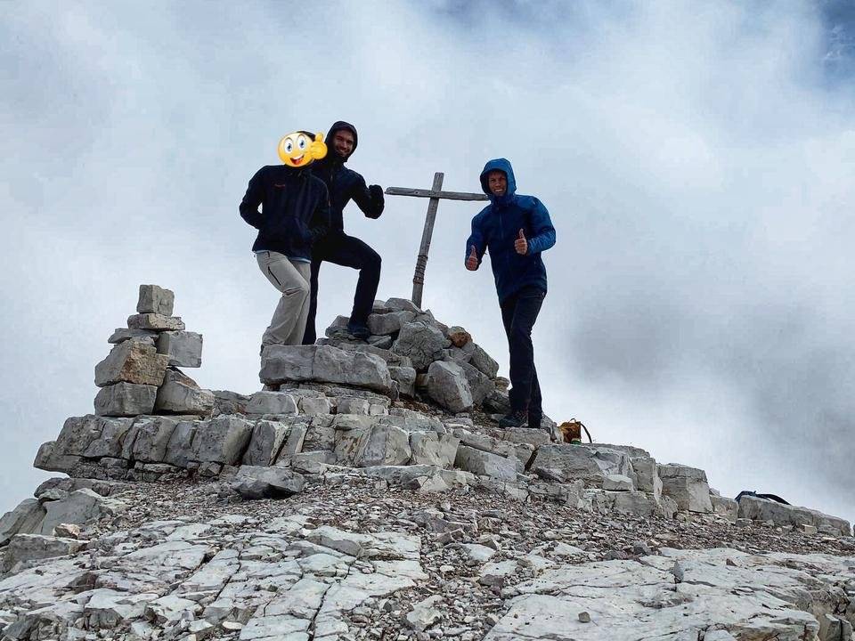
After a long walk, we finally arrived at the top. Unfortunately, we haven't been rewarded with a great panorama view once again. It seems like a curse - The three highest peaks I have been at so far have all been covered in fog and/or clouds. However, the atmosphere was still amazing and the Radler we brought with us tasted well once again. This time I combined it with a ciabatta filled with some fresh Italian prosicutto. It was delicious! :)
I tried to record a time-lapse video again, however it didn't turn out quite as well as the one I recorded the day before. Therefore, I have decided to look up a video showing how it could have looked up there if the weather would have been better. Maybe I will be able to enjoy the following view if I walk up there with ski in the winter - @weitblicker and me are definitely considering the tour, let's see if it works out. But now, enjoy!
After we had finished our meal and had done our mandatory photo shooting, we decided to start our way back, as it got quite gold up in almost 3000 meters above sea level. Luckily it got cold that fast, otherwise we would have stayed longer, which would have been a problem later, as you will see.
We had forgotten that the bus only drives until 6pm, so we had only about two and a half hours to get all they way back. At least, if we didn't want to walk an extra few miles on a street 😅 Therefore, we walked quite fast and didn't take many pictures. But it payed off. Literally as the bus was about to leave, I was fortunate enough to draw the driver’s attention and get into the bus. Fortunately for @weitblicker and our friend, the bus driver was kind enough to wait another minute after I had told him that two more friends are coming.
Back at the parking lot, we all were quite happy to exchange our heavy walking boots into some comfortableand light-weight sneakers. No wonder, as we hald walked even further than the day before - close to 8hrs, 23 kilometers and 1750 meters of elevation.
After enjoying another great meal at the Pizzeria Martina, we quickly fell into our beds and continued hiking only in our dreamlands 🙂.
On the next day, we only did a "short" hike up the so called "Heimatsteig" to reach the mountain Helm, which seperates Austria from Italy.
After finishing this last hike and adding another 12 kilometers of hiking and 1050 meters of elevation to our fitness, we left Sexten and drove back into the country on the other side of the mountain we just had returned from.
I hope you enjoy reading these two posts as much as I enjoyed collection the information and writing about our adventures in the Dolomites! I am quite sure that those were not the last pictures from South Tyrol that you will be able to see on my profile!
See you,
Martin
P.S.: If you have missed part 1, check it out now: Hiking in the Dolomites - Between Paradise and World War I! - Part 1
Disclaimer: All pictures in this post have been taken by me or my friends with our smartphones and edited with the app Snapseed. You can use the pictures if you want, but please don't forget to mention me as the owner. Furthermore I want to make clear that I didn't receive a single cent from any of the brands/restaurants/etc. mentioned in this post!
 Trentino-Alto Adige/Südtirol


