Eagle's Nest is located in the Gilgit-Baltistan region of Pakistan. This is a place that at first seems like a boring heap of dusty stones, but upon closer sight, it surprises and delights. I spent quite a lot of time there and I am ready to say that I will gladly return there again and understand the Pakistanis who come there from all over the country. But more on that later, and for now ...
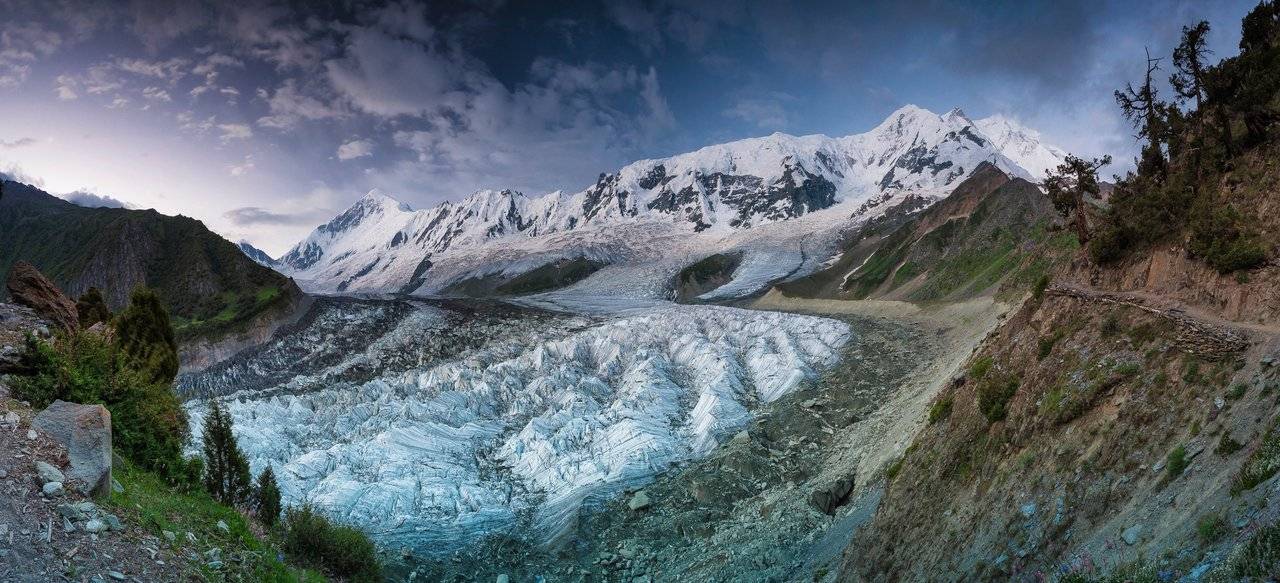
... in the meantime, my new day began at the foot of Mount Rakaposhi, where we camped. At night, I photographed the Milky Way, went to bed rather late and really hoped to get at least a little sleep before dawn, because yesterday, Olya @kibela and company went to the beginning of the ridge and saw something beautiful. In any case, they returned very inspired and talked, it seemed, only in interjections and indefinite articles. I could not get clear answers, and I decided to go there before dawn to see the views. But I didn't get a good night's sleep.
Avalanches rumbled all night. I knew that our tent was more or less protected from them, but I still wanted to gaze at the source of the roar. I opened the canopy of the tent and stared into the darkness. Nothing ... just a fading roar and the night that surrounds us.
Closer to morning, the nightmare began — the monsters woke up, accumulating strength in the darkness all night. I tried to fall asleep, but something huge and snorting loudly fell on the edge of the tent. I grabbed the zipper, pulled, and in the opening opening saw a backpack crawling out. “Hey, what an impudence!” I shouted in a whisper. In a whisper, because it was very scary. Outside, somebody puffed, groaned and hooted, the tent sagged under the weight of a huge shadow, and I lay and was afraid to grab onto the outer zipper.
Time passed, I screamed and was afraid, and things became less and less, and so I overpowered myself and got out. Damn, these were ordinary cows! They stood in a circle and chewed our things! AAAAA! It was a pity for things, but it was even more offensive for those fleeting moments when I could see some artistic dreams. I rushed in the dark at these horned beasts, they ran away from me, in general, the bridgehead was captured by me. I stopped and, proud of myself, decided to relax a little, to do what all people usually do in the morning. It was my big mistake — I immediately heard an approaching stomp and hastily retreated. It turns out that these monsters do not have enough salt, and in their desire to replenish it, as well as in their methods, they are quite similar to reindeer, which lick yellow snow and may even try to lick a person :)
Having fought off a couple more insidious cow attacks, I heard the trills of the alarm clock and went out of the tent, leaving its guard on Olya, which she successfully carried out without ever waking up. In any case, we did not find the loss of things, but some sweaty things were chewed. Such serious nightmares happen in the mountains :)
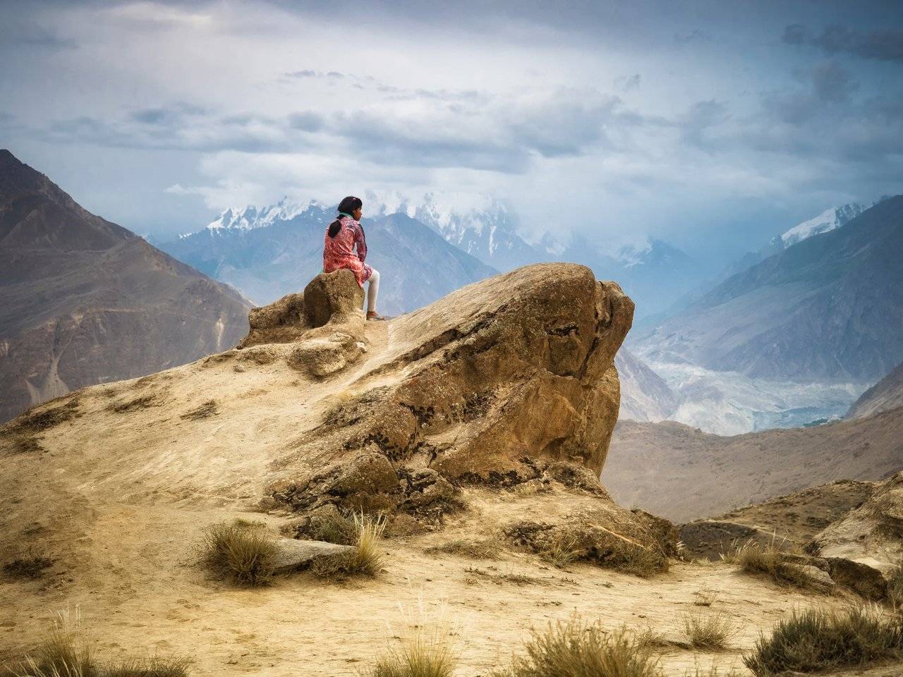
In the dark, I got to the point from where I want to see he view and waited. At first I stood, then sat down, then, it seems, dozed off. I woke up from Dima's voice. "Get up and go!" — it was told to me ... It's good that Dima joined me!
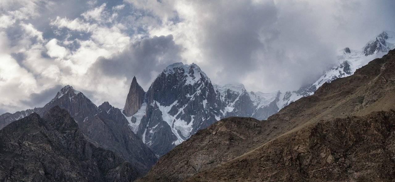
And I went further, where the views turned out to be even more interesting. This is a view of Rakaposhi. The mountain is on the right, and on the left is just a huge stone.
From here we can clearly see the top and even yesterday's waterfall.
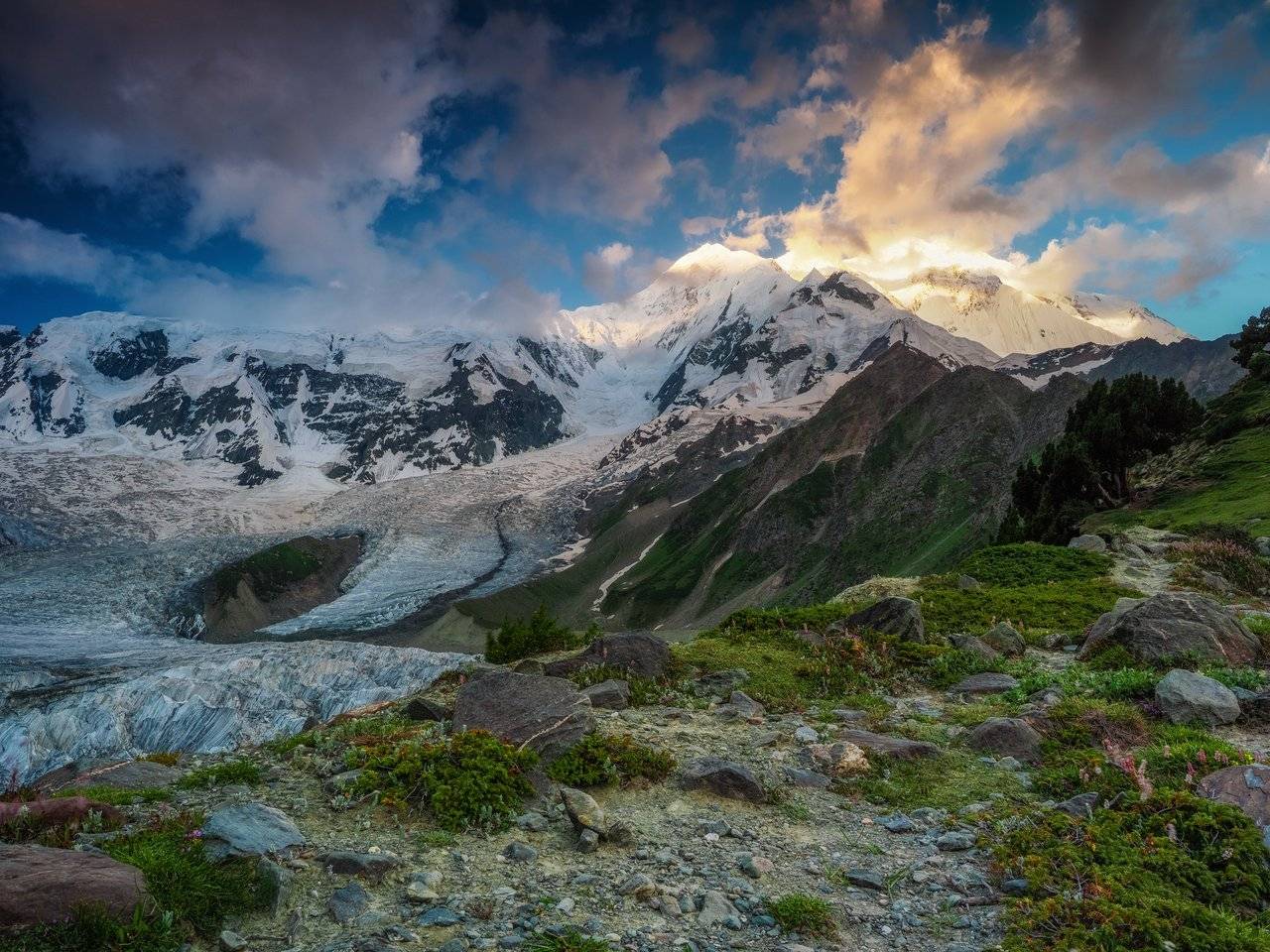
And if we go a little further, then we can see the town of Minapin Nagar — the place from where we got here.
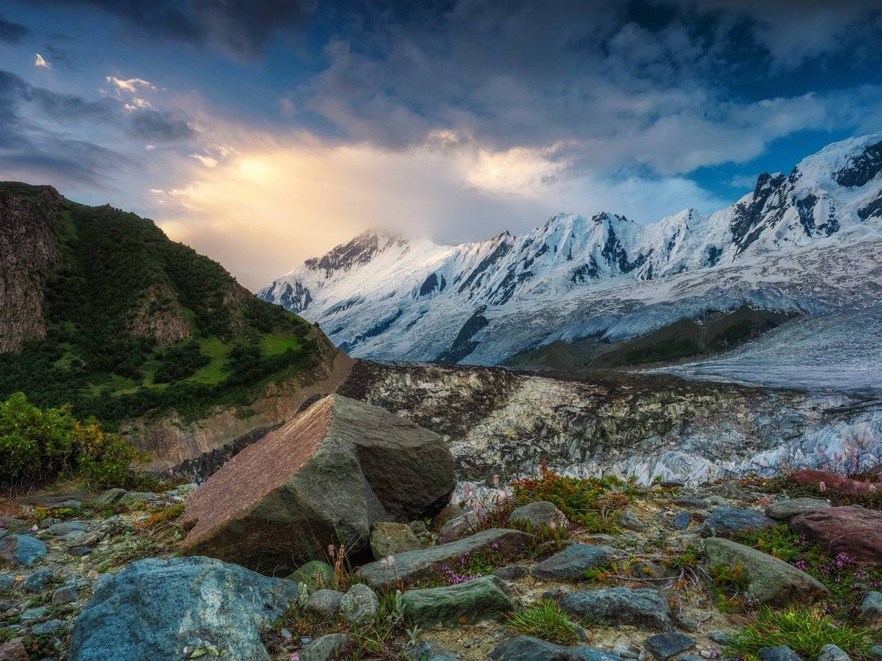
After taking a few shots and once again looking at the Diran peak, this time again hiding in the clouds, we moved back.
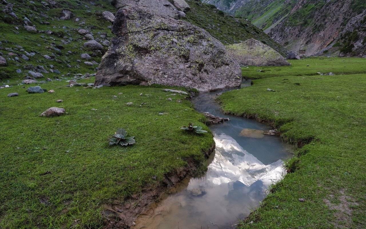
On the way to the camp, Dima saw the reflection of the mountains in the stream, and I tried to photograph it. I think it turned out nice :)
After a light breakfast, we packed up and headed back along the narrow paths hanging over the cliff. We, in principle, are already used to them, so it was not scary at all.
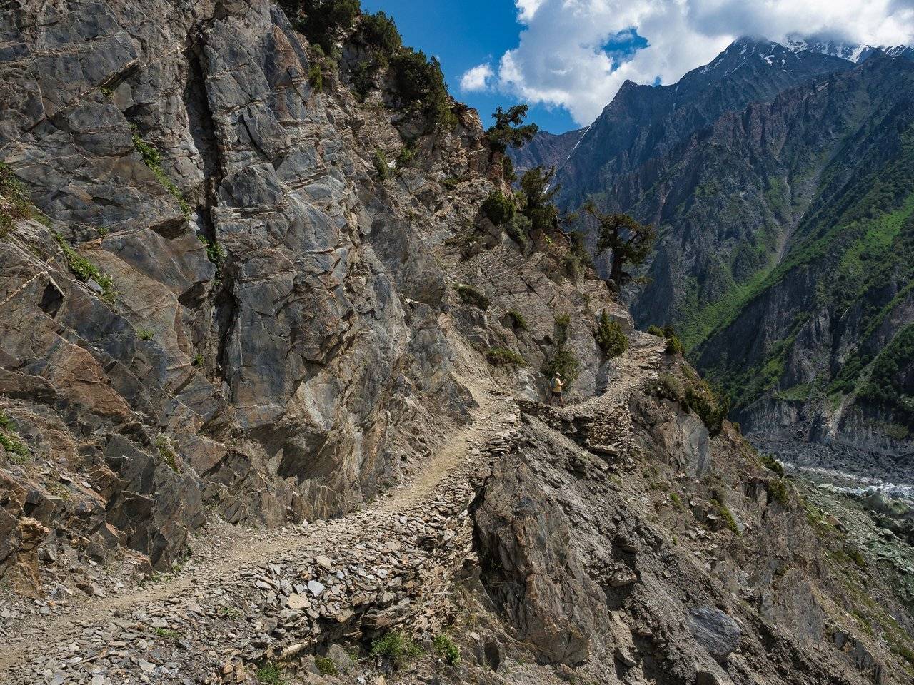
The sun is warm, it's good that we are going down quickly and the headwind blows our hair and cools our faces.
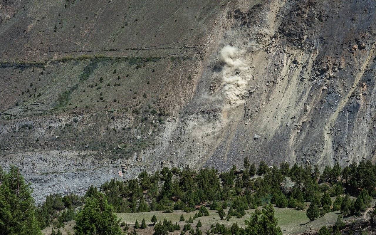
On the way we see a rockfall. Small dust spots on talus quickly turn into a local disaster. I hope there was no one below — the stones flew very actively towards the end.
Here it is, our path. Nice and well-trodden, but by whom? I am still interested in this question, because you can count the tourists here on one hand.
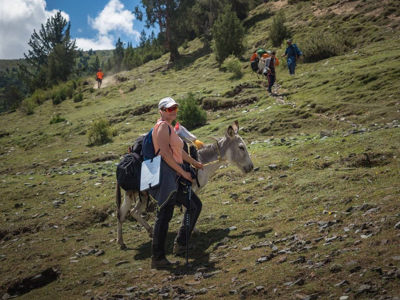
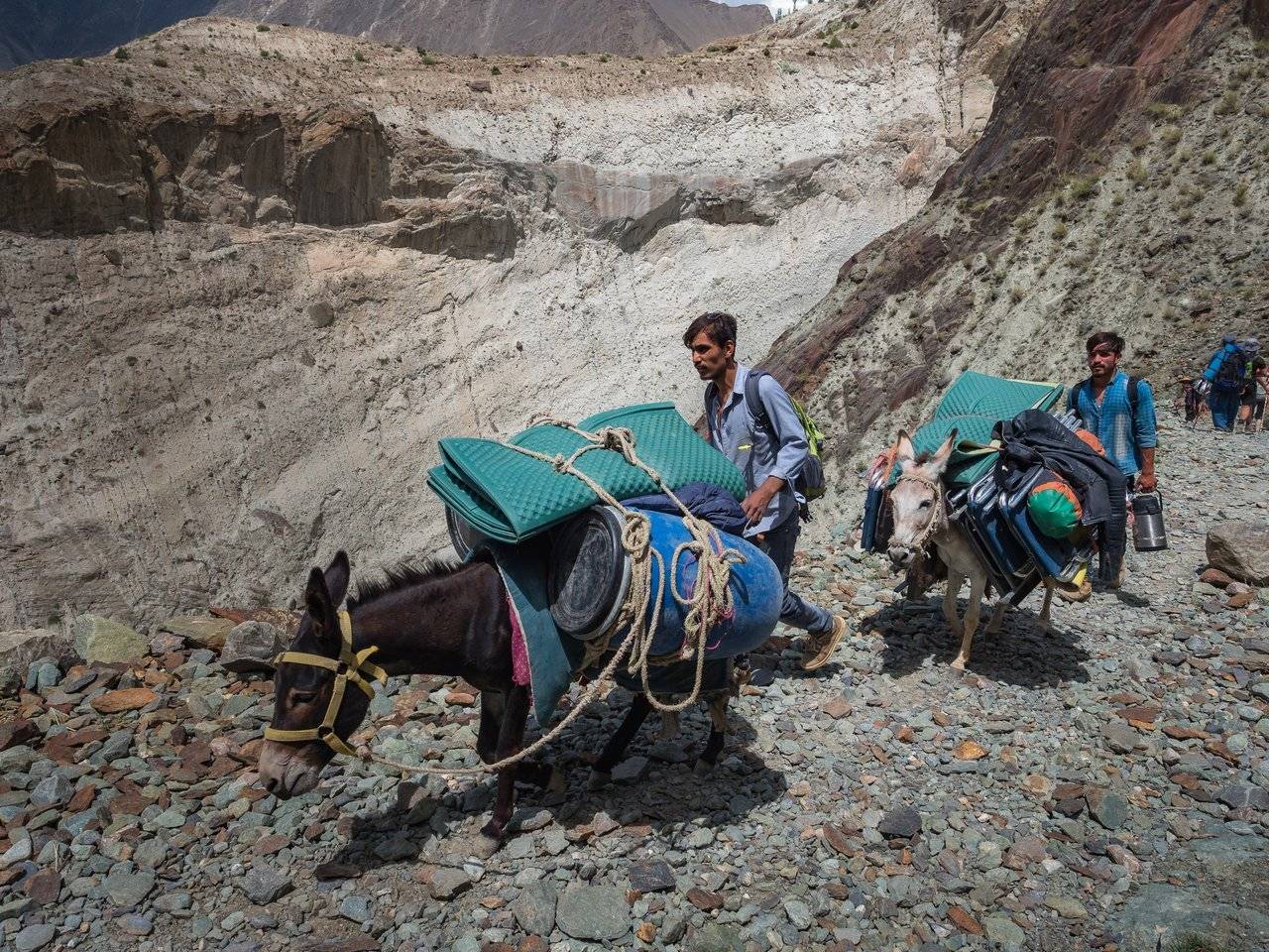
Meet Natasha, the non-local donkey driver. This naughty animal decided that only a woman could rule over him, and Natasha, instead of controlling her own descent, controlled this eared and very hardy creature.
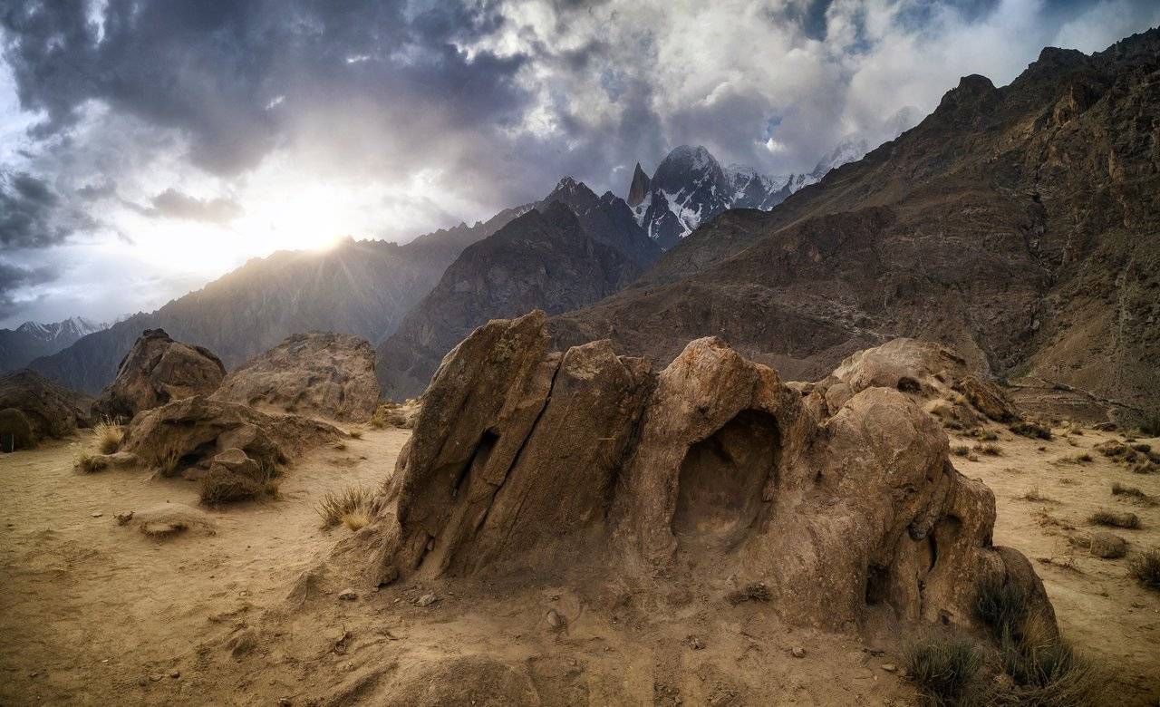
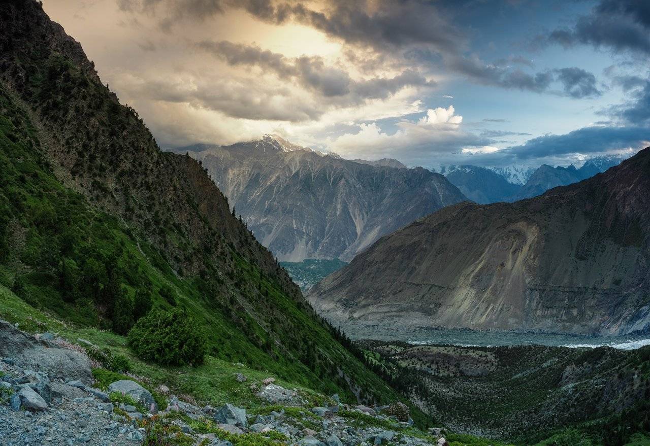
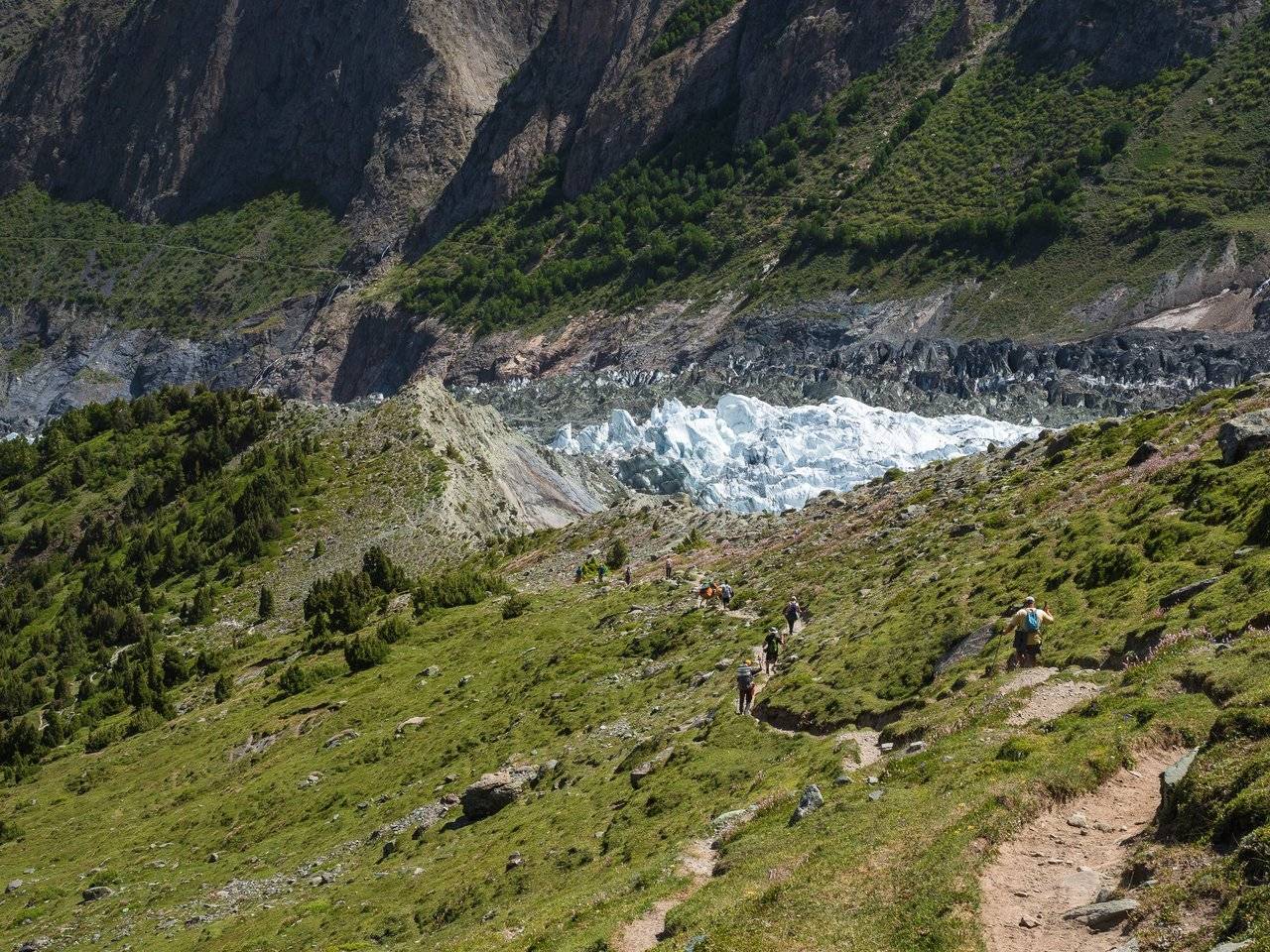
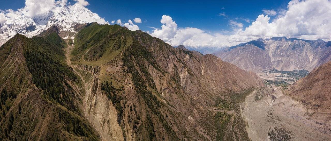
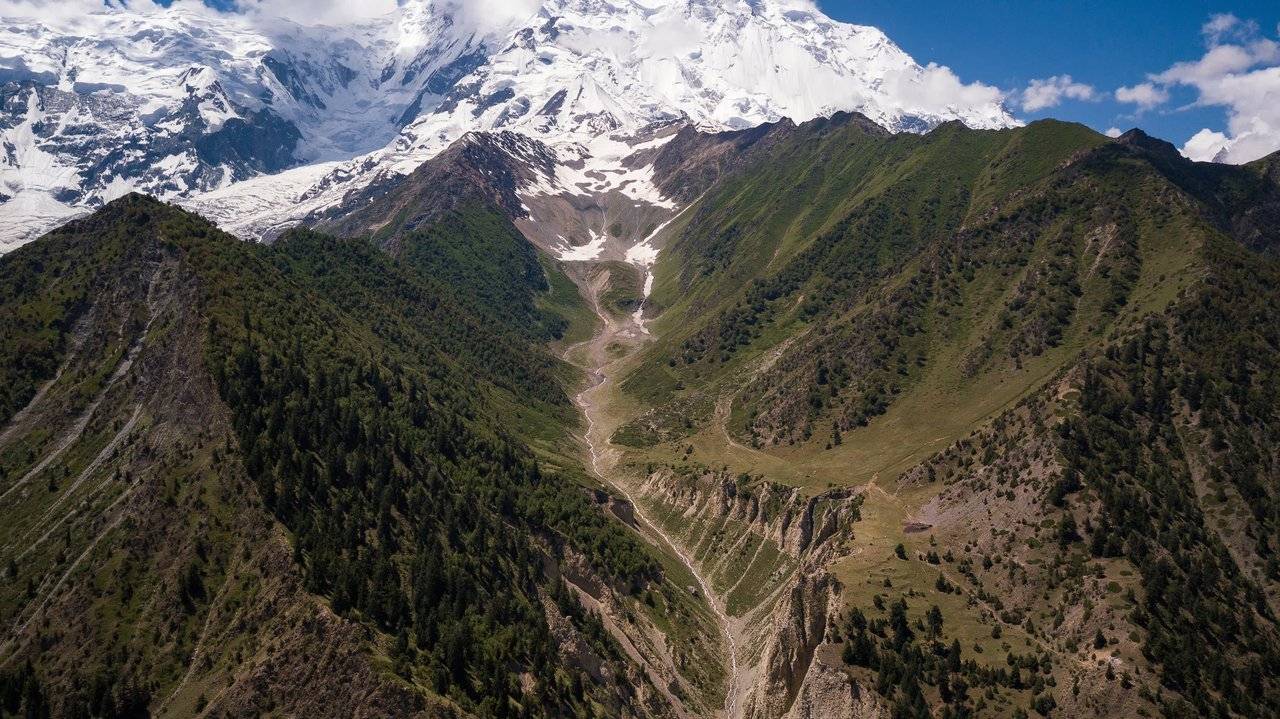
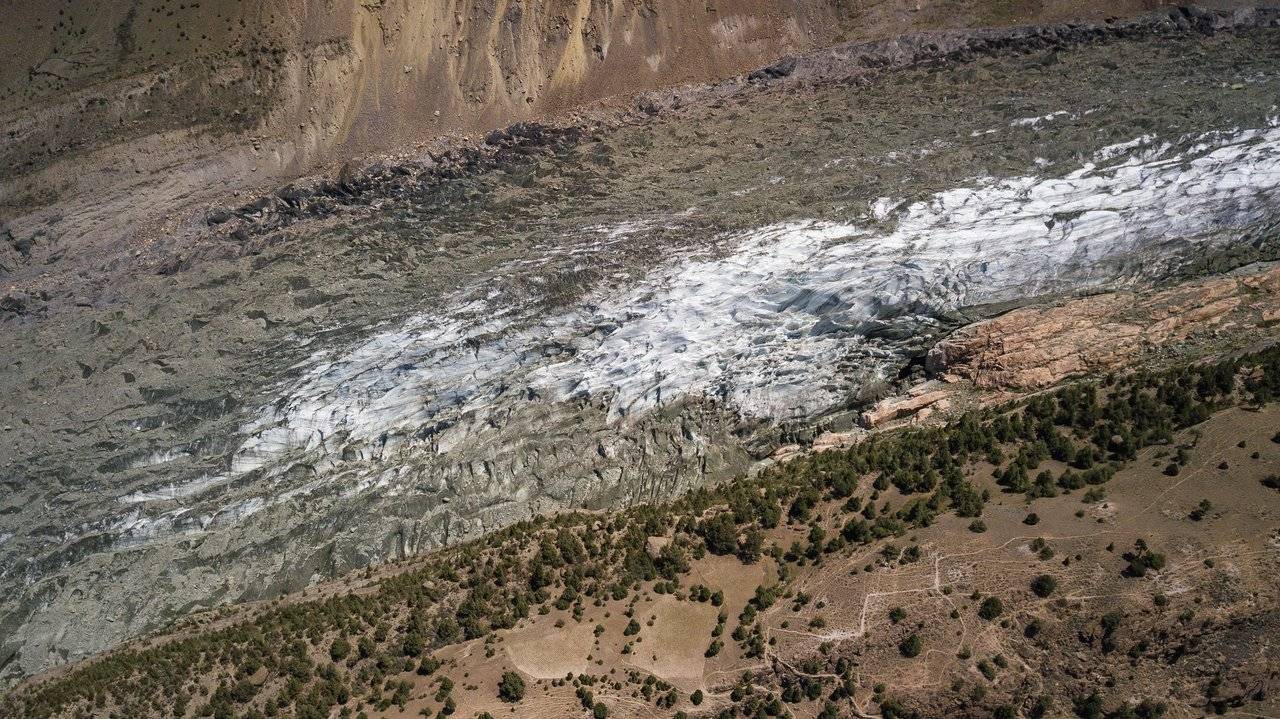
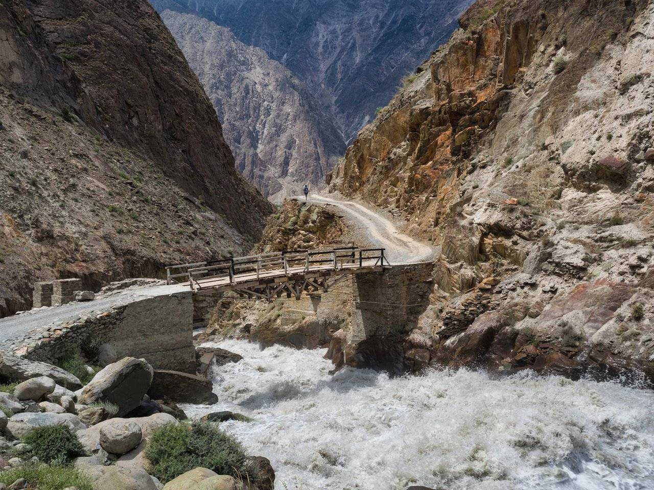
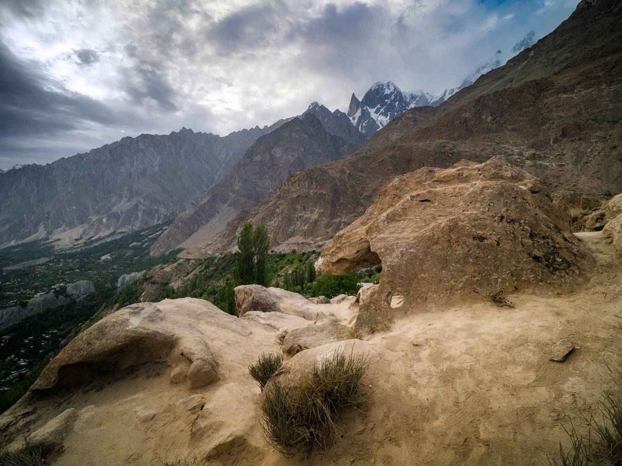
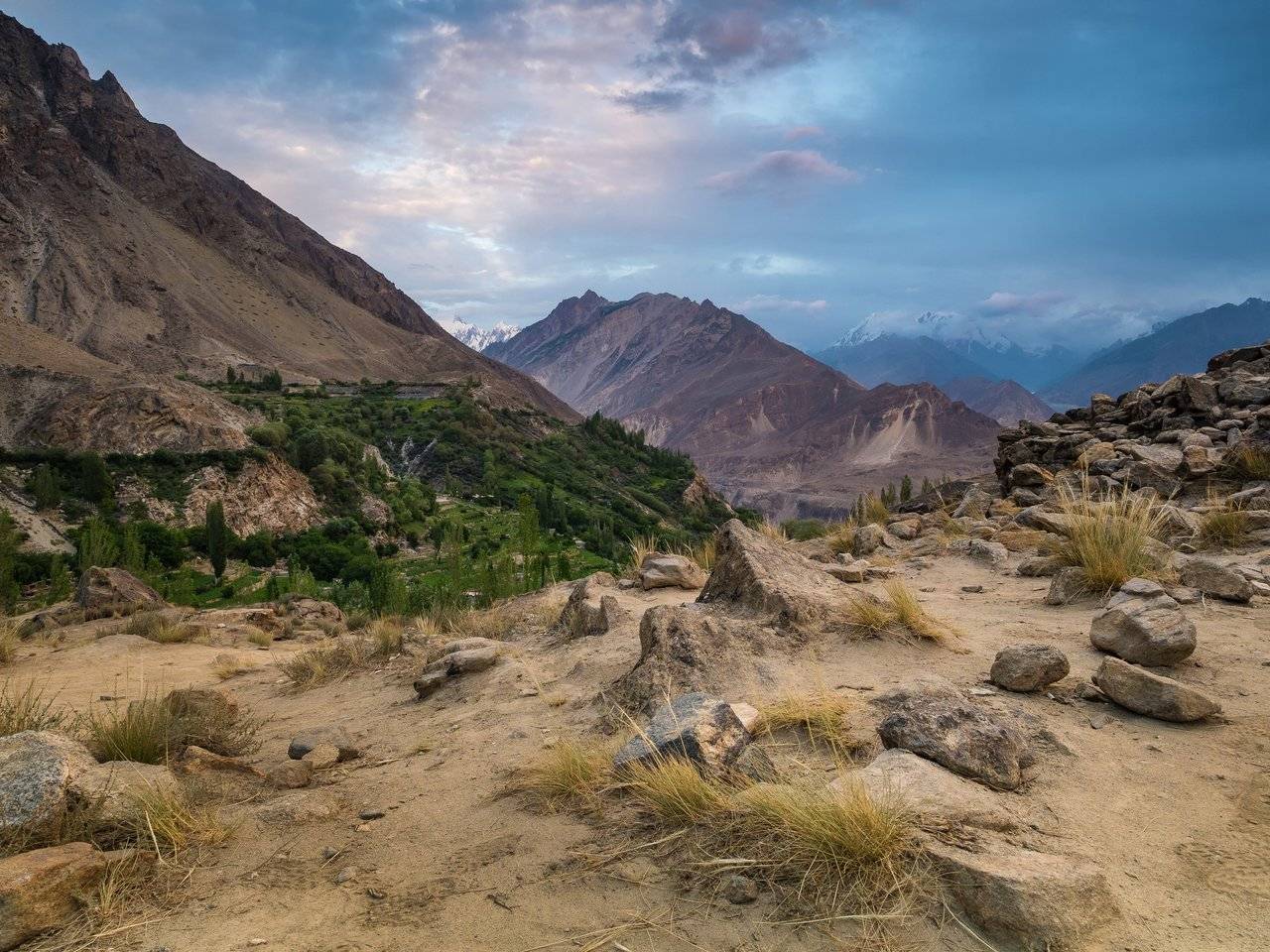
And this is a gorge that we have not yet walked. The path is straight up to the top (although there is no path on the peak there), and on the right is the road down to Minapin. We can see the end of the glacier, which turns into a fast river.
And on the surface it seems that it is so easy to walk along it ... But I think the feeling is rather deceiving. Although, if you look closely, at least at the beginning you can see a small trail.
A bunch of paths that are suggestive. Sheep or aliens?)
We go down to the Hakapun, which I talked about in one of the posts. The guys are playing some kind of board game. "Hey, I love board games too! I have Mansions of Madness, Descent, Gloomhaven, Fallout, Runebound, Cthulhu: Death may die and so on!" - I shout to them, but they quickly removed everything and run to prepare tea for the newly arrived tourists. Eh, I never found out what kind of game they had.
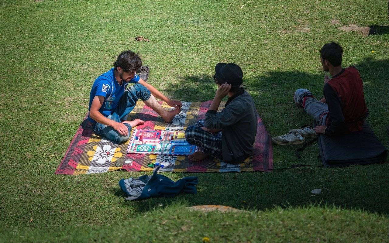
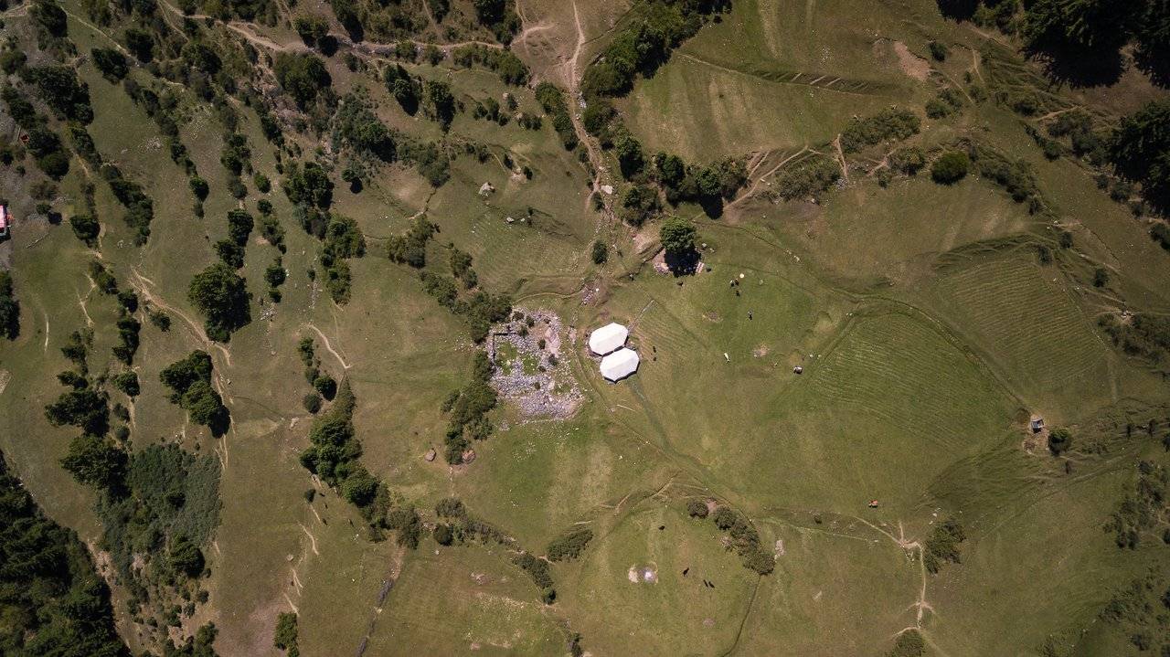
Two large tents where tourists can wait out the bad weather and inside which the hosts prepare tea and food. View from above.
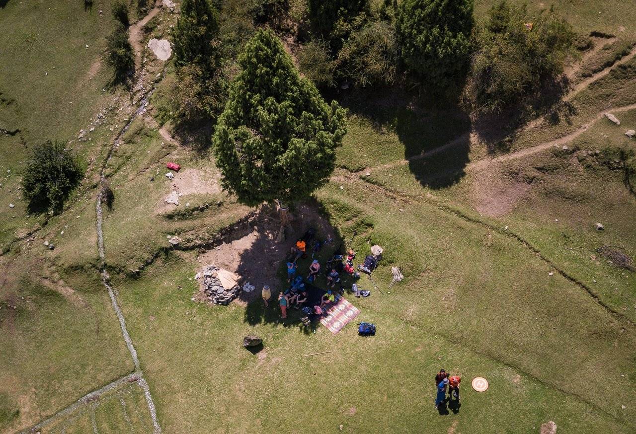
We gathered with the whole crowd under the shade of a tree and relax. It's hot!
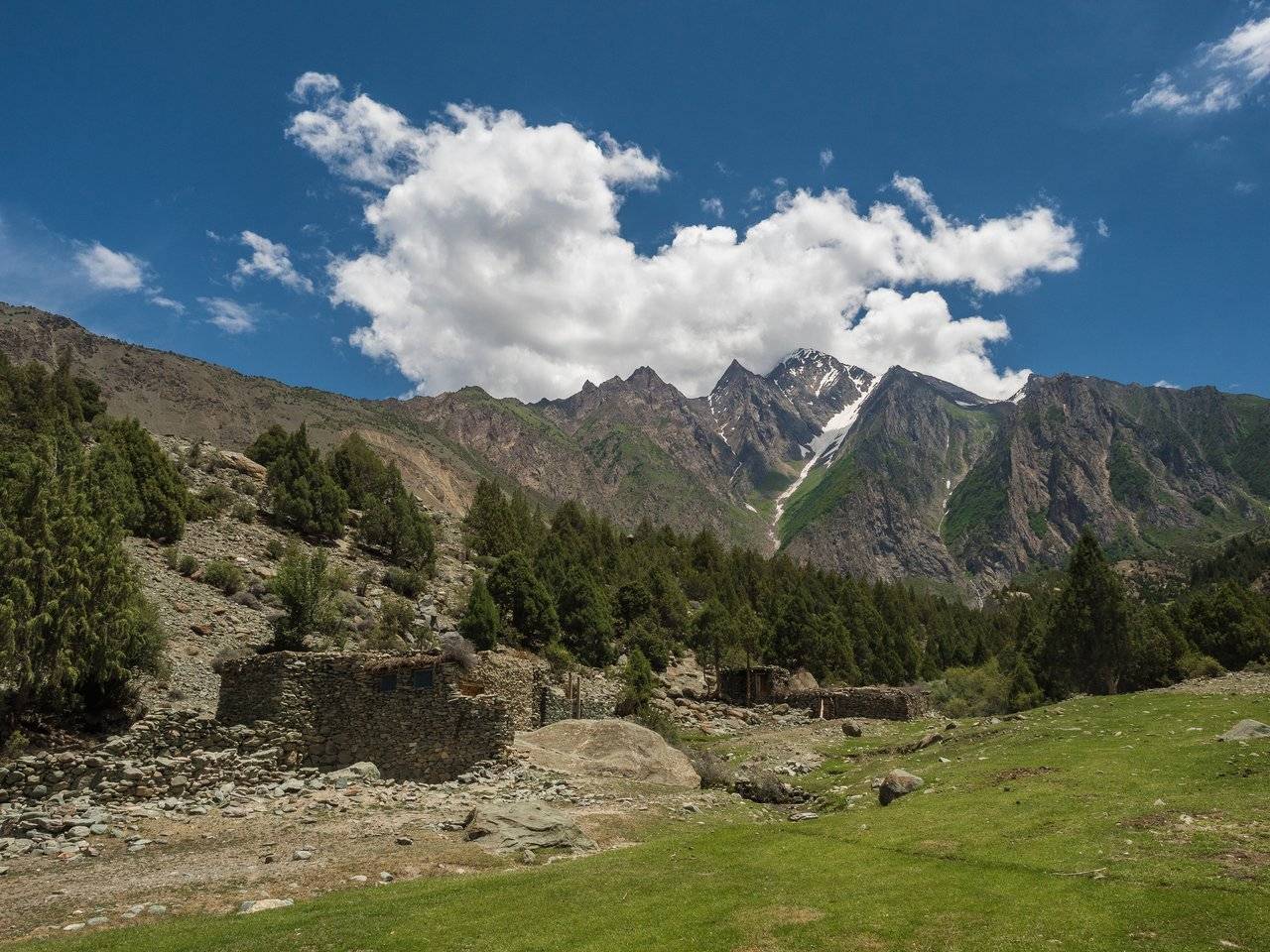
Well, after small break we can move down — again through a "kefir" village. Well, what else can we call it? It is not indicated on the maps.
This time we met here with a Russian-speaking girl. She is married to a Pakistani, lives in the country for a long time and travels absolutely calmly. Looking ahead, I tell you that later we once again accidentally saw her in another town.
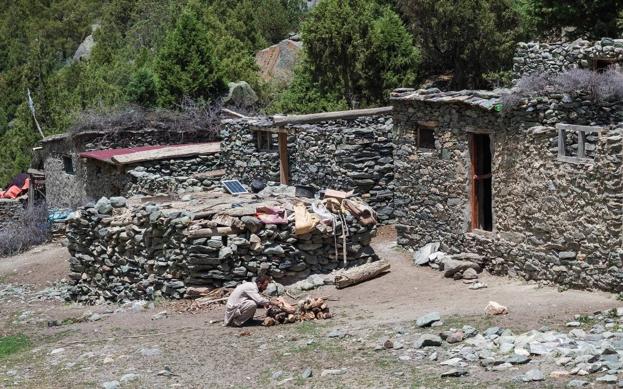
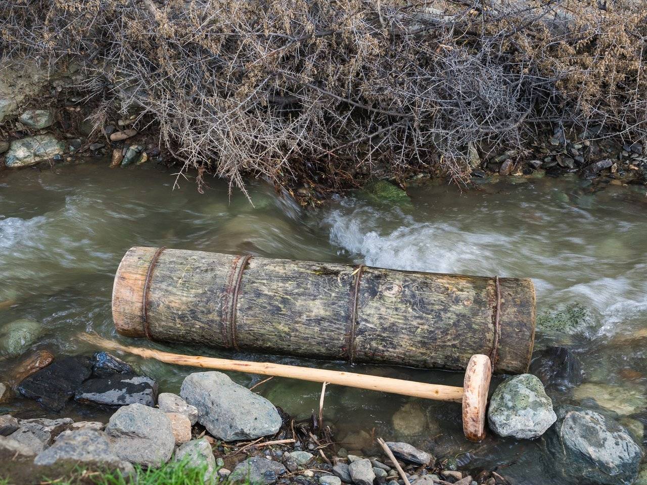
Why is this village so beautiful? Yes, just drinking like kefir or something like that from the goat milk. This is the only very, very low alcohol drink that we have met during the entire trip. And they do it with the help of these devices. I'm sorry, but I can't tell you how.
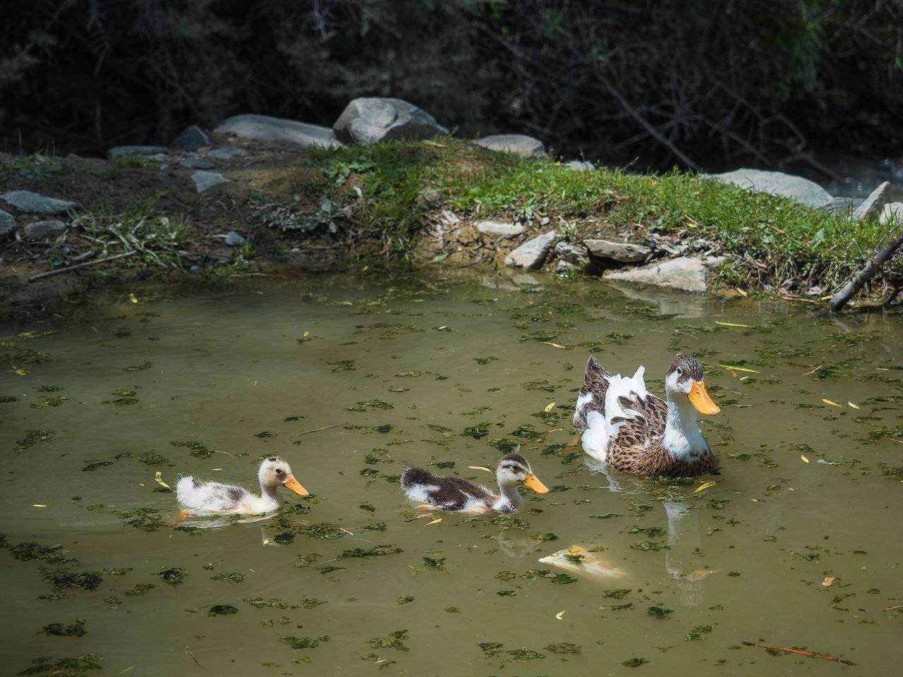
We sat in the shade, drinking kefir, and watched the ducks swimming in the local pounds. I didn't want to go anywhere until Dima got his "incentive".
Ten minutes to get ready, and now we are rushing down.
People are walking towards us, leading donkeys laden with barrels of food and various things. Someone will have a good night.
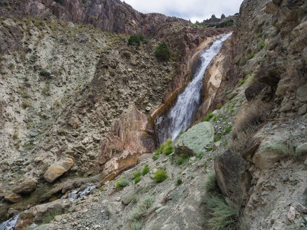
Waterfall again. Fairly clean drinking water. And below ...
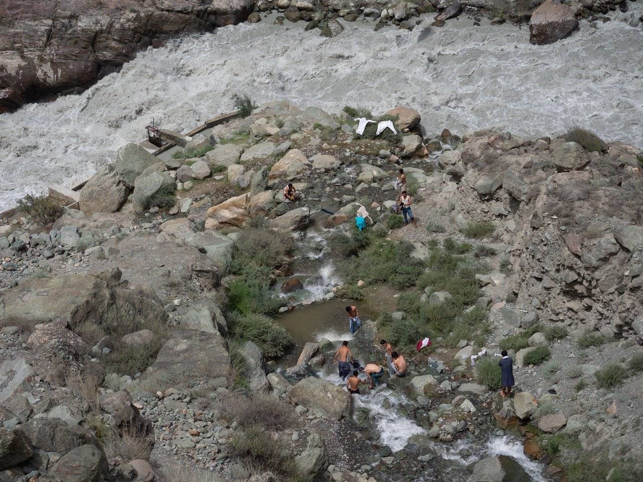
... below our girls were hanging for a long time — where else can they see so many half-naked Pakistani men doing laundry.
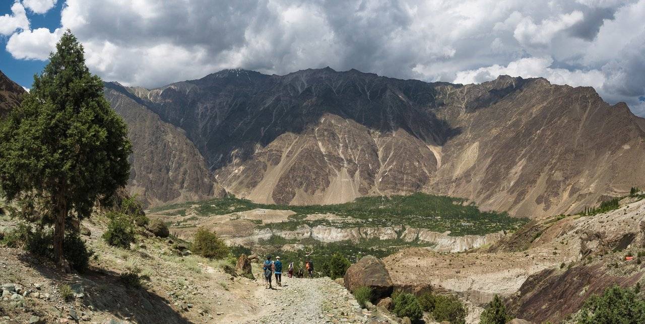
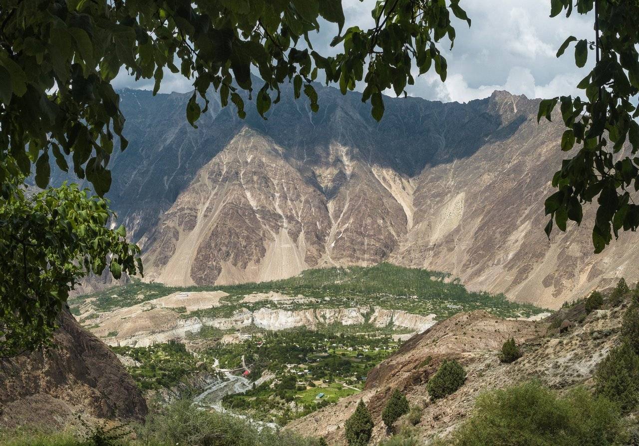
Here is Minapin, getting closer and closer! I already want cold drinks, cold ice cream and cold women who will serve cold apricots.
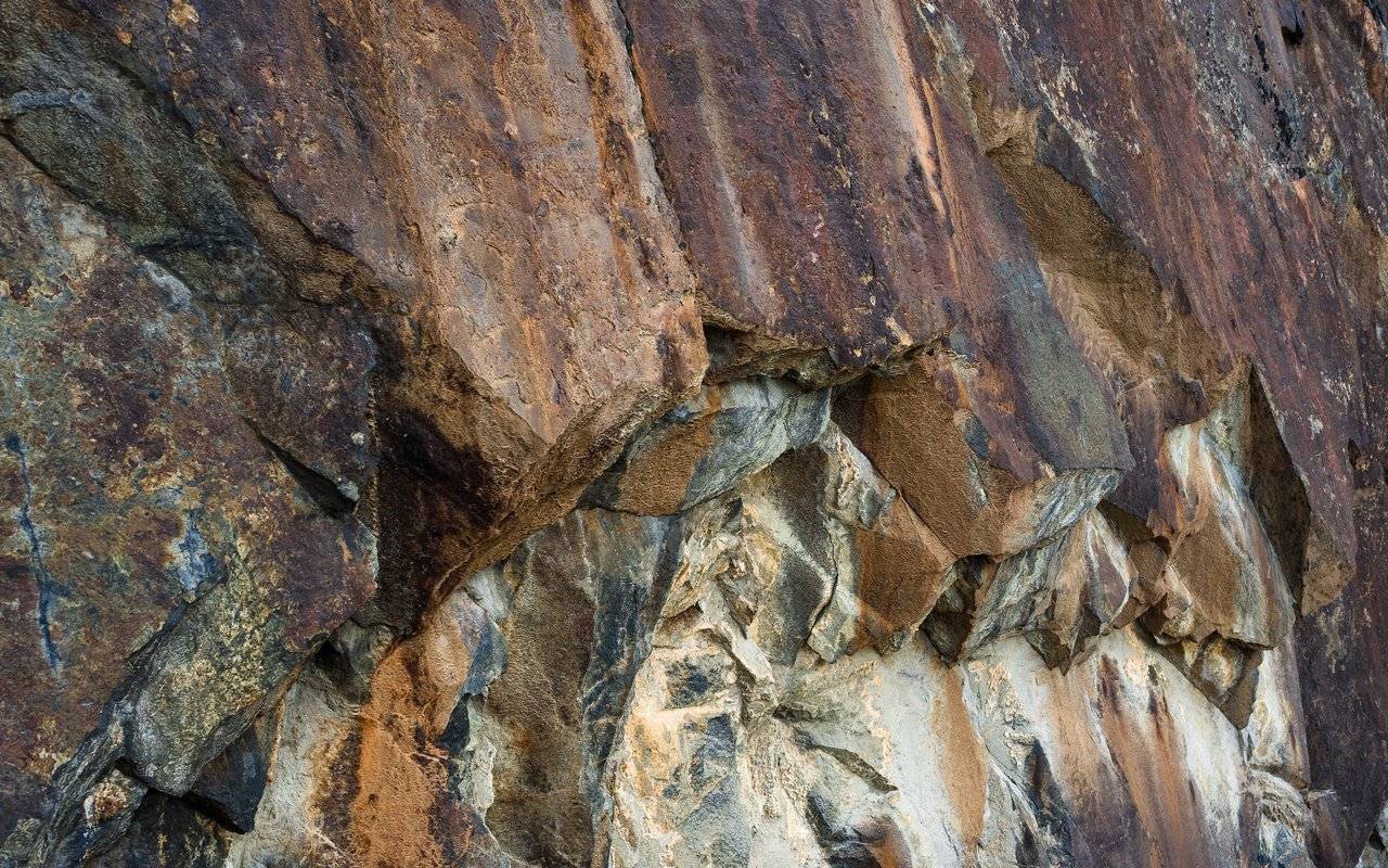
But for now, we can only touch the hot and insanely beautiful stones of the Pakistani mountains.
We pass by the water treatment facilities. What are these children collecting? Is it ice or diamonds? I did not see ice in the river, even though it is glacial water, nor diamonds. Where do these "things" come from, which they put in bags?
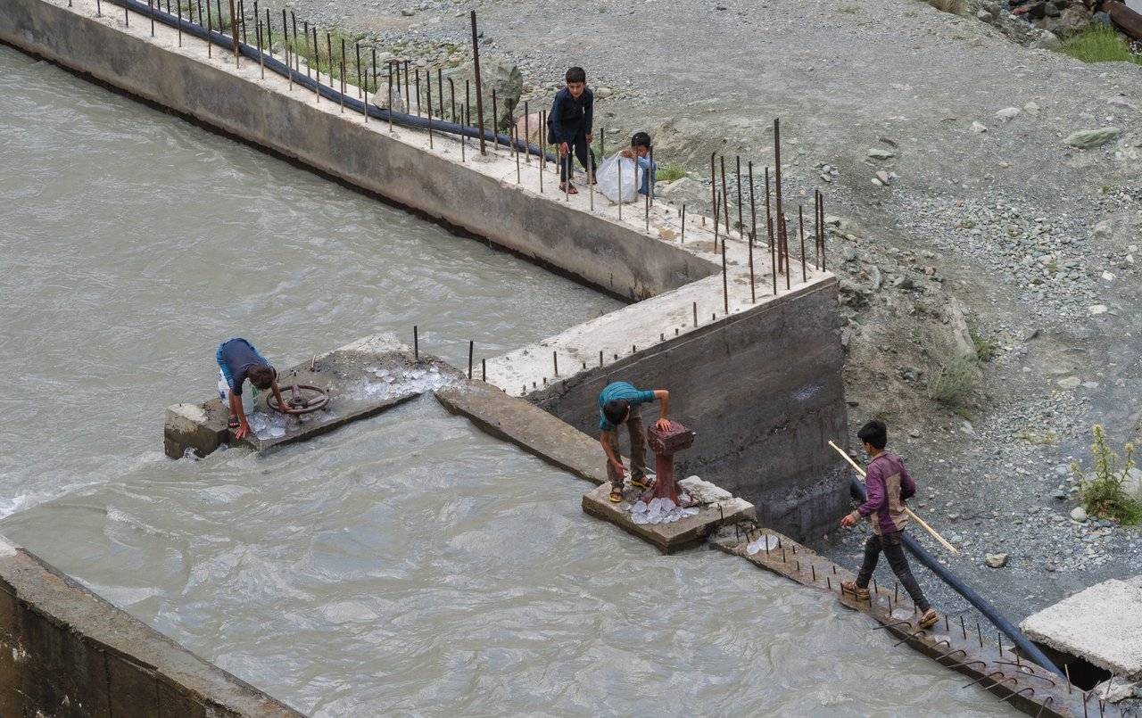
Having not received an answer, I go further across the bridge. Ahead @kibela's silhouette quickly disappears into the distance. It turns out that I am the last... I need to catch up with the rest of the group.
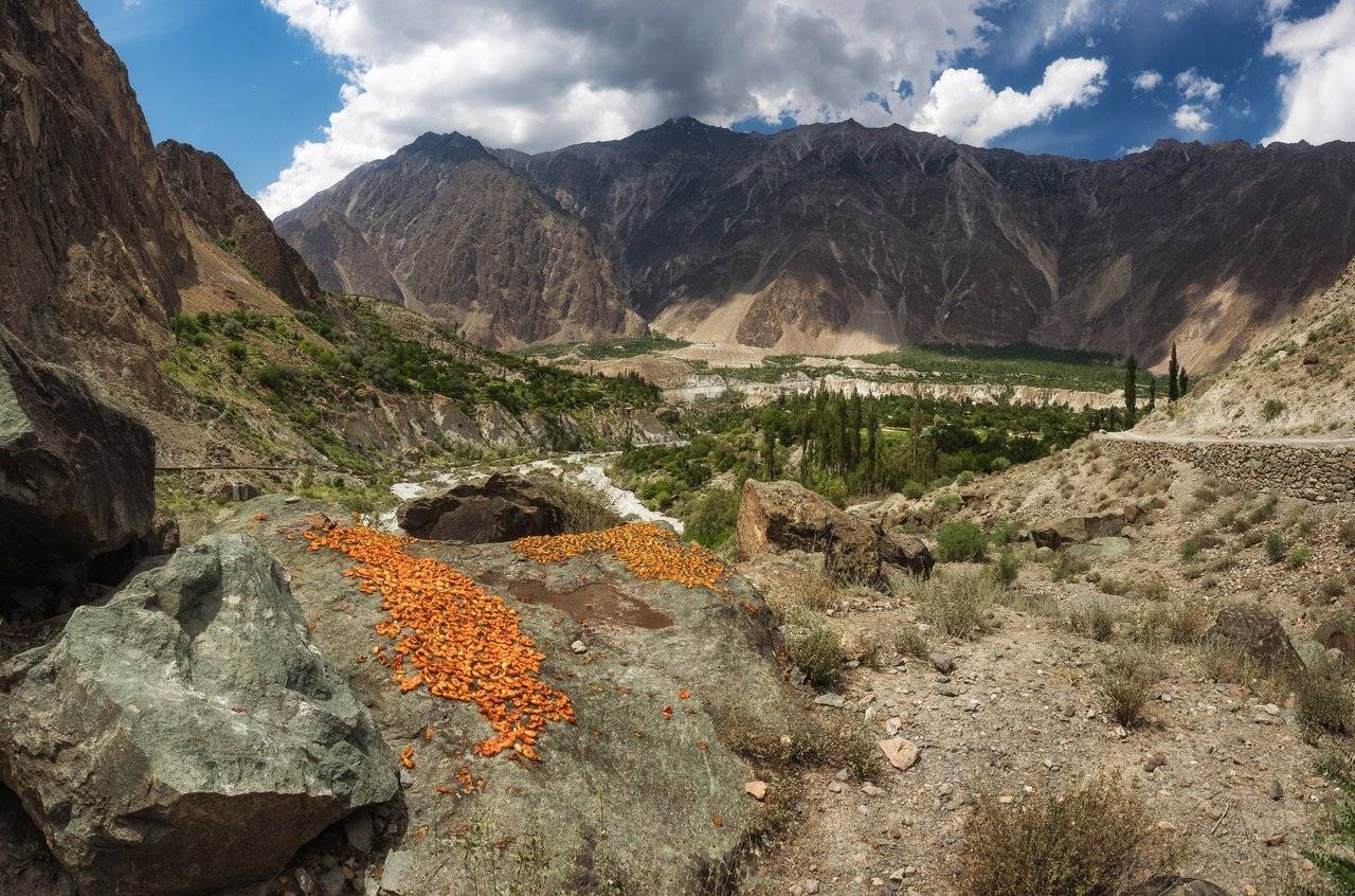
Dried apricots we saw along the road, by the way, are also quite hot and very dusty. I know for sure that I will now wash any dried apricots before eating. To avoid problems.
On the way to the town and already in it among the stone houses it was very hot, and only a cold shower in the hotel, where our unnecessary things remained, saved me from overheating.
After a shower, I had to face a problem — here they pay very strangely with porters and guides. There is a certain amount for their services, which is calculated based on the complexity of the route and the total weight of things. Our route for the whole team, except for our leader Dima Kozlov, who carried his backpack on his own, cost 25,000 rupees. Ascent and descent of things was 4500 rupees for the porter, and the guide gets only 2500 of this money — the owner of the hotel, who organized the whole team of porters+guide, said that the price is fixed and everyone knows what they are doing. The owner himself has no profit from this, but he must follow local rules. And it turns out that our local guide Haider, who walked the entire route with us, communicated with us and, in addition, carried one of our backpacks, although the lightest, receives the least of all the others. Not fair! So we decided to chip in to Haider for a tip. The guy was happy!
We loaded our backpacks onto the roof of the minibus and set off. On the way, we stopped at a shop and bought a bunch of sweets and chilled drinks. They sell many variations of the basil seed drink with different flavors. We tried more than a dozen different ones for sure.
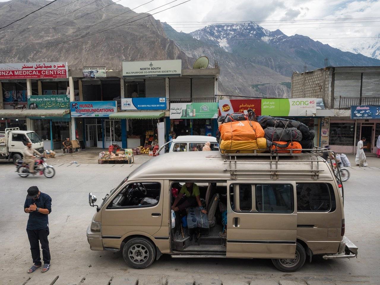
In the late afternoon we began to climb the steep serpentine. A couple of times we had to get out, because in some places the minibus could not enter the uphill in sharp turns with all of us and the load. Where are we going?
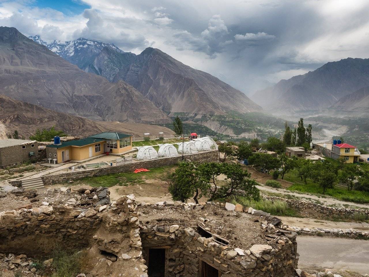
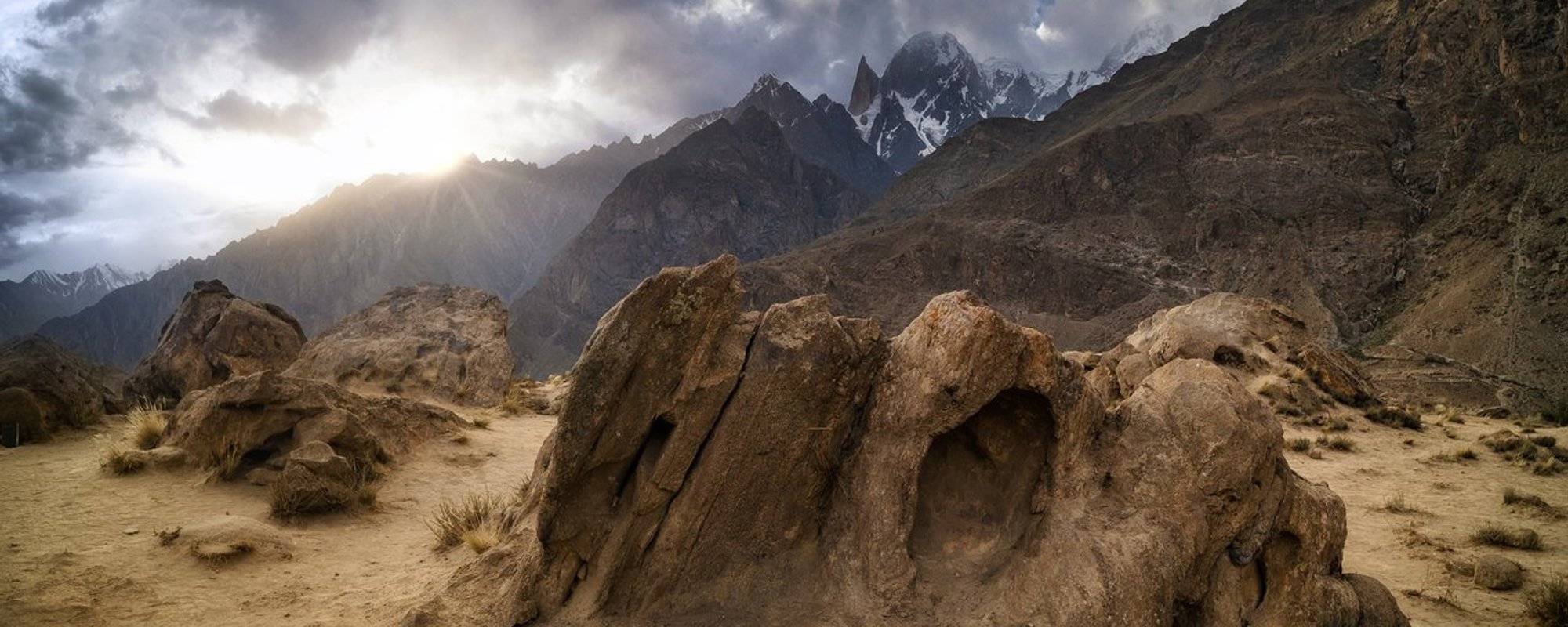
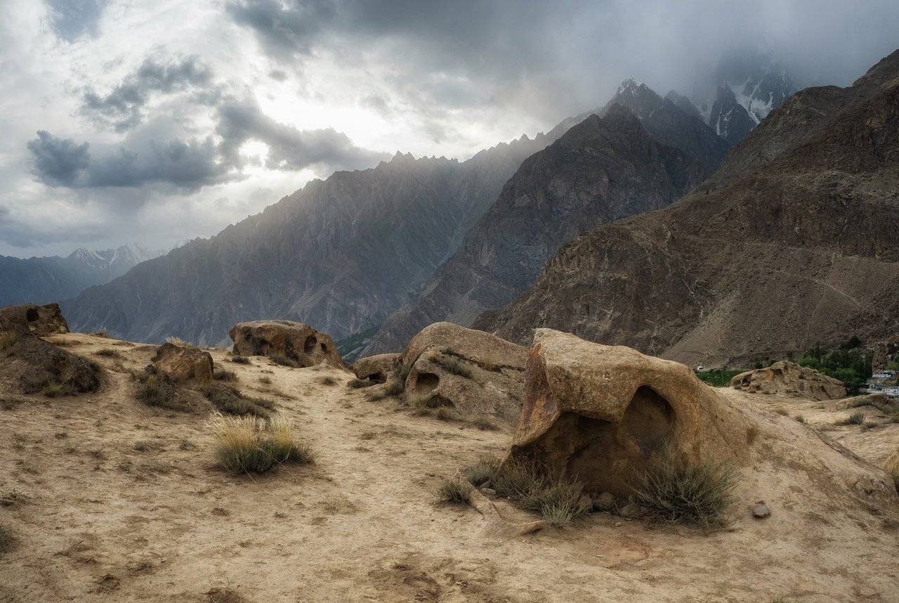
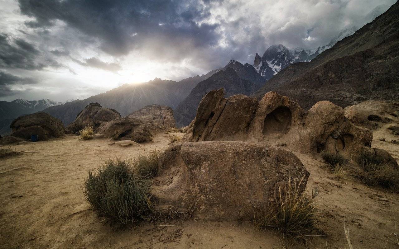
It turned out that we would be spending the night near a very interesting place - Eagle's Nest. However, when we checked into our Hunza Huts hotel, which is located right next to the road and looked from the side to the observation deck, it looked absolutely unpresentable. Just some kind of superfluous small mound in these majestic mountains, a sandy hill with rare stones.
Ok, there are mountains around, but what's so unusual? Yes, around the mountain, but what's so unusual? We were in much higher mountains this morning.
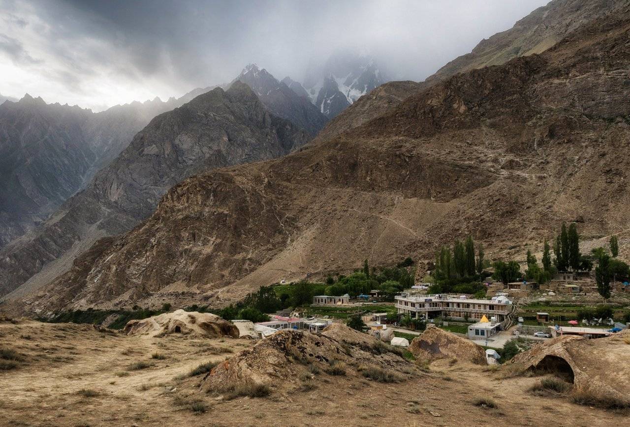
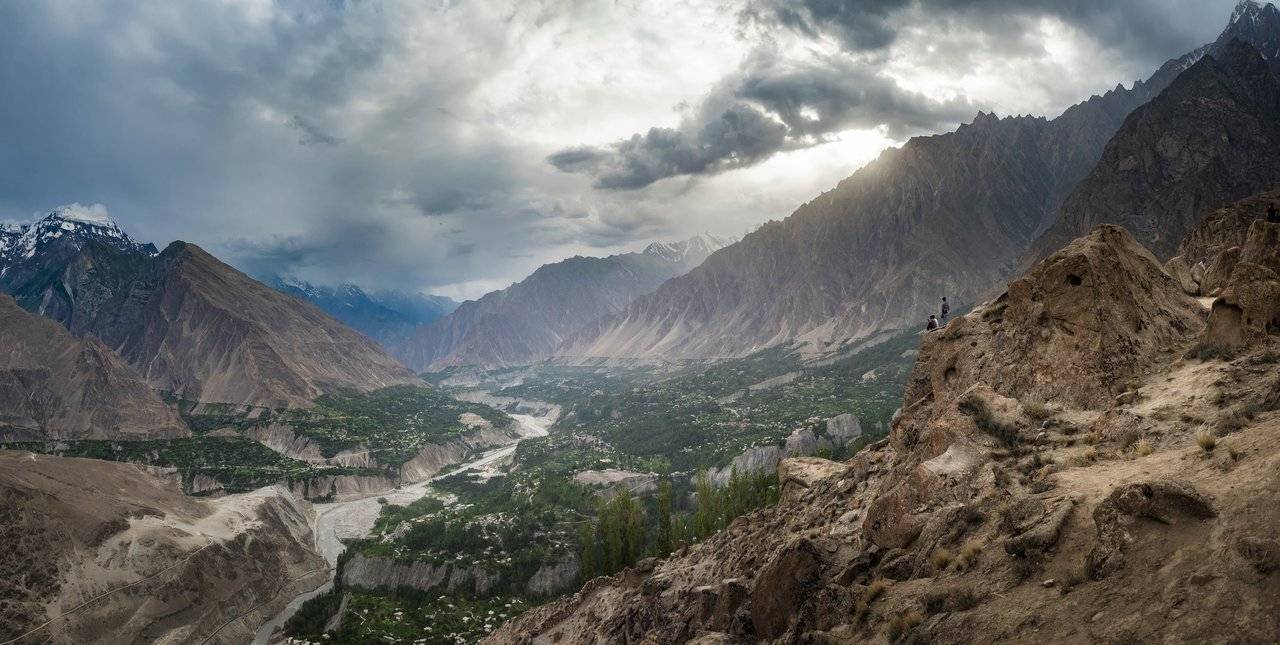
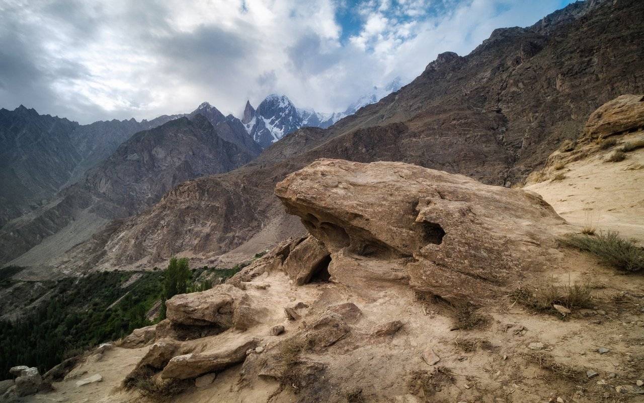
But how great it turned out when I got up — it was just breathtaking! Indeed, the Eagle's Nest in the mountains above the valley. But one of the main attractions of these places was still in the clouds.
Below there is a view of Karimabad — the largest city in terms of population in Gilgit-Baltistan.
It seems to be the meeting place for all of Pakistan. When I talked with people and asked where they were from, it turned out that they were from all regions of the country.
But it seems that foreigners do not appear here at all. Each of us was like a fashion model, everyone wants to take a photo with us :)
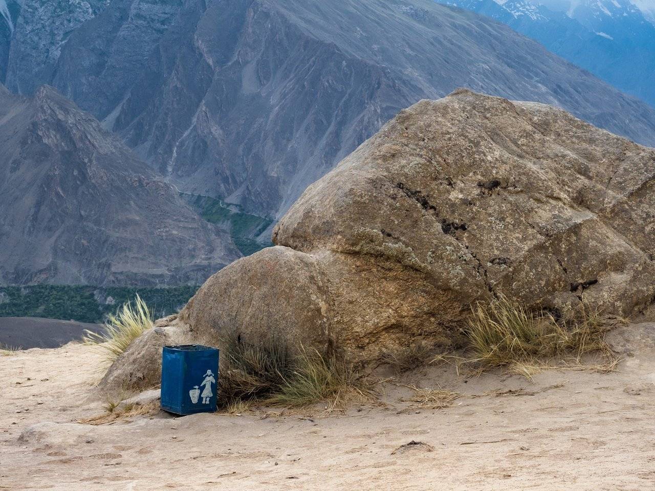
I never stop to be amazed at Pakistan — there are a lot of trash cans here and very clean around, when compared with neighboring India.
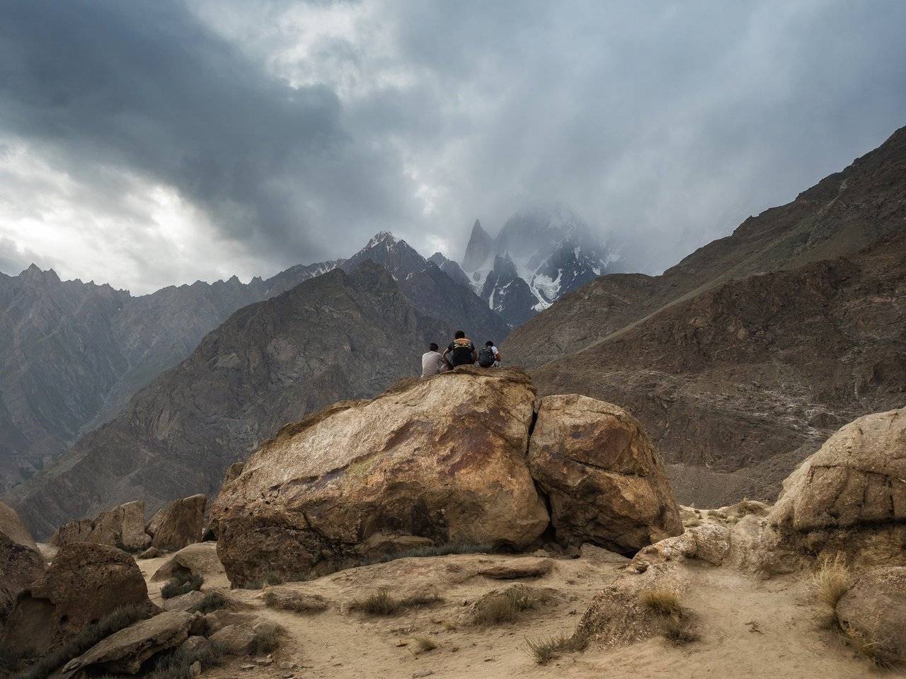
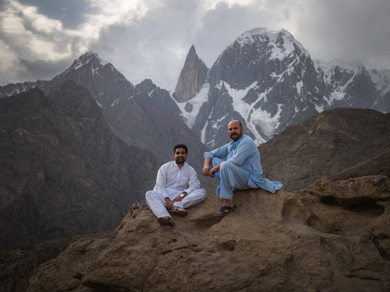
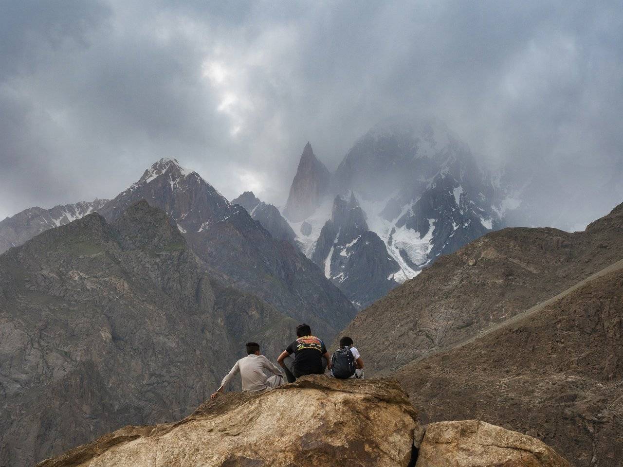
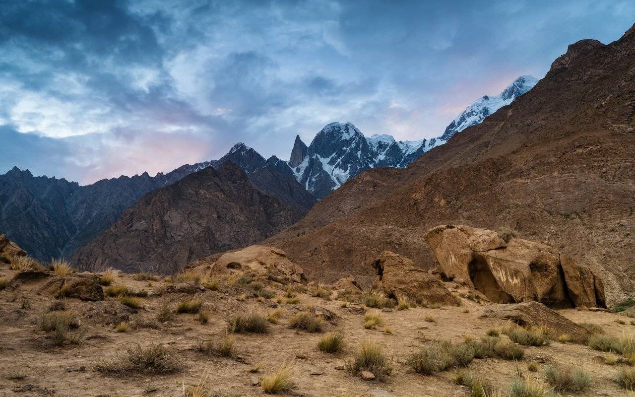
Time passes, I run in circles and try to find interesting shots. I look into the distance — and here it is, opened: the Ladyfinger peak. Its height is very easy to remember - exactly six thousand meters above sea level.
The local people are very sociable and love to take selfies with us, just as we love to photograph them. I met and talked to a Pakistani in blue clothes for quite some time about the life and history of Pakistan. He even invited me to drink tea somewhere downstairs, but I had plans to wait until sunset, so I had to refuse.
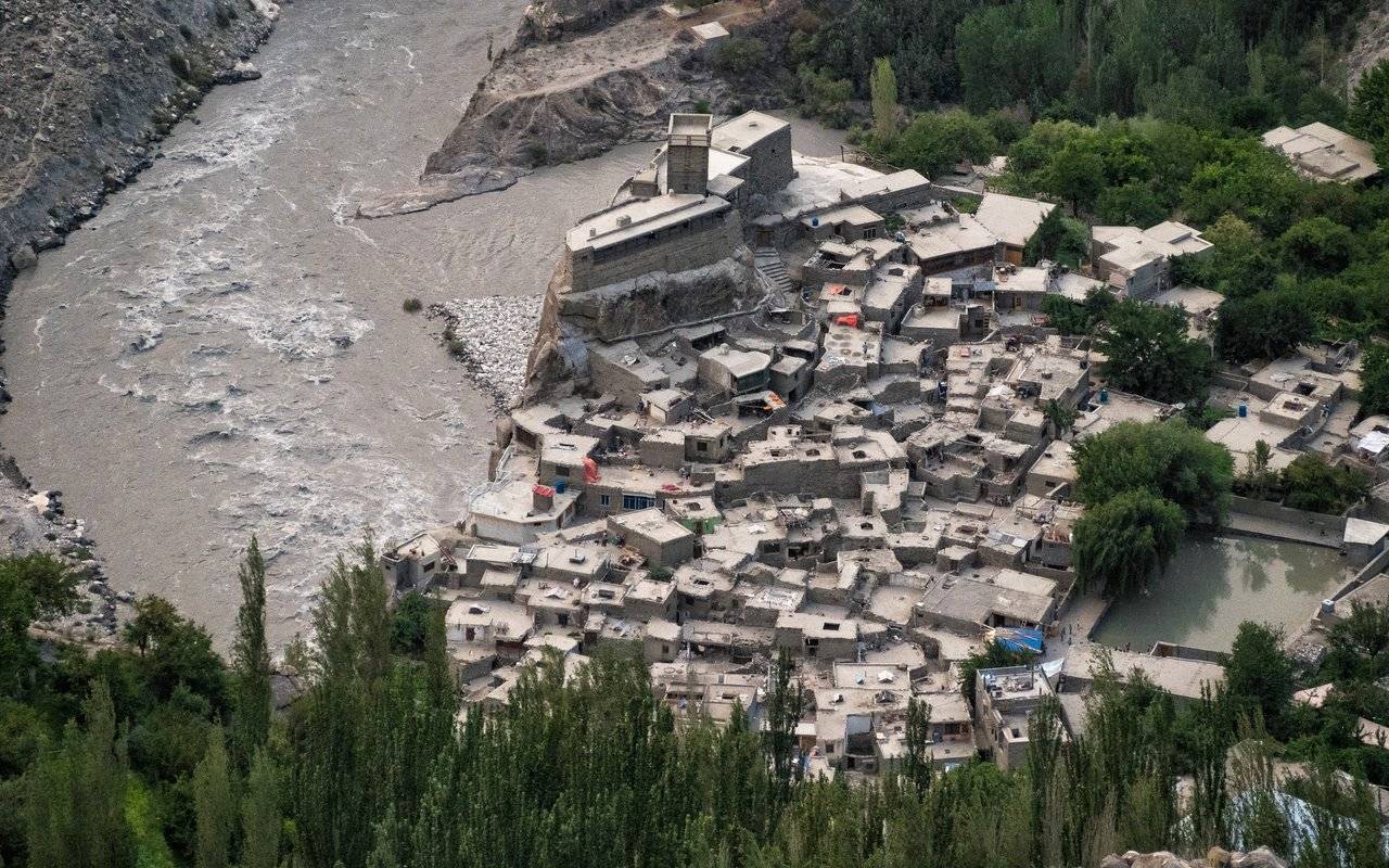
It turns out that Karimabad is a merger of several "states" and the forts that stand here used to protect the borders. Here is one of them, Altit Fort, built on a huge rock. Nearby there are many houses, it seems that there are no paths between them at all. And you can see a huge water reservoir, because the main thing during a siege is water.
It is curious that the inhabitants of the Hunza Valley are very similar to Europeans. According to legend, Alexander the Great passed through this place during his Indian campaign and founded a settlement here, in which military discipline was established.
The Hunza River was a natural barrier for the two medieval principalities Hunza and Nagar. Since the 17th century, these principalities have been constantly at odds, stealing women and children from each other and selling them into slavery. Both those and other people lived in fortified villages.
And now they live together, in the one region of a single country. It seems that now they have peace with each other.
The Pakistanis call the Ladies Finger Peak — Bublimating Peak. In Baltistan there lived a prince named Kisar. Once, at the call of the spirit of adventure, he found himself in the Hunza Valley and there he met the beautiful princess Bubli, charmed her, they got married and lived happily ever after. But the fairy tale does not last long, and then the unpleasant news comes — the first wife of the prince was kidnapped by the king of "another country" Lorimer.
Kisar gently hugs Bubli and invites her to walk to the top of the peak, from where a wonderful view of the Hunza River valley opens. After a long ascent and joyful shouts at the top, he hands her a bag of grain and a chicken, explains the situation and says: "Feed him grain every year, and when the bag is empty, I will return." He is gone, and they say Bubli is still waiting.
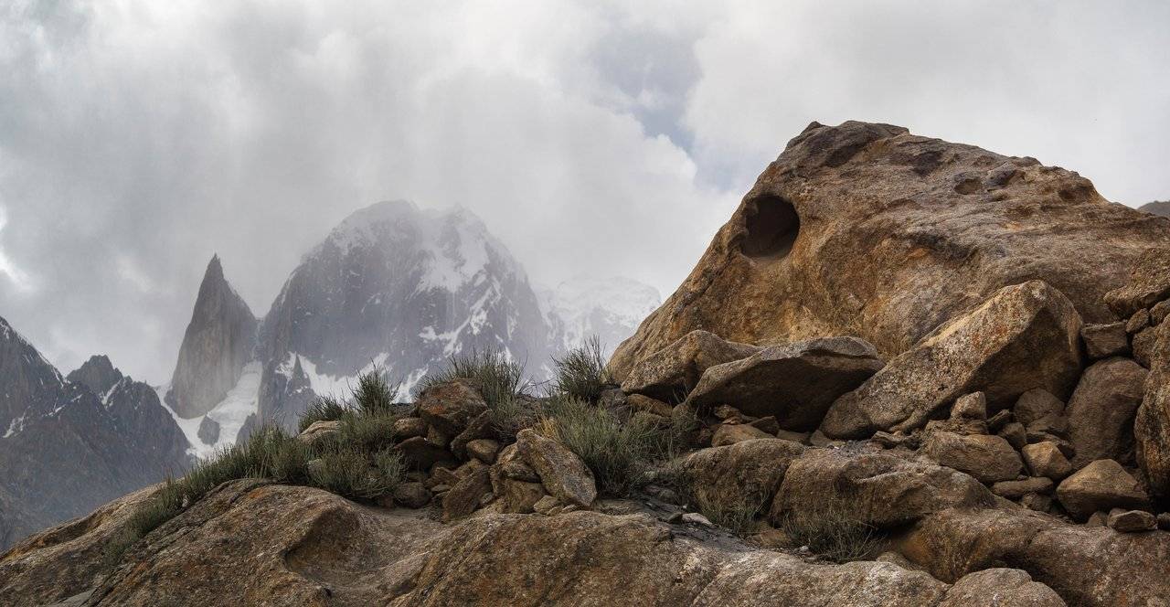
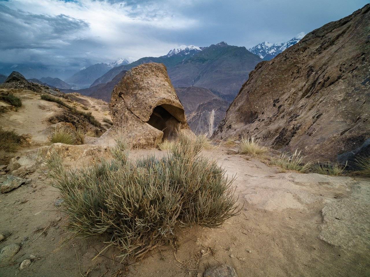
And this place itself is called Eagle's Nest because of the rock, very similar to a seated eagle. Tell me, do you see the eagle in this photo?
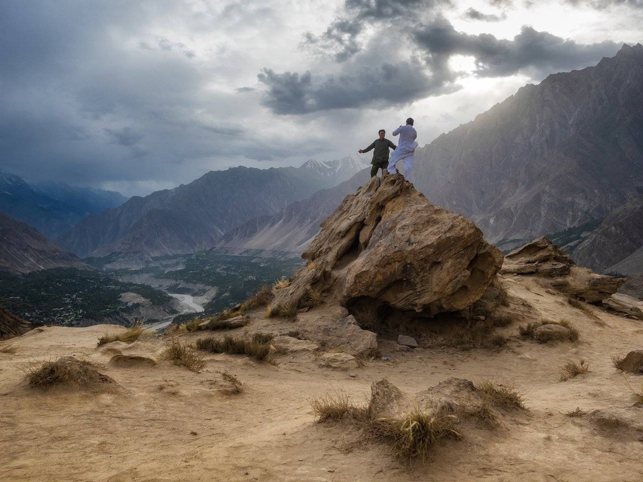
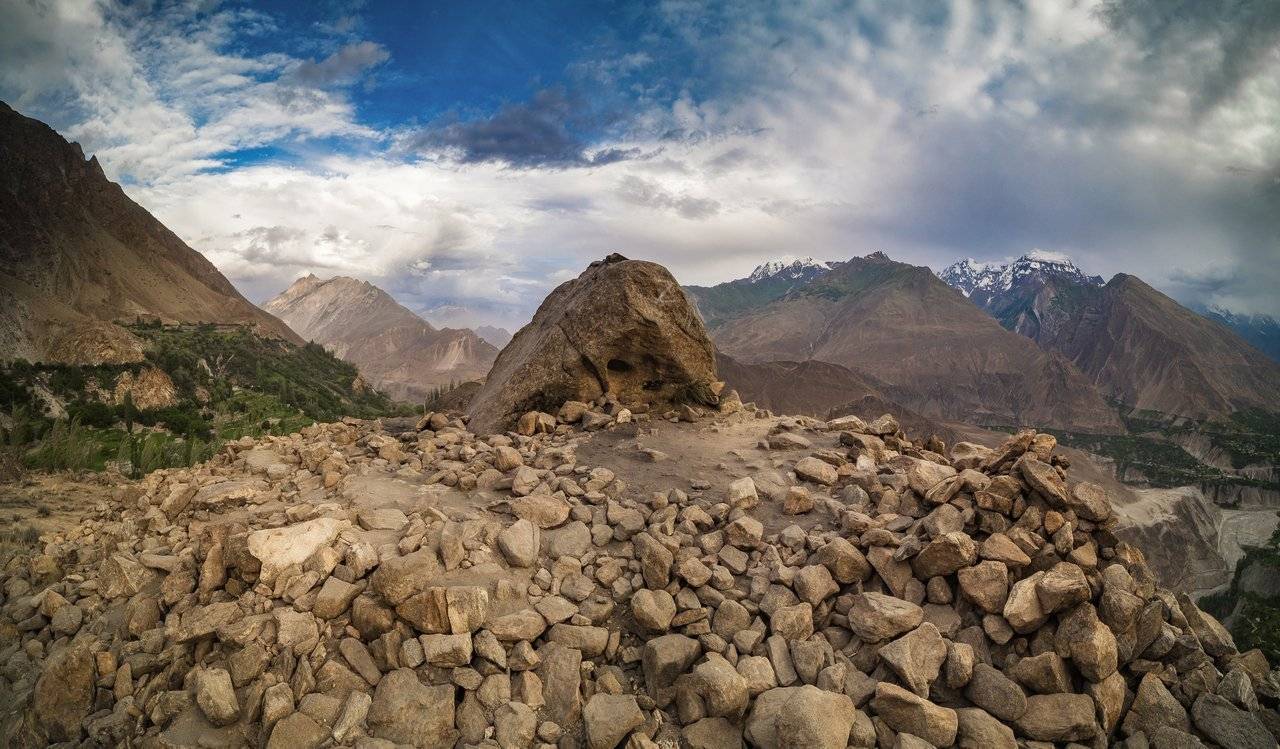
In any case, the Eagle's Nest is a stunningly beautiful place!
The views around, these bizarre stones and the opportunity to live here in comfort and proximity to the benefits of civilization — everything is just wonderful. Dima did not deceive us then — there are a comfortable bed, delicious food and delightful mountains around at the same time.
I don't even want to leave this place! We will stay here for 2 nights and, of course, we will also wander through the surrounding mountains and go down to the town tomorrow.
And this is wonderful for two reasons: the first is that I will have one more sunset and two sunrises to shoot here :), and the second is that here we can see more locals who do not live in huts high in mountains, but in the city and nearby.
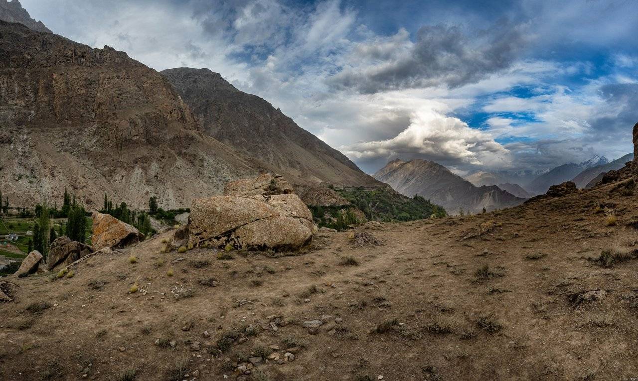
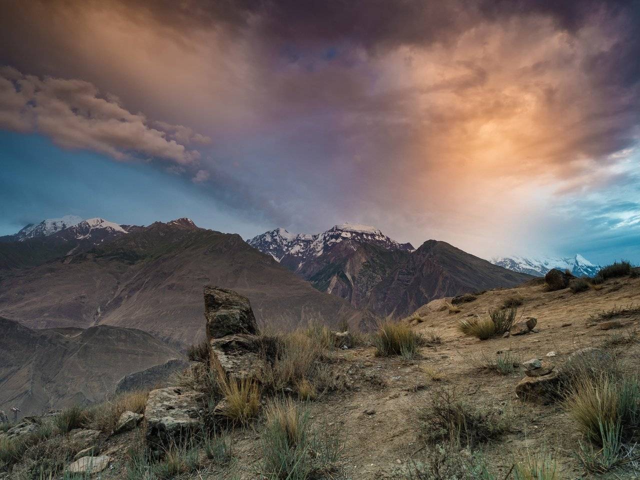
Little by little, the sun began to set, and the night began to take over.
The sky lit up with bright colors for the last time today. That's it, now I can go to the hotel.
In the evening we had a very tasty and rather spicy dinner. With chicken! Hooray! :) I was pleased, but one of our group (Volodya) was not very good: he does not like spicy foods, so he remained a little hungry.
After dinner, already at night, the host's cousins arranged a small concert of Pakistani music for us — they played the flute and a small drum, we even tried to dance, although it looked rather funny and awkward compared to the dancing of the locals.
Here is a small video filmed by @kibela on the phone: there you can listen to music, watch how Dima and I try to dance to it (yes, I know, I'm not the best dancer). The man in the cap who showed us the movements is our hospitable host, and in the second half of the video you can see the musicians themselves.
No matter how good it is to sit or dance, but I have to sleep. To meet dawn tomorrow, and in general, the day promises to be eventful, as always :)
To be continued...
Parts of the journey:
- The Land of High Mountains: Pakistan. Day 1. Arrival and Transfer to the Mountains
- The Land of High Mountains: Pakistan. Day 1. Trekking to Fairy Meadows
- The Land of High Mountains: Pakistan. Day 2. Acclimatization
- The Land of High Mountains: Pakistan. Day 3. Trekking to Nanga Parbat Base Camp - Start
- The Land of High Mountains: Pakistan. Day 3. Trekking to Nanga Parbat Base Camp - Finish
- The Land of High Mountains: Pakistan. Day 4. From the Himalayas to the Karakoram
- The Land of High Mountains: Pakistan. Day 5. The road to Mount Rakaposhi - Hakapun or further?
- The Land of High Mountains: Pakistan. Day 5. The road to Mount Rakaposhi - Base Camp
- The Land of High Mountains: Pakistan. Day 6. Minapin Glacier and Ice Bridge
- The Land of High Mountains: Pakistan. Day 7. How to Get to the Eagle's Nest?
- The Land of High Mountains: Pakistan. Day 8. Hike to Ladyfinger Peak
- The Land of High Mountains: Pakistan. Day 8. Walk in Karimabad to Altit and Baltit Forts
- The Land of High Mountains: Pakistan. Day 9. Karimabad and the Sacred Rocks of Hunza
- The Land of High Mountains: Pakistan. Day 9. Attabad Lake, Hussaini Bridge and Passu Cathedral
- The Land of High Mountains: Pakistan. Day 10. Crossing the Batura Glacier: the Beginning
- The Land of High Mountains: Pakistan. Day 10. Crossing the Batura Glacier: Finish
Camera: OLYMPUS E-M1 Mark II and DJI Mavic 2 Pro
It's better to watch the photos in high resolution — just click on them and open in a new window.
You can also see my photos in my blog LJ and in my profile on NatGeo

By the way, if you are interested in purchasing my high-resolution photographs in order to use them privately (including printing on photo paper or large canvas), create a collection of limited editions of digital pictures you own or just thank me for my work, you can visit the new Lensy.io marketplace and view and buy one of limited editions of my tokenized photos. Lensy.io is a digital photography marketplace built on the Hive blockchain.
You can also feel free to write me and ask any photo you like from my blog to add there for the purpose of further purchase.