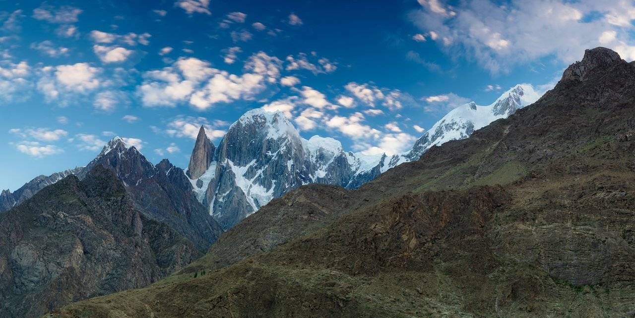
Today we will have a trek to the observation point at Ladyfinger, the sharp peak of which rises above the sea exactly six thousand meters. The climb that we plan to do on this day should be about 750 meters.
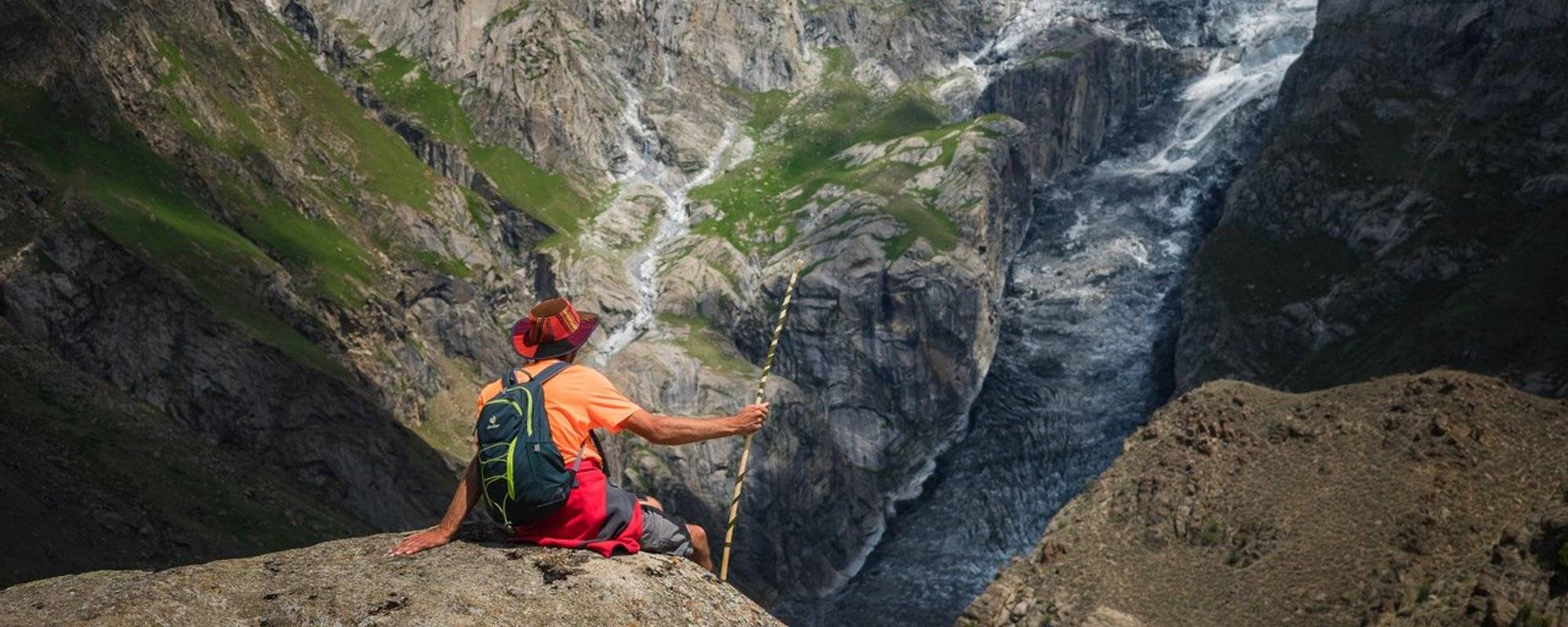
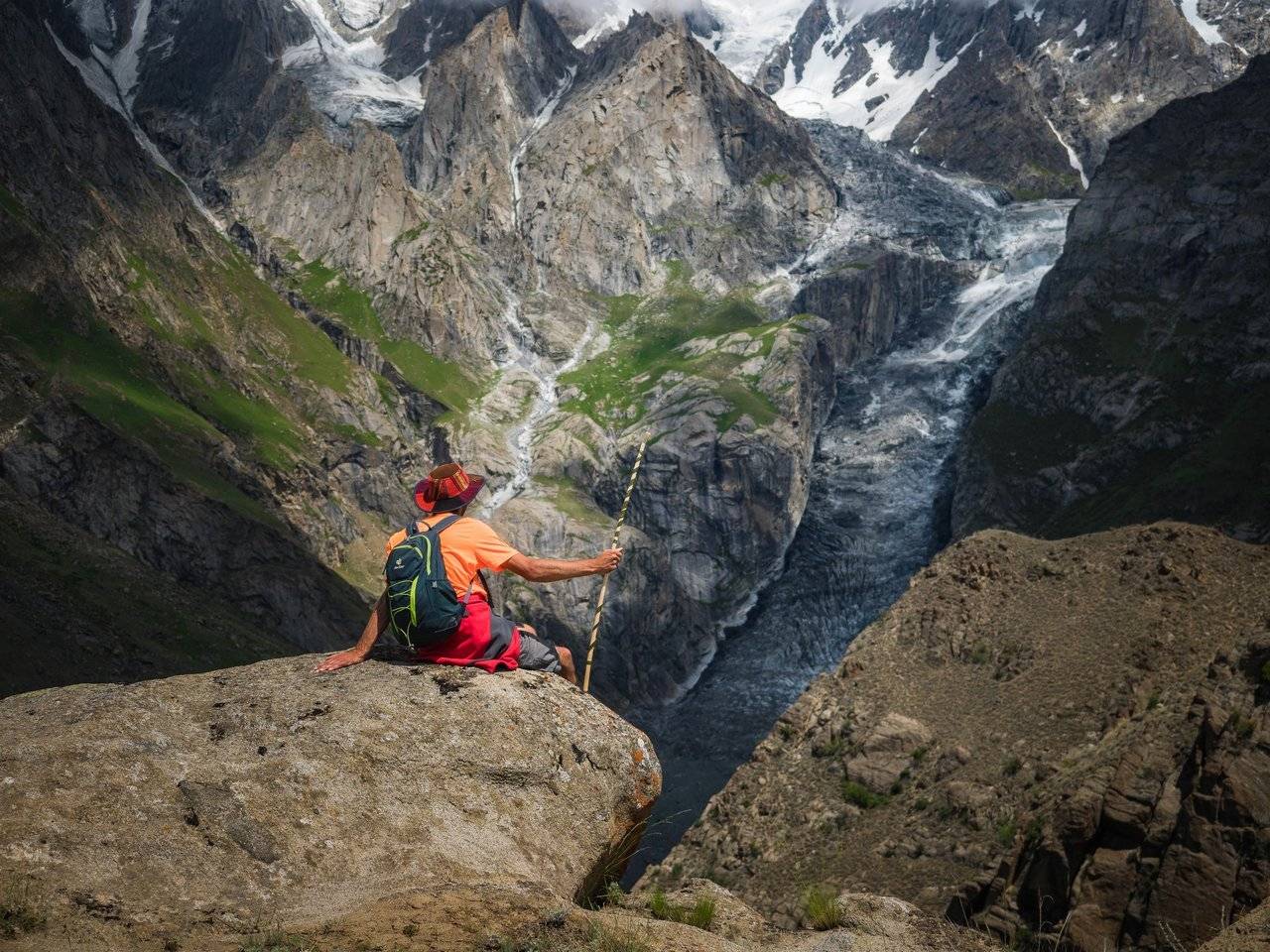
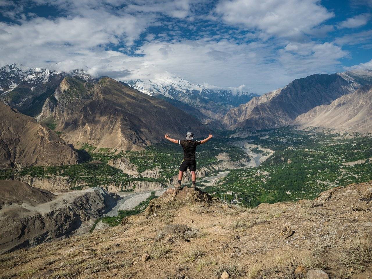
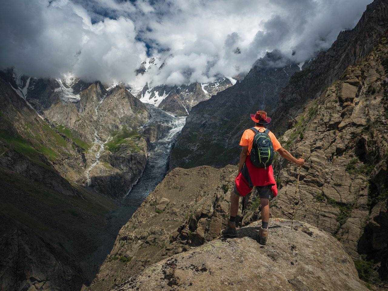
In this photo, on the edge of the cliff, Dmitry Kozlov is already sitting on the lookout. In his hand you can see a freshly cut staff that our guide on Rakaposhi — Haider — made for him yesterday.
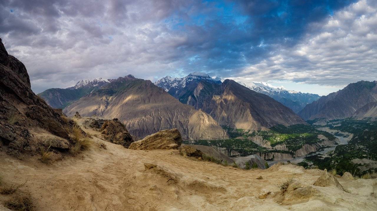
But this view will open to us much later, and for now, getting up again at dawn, I look at the top of the Hunza Peak, whose height is 6270 meters, and at the Ladyfinger Peak from below, from the Eagle's Nest.
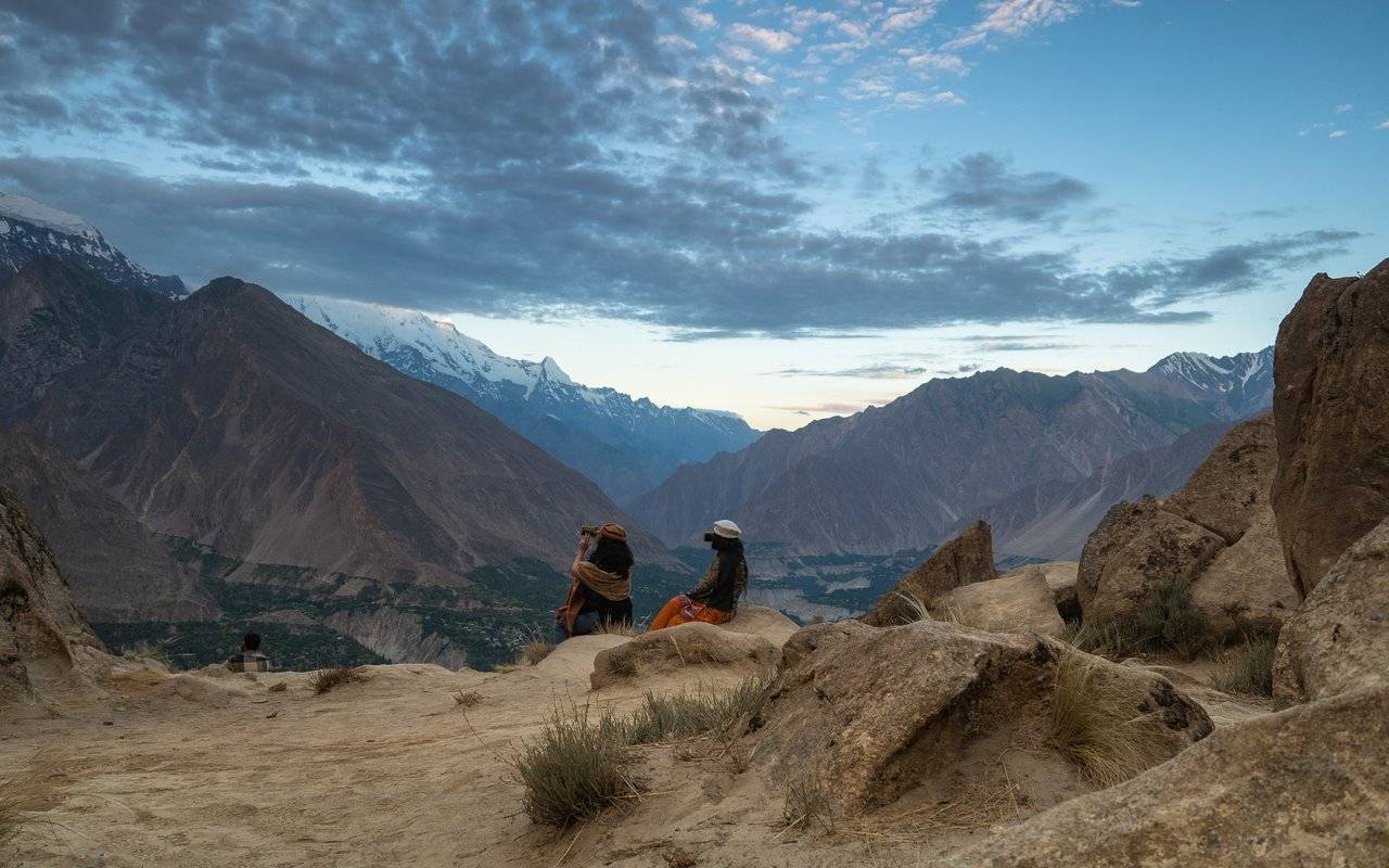
Here, even at dawn and on weekdays, you can meet many Pakistani and Indian tourists. They sit on rocks, wander around and admire the surroundings.
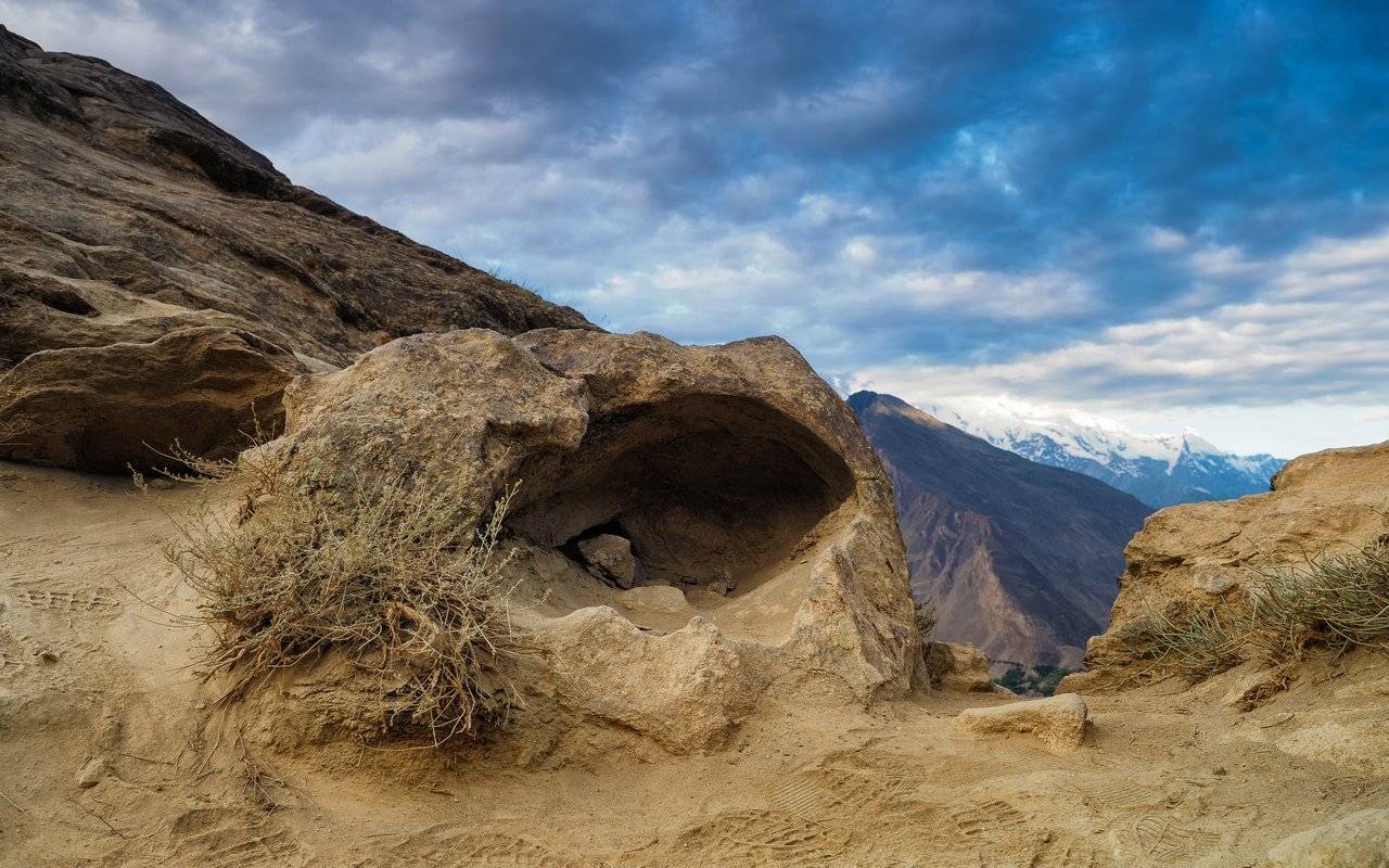
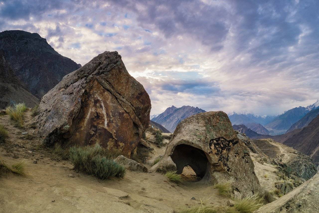
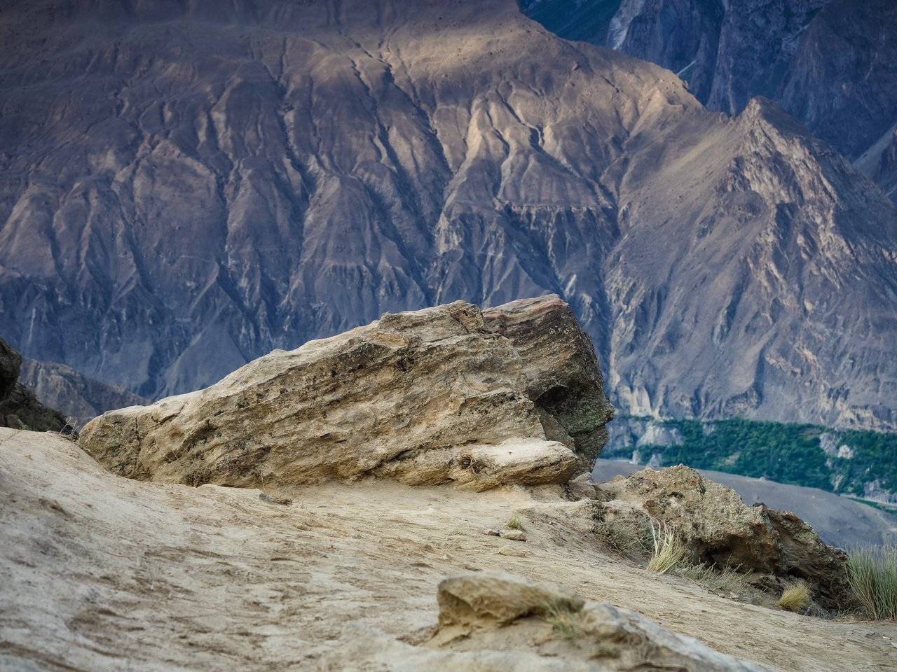
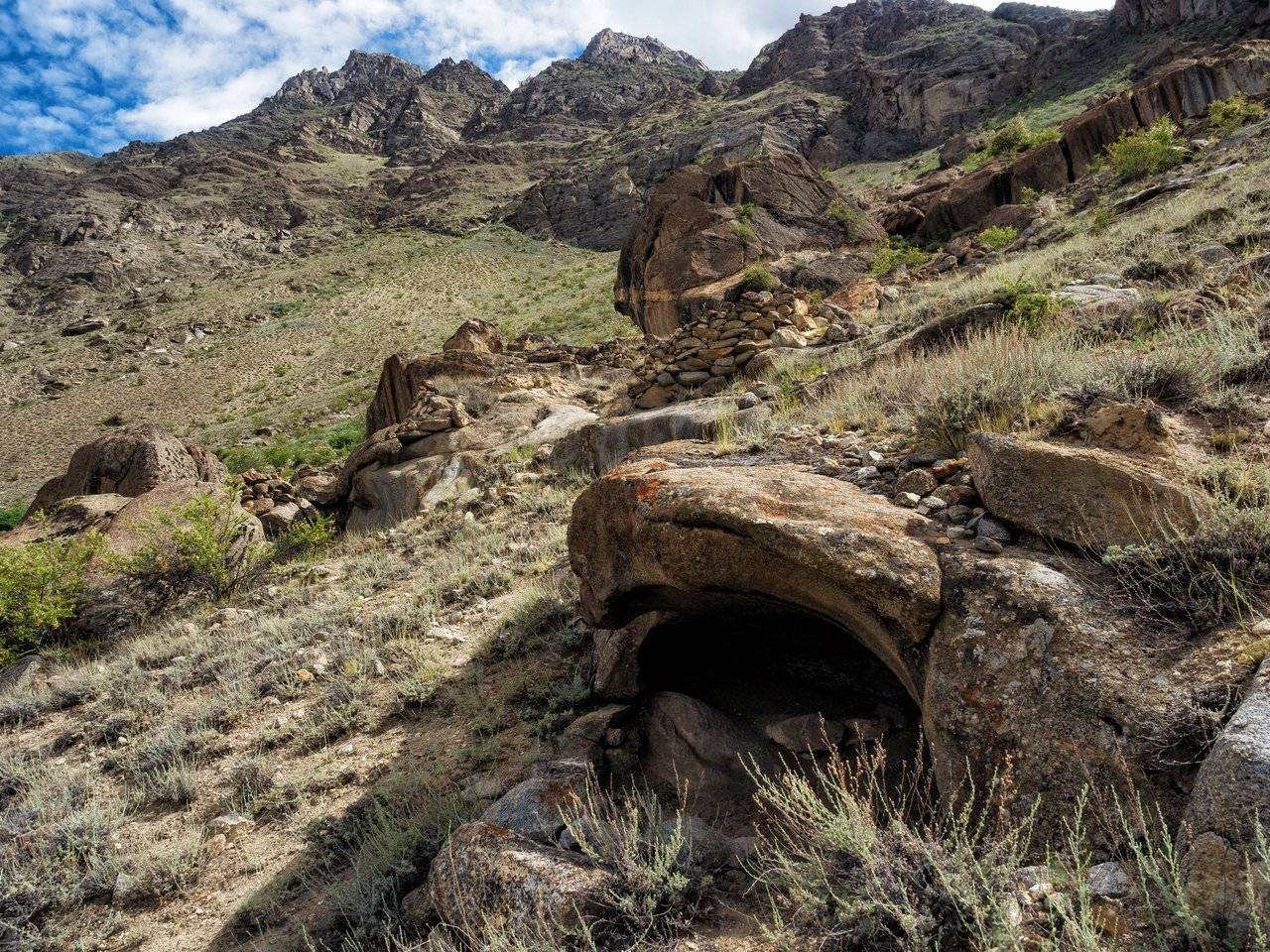
Very picturesque stones, like the entire surrounding landscape. Each boulder is like a work of modern art: put one in a museum, and visitors will look for hidden meanings that the sculptor wanted to convey.
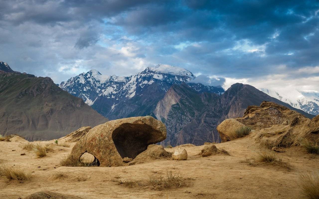
There are tons of options for landscape photography: great variety of foreground objects and great backdrop views.
Well, the dawn is also doing its job. And if it were more colorful today, mmm ... it could be just a masterpiece! But even now it is very beautiful.
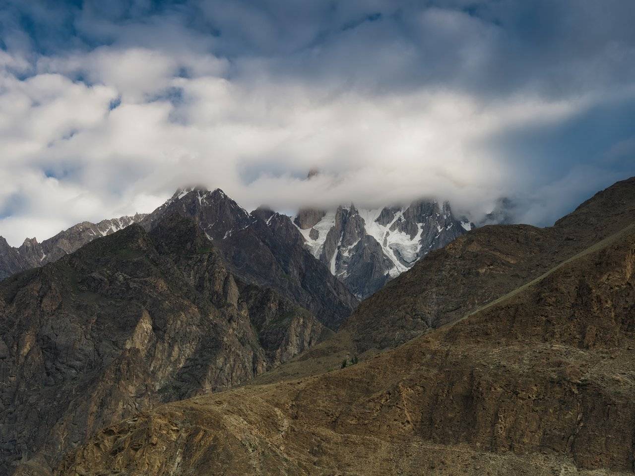
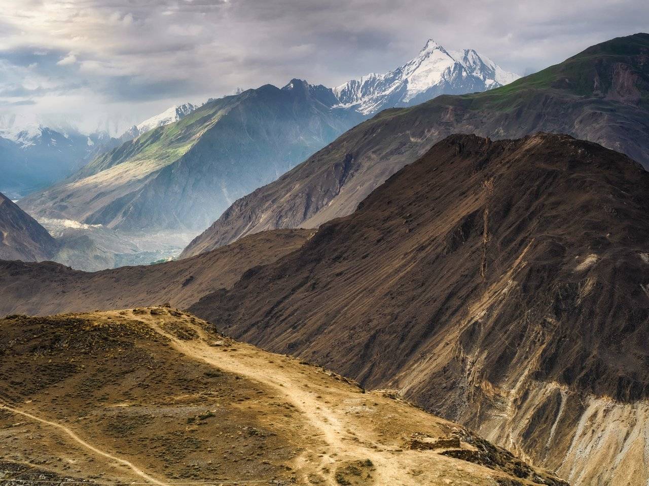
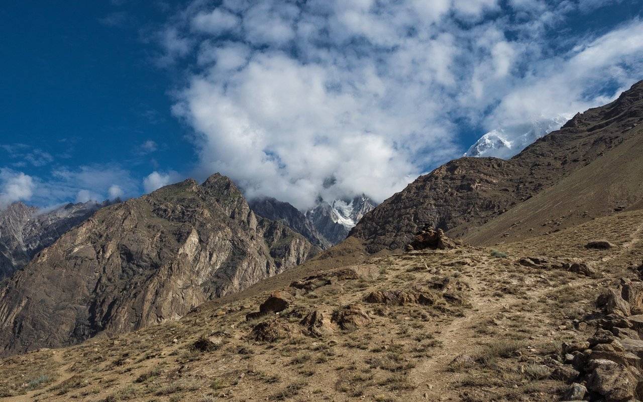
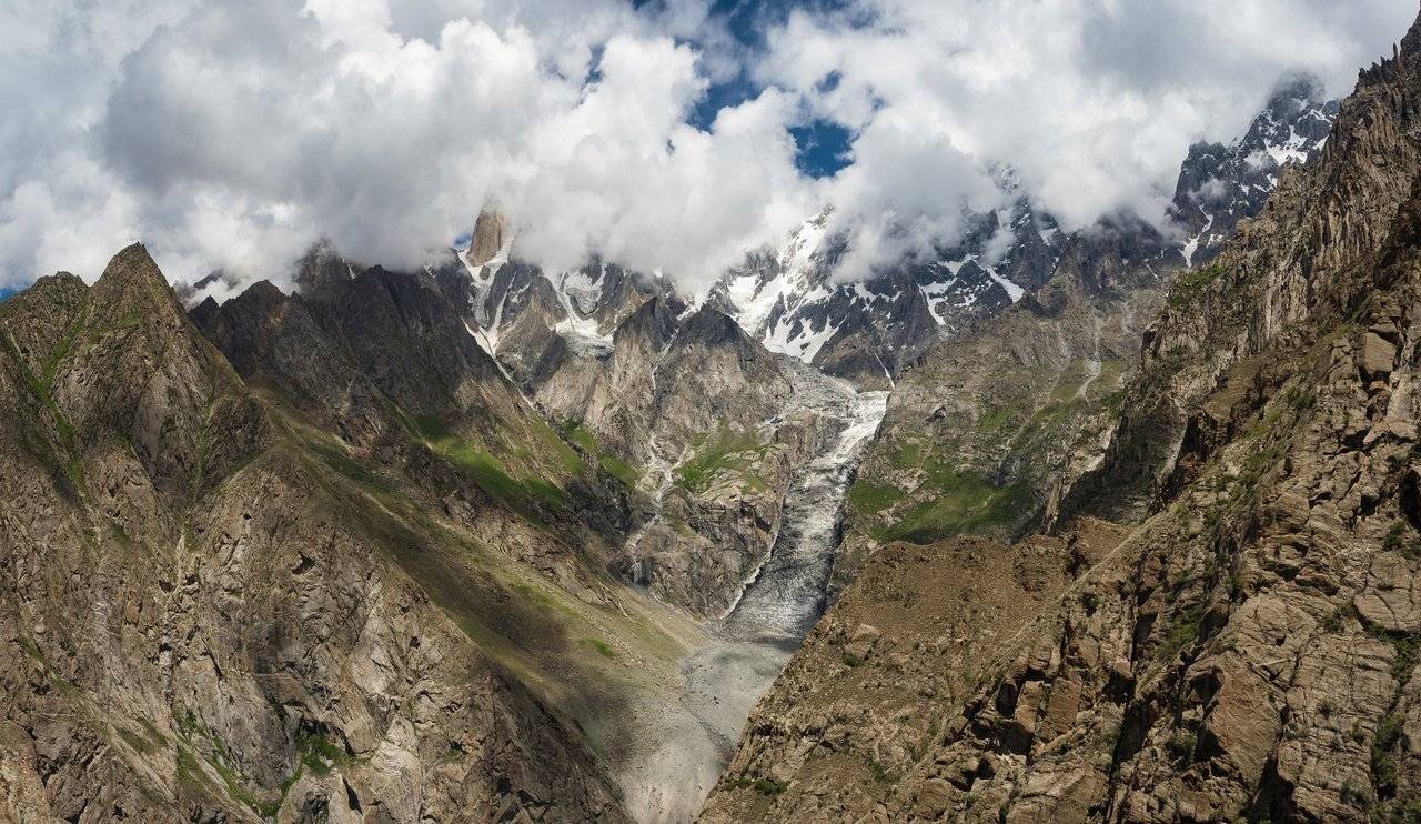
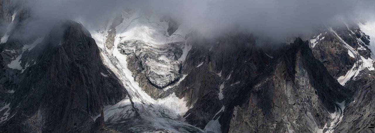
Barely emerging from the cloud cover, the tops of both peaks again hid in the clouds. Hey, don't do that, we want to go there today! There — to the right of the picture, into a small hollow at an altitude of 3550 meters.
Eh, what a weather! I got a little sad and, sitting on a stone, began to look around.
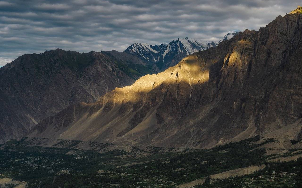
The top of Mount Rakaposhi is also hidden in the clouds. The main thing is not to start raining — to crawl up and then down on wet stones is not a big pleasure.
Soon the whole sky was covered with the clouds, through which the sun only broke through in places, leaving bright spots on the rocks. So I can definitely go back to the hotel.
And still what a magical place here!
When I ran into the dining room, everyone was already sitting at the table and knocking with spoons, I joined in and had a hearty breakfast, because the day promised to be very busy. Olya, Lena and Dina stayed at the hotel, so that instead of the peak, which, in principle, can be seen quite well from the Eagle's Nest, they will go to the Old Town, take a walk around Altit Fort and maybe do some shopping.
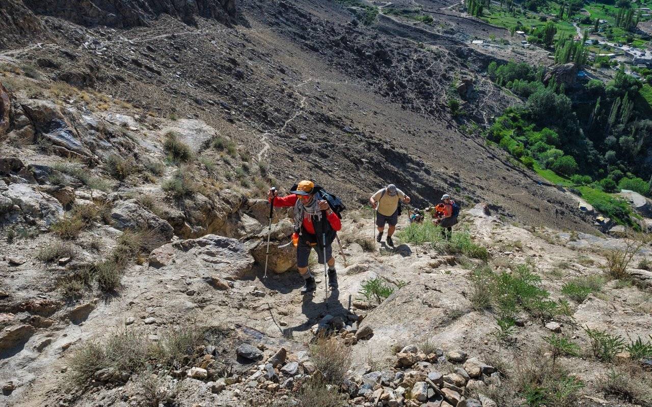
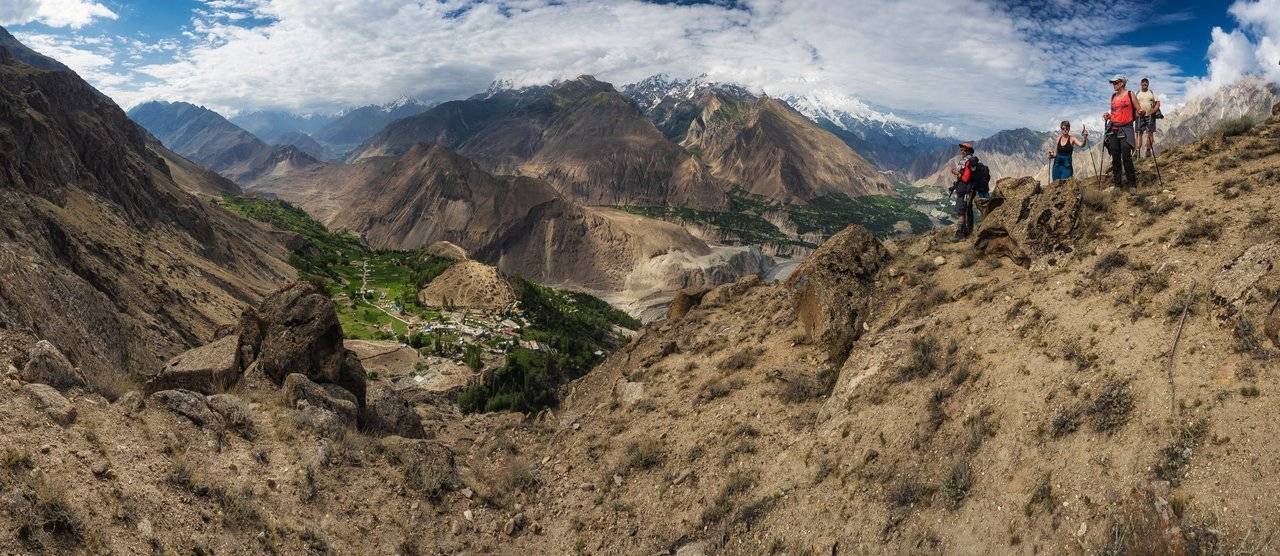
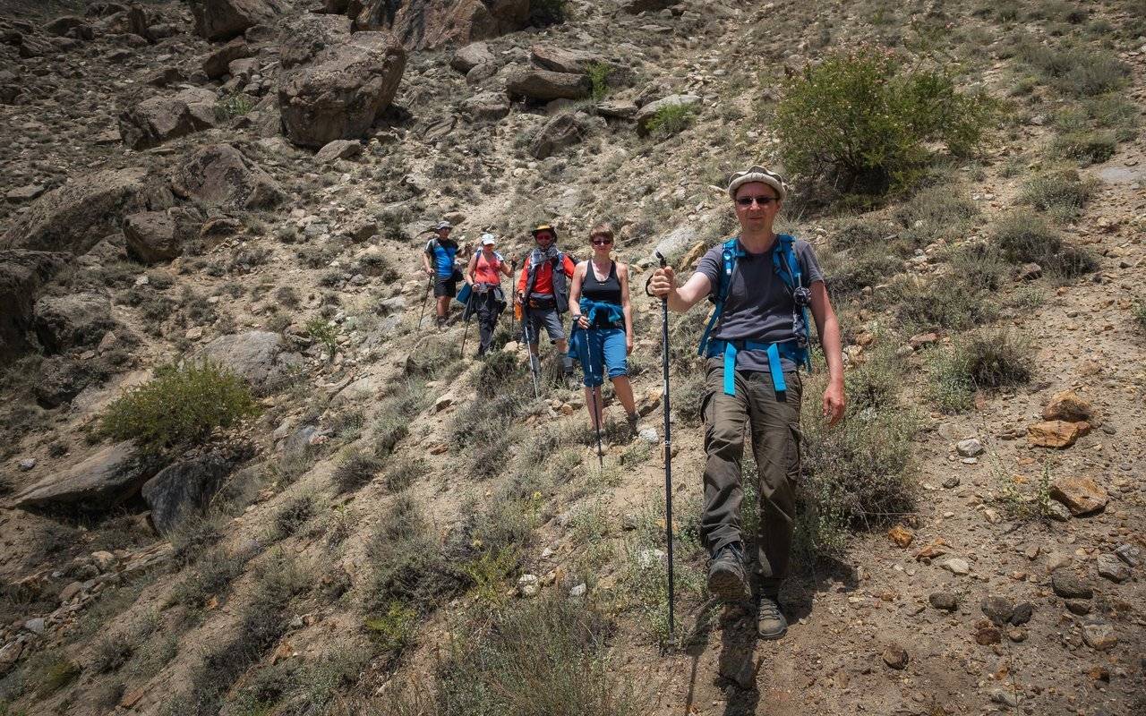
The rest of the group, led by two new local guides, departed at about 8 am, before it was very hot. It was even good that the sky was covered with clouds — it was comfortable to walk. But the peak itself was closed, so this fact was rather unpleasant, because it was the top of Ladyfinger Peak that was the goal of the ascent.
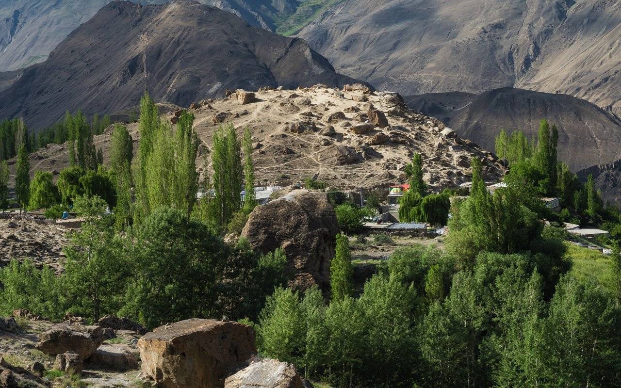
On the surface of the Eagle's Nest, which looks very funny from the side, many paths have been trodden. It still seems to me that this place does not look so interesting from the side. It is much better to walk right there and look at the boulders.
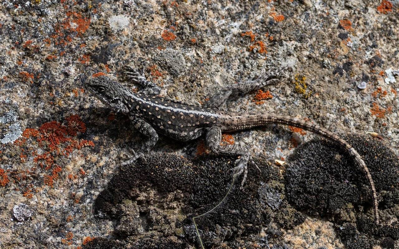
Gradually the sky clears and nimble lizards crawl out to warm themselves on the rapidly warming stones, perfectly merging with the ground: you can hardly see it.
When we went to the terraces, our guide said that ancient people grew wheat here, and they themselves lived in caves nearby. I can hardly imagine it and admire them.
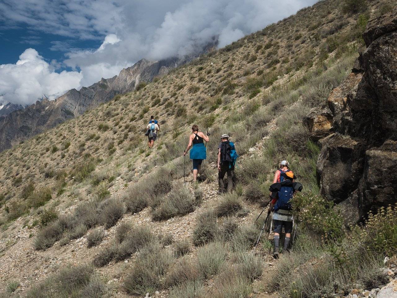
The higher we go, the more breathtaking the views are. Volodya, and everyone else, is absolutely delighted.
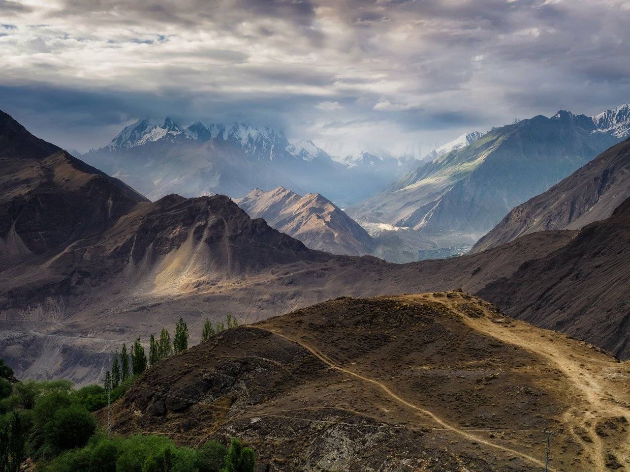
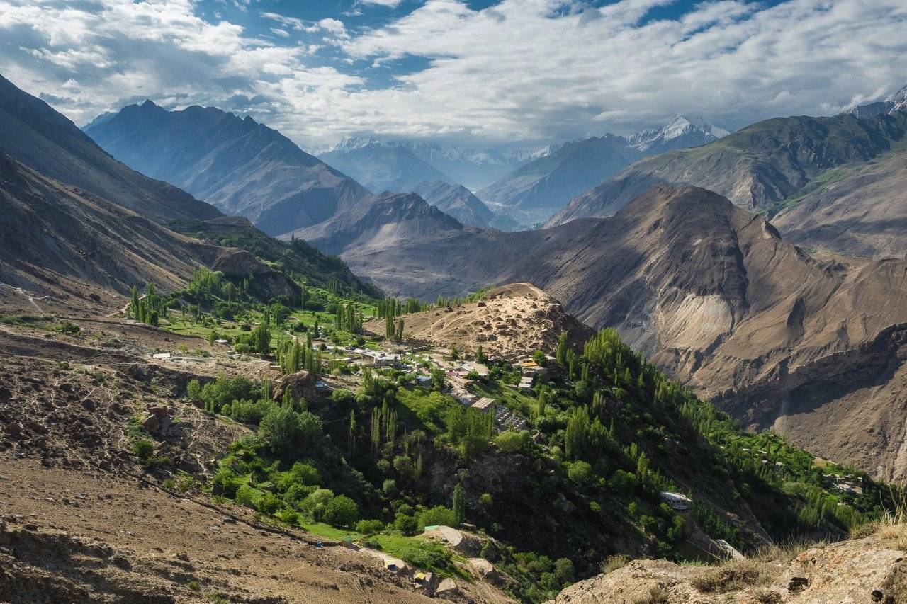
It is very clear here that we live in a real small oasis in the middle of rather lifeless slopes.
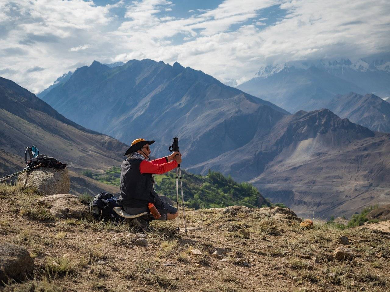
A small photo break, and again on the road!
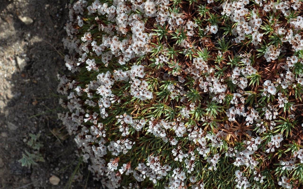
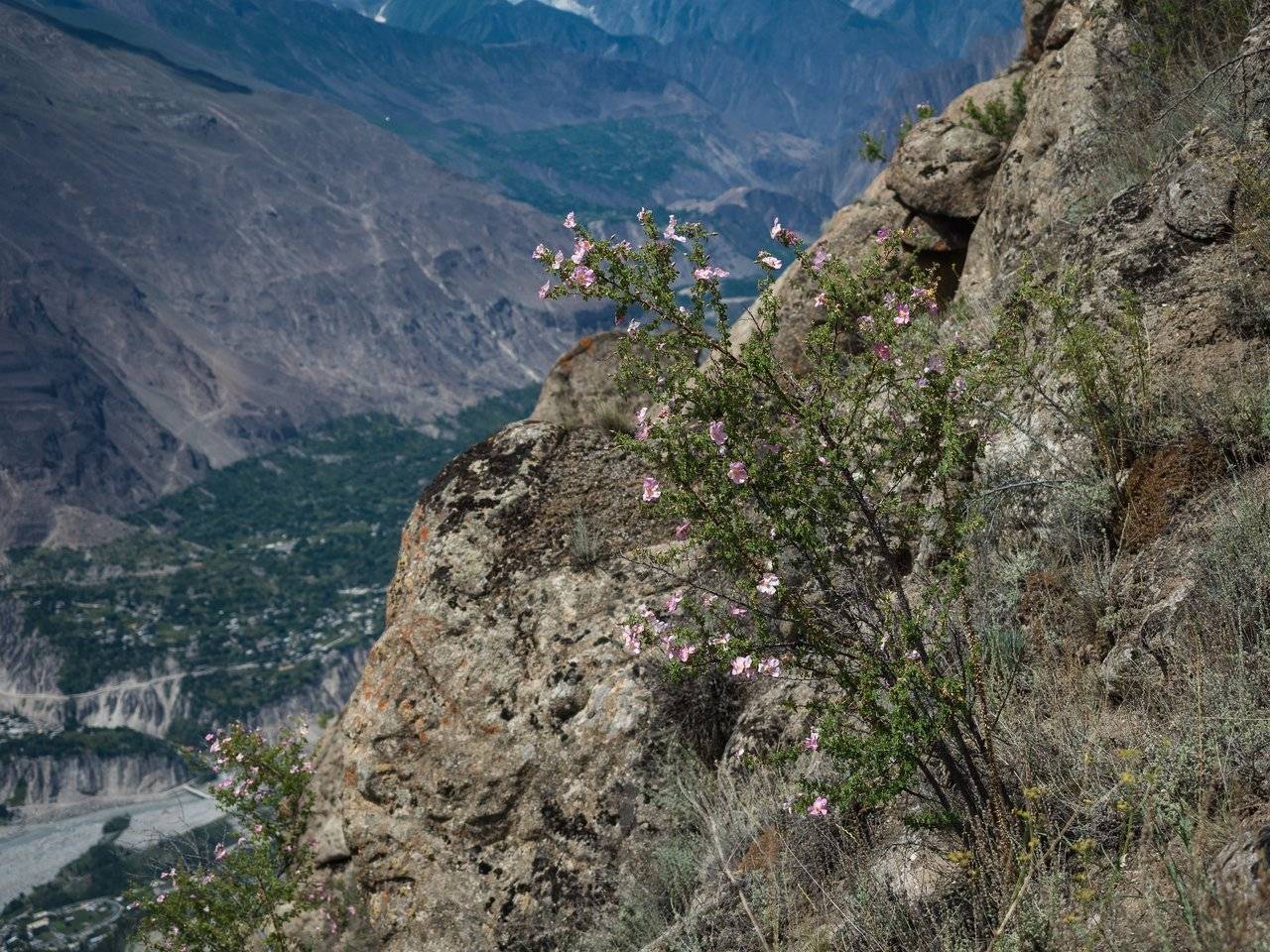
Some flowering shrubs look like solid flower green balls. By the way, who knows what kind of plant it is?
Oleg (he is now second, right after the guide), our biggest "big boss", as the owner of the "Hunza Huts" hotel Rakhim called him, kept repeating to the guide that "everything is okay", to which he answered with laughter.
In general, it seems that Oleg did not want to speak English in principle, but all the Pakistanis still understood him because of his innate charm, so he was often delegated to difficult negotiations with the authorities, which he conducted flawlessly.
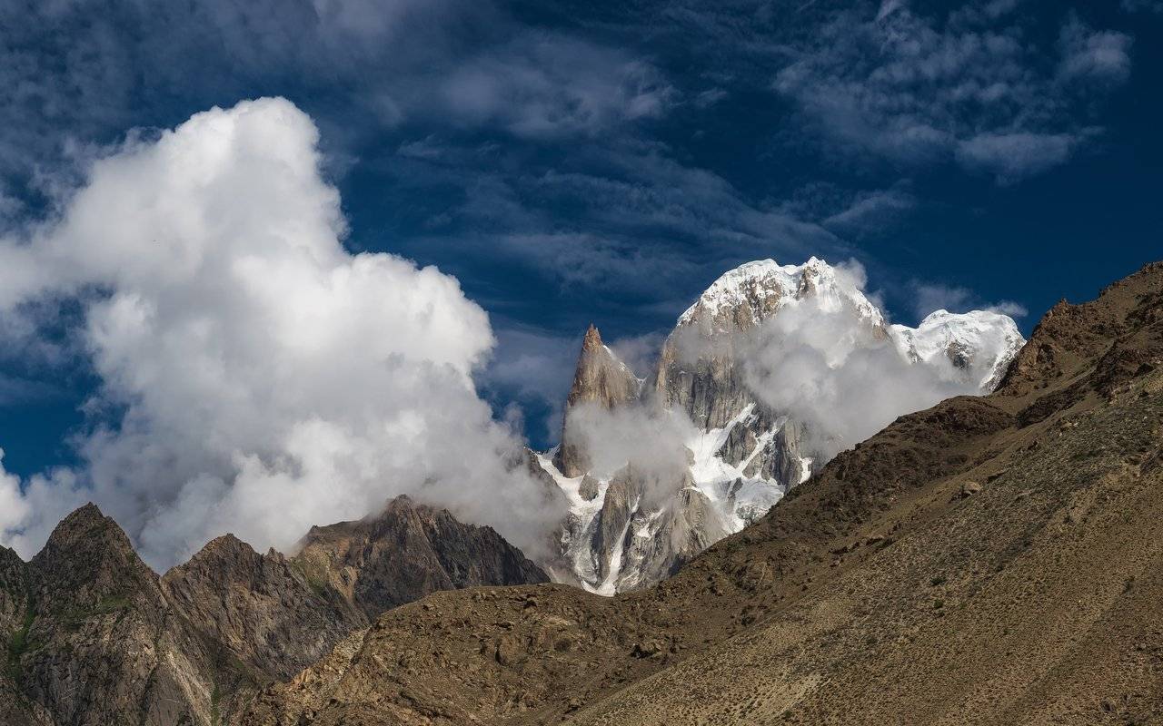
Wow! The peak has opened again! I shoot the panorama while I can, because at any moment everything can be closed again.
And we are climbing higher and higher. Down there is our Eagle's Nest, so small! By the way, we also saw real eagles, but they soared very high in the sky.
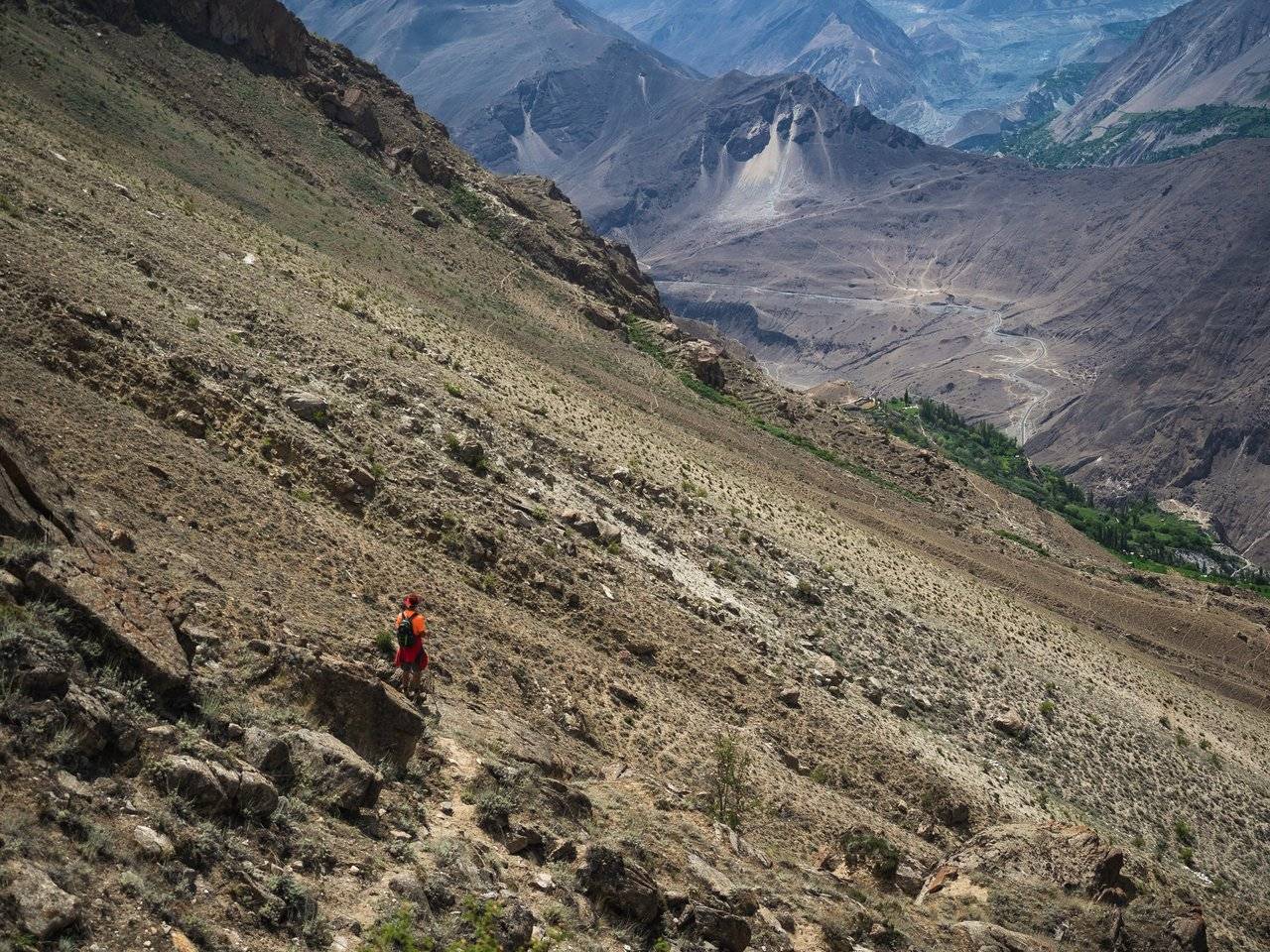
Soon it became very unpleasant to walk — we walked along crumbling small and not very stones, which were trying to escape from under our feet.
On the way a couple of times we met the remains of wheel tires. In response to my question, Nizam explained that there is a holiday during which tires are raised up, and at night they are set on fire and let down — this is a very beautiful, albeit not entirely ecological sight.
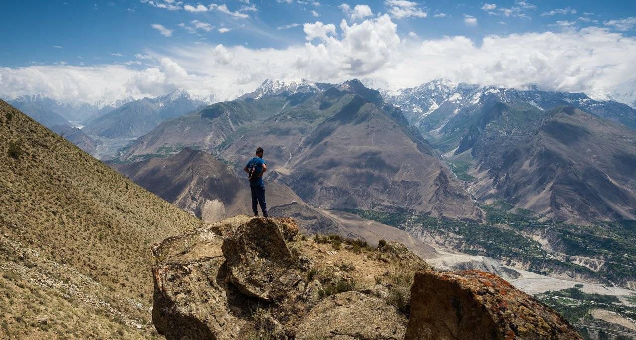
Even though we walked along crumbling slopes, but we still walked quite briskly and soon, after three hours of hard work, we climbed the ridge. Here it is, height 3550.
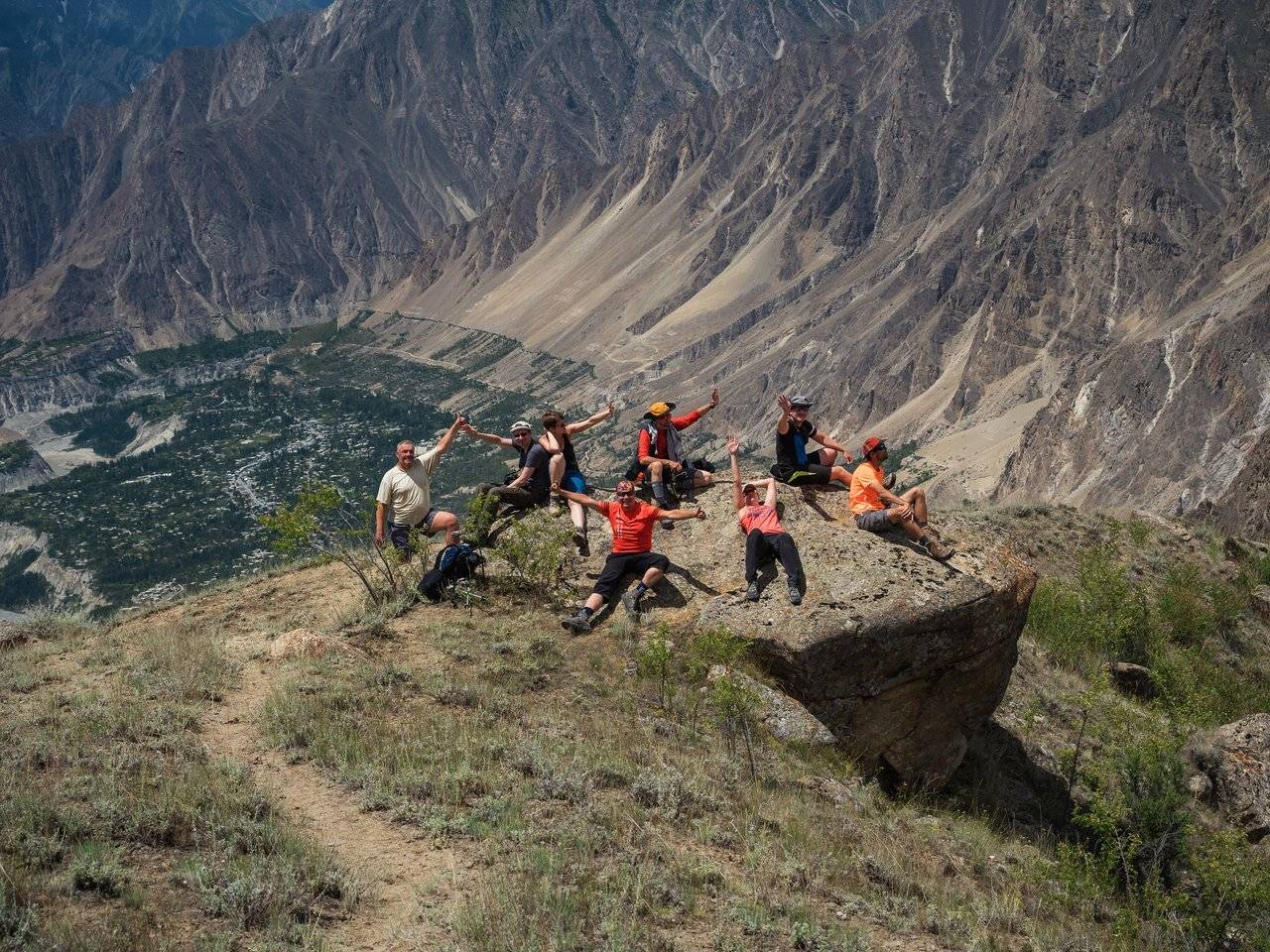
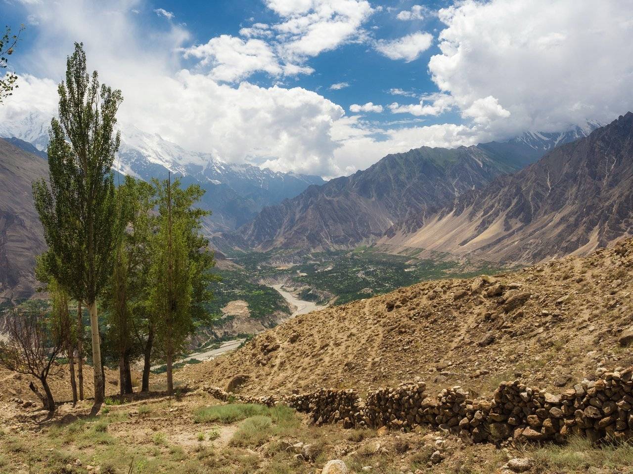
From here there is an excellent view of the valley in which the city of Karimabad is spread.
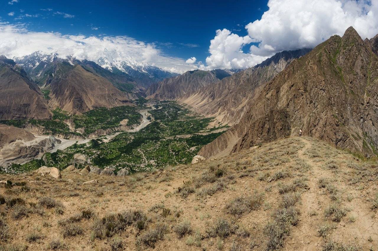
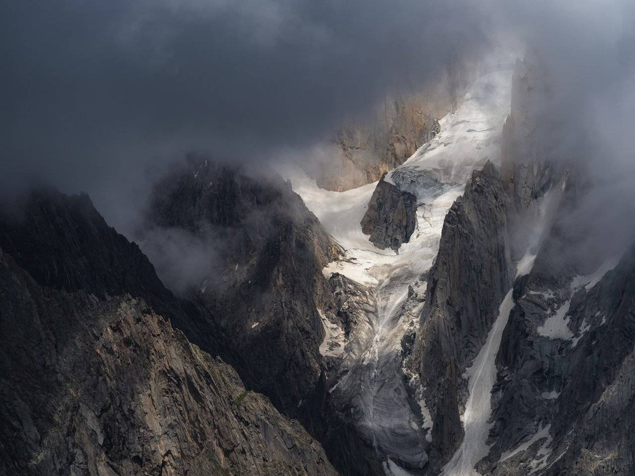
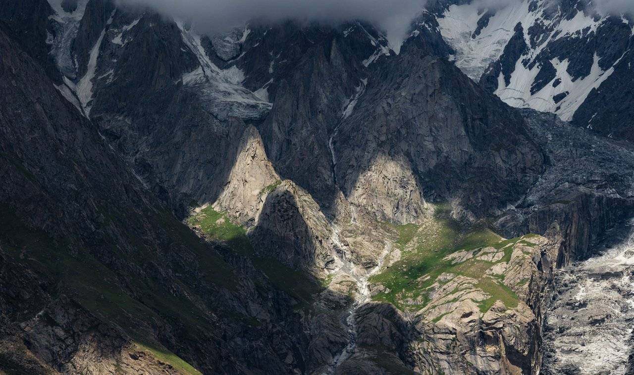
The view towards the nearby mountains is even more impressive. If only the clouds hid them from us less!
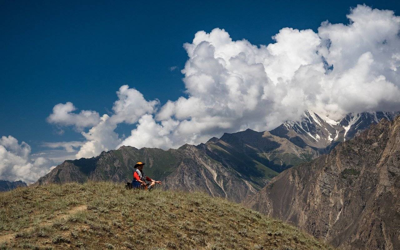
Our second Oleg, without hesitation, climbed even higher, to meditate. Well, this is a good thing, at the same time you can feed on the energy of the sun and space, from here it is just closer, not like from the plains :)
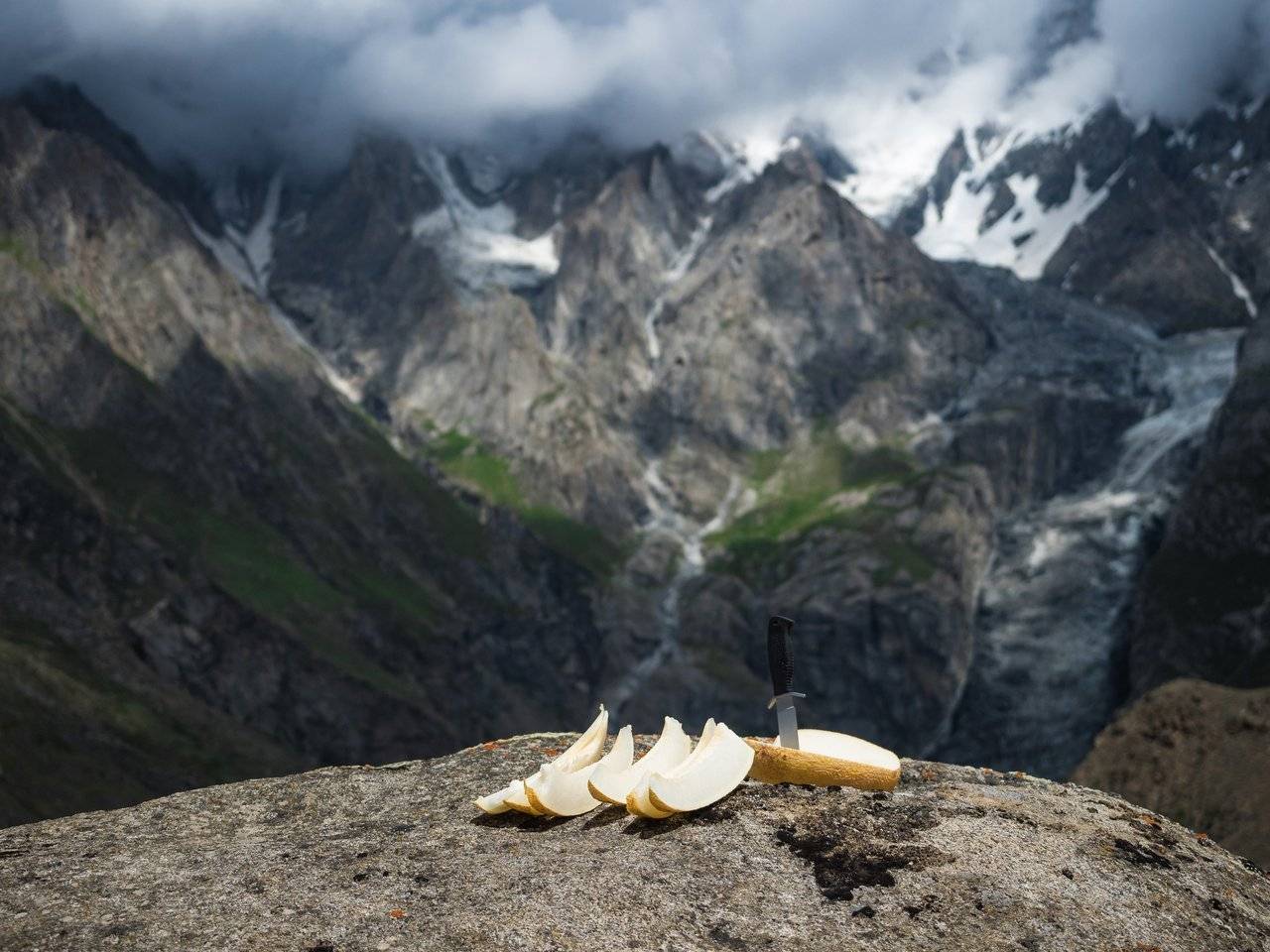
And then Dima surprised us by taking a melon out of his backpack. Wow! I made mine as light as possible so that it was comfortable to walk, and he was dragging up such an uncomfortable, heavy load. Here he is, our hero — going to brutally stab it.
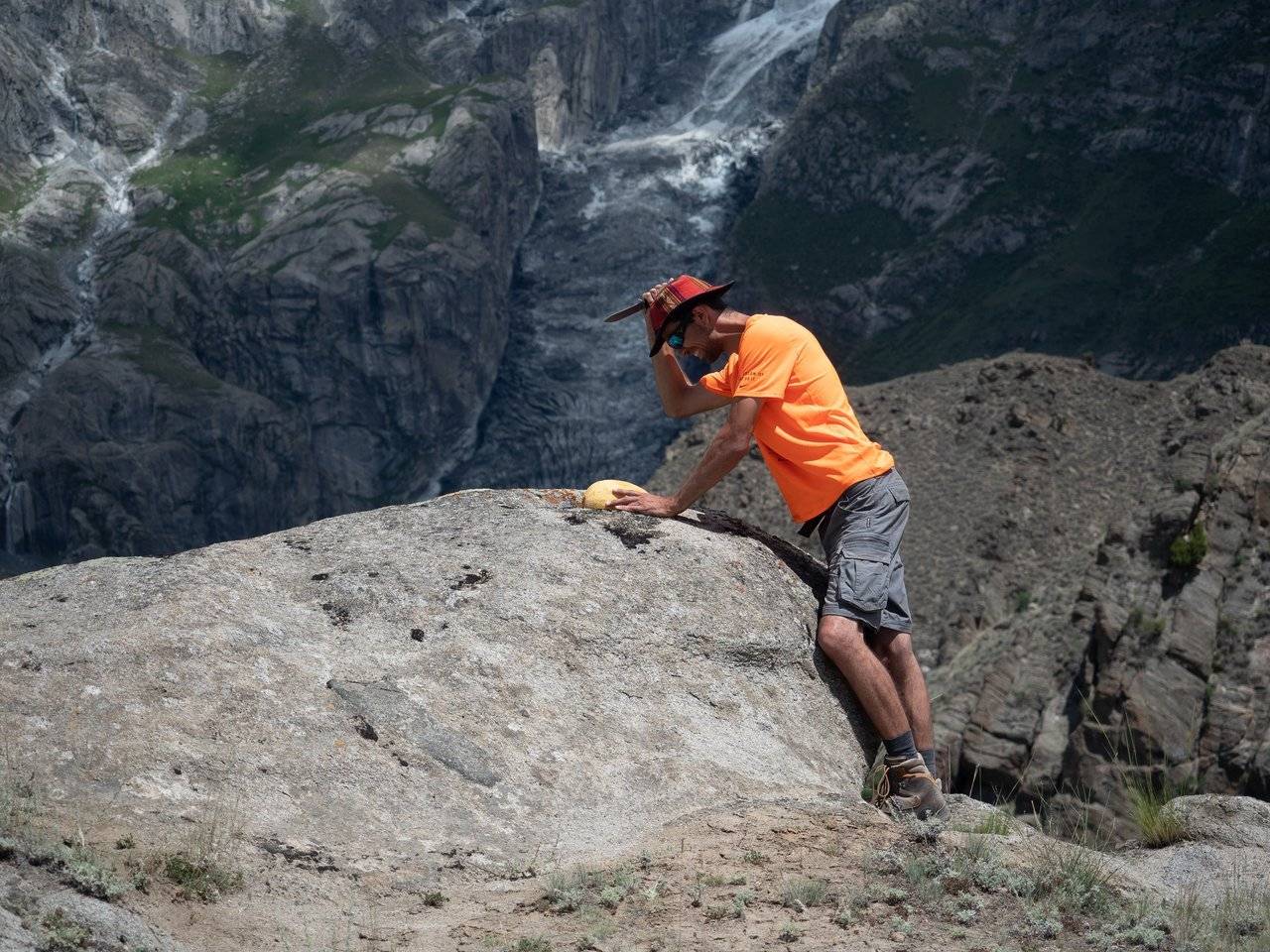
It turned out to be very handy: the melons here are quite tasty, although I would put them in second place after the Uzbek ones. And to eat such a meal in the mountains is a nice thing.
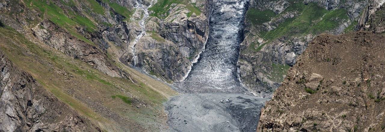
According to preliminary plans, we were supposed to live right there, below, not far from the glacier, but quite recently the house, which stood there a few months ago, was demolished by a mudflow, burying three people under the rubble. Now we can't even understand where the exact place was — mountains are an unreliable thing.
Somewhere here, to the right of Hunza peak, Ultar Sar peak (7388 m) is hidden in the clouds.
At some point, I pour water from a bottle into my hand and moisten the bu: my head heats up a lot in the sun, and it becomes easier for me. And so, with a wet rag on my head, I hear how at this moment Dima tells someone from the group that we should save water — there is not much of it left to go back. Damn!
These views are worth going for and enduring the heat. It is a pity, but the girls who remained below did not see this glacier.
I hope they are having a great time too while we admire the cloudy beauties here.
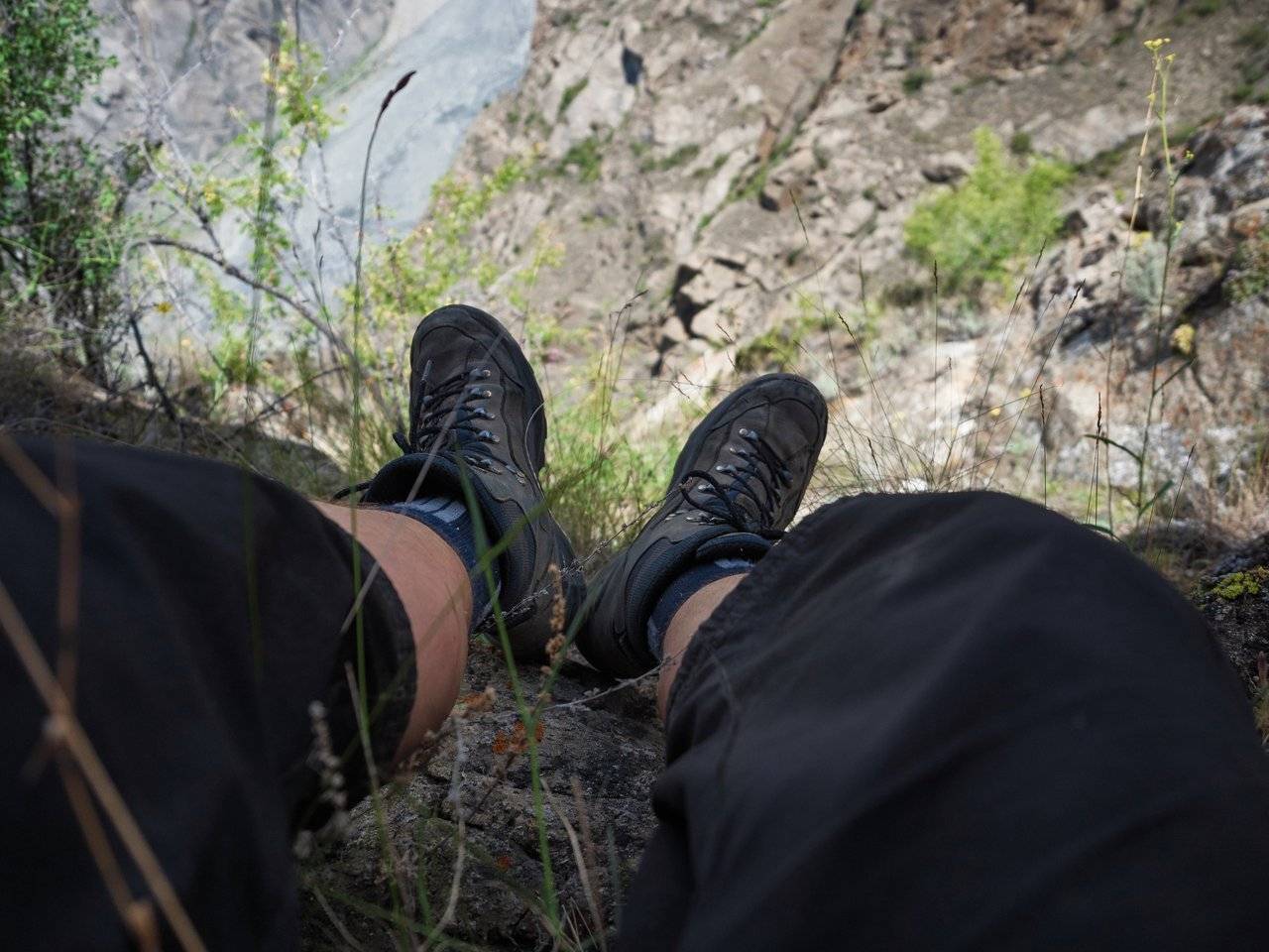
But it's still very hot here. All in turn climbed under a large stone and hid in its shadow. I can sit here only with my legs dangling over the abyss, one wrong move and it will take a long time to fly. And I'm afraid of heights!
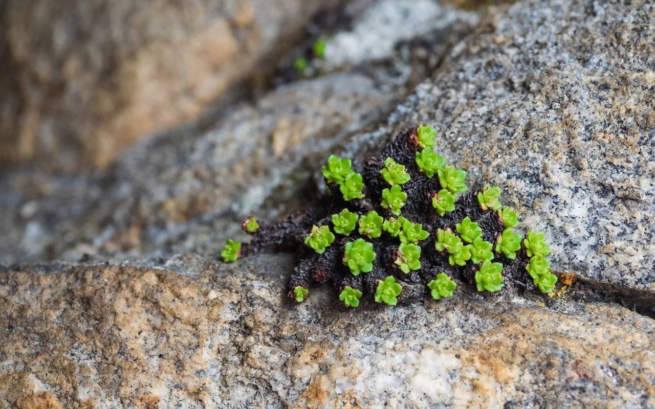
The most important thing is to distract myself in time, so I sat and looked at the local succulents, such plants that live in a hot environment and accumulate water in their fleshy leaves. By the way, cacti also belong to them.
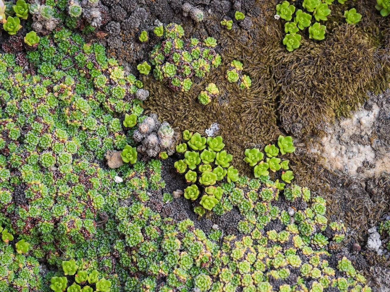
They grow practically on bare stones! I wish we had such vitality :)
I also looked at the black rocks and the spots of light playing on them.
The peak did not open anymore, and soon we set off on our way back down.
Our local guide, a cousin of the innkeeper and a very cheerful young man Nizam, suggested that the road be slightly shortened, and we happily galloped straight down, without a path, driving our heels into the mud and stones. Of course, we needed to control ourself, but it was a pretty fun activity.
Soon we were sitting downstairs in the shade of the trees, drinking the rest of the water. There was just a short walk to the house.
Cold juices that we buy in shops — mango, guava, cause great joy after the track. I just bought a bunch of bottles, half of which I drank right there. We wanted to find beer, but there was only non-alcoholic around. Well, this is the country.

Now we will take a short rest and it will be possible to go sightseeing, specifically two forts: Altit and Baltit. I think it will be interesting :)
To be continued...
Parts of the journey:
- The Land of High Mountains: Pakistan. Day 1. Arrival and Transfer to the Mountains
- The Land of High Mountains: Pakistan. Day 1. Trekking to Fairy Meadows
- The Land of High Mountains: Pakistan. Day 2. Acclimatization
- The Land of High Mountains: Pakistan. Day 3. Trekking to Nanga Parbat Base Camp - Start
- The Land of High Mountains: Pakistan. Day 3. Trekking to Nanga Parbat Base Camp - Finish
- The Land of High Mountains: Pakistan. Day 4. From the Himalayas to the Karakoram
- The Land of High Mountains: Pakistan. Day 5. The road to Mount Rakaposhi - Hakapun or further?
- The Land of High Mountains: Pakistan. Day 5. The road to Mount Rakaposhi - Base Camp
- The Land of High Mountains: Pakistan. Day 6. Minapin Glacier and Ice Bridge
- The Land of High Mountains: Pakistan. Day 7. How to Get to the Eagle's Nest?
- The Land of High Mountains: Pakistan. Day 8. Hike to Ladyfinger Peak
- The Land of High Mountains: Pakistan. Day 8. Walk in Karimabad to Altit and Baltit Forts
- The Land of High Mountains: Pakistan. Day 9. Karimabad and the Sacred Rocks of Hunza
- The Land of High Mountains: Pakistan. Day 9. Attabad Lake, Hussaini Bridge and Passu Cathedral
- The Land of High Mountains: Pakistan. Day 10. Crossing the Batura Glacier: the Beginning
- The Land of High Mountains: Pakistan. Day 10. Crossing the Batura Glacier: Finish
Camera: OLYMPUS E-M1 Mark II
It's better to watch the photos in high resolution — just click on them and open in a new window.
You can also see my photos in my blog LJ and in my profile on NatGeo

By the way, if you are interested in purchasing my high-resolution photographs in order to use them privately (including printing on photo paper or large canvas), create a collection of limited editions of digital pictures you own or just thank me for my work, you can visit the new Lensy.io marketplace and view and buy one of limited editions of my tokenized photos. Lensy.io is a digital photography marketplace built on the Hive blockchain.
You can also feel free to write me and ask any photo you like from my blog to add there for the purpose of further purchase.